Bacastair
Coastal Feature, Headland, Point in Argyllshire
Scotland
Bacastair
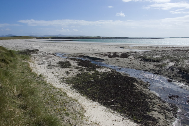
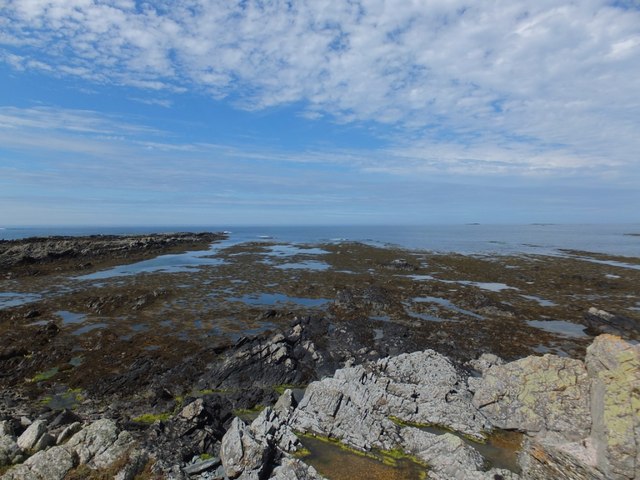
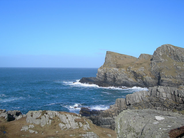
Bacastair is a captivating coastal feature located in Argyllshire, Scotland. Situated on the west coast, it is known for its remarkable headland and prominent point that juts out into the sea. The area is rich in natural beauty and offers breathtaking views of the surrounding landscape.
The headland at Bacastair is characterized by its steep cliffs, which tower above the crashing waves below. These cliffs are made of rugged, weather-beaten rock formations that have been shaped by years of erosion. They provide a mesmerizing backdrop against the azure waters of the Atlantic Ocean.
Visitors to Bacastair can explore the point, which offers stunning panoramas of the coast and the sprawling ocean beyond. The point is an ideal vantage point for observing marine life, as dolphins, seals, and various seabirds are often spotted in the area. It is also a popular spot for photographers, who are drawn to the dramatic scenery and the interplay of light and shadow.
For those who enjoy outdoor activities, Bacastair offers opportunities for hiking and walking along the cliffs, providing a chance to immerse oneself in the wild and untamed beauty of the Scottish coastline. The area is home to a diverse array of flora and fauna, with wildflowers blooming in the spring and seabirds nesting on the cliffs during the summer months.
Overall, Bacastair is a captivating coastal feature that showcases the raw beauty of the Argyllshire coastline. With its dramatic cliffs, panoramic views, and abundant wildlife, it is a must-visit destination for nature enthusiasts and those seeking a tranquil escape by the sea.
If you have any feedback on the listing, please let us know in the comments section below.
Bacastair Images
Images are sourced within 2km of 56.017822/-6.2857697 or Grid Reference NR3388. Thanks to Geograph Open Source API. All images are credited.

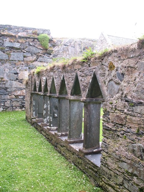
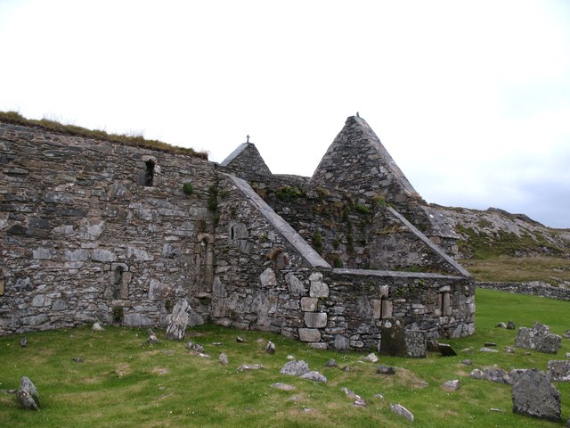
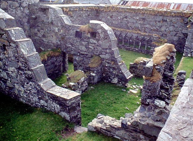
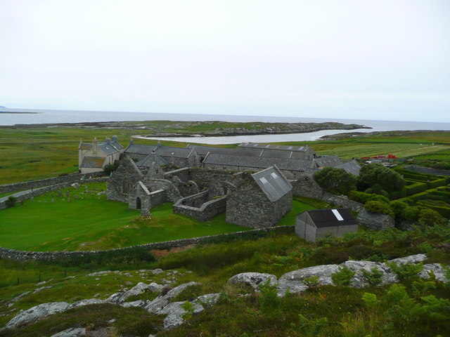
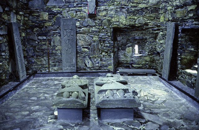
![Oronsay Priory - church interior The nave and choir of Oronsay Priory looking towards the east window. The altar was most likely restored circa 1624 when Irish Franciscan missionaries converted the islands to Catholicism. It is interesting to compare this modest little priory church, some 20 metres long with that of Fountains Abbey [SE2768], where the huge church is some 110 metres in length.](https://s3.geograph.org.uk/geophotos/02/53/98/2539891_438c207e.jpg)
Bacastair is located at Grid Ref: NR3388 (Lat: 56.017822, Lng: -6.2857697)
Unitary Authority: Argyll and Bute
Police Authority: Argyll and West Dunbartonshire
What 3 Words
///jotting.trickling.treating. Near Scalasaig, Argyll & Bute
Nearby Locations
Related Wikis

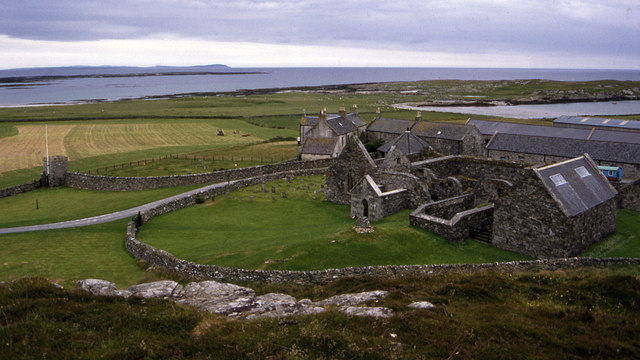
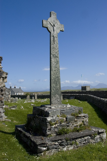
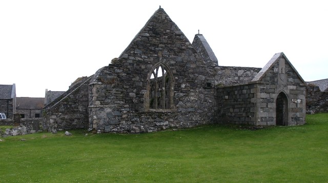
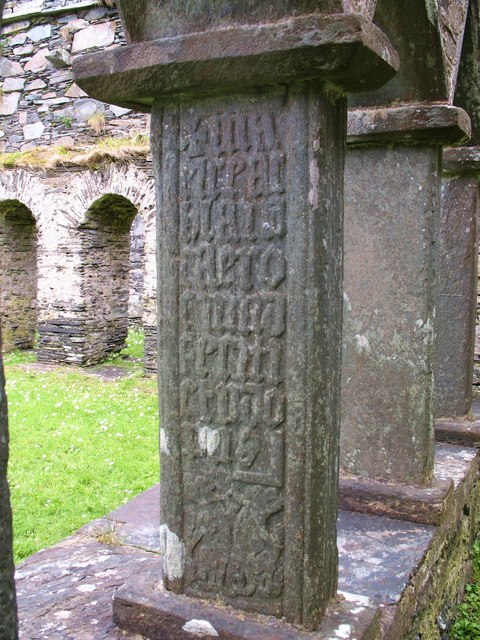
Oronsay Priory
Oronsay Priory was a monastery of canons regular on the island of Oronsay, Inner Hebrides, Argyll, off the coast of Scotland. It was in existence by 1353...

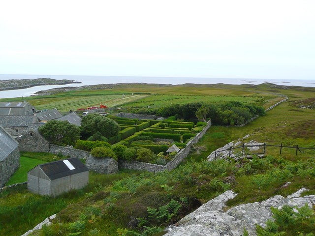
Oronsay, Colonsay
Oronsay (Scottish Gaelic: Orasaigh), also sometimes spelt and pronounced Oransay by the local community, is a small tidal island south of Colonsay in the...

Ardskenish
Ardskenish is a hamlet on the island of Colonsay, in the civil parish of Colonsay and Oronsay, in the council area of Argyll and Bute, Scotland. ��2�...

Dùn Galláin
Dùn Galláin (English: Fort of the Strangers) is a promontory fort located on the Inner Hebridean island of Colonsay, Scotland. The site is located at grid...
Colonsay Airport
Colonsay Airport (Scottish Gaelic: Port-adhair Colbhasaigh) (IATA: CSA, ICAO: EGEY) is located on the island of Colonsay, Argyll and Bute, Scotland. Located...
Dùn Cholla
Dùn Cholla is a hill fort located on the Inner Hebridean island of Colonsay, Scotland. The site is located at grid reference NR37759150.According to tradition...
Dùn Meadhonach
Dùn Meadhonach (English: Middle Fort) is a hillfort located on the Inner Hebridean island of Colonsay, Scotland. The site is located at grid reference...
Colonsay Group
The Colonsay Group is an estimated 5,000 m thick sequence of mildly metamorphosed Neoproterozoic sedimentary rocks that outcrop on the islands of Colonsay...
Have you been to Bacastair?
Leave your review of Bacastair below (or comments, questions and feedback).