South Geedon

Sea, Estuary, Creek in Essex Colchester

England

South Geedon

Squeezed Saltmarsh This is an example of coastal squeeze where the natural saltmarsh is squeezed against the sea wall. The outer edge is subject to erosion creating a <a href="https://www.geograph.org.uk/photo/7542909">TM0616 : Mud Cliffs</a>. As the sea level rises the salt marsh habitat will vanish unless there is some managed retreat.
Squeezed Saltmarsh Credit: Glyn Baker

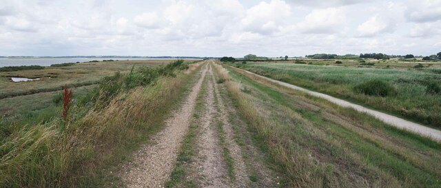
South Geedon is a small village located in the county of Essex, England. It is situated on the shores of the North Sea, at the mouth of the River Blackwater. The village is known for its picturesque setting, with stunning views of the sea, estuary, and surrounding creeks.

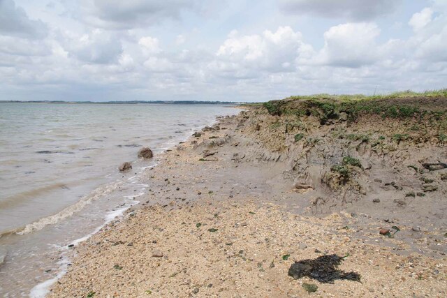
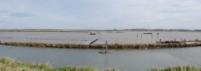
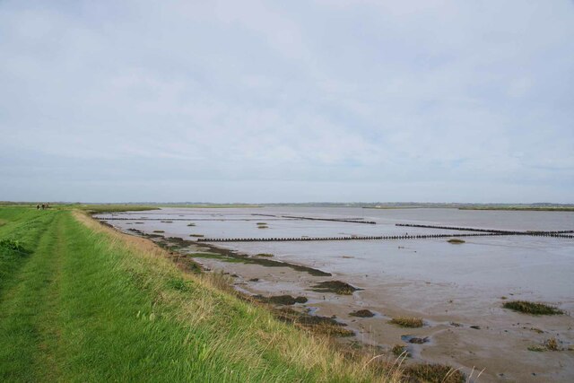
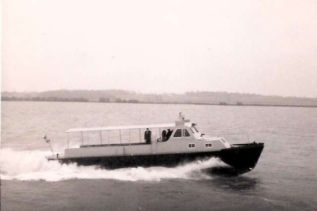
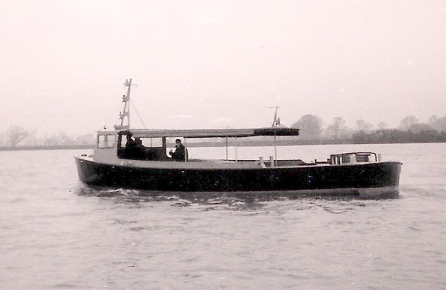
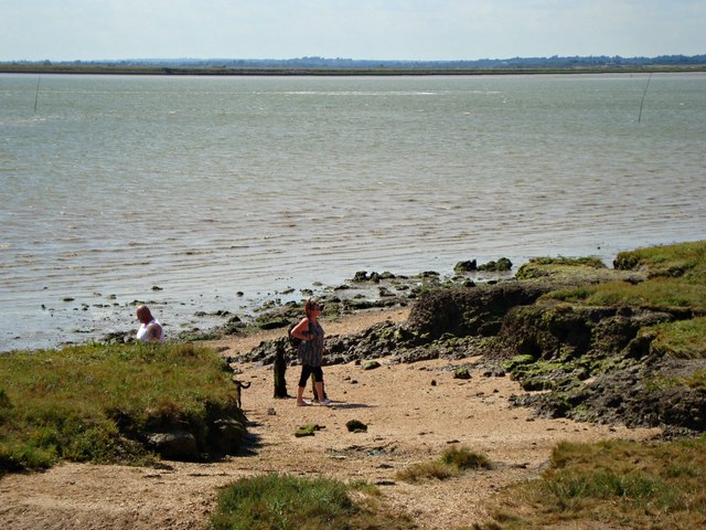
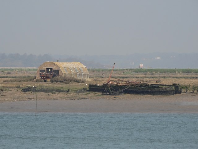
The sea in South Geedon is a prominent feature, offering residents and visitors alike the opportunity to enjoy various water activities such as swimming, sailing, and fishing. The beach is a popular spot for families to relax and soak up the sun during the warmer months. The sea also plays a significant role in the local economy, with a small fishing industry operating in the village.

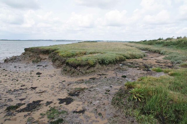
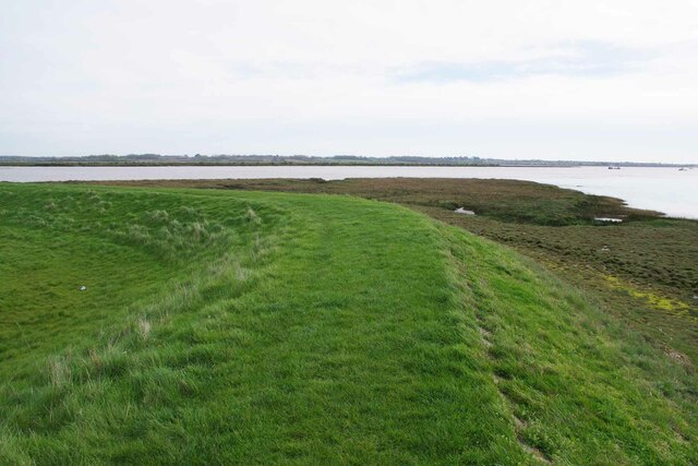
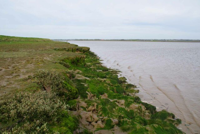
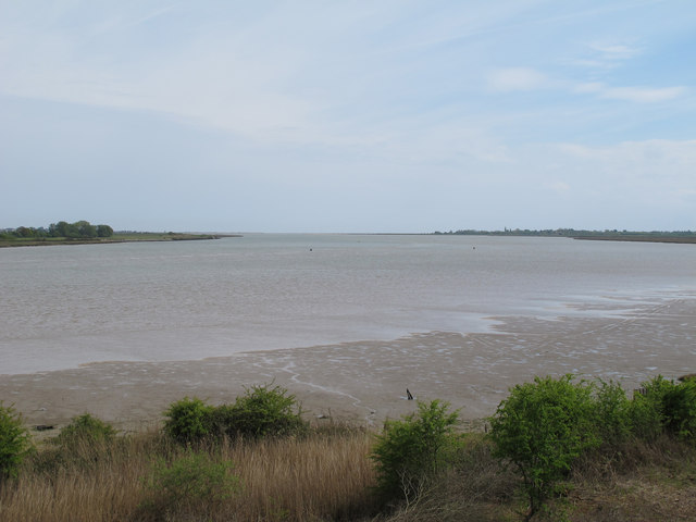
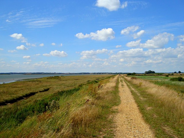
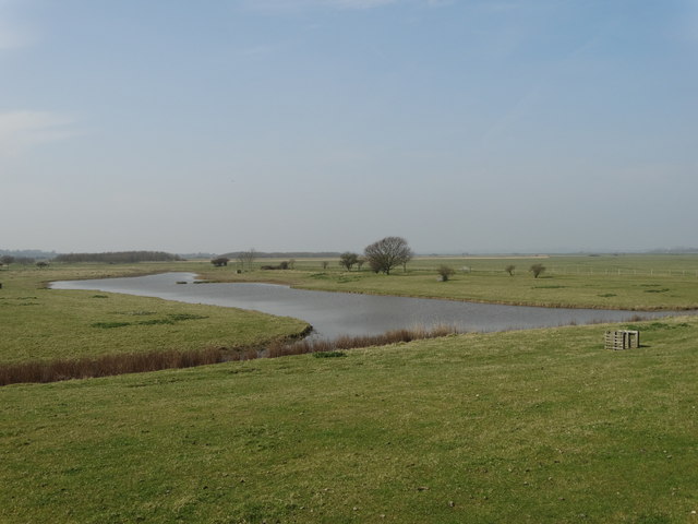
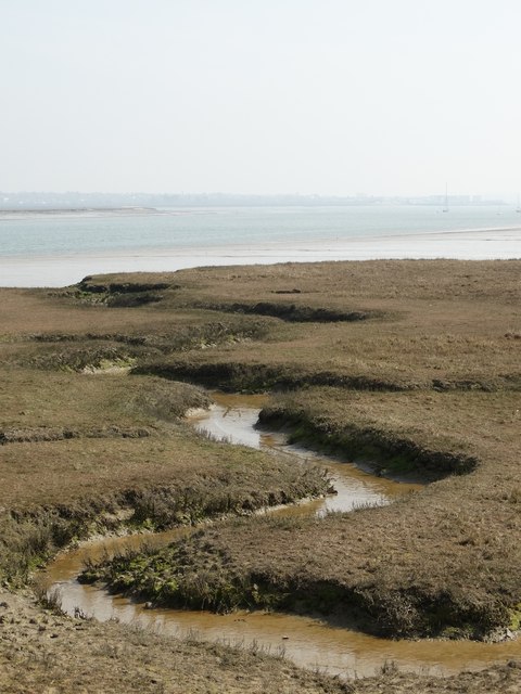
The estuary of the River Blackwater adds to the charm of South Geedon. It provides a habitat for a diverse range of wildlife, including various species of birds and marine life. The estuary is a haven for birdwatchers, who can spot migratory birds and wading species throughout the year. It also offers opportunities for boating and kayaking, allowing visitors to explore the tranquil waterways and admire the beautiful landscape.

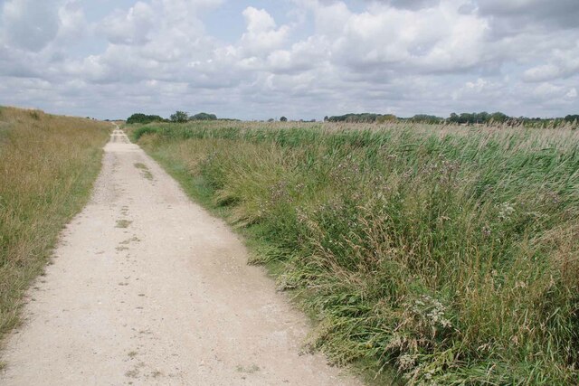
Creeks are another characteristic feature of South Geedon. These narrow water channels wind their way through the village, providing scenic views and opportunities for exploration. The creeks are home to an abundance of plant and animal life, making them a haven for nature enthusiasts.

Overall, South Geedon in Essex offers a unique and stunning coastal experience, with its sea, estuary, and creeks providing a wealth of recreational activities and natural beauty for residents and visitors to enjoy.

If you have any feedback on the listing, please let us know in the comments section below.
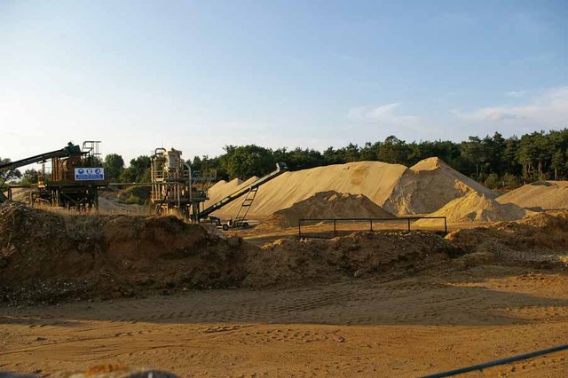
South Geedon Images

Images are sourced within 2km of 51.816829/0.98216835 or Grid Reference TM0517. Thanks to Geograph Open Source API. All images are credited.

Squeezed Saltmarsh This is an example of coastal squeeze where the natural saltmarsh is squeezed against the sea wall. The outer edge is subject to erosion creating a <a href="https://www.geograph.org.uk/photo/7542909">TM0616 : Mud Cliffs</a>. As the sea level rises the salt marsh habitat will vanish unless there is some managed retreat.
Squeezed Saltmarsh
This is an example of coastal squeeze where the natural saltmarsh is squeezed against the sea wall. The outer edge is subject to erosion creating a TM0616 : Mud Cliffs. As the sea level rises the salt marsh habitat will vanish unless there is some managed retreat.
Mud Cliffs Here the saltmarsh is eroding away due to coastal squeeze see <a href="https://www.geograph.org.uk/photo/7542906">TM0616 : Squeezed Saltmarsh</a>.
Mud Cliffs
Here the saltmarsh is eroding away due to coastal squeeze see TM0616 : Squeezed Saltmarsh.
Footpath 34 Panorama Part of the Colne Estuary National Nature Reserve. The coastal grazing marsh to the right is of particular value to birds on migration.
Footpath 34 Panorama
Part of the Colne Estuary National Nature Reserve. The coastal grazing marsh to the right is of particular value to birds on migration.
Track by the Sea Wall Looking towards Alresford; this track runs in the lea of the sea wall.
Track by the Sea Wall
Looking towards Alresford; this track runs in the lea of the sea wall.
Mersea is an Island #4: Pyfleet Channel Panorama Looking across an oyster bed into the channel
See also <a href="https://www.geograph.org.uk/photo/7744436">TM0515 : Mersea is an Island #5: Polders in the Pyfleet Channel</a>
Mersea is an Island #4: Pyfleet Channel Panorama
Looking across an oyster bed into the channel See also TM0515 : Mersea is an Island #5: Polders in the Pyfleet Channel
Mersea is an Island #5: Polders in the Pyfleet Channel I believe the stakes in the mud are designed to allow the build up of silt etc to help prevent erosion of the sea wall.
See also <a href="https://www.geograph.org.uk/photo/7744460">TM0516 : Mersea is an Island #6: Coastal Squeeze in the Pyfleet Channel</a>
Mersea is an Island #5: Polders in the Pyfleet Channel
I believe the stakes in the mud are designed to allow the build up of silt etc to help prevent erosion of the sea wall. See also TM0516 : Mersea is an Island #6: Coastal Squeeze in the Pyfleet Channel
Mersea is an Island #6: Coastal Squeeze in the Pyfleet Channel The reclaiming of Reeveshall Marsh from the sea means the remaining salt marsh is squeezed against the sea wall that carries East Mersea Footpath 13
See also <a href="https://www.geograph.org.uk/photo/7744472">TM0416 : Mersea is an Island #7: Mud Shelf In the Pyfleet Channel</a>
Mersea is an Island #6: Coastal Squeeze in the Pyfleet Channel
The reclaiming of Reeveshall Marsh from the sea means the remaining salt marsh is squeezed against the sea wall that carries East Mersea Footpath 13 See also TM0416 : Mersea is an Island #7: Mud Shelf In the Pyfleet Channel
Mersea is an Island #7: Mud Shelf In the Pyfleet Channel About an hour and a half before high tide.
see also <a href="https://www.geograph.org.uk/photo/7744502">TM0316 : Mersea is an Island #8: East Meets West</a>
Mersea is an Island #7: Mud Shelf In the Pyfleet Channel
About an hour and a half before high tide. see also TM0316 : Mersea is an Island #8: East Meets West
Sand Quarry in Ford Lane On the way to the ford across Alresford Creek
Sand Quarry in Ford Lane
On the way to the ford across Alresford Creek
Shell boats In the 1950’s Rowhedge Ironworks Ltd, of Rowhedge, Nr, Colchester, Essex, built  high speed launches and general work boats for Shell, which were employed servicing their oil rigs on Lake Maracaibo, Venezuela.
This photograph, date unknown shows one of the high speed launches on the River Colne estuary during speed trails. 
The scenery in the background is the Brightlingsea shore, the dark line being the seawall which also carried the ‘Crab and Winkle Line’, the railway line between Wivenhoe and Brightlingsea before it fell to Dr Beeching’s axe.
Shell boats
In the 1950’s Rowhedge Ironworks Ltd, of Rowhedge, Nr, Colchester, Essex, built high speed launches and general work boats for Shell, which were employed servicing their oil rigs on Lake Maracaibo, Venezuela. This photograph, date unknown shows one of the high speed launches on the River Colne estuary during speed trails. The scenery in the background is the Brightlingsea shore, the dark line being the seawall which also carried the ‘Crab and Winkle Line’, the railway line between Wivenhoe and Brightlingsea before it fell to Dr Beeching’s axe.
Shell boats In the 1950’s Rowhedge Ironworks Ltd, of Rowhedge, Nr, Colchester, Essex, built  high speed launches and general work boats for Shell, which were employed servicing their oil rigs on Lake Maracaibo, Venezuela. 
This photograph, date unknown shows one of the work launches on the River Colne estuary during  trails.
The deck area was clear and flat to carry equipment and there was a towing post
Shell boats
In the 1950’s Rowhedge Ironworks Ltd, of Rowhedge, Nr, Colchester, Essex, built high speed launches and general work boats for Shell, which were employed servicing their oil rigs on Lake Maracaibo, Venezuela. This photograph, date unknown shows one of the work launches on the River Colne estuary during trails. The deck area was clear and flat to carry equipment and there was a towing post
River Colne, from Geedon Bay Hide, Fingringhoe Wick Fingringhoe Wick Nature Reserve is owned and managed by the Essex Wildlife Trust.

Essex Wildlife Trust: <span class="nowrap"><a title="http://www.webcitation.org/6Gg3tDwDL" rel="nofollow ugc noopener" href="http://www.webcitation.org/6Gg3tDwDL">Link</a><img style="margin-left:2px;" alt="External link" title="External link - shift click to open in new window" src="https://s1.geograph.org.uk/img/external.png" width="10" height="10"/></span>
Wild Essex: <span class="nowrap"><a title="http://www.webcitation.org/6Gg3yL7hI" rel="nofollow ugc noopener" href="http://www.webcitation.org/6Gg3yL7hI">Link</a><img style="margin-left:2px;" alt="External link" title="External link - shift click to open in new window" src="https://s1.geograph.org.uk/img/external.png" width="10" height="10"/></span>
River Colne, from Geedon Bay Hide, Fingringhoe Wick
Fingringhoe Wick Nature Reserve is owned and managed by the Essex Wildlife Trust. Essex Wildlife Trust: LinkExternal link Wild Essex: LinkExternal link
A beach of our own Saltings north of Brightlingsea
A beach of our own
Saltings north of Brightlingsea
Seawall Walk Until 1964, the seawall formed the embankment carrying the rail line from Colchester to Brightlingsea via Wivenhoe
Seawall Walk
Until 1964, the seawall formed the embankment carrying the rail line from Colchester to Brightlingsea via Wivenhoe
Barn in the Woods North of Mitchell's Farm. The property is known as "Fishponds".
Barn in the Woods
North of Mitchell's Farm. The property is known as "Fishponds".
Broad Fleet in April
View towards Pyefleet Channel From the seawall that protects the farming land still known as Reeveshall Marsh.
View towards Pyefleet Channel
From the seawall that protects the farming land still known as Reeveshall Marsh.
View of Pewit Island From the sea wall that defends Reeveshall Marsh. Pewit Island was once a little hive of industry with regard to oyster farming but that muddy island activity has now ceased.
View of Pewit Island
From the sea wall that defends Reeveshall Marsh. Pewit Island was once a little hive of industry with regard to oyster farming but that muddy island activity has now ceased.
Show me another place!

South Geedon is located at Grid Ref: TM0517 (Lat: 51.816829, Lng: 0.98216835)

Administrative County: Essex

District: Colchester

Police Authority: Essex

What 3 Words

///taller.stuck.riverbed. Near Brightlingsea, Essex

Nearby Locations

South Geedon North Geedon

Related Wikis

Colne Estuary

Colne Estuary is a 2915 hectare biological and geological Site of Special Scientific Interest near Brightlingsea in Essex. It is also a Nature Conservation...

Fingringhoe Wick

Fingringhoe Wick is a 48.6-hectare (120-acre) nature reserve in Fingringhoe in Essex. It is managed by the Essex Wildlife Trust, which runs a visitor centre...

East Mersea

East Mersea is a village and civil parish on Mersea Island in the City of Colchester district of Essex, England. It was historically referred to as Mersea...

River Colne, Essex

The River Colne ( or ) is a small river that runs through Essex, England and passes through Colchester. It is not a tributary of any other river, instead...

Have you been to South Geedon?

Leave your review of South Geedon below (or comments, questions and feedback).