North Geedon

Sea, Estuary, Creek in Essex Colchester

England

North Geedon

Fingringhoe marsh & ranges
Fingringhoe marsh & ranges Credit: Mr James D

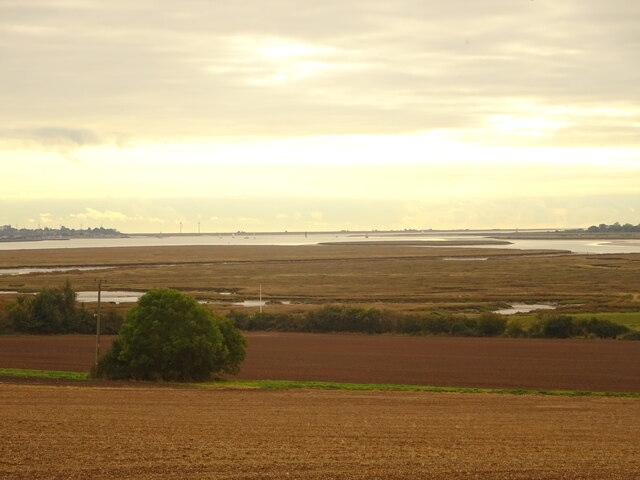
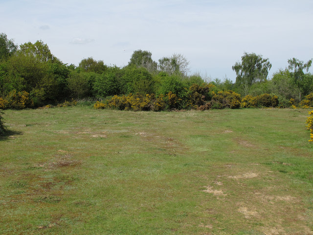
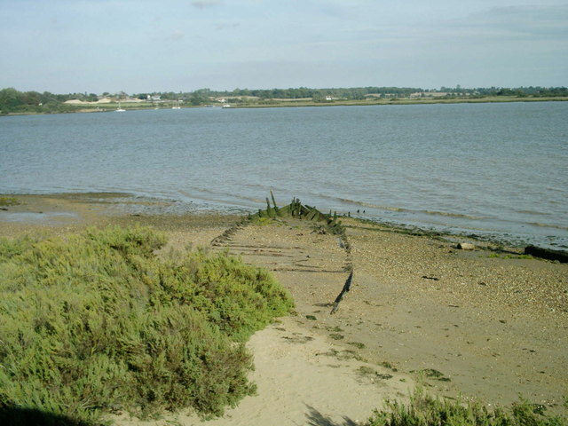
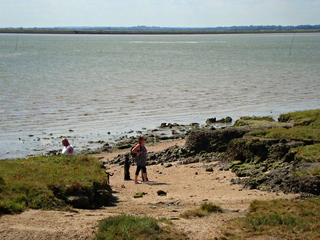
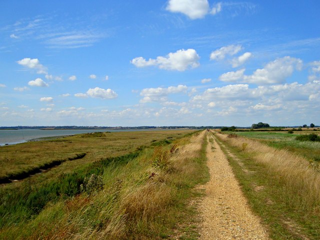
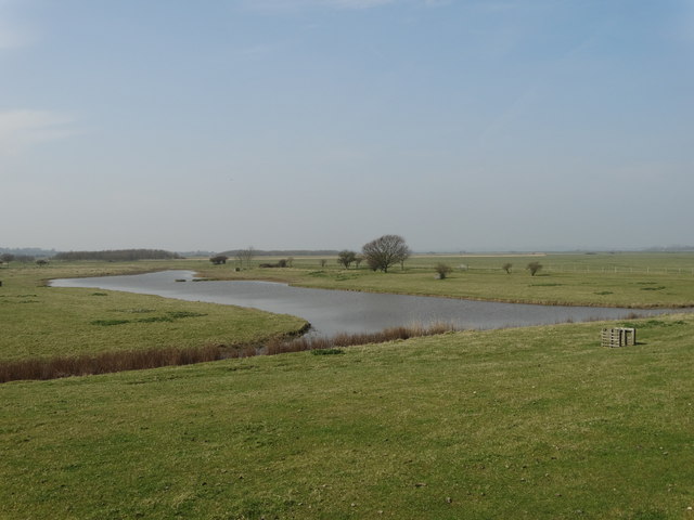
North Geedon is a picturesque village located in the county of Essex, England. Situated on the east coast of the country, it is bordered by the North Sea to the east, the River Blackwater estuary to the south, and a small creek to the west. The village is nestled amidst stunning natural beauty, with its coastal location offering breathtaking views and a tranquil atmosphere.

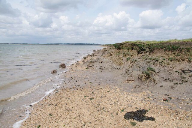
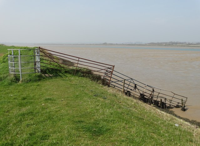
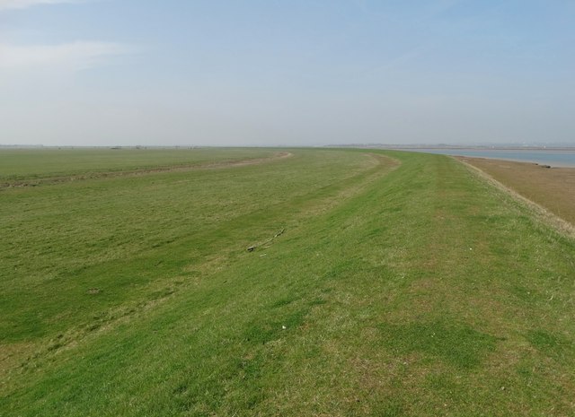
The North Sea, with its vast expanse of shimmering blue waters, provides a stunning backdrop to the village. The sea is known for its strong tides and has created a rugged coastline, which attracts many visitors who enjoy walking along the cliffs and exploring the rocky beaches.

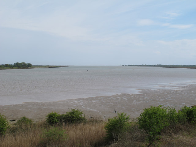
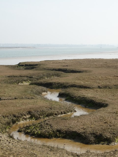
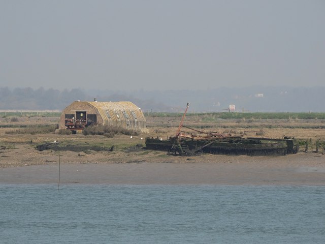
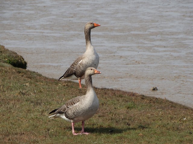
To the south of the village lies the River Blackwater estuary, a wide and picturesque stretch of water that is home to a diverse range of wildlife. The estuary is a haven for birdwatchers, as it attracts a variety of species throughout the year, including wading birds and migratory seabirds.

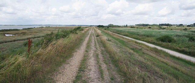
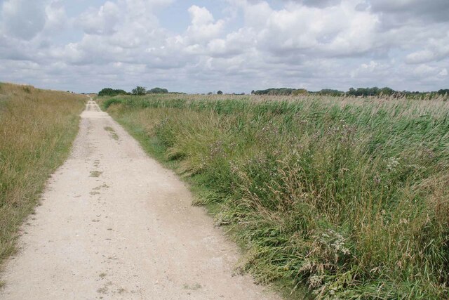
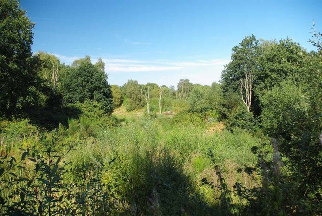
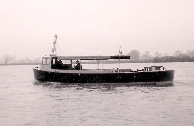
A small creek flows to the west of North Geedon, adding to the village's charm. This peaceful waterway is a popular spot for boating and fishing enthusiasts, who can often be seen enjoying the tranquility of the area.

In addition to its natural beauty, North Geedon boasts a close-knit community, with a handful of local businesses, charming cottages, and a historic church. The village offers a peaceful retreat from the hustle and bustle of city life, making it a popular destination for those seeking relaxation and a connection with nature.

If you have any feedback on the listing, please let us know in the comments section below.

North Geedon Images

Images are sourced within 2km of 51.818517/0.97410956 or Grid Reference TM0517. Thanks to Geograph Open Source API. All images are credited.

Fingringhoe marsh & ranges
Mud Cliffs Here the saltmarsh is eroding away due to coastal squeeze see <a href="https://www.geograph.org.uk/photo/7542906">TM0616 : Squeezed Saltmarsh</a>.
Mud Cliffs
Here the saltmarsh is eroding away due to coastal squeeze see TM0616 : Squeezed Saltmarsh.
Footpath 34 Panorama Part of the Colne Estuary National Nature Reserve. The coastal grazing marsh to the right is of particular value to birds on migration.
Footpath 34 Panorama
Part of the Colne Estuary National Nature Reserve. The coastal grazing marsh to the right is of particular value to birds on migration.
Track by the Sea Wall Looking towards Alresford; this track runs in the lea of the sea wall.
Track by the Sea Wall
Looking towards Alresford; this track runs in the lea of the sea wall.
Regrowth at Fingeringhoe Wick A view across one of the former gravel pits on Fingeringhoe Wick Nature Reserve <span class="nowrap"><a title="http://www.essexwt.org.uk/visitor_centres__nature_reserves/fingringhoe_wick/" rel="nofollow ugc noopener" href="http://www.essexwt.org.uk/visitor_centres__nature_reserves/fingringhoe_wick/">Link</a><img style="margin-left:2px;" alt="External link" title="External link - shift click to open in new window" src="https://s1.geograph.org.uk/img/external.png" width="10" height="10"/></span>
Regrowth at Fingeringhoe Wick
A view across one of the former gravel pits on Fingeringhoe Wick Nature Reserve LinkExternal link
Shell boats In the 1950’s Rowhedge Ironworks Ltd, of Rowhedge, Nr, Colchester, Essex, built  high speed launches and general work boats for Shell, which were employed servicing their oil rigs on Lake Maracaibo, Venezuela. 
This photograph, date unknown shows one of the work launches on the River Colne estuary during  trails.
The deck area was clear and flat to carry equipment and there was a towing post
Shell boats
In the 1950’s Rowhedge Ironworks Ltd, of Rowhedge, Nr, Colchester, Essex, built high speed launches and general work boats for Shell, which were employed servicing their oil rigs on Lake Maracaibo, Venezuela. This photograph, date unknown shows one of the work launches on the River Colne estuary during trails. The deck area was clear and flat to carry equipment and there was a towing post
River Colne, from Geedon Bay Hide, Fingringhoe Wick Fingringhoe Wick Nature Reserve is owned and managed by the Essex Wildlife Trust.

Essex Wildlife Trust: <span class="nowrap"><a title="http://www.webcitation.org/6Gg3tDwDL" rel="nofollow ugc noopener" href="http://www.webcitation.org/6Gg3tDwDL">Link</a><img style="margin-left:2px;" alt="External link" title="External link - shift click to open in new window" src="https://s1.geograph.org.uk/img/external.png" width="10" height="10"/></span>
Wild Essex: <span class="nowrap"><a title="http://www.webcitation.org/6Gg3yL7hI" rel="nofollow ugc noopener" href="http://www.webcitation.org/6Gg3yL7hI">Link</a><img style="margin-left:2px;" alt="External link" title="External link - shift click to open in new window" src="https://s1.geograph.org.uk/img/external.png" width="10" height="10"/></span>
River Colne, from Geedon Bay Hide, Fingringhoe Wick
Fingringhoe Wick Nature Reserve is owned and managed by the Essex Wildlife Trust. Essex Wildlife Trust: LinkExternal link Wild Essex: LinkExternal link
East Heath, Fingringhoe Wick Fingringhoe Wick Nature Reserve is owned and managed by the Essex Wildlife Trust.

Essex Wildlife Trust: <span class="nowrap"><a title="http://www.webcitation.org/6Gg3tDwDL" rel="nofollow ugc noopener" href="http://www.webcitation.org/6Gg3tDwDL">Link</a><img style="margin-left:2px;" alt="External link" title="External link - shift click to open in new window" src="https://s1.geograph.org.uk/img/external.png" width="10" height="10"/></span>
Wild Essex: <span class="nowrap"><a title="http://www.webcitation.org/6Gg3yL7hI" rel="nofollow ugc noopener" href="http://www.webcitation.org/6Gg3yL7hI">Link</a><img style="margin-left:2px;" alt="External link" title="External link - shift click to open in new window" src="https://s1.geograph.org.uk/img/external.png" width="10" height="10"/></span>
East Heath, Fingringhoe Wick
Fingringhoe Wick Nature Reserve is owned and managed by the Essex Wildlife Trust. Essex Wildlife Trust: LinkExternal link Wild Essex: LinkExternal link
Fingringhoe Wick shoreline, hulk and River Colne View of shoreline at Fingringhoe Wick with River Colne. Image shows remains of boat hulk. Alresford Creek is on the other side of the river in the distance.
Fingringhoe Wick shoreline, hulk and River Colne
View of shoreline at Fingringhoe Wick with River Colne. Image shows remains of boat hulk. Alresford Creek is on the other side of the river in the distance.
A beach of our own Saltings north of Brightlingsea
A beach of our own
Saltings north of Brightlingsea
Seawall Walk Until 1964, the seawall formed the embankment carrying the rail line from Colchester to Brightlingsea via Wivenhoe
Seawall Walk
Until 1964, the seawall formed the embankment carrying the rail line from Colchester to Brightlingsea via Wivenhoe
Barn in the Woods North of Mitchell's Farm. The property is known as "Fishponds".
Barn in the Woods
North of Mitchell's Farm. The property is known as "Fishponds".
Broad Fleet in April
View towards Pyefleet Channel From the seawall that protects the farming land still known as Reeveshall Marsh.
View towards Pyefleet Channel
From the seawall that protects the farming land still known as Reeveshall Marsh.
View of Pewit Island From the sea wall that defends Reeveshall Marsh. Pewit Island was once a little hive of industry with regard to oyster farming but that muddy island activity has now ceased.
View of Pewit Island
From the sea wall that defends Reeveshall Marsh. Pewit Island was once a little hive of industry with regard to oyster farming but that muddy island activity has now ceased.
On the sea wall north of Maydays Marsh Looking out to Pyefleet Channel as the tide comes in.
On the sea wall north of Maydays Marsh
Looking out to Pyefleet Channel as the tide comes in.
Reeveshall Marsh View Whilst walking on the sea wall path with Pyefleet Channel to the right.
Reeveshall Marsh View
Whilst walking on the sea wall path with Pyefleet Channel to the right.
Greylag geese by Pyefleet Channel
Show me another place!

North Geedon is located at Grid Ref: TM0517 (Lat: 51.818517, Lng: 0.97410956)

Administrative County: Essex

District: Colchester

Police Authority: Essex

What 3 Words

///practical.rebounder.state. Near Brightlingsea, Essex

Nearby Locations

South Geedon North Geedon

Related Wikis

Colne Estuary

Colne Estuary is a 2915 hectare biological and geological Site of Special Scientific Interest near Brightlingsea in Essex. It is also a Nature Conservation...

Fingringhoe Wick

Fingringhoe Wick is a 48.6-hectare (120-acre) nature reserve in Fingringhoe in Essex. It is managed by the Essex Wildlife Trust, which runs a visitor centre...

East Mersea

East Mersea is a village and civil parish on Mersea Island in the City of Colchester district of Essex, England. It was historically referred to as Mersea...

Mersea Fort

Mersea Fort, also known as Cudmore Grove Blockhouse, was an artillery fort established by Henry VIII on the East Mersea coast in 1543. It formed part of...

Related Videos

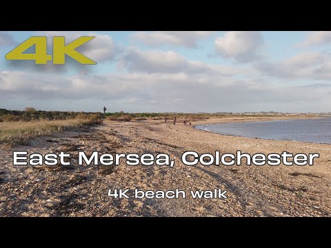
🇬🇧 East Mersea Colchester Essex UK | 4K UHD Beach Walking Video ⛅️

4K beach walk of Cudmore Grove on East Mersea Island, Colchester, Essex. Filmed using DJI Osmo Pocket.

East Mersea

A run around the east coast of Mersea Island on a stunning February morning. Starting at the eastern tip of the island, following ...

Coastal Walk - Cudmore Grove, East Mersea, Essex (The Essex Serpent Filming Location) [4K]

A short walk around Cudmore Grove Country Park in East Mersea, Essex. This video was filmed on Saturday 28th August, 2021.

Have you been to North Geedon?

Leave your review of North Geedon below (or comments, questions and feedback).