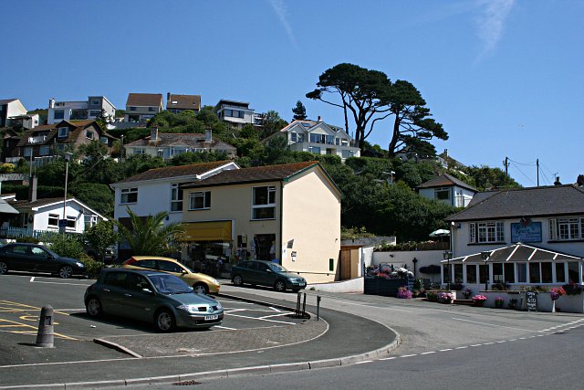
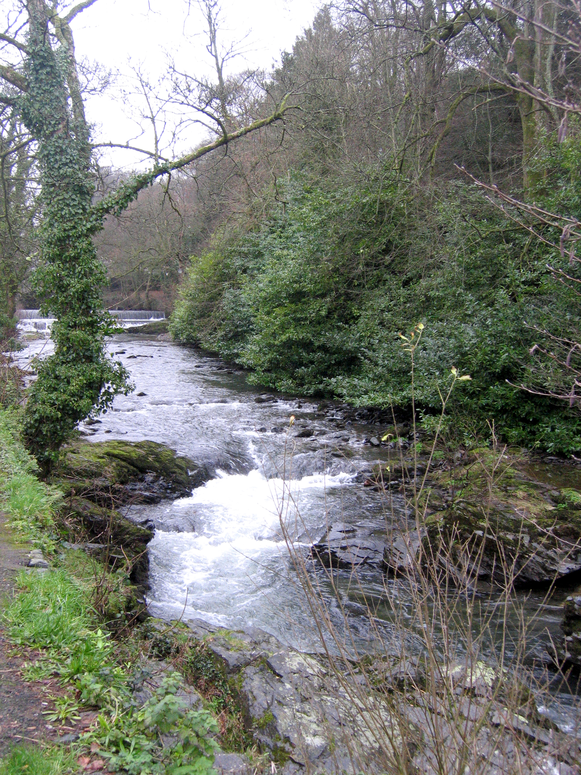
Boat Pool

Sea, Estuary, Creek in Cornwall

England

Boat Pool

Downderry - Beach and view to Rame Head Downderry's shingly beach is similar to that at nearby Seaton - if you want sand you have to travel a few miles further east to Whitsand Bay. Guarding the end of that bay is the peninsula of Rame Head, seen in the distance in this image. It has a little abandoned chapel on top which can be seen as a pimple in this image.
(see <a href="https://www.geograph.org.uk/photo/3250122">SX4148 : Chapel, Rame Head</a>)
Downderry - Beach and view to Rame Head Credit: Rob Farrow

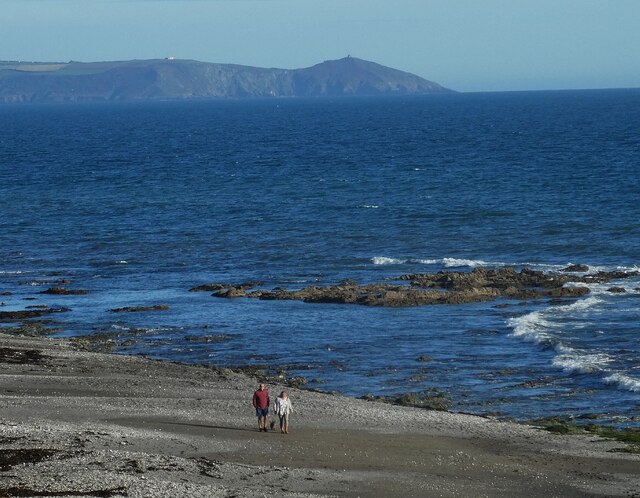
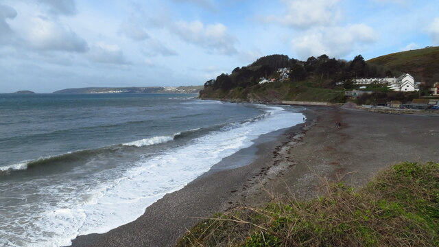
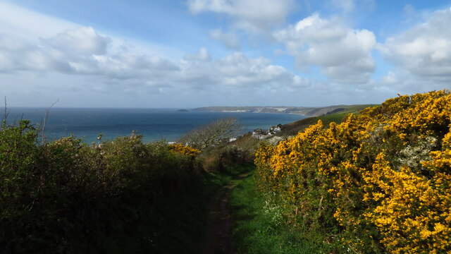
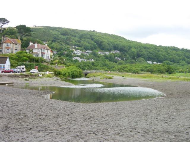
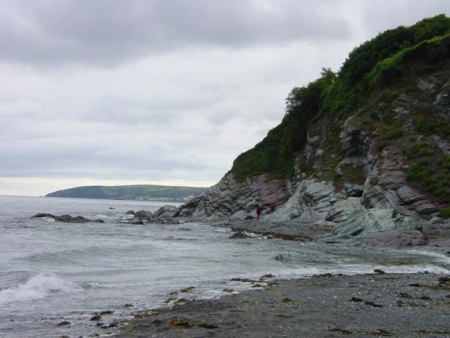
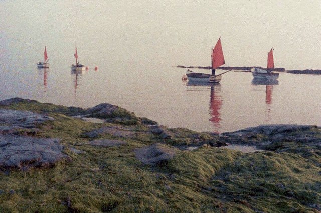
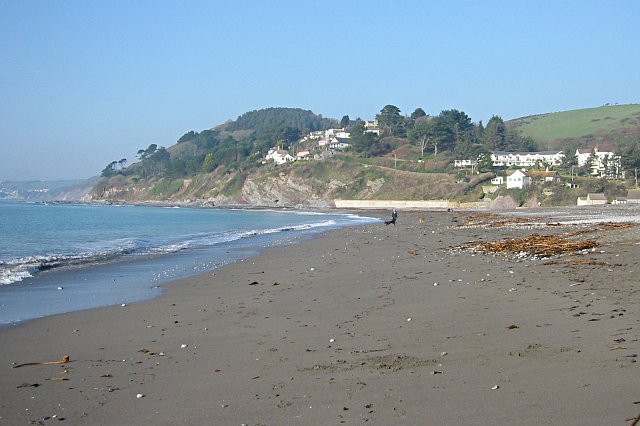
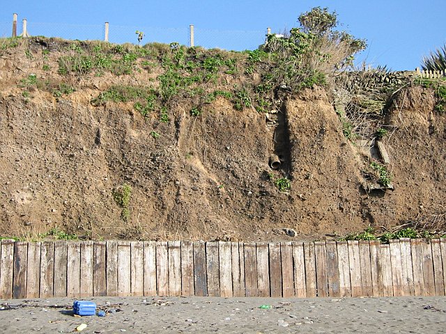
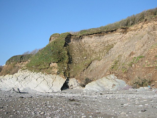
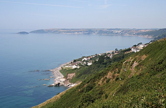
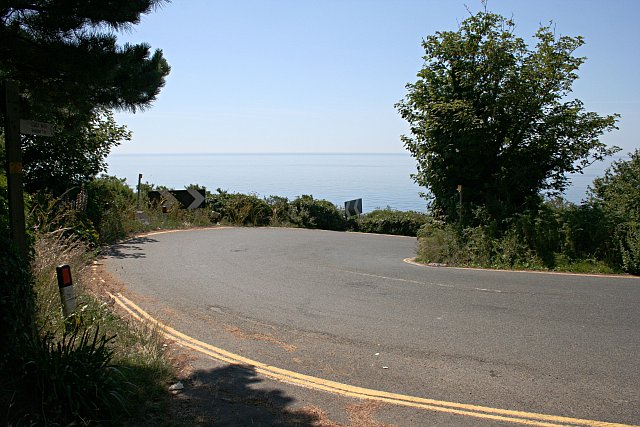
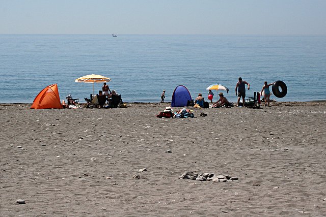
Boat Pool, located in Cornwall, is a picturesque body of water that combines the features of a sea, estuary, and creek. This unique spot is situated in a secluded area surrounded by lush greenery, providing a peaceful and tranquil setting for visitors to enjoy. The waters of Boat Pool are a vibrant blue, reflecting the clear skies above and creating a stunning backdrop for relaxation and recreation.

Boat Pool is a popular destination for boating enthusiasts, with its calm waters ideal for sailing, kayaking, and paddleboarding. The estuary and creek aspects of the pool provide a variety of habitats for marine life, making it a great spot for fishing and wildlife observation. Visitors can expect to see a diverse array of bird species, fish, and plant life thriving in this coastal ecosystem.

The stunning natural beauty of Boat Pool, combined with its recreational opportunities and diverse wildlife, make it a must-visit destination for nature lovers and outdoor enthusiasts in Cornwall. Whether you are looking to relax on the shore, explore the waters by boat, or simply admire the scenic surroundings, Boat Pool offers something for everyone to enjoy.

If you have any feedback on the listing, please let us know in the comments section below.
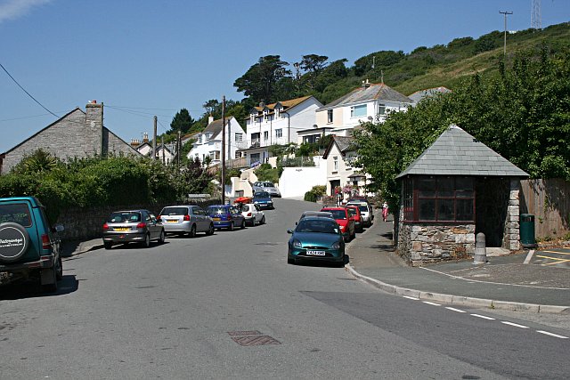
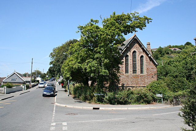
Boat Pool Images

Images are sourced within 2km of 50.359665/-4.3708112 or Grid Reference SX3153. Thanks to Geograph Open Source API. All images are credited.

Downderry - Beach and view to Rame Head Downderry's shingly beach is similar to that at nearby Seaton - if you want sand you have to travel a few miles further east to Whitsand Bay. Guarding the end of that bay is the peninsula of Rame Head, seen in the distance in this image. It has a little abandoned chapel on top which can be seen as a pimple in this image.
(see <a href="https://www.geograph.org.uk/photo/3250122">SX4148 : Chapel, Rame Head</a>)
Downderry - Beach and view to Rame Head
Downderry's shingly beach is similar to that at nearby Seaton - if you want sand you have to travel a few miles further east to Whitsand Bay. Guarding the end of that bay is the peninsula of Rame Head, seen in the distance in this image. It has a little abandoned chapel on top which can be seen as a pimple in this image. (see SX4148 : Chapel, Rame Head)
Seaton Beach, Seaton, Cornwall
On coastal path, E of Downderry
Seaton from the beach The River Seaton flows onto the beach at the western end of the bay.
Seaton from the beach
The River Seaton flows onto the beach at the western end of the bay.
Looking west from Seaton beach Looe and Hannafore Point in the distance.
Looking west from Seaton beach
Looe and Hannafore Point in the distance.
Downderry - east side, from Battern Cliffs A zoomed shot from an adjacent grid square gives a view of Downderry which emphasises its location on a precarious platform of soft rock above the sea.
Downderry - east side, from Battern Cliffs
A zoomed shot from an adjacent grid square gives a view of Downderry which emphasises its location on a precarious platform of soft rock above the sea.
Farmhouse B&B, Downderry, Cornwall On the road between Downderry and Trellidon. Marked with camp site symbol on the map
Farmhouse B&B, Downderry, Cornwall
On the road between Downderry and Trellidon. Marked with camp site symbol on the map
Red sails on a misty morning, Downderry Taken from the Coastguard Cottages, now converted into homes and holiday homes, on top of the low cliffs at Downderry. The foreshore lies below sandy cliffs near the slipway - flat rocks covered with seaweed. Looking south, out to sea. An old one, but the atmosphere is unchanged when the tourists are away.
Red sails on a misty morning, Downderry
Taken from the Coastguard Cottages, now converted into homes and holiday homes, on top of the low cliffs at Downderry. The foreshore lies below sandy cliffs near the slipway - flat rocks covered with seaweed. Looking south, out to sea. An old one, but the atmosphere is unchanged when the tourists are away.
Seaton Beach Taken on a bright February morning this view looks westwards across the beach to Looe Hill.
Seaton Beach
Taken on a bright February morning this view looks westwards across the beach to Looe Hill.
Sea Cliffs at Downderry The problem with Downderry village is that much of it is built on this stuff.  This cliff is made of 'Glacial Head Deposits'.  During the ice age when the sea level dropped considerably and the shoreline retreated several kilometres, the high sea cliffs here were subject to a lot of erosion by repeated freeze-thaw action.  The resulting rubble piled up at the bottom of the cliff and eventually slumped further down to form a nice fertile sloping plain in front of the cliff.  A good place to put a village like Downderry.  This deposit is very easily eroded by the sea and this low cliff at Downderry shows that it is in the process of being eroded.  The only reason there is any of this left here at all is because the underlying hard rock platform over which the tide washes is slightly higher here and moderates the effects of the sea.  Global warming however is slowly increasing sea levels making it more likely that winter storms will start to take much more of this land and put houses in danger.
Sea Cliffs at Downderry
The problem with Downderry village is that much of it is built on this stuff. This cliff is made of 'Glacial Head Deposits'. During the ice age when the sea level dropped considerably and the shoreline retreated several kilometres, the high sea cliffs here were subject to a lot of erosion by repeated freeze-thaw action. The resulting rubble piled up at the bottom of the cliff and eventually slumped further down to form a nice fertile sloping plain in front of the cliff. A good place to put a village like Downderry. This deposit is very easily eroded by the sea and this low cliff at Downderry shows that it is in the process of being eroded. The only reason there is any of this left here at all is because the underlying hard rock platform over which the tide washes is slightly higher here and moderates the effects of the sea. Global warming however is slowly increasing sea levels making it more likely that winter storms will start to take much more of this land and put houses in danger.
Sea Cliffs at Downderry See <a href="https://www.geograph.org.uk/photo/201512">SX3153 : Sea Cliffs at Downderry</a> for more information about these cliffs.
Sea Cliffs at Downderry
See SX3153 : Sea Cliffs at Downderry for more information about these cliffs.
View from Batten Cliffs, Looe Bay Downderry is in the foreground, from there the view takes in the sweep of the bay round to Looe Island.
View from Batten Cliffs, Looe Bay
Downderry is in the foreground, from there the view takes in the sweep of the bay round to Looe Island.
New Houses at Downderry These houses have been built high above the village on the steep cliff slope.  Here the foundations are of hard Devonian slates and not the soft glacial head deposits found lower in the village.
New Houses at Downderry
These houses have been built high above the village on the steep cliff slope. Here the foundations are of hard Devonian slates and not the soft glacial head deposits found lower in the village.
Hairpin Bend Near the bottom of Tregunnus Lane the road doubles back on itself as it looses height rapidly before entering Downderry.  This is not a place to come off the road, there is nothing but a cliff beyond the edge.
Hairpin Bend
Near the bottom of Tregunnus Lane the road doubles back on itself as it looses height rapidly before entering Downderry. This is not a place to come off the road, there is nothing but a cliff beyond the edge.
Downderry The village of Downderry is strung out along a road which parallels the coast. Here the road is quite wide but in many places it is a narrow single track road causing some traffic problems.
Downderry
The village of Downderry is strung out along a road which parallels the coast. Here the road is quite wide but in many places it is a narrow single track road causing some traffic problems.
July on the Beach Seaton Beach - popular with sun worshippers.
July on the Beach
Seaton Beach - popular with sun worshippers.
Downderry Church The Church of St Nicolas Downderry began as a mission church to service the growing population of the village.  The building dates from 1905.  The bent-over shape of the tree in front of the church is interesting as it may indicate a response by the tree to being battered by strong southwesterly gales in the winter in this exposed coastal location.
Downderry Church
The Church of St Nicolas Downderry began as a mission church to service the growing population of the village. The building dates from 1905. The bent-over shape of the tree in front of the church is interesting as it may indicate a response by the tree to being battered by strong southwesterly gales in the winter in this exposed coastal location.
Downderry Housing on the steep hillside seen from the main road through the village.
Downderry
Housing on the steep hillside seen from the main road through the village.
Show me another place!

Boat Pool is located at Grid Ref: SX3153 (Lat: 50.359665, Lng: -4.3708112)

Unitary Authority: Cornwall

Police Authority: Devon and Cornwall

What 3 Words

///charts.bought.developed. Near Looe, Cornwall

Related Wikis

Downderry

Downderry (Cornish: Downderri) is a coastal village in southeast Cornwall, England, United Kingdom. It is situated 12 miles (19 km) west of Plymouth and...

Seaton, Cornwall

Seaton (Cornish: Sethyn, meaning little arrow after the river) is a village on the south coast of Cornwall, England, at the mouth of the River Seaton...

River Seaton

The River Seaton is a river in east Cornwall, England, UK which flows southwards for 11 miles (17 km) into the English Channel. The river rises near Caradon...

Narkurs

Narkurs is a hamlet in the south east of Cornwall, England. It is part of the civil parish of Deviock. It is about 2 km southeast of Hessenford. Historically...

Nearby Amenities

Located within 500m of 50.359665,-4.3708112
Downderry
Is In: Cornwall, England, UK
Is In Country: England
Is In Country Code: GB
Is In County: Cornwall
Name Kw: Downderri
Place: village
Wikidata: Q5303081
Lat/Long: 50.3619837/-4.3706938
Bus Stop
The Nook
Bench: no
Bin: no
Bus: yes
Naptan AtcoCode: 0800COA10296
Naptan Bearing: N
Naptan CommonName: The Nook
Naptan Crossing: Main Road
Naptan NaptanCode: cordtpmj
Naptan Street: Broads Yard
Naptan Verified: no
Public Transport: platform
Shelter: no
Source: naptan_import
Lat/Long: 50.3620698/-4.3710574
Bus Stop
John Fowler Holiday Camp
Bench: yes
Bin: yes
Bus: yes
Naptan AtcoCode: 0800COA10298
Naptan Bearing: N
Naptan CommonName: John Fowler Holiday Camp
Naptan Crossing: Top Road
Naptan NaptanCode: cordtpmp
Naptan Street: Broads Yard
Naptan Verified: no
Public Transport: platform
Shelter: yes
Source: naptan_import
Tactile Paving: no
Lat/Long: 50.362077/-4.3708123
Bus Stop
Church
Bench: no
Bin: no
Bus: yes
Naptan AtcoCode: 0800COA10299
Naptan Bearing: E
Naptan CommonName: Church
Naptan Crossing: Lower Road
Naptan NaptanCode: cordtpwm
Naptan Street: Main Road
Naptan Verified: no
Public Transport: platform
Shelter: no
Source: naptan_import
Tactile Paving: no
Lat/Long: 50.3615205/-4.3654553
Spar
Brand: Spar
Brand Wikidata: Q610492
Shop: convenience
Lat/Long: 50.3618896/-4.3701741
Post Office
Downderry Post Office
Brand: Post Office
Brand Wikidata: Q1783168
Check Date: 2023-09-27
Ref Pol Id: 147583
Lat/Long: 50.3619038/-4.3702474
Cafe
Summink Different
Addr City: Torpoint
Addr County: Cornwall
Addr Housename: Trerieve Estate
Addr Postcode: PL11 3LX
Addr Village: Downderry
Fhrs Id: 1012139
Source Addr: FHRS Open Data
Lat/Long: 50.3622015/-4.3705227
Generator Method: photovoltaic
Generator Output Electricity: yes
Generator Source: solar
Generator Type: solar_photovoltaic_panel
Location: roof
Power: generator
Lat/Long: 50.3618699/-4.3706714
Generator Method: photovoltaic
Generator Output Electricity: yes
Generator Source: solar
Generator Type: solar_photovoltaic_panel
Location: roof
Power: generator
Lat/Long: 50.3613277/-4.3671831
Generator Method: photovoltaic
Generator Output Electricity: yes
Generator Source: solar
Generator Type: solar_photovoltaic_panel
Location: roof
Power: generator
Lat/Long: 50.362373/-4.3673924
Generator Method: photovoltaic
Generator Orientation: 180
Generator Output Electricity: yes
Generator Solar Modules: 24
Generator Source: solar
Generator Type: solar_photovoltaic_panel
Location: roof
Power: generator
Lat/Long: 50.3606284/-4.365344
Generator Method: photovoltaic
Generator Output Electricity: yes
Generator Source: solar
Generator Type: solar_photovoltaic_panel
Location: roof
Power: generator
Lat/Long: 50.3626629/-4.3760184
Generator Method: photovoltaic
Generator Output Electricity: yes
Generator Source: solar
Generator Type: solar_photovoltaic_panel
Location: roof
Power: generator
Lat/Long: 50.3608752/-4.367747
Generator Method: photovoltaic
Generator Output Electricity: yes
Generator Source: solar
Generator Type: solar_photovoltaic_panel
Location: roof
Power: generator
Lat/Long: 50.3618505/-4.3660362
Generator Method: photovoltaic
Generator Output Electricity: yes
Generator Source: solar
Generator Type: solar_photovoltaic_panel
Location: roof
Power: generator
Lat/Long: 50.3626783/-4.3756878
Generator Method: photovoltaic
Generator Output Electricity: yes
Generator Source: solar
Generator Type: solar_photovoltaic_panel
Location: roof
Power: generator
Lat/Long: 50.3607873/-4.3667981
Generator Method: photovoltaic
Generator Output Electricity: yes
Generator Source: solar
Generator Type: solar_photovoltaic_panel
Location: roof
Power: generator
Lat/Long: 50.3608192/-4.3672997
Generator Method: photovoltaic
Generator Output Electricity: yes
Generator Source: solar
Generator Type: solar_photovoltaic_panel
Location: roof
Power: generator
Lat/Long: 50.3607405/-4.3657411
Generator Method: photovoltaic
Generator Output Electricity: yes
Generator Source: solar
Generator Type: solar_photovoltaic_panel
Location: roof
Power: generator
Lat/Long: 50.3623582/-4.3754417
Generator Method: photovoltaic
Generator Output Electricity: yes
Generator Source: solar
Generator Type: solar_photovoltaic_panel
Location: roof
Power: generator
Lat/Long: 50.3614182/-4.3699553
Generator Method: photovoltaic
Generator Output Electricity: yes
Generator Source: solar
Generator Type: solar_photovoltaic_panel
Location: roof
Power: generator
Lat/Long: 50.3624242/-4.3757936
Generator Method: photovoltaic
Generator Output Electricity: yes
Generator Source: solar
Generator Type: solar_photovoltaic_panel
Location: roof
Power: generator
Lat/Long: 50.3622453/-4.3696488
Generator Method: photovoltaic
Generator Output Electricity: yes
Generator Source: solar
Generator Type: solar_photovoltaic_panel
Location: roof
Power: generator
Lat/Long: 50.3624802/-4.376208
Man Made: flagpole
Lat/Long: 50.3607523/-4.368828
Man Made: tower
Tower Construction: lattice
Tower Type: communication
Lat/Long: 50.3635331/-4.3729577
Post Box
Brand: Royal Mail
Brand Wikidata: Q638098
Brand Wikipedia: en:Royal Mail
Collection Times: Mo-Fr 11:00; Sa 11:00
Operator: Royal Mail
Operator Wikidata: Q638098
Post Box Mounting: wall
Post Box Type: wall
Ref: PL11 666
Royal Cypher: GR
Royal Cypher Wikidata: Q33102273
Lat/Long: 50.3624644/-4.3732877
Post Box
Collection Times: Mo-Fr 15:15; Sa 10:00
Mapillary: 4129168573843057
Post Box Mounting: pier
Post Box Type: lamp
Ref: PL11 525
Royal Cypher: EIIR
Royal Cypher Wikidata: Q33102113
Source Position: Mapillary 2021-07-08
Survey Date: 2021-07-08
Lat/Long: 50.361934/-4.3701008
Waste Basket
Survey Date: 2022-12-12
Lat/Long: 50.3615343/-4.3654512
Post Box
Brand: Royal Mail
Brand Wikidata: Q638098
Collection Times: Mo-Fr 15:15; Sa 09:30
Mapillary: 828278514471080
Operator: Royal Mail
Operator Wikidata: Q638098
Post Box Mounting: pier
Post Box Type: lamp
Ref: PL11 564
Royal Cypher: EIIR
Royal Cypher Wikidata: Q33102113
Survey Date: 2022-12-12
Lat/Long: 50.3615531/-4.3658167
Bench
Backrest: yes
Survey Date: 2022-12-12
Lat/Long: 50.361534/-4.3655187
Fire Hydrant
Emergency: fire_hydrant
Fire Hydrant Type: underground
Survey Date: 2022-12-12
Lat/Long: 50.3616913/-4.3672448
Fire Hydrant
Emergency: fire_hydrant
Fire Hydrant Type: underground
Survey Date: 2022-12-12
Lat/Long: 50.3617691/-4.3681368
Telephone
Booth: K6
Survey Date: 2022-12-12
Lat/Long: 50.3619651/-4.3703653
Waste Basket
Survey Date: 2022-12-12
Lat/Long: 50.3622519/-4.3706739
Fire Hydrant
Emergency: fire_hydrant
Fire Hydrant Type: underground
Survey Date: 2022-12-12
Lat/Long: 50.3620269/-4.3706429
Waste Basket
Survey Date: 2022-12-12
Lat/Long: 50.3621149/-4.3708821
Grit Bin
Survey Date: 2022-12-12
Lat/Long: 50.3620171/-4.3709821
Waste Basket
Survey Date: 2022-12-12
Lat/Long: 50.3619888/-4.3709858
Life Ring
Emergency: life_ring
Note: Life bouy
Survey Date: 2022-12-12
Lat/Long: 50.3607625/-4.3691867
Waste Basket
Survey Date: 2022-12-12
Waste: dog_excrement
Lat/Long: 50.3603577/-4.3643046
Waste Basket
Survey Date: 2022-12-12
Waste: dog_excrement
Lat/Long: 50.3614601/-4.3652635
Fire Hydrant
Emergency: fire_hydrant
Fire Hydrant Type: underground
Survey Date: 2022-12-12
Lat/Long: 50.3620269/-4.3706429
Fire Hydrant
Emergency: fire_hydrant
Fire Hydrant Type: underground
Survey Date: 2022-12-12
Lat/Long: 50.3623215/-4.3721743
Fire Hydrant
Emergency: fire_hydrant
Fire Hydrant Type: underground
Survey Date: 2022-12-12
Lat/Long: 50.3623215/-4.3721743
Waste Basket
Survey Date: 2022-12-12
Waste: dog_excrement
Lat/Long: 50.3620312/-4.3709757
Waste Basket
Survey Date: 2022-12-12
Lat/Long: 50.3607945/-4.3693362
Waste Basket
Survey Date: 2022-12-12
Waste: dog_excrement
Lat/Long: 50.3614601/-4.3652635
Waste Basket
Survey Date: 2022-12-12
Lat/Long: 50.3621149/-4.3708821
Waste Basket
Survey Date: 2022-12-12
Lat/Long: 50.3619888/-4.3709858
Waste Basket
Survey Date: 2022-12-12
Lat/Long: 50.3607945/-4.3693362
Life Ring
Emergency: life_ring
Note: Life bouy
Survey Date: 2022-12-12
Lat/Long: 50.3607625/-4.3691867
Waste Basket
Survey Date: 2022-12-12
Waste: dog_excrement
Lat/Long: 50.3620312/-4.3709757
Grit Bin
Survey Date: 2022-12-12
Lat/Long: 50.3620171/-4.3709821
Waste Basket
Survey Date: 2022-12-12
Waste: dog_excrement
Lat/Long: 50.3603577/-4.3643046
The data included in this document is from www.openstreetmap.org. The data is made available under ODbL.

Have you been to Boat Pool?

Leave your review of Boat Pool below (or comments, questions and feedback).