Sgeir Dhearg

Island in Inverness-shire

Scotland

Sgeir Dhearg

Rubha Doire na Boceinein, Scalpay The eastern side of Scalpay, as seen from North Fearns, Raasay. The smaller island to the left is Longay.
Rubha Doire na Boceinein, Scalpay Credit: M J Richardson

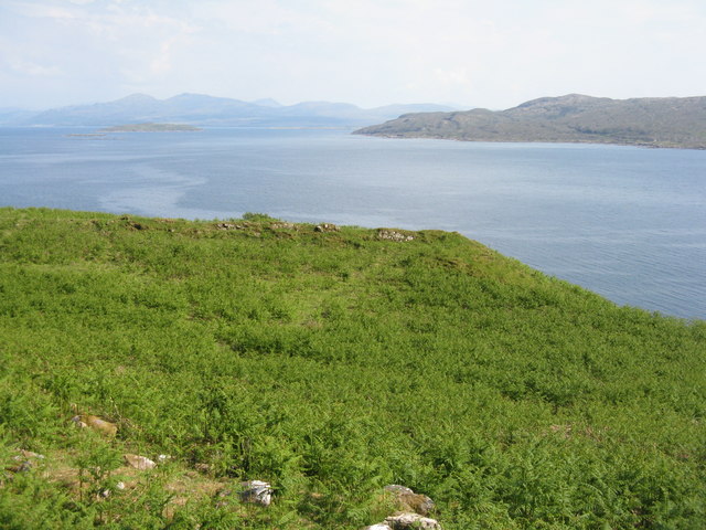
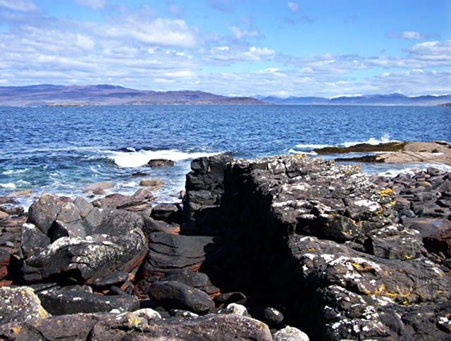
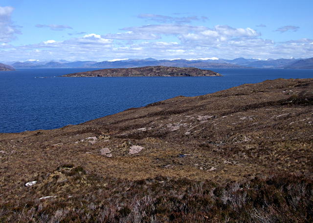
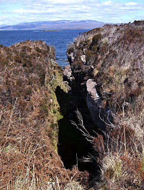
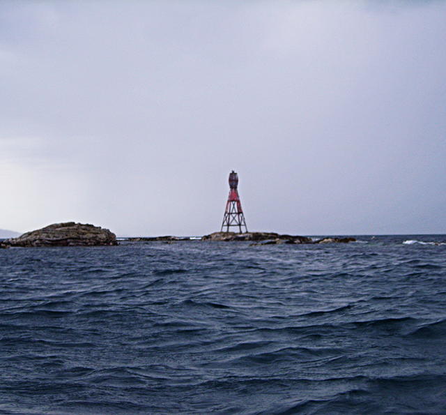
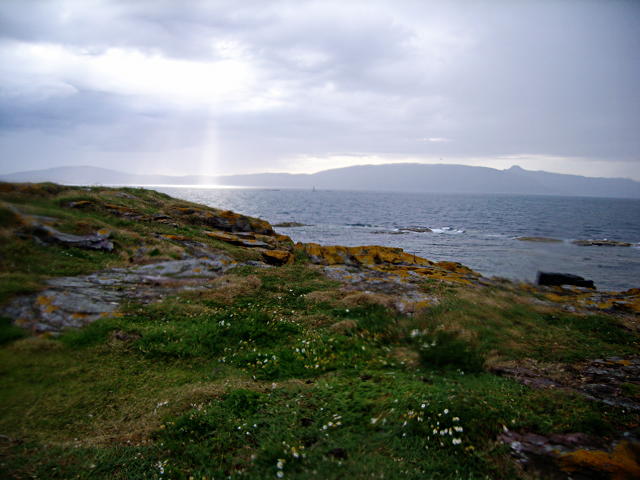
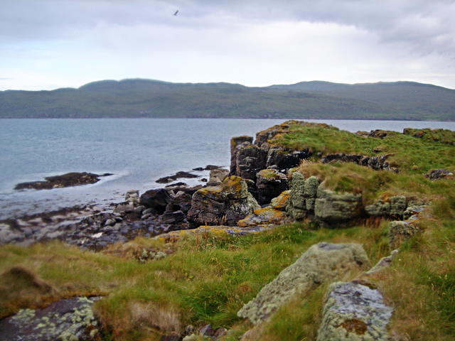
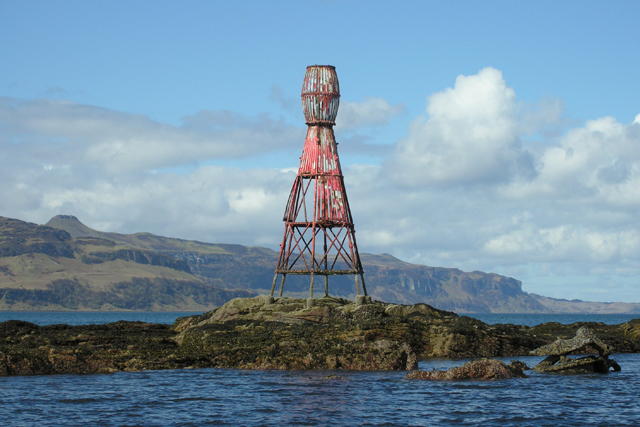
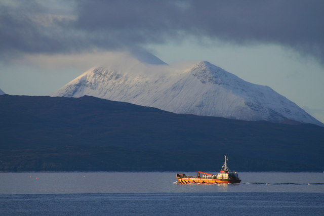
Sgeir Dhearg is a small island located in the Inner Hebrides of Scotland, specifically in Inverness-shire. The island is known for its stunning natural beauty, with rugged coastlines, rocky cliffs, and crystal-clear waters surrounding it. Sgeir Dhearg is uninhabited and is a popular destination for birdwatchers, as it is home to a variety of seabirds such as puffins, guillemots, and razorbills.

The island is also a great spot for outdoor enthusiasts, offering opportunities for hiking, wildlife viewing, and photography. Visitors can explore the island's rocky shores and tidal pools, or simply relax and enjoy the peaceful atmosphere.

Access to Sgeir Dhearg is limited, as it is only accessible by boat. The island is located off the coast of the Isle of Skye, and boat tours are available for those looking to visit. Overall, Sgeir Dhearg is a hidden gem in the Scottish Highlands, offering a unique and tranquil experience for those who venture to its shores.

If you have any feedback on the listing, please let us know in the comments section below.

Sgeir Dhearg Images

Images are sourced within 2km of 57.32653/-5.9261788 or Grid Reference NG6333. Thanks to Geograph Open Source API. All images are credited.

Rubha Doire na Boceinein, Scalpay The eastern side of Scalpay, as seen from North Fearns, Raasay. The smaller island to the left is Longay.
Rubha Doire na Boceinein, Scalpay
The eastern side of Scalpay, as seen from North Fearns, Raasay. The smaller island to the left is Longay.
Scalpay coast A volcanic dyke stands proud, where it has proved more resistant to marine erosion than the surrounding sandstones.
Scalpay coast
A volcanic dyke stands proud, where it has proved more resistant to marine erosion than the surrounding sandstones.
North Scalpay hillside Heather-clad slopes stretch down to the sea.

In the background can be seen the island of Longay, and beyond that the mainland of Scotland from Loch Carron to Loch Alsh.
North Scalpay hillside
Heather-clad slopes stretch down to the sea. In the background can be seen the island of Longay, and beyond that the mainland of Scotland from Loch Carron to Loch Alsh.
Rift This rift is probably a development of a joint in the sandstone beds that has subsequently been eroded by weather and sea.  Beyond can be seen Sgeir Dhearg (which straddles <a href="https://www.geograph.org.uk/gridref/NG6332">NG6332</a> and <a href="https://www.geograph.org.uk/gridref/NG6333">NG6333</a>) and the Crowlin Isles before the mainland of Applecross.
Rift
This rift is probably a development of a joint in the sandstone beds that has subsequently been eroded by weather and sea. Beyond can be seen Sgeir Dhearg (which straddles NG6332 and NG6333) and the Crowlin Isles before the mainland of Applecross.
The beacon on Sgeir Thraid No longer used for navigation.
The beacon on Sgeir Thraid
No longer used for navigation.
The northern part of Sgeir Dhearg Although small, Sgeir Dhearg is tall enough to support some vegetation above the tide line.  In the background can be seen Dun Caan and the beacon of Sgeir Thraid.
The northern part of Sgeir Dhearg
Although small, Sgeir Dhearg is tall enough to support some vegetation above the tide line. In the background can be seen Dun Caan and the beacon of Sgeir Thraid.
Rocky coast of Sgeir Dhearg The southern end of this island has crags about 10ft tall.
Rocky coast of Sgeir Dhearg
The southern end of this island has crags about 10ft tall.
Beacon, Sgeir Thraid The beacon marks the low lying rocks of Sgeir Thraid. Raasay and its top, Dun Caan on left of photograph.
Beacon, Sgeir Thraid
The beacon marks the low lying rocks of Sgeir Thraid. Raasay and its top, Dun Caan on left of photograph.
Wintry day off Scalpay Fishing boat off Scalpay, with Glamaig behind.
Wintry day off Scalpay
Fishing boat off Scalpay, with Glamaig behind.
Show me another place!

Sgeir Dhearg is located at Grid Ref: NG6333 (Lat: 57.32653, Lng: -5.9261788)

Unitary Authority: Highland

Police Authority: Highlands and Islands

What 3 Words

///dictation.tonic.slimming. Near Broadford, Highland

Nearby Locations

Sgeir Dhearg

Related Wikis

Longay

Longay (Scottish Gaelic: Longaigh) is a small uninhabited Scottish island in the Inner Sound just off the coast of the Isle of Skye, north of Pabay and...

Scalpay, Inner Hebrides

Scalpay (; Scottish Gaelic: Sgalpaigh) is an inhabited island in the Inner Hebrides of Scotland which has a population of 4. == Geology == The bedrock...

Eilean Meadhonach

Eilean Meadhonach is the second largest of the Crowlin Islands, located in the Inner Sound off the island of Skye, Scotland. It is situated immediately...

Eilean Mòr, Crowlin Islands

Eilean Mòr is the largest of the Crowlin Islands in the Inner Sound off the Isle of Skye, Scotland. Eilean Mòr is situated at the mouth of Loch Carron...

Nearby Amenities

Located within 500m of 57.32653,-5.9261788
Sgeir Dhearg
Place: islet
Source: OS7
Wikidata: Q24649306
Lat/Long: 57.3262459/-5.9263601
The data included in this document is from www.openstreetmap.org. The data is made available under ODbL.

Have you been to Sgeir Dhearg?

Leave your review of Sgeir Dhearg below (or comments, questions and feedback).