Tannaraidh

Island in Ross-shire

Scotland

Tannaraidh

Loch Nighe at Cromore The sealoch beyond is Loch Erisort.
Loch Nighe at Cromore Credit: Alan Reid

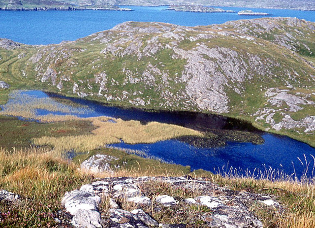
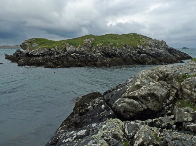
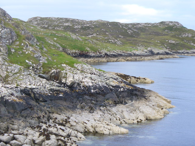
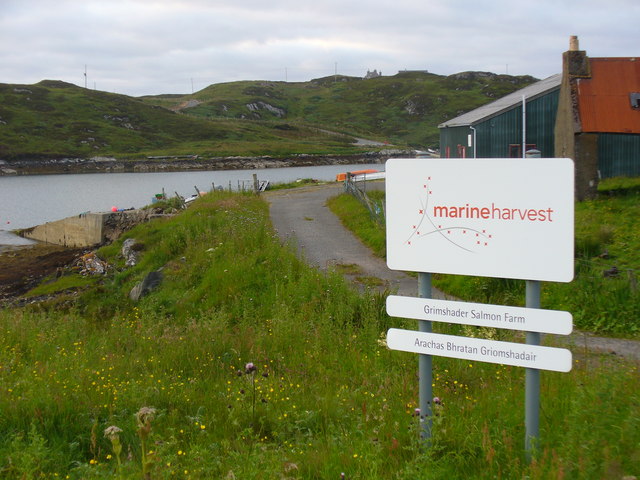
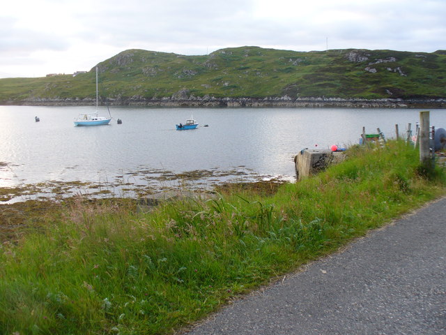
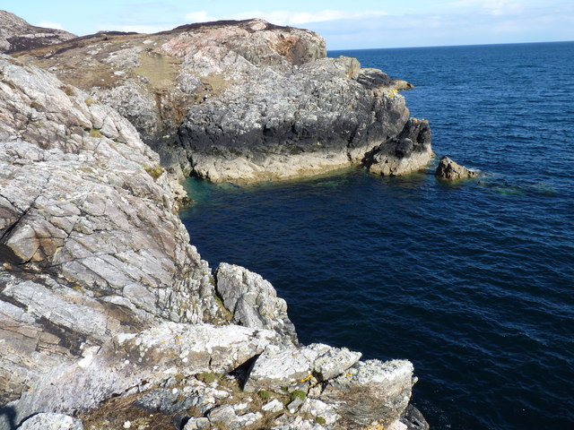
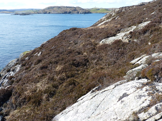
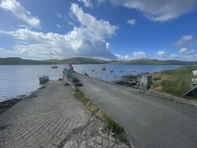
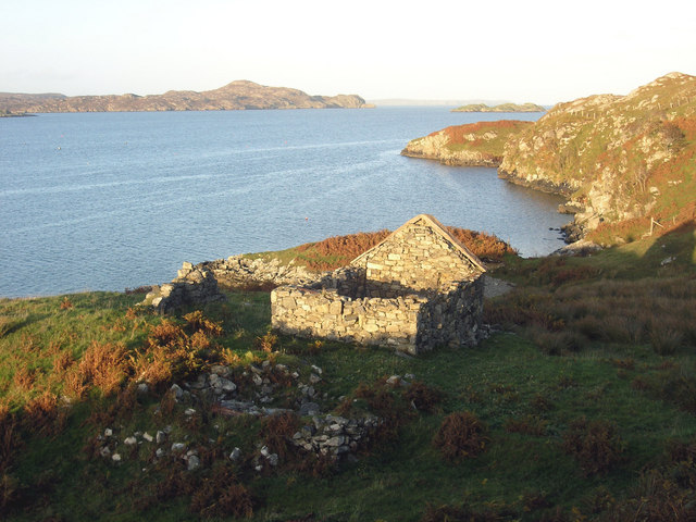
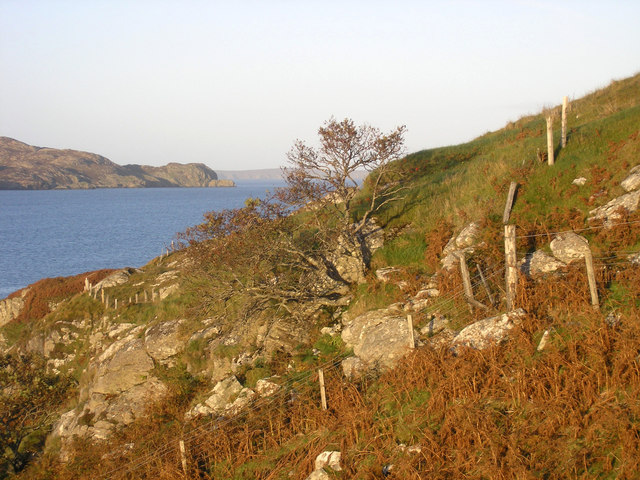
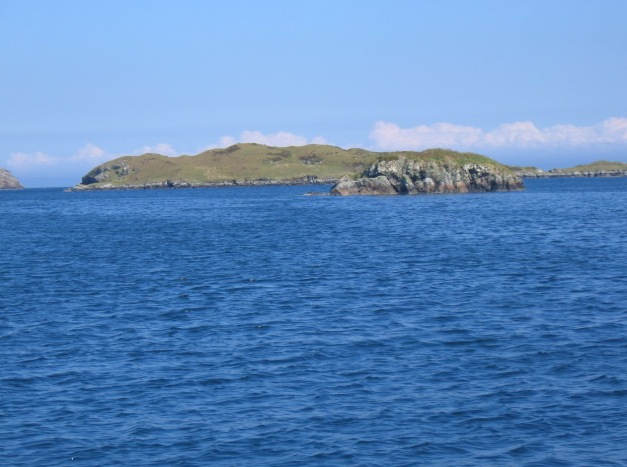
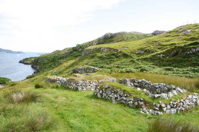
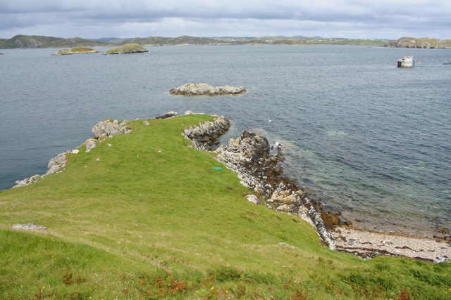
Tannaraidh is an uninhabited island located off the coast of Ross-shire, Scotland. Situated in the North Atlantic Ocean, the island is part of the Inner Hebrides archipelago. With an area of approximately 1 square kilometer, Tannaraidh is characterized by its rugged and rocky terrain, surrounded by the stunning waters of the Atlantic.

The island is known for its rich biodiversity, featuring a variety of plant and animal species. Its coastal cliffs provide nesting sites for seabirds such as fulmars, guillemots, and razorbills. The surrounding waters are home to seals, dolphins, and occasionally whales, making it a popular spot for wildlife enthusiasts and birdwatchers.

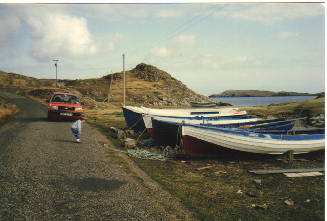
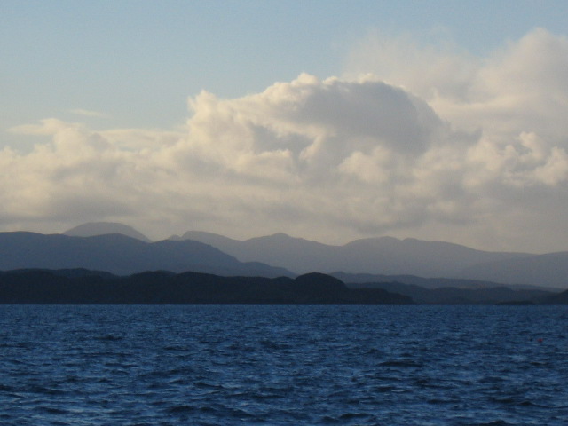
Tannaraidh offers picturesque views of the surrounding islands and the mainland, with glimpses of the Scottish Highlands in the distance. The island's rocky shores are dotted with small coves and sandy beaches, offering opportunities for exploring and relaxation.

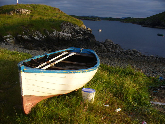
Access to Tannaraidh can be challenging, as there are no regular ferry services to the island. Visitors can arrange private boat trips or join guided tours to explore its natural beauty and enjoy activities such as hiking, wildlife spotting, and photography. It is important to note that the island has no facilities or amenities, so visitors must bring their own supplies and be respectful of the island's fragile ecosystem.

Tannaraidh is a hidden gem for those seeking a remote and untouched natural retreat in the Ross-shire region. Its untouched landscapes and abundant wildlife make it a unique destination for nature lovers and adventure seekers alike.

If you have any feedback on the listing, please let us know in the comments section below.
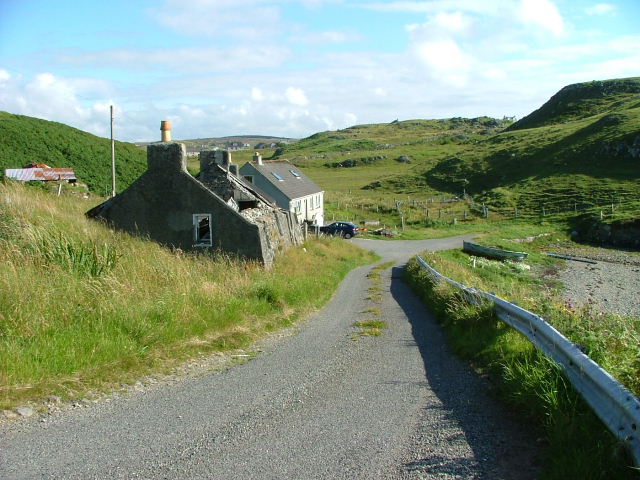
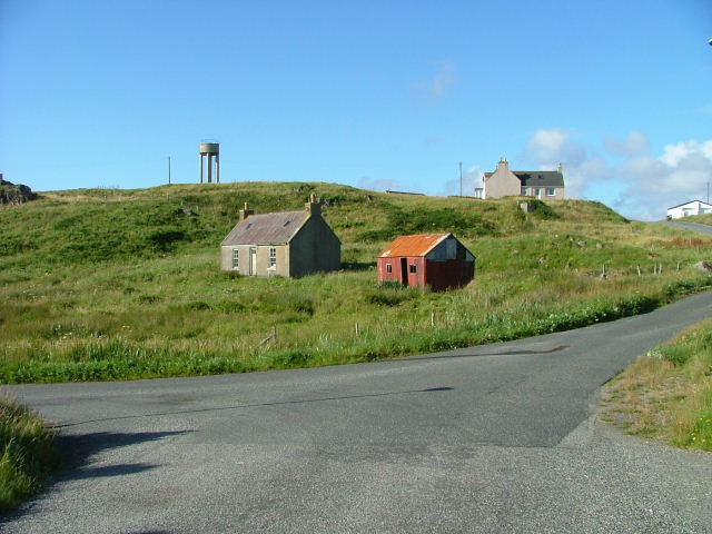
Tannaraidh Images

Images are sourced within 2km of 58.12374/-6.412659 or Grid Reference NB4023. Thanks to Geograph Open Source API. All images are credited.

Loch Nighe at Cromore The sealoch beyond is Loch Erisort.
Loch Nighe at Cromore
The sealoch beyond is Loch Erisort.
Stangraidh, Isle of Lewis The rocks from which the photo was taken, the channel and approximately three quarters of the island lie within the grid square.

The snout of a nosy seal can just be seen at the left hand end of the channel.
Stangraidh, Isle of Lewis
The rocks from which the photo was taken, the channel and approximately three quarters of the island lie within the grid square. The snout of a nosy seal can just be seen at the left hand end of the channel.
Shore at  Cuidhir Rocky shoreline backed by equally rocky hills at the Cuidhir road end.
Shore at Cuidhir
Rocky shoreline backed by equally rocky hills at the Cuidhir road end.
Evening at Cuidhir Rowing boat, in the evening sunshine, pulled up onto the grass above the small, rocky cove at Cuidhir.
Evening at Cuidhir
Rowing boat, in the evening sunshine, pulled up onto the grass above the small, rocky cove at Cuidhir.
Grimshader Salmon Farm Marine Harvest - Arachas Bhratan Griomshadair. Sea loch industry on the shores of Loch Griomsiadair.
Grimshader Salmon Farm
Marine Harvest - Arachas Bhratan Griomshadair. Sea loch industry on the shores of Loch Griomsiadair.
Loch Griomsiadair Yacht and lobster boat moored in the sheltered sea loch at Grimshader which is also used for salmon farming.
Loch Griomsiadair
Yacht and lobster boat moored in the sheltered sea loch at Grimshader which is also used for salmon farming.
Small inlet near Eilean Glas
Coastline
Coastline
Crosbost Jetty Geocaching is a type of global treasure hunt of people looking for caches, or hidden stashes of objects. Geocaching may also be described as a series of hide-and-seek games, where hiders provide online clues for seekers. Seekers use global positioning system (GPS) devices to find hidden caches
Crosbost Jetty
Geocaching is a type of global treasure hunt of people looking for caches, or hidden stashes of objects. Geocaching may also be described as a series of hide-and-seek games, where hiders provide online clues for seekers. Seekers use global positioning system (GPS) devices to find hidden caches
Boats at Cuidhir Loch Leurbost The Islands of Tabhaidh Bheag and Tabhaidh are clearly seen in distance.
Boats at Cuidhir Loch Leurbost
The Islands of Tabhaidh Bheag and Tabhaidh are clearly seen in distance.
Entrance to Loch Erisort Eilean Cholum Chille (St.Columba's Isle) in mid picture and Clisham 799m -highest hill in Hebrides in distance to left of frame
Entrance to Loch Erisort
Eilean Cholum Chille (St.Columba's Isle) in mid picture and Clisham 799m -highest hill in Hebrides in distance to left of frame
House at Cromore Ruined house at the end of Cromore, on Loch Erisort
House at Cromore
Ruined house at the end of Cromore, on Loch Erisort
Cromore Common Grazings Steep rocky slopes to the shore at the north end of Cromore Grazings.  Loch Erisort and the island of Tannaraidh beyond.
Cromore Common Grazings
Steep rocky slopes to the shore at the north end of Cromore Grazings. Loch Erisort and the island of Tannaraidh beyond.
Eilean Bhatarsaidh Unnamed Islet in foreground and Stac at Loch Erisort Entrance in distance (left of frame). Collectively these Islands are referred to as Na h-Eileanan Bairclin or Barkin Isles.
Eilean Bhatarsaidh
Unnamed Islet in foreground and Stac at Loch Erisort Entrance in distance (left of frame). Collectively these Islands are referred to as Na h-Eileanan Bairclin or Barkin Isles.
Remains of crofts, Cromor
Promontory, Cromor
Promontory, Cromor
Road end at Crosbost
Old croft buildings at Ranais
Show me another place!

Tannaraidh is located at Grid Ref: NB4023 (Lat: 58.12374, Lng: -6.412659)

Unitary Authority: Na h-Eileanan an Iar

Police Authority: Highlands and Islands

What 3 Words

///intro.pitch.firewall. Near Leurbost, Na h-Eileanan Siar

Related Wikis

Crossbost

Crossbost is a village on the Isle of Lewis in the parish of North Lochs, in the Outer Hebrides, Scotland. It is located approximately ten miles away...

Cromore

Cromore (Scottish Gaelic: Crò Mòr) is a crofting township on the Isle of Lewis in the district of Pairc, in the Outer Hebrides, Scotland. The settlement...

Eilean Chaluim Chille

Eilean Chaluim Chille (Gaelic: island of Saint Columba, Calum Cille) is an unpopulated island in the Outer Hebrides. It lies off the east coast of Lewis...

North Lochs

North Lochs, (Scottish Gaelic: Ceann a Tuath nan Loch), an area in eastern Lewis, Outer Hebrides, Scotland, is named for the many lochans (small lochs...

Have you been to Tannaraidh?

Leave your review of Tannaraidh below (or comments, questions and feedback).