Cunninger Bottom

Valley in Hampshire New Forest

England

Cunninger Bottom

View across the head of Black Gutter Bottom A distinctive unnamed copse seen across an area of bog which drains into Black Gutter Bottom.
View across the head of Black Gutter Bottom Credit: David Martin

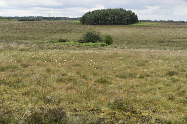
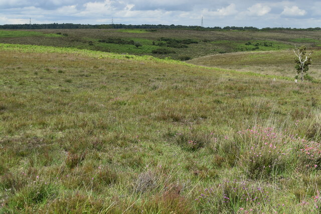
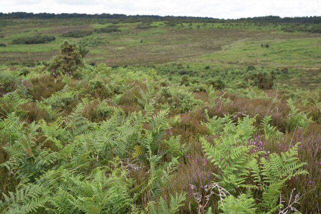
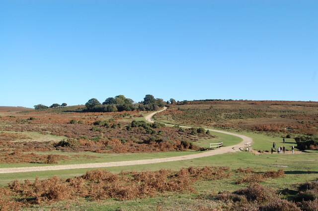
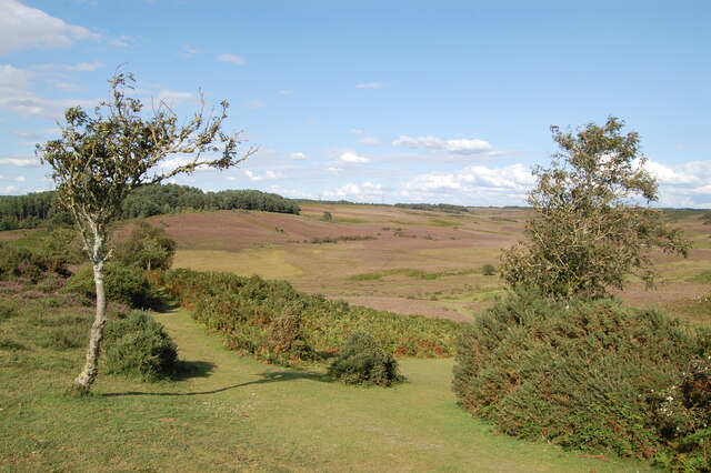
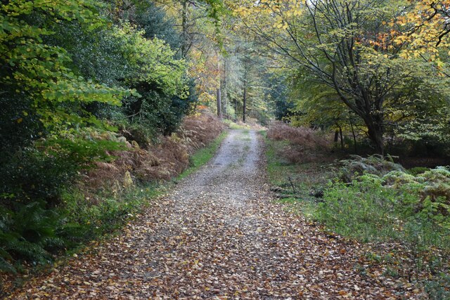
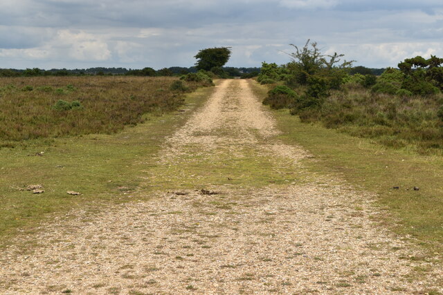
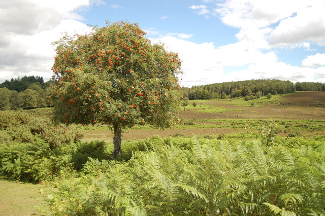
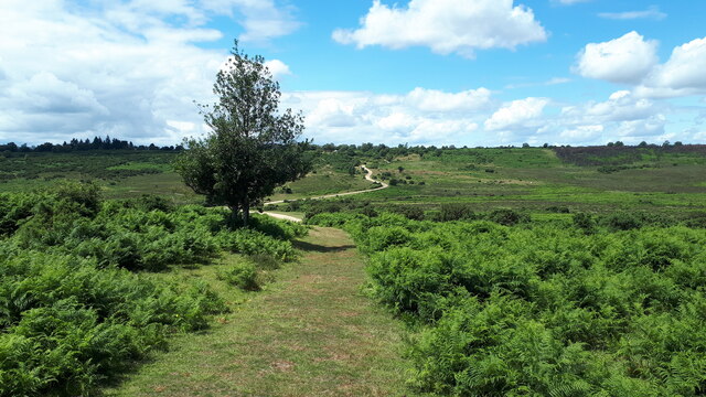
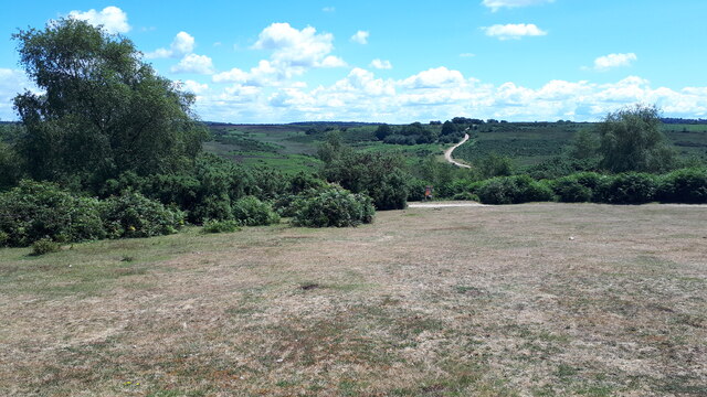
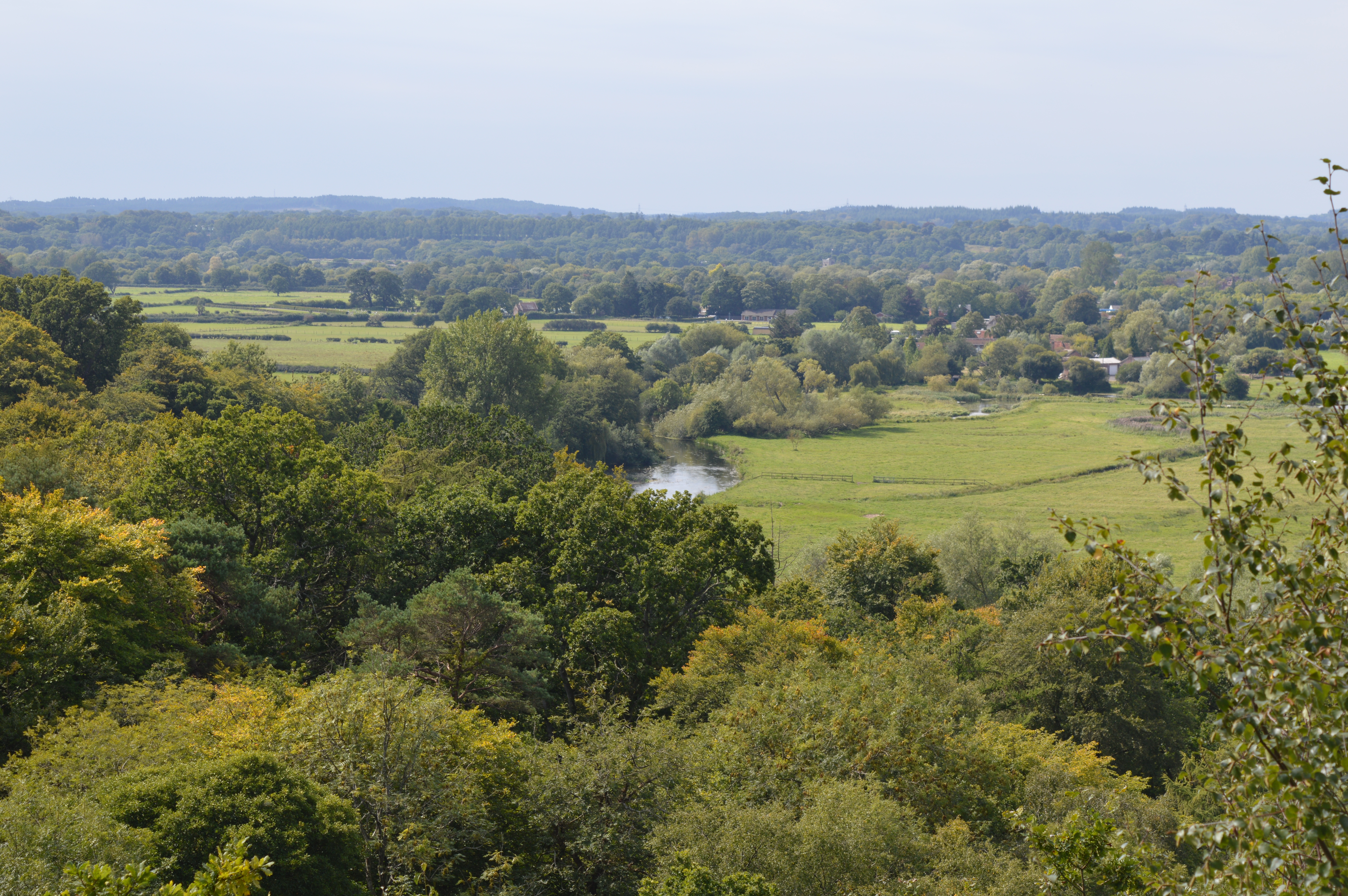
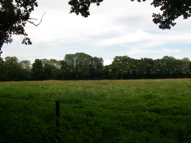
Cunninger Bottom is a picturesque valley located in the county of Hampshire, England. Nestled amidst rolling hills and lush greenery, this idyllic valley is renowned for its natural beauty and tranquil atmosphere. Situated in the southern part of the county, Cunninger Bottom offers a peaceful retreat from the hustle and bustle of city life.

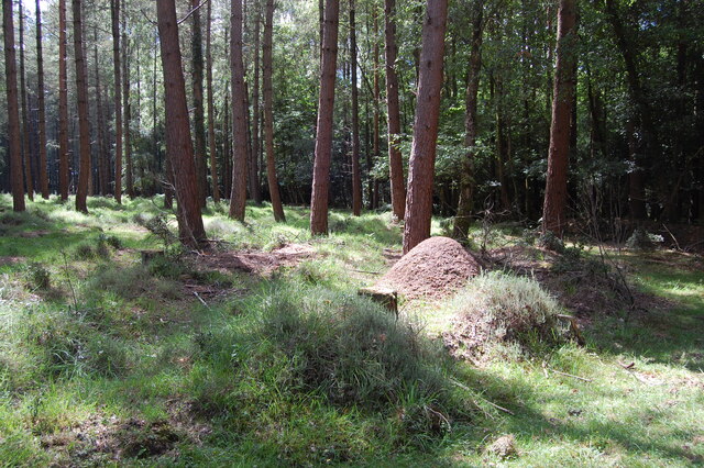
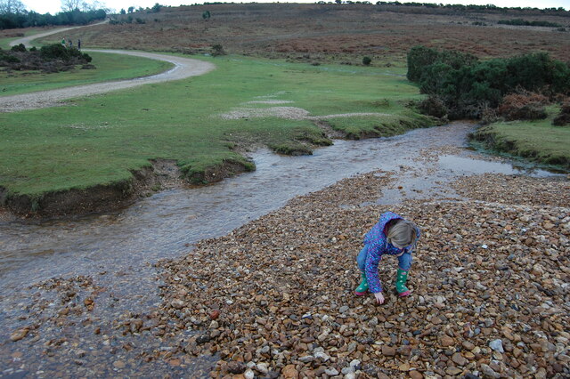
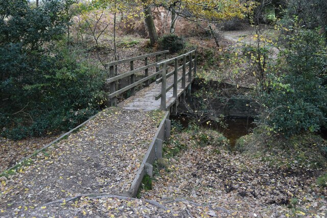
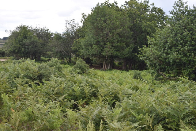
The valley is characterized by its meandering stream, which flows gently through the landscape, adding to the charm of the surroundings. The stream is lined with ancient trees, creating a delightful backdrop for leisurely walks and picnics. The valley is also home to a variety of wildlife, including birds, butterflies, and small mammals, making it a haven for nature lovers and wildlife enthusiasts.

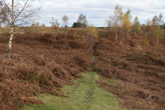
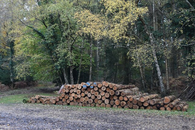
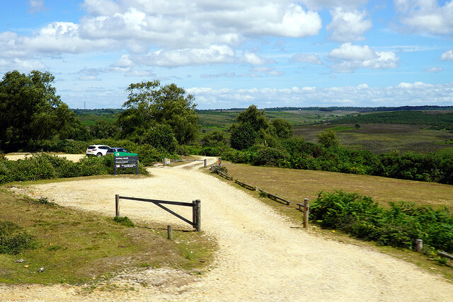
Cunninger Bottom is a popular destination for outdoor activities, with numerous walking trails and cycling routes crisscrossing the area. Visitors can explore the valley's scenic beauty and enjoy the fresh air while indulging in their favorite outdoor pursuits. Additionally, the valley is dotted with several picnic spots, allowing visitors to relax and soak in the serenity of the surroundings.

For those interested in history and culture, Cunninger Bottom is also home to a few historical sites. One notable landmark is an ancient burial mound, believed to date back to the Neolithic period. This archaeological site offers a glimpse into the area's rich history and provides an opportunity for visitors to learn about the region's past.

In conclusion, Cunninger Bottom in Hampshire is a stunning valley that offers a peaceful and picturesque retreat for nature lovers, outdoor enthusiasts, and history buffs alike. With its scenic beauty, abundant wildlife, and historical sites, this hidden gem is a must-visit destination for anyone seeking a tranquil escape in the heart of Hampshire.

If you have any feedback on the listing, please let us know in the comments section below.

Cunninger Bottom Images

Images are sourced within 2km of 50.949394/-1.7216345 or Grid Reference SU1916. Thanks to Geograph Open Source API. All images are credited.

View across the head of Black Gutter Bottom A distinctive unnamed copse seen across an area of bog which drains into Black Gutter Bottom.
View across the head of Black Gutter Bottom
A distinctive unnamed copse seen across an area of bog which drains into Black Gutter Bottom.
View down side valley into Black Gutter Bottom
Bracken across the path above Black Gutter Bottom
Cows and ponies on target The animals and photographer are standing on one of the major target areas of Ashley Walk Bombing Range. Fortunately it closed in 1946. For full details see <a href="https://www.geograph.org.uk/photo/4477882">SU2014 : (7d) A tour of the WWII Ashley Walk Bombing Range - Observation Shelter (detail)</a>.
Cows and ponies on target
The animals and photographer are standing on one of the major target areas of Ashley Walk Bombing Range. Fortunately it closed in 1946. For full details see SU2014 : (7d) A tour of the WWII Ashley Walk Bombing Range - Observation Shelter (detail).
Ant hill in Turf Hill Inclosure
The snake path near Godshill
Ditchend Brook near The Snake Path
Taking the path down to Cunninger Bottom The edge of Turf Hill Inclosure on the sky line
Taking the path down to Cunninger Bottom
The edge of Turf Hill Inclosure on the sky line
Path below Godshill Inclosure
Track in Godshill Inclosure
Timber stack in Godshill Inclosure
Footbridge in Millersford Bottom
Ashley Walk car park on Godshill Ridge Looking over Stone Quarry Bottom.
Ashley Walk car park on Godshill Ridge
Looking over Stone Quarry Bottom.
Track on Little Cockley Plain Within the area of the former Ashley Walk Bombing Range. For details see <a href="https://www.geograph.org.uk/photo/4477882">SU2014 : (7d) A tour of the WWII Ashley Walk Bombing Range - Observation Shelter (detail)</a>.
Track on Little Cockley Plain
Within the area of the former Ashley Walk Bombing Range. For details see SU2014 : (7d) A tour of the WWII Ashley Walk Bombing Range - Observation Shelter (detail).
Bracken and woodland at Lodge Hill
Rowan Tree Loaded with berries. Note the browse line on the tree created by the commoners animals. Turf hill inclosure on the skyline.
Rowan Tree
Loaded with berries. Note the browse line on the tree created by the commoners animals. Turf hill inclosure on the skyline.
View from Cockley Hill Roger Penny Way runs along the skyline on the other side of the valley. For the reverse view, see <a href="https://www.geograph.org.uk/photo/7547811">SU1815 : View towards Cockley Hill from Ashley Walk car park</a>.
View from Cockley Hill
Roger Penny Way runs along the skyline on the other side of the valley. For the reverse view, see SU1815 : View towards Cockley Hill from Ashley Walk car park.
View towards Cockley Hill from Ashley Walk car park For the view from the distant path looking the other way, see <a href="https://www.geograph.org.uk/photo/7547805">SU1915 : View from Cockley Hill</a>.
View towards Cockley Hill from Ashley Walk car park
For the view from the distant path looking the other way, see SU1915 : View from Cockley Hill.
Show me another place!

Cunninger Bottom is located at Grid Ref: SU1916 (Lat: 50.949394, Lng: -1.7216345)

Administrative County: Hampshire

District: New Forest

Police Authority: Hampshire

What 3 Words

///jigging.completed.vegetable. Near Fordingbridge, Hampshire

Related Wikis

Ashley Range

Ashley Range is a former World War II bombing range in the New Forest, Hampshire, England. The range is approximately 5 mi (8.0 km) north-west of Lyndhurst...

Hale, Hampshire

Hale is a small village and civil parish in Hampshire, England. It lies on the border of the New Forest, overlooking the valley of the River Avon. The...

Woodgreen

Woodgreen is a village and civil parish within the New Forest district of Hampshire in England. == Overview == Woodgreen lies between Breamore and Hale...

Bohemia, Wiltshire

Bohemia is a hamlet in Wiltshire, England, in the parish of Redlynch. It lies about 1 mile (1.6 km) southeast of Redlynch and 7.5 miles (12 km) southeast...

Sandy Balls

Sandy Balls is 120 acres (0.49 km2) of woods and parkland near the New Forest in Hampshire, England. Located between the village of Godshill and the town...

Frankenbury Camp

Frankenbury Camp is the site of an Iron Age univallate hillfort located in Hampshire. The site is on a very slight promontory overlooking the Avon Valley...

Loosehanger Copse and Meadows

Loosehanger Copse and Meadows (grid reference SU215195) is a 56.27 hectare biological Site of Special Scientific Interest in Wiltshire, England, notified...

Godshill, Hampshire

Godshill is a village and civil parish and in New Forest National Park in Hampshire, England. It is about 1+1⁄2 miles (2.4 km) east of the town of Fordingbridge...

Nearby Amenities

Located within 500m of 50.949394,-1.7216345
Millers Ford
Bicycle: yes
Ford: yes
Motor Vehicle: yes
Lat/Long: 50.9511396/-1.7279154
Ford: yes
Lat/Long: 50.950584/-1.7170536
Ford: yes
Lat/Long: 50.9511826/-1.7279564
Bicycle: yes
Ford: yes
Motor Vehicle: yes
Lat/Long: 50.9493301/-1.7222004
Ford: yes
Lat/Long: 50.9507068/-1.7164099
Ford: yes
Lat/Long: 50.9507795/-1.7158413
Ford: yes
Lat/Long: 50.9499149/-1.7189433
Cunninger Bottom
Place: locality
Lat/Long: 50.9486879/-1.7236037
Ford: yes
Lat/Long: 50.9509065/-1.7270821
Ele: 102
Natural: peak
Lat/Long: 50.9473459/-1.7259122
Turf Hill
Ele: 105
Natural: peak
Lat/Long: 50.9530733/-1.7186787
The data included in this document is from www.openstreetmap.org. The data is made available under ODbL.

Have you been to Cunninger Bottom?

Leave your review of Cunninger Bottom below (or comments, questions and feedback).