The Dingle

Valley in Gloucestershire Tewkesbury

England

The Dingle

Sudeley Castle - Ruins of banqueting hall Looking across the lawn which centuries ago would have been the floor of the great hall that once stood here. The romantic ruins of the northeastern corner of this former building still stand giving an idea of its original height.
Sudeley Castle - Ruins of banqueting hall Credit: Rob Farrow

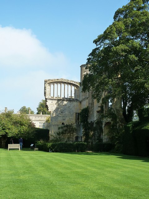
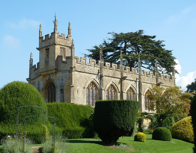
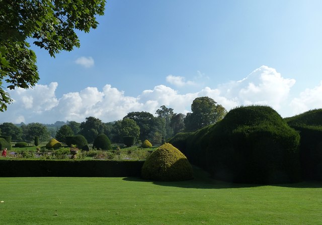
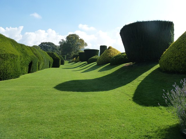
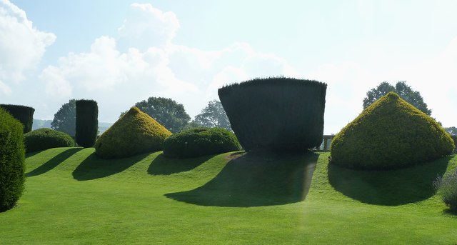
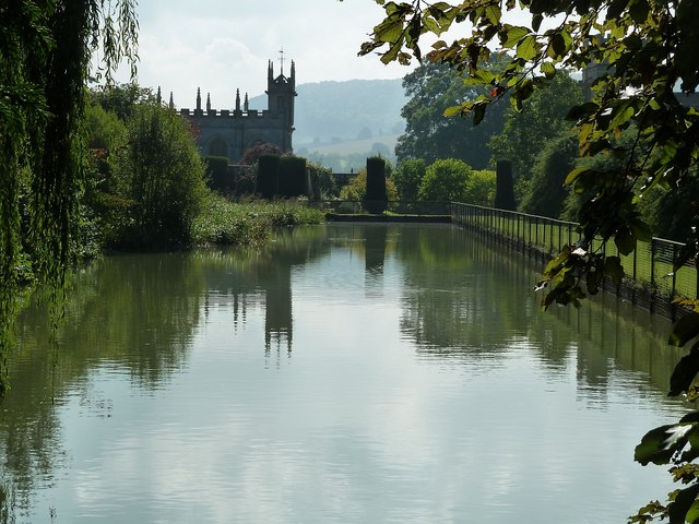
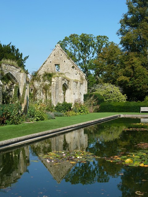
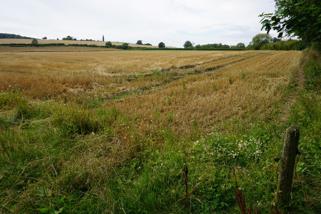
The Dingle, located in Gloucestershire, is a picturesque valley that offers a serene and scenic escape from the hustle and bustle of city life. Situated in the beautiful Cotswold region, this tranquil valley is surrounded by rolling hills and lush greenery, providing visitors with a truly idyllic setting.

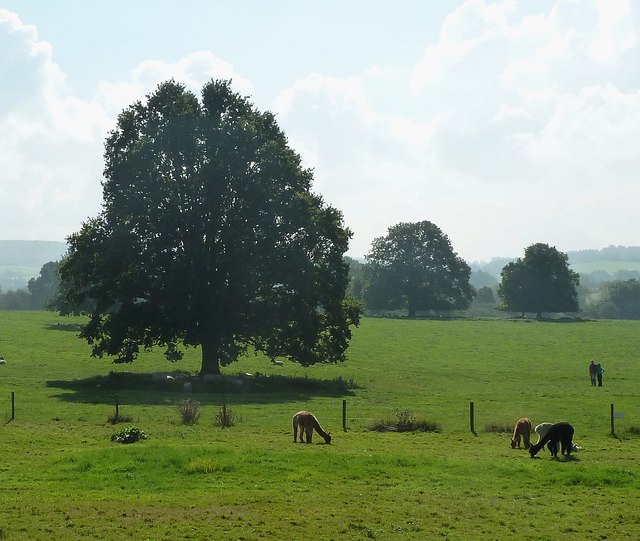
The Dingle is renowned for its natural beauty, with a meandering stream flowing through the valley, adding to its charm. The area is abundant in wildlife, making it a popular spot for nature enthusiasts and birdwatchers. Visitors can spot a variety of bird species, including kingfishers, herons, and woodpeckers, as well as other wildlife such as deer and rabbits.

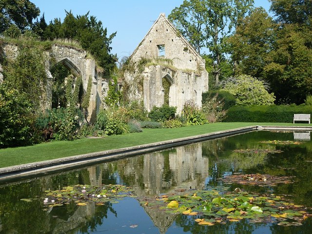
The valley is also home to a number of walking and hiking trails, offering visitors the opportunity to explore the stunning countryside. These trails cater to all levels of fitness, from gentle walks suitable for families to more challenging hikes for experienced adventurers. The Dingle is particularly popular during the spring and summer months when wildflowers bloom, creating a vibrant and colorful landscape.

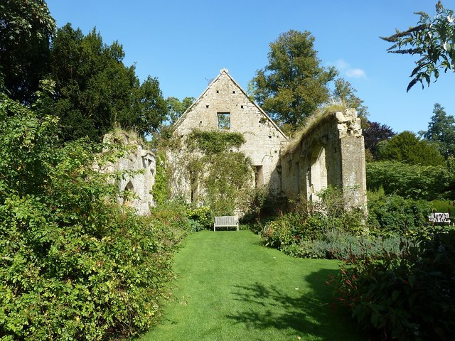
For those seeking a peaceful retreat, The Dingle offers several picnic spots where visitors can relax and enjoy the tranquility of the surroundings. Additionally, there are some benches strategically placed along the walking trails, providing a perfect spot to take in the breathtaking views.

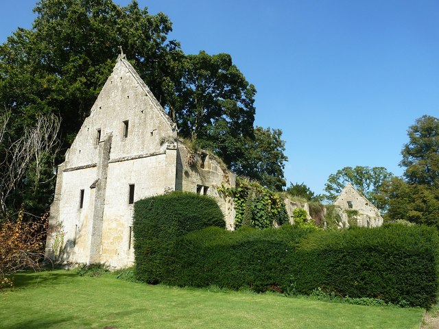
Overall, The Dingle in Gloucestershire is a hidden gem that showcases the natural beauty of the Cotswolds. With its peaceful atmosphere, diverse wildlife, and stunning scenery, it is a must-visit destination for nature lovers and anyone seeking a peaceful escape.

If you have any feedback on the listing, please let us know in the comments section below.

The Dingle Images

Images are sourced within 2km of 51.949201/-1.9406347 or Grid Reference SP0427. Thanks to Geograph Open Source API. All images are credited.

Sudeley Castle - Ruins of banqueting hall Looking across the lawn which centuries ago would have been the floor of the great hall that once stood here. The romantic ruins of the northeastern corner of this former building still stand giving an idea of its original height.
Sudeley Castle - Ruins of banqueting hall
Looking across the lawn which centuries ago would have been the floor of the great hall that once stood here. The romantic ruins of the northeastern corner of this former building still stand giving an idea of its original height.
Sudeley Castle - St Mary's church Originally a private chapel built by Ralph Boteler in the mid C15th, this little church in the grounds of Sudeley Castle fell into ruin after the depredations of the English Civil War and the damage inflicted upon it by Cromwell's troops.
In the C18th a tomb was discovered bearing an inscription revealing that it belonged to Katherine Parr - the last of Henry VIII's six wives. 
The church was restored by the Dent family in the mid C19th, and Katherine's body now lies within a fine monument within this church. (see <a href="https://www.geograph.org.uk/photo/4678430">SP0327 : Sudeley - Tomb of Katherine Parr (1512-1548)</a>)
Sudeley Castle - St Mary's church
Originally a private chapel built by Ralph Boteler in the mid C15th, this little church in the grounds of Sudeley Castle fell into ruin after the depredations of the English Civil War and the damage inflicted upon it by Cromwell's troops. In the C18th a tomb was discovered bearing an inscription revealing that it belonged to Katherine Parr - the last of Henry VIII's six wives. The church was restored by the Dent family in the mid C19th, and Katherine's body now lies within a fine monument within this church. (see SP0327 : Sudeley - Tomb of Katherine Parr (1512-1548))
Sudeley - Tomb of Katherine Parr (1512-1548) Katherine (or Catherine, Kathryn, Kathryne etc.) Parr was born in 1512 most likely in Blackfriars, London rather than at her family's ancestral home in Westmorland.
In 1543 she became the sixth and final wife of the by-then decrepit and obese Henry VIII. This was her third marriage, her two former husbands Sir Edward Burgh and John Neville, Lord Latimer both having died.
Katherine was apparently a very effective Queen Consort, proficiently acting as Regent in Henry's absence. When Henry died in 1547 she had hoped and expected to be named as Regent and advisor to the young Edward VI, however the quixotic Henry had made other arrangements and Katherine was sidelined.
Katherine moved to Sudeley and married the man she had long desired, Thomas Seymour. Her new husband was ambitious and rash, and no doubt considered his marriage to Katherine as a fine political move. 
Sadly, Katherine died within a year, soon after giving birth to a daughter - this daughter has mysteriously vanished from History and no-one knows her fate, though it is believed that she survived infancy at least.
Thomas Seymour, with a female heir and a dead wife, left Sudeley, never to return, not even for his wife's funeral.
Katherine was interred in the private chapel - or small church - on the estate. During the Civil War in the mid C17th the church was damaged by Cromwell's troops and eventually became ruinous. Katherine's tomb was effectively lost and forgotten.
It was not until the mid C18th that two ladies visiting the romantic ruins of the castle, looked in on the remains of the church and noticed a carved stone. They requested that this be investigated and soon a tomb was rediscovered with a plaque on it stating it belonged to the Queen of England, Katherine Parr.
On opening the lead sarcophagus, Katherine was found to be almost perfectly preserved. However once air got into the coffin, decay commenced and by the time of her reburial in the mid C19th, her body had become little more than dust and bones. 
She was re-interred in the fine tomb which can be found in the church today, with an effigy by J.B. Philip resting on a marble chest tomb.
To see the church <a href="https://www.geograph.org.uk/photo/4678400">SP0327 : Sudeley Castle - St Mary's church</a>
Sudeley - Tomb of Katherine Parr (1512-1548)
Katherine (or Catherine, Kathryn, Kathryne etc.) Parr was born in 1512 most likely in Blackfriars, London rather than at her family's ancestral home in Westmorland. In 1543 she became the sixth and final wife of the by-then decrepit and obese Henry VIII. This was her third marriage, her two former husbands Sir Edward Burgh and John Neville, Lord Latimer both having died. Katherine was apparently a very effective Queen Consort, proficiently acting as Regent in Henry's absence. When Henry died in 1547 she had hoped and expected to be named as Regent and advisor to the young Edward VI, however the quixotic Henry had made other arrangements and Katherine was sidelined. Katherine moved to Sudeley and married the man she had long desired, Thomas Seymour. Her new husband was ambitious and rash, and no doubt considered his marriage to Katherine as a fine political move. Sadly, Katherine died within a year, soon after giving birth to a daughter - this daughter has mysteriously vanished from History and no-one knows her fate, though it is believed that she survived infancy at least. Thomas Seymour, with a female heir and a dead wife, left Sudeley, never to return, not even for his wife's funeral. Katherine was interred in the private chapel - or small church - on the estate. During the Civil War in the mid C17th the church was damaged by Cromwell's troops and eventually became ruinous. Katherine's tomb was effectively lost and forgotten. It was not until the mid C18th that two ladies visiting the romantic ruins of the castle, looked in on the remains of the church and noticed a carved stone. They requested that this be investigated and soon a tomb was rediscovered with a plaque on it stating it belonged to the Queen of England, Katherine Parr. On opening the lead sarcophagus, Katherine was found to be almost perfectly preserved. However once air got into the coffin, decay commenced and by the time of her reburial in the mid C19th, her body had become little more than dust and bones. She was re-interred in the fine tomb which can be found in the church today, with an effigy by J.B. Philip resting on a marble chest tomb. To see the church SP0327 : Sudeley Castle - St Mary's church
Sudeley Castle - Knot Garden - looking east A view of the Knot Garden within a quadrangular internal courtyard of Sudeley Castle. This view is looking eastwards. See also the view from under the arbor (seen ahead) looking westwards <a href="https://www.geograph.org.uk/photo/4678443">SP0327 : Sudeley Castle - Knot Garden - looking westwards</a>
Sudeley Castle - Knot Garden - looking east
A view of the Knot Garden within a quadrangular internal courtyard of Sudeley Castle. This view is looking eastwards. See also the view from under the arbor (seen ahead) looking westwards SP0327 : Sudeley Castle - Knot Garden - looking westwards
Sudeley Castle - Knot Garden - looking westwards The complementary view to <a href="https://www.geograph.org.uk/photo/4678442">SP0327 : Sudeley Castle - Knot Garden - looking east</a> looking westwards across the Knot Garden at Sudeley from beneath the arbor on the eastern side of the quadrangle.
Sudeley Castle - Knot Garden - looking westwards
The complementary view to SP0327 : Sudeley Castle - Knot Garden - looking east looking westwards across the Knot Garden at Sudeley from beneath the arbor on the eastern side of the quadrangle.
Sudeley Castle - Gardens A view over the immaculately tended gardens at Sudeley Castle.
Sudeley Castle - Gardens
A view over the immaculately tended gardens at Sudeley Castle.
Sudeley Castle - Yew Tree Walk The sculpturally trimmed yew trees cast strong shadows onto the neatly mown grass of a walk between the numerous yew trees at the southern end of the gardens at Sudeley Castle.
See also <a href="https://www.geograph.org.uk/photo/4678593">SP0327 : Sudeley Castle - Topiary</a> and shared description below:
Sudeley Castle - Yew Tree Walk
The sculpturally trimmed yew trees cast strong shadows onto the neatly mown grass of a walk between the numerous yew trees at the southern end of the gardens at Sudeley Castle. See also SP0327 : Sudeley Castle - Topiary and shared description below:
Sudeley Castle - Topiary The yew trees on the southern fringe of the gardens at Sudeley Castle have been trimmed into neat geometric shapes which were casting strong shadows on this bright early Autumn day. See also <a href="https://www.geograph.org.uk/photo/4678589">SP0327 : Sudeley Castle - Yew Tree Walk</a> and the shared description below:
Sudeley Castle - Topiary
The yew trees on the southern fringe of the gardens at Sudeley Castle have been trimmed into neat geometric shapes which were casting strong shadows on this bright early Autumn day. See also SP0327 : Sudeley Castle - Yew Tree Walk and the shared description below:
Sudeley Castle - Alpacas I think that these woolly creatures are alpacas rather than llamas as they are too small for the latter I think.
They were grazing in a field immediately to the south of the gardens at Sudeley Castle - still within its grounds however.
Sudeley Castle - Alpacas
I think that these woolly creatures are alpacas rather than llamas as they are too small for the latter I think. They were grazing in a field immediately to the south of the gardens at Sudeley Castle - still within its grounds however.
Sudeley Castle - view to St Mary's church Looking along the length of the ornamental pool to the north of Sudeley Castle to the tower end of St Mary's church in the castle grounds. The pool was well stocked with large fish.
Sudeley Castle - view to St Mary's church
Looking along the length of the ornamental pool to the north of Sudeley Castle to the tower end of St Mary's church in the castle grounds. The pool was well stocked with large fish.
Sudeley Castle - Tithe Barn The large, but ruined Tithe Barn at Sudeley Castle which lies to the northwest of the castle is contemporary with the oldest parts of the castle having been built for Ralph Boteler in the mid C15th. It is EH Grade I listed <span class="nowrap"><a title="http://www.historicengland.org.uk/listing/the-list/list-entry/1000784" rel="nofollow ugc noopener" href="http://www.historicengland.org.uk/listing/the-list/list-entry/1000784">Link</a><img style="margin-left:2px;" alt="External link" title="External link - shift click to open in new window" src="https://s1.geograph.org.uk/img/external.png" width="10" height="10"/></span>
see also <a href="https://www.geograph.org.uk/photo/4678615">SP0327 : Sudeley Castle - Tithe Barn - Interior (NE end)</a>, <a href="https://www.geograph.org.uk/photo/4678630">SP0327 : Sudeley Castle - Reflected Tithe Barn</a> and <a href="https://www.geograph.org.uk/photo/4678646">SP0327 : Sudeley Castle - Lily pond reflecting the Tithe Barn</a>
Sudeley Castle - Tithe Barn
The large, but ruined Tithe Barn at Sudeley Castle which lies to the northwest of the castle is contemporary with the oldest parts of the castle having been built for Ralph Boteler in the mid C15th. It is EH Grade I listed LinkExternal link see also SP0327 : Sudeley Castle - Tithe Barn - Interior (NE end), SP0327 : Sudeley Castle - Reflected Tithe Barn and SP0327 : Sudeley Castle - Lily pond reflecting the Tithe Barn
Sudeley Castle - Tithe Barn - Interior (NE end) Inside the enormous ruined Tithe Barn at Sudeley Castle, looking from roughly its mid point to the northeastern end of this fine old building. The old stones are proving to be an  excellent trellis for climbing plants.
see also <a href="https://www.geograph.org.uk/photo/4678610">SP0327 : Sudeley Castle - Tithe Barn</a>, <a href="https://www.geograph.org.uk/photo/4678630">SP0327 : Sudeley Castle - Reflected Tithe Barn</a> and <a href="https://www.geograph.org.uk/photo/4678646">SP0327 : Sudeley Castle - Lily pond reflecting the Tithe Barn</a>
Sudeley Castle - Tithe Barn - Interior (NE end)
Inside the enormous ruined Tithe Barn at Sudeley Castle, looking from roughly its mid point to the northeastern end of this fine old building. The old stones are proving to be an excellent trellis for climbing plants. see also SP0327 : Sudeley Castle - Tithe Barn, SP0327 : Sudeley Castle - Reflected Tithe Barn and SP0327 : Sudeley Castle - Lily pond reflecting the Tithe Barn
Sudeley Castle - Reflected Tithe Barn The first of two photos of the northwestern end of the Tithe Barn at Sudeley reflected in the lily pond which is to its east. In this landscape view more of the side of the old barn can be seen than in the portrait view here <a href="https://www.geograph.org.uk/photo/4678646">SP0327 : Sudeley Castle - Lily pond reflecting the Tithe Barn</a>
See also <a href="https://www.geograph.org.uk/photo/4678610">SP0327 : Sudeley Castle - Tithe Barn</a> and <a href="https://www.geograph.org.uk/photo/4678615">SP0327 : Sudeley Castle - Tithe Barn - Interior (NE end)</a>
Sudeley Castle - Reflected Tithe Barn
The first of two photos of the northwestern end of the Tithe Barn at Sudeley reflected in the lily pond which is to its east. In this landscape view more of the side of the old barn can be seen than in the portrait view here SP0327 : Sudeley Castle - Lily pond reflecting the Tithe Barn See also SP0327 : Sudeley Castle - Tithe Barn and SP0327 : Sudeley Castle - Tithe Barn - Interior (NE end)
Sudeley Castle - Lily pond reflecting the Tithe Barn A similar view to <a href="https://www.geograph.org.uk/photo/4678630">SP0327 : Sudeley Castle - Reflected Tithe Barn</a> but in portrait format and from a slightly different perspective. The mellow old Cotswold stone of the Tithe Barn is partly covered in plants growing in and around the barn, and its northwestern gable end is reflected in the lily pond in the foreground.
see also <a href="https://www.geograph.org.uk/photo/4678610">SP0327 : Sudeley Castle - Tithe Barn</a> and <a href="https://www.geograph.org.uk/photo/4678615">SP0327 : Sudeley Castle - Tithe Barn - Interior (NE end)</a>
Sudeley Castle - Lily pond reflecting the Tithe Barn
A similar view to SP0327 : Sudeley Castle - Reflected Tithe Barn but in portrait format and from a slightly different perspective. The mellow old Cotswold stone of the Tithe Barn is partly covered in plants growing in and around the barn, and its northwestern gable end is reflected in the lily pond in the foreground. see also SP0327 : Sudeley Castle - Tithe Barn and SP0327 : Sudeley Castle - Tithe Barn - Interior (NE end)
Fields below Newmeadow Farm This is the valley bottom of Beesmoor Brook, which is a significant tributary of the River Isbourne.
Fields below Newmeadow Farm
This is the valley bottom of Beesmoor Brook, which is a significant tributary of the River Isbourne.
Cows by the Windrush Way The Windrush Way is roughly following the line of Beesmoor Brook, though you don't get to see the brook.
Cows by the Windrush Way
The Windrush Way is roughly following the line of Beesmoor Brook, though you don't get to see the brook.
Low-flying aircraft near Winchcombe A reminder that there are RAF bases not too far away. The birds in the tree on the left considered this sufficient disturbance to move.
Low-flying aircraft near Winchcombe
A reminder that there are RAF bases not too far away. The birds in the tree on the left considered this sufficient disturbance to move.
Harvested field by No Man's Patch The Windrush Way runs by the edge of this field.
Harvested field by No Man's Patch
The Windrush Way runs by the edge of this field.
Show me another place!

The Dingle is located at Grid Ref: SP0427 (Lat: 51.949201, Lng: -1.9406347)

Administrative County: Gloucestershire

District: Tewkesbury

Police Authority: Gloucestershire

What 3 Words

///painted.blanking.crew. Near Winchcombe, Gloucestershire

Related Wikis

5 North St

5 North St, also known as 5 North Street, is a restaurant located in Winchcombe, Gloucestershire, England, which is owned and run by chef Marcus Ashenford...

Winchcombe Town Hall

Winchcombe Town Hall is a municipal building in the High Street, Winchcombe, Gloucestershire, England. The structure, which accommodates the Winchcombe...

Winchcombe

Winchcombe () is a market town and civil parish in the Borough of Tewkesbury in the county of Gloucestershire, England, it is 6 miles (10 km) north-east...

Winchcombe Castle

Winchcombe Castle was a castle in the town of Winchcombe in Gloucestershire, England. The motte and bailey castle was built during the chaos of the Anarchy...

Nearby Amenities

Located within 500m of 51.949201,-1.9406347
Barrier: kissing_gate
Foot: yes
Lat/Long: 51.9501729/-1.9378818
Barrier: kissing_gate
Lat/Long: 51.9507754/-1.9453969
Barrier: kissing_gate
Lat/Long: 51.9516072/-1.9434159
Barrier: kissing_gate
Lat/Long: 51.9519185/-1.943017
Barrier: kissing_gate
Lat/Long: 51.9525989/-1.9373317
Barrier: kissing_gate
Lat/Long: 51.9525952/-1.9391428
Post Box
Collection Times: Mo-Fr 16:30; Sa 09:30
Post Box Type: wall
Ref: GL54 52
Royal Cypher: EVIIR
Royal Cypher Wikidata: Q33102324
Lat/Long: 51.9471965/-1.9454504
Passing Place
Lat/Long: 51.9502099/-1.9346585
Sudeley Hill Barn - Trans
Power: pole
Transformer: distribution
Voltage Primary: 11000
Lat/Long: 51.9507186/-1.9362907
St Kenelm Chapel
Location Transition: yes
Power: pole
Transformer: distribution
Voltage Primary: 11000
Lat/Long: 51.9476075/-1.9387691
Kenelm Lodge
Power: pole
Transformer: distribution
Voltage Primary: 11000
Lat/Long: 51.9474397/-1.939758
Power: pole
Lat/Long: 51.9472186/-1.9412644
Power: pole
Lat/Long: 51.9470061/-1.9426046
Power: pole
Lat/Long: 51.9468184/-1.9439097
Power: pole
Lat/Long: 51.9464489/-1.9444023
Power: pole
Lat/Long: 51.946531/-1.9452374
Power: pole
Lat/Long: 51.9466488/-1.9464378
The data included in this document is from www.openstreetmap.org. The data is made available under ODbL.

Have you been to The Dingle?

Leave your review of The Dingle below (or comments, questions and feedback).