Deep Cleugh

Valley in Durham

England

Deep Cleugh

Slope descending from Long Hill The view is from a cairn, west from the high point of the moorland summit, Long Hill. Beyond, the sunlit ground is on the far side of Rook Hope and most distant are Fendrith Hill and Chapel Fell, seen across both Rook Hope and Weardale.
Slope descending from Long Hill Credit: Trevor Littlewood

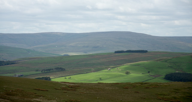
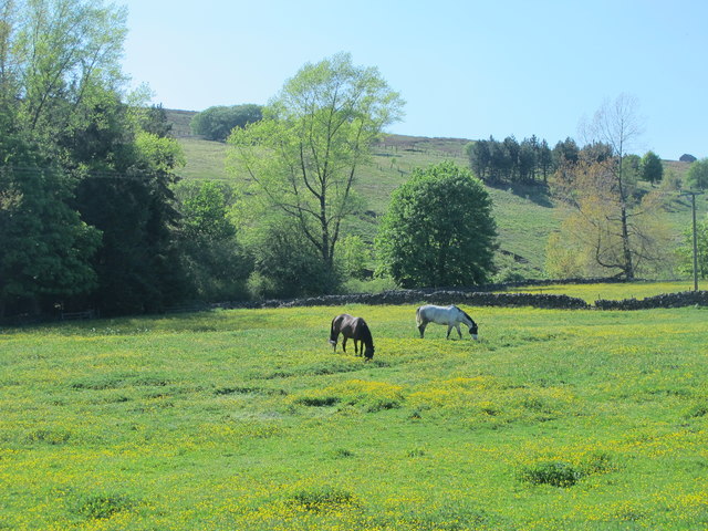
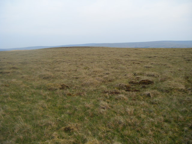
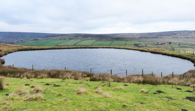
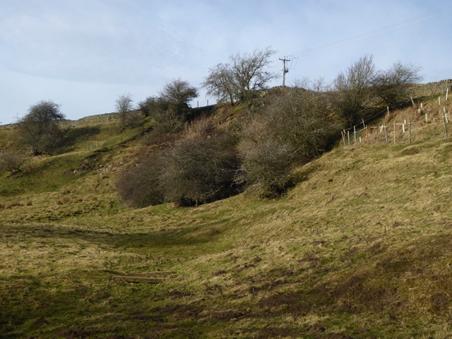
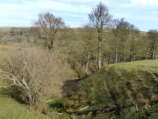
Deep Cleugh is a picturesque valley located in Durham, England. Situated in the eastern part of the county, this valley is renowned for its stunning natural beauty and tranquil atmosphere. It is nestled amidst rolling hills and dense woodland, offering visitors a peaceful retreat away from the hustle and bustle of city life.

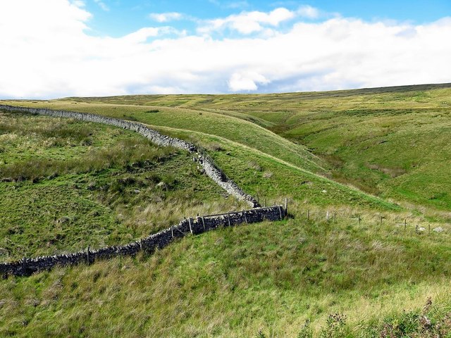
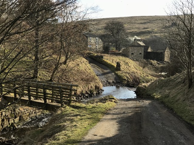
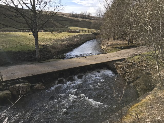
The valley is characterized by its deep, narrow gorge, which has been carved out over centuries by the meandering Deep Cleugh Burn. This small river runs through the center of the valley, creating a soothing babbling sound as it flows over smooth pebbles. The valley's steep sides are covered with lush vegetation, including a variety of trees such as oak, beech, and birch, which provide a vibrant display of colors during the autumn months.

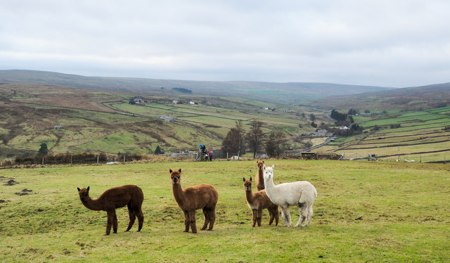
Deep Cleugh is a haven for wildlife enthusiasts, as it is home to a diverse range of flora and fauna. The valley provides a habitat for numerous bird species, including woodpeckers, kingfishers, and various songbirds. Visitors may also spot small mammals like squirrels and rabbits, as well as the occasional deer or fox.

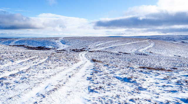
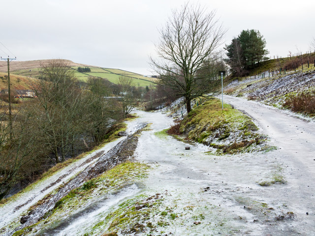
For those seeking outdoor activities, Deep Cleugh offers a network of hiking trails that wind through the valley and surrounding countryside. These trails provide stunning views of the valley from various vantage points and allow visitors to fully immerse themselves in the natural beauty of the area.

Overall, Deep Cleugh is a hidden gem in Durham, offering visitors a chance to escape into nature and enjoy the tranquility of this beautiful valley.

If you have any feedback on the listing, please let us know in the comments section below.
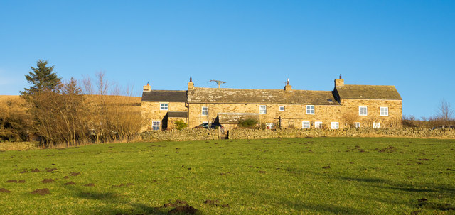
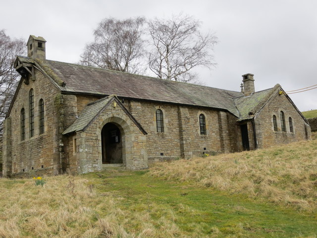
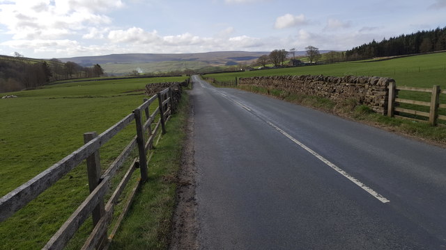
Deep Cleugh Images

Images are sourced within 2km of 54.766609/-2.0960654 or Grid Reference NY9341. Thanks to Geograph Open Source API. All images are credited.

Slope descending from Long Hill The view is from a cairn, west from the high point of the moorland summit, Long Hill. Beyond, the sunlit ground is on the far side of Rook Hope and most distant are Fendrith Hill and Chapel Fell, seen across both Rook Hope and Weardale.
Slope descending from Long Hill
The view is from a cairn, west from the high point of the moorland summit, Long Hill. Beyond, the sunlit ground is on the far side of Rook Hope and most distant are Fendrith Hill and Chapel Fell, seen across both Rook Hope and Weardale.
High Brandon High Brandon has the appearance of being a terrace of several homes but according to an offer for sale in 2011 (at £450 000), it's a single house with an attached cottage. It sits high on the eastern slope of the valley of Rook Hope and is described as a "Traditional dales long house".
High Brandon
High Brandon has the appearance of being a terrace of several homes but according to an offer for sale in 2011 (at £450 000), it's a single house with an attached cottage. It sits high on the eastern slope of the valley of Rook Hope and is described as a "Traditional dales long house".
The now closed and derelict Church of St John at Rookhope Viewed from the south-west. A notice within the porch of the church indicates how the contents were dispersed upon closure in 2014. One can hope that it will find a new use as a dwelling.
The now closed and derelict Church of St John at Rookhope
Viewed from the south-west. A notice within the porch of the church indicates how the contents were dispersed upon closure in 2014. One can hope that it will find a new use as a dwelling.
Road between Rookhope and Eastgate
Horses grazing in a buttercup meadow south of Rookhope
Boundary wall near Crow's Cleugh
Multiple tracks on East Slate Quarry Hill The tracks have been formed by years of passage by vehicles, mainly quad bikes but also perhaps, occasional tractors.
Multiple tracks on East Slate Quarry Hill
The tracks have been formed by years of passage by vehicles, mainly quad bikes but also perhaps, occasional tractors.
Bolt's Burn Ford This ford is found at Bolt's Burn near Rook Hope. A video of the ford can be seen at:
<span class="nowrap"><a title="https://youtu.be/gZGAAH_NoGs" rel="nofollow ugc noopener" href="https://youtu.be/gZGAAH_NoGs">Link</a><img style="margin-left:2px;" alt="External link" title="External link - shift click to open in new window" src="https://s1.geograph.org.uk/img/external.png" width="10" height="10"/></span>
Bolt's Burn Ford
This ford is found at Bolt's Burn near Rook Hope. A video of the ford can be seen at: LinkExternal link
Church House Farm Ford This irish bridge ford is found on the driveway to Church House Farm.
Church House Farm Ford
This irish bridge ford is found on the driveway to Church House Farm.
Reahope Moor
Reahope Moor
A consequence of freezing rain Freezing rain had been forecast to fall during 15 December 2018; it did and this is the result. Ordinary liquid rain falls landing on surfaces below freezing point; the rain then freezes. On fairly level surfaces such as paths and roads the result can then be a sheet of ice, and that's the situation here, the ice persisting even two days later.
To make progress on foot over the paths and roads was extremely awkward and an alternative walking route had to be used than that planned.
A consequence of freezing rain
Freezing rain had been forecast to fall during 15 December 2018; it did and this is the result. Ordinary liquid rain falls landing on surfaces below freezing point; the rain then freezes. On fairly level surfaces such as paths and roads the result can then be a sheet of ice, and that's the situation here, the ice persisting even two days later. To make progress on foot over the paths and roads was extremely awkward and an alternative walking route had to be used than that planned.
Alpacas above Rookhope village A small group of alpacas in a field to the east of Rookhope in the valley, Rook Hope. They are on the line of a public footpath recently used by a walking party.
Alpacas above Rookhope village
A small group of alpacas in a field to the east of Rookhope in the valley, Rook Hope. They are on the line of a public footpath recently used by a walking party.
Circular reservoir above Rookhope village The small reservoir lies on the moorland of Smailsburn Common south-west of the village.
Circular reservoir above Rookhope village
The small reservoir lies on the moorland of Smailsburn Common south-west of the village.
War memorial, Rookhope The war memorial in the village of Rookhope, in the valley, Rook Hope.
War memorial, Rookhope
The war memorial in the village of Rookhope, in the valley, Rook Hope.
Tiny village green in Rookhope An old mining wagon stands on the tiny village green in the village of Rookhope. Public toilets beyond.
Tiny village green in Rookhope
An old mining wagon stands on the tiny village green in the village of Rookhope. Public toilets beyond.
Attention all cyclists! Notice at the beginning of the notorious Boltslaw Incline which carries the world-famous C2C cycle route. As one of the conditions for establishing the route, the owners of Stanhope Common insisted that cyclists should not use this part of the route when grouse shooting is in progress. It is not clear how cyclists are expected to disturb the birds any more than the walkers who cannot be banned because the incline is a public footpath. Beneath this notice is another specifying the dates in the year when shooting will take place. There is a roundabout 
on-road route to be taken at these times.
Attention all cyclists!
Notice at the beginning of the notorious Boltslaw Incline which carries the world-famous C2C cycle route. As one of the conditions for establishing the route, the owners of Stanhope Common insisted that cyclists should not use this part of the route when grouse shooting is in progress. It is not clear how cyclists are expected to disturb the birds any more than the walkers who cannot be banned because the incline is a public footpath. Beneath this notice is another specifying the dates in the year when shooting will take place. There is a roundabout on-road route to be taken at these times.
Hillside in the Rookhope valley
Gully in the lower Rookhope valley Below South Hanging Wells Farm.
Gully in the lower Rookhope valley
Below South Hanging Wells Farm.
Show me another place!

Deep Cleugh is located at Grid Ref: NY9341 (Lat: 54.766609, Lng: -2.0960654)

Unitary Authority: County Durham

Police Authority: Durham

What 3 Words

///themes.slippery.delusions. Near Stanhope, Co. Durham

Related Wikis

Rookhope

Rookhope is a village in the civil parish of Stanhope, in County Durham, England. A former lead and fluorspar mining community, it first existed as a group...

Lintzgarth

Lintzgarth is a village in the civil parish of Stanhope, in County Durham, England. It is situated to the west of Rookhope. The Lintzgarth smeltmill was...

Eastgate, County Durham

Eastgate is a village in the civil parish of Stanhope, in County Durham, England. It is situated in Weardale, a few miles west of Stanhope. In the 2001...

Weardale campaign

The Weardale campaign, part of the First War of Scottish Independence, occurred during July and August 1327 in Weardale, England. A Scottish force under...

Nearby Amenities

Located within 500m of 54.766609,-2.0960654
Barrier: stile
Material: wood
Source: survey;gps
Stile: stepover
Lat/Long: 54.7681454/-2.0888191
Barrier: entrance
Lat/Long: 54.7701481/-2.1001165
Power: pole
Lat/Long: 54.7628778/-2.0941293
Power: pole
Lat/Long: 54.7636353/-2.0943117
Power: pole
Lat/Long: 54.7644067/-2.0946698
Power: pole
Lat/Long: 54.7651835/-2.0950305
Power: pole
Lat/Long: 54.7659263/-2.0953645
Power: pole
Lat/Long: 54.7665066/-2.0949836
Power: pole
Lat/Long: 54.7670365/-2.0946336
Power: pole
Lat/Long: 54.7676532/-2.0942085
Power: pole
Lat/Long: 54.768286/-2.0937967
Power: pole
Lat/Long: 54.769004/-2.0936197
Power: pole
Lat/Long: 54.7696275/-2.0934856
Power: pole
Lat/Long: 54.7702132/-2.0936465
Power: pole
Lat/Long: 54.7707346/-2.0938021
High Smailsburn
Place: isolated_dwelling
Source Name: OS_OpenData_StreetView
Lat/Long: 54.7688988/-2.0993623
The data included in this document is from www.openstreetmap.org. The data is made available under ODbL.

Have you been to Deep Cleugh?

Leave your review of Deep Cleugh below (or comments, questions and feedback).