Malhamdale

Valley in Yorkshire Craven

England

Malhamdale

Kirkby Malham, St Michael's church This is the west facing side of the church tower, and cut into the 2nd course of stones is a benchmark.
Kirkby Malham, St Michael's church Credit: Mel Towler

Malhamdale is a charming and picturesque valley located in the county of Yorkshire, England. Nestled within the Yorkshire Dales National Park, it is renowned for its stunning natural beauty and rich history. The valley is named after the small village of Malham, which lies at its heart.

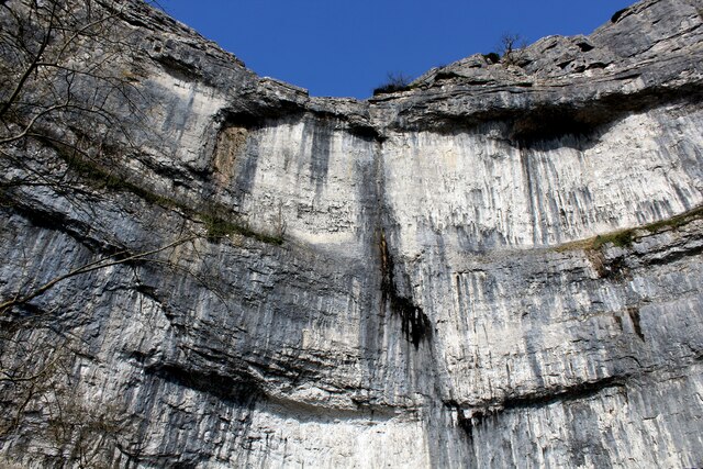
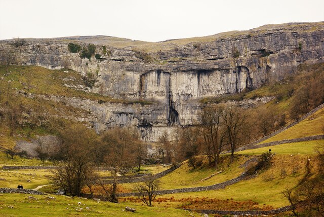
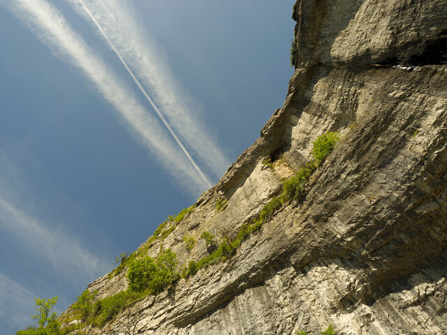
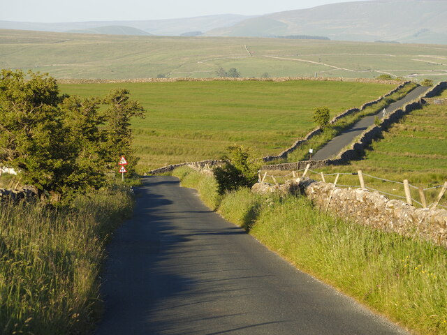
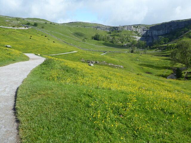
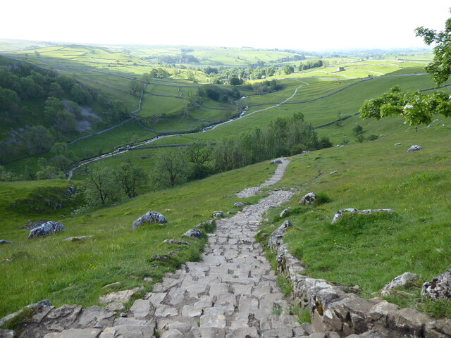
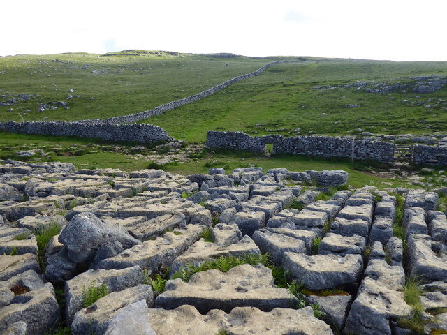
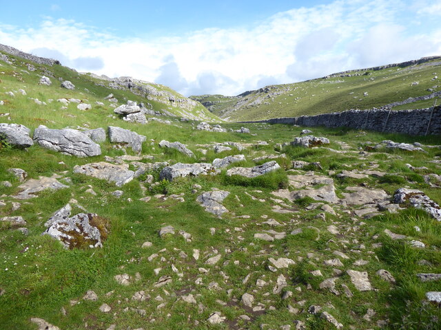
The landscape of Malhamdale is characterized by rolling hills, limestone pavement, and a number of striking geological features. One of the most notable attractions is Malham Cove, a large limestone cliff that stretches 260 feet high and features a natural amphitheater at its base. Nearby, visitors can also explore Gordale Scar, a dramatic gorge with towering cliffs and a waterfall.

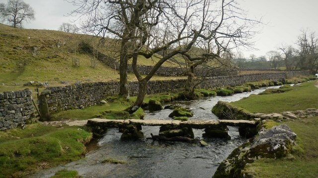
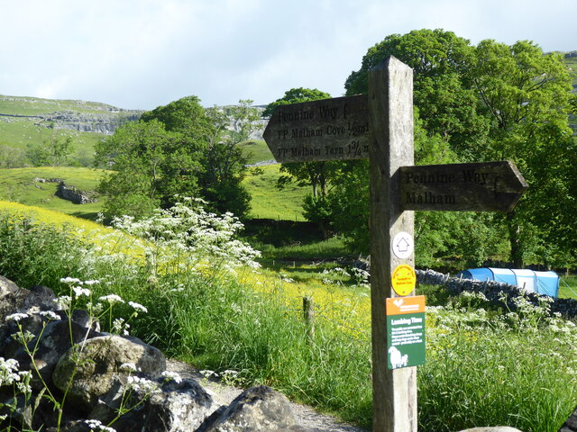
The valley is a haven for outdoor enthusiasts and offers a variety of activities. Hiking and walking trails crisscross the area, providing breathtaking views of the surrounding countryside. The Pennine Way, a famous long-distance footpath, passes through Malhamdale, attracting hikers from around the world. Additionally, the picturesque Malham Tarn, a glacial lake, is a popular spot for birdwatching and fishing.

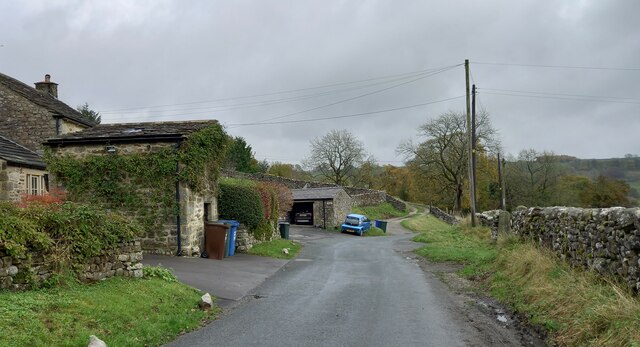
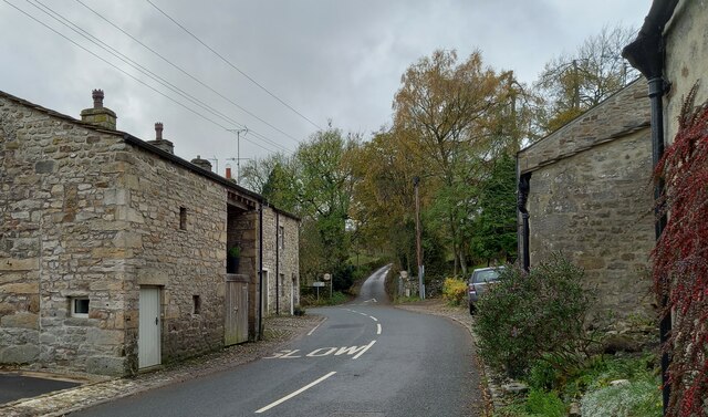
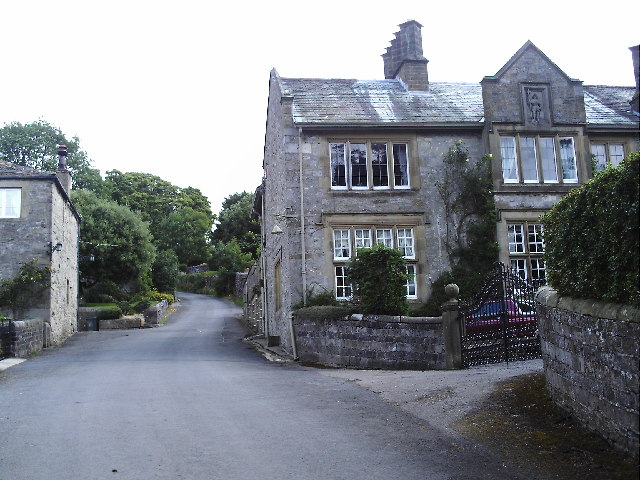
Malham village itself is a quaint and charming settlement, with traditional stone-built houses and a welcoming atmosphere. It is home to a few local shops, pubs, and tearooms, providing a taste of traditional Yorkshire hospitality. The village is also a popular base for exploring the wider Yorkshire Dales, with its easy access to other scenic spots such as the Settle-Carlisle Railway, Ribblehead Viaduct, and Ingleborough, one of the famous Three Peaks.

In conclusion, Malhamdale offers visitors a captivating blend of natural beauty, outdoor activities, and historical charm. Whether it's exploring its unique geological formations, embarking on scenic walks, or simply enjoying the tranquility of village life, this Yorkshire valley is sure to leave a lasting impression.

If you have any feedback on the listing, please let us know in the comments section below.
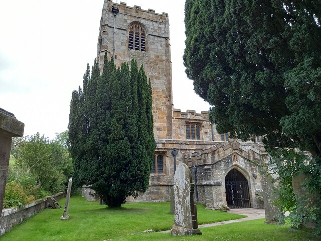
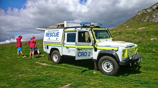
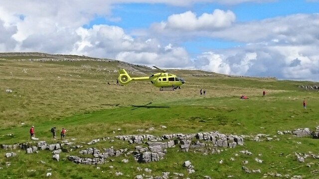
Malhamdale Images

Images are sourced within 2km of 54.058311/-2.1579545 or Grid Reference SD8962. Thanks to Geograph Open Source API. All images are credited.

Kirkby Malham, St Michael's church This is the west facing side of the church tower, and cut into the 2nd course of stones is a benchmark.
Kirkby Malham, St Michael's church
This is the west facing side of the church tower, and cut into the 2nd course of stones is a benchmark.
Kirkby Malham, St Michael's church A wider angle showing the main access door and the church tower. There is a benchmark cut into the west facing side of the church tower. The mark is on the 2nd course of stones.
Kirkby Malham, St Michael's church
A wider angle showing the main access door and the church tower. There is a benchmark cut into the west facing side of the church tower. The mark is on the 2nd course of stones.
Kirkby Malham outbuilding The benchmark is cut into a right corner stone of this small outbuilding facing onto the road.
Kirkby Malham outbuilding
The benchmark is cut into a right corner stone of this small outbuilding facing onto the road.
Kirkby Malham outbuilding There is a benchmark cut into a right corner stone of this small outbuilding facing onto the road.
Kirkby Malham outbuilding
There is a benchmark cut into a right corner stone of this small outbuilding facing onto the road.
Kirkby Malham, converted house The benchmark is cut into a right cornerstone of this converted agricultural building on the village through road.
Kirkby Malham, converted house
The benchmark is cut into a right cornerstone of this converted agricultural building on the village through road.
Kirkby Malham converted house There is a benchmark cut into a right cornerstone of this converted agricultural building on the village through road. The cut mark is opposite the SLOW sign painted on the road.
Kirkby Malham converted house
There is a benchmark cut into a right cornerstone of this converted agricultural building on the village through road. The cut mark is opposite the SLOW sign painted on the road.
Mountain rescue team at Malham Cove
Air ambulance at Malham Cove The Yorkshire Air Ambulance takes off from Malham Cove.
Air ambulance at Malham Cove
The Yorkshire Air Ambulance takes off from Malham Cove.
Sheer Face of Malham Cove Looking up the sheer limestone cliff of Malham Cove from below.
Sheer Face of Malham Cove
Looking up the sheer limestone cliff of Malham Cove from below.
Malham Cove
Malham Cove
Clapper Bridge Across the Malham Beck
Clapper Bridge
Across the Malham Beck
Jet Trails over Malham Cove Taken from the bottom of the cove looking nearly vertically upwards.
Jet Trails over Malham Cove
Taken from the bottom of the cove looking nearly vertically upwards.
The Settle to Kirkby Malham Road in the Evening
The Pennine Way near Town Head
The Pennine Way near High Barn
The Pennine Way near Malham Cove
The Pennine Way near Raven Scar
Show me another place!

Malhamdale is located at Grid Ref: SD8962 (Lat: 54.058311, Lng: -2.1579545)

Division: West Riding

Administrative County: North Yorkshire

District: Craven

Police Authority: North Yorkshire

What 3 Words

///zaps.drooling.covers. Near Hellifield, North Yorkshire

Nearby Locations

Malhamdale

Related Wikis

Malham

Malham is a village and civil parish in the Craven district of North Yorkshire, England. Before 20th century boundary changes, the village was part of...

Friar Garth Farmhouse

Friar Garth Farmhouse is a Grade II listed building in Malham, North Yorkshire, England. It was listed as an historic site by English Heritage on 13 September...

Hanlith

Hanlith is a small village and civil parish in the Craven district of North Yorkshire, England. It is situated near Kirkby Malham and the tourist attraction...

Malham Cove

Malham Cove is a large curved limestone formation 0.6 miles (1 km) north of the village of Malham, North Yorkshire, England. It was formed by a waterfall...

Nearby Amenities

Located within 500m of 54.058311,-2.1579545
Foot: no
Ford: yes
Lat/Long: 54.0599776/-2.1527374
Description: moved to new box 12m west
Disused Amenity: post_box
Operator: Royal Mail
Post Box Type: wall
Ref: BD23 109
Royal Cypher: GR
Source: survey
Survey Date: 2015-05-22
Lat/Long: 54.0613997/-2.1529766
Barrier: stile
Material: stone
Source: survey;gps
Stile: stepover
Lat/Long: 54.0599204/-2.1530808
Barrier: kissing_gate
Source: survey
Lat/Long: 54.0574848/-2.151004
Aire Head
Natural: spring
Lat/Long: 54.05551/-2.1522384
National Park Centre
Bus: yes
Public Transport: stop_position
Lat/Long: 54.0604448/-2.1543177
Crossing
Crossing: marked
Crossing Island: no
Crossing Markings: yes
Tactile Paving: no
Lat/Long: 54.0600145/-2.154281
Barrier: stile
Material: stone
Source: survey;gps
Stile: stepover
Lat/Long: 54.0588816/-2.1624853
Entrance: main
Lat/Long: 54.0598036/-2.1538048
Entrance: yes
Lat/Long: 54.0600514/-2.1532287
Entrance: yes
Lat/Long: 54.0603853/-2.1531426
Telephone
Booth: K6
Covered: booth
Listed Status: Grade II
Operator: BT
Operator Wikidata: Q593786
Lat/Long: 54.0616631/-2.1531099
Bus Stop
The Buck Inn
Bench: yes
Bus: yes
Naptan AtcoCode: 3200YNA01914
Naptan Bearing: S
Naptan BusStopType: MKD
Naptan CommonName: The Buck Inn
Naptan Indicator: S-bound
Naptan Landmark: N/A
Naptan LocalityCode: E0048918
Naptan NaptanCode: 32001914
Naptan Street: Chapel Gate
Naptan Verified: no
Public Transport: platform
Ref: 32001914
Shelter: no
Tactile Paving: no
Timetable: yes
Lat/Long: 54.0611865/-2.1527841
YDNP Visitor Centre
Information: office
Tourism: information
Lat/Long: 54.0598324/-2.153709
Bus Stop
The Buck Inn
Bench: no
Bus: yes
Naptan AtcoCode: 3200YNA01913
Naptan Bearing: N
Naptan BusStopType: CUS
Naptan CommonName: The Buck Inn
Naptan Indicator: N-bound
Naptan Landmark: Malham Smithy
Naptan LocalityCode: E0048918
Naptan NaptanCode: 32001913
Naptan Street: Chapel Gate
Naptan Verified: no
Public Transport: platform
Ref: 32001913
Shelter: no
Tactile Paving: no
Lat/Long: 54.0610168/-2.1529632
Malham
Is In: UK, Yorkshire, North Yorkshire, Airedale
Is In Country Code: GB
Is In County: North Yorkshire
Is In Municipality: Craven
Is In National Park: Yorkshire Dales National Park
Place: village
Postal Code: BD23
Website: https://www.malhamdale.com/
Wikidata: Q1247558
Wikipedia: en:Malham
Lat/Long: 54.0612719/-2.1529001
Defibrillator
Defibrillator Location: outside toilets, Malham
Emergency: defibrillator
Indoor: no
Lat/Long: 54.0612533/-2.1530873
Bench
Backrest: yes
Source: GPS survey
Lat/Long: 54.0612093/-2.1527349
Bench
Backrest: yes
Source: GPS survey
Lat/Long: 54.0600507/-2.1528536
Bench
Source: GPS survey
Lat/Long: 54.0598759/-2.1529985
Hiking: yes
Information: guidepost
Source: GPS survey
Tourism: information
Lat/Long: 54.0574758/-2.1509466
Entrance: yes
Lat/Long: 54.061227/-2.1531249
Entrance: yes
Lat/Long: 54.0612813/-2.1531667
Hiking: yes
Information: guidepost
Source: GPS survey
Tourism: information
Lat/Long: 54.0599712/-2.153028
The Buck Inn
Bus: yes
Public Transport: stop_position
Lat/Long: 54.0610141/-2.1528945
Bus Stop
National Park Centre
Bus: yes
Departures Board: timetable
Naptan AtcoCode: 3200YNA96454
Naptan Bearing: W
Naptan BusStopType: MKD
Naptan CommonName: National Park Centre
Naptan Indicator: W-bound
Naptan Landmark: National Park Centre
Naptan LocalityCode: E0048918
Naptan NaptanCode: 32096454
Naptan Street: Chapel Gate
Naptan Verified: yes
Public Transport: platform
Ref: 32096454
Shelter: no
Lat/Long: 54.0605182/-2.1542467
The Buck Inn
Bus: yes
Public Transport: stop_position
Lat/Long: 54.0611956/-2.1528369
Bench
Lat/Long: 54.0614156/-2.1530601
Hiking: yes
Information: guidepost
Source: GPS Survey
Tourism: information
Lat/Long: 54.0613455/-2.1530937
Bicycle Parking
Access: yes
Bicycle Parking: stands
Capacity: 8
Covered: no
Fee: no
Operator: Yorkshire Dales National Park
Lat/Long: 54.0598263/-2.1537253
Miresfield Bed & Breakfast
Addr City: Skipton
Addr Postcode: BD23 4DA
Addr Suburb: Malham
Alt Name: Miresfield Farm
Phone: +441729 830414
Tourism: guest_house
Website: http://miresfieldfarm.co.uk/
Lat/Long: 54.0608608/-2.1520902
Post Box
Operator: Royal Mail
Operator Wikidata: Q638098
Post Box Type: lamp
Ref: BD23 109
Royal Cypher: EIIR
Royal Cypher Wikidata: Q33102113
Source: survey
Survey Date: 2020-02-01
Lat/Long: 54.0613128/-2.1530729
Hiking: yes
Information: guidepost
Source: survey
Tourism: information
Lat/Long: 54.0605841/-2.1525506
Power: pole
Lat/Long: 54.0590868/-2.1523138
Power: pole
Lat/Long: 54.0598067/-2.1524486
Bench
Backrest: no
Material: stone
Lat/Long: 54.0610488/-2.1526605
Power: pole
Lat/Long: 54.0587743/-2.1525539
Leisure: picnic_table
Lat/Long: 54.0599678/-2.1536954
Leisure: picnic_table
Lat/Long: 54.059967/-2.1536283
Information: map
Map Size: yes
Map Type: 3
Tourism: information
Lat/Long: 54.0599091/-2.1539321
Drinking Water
Access: yes
Fee: no
Man Made: water_tap
Lat/Long: 54.0599134/-2.153916
Crossing
Crossing: marked
Crossing Island: no
Crossing Markings: yes
Tactile Paving: no
Lat/Long: 54.060255/-2.1542774
Tourism: picnic_site
Lat/Long: 54.0599873/-2.1537633
Walter Morrison
Historic: memorial
Memorial: blue_plaque
Start Date: 2021-12-18
Wikipedia: en:Walter Morrison (politician)
Lat/Long: 54.0614199/-2.1531527
Entrance: yes
Wheelchair: no
Lat/Long: 54.0614383/-2.1531926
Waste Basket
Waste: trash
Lat/Long: 54.0612014/-2.1527999
Recycling
Recycling Cans: yes
Recycling Glass Bottles: yes
Recycling Paper: yes
Recycling Plastic Bottles: yes
Recycling Type: container
Lat/Long: 54.0612308/-2.1530098
Waste Basket
Waste: trash
Lat/Long: 54.0612385/-2.1530132
Waste Basket
Waste: dog_excrement
Lat/Long: 54.0600349/-2.152574
Disused Amenity: post_box
Post Box Type: wall
Lat/Long: 54.0613878/-2.1529506
Drinking Water
Access: yes
Fee: no
Lat/Long: 54.0612624/-2.1530871
The data included in this document is from www.openstreetmap.org. The data is made available under ODbL.

Have you been to Malhamdale?

Leave your review of Malhamdale below (or comments, questions and feedback).