Outer Hare Cleuch

Valley in Roxburghshire

Scotland

Outer Hare Cleuch

Pennine Way near Foulstep Sike The thin path of the Pennine Way is, at this point, heading towards a crossing of the watershed of Foulstep Sike with the border between England and Scotland lying just over 100 metres to the north. For a selection of detailed free to download walking routes in the area visit <span class="nowrap"><a title="www.cheviotwalks.co.uk" rel="nofollow ugc noopener" href="http://www.cheviotwalks.co.uk">Link</a><img style="margin-left:2px;" alt="External link" title="External link - shift click to open in new window" src="https://s1.geograph.org.uk/img/external.png" width="10" height="10"/></span>
Pennine Way near Foulstep Sike Credit: Geoff Holland

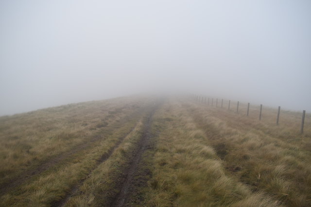
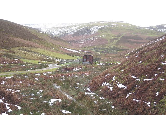
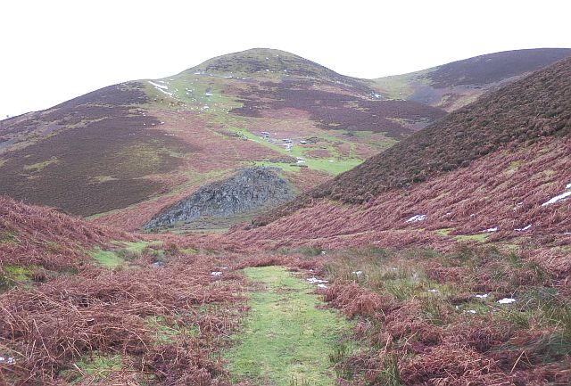
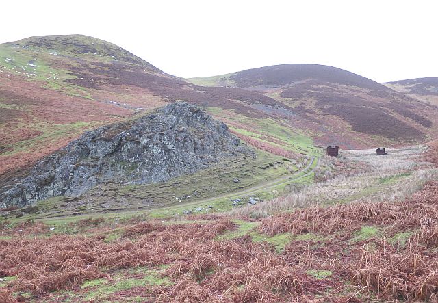
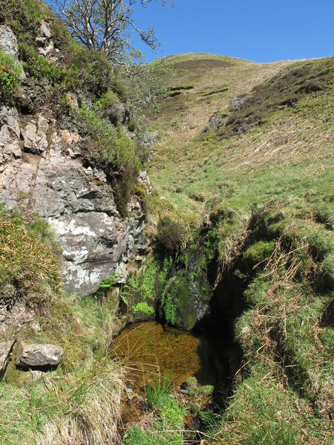
Outer Hare Cleuch is a picturesque valley located in the county of Roxburghshire, Scotland. Situated in the southern part of the country, this valley is known for its stunning natural beauty and diverse wildlife.

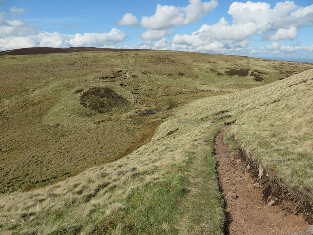
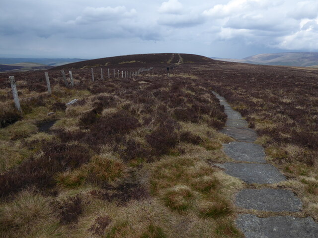
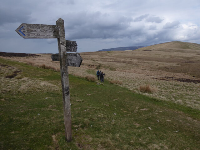
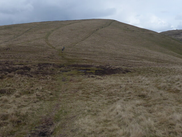
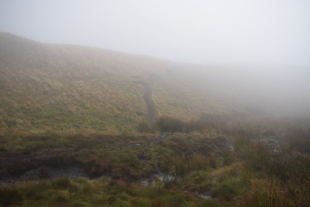
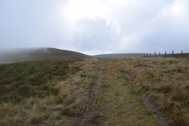
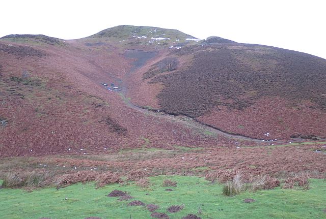
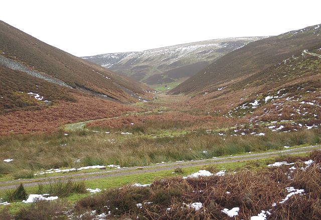
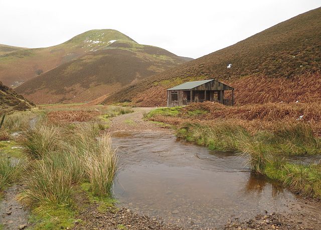
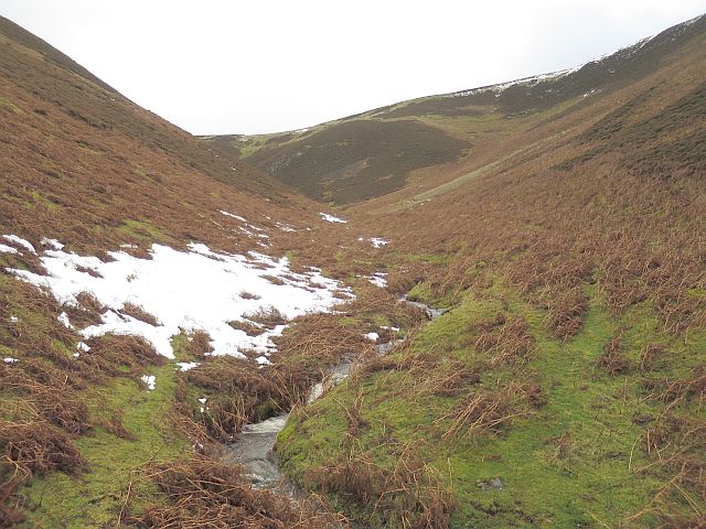
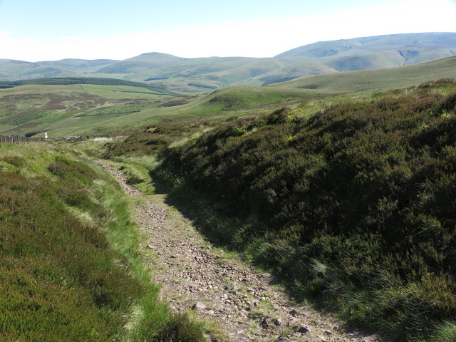
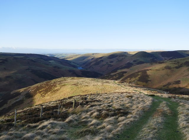
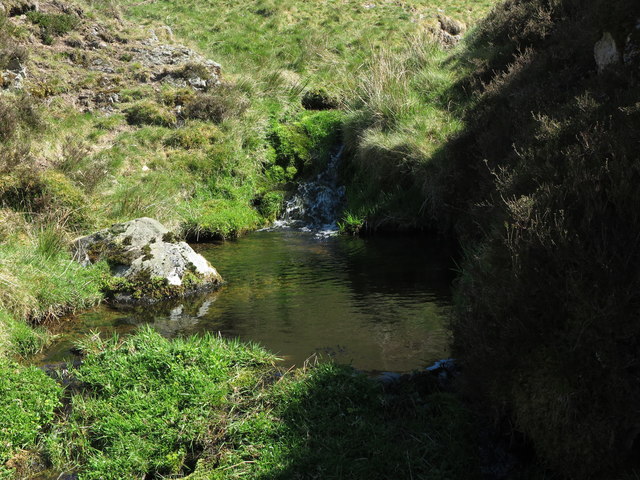
The valley is surrounded by rolling hills and lush greenery, creating a serene and tranquil atmosphere. It is intersected by a small river, which adds to the charm of the landscape. The area is popular among nature enthusiasts, hikers, and photographers who are drawn to its unspoiled beauty.

Outer Hare Cleuch is home to a variety of plant and animal species, making it a haven for wildlife. Visitors can spot a range of birds, including buzzards, kestrels, and peregrine falcons, soaring above the valley. The river is also home to otters and various fish species, adding to the biodiversity of the area.

The valley offers a range of recreational activities for visitors to enjoy. There are numerous hiking trails that meander through the hills, providing stunning panoramic views of the surrounding countryside. Fishing is also a popular pastime, with the river offering opportunities for anglers to catch trout and salmon.

In addition to its natural beauty, Outer Hare Cleuch is steeped in history. The area has several ancient ruins and archaeological sites, including standing stones and remnants of old settlements, which provide a glimpse into its rich past.

Overall, Outer Hare Cleuch is a hidden gem in Roxburghshire, offering visitors a chance to immerse themselves in the breathtaking beauty of the Scottish countryside while enjoying its abundant wildlife and historical significance.

If you have any feedback on the listing, please let us know in the comments section below.

Outer Hare Cleuch Images

Images are sourced within 2km of 55.439447/-2.265093 or Grid Reference NT8316. Thanks to Geograph Open Source API. All images are credited.

Pennine Way near Foulstep Sike The thin path of the Pennine Way is, at this point, heading towards a crossing of the watershed of Foulstep Sike with the border between England and Scotland lying just over 100 metres to the north. For a selection of detailed free to download walking routes in the area visit <span class="nowrap"><a title="www.cheviotwalks.co.uk" rel="nofollow ugc noopener" href="http://www.cheviotwalks.co.uk">Link</a><img style="margin-left:2px;" alt="External link" title="External link - shift click to open in new window" src="https://s1.geograph.org.uk/img/external.png" width="10" height="10"/></span>
Pennine Way near Foulstep Sike
The thin path of the Pennine Way is, at this point, heading towards a crossing of the watershed of Foulstep Sike with the border between England and Scotland lying just over 100 metres to the north. For a selection of detailed free to download walking routes in the area visit LinkExternal link
The Pennine Way near Mozie Law
The Pennine Way near Plea Knowe
The Pennine Way near Mossy Law
Pennine Way in the mist West of Windy Gyle, above the steep sided valley of Rowhope Burn to the left.
Pennine Way in the mist
West of Windy Gyle, above the steep sided valley of Rowhope Burn to the left.
Foul Step - in the mist The Pennine Way at the aptly named Foul Step, crossing the boggy area above the head-water of Foulstep Sike.
Foul Step - in the mist
The Pennine Way at the aptly named Foul Step, crossing the boggy area above the head-water of Foulstep Sike.
The Street  towards Black Braes The Street is an old drove road heading from Scotland to the site of The Slimefoot Inn by Trows Road End - much used as a smuggling route. In clearing mist and low cloud.
The Street towards Black Braes
The Street is an old drove road heading from Scotland to the site of The Slimefoot Inn by Trows Road End - much used as a smuggling route. In clearing mist and low cloud.
Greenbrough Hill The white structures half-way up the hill are a feeding station for game birds. There were large numbers of Pheasant and Red Grouse in evidence.
Greenbrough Hill
The white structures half-way up the hill are a feeding station for game birds. There were large numbers of Pheasant and Red Grouse in evidence.
Big Dun Rig Big Dun Rig is the hill at the head of this valley, and the slope on the left is Hard Rig. The river was in spate so I was unable to get across it on to the track, but there is a rough sheep track that just and no more got me into the square before it came to a sudden end where the river had eroded it away, leaving only a bog in front of me.
Big Dun Rig
Big Dun Rig is the hill at the head of this valley, and the slope on the left is Hard Rig. The river was in spate so I was unable to get across it on to the track, but there is a rough sheep track that just and no more got me into the square before it came to a sudden end where the river had eroded it away, leaving only a bog in front of me.
Philip Hope A side valley, its track unreachable to me because the Heatherhope Burn was in spate.
Philip Hope
A side valley, its track unreachable to me because the Heatherhope Burn was in spate.
Shooting Hut The ford is one of several, all impassable today because of the melting snow. I had to stick to a sheep track on the left to bypass them all. On the skyline is Greenbrough Hill.
Shooting Hut
The ford is one of several, all impassable today because of the melting snow. I had to stick to a sheep track on the left to bypass them all. On the skyline is Greenbrough Hill.
Little Sund Hope A side valley, still with drifts of wet snow following a heavy fall a few days ago.
Little Sund Hope
A side valley, still with drifts of wet snow following a heavy fall a few days ago.
Little Sund Hope Looking down the valley to where the burn merges with Muckle Sund Hope, below one of the few outcrops of bedrock in the vicinity. Beyond it is Greenbrough Hill, with a large game bird feeding station on the lower grassy slope, just above a fank on top of the outcrop.
Little Sund Hope
Looking down the valley to where the burn merges with Muckle Sund Hope, below one of the few outcrops of bedrock in the vicinity. Beyond it is Greenbrough Hill, with a large game bird feeding station on the lower grassy slope, just above a fank on top of the outcrop.
Muckle Sund Hope Muckle Sund Hope comes in from the right, past two of the numerous old railway waggons in use as stores or shelters in these hills. Greenbrough Hill is at upper left, and the only sizeable outcrop of bare rock in the vicinity is at lower left.
Muckle Sund Hope
Muckle Sund Hope comes in from the right, past two of the numerous old railway waggons in use as stores or shelters in these hills. Greenbrough Hill is at upper left, and the only sizeable outcrop of bare rock in the vicinity is at lower left.
The Street This is the cross-border track known as The Street which runs from Slymefoot in Upper Coquetdale to Hownam on Kale Water. This section of the track was named as The Clattering Path on the map attached to Roy`s Military Survey of Scotland 1747-55. The border fence can be seen slightly further downhill. For a selection of detailed free to download walking routes in the area visit <span class="nowrap"><a title="www.cheviotwalks.co.uk" rel="nofollow ugc noopener" href="http://www.cheviotwalks.co.uk">Link</a><img style="margin-left:2px;" alt="External link" title="External link - shift click to open in new window" src="https://s1.geograph.org.uk/img/external.png" width="10" height="10"/></span>
The Street
This is the cross-border track known as The Street which runs from Slymefoot in Upper Coquetdale to Hownam on Kale Water. This section of the track was named as The Clattering Path on the map attached to Roy`s Military Survey of Scotland 1747-55. The border fence can be seen slightly further downhill. For a selection of detailed free to download walking routes in the area visit LinkExternal link
Heading down from Mozie Law Heading down the track from Mozie Law towards Heatherhope.  Heatherhope Reservoir can be seen in the distance.
Heading down from Mozie Law
Heading down the track from Mozie Law towards Heatherhope. Heatherhope Reservoir can be seen in the distance.
Plunge pool, Richard's Cleugh This delightful small plunge pool lies well-hidden in Richard's Cleugh beneath a mountain ash tree which grows precariously out of a rocky outcrop. For a selection of detailed free to download walking routes in the area visit <span class="nowrap"><a title="www.cheviotwalks.co.uk" rel="nofollow ugc noopener" href="http://www.cheviotwalks.co.uk">Link</a><img style="margin-left:2px;" alt="External link" title="External link - shift click to open in new window" src="https://s1.geograph.org.uk/img/external.png" width="10" height="10"/></span>
Plunge pool, Richard's Cleugh
This delightful small plunge pool lies well-hidden in Richard's Cleugh beneath a mountain ash tree which grows precariously out of a rocky outcrop. For a selection of detailed free to download walking routes in the area visit LinkExternal link
Plunge pool on the Rowhope Burn This plunge pool is one of a small number of such pools encountered on this stretch of the Rowhope Burn where this lonely valley is at its narrowest (see <a title="https://www.geograph.org.uk/photo/3315297" href="https://www.geograph.org.uk/photo/3315297">Link</a> for a similar one slightly further downstream). For a selection of detailed free to download walking routes in the area visit <span class="nowrap"><a title="www.cheviotwalks.co.uk" rel="nofollow ugc noopener" href="http://www.cheviotwalks.co.uk">Link</a><img style="margin-left:2px;" alt="External link" title="External link - shift click to open in new window" src="https://s1.geograph.org.uk/img/external.png" width="10" height="10"/></span>
Plunge pool on the Rowhope Burn
This plunge pool is one of a small number of such pools encountered on this stretch of the Rowhope Burn where this lonely valley is at its narrowest (see Link for a similar one slightly further downstream). For a selection of detailed free to download walking routes in the area visit LinkExternal link
Show me another place!

Outer Hare Cleuch is located at Grid Ref: NT8316 (Lat: 55.439447, Lng: -2.265093)

Unitary Authority: The Scottish Borders

Police Authority: The Lothians and Scottish Borders

What 3 Words

///washable.dizziness.planet. Near Kirknewton, Northumberland

Related Wikis

Windy Gyle

Windy Gyle is a mountain in the Cheviot Hills range, on the border between England and Scotland. Like the other hills in the area, it is rounded and grass...

Mowhaugh

Mowhaugh is a hamlet and farm steading near the Calroust Burn and the Bowmont Water, near Morebattle, in the Scottish Borders area of Scotland, and in...

Hownam

Hownam or Hounam is a small village and parish situated 8 miles east of Jedburgh in the Scottish Borders area of Scotland, near the Anglo-Scottish border...

Barrow Burn Meadows

Barrow Burn Meadows is a Site of Special Scientific Interest (SSSI) in north Northumberland, England. The site is a species-rich hay meadow of a sort now...

Nearby Amenities

Located within 500m of 55.439447,-2.265093
Belshaw's Knowe
Natural: peak
Lat/Long: 55.4391756/-2.2582184
The data included in this document is from www.openstreetmap.org. The data is made available under ODbL.

Have you been to Outer Hare Cleuch?

Leave your review of Outer Hare Cleuch below (or comments, questions and feedback).