Lench Fold Clough

Valley in Lancashire Rossendale

England

Lench Fold Clough

Cyclepath through Newchurch No.2 Tunnel View West on newly laid cyclepath with the blocked Thrutch Tunnel to the left
Cyclepath through Newchurch No.2 Tunnel Credit: Kevin Waterhouse

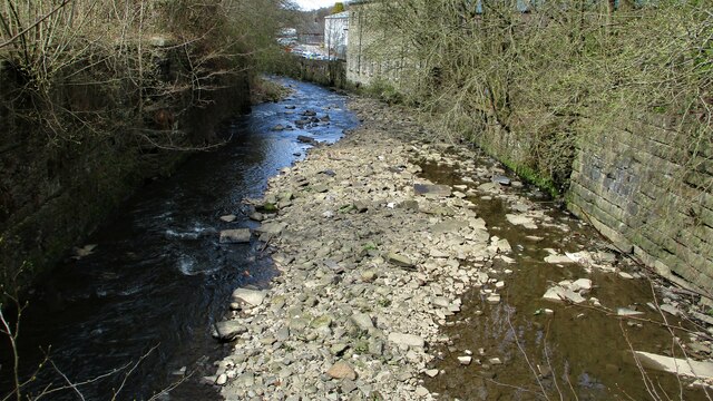
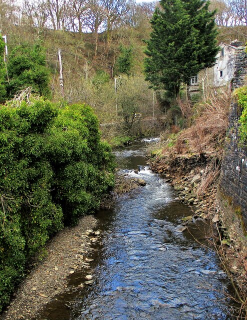
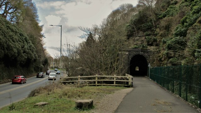
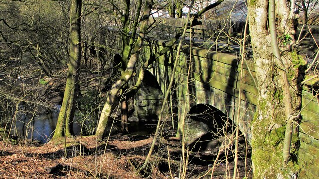
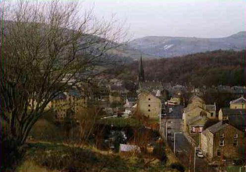
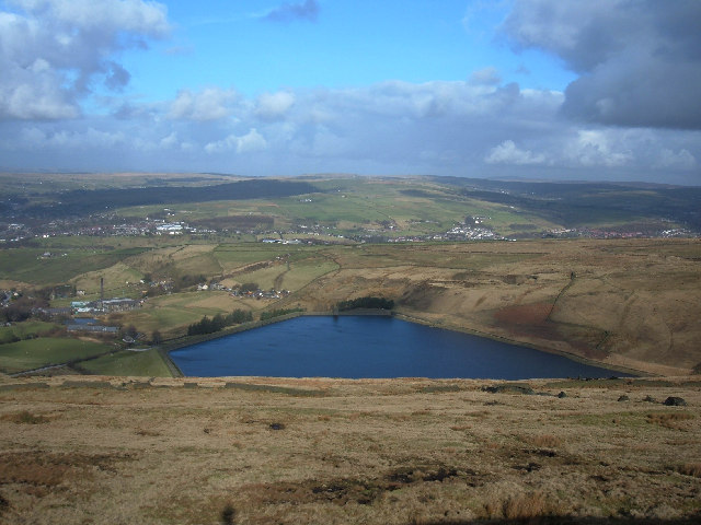
Lench Fold Clough is a scenic valley located in Lancashire, England. Situated near the town of Oswaldtwistle, this picturesque valley is renowned for its natural beauty and tranquil atmosphere. The clough is formed by the convergence of several streams and is surrounded by rolling hills covered in lush greenery.

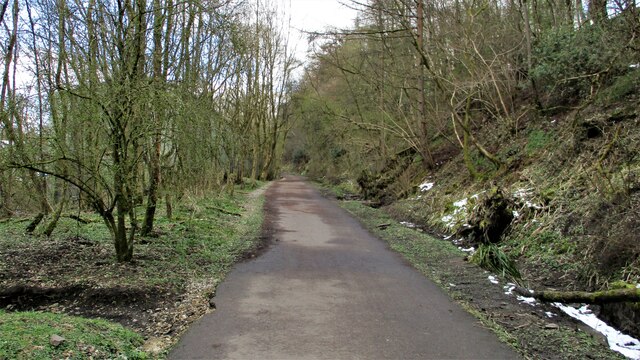
The valley is characterized by its diverse flora and fauna, making it a popular destination for nature enthusiasts and hikers. The area is abundant with a variety of trees, including oak, beech, and sycamore, which create a dense canopy overhead. Wildflowers such as bluebells and primroses carpet the valley floor during the spring, adding bursts of color to the landscape.

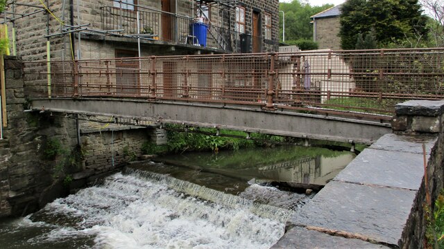
Lench Fold Clough is home to a wide range of wildlife. Visitors may spot various bird species, including woodpeckers, thrushes, and owls, as well as small mammals like rabbits and squirrels. The clough's streams provide a habitat for fish, frogs, and other aquatic creatures.

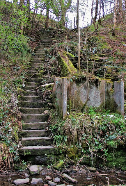
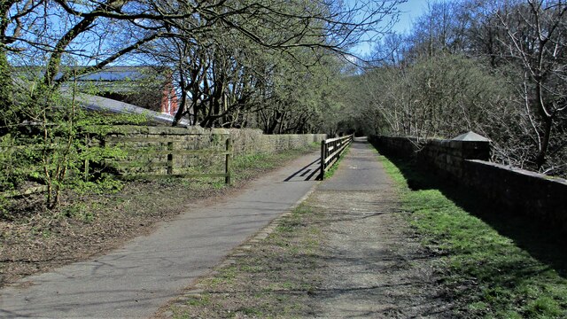
The valley offers a network of footpaths and trails, allowing visitors to explore its beauty at their own pace. These paths meander through woodlands, alongside streams, and up to vantage points offering breathtaking views of the surrounding countryside. Lench Fold Clough also features picnic areas, providing visitors with the opportunity to enjoy a peaceful meal amidst nature.

Overall, Lench Fold Clough in Lancashire is a stunning valley that offers a serene escape from the hustle and bustle of everyday life. Whether for a leisurely stroll, a family picnic, or birdwatching, this scenic location is a haven for nature lovers seeking tranquility in the heart of Lancashire.

If you have any feedback on the listing, please let us know in the comments section below.

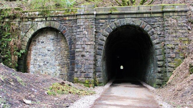
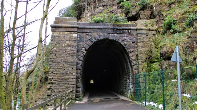
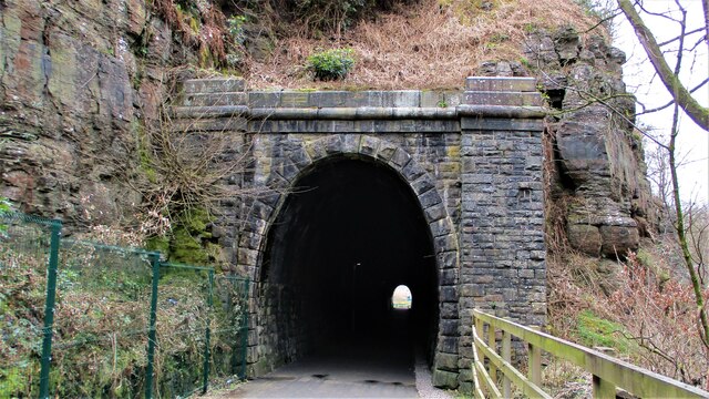
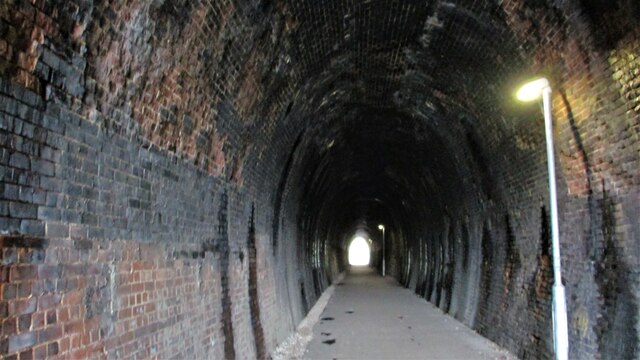
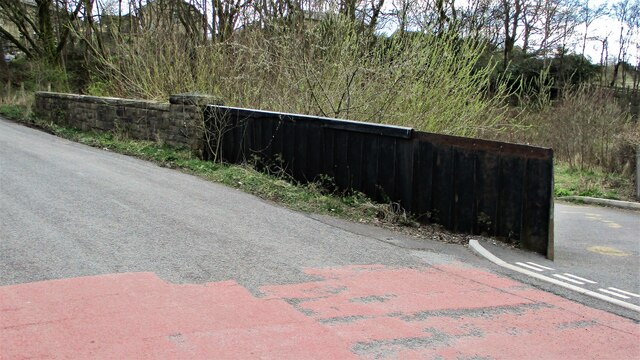
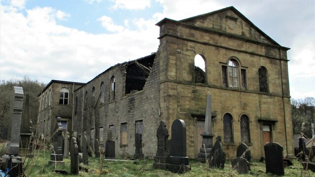
Lench Fold Clough Images

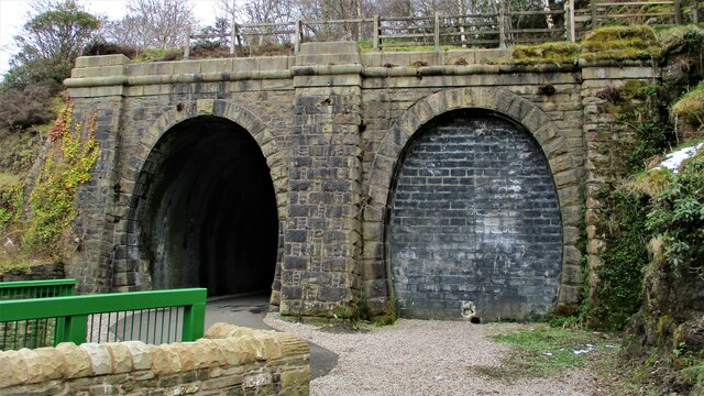
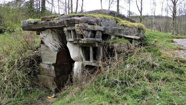
Images are sourced within 2km of 53.685819/-2.2559735 or Grid Reference SD8321. Thanks to Geograph Open Source API. All images are credited.

Cyclepath through Newchurch No.2 Tunnel View West on newly laid cyclepath with the blocked Thrutch Tunnel to the left
Cyclepath through Newchurch No.2 Tunnel
View West on newly laid cyclepath with the blocked Thrutch Tunnel to the left
Cyclepath through Newchurch No.2 Tunnel The West portal of the railway tunnel
Cyclepath through Newchurch No.2 Tunnel
The West portal of the railway tunnel
Cyclepath through Newchurch No.1 Tunnel View West through the tunnel
Cyclepath through Newchurch No.1 Tunnel
View West through the tunnel
Cyclepath inside Newchurch No.1 Tunnel View East through the tunnel, with lighting provision
Cyclepath inside Newchurch No.1 Tunnel
View East through the tunnel, with lighting provision
Cyclepath West entrance to Newchurch No.1 Tunnel New footbridge across River Irwell allows easy access. Blocked Thrutch tunnel to the right.
Cyclepath West entrance to Newchurch No.1 Tunnel
New footbridge across River Irwell allows easy access. Blocked Thrutch tunnel to the right.
Sculpture on the Irwell Trail Spaces 9XXXV94 by Petre Nikoloski. Near to St. Michaels Countryside Centre
Sculpture on the Irwell Trail
Spaces 9XXXV94 by Petre Nikoloski. Near to St. Michaels Countryside Centre
River Irwell from Holt Mill Road Bridge The river meandering West confined by substantial walling
River Irwell from Holt Mill Road Bridge
The river meandering West confined by substantial walling
River Irwell coming out of The Glen View of the river from the new footbridge on the Newchurch tunnel cyclepath
River Irwell coming out of The Glen
View of the river from the new footbridge on the Newchurch tunnel cyclepath
Road, River & Railway in The Glen The A681 Newchurch Road, the River Irwell in a culvert and the West portal of Newchurch No.2 tunnel all squeezed together
Road, River & Railway in The Glen
The A681 Newchurch Road, the River Irwell in a culvert and the West portal of Newchurch No.2 tunnel all squeezed together
Cyclepath East of Thrutch Tunnel Cyclepath view East along former railway towards Bacup. It is contoured in the hillside above the River Irwell at this point
Cyclepath East of Thrutch Tunnel
Cyclepath view East along former railway towards Bacup. It is contoured in the hillside above the River Irwell at this point
Steps in Railway Cutting near Waterbarn Mill The railway presumably had hillside water drainage problems and needed to climb out of the cutting. Old OS maps have a tank marked about here.
Steps in Railway Cutting near Waterbarn Mill
The railway presumably had hillside water drainage problems and needed to climb out of the cutting. Old OS maps have a tank marked about here.
Vertical Culvert in Railway Cutting This appears to be a drain from the hillside which has required substantial masonry. Near Waterbarn Mills
Vertical Culvert in Railway Cutting
This appears to be a drain from the hillside which has required substantial masonry. Near Waterbarn Mills
Metal Bridge Parapet on Rakehead Lane The railway bridge for Rakehead Lane has been infilled so the cyclepath has to cross the lane on the level
Metal Bridge Parapet on Rakehead Lane
The railway bridge for Rakehead Lane has been infilled so the cyclepath has to cross the lane on the level
Rakehead Lane Railway Bridge Parapets The former railway bridge which has been infilled has a metal and a masonry parapet
Rakehead Lane Railway Bridge Parapets
The former railway bridge which has been infilled has a metal and a masonry parapet
Waterbarn Baptist Chapel at risk The Grade II listed building appears at risk of collapse viewed from Brandwood Road
Waterbarn Baptist Chapel at risk
The Grade II listed building appears at risk of collapse viewed from Brandwood Road
Footbridge over the River Irwell, Waterbarn This metal bridge connects Waterbarn Lane with Newchurch Road
Footbridge over the River Irwell, Waterbarn
This metal bridge connects Waterbarn Lane with Newchurch Road
Cycleway along Hareholme Viaduct The trackbed of the former railway viaduct at Hareholme from the West
Cycleway along Hareholme Viaduct
The trackbed of the former railway viaduct at Hareholme from the West
Hareholme Railway Viaduct over River Irwell The first arches over the River Irwell. The viaduct now carries a cycleway
Hareholme Railway Viaduct over River Irwell
The first arches over the River Irwell. The viaduct now carries a cycleway
Show me another place!

Lench Fold Clough is located at Grid Ref: SD8321 (Lat: 53.685819, Lng: -2.2559735)

Administrative County: Lancashire

District: Rossendale

Police Authority: Lancashire

What 3 Words

///spent.shows.reform. Near Rossendale, Lancashire

Related Wikis

Borough of Rossendale

Rossendale () is a local government district with borough status in Lancashire, England. The council is based in Bacup and the largest town is Rawtenstall...

Waterfoot railway station

Waterfoot railway station served Waterfoot, Rossendale near Rawtenstall, Lancashire, England from 1848 until the line closed in 1966. == History == The...

Waterfoot, Lancashire

Waterfoot is a historic mill town and civil parish in the Borough of Rossendale between Rawtenstall and Bacup in Lancashire, England. The B6238 road from...

Cowpe

Cowpe is a hamlet in Rossendale, Lancashire, England. It lies in the South Pennines, north of Scout Moor Wind Farm, by the Pennine Bridleway. Rawtenstall...

Nearby Amenities

Located within 500m of 53.685819,-2.2559735
Hugh Mill
Place: village
Source: npe
Lat/Long: 53.6895965/-2.252308
Entrance: yes
Lat/Long: 53.6870395/-2.2525916
Barrier: cattle_grid
Lat/Long: 53.6862875/-2.2532068
Entrance: yes
Lat/Long: 53.6901809/-2.2555384
The data included in this document is from www.openstreetmap.org. The data is made available under ODbL.

Have you been to Lench Fold Clough?

Leave your review of Lench Fold Clough below (or comments, questions and feedback).