Cnoc na h-Àirde

Hill, Mountain in Ross-shire

Scotland

Cnoc na h-Àirde

Dun in Loch an Dùnain Relatively well preserved dun close to the main road <span class="nowrap"><a title="https://canmore.org.uk/site/4092/lewis-loch-an-duin" rel="nofollow ugc noopener" href="https://canmore.org.uk/site/4092/lewis-loch-an-duin">Link</a><img style="margin-left:2px;" alt="External link" title="External link - shift click to open in new window" src="https://s1.geograph.org.uk/img/external.png" width="10" height="10"/></span>
Dun in Loch an Dùnain Credit: Sandy Gerrard

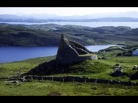
Cnoc na h-Àirde, located in Ross-shire, Scotland, is a prominent hill/mountain that stands at an elevation of 845 meters (2,772 feet). It is situated in the picturesque region of the Northwest Highlands, which is renowned for its rugged and breathtaking landscapes. Cnoc na h-Àirde is part of the Torridon Hills, a mountain range that offers some of the most spectacular views in the country.

The hill/mountain is characterized by its steep slopes, rocky terrain, and a distinctive pointed summit. It is composed mainly of Torridonian sandstone, which gives it a reddish appearance. Cnoc na h-Àirde is a popular destination for hikers and climbers due to its challenging nature and stunning vistas from the top.

The ascent to the summit can be demanding, requiring a good level of fitness and navigation skills. However, those who undertake the climb are rewarded with breathtaking panoramic views of the surrounding landscape, including the nearby Loch Torridon and the majestic Beinn Eighe mountain.

The area around Cnoc na h-Àirde is rich in flora and fauna, with various species of plants and animals calling it home. It is not uncommon to spot red deer, golden eagles, and ptarmigans in the vicinity of the mountain.

Overall, Cnoc na h-Àirde is a captivating natural feature that offers outdoor enthusiasts a chance to experience the beauty and grandeur of the Scottish Highlands. Whether admired from afar or conquered by foot, this hill/mountain is a must-visit for anyone seeking an authentic Scottish adventure.

If you have any feedback on the listing, please let us know in the comments section below.

Cnoc na h-Àirde Images

Images are sourced within 2km of 58.247625/-6.7921925 or Grid Reference NB1838. Thanks to Geograph Open Source API. All images are credited.

Dun in Loch an Dùnain Relatively well preserved dun close to the main road <span class="nowrap"><a title="https://canmore.org.uk/site/4092/lewis-loch-an-duin" rel="nofollow ugc noopener" href="https://canmore.org.uk/site/4092/lewis-loch-an-duin">Link</a><img style="margin-left:2px;" alt="External link" title="External link - shift click to open in new window" src="https://s1.geograph.org.uk/img/external.png" width="10" height="10"/></span>
Dun in Loch an Dùnain
Relatively well preserved dun close to the main road LinkExternal link
Doune Braes Hotel
Doune Braes Hotel
Loch an Dùnain
Loch an Dùnain
Isle of Lewis, Loch an Dùnain
View towards Tolsta Chaolais
West Point
West Point
The Road to Tolsta Chaolais
Fish Farm Cages, Loch na Muilne
Loch na Muilne
Loch na Muilne
Port a' Chaoil Stream flowing from Loch a' Bhaile enters Loch Rog an Ear, a sea loch, at Aird na Moine.
Port a' Chaoil
Stream flowing from Loch a' Bhaile enters Loch Rog an Ear, a sea loch, at Aird na Moine.
Loch a' Bhaile The narrow loch, hemmed in by steep hillsides, flows out into Loch Rog an Ear, a sea loch, via a short river.
Loch a' Bhaile
The narrow loch, hemmed in by steep hillsides, flows out into Loch Rog an Ear, a sea loch, via a short river.
Loch a' Bhaile Loch a' Bhaile & Tolastadh a' Chaolais beyond.
Loch a' Bhaile
Loch a' Bhaile & Tolastadh a' Chaolais beyond.
Tolstachaolais: the post office While many post offices have a buzzer which sounds as the door opens, the postmistress here is alerted to the arrival of customers by the loud bark of the dog tethered to the outside wall.
Tolstachaolais: the post office
While many post offices have a buzzer which sounds as the door opens, the postmistress here is alerted to the arrival of customers by the loud bark of the dog tethered to the outside wall.
Tolstachaolais: along the shore of Loch a' Bhaile Looking across the loch, which runs alongside the road through the village. However, this is the far side that we are looking along.
Tolstachaolais: along the shore of Loch a' Bhaile
Looking across the loch, which runs alongside the road through the village. However, this is the far side that we are looking along.
Tolstachaolais: postbox № HS2 62 This postbox stands more or less in the centre of the village, in front of a house that is set particularly well back from the road. The larger-scale map still marks that house as a post office, although it has actually (as reflected in the 1:50,000 and 1:25,000 map) relocated just over a kilometre to the north - see <a href="https://www.geograph.org.uk/photo/3086624">NB1939 : Tolstachaolais: the post office</a>.
Tolstachaolais: postbox № HS2 62
This postbox stands more or less in the centre of the village, in front of a house that is set particularly well back from the road. The larger-scale map still marks that house as a post office, although it has actually (as reflected in the 1:50,000 and 1:25,000 map) relocated just over a kilometre to the north - see NB1939 : Tolstachaolais: the post office.
Tolstachaolais: Loch a’ Bhaile Looking down this loch from its northern end, with the main part of the village visible far right.
Tolstachaolais: Loch a’ Bhaile
Looking down this loch from its northern end, with the main part of the village visible far right.
Tolstachaolais: hillside cows and Bernera view Looking across the sound separating the eastern side of Bernera from the Lewis mainland, beyond three cows grazing on the slopes to the south of Tolstachaolais village.
Tolstachaolais: hillside cows and Bernera view
Looking across the sound separating the eastern side of Bernera from the Lewis mainland, beyond three cows grazing on the slopes to the south of Tolstachaolais village.
Outlet from Loch a' Bhaile into Port a' Chaoil At the crofting community of Tolastadh a' Chaolais.
Outlet from Loch a' Bhaile into Port a' Chaoil
At the crofting community of Tolastadh a' Chaolais.
Show me another place!

Cnoc na h-Àirde is located at Grid Ref: NB1838 (Lat: 58.247625, Lng: -6.7921925)

Unitary Authority: Na h-Eileanan an Iar

Police Authority: Highlands and Islands

What 3 Words

///lobbed.applause.rags. Near Carloway, Na h-Eileanan Siar

Related Wikis

Tolsta Chaolais

Tolsta Chaolais (also Tolastadh Chaolais, Tolstadh a' Chaolais) is a village on the Isle of Lewis, Scotland. It consists of about forty houses, clustered...

Dun Carloway

Dun Carloway (Scottish Gaelic: Dùn Chàrlabhaigh) is a broch situated in the district of Carloway, on the west coast of the Isle of Lewis, Scotland (grid...

Breaclete

Breacleit (or Roulanish; Scottish Gaelic: Breacleit; Old Norse: Breiðiklettr) is the central village on Great Bernera in the Outer Hebrides, Scotland....

Ceabhaigh

Ceabhaigh is a small island in an arm of Loch Ròg on the west coast of Lewis in the Outer Hebrides of Scotland. It is about 25 hectares (62 acres) in extent...

Borrowston, Lewis

Borrowston (Scottish Gaelic: Borghastan), with a population of about 50, is a crofting township situated on the Isle of Lewis, on the Outer Hebrides of...

Great Bernera

Great Bernera (; Scottish Gaelic: Beàrnaraigh Mòr), often known just as Bernera (Scottish Gaelic: Beàrnaraigh), is an island and community in the Outer...

Carloway

Carloway (Scottish Gaelic: Càrlabhagh [ˈkʰaːɾɫ̪ə.ɤː]) is a crofting township and a district on the west coast of the Isle of Lewis, in the Outer Hebrides...

Breasclete

Breasclete (Scottish Gaelic: Brèascleit) is a village and community on the west side of the Isle of Lewis, in the Outer Hebrides, Scotland. Breasclete...

Related Videos

Alpkit Kangri Carloway Trip

Gusting up to 50mph in Carloway, the Kangri never moved an inch.

Dun Carloway Broch On Visit To Isle Of Lewis Outer Hebrides Scotland

Tour Scotland travel video, with Scottish music, of Dun Carloway Broch, Scottish Gaelic: Dùn Chàrlabhaigh, on visit to the west ...

Dun Carloway Broch With Music On History Visit To Isle Of Lewis Outer Hebrides Scotland

Tour Scotland 4K travel video, with Scottish music, of Dun Carloway Broch, Scottish Gaelic: Dùn Chàrlabhaigh, on visit to the west ...

Nearby Amenities

Located within 500m of 58.247625,-6.7921925
Power: pole
Lat/Long: 58.2467717/-6.7840258
Power: pole
Lat/Long: 58.2471404/-6.78401
Power: pole
Lat/Long: 58.24753/-6.783981
Power: pole
Lat/Long: 58.2479159/-6.7839827
Power: pole
Lat/Long: 58.2484296/-6.7840236
Power: pole
Lat/Long: 58.2496806/-6.7849841
Power: pole
Lat/Long: 58.2492842/-6.7858521
Power: pole
Lat/Long: 58.2498311/-6.7862379
Power: pole
Lat/Long: 58.24935/-6.7871571
Power: pole
Lat/Long: 58.2498773/-6.7881832
Power: pole
Lat/Long: 58.2506355/-6.7902412
Power: pole
Lat/Long: 58.2504202/-6.7896301
Power: pole
Lat/Long: 58.2484179/-6.7837993
Power: pole
Lat/Long: 58.2490706/-6.7866393
Cnoc an t-Sneachd
Place: locality
Lat/Long: 58.2440963/-6.7888847
Cnoc na Nathrach
Place: locality
Lat/Long: 58.2480487/-6.7843572
Garadh Shiadair
Place: locality
Lat/Long: 58.2506458/-6.7869535
Cnoc a' Charnain
Place: locality
Lat/Long: 58.2510749/-6.7891851
Creag Ruadh
Place: locality
Lat/Long: 58.2505442/-6.7942492
Loch Shiadair
Natural: bay
Lat/Long: 58.2491102/-6.7948714
Cnoc na Buaile Mòra
Place: locality
Lat/Long: 58.2449546/-6.7959014
Mol Mòr
Place: locality
Lat/Long: 58.2456774/-6.7976609
The data included in this document is from www.openstreetmap.org. The data is made available under ODbL.

Have you been to Cnoc na h-Àirde?

Leave your review of Cnoc na h-Àirde below (or comments, questions and feedback).