Sìdhean Mór Chearsta Cleit

Hill, Mountain in Ross-shire

Scotland

Sìdhean Mór Chearsta Cleit

Lewis style bus shelter (i)
Lewis style bus shelter (i) Credit: Peter Moore

Sìdhean Mór Chearsta Cleit, located in Ross-shire, Scotland, is a prominent hill known for its magnificent views and natural beauty. Standing at an elevation of approximately 348 meters (1141 feet), it offers a challenging yet rewarding hike for outdoor enthusiasts.

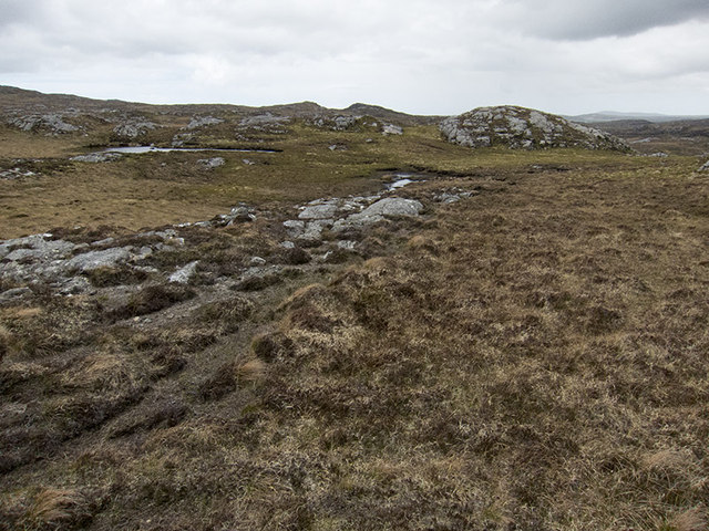
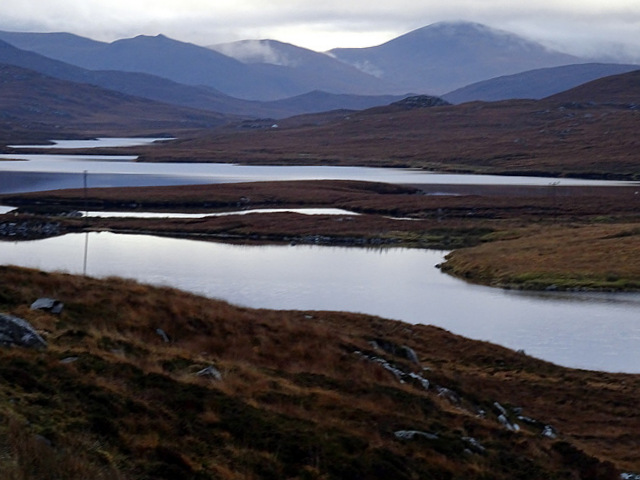
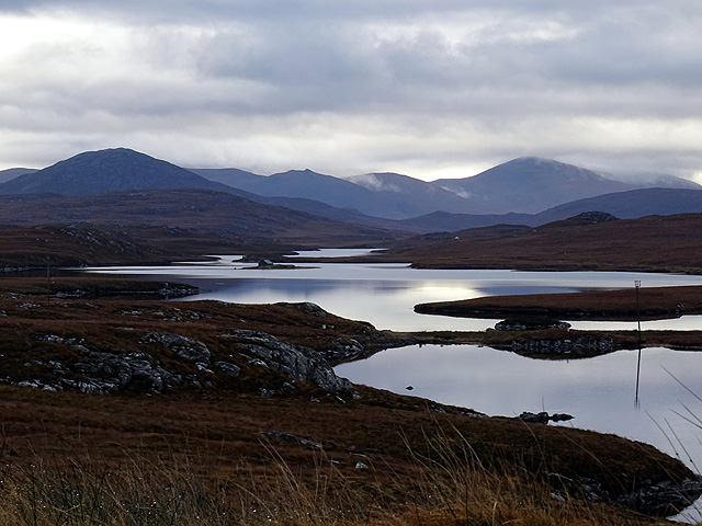
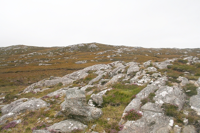
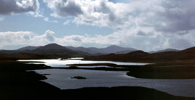
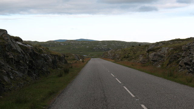
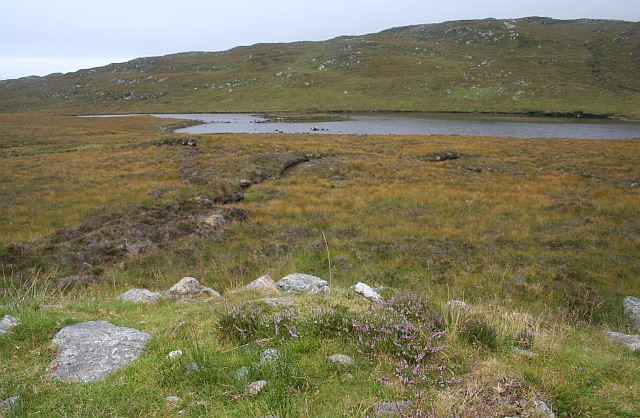
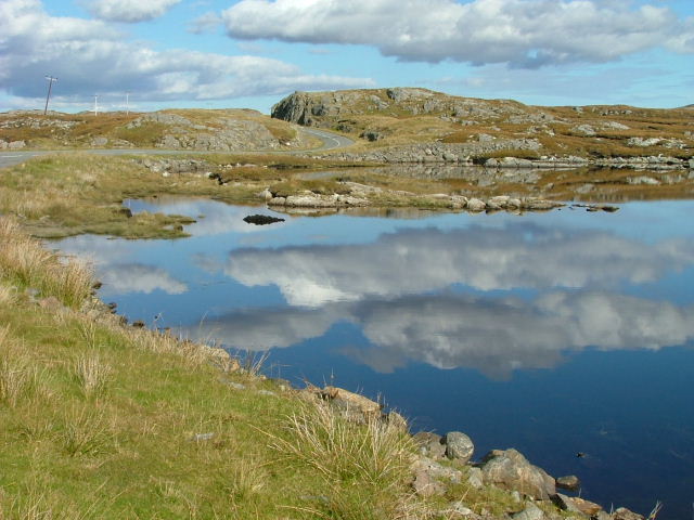
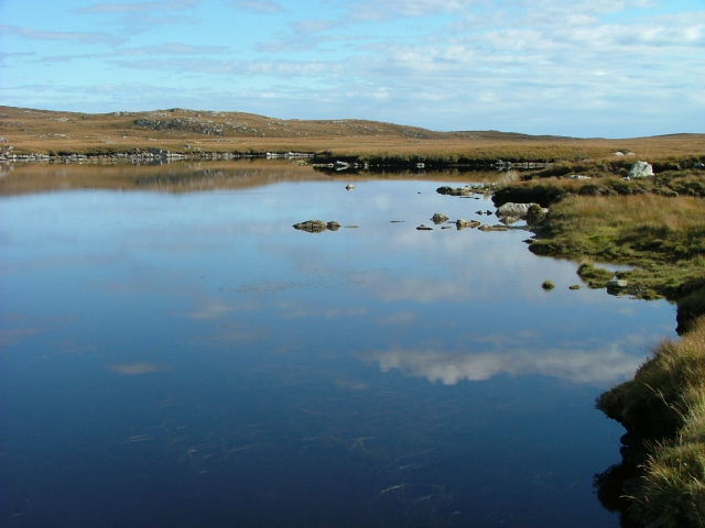
The hill is characterized by its grassy slopes and rocky terrain, offering a diverse range of landscapes to explore. As hikers ascend, they are greeted by panoramic vistas of the surrounding countryside, including the stunning peaks of the nearby mountains.

Sìdhean Mór Chearsta Cleit is home to a variety of flora and fauna, making it an ideal destination for nature lovers. The hill is covered in heather, providing a colorful spectacle during the summer months. It is also common to spot birds of prey soaring overhead, adding to the allure of the area.

For those interested in history, the hill has a rich cultural heritage. It is believed to have been an important site for ancient rituals and gatherings, with remnants of stone circles and cairns scattered across its slopes.

Hikers can reach Sìdhean Mór Chearsta Cleit by following a marked trail that starts from a nearby village. The ascent can be challenging at times, but the stunning views and serenity of the landscape make it all worthwhile.

Overall, Sìdhean Mór Chearsta Cleit is a must-visit destination for outdoor enthusiasts and nature lovers seeking a memorable hiking experience in the picturesque Ross-shire region of Scotland.

If you have any feedback on the listing, please let us know in the comments section below.

Sìdhean Mór Chearsta Cleit Images

Images are sourced within 2km of 58.166703/-6.7816036 or Grid Reference NB1829. Thanks to Geograph Open Source API. All images are credited.

Lewis style bus shelter (i)
Loch Faoghail am Tuim Looking south towards the hills of West Lewis. The little house highlighted by a ray of sunshine is a boathouse, in the next square. The nearest hill on the left is Ciorabhal, and on the right is Geure Dubh Mhòr. On the distant skyline is Roineabhal.
Loch Faoghail am Tuim
Looking south towards the hills of West Lewis. The little house highlighted by a ray of sunshine is a boathouse, in the next square. The nearest hill on the left is Ciorabhal, and on the right is Geure Dubh Mhòr. On the distant skyline is Roineabhal.
Up above the old road This is not country in which to venture without navigations skills. It's boggy, and many of the ups and downs are not pronounced enough to generate contours. We were able to park on the old road - visible on the 1:25000 OS map - and it was a slightly boggy walk up onto rock. One of little lochans in the square can be seen, as can a typical "knock" of Lewisian gneiss. The (somewhat dilapidated) fence to my west could not be seen from where I took the photo.
Up above the old road
This is not country in which to venture without navigations skills. It's boggy, and many of the ups and downs are not pronounced enough to generate contours. We were able to park on the old road - visible on the 1:25000 OS map - and it was a slightly boggy walk up onto rock. One of little lochans in the square can be seen, as can a typical "knock" of Lewisian gneiss. The (somewhat dilapidated) fence to my west could not be seen from where I took the photo.
Cycling the B8059 The hills of Harris on the skyline
Cycling the B8059
The hills of Harris on the skyline
B8059 and the lochs leading in to the Lewis-Harris borderlands This string of linked lochs have 'Faoghail' in their names; this is the Gaelic word for ford.
B8059 and the lochs leading in to the Lewis-Harris borderlands
This string of linked lochs have 'Faoghail' in their names; this is the Gaelic word for ford.
Looking south east from the old Ardroil road A short spur which has been bypassed by new road construction forms a convenient parking place to admire the view.
Looking south east from the old Ardroil road
A short spur which has been bypassed by new road construction forms a convenient parking place to admire the view.
Lewis bus shelter
Lewis bus shelter
Loch Speireag Viewed from the B8059 road. The hills of North Harris in view.
Loch Speireag
Viewed from the B8059 road. The hills of North Harris in view.
Loch Sgàire Viewed from the B8059 road from Great Bernera.
Loch Sgàire
Viewed from the B8059 road from Great Bernera.
Jetty and fishing bothy, Loch Faoghail an Tuim, Isle of Lewis Loch Faoghail an Tuim is part of the Grimersta salmon system (<span class="nowrap"><a title="https://www.grimersta.com/guide.htm" rel="nofollow ugc noopener" href="https://www.grimersta.com/guide.htm">Link</a><img style="margin-left:2px;" alt="External link" title="External link - shift click to open in new window" src="https://s1.geograph.org.uk/img/external.png" width="10" height="10"/></span> ).
Jetty and fishing bothy, Loch Faoghail an Tuim, Isle of Lewis
Loch Faoghail an Tuim is part of the Grimersta salmon system (LinkExternal link ).
Aird na Faoghalach Rocky landscape interspersed with peat bog.
Aird na Faoghalach
Rocky landscape interspersed with peat bog.
Stornoway Cliff Rescue Team waiting to be lifted by helicopter from the old road The Stonoway based coastguard rescue helicopter lifted the team to a job in a remote part of the west coast of the island which has no road access.
Stornoway Cliff Rescue Team waiting to be lifted by helicopter from the old road
The Stonoway based coastguard rescue helicopter lifted the team to a job in a remote part of the west coast of the island which has no road access.
Bus shelter, Lewis style
View southwards from above Loch Sgaire The main road south of Garynahine crosses Loch Sgaire on a causeway.  The line of the road can be seen by the telegraph wires.  Loch Sgaire is one extremity of the complex of interlocking lochs that feed into Loch Langavat.  This view is taken from the side road to Great Bernera.
View southwards from above Loch Sgaire
The main road south of Garynahine crosses Loch Sgaire on a causeway. The line of the road can be seen by the telegraph wires. Loch Sgaire is one extremity of the complex of interlocking lochs that feed into Loch Langavat. This view is taken from the side road to Great Bernera.
Rocky cutting on the B8011 The reconstructed B8011 in West Lewis has been built through the landscape with cuttings and embankments, unlike the old road which was laid over the landscape. The new road encourages rapid progress, but drivers should beware of sheep and red deer.
Rocky cutting on the B8011
The reconstructed B8011 in West Lewis has been built through the landscape with cuttings and embankments, unlike the old road which was laid over the landscape. The new road encourages rapid progress, but drivers should beware of sheep and red deer.
Loch Speireig The loch has a very interesting small circular island that could well be a man-made, iron age, dun or crannog.
Loch Speireig
The loch has a very interesting small circular island that could well be a man-made, iron age, dun or crannog.
Reflections on Loch Sgaire A short causeway separates this loch from Loch Faoghail an Tuim.
Reflections on Loch Sgaire
A short causeway separates this loch from Loch Faoghail an Tuim.
Loch Sgaire Nice reflections on a calm and sunny day.
Loch Sgaire
Nice reflections on a calm and sunny day.
Show me another place!

Sìdhean Mór Chearsta Cleit is located at Grid Ref: NB1829 (Lat: 58.166703, Lng: -6.7816036)

Unitary Authority: Na h-Eileanan an Iar

Police Authority: Highlands and Islands

What 3 Words

///lure.firming.thankful. Near Carloway, Na h-Eileanan Siar

Related Wikis

Eilean Chearstaidh

Eilean Kearstay (Scottish Gaelic: Eilean Chearstaigh) is an uninhabited island in Loch Roag in the Outer Hebrides of Scotland. It lies south east of Great...

Callanish Stones

The Callanish Stones (or "Callanish I": Scottish Gaelic: Clachan Chalanais or Tursachan Chalanais) are an arrangement of standing stones placed in a cruciform...

Callanish IV

The Callanish IV stone circle (Scottish Gaelic: Ceann Hulavig) is one of many megalithic structures around the better-known (and larger) Calanais I on...

Callanish II

The Callanish II stone circle (Scottish Gaelic: Cnoc Ceann a' Gharaidh) is one of many megalithic structures around the better-known (and larger) Calanais...

Callanish

Callanish (Scottish Gaelic: Calanais) is a village (township) on the west side of the Isle of Lewis, in the Outer Hebrides (Western Isles), Scotland. Callanish...

Callanish III

The Callanish III stone circle (Scottish Gaelic: Cnoc Fillibhir Bheag) is one of many megalithic structures around the better-known (and larger) Calanais...

Callanish VIII

The Callanish VIII stone setting is one of many megalithic structures around the better-known (and larger) Calanais I on the west coast of the Isle of...

Garynahine

Garynahine (Scottish Gaelic: Gearraidh na h-aibhne) is a settlement on Lewis, in the Outer Hebrides, Scotland. Garynahine is situated at a T-junction where...

Have you been to Sìdhean Mór Chearsta Cleit?

Leave your review of Sìdhean Mór Chearsta Cleit below (or comments, questions and feedback).