Beinn a' Sgurain
Hill, Mountain in Ross-shire
Scotland
Beinn a' Sgurain
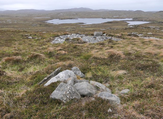
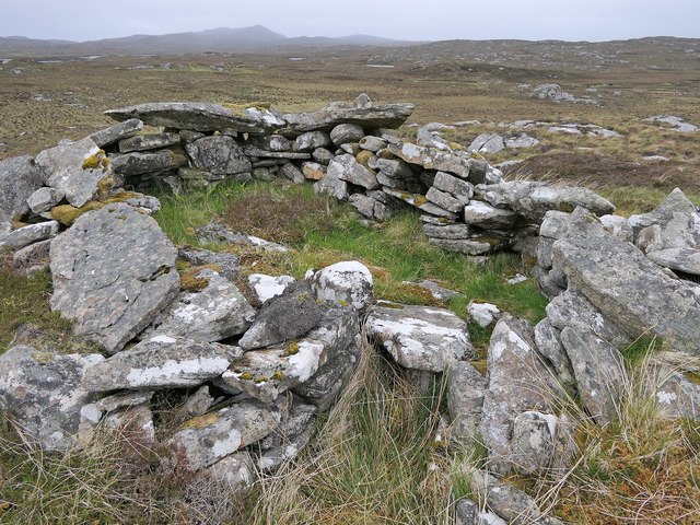
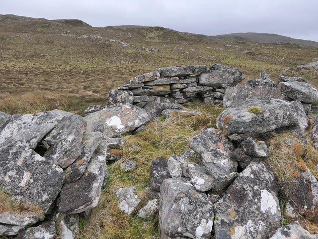
![Ben Mohal [Beinn Mothal] Cairn Second HuMP of four today with Michael Earnshaw, Jim Bloomer and Martin Richardson in mixed weather. This is the cairn at the alternative summit.
Name: Ben Mohal [Beinn Mothal]
Hill number: 4944
Height: 207m / 679ft
Area: 24A: Lewis and Nearby Islands
Class: Hu,2
Grid ref: NB176240 (est)
Drop: 129m
Col: 78m NB168236](https://s1.geograph.org.uk/geophotos/03/69/37/3693745_84757201.jpg)
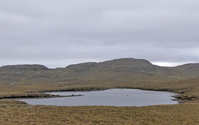
Beinn a' Sgurain is a prominent hill located in Ross-shire, Scotland. Rising to an elevation of 481 meters (1,578 feet), it is a popular destination for hikers and outdoor enthusiasts due to its breathtaking views and rugged terrain.
Situated in the remote and picturesque Scottish Highlands, Beinn a' Sgurain offers panoramic vistas of the surrounding landscape, including nearby lochs and glens. The hill is characterized by its distinct shape, with a steep and rocky summit that provides a challenging climb for experienced hikers. The ascent typically takes around two to three hours, depending on the route chosen.
The hill is covered in a mix of heather, grasses, and moorland vegetation, creating a diverse and vibrant ecosystem. It is home to various species of birds, such as ptarmigans and golden eagles, which can often be spotted soaring high above the hilltop. The surrounding area is also known for its rich wildlife, including red deer and mountain hares.
Beinn a' Sgurain is accessible from several starting points, with the nearest village being Contin. Hikers can choose from a range of routes, each offering a unique experience. The hill is best tackled during the summer months when the weather is more predictable, although caution should still be exercised due to the potential for sudden changes in conditions.
Overall, Beinn a' Sgurain is a majestic and challenging hill that offers outdoor enthusiasts the opportunity to immerse themselves in the natural beauty of the Scottish Highlands.
If you have any feedback on the listing, please let us know in the comments section below.
Beinn a' Sgurain Images
Images are sourced within 2km of 58.11488/-6.7768216 or Grid Reference NB1823. Thanks to Geograph Open Source API. All images are credited.
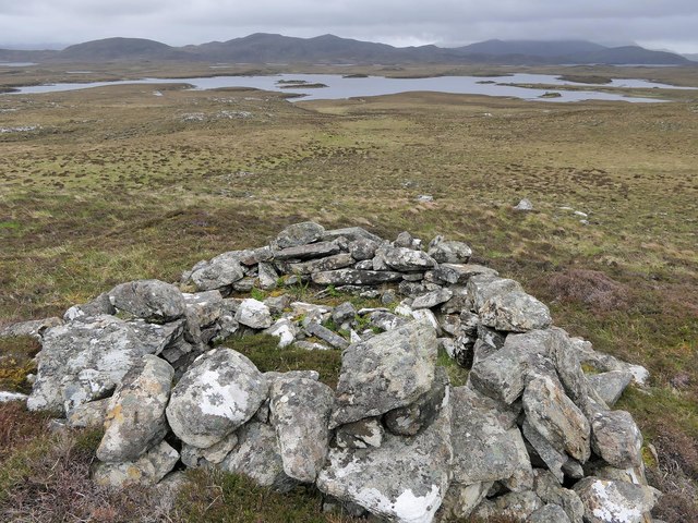
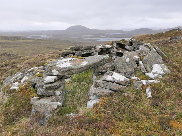
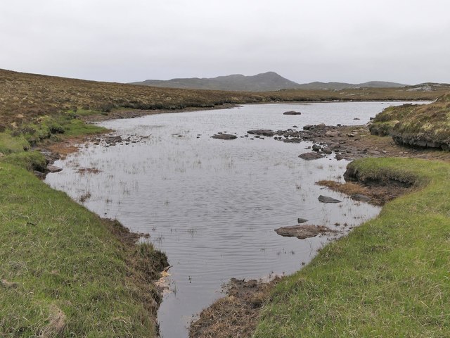
![Ben Mohal [Beinn Mothal] Looking from the alternative top cairn back towards the 207 metre spot height.
Name: Ben Mohal [Beinn Mothal]
Hill number: 4944
Height: 207m / 679ft
Area: 24A: Lewis and Nearby Islands
Class: Hu,2
Grid ref: NB176240 (est)
Drop: 129m
Col: 78m NB168236](https://s3.geograph.org.uk/geophotos/03/69/37/3693751_2745a451.jpg)
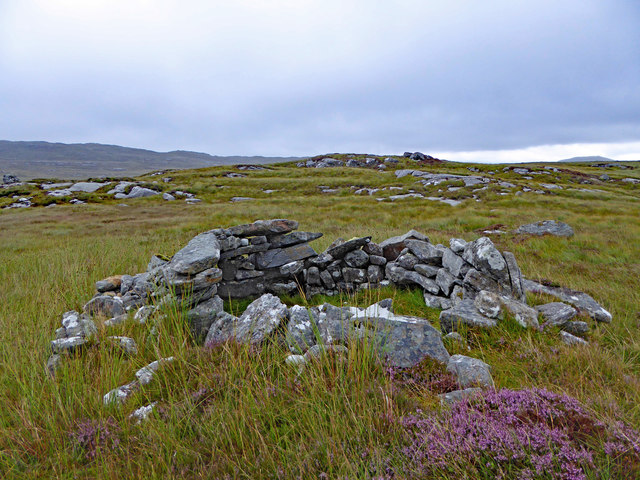
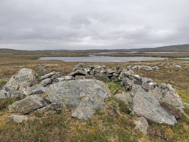
![Ben Mohal [Beinn Mothal] Summit Second HuMP of four today with Michael Earnshaw, Jim Bloomer and Martin Richardson in mixed weather. View of the 207 metre spot height towards the cairn.
Name: Ben Mohal [Beinn Mothal]
Hill number: 4944
Height: 207m / 679ft
Area: 24A: Lewis and Nearby Islands
Class: Hu,2
Grid ref: NB176240 (est)
Drop: 129m
Col: 78m NB168236](https://s1.geograph.org.uk/geophotos/03/69/37/3693757_f0c1ec6a.jpg)

Beinn a' Sgurain is located at Grid Ref: NB1823 (Lat: 58.11488, Lng: -6.7768216)
Unitary Authority: Na h-Eileanan an Iar
Police Authority: Highlands and Islands
What 3 Words
///embedded.measuring.basically. Near Leurbost, Na h-Eileanan Siar
Nearby Locations
Related Wikis

Eilean Mòr, Loch Langavat
Eilean Mòr is an island in Loch Langavat on the Isle of Lewis in the Outer Hebrides of Scotland. == Footnotes ==

Gisla Hydro-Electric Scheme
Gisla Hydro-Electric Scheme was a small scheme promoted by the North of Scotland Hydro-Electric Board on the Isle of Lewis, Outer Hebrides, Scotland. It...

Callanish IV
The Callanish IV stone circle (Scottish Gaelic: Ceann Hulavig) is one of many megalithic structures around the better-known (and larger) Calanais I on...

Airidh a' Bhruaich
Airidh a' Bhruaich (Arivruaich - anglicised) is a scattered crofting township in the South Lochs district of the Isle of Lewis in the Outer Hebrides of...
Nearby Amenities
Located within 500m of 58.11488,-6.7768216Have you been to Beinn a' Sgurain?
Leave your review of Beinn a' Sgurain below (or comments, questions and feedback).