Cnoc Easgann

Hill, Mountain in Inverness-shire

Scotland

Cnoc Easgann

Ruin at Ardvey Abandoned and derelict, in spite of being relatively modern.
Ruin at Ardvey Credit: Richard Dorrell

Cnoc Easgann, located in Inverness-shire, Scotland, is a prominent hill/mountain that offers breathtaking views and outdoor recreational opportunities for visitors. With an elevation of approximately 309 meters (1,014 feet), it is a popular destination for hikers, nature enthusiasts, and photographers.

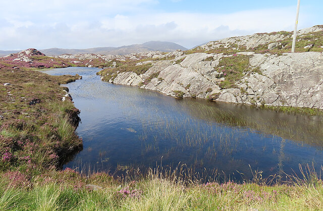
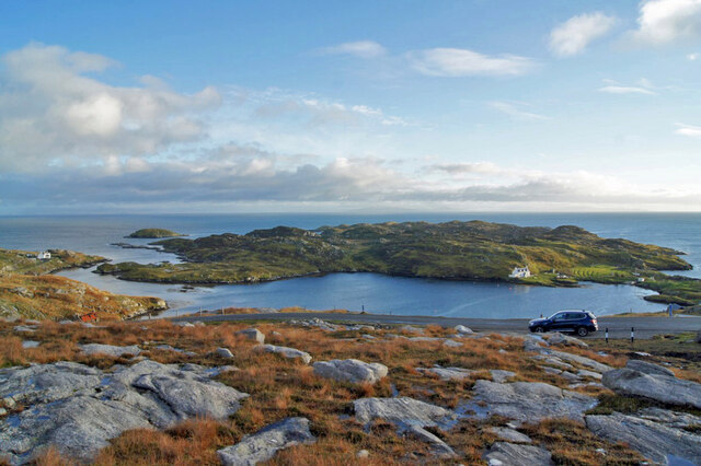
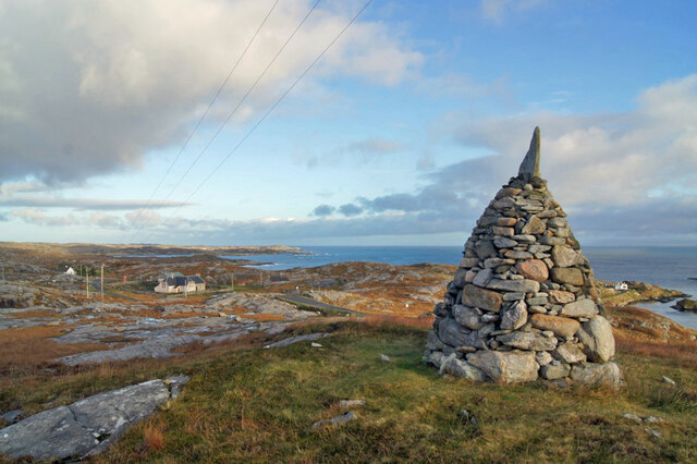
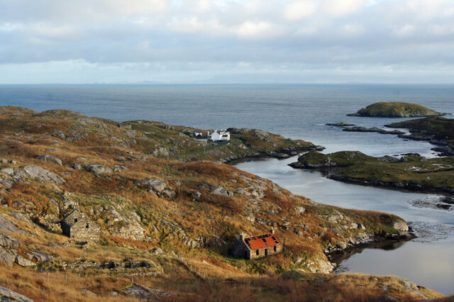
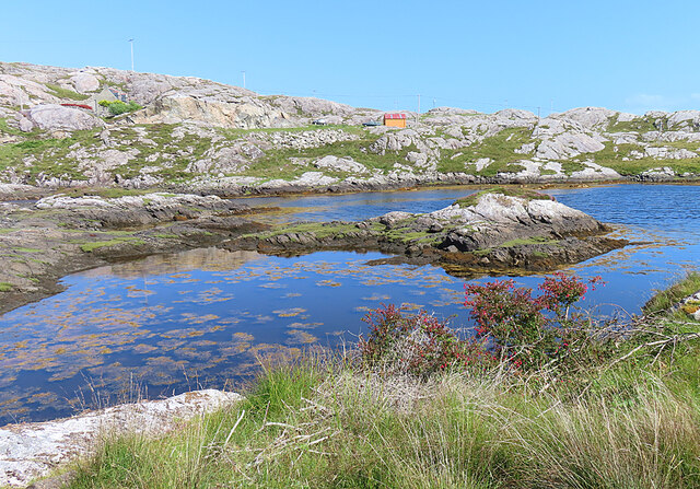
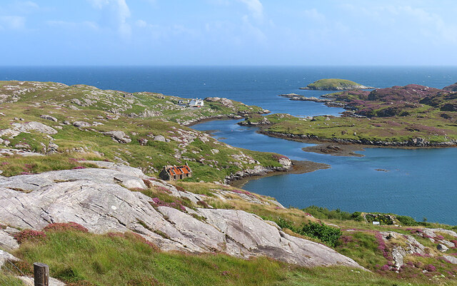
The hill/mountain is situated in a remote and rugged region, surrounded by stunning landscapes, including rolling hills, vast moorlands, and shimmering lochs. Its strategic location provides panoramic views of the surrounding area, making it an ideal spot for capturing photographs of the picturesque Scottish Highlands.

Cnoc Easgann is known for its diverse flora and fauna, with heather, ferns, and wildflowers covering its slopes during the summer months. Birdwatchers can spot various species, including golden eagles, peregrine falcons, and red grouse, among others.

Hiking up Cnoc Easgann is a popular activity, with several well-marked trails catering to different skill levels. The paths offer a mix of gentle ascents and steeper sections, providing a moderate challenge for adventurers. The summit rewards climbers with breathtaking panoramic views, where they can marvel at the vast expanse of rugged beauty that stretches as far as the eye can see.

Visitors are advised to come well-prepared, with appropriate clothing, maps, and supplies, as the weather conditions in Inverness-shire can be unpredictable, especially at higher elevations. It is also important to respect the natural environment and adhere to the Scottish Outdoor Access Code while exploring Cnoc Easgann.

If you have any feedback on the listing, please let us know in the comments section below.

Cnoc Easgann Images

Images are sourced within 2km of 57.785223/-6.8846351 or Grid Reference NG0987. Thanks to Geograph Open Source API. All images are credited.

Ruin at Ardvey Abandoned and derelict, in spite of being relatively modern.
Ruin at Ardvey
Abandoned and derelict, in spite of being relatively modern.
Loch Fhionnsabhaigh The blue pay-to-view telescope is probably there to enable seal-watchers to get a closer view - though as the seals were today basking on rocks just a few yards from the shore, the scope was barely necessary.
See also: <a href="https://www.geograph.org.uk/photo/7033022">NG0887 : Common seals in Loch Fhionnsabhaigh</a>.
Loch Fhionnsabhaigh
The blue pay-to-view telescope is probably there to enable seal-watchers to get a closer view - though as the seals were today basking on rocks just a few yards from the shore, the scope was barely necessary. See also: NG0887 : Common seals in Loch Fhionnsabhaigh.
Common seals in Loch Fhionnsabhaigh A slightly zoomed-in image, taken from the shore of the loch.
Common seals in Loch Fhionnsabhaigh
A slightly zoomed-in image, taken from the shore of the loch.
Fish Farm Pier at Loch Huamabhat
Solitary White house Geocaching is a type of global treasure hunt of people looking for caches, or hidden stashes of objects. Geocaching may also be described as a series of hide-and-seek games, where hiders provide online clues for seekers. Seekers use global positioning system (GPS) devices to find hidden caches
Solitary White house
Geocaching is a type of global treasure hunt of people looking for caches, or hidden stashes of objects. Geocaching may also be described as a series of hide-and-seek games, where hiders provide online clues for seekers. Seekers use global positioning system (GPS) devices to find hidden caches
Flodabay postbox Geocaching is a type of global treasure hunt of people looking for caches, or hidden stashes of objects. Geocaching may also be described as a series of hide-and-seek games, where hiders provide online clues for seekers. Seekers use global positioning system (GPS) devices to find hidden caches
Flodabay postbox
Geocaching is a type of global treasure hunt of people looking for caches, or hidden stashes of objects. Geocaching may also be described as a series of hide-and-seek games, where hiders provide online clues for seekers. Seekers use global positioning system (GPS) devices to find hidden caches
Tidal Inlet at Aird Mhighe The inlet is in this square but the house is in the next square.
Tidal Inlet at Aird Mhighe
The inlet is in this square but the house is in the next square.
Loch Fhionnsabhaigh One of the larger sea-lochs on the east coast of Harris.
Loch Fhionnsabhaigh
One of the larger sea-lochs on the east coast of Harris.
Loch Holmasaig A small lochan, one of dozens alongside the Bays road.
Loch Holmasaig
A small lochan, one of dozens alongside the Bays road.
Loch Huamabhat One of the larger lochans in the wilderness of East Harris.
Loch Huamabhat
One of the larger lochans in the wilderness of East Harris.
Fishing Station? It's not immediately obvious what the reason for the large raft and jetties is.
Fishing Station?
It's not immediately obvious what the reason for the large raft and jetties is.
Cnoc and Lochan Topography The Lewisian gneiss typically produces topography with knolls or rocks interspersed with hollows that are occupied by small lochs. In geography and geology this is described as Cnoc and lochan topography.
Cnoc and Lochan Topography
The Lewisian gneiss typically produces topography with knolls or rocks interspersed with hollows that are occupied by small lochs. In geography and geology this is described as Cnoc and lochan topography.
Loch Buaile Cairistiona Mhurchaidh This rather cumbersome name for a very small loch means something like 'loch of Christina Murdoch's cattle fold'.
Loch Buaile Cairistiona Mhurchaidh
This rather cumbersome name for a very small loch means something like 'loch of Christina Murdoch's cattle fold'.
View over Ob Leasaid Looking south east from beside a cairn on the hillside just east of Manish.
View over Ob Leasaid
Looking south east from beside a cairn on the hillside just east of Manish.
Cairn and view, Manish Looking east past a neatly built cairn on the hillside just east of Manish.
Cairn and view, Manish
Looking east past a neatly built cairn on the hillside just east of Manish.
Ruins and a house, Ardslave A view to the south east over the eastern coast of Harris.
Ruins and a house, Ardslave
A view to the south east over the eastern coast of Harris.
Inlet near Manais Another place where an arm of the sea penetrates well into the land.
Inlet near Manais
Another place where an arm of the sea penetrates well into the land.
Ob Leasaid Ob means an enclosed bay and this one is an excellent example, with a narrow channel from the sea widening to form a wide sea loch.
Ob Leasaid
Ob means an enclosed bay and this one is an excellent example, with a narrow channel from the sea widening to form a wide sea loch.
Show me another place!

Cnoc Easgann is located at Grid Ref: NG0987 (Lat: 57.785223, Lng: -6.8846351)

Unitary Authority: Na h-Eileanan an Iar

Police Authority: Highlands and Islands

What 3 Words

///quilt.kinks.spearing. Near Leverburgh, Na h-Eileanan Siar

Nearby Locations

Loch nan Caor Cnoc Easgann

Related Wikis

Borsham

Borsham (Scottish Gaelic: Boirseam) is a village in the 'Bays' area of Harris in the Outer Hebrides, Scotland. Borsham is within the parish of Harris....

Lingarabay

Lingarabay (also Lingerabay or Lingerbay; Scottish Gaelic: Lingreabhagh) is a small coastal settlement on Harris, in the Outer Hebrides of Scotland. It...

Harris Superquarry

The Harris Super Quarry was a super quarry at Lingerbay, Harris, Scotland proposed by Redland Aggregates in 1991. The plan was to surface mine aggregate...

Stockinish Island

Stockinish Island (Scottish Gaelic: Eilean Stocainis) is an uninhabited island off Harris, in the Outer Hebrides. == Geography and geology == Stockinish...

Roineabhal

Roineabhal is a hill in Harris, in the Western Isles of Scotland. The granite on the summit plateau of the mountain is anorthosite, and is similar in composition...

St Clement's Church, Rodel

St Clement's Church (Scottish Gaelic: Tùr Chliamhainn, meaning Clement's Tower) is a late fifteenth-century or early sixteenth-century church in Rodel...

Rodel

Rodel (Scottish Gaelic: Roghadal) is a village on the south-eastern coast of Harris, an island in the Scottish Outer Hebrides. Rodel is situated in the...

Leverburgh

Leverburgh (Scottish Gaelic: An t-Òb [ən̪ˠ ˈt̪ɔːp]) is the second largest village, after Tarbert, in Harris in the Outer Hebrides of Scotland. Leverburgh...

Nearby Amenities

Located within 500m of 57.785223,-6.8846351
Cnoc Easgann
Alt Name: Cnocesgainn
Is In: Na Hearadh
Place: isolated_dwelling
Lat/Long: 57.7840196/-6.8834669
Turning Circle
Lat/Long: 57.7843352/-6.8855163
Passing Place
Lat/Long: 57.7863348/-6.8846284
Material: wood
Power: pole
Lat/Long: 57.7842974/-6.8851751
Material: wood
Power: pole
Lat/Long: 57.784976/-6.8849109
Power: pole
Lat/Long: 57.7890948/-6.8856775
Power: pole
Lat/Long: 57.7885195/-6.8850592
Power: pole
Lat/Long: 57.7877794/-6.884268
Power: pole
Lat/Long: 57.7874652/-6.8839406
Material: wood
Power: pole
Lat/Long: 57.786957/-6.8841344
Material: wood
Power: pole
Lat/Long: 57.7864387/-6.8843396
Material: wood
Power: pole
Lat/Long: 57.7857595/-6.884577
Material: wood
Power: pole
Lat/Long: 57.7852526/-6.8847996
Loch Flodabay
Natural: bay
Lat/Long: 57.7858339/-6.8836965
The data included in this document is from www.openstreetmap.org. The data is made available under ODbL.

Have you been to Cnoc Easgann?

Leave your review of Cnoc Easgann below (or comments, questions and feedback).