Mulberry Green

Downs, Moorland in Essex Colchester

England

Mulberry Green

Easthorpe Road, Eastthorpe
Easthorpe Road, Eastthorpe Credit: PAUL FARMER

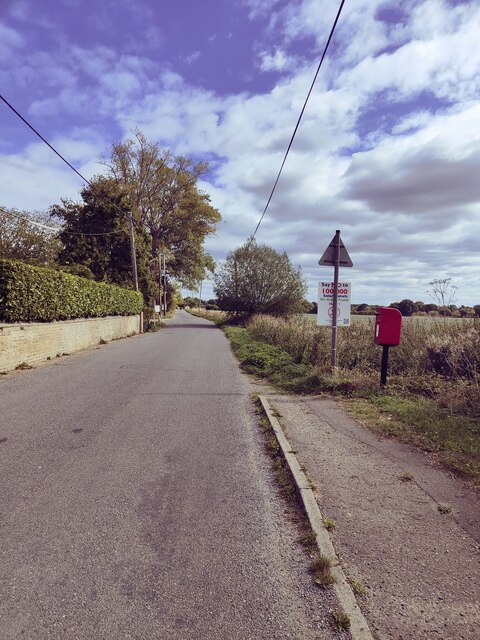
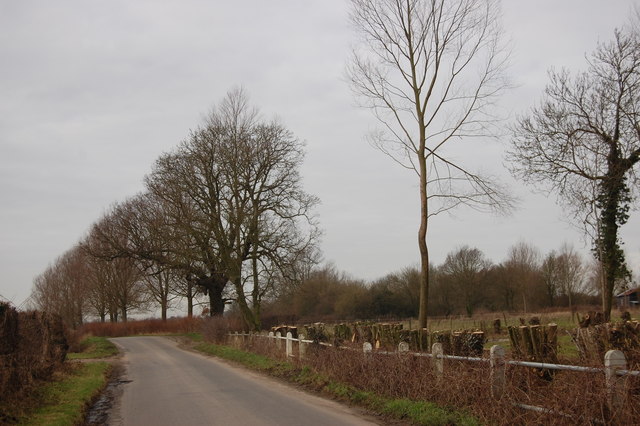
Mulberry Green is a picturesque village located in the county of Essex, England. Situated in the heart of the Essex countryside, Mulberry Green is surrounded by beautiful landscapes, including downs and moorland.

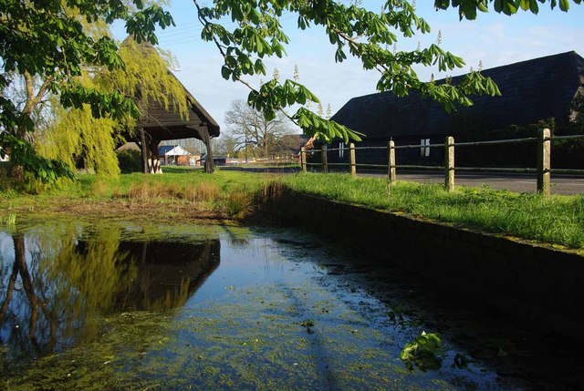
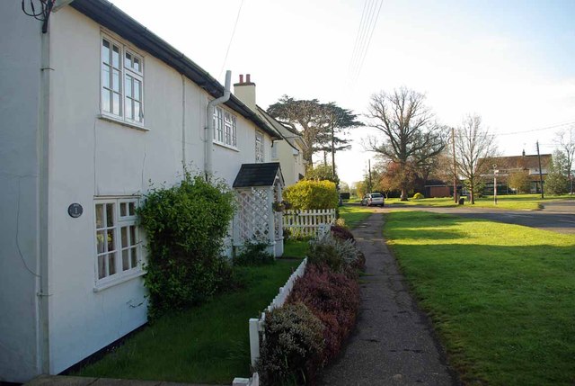
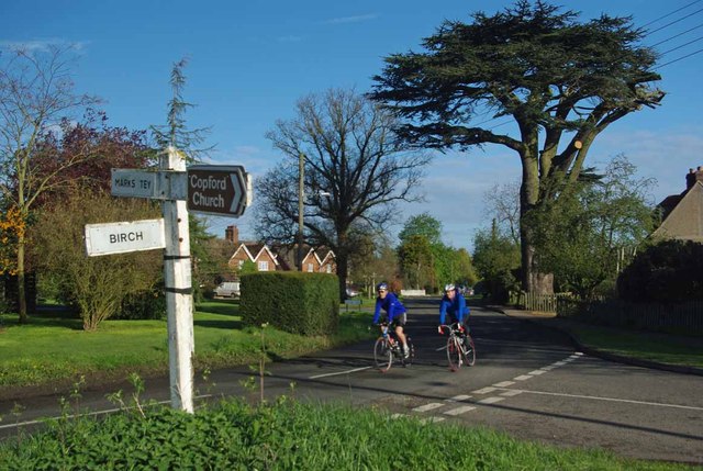
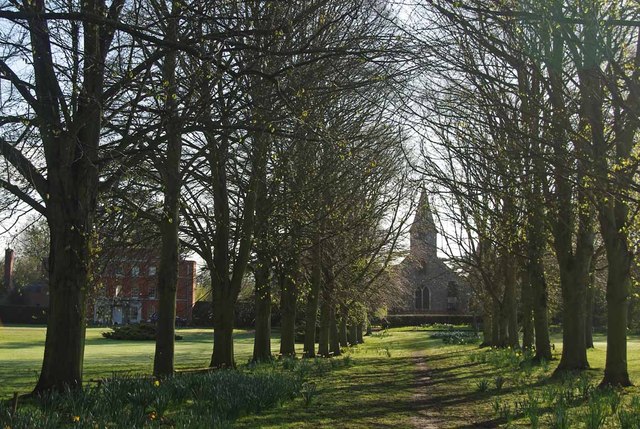
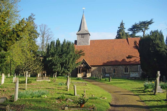
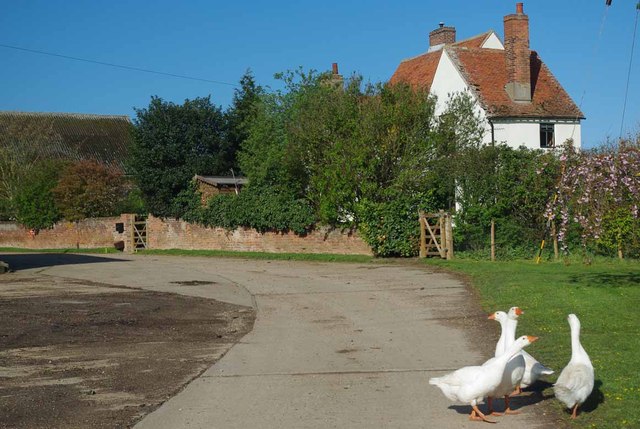
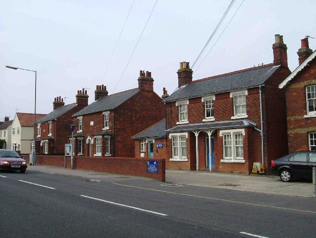
The village is known for its historic charm, with many of its buildings dating back several centuries. The architecture reflects traditional English country style, with thatched roofs and timber-framed houses adding to its quaint and scenic appeal.

Mulberry Green is a close-knit community, with a population of approximately 500 residents. The village is home to a range of amenities, including a local pub, a village hall, and a primary school. The pub serves as a popular meeting place for locals and visitors alike, offering a friendly and welcoming atmosphere.

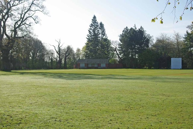
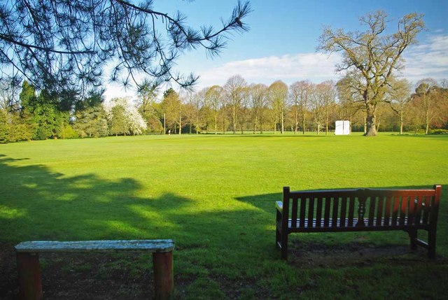
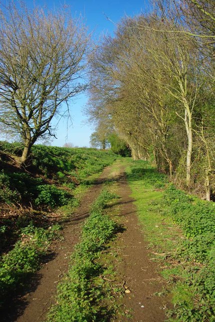
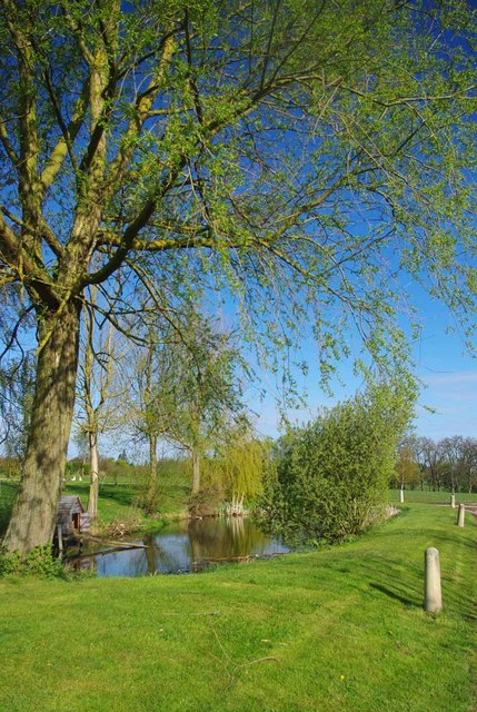
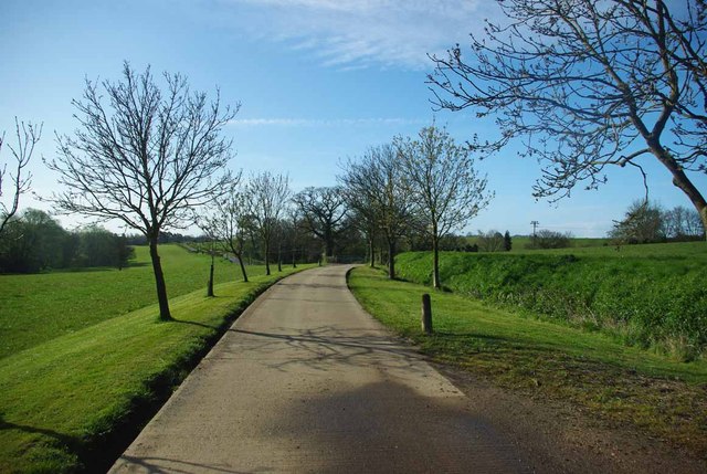
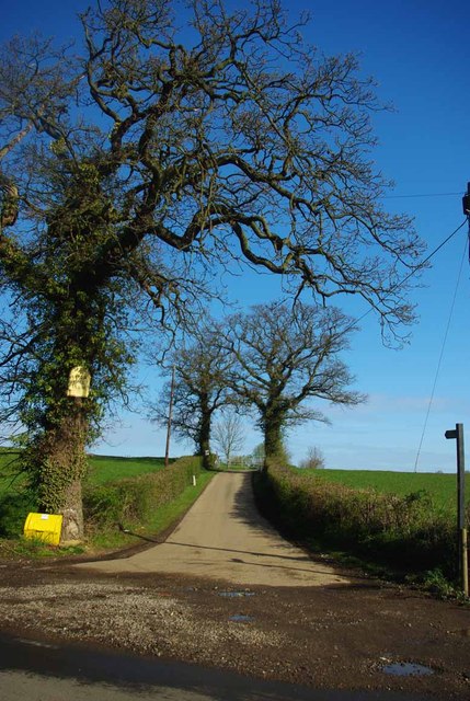
The surrounding downs and moorland provide ample opportunities for outdoor activities, such as hiking, cycling, and horse riding. The landscape is dotted with rolling hills, wildflower meadows, and ancient woodlands, making it a haven for nature enthusiasts.

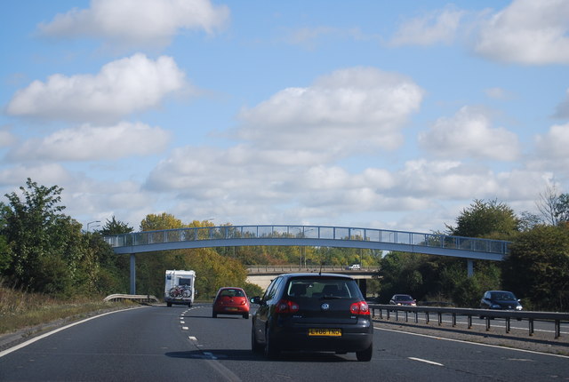
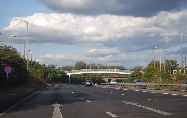
Mulberry Green is well-connected to neighboring towns and cities, with good transport links, including a nearby train station and easy access to major roads. This makes it an ideal location for those seeking a peaceful rural lifestyle while still being within reach of urban amenities.

In summary, Mulberry Green is a charming village in Essex, offering a tranquil and picturesque setting with its downs, moorland, and historic buildings. With a strong sense of community, it provides a desirable location for those seeking a peaceful countryside retreat.

If you have any feedback on the listing, please let us know in the comments section below.

Mulberry Green Images

Images are sourced within 2km of 51.863176/0.79504229 or Grid Reference TL9221. Thanks to Geograph Open Source API. All images are credited.

Easthorpe Road, Eastthorpe
Footbridge over the A12, Marks Tey The A12 is a 129 mile long trunk road from London to Great Yarmouth. It runs through Greater London, Essex, Suffolk and Norfolk. It passes by Brentwood, Colchester and Ipswich as well as passing through Lowestoft.
<span class="nowrap"><a title="http://www.sabre-roads.org.uk/wiki/index.php?title=A12" rel="nofollow ugc noopener" href="http://www.sabre-roads.org.uk/wiki/index.php?title=A12">Link</a><img style="margin-left:2px;" alt="External link" title="External link - shift click to open in new window" src="https://s1.geograph.org.uk/img/external.png" width="10" height="10"/></span> 
Wikipedia: <span class="nowrap"><a title="http://en.wikipedia.org/wiki/A12_road_(England)" rel="nofollow ugc noopener" href="http://en.wikipedia.org/wiki/A12_road_(England)">Link</a><img style="margin-left:2px;" alt="External link" title="External link - shift click to open in new window" src="https://s1.geograph.org.uk/img/external.png" width="10" height="10"/></span>
Footbridge over the A12, Marks Tey
The A12 is a 129 mile long trunk road from London to Great Yarmouth. It runs through Greater London, Essex, Suffolk and Norfolk. It passes by Brentwood, Colchester and Ipswich as well as passing through Lowestoft. LinkExternal link Wikipedia: LinkExternal link
A Copford Green Pond & Cart Lodge I strongly suspect that the pond was used for washing down the carts that were once stored in the 17 Century cart lodge.
A Copford Green Pond & Cart Lodge
I strongly suspect that the pond was used for washing down the carts that were once stored in the 17 Century cart lodge.
Copford Green A quiet Sunday morning in Copford Green
Copford Green
A quiet Sunday morning in Copford Green
School Rd Copford Green A pair of cyclists pass the Junction of School Rd and Church Rd Copford Green.
School Rd Copford Green
A pair of cyclists pass the Junction of School Rd and Church Rd Copford Green.
St Michaels and Copford Hall Looking along an avenue of trees towards <a href="https://www.geograph.org.uk/photo/2911552">TL9322 : Copford Hall</a> and the church 
see <a href="https://www.geograph.org.uk/photo/2911561">TL9322 : No Parishioners Yet!</a>
St Michaels and Copford Hall
Looking along an avenue of trees towards TL9322 : Copford Hall and the church see TL9322 : No Parishioners Yet!
Copford Hall Copford Hall was built around 1760  for more info see <span class="nowrap"><a title="http://www.britishlistedbuildings.co.uk/en-416466-copford-hall-copford" rel="nofollow ugc noopener" href="http://www.britishlistedbuildings.co.uk/en-416466-copford-hall-copford">Link</a><img style="margin-left:2px;" alt="External link" title="External link - shift click to open in new window" src="https://s1.geograph.org.uk/img/external.png" width="10" height="10"/></span>
Copford Hall
Copford Hall was built around 1760 for more info see LinkExternal link
No Parishioners Yet! No sign of any congregation arriving at St Michael & All Saints this early on a sunny Sunday morning.
No Parishioners Yet!
No sign of any congregation arriving at St Michael & All Saints this early on a sunny Sunday morning.
Copford Cricket Club Copford Cricket Club have played here since 1972. The Oak tree on the left is on the playing area. Read more at <span class="nowrap"><a title="http://www.copfordcc.org.uk/contactus.html" rel="nofollow ugc noopener" href="http://www.copfordcc.org.uk/contactus.html">Link</a><img style="margin-left:2px;" alt="External link" title="External link - shift click to open in new window" src="https://s1.geograph.org.uk/img/external.png" width="10" height="10"/></span>
Copford Cricket Club
Copford Cricket Club have played here since 1972. The Oak tree on the left is on the playing area. Read more at LinkExternal link
Copford Cricket Pitch Seats just waiting a few more days for the start of the season. Copford Cricket Club have played here since 1972 read more at <span class="nowrap"><a title="http://www.copfordcc.org.uk/contactus.html" rel="nofollow ugc noopener" href="http://www.copfordcc.org.uk/contactus.html">Link</a><img style="margin-left:2px;" alt="External link" title="External link - shift click to open in new window" src="https://s1.geograph.org.uk/img/external.png" width="10" height="10"/></span>
Copford Cricket Pitch
Seats just waiting a few more days for the start of the season. Copford Cricket Club have played here since 1972 read more at LinkExternal link
Footpath to Aldercar Road This is the footpath from Upper Hill Farm to Aldercar Rd
Footpath to Aldercar Road
This is the footpath from Upper Hill Farm to Aldercar Rd
Guard Geese & Upper Hill Farm Geese have been used as "guard dogs" since at least Roman times. 
The lane is the <a href="https://www.geograph.org.uk/photo/2911582">TL9322 : Footpath to Aldercar Road</a>
Guard Geese & Upper Hill Farm
Geese have been used as "guard dogs" since at least Roman times. The lane is the TL9322 : Footpath to Aldercar Road
Upper Hill Farm Pond A small pond beside a footpath.
Upper Hill Farm Pond
A small pond beside a footpath.
Footpath to Fountain Lane The farm drive to Upper Hill Farm is a footpath that come out on Fountain Lane.
Footpath to Fountain Lane
The farm drive to Upper Hill Farm is a footpath that come out on Fountain Lane.
Footpath to Upper Hill farm Clear proof that Geographers think alike! I must have stood on Robert's wheel tracks however. I clearly got the better weather! see <a href="https://www.geograph.org.uk/photo/706823">TL9422 : The road to Upper Hill Farm</a>
Footpath to Upper Hill farm
Clear proof that Geographers think alike! I must have stood on Robert's wheel tracks however. I clearly got the better weather! see TL9422 : The road to Upper Hill Farm
A12 at Marks Tey The A12 is a 129 mile long trunk road from London to Great Yarmouth. It runs through Greater London, Essex, Suffolk and Norfolk. It passes by Brentwood, Colchester and Ipswich as well as passing through Lowestoft.
<span class="nowrap"><a title="http://www.sabre-roads.org.uk/wiki/index.php?title=A12" rel="nofollow ugc noopener" href="http://www.sabre-roads.org.uk/wiki/index.php?title=A12">Link</a><img style="margin-left:2px;" alt="External link" title="External link - shift click to open in new window" src="https://s1.geograph.org.uk/img/external.png" width="10" height="10"/></span> 
Wikipedia: <span class="nowrap"><a title="http://en.wikipedia.org/wiki/A12_road_(England)" rel="nofollow ugc noopener" href="http://en.wikipedia.org/wiki/A12_road_(England)">Link</a><img style="margin-left:2px;" alt="External link" title="External link - shift click to open in new window" src="https://s1.geograph.org.uk/img/external.png" width="10" height="10"/></span>
A12 at Marks Tey
The A12 is a 129 mile long trunk road from London to Great Yarmouth. It runs through Greater London, Essex, Suffolk and Norfolk. It passes by Brentwood, Colchester and Ipswich as well as passing through Lowestoft. LinkExternal link Wikipedia: LinkExternal link
Footbridge over the A12, Marks Tey The A12 is a 129 mile long trunk road from London to Great Yarmouth. It runs through Greater London, Essex, Suffolk and Norfolk. It passes by Brentwood, Colchester and Ipswich as well as passing through Lowestoft.
<span class="nowrap"><a title="http://www.sabre-roads.org.uk/wiki/index.php?title=A12" rel="nofollow ugc noopener" href="http://www.sabre-roads.org.uk/wiki/index.php?title=A12">Link</a><img style="margin-left:2px;" alt="External link" title="External link - shift click to open in new window" src="https://s1.geograph.org.uk/img/external.png" width="10" height="10"/></span> 
Wikipedia: <span class="nowrap"><a title="http://en.wikipedia.org/wiki/A12_road_(England)" rel="nofollow ugc noopener" href="http://en.wikipedia.org/wiki/A12_road_(England)">Link</a><img style="margin-left:2px;" alt="External link" title="External link - shift click to open in new window" src="https://s1.geograph.org.uk/img/external.png" width="10" height="10"/></span>
Footbridge over the A12, Marks Tey
The A12 is a 129 mile long trunk road from London to Great Yarmouth. It runs through Greater London, Essex, Suffolk and Norfolk. It passes by Brentwood, Colchester and Ipswich as well as passing through Lowestoft. LinkExternal link Wikipedia: LinkExternal link
Easthorpe Road Following the line of a Roman road. The finger post for the footpath to Easthorpegreen Farm can just be made out beside the largest tree.
Easthorpe Road
Following the line of a Roman road. The finger post for the footpath to Easthorpegreen Farm can just be made out beside the largest tree.
Show me another place!

Mulberry Green is located at Grid Ref: TL9221 (Lat: 51.863176, Lng: 0.79504229)

Administrative County: Essex

District: Colchester

Police Authority: Essex

What 3 Words

///bombshell.hamsters.stuffy. Near Marks Tey, Essex

Related Wikis

Copford Green

Copford Green is a hamlet within the civil parish of Copford and the district of Colchester in Essex, England. It is near the A12 and A120 roads, and is...
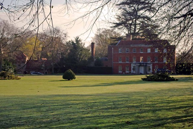
Copford Hall

Copford Hall is a manorial seat and Grade II listed country house, with gardens by Capability Brown, in the village of Copford, Essex, England, 46 miles...

Hardy's Green

Hardy's Green is a hamlet in civil parish of Birch in the Colchester district, in the county of Essex, England. Nearby settlements include the large town...

Heckfordbridge

Heckfordbridge or Heckford is a hamlet in the civil parish of Birch, in the county of Essex, England. The settlement is on the B1022 road, between Colchester...

Copford

Copford is a village and civil parish in the City of Colchester district of Essex, England. It is 3 kilometres (2 mi) west of Colchester, and the hamlet...

Marks Tey railway station

Marks Tey railway station is on the Great Eastern Main Line (GEML) in the East of England, serving the large village of Marks Tey, Essex. It is 46 miles...

Marks Tey

Marks Tey is a large village and electoral ward in Essex, England; it is located six miles west of Colchester. == Facilities == Marks Tey is one of a...

Easthorpe, Essex

Easthorpe is a small village and former civil parish, now in the parish of Copford, in the Colchester district, in the county of Essex, England. Easthorpe...

Nearby Amenities

Located within 500m of 51.863176,0.79504229
Generator Method: photovoltaic
Generator Output Electricity: yes
Generator Source: solar
Generator Type: solar_photovoltaic_panel
Location: roof
Power: generator
Lat/Long: 51.8613685/0.7915092
Generator Method: photovoltaic
Generator Output Electricity: yes
Generator Source: solar
Generator Type: solar_photovoltaic_panel
Location: roof
Power: generator
Lat/Long: 51.8608675/0.7911229
Generator Method: photovoltaic
Generator Output Electricity: yes
Generator Source: solar
Generator Type: solar_photovoltaic_panel
Location: roof
Power: generator
Lat/Long: 51.8609536/0.7915145
Generator Method: photovoltaic
Generator Output Electricity: yes
Generator Source: solar
Generator Type: solar_photovoltaic_panel
Location: roof
Power: generator
Lat/Long: 51.8609536/0.7915628
Generator Method: photovoltaic
Generator Output Electricity: yes
Generator Source: solar
Generator Type: solar_photovoltaic_panel
Location: roof
Power: generator
Lat/Long: 51.8603714/0.7902271
Generator Method: photovoltaic
Generator Output Electricity: yes
Generator Source: solar
Generator Type: solar_photovoltaic_panel
Location: roof
Power: generator
Lat/Long: 51.8603747/0.7902579
The data included in this document is from www.openstreetmap.org. The data is made available under ODbL.

Have you been to Mulberry Green?

Leave your review of Mulberry Green below (or comments, questions and feedback).