Kilverstone Heath

Downs, Moorland in Norfolk Breckland

England

Kilverstone Heath

Evening at Langmere Taken just after sunset on the shortest night of the year.
Evening at Langmere Credit: David Bremner

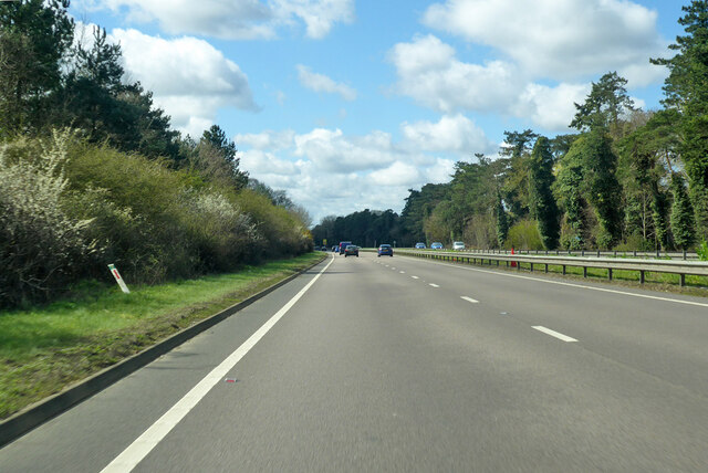
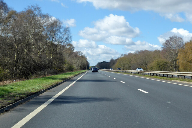
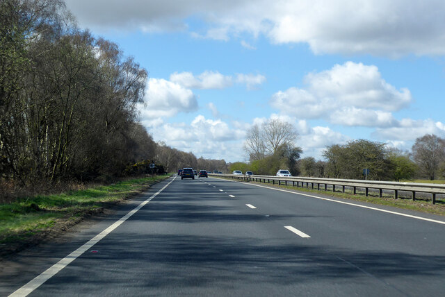
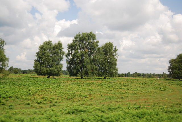
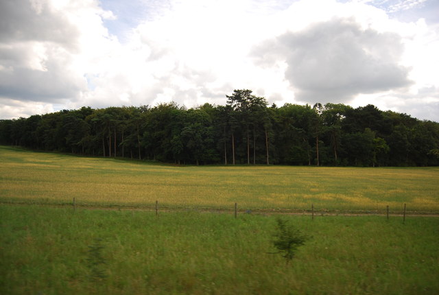
Kilverstone Heath, located in Norfolk, England, is a picturesque area known for its diverse landscapes, including downs and moorland. Spanning approximately 400 acres, this heathland is a designated Site of Special Scientific Interest (SSSI) due to its ecological significance.

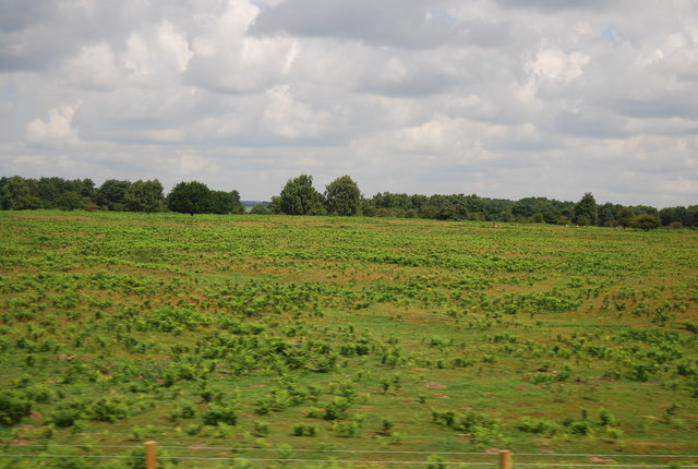
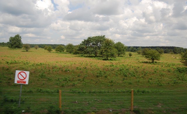
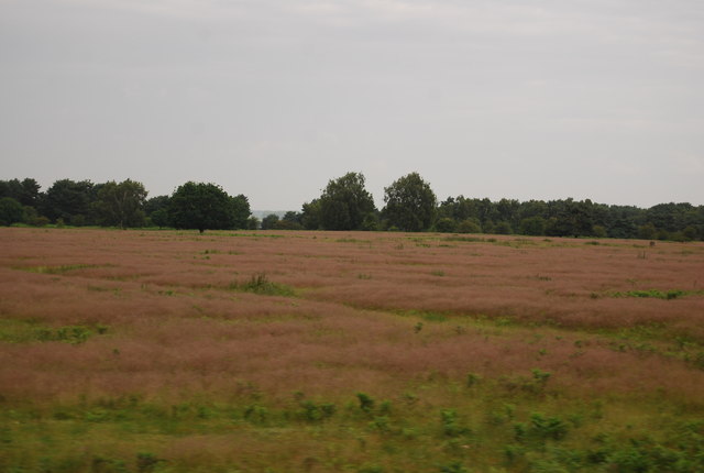
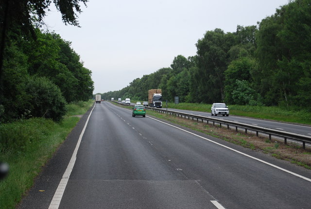
The downs of Kilverstone Heath are characterized by gently rolling hills covered in short grasses and scattered shrubs. This habitat supports a variety of plant species, such as heather, gorse, and bracken, which provide food and shelter for numerous wildlife species. The downs also offer stunning panoramic views of the surrounding countryside, making it a popular spot for hikers and nature enthusiasts.

In contrast to the downs, the moorland of Kilverstone Heath features wetter and more boggy terrain. Here, visitors can find an array of plant life, including sphagnum moss, cotton grass, and various species of sedges. This unique habitat supports a range of wildlife, including birds like curlews and lapwings, as well as insects like dragonflies and damselflies.

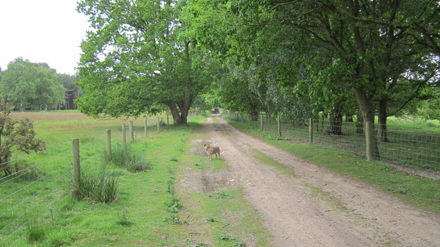
Kilverstone Heath is managed by local conservation organizations in collaboration with the Norfolk Wildlife Trust. They work to protect and enhance the natural habitats, ensuring the preservation of the area's biodiversity. Access to the heath is provided through a network of footpaths and trails, enabling visitors to explore and appreciate the beauty of this unspoiled landscape.

With its diverse ecosystems and stunning vistas, Kilverstone Heath offers a tranquil escape from the hustle and bustle of everyday life, allowing visitors to connect with nature and experience the unique charm of Norfolk's countryside.

If you have any feedback on the listing, please let us know in the comments section below.

Kilverstone Heath Images

Images are sourced within 2km of 52.444162/0.80393642 or Grid Reference TL9086. Thanks to Geograph Open Source API. All images are credited.

Evening at Langmere Taken just after sunset on the shortest night of the year.
Evening at Langmere
Taken just after sunset on the shortest night of the year.
A11 towards London
A11 towards London
A11 towards London
A11 towards London
A11 towards London
A11 towards London
Bridgham Heath
Bridgham Heath
Bridgham Heath
Bridgham Heath
The A11 The A11 is a major road in Eastern England. It runs roughly north east for 111 miles from London to Norwich, With the M11 opening in the 1970s and then the A12 extension in 1999, a lengthy section has been downgraded between the suburbs of east London and the north-west corner of the county of Essex. It also overlaps with the A14 on the Newmarket bypass.
<span class="nowrap"><a title="http://www.sabre-roads.org.uk/wiki/index.php?title=A11" rel="nofollow ugc noopener" href="http://www.sabre-roads.org.uk/wiki/index.php?title=A11">Link</a><img style="margin-left:2px;" alt="External link" title="External link - shift click to open in new window" src="https://s1.geograph.org.uk/img/external.png" width="10" height="10"/></span>
The A11
The A11 is a major road in Eastern England. It runs roughly north east for 111 miles from London to Norwich, With the M11 opening in the 1970s and then the A12 extension in 1999, a lengthy section has been downgraded between the suburbs of east London and the north-west corner of the county of Essex. It also overlaps with the A14 on the Newmarket bypass. LinkExternal link
Danger Area, Bridgham Heath
The A11 The A11 is a major road in Eastern England. It runs roughly north east for 111 miles from London to Norwich, With the M11 opening in the 1970s and then the A12 extension in 1999, a lengthy section has been downgraded between the suburbs of east London and the north-west corner of the county of Essex. It also overlaps with the A14 on the Newmarket bypass.
<span class="nowrap"><a title="http://www.sabre-roads.org.uk/wiki/index.php?title=A11" rel="nofollow ugc noopener" href="http://www.sabre-roads.org.uk/wiki/index.php?title=A11">Link</a><img style="margin-left:2px;" alt="External link" title="External link - shift click to open in new window" src="https://s1.geograph.org.uk/img/external.png" width="10" height="10"/></span>
The A11
The A11 is a major road in Eastern England. It runs roughly north east for 111 miles from London to Norwich, With the M11 opening in the 1970s and then the A12 extension in 1999, a lengthy section has been downgraded between the suburbs of east London and the north-west corner of the county of Essex. It also overlaps with the A14 on the Newmarket bypass. LinkExternal link
Milestone Plantation
A11, northbound The A11 is a major road in Eastern England. It runs roughly north east for 111 miles from London to Norwich, With the M11 opening in the 1970s and then the A12 extension in 1999, a lengthy section has been downgraded between the suburbs of east London and the north-west corner of the county of Essex. It also overlaps with the A14 on the Newmarket bypass.
<span class="nowrap"><a title="http://www.sabre-roads.org.uk/wiki/index.php?title=A11" rel="nofollow ugc noopener" href="http://www.sabre-roads.org.uk/wiki/index.php?title=A11">Link</a><img style="margin-left:2px;" alt="External link" title="External link - shift click to open in new window" src="https://s1.geograph.org.uk/img/external.png" width="10" height="10"/></span>
A11, northbound
The A11 is a major road in Eastern England. It runs roughly north east for 111 miles from London to Norwich, With the M11 opening in the 1970s and then the A12 extension in 1999, a lengthy section has been downgraded between the suburbs of east London and the north-west corner of the county of Essex. It also overlaps with the A14 on the Newmarket bypass. LinkExternal link
The A11
The A11
The A11 The A11 is a major road in Eastern England. It runs roughly north east for 111 miles from London to Norwich, With the M11 opening in the 1970s and then the A12 extension in 1999, a lengthy section has been downgraded between the suburbs of east London and the north-west corner of the county of Essex. It also overlaps with the A14 on the Newmarket bypass.
<span class="nowrap"><a title="http://www.sabre-roads.org.uk/wiki/index.php?title=A11" rel="nofollow ugc noopener" href="http://www.sabre-roads.org.uk/wiki/index.php?title=A11">Link</a><img style="margin-left:2px;" alt="External link" title="External link - shift click to open in new window" src="https://s1.geograph.org.uk/img/external.png" width="10" height="10"/></span>
The A11
The A11 is a major road in Eastern England. It runs roughly north east for 111 miles from London to Norwich, With the M11 opening in the 1970s and then the A12 extension in 1999, a lengthy section has been downgraded between the suburbs of east London and the north-west corner of the county of Essex. It also overlaps with the A14 on the Newmarket bypass. LinkExternal link
Bridgham Heath
Bridgham Heath
The A11 The A11 is a major road in Eastern England. It runs roughly north east for 111 miles from London to Norwich, With the M11 opening in the 1970s and then the A12 extension in 1999, a lengthy section has been downgraded between the suburbs of east London and the north-west corner of the county of Essex. It also overlaps with the A14 on the Newmarket bypass.
<span class="nowrap"><a title="http://www.sabre-roads.org.uk/wiki/index.php?title=A11" rel="nofollow ugc noopener" href="http://www.sabre-roads.org.uk/wiki/index.php?title=A11">Link</a><img style="margin-left:2px;" alt="External link" title="External link - shift click to open in new window" src="https://s1.geograph.org.uk/img/external.png" width="10" height="10"/></span>
The A11
The A11 is a major road in Eastern England. It runs roughly north east for 111 miles from London to Norwich, With the M11 opening in the 1970s and then the A12 extension in 1999, a lengthy section has been downgraded between the suburbs of east London and the north-west corner of the county of Essex. It also overlaps with the A14 on the Newmarket bypass. LinkExternal link
Hereward Way Hereward Way looking in the direction of Croxton Heath.
Hereward Way
Hereward Way looking in the direction of Croxton Heath.
A11 The A11 is a major road in Eastern England. It runs roughly north east for 111 miles from London to Norwich, With the M11 opening in the 1970s and then the A12 extension in 1999, a lengthy section has been downgraded between the suburbs of east London and the north-west corner of the county of Essex. It also overlaps with the A14 on the Newmarket bypass.
<span class="nowrap"><a title="http://www.sabre-roads.org.uk/wiki/index.php?title=A11" rel="nofollow ugc noopener" href="http://www.sabre-roads.org.uk/wiki/index.php?title=A11">Link</a><img style="margin-left:2px;" alt="External link" title="External link - shift click to open in new window" src="https://s1.geograph.org.uk/img/external.png" width="10" height="10"/></span>
A11
The A11 is a major road in Eastern England. It runs roughly north east for 111 miles from London to Norwich, With the M11 opening in the 1970s and then the A12 extension in 1999, a lengthy section has been downgraded between the suburbs of east London and the north-west corner of the county of Essex. It also overlaps with the A14 on the Newmarket bypass. LinkExternal link
Show me another place!

Kilverstone Heath is located at Grid Ref: TL9086 (Lat: 52.444162, Lng: 0.80393642)

Administrative County: Norfolk

District: Breckland

Police Authority: Norfolk

What 3 Words

///yield.evoked.bits. Near Thetford, Norfolk

Related Wikis

East Wretham Heath

East Wretham Heath is a 141.1-hectare (349-acre) biological Site of Special Scientific Interest south-east of Thetford in Norfolk. It is a Nature Conservation...

Bridgham and Brettenham Heaths

Bridgham and Brettenham Heaths is a 439.9-hectare (1,087-acre) biological Site of Special Scientific Interest north-east of Thetford in Norfolk, England...

Roudham Junction railway station

Roudham Junction railway station was a station in Norfolk, England. It was located in a remote area east of Thetford, where the Main Line between Norwich...

Kilverstone

Kilverstone is a civil parish in the English county of Norfolk east of Thetford. It covers an area of 7.46 km2 (2.88 sq mi) and had a population of 60...

Kilverstone Hall

Kilverstone Hall is a Grade II listed building in Kilverstone in Norfolk, England. == History == Kilverstone Hall is a country house built in the early...

Croxton, Norfolk

Croxton is a village and civil parish in the English county of Norfolk, within the district of Breckland. Croxton is located 2.2 miles north of Thetford...
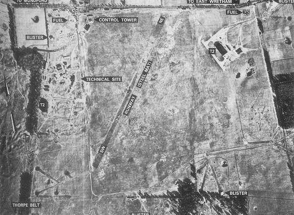
RAF East Wretham

Royal Air Force East Wretham or more simply RAF East Wretham is a former Royal Air Force station located 6 miles (9.7 km) northeast of Thetford, Norfolk...

The Thetford Academy, Norfolk

The Thetford Academy is a coeducational secondary school and sixth form with academy status located in Thetford, Norfolk, England. == History == Before...

Nearby Amenities

Located within 500m of 52.444162,0.80393642
Crossing Barrier: half
Railway: level_crossing
Lat/Long: 52.4455386/0.7980124
Crossing Barrier: half
Railway: level_crossing
Lat/Long: 52.4456026/0.7980817
The data included in this document is from www.openstreetmap.org. The data is made available under ODbL.

Have you been to Kilverstone Heath?

Leave your review of Kilverstone Heath below (or comments, questions and feedback).