Hamptons Park

Downs, Moorland in Kent Tonbridge and Malling

England

Hamptons Park

Dene Park car park, Puttenden Road
Dene Park car park, Puttenden Road Credit: Ron Lee

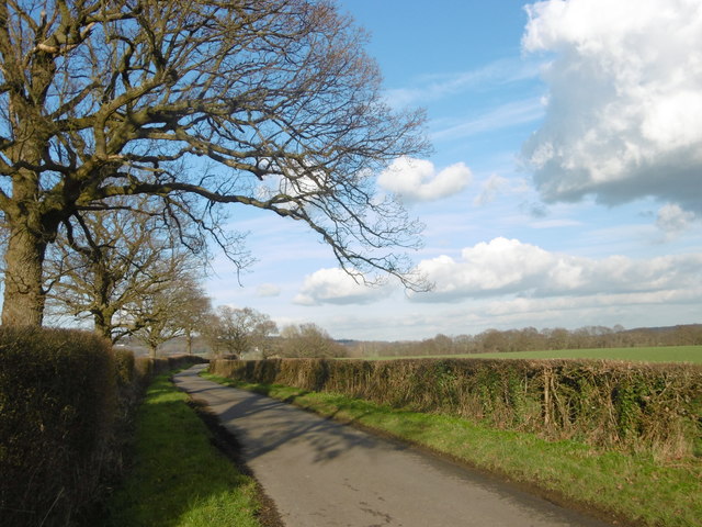
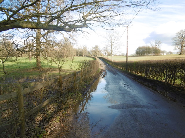
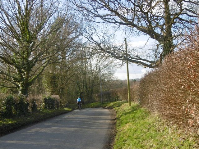
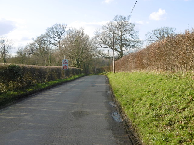
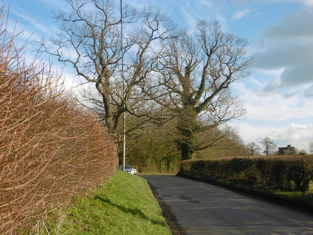
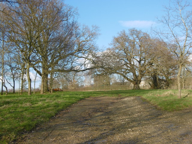
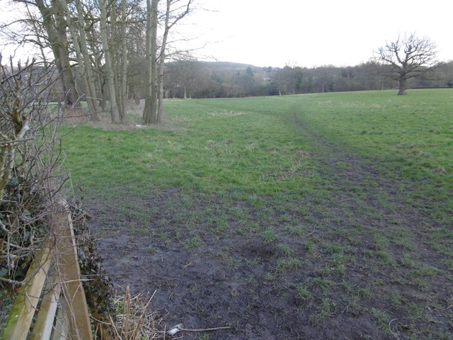
Hamptons Park, located in Kent, England, is a picturesque and expansive area that offers a variety of natural landscapes, including downs and moorland. Spanning over a considerable area, the park provides visitors with a tranquil and idyllic setting to explore and appreciate the beauty of nature.

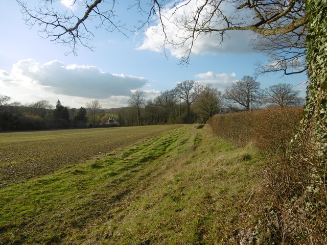
The downs of Hamptons Park are characterized by rolling hills covered in lush green grass and scattered with wildflowers, presenting a visually stunning sight. This part of the park is ideal for leisurely walks, picnics, and enjoying the panoramic views of the surrounding countryside.

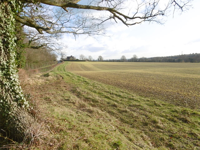
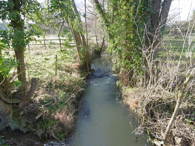
The moorland section of Hamptons Park offers a contrast to the downs, featuring open expanses of heathland and peat bogs. This unique habitat supports a diverse range of flora and fauna, including rare species such as the Dartford warbler and the silver-studded blue butterfly. Nature enthusiasts can indulge in birdwatching, as the moorland attracts a variety of avian species.

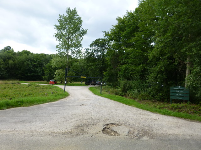
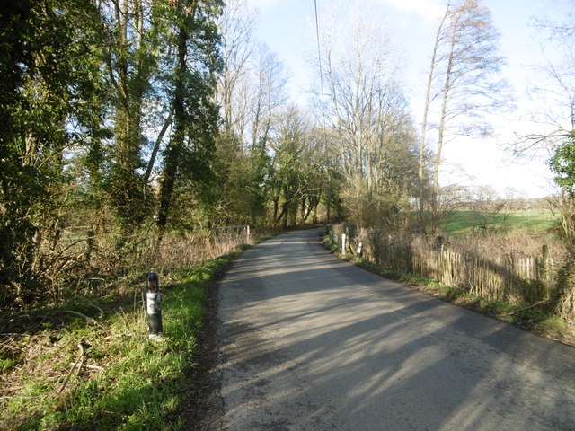
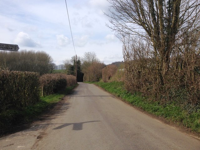
The park provides designated trails and paths for visitors to explore, ensuring a safe and enjoyable experience. Additionally, information boards and signage are placed strategically throughout the park, offering educational insights into the local wildlife and ecosystems.

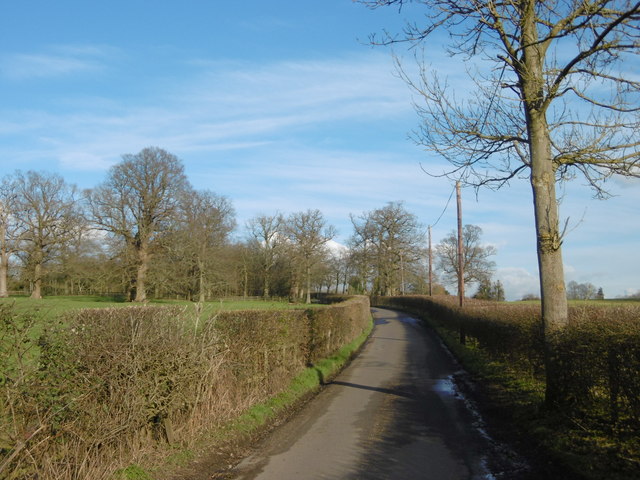
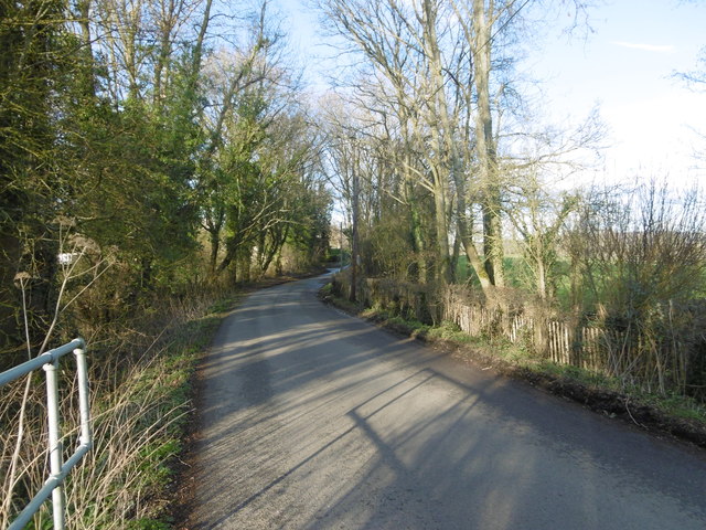
Hamptons Park also boasts facilities such as picnic areas, benches, and designated parking spaces. These amenities make it an ideal destination for families, couples, and individuals seeking a peaceful retreat from the hustle and bustle of daily life.

Overall, Hamptons Park in Kent offers a diverse and captivating natural landscape, combining downs and moorland, making it a haven for nature lovers and a perfect escape for those seeking solace amidst the beauty of the outdoors.

If you have any feedback on the listing, please let us know in the comments section below.

Hamptons Park Images

Images are sourced within 2km of 51.243193/0.32413059 or Grid Reference TQ6251. Thanks to Geograph Open Source API. All images are credited.

Dene Park car park, Puttenden Road
Matthews Lane junction with Common Road, Hadlow
High House Lane near Hadlow High House Lane has a notice near its start saying "Quiet lane". The attractive highway lives up to this name. The Greensand Ridge can be seen in the distance.
High House Lane near Hadlow
High House Lane has a notice near its start saying "Quiet lane". The attractive highway lives up to this name. The Greensand Ridge can be seen in the distance.
Field next to Hamptons Road This was a lovely clear afternoon light in Kent. This field is next to the road from Hadlow to Paxtol and opposite the junction with Park Road.
Field next to Hamptons Road
This was a lovely clear afternoon light in Kent. This field is next to the road from Hadlow to Paxtol and opposite the junction with Park Road.
Park Road near Hadlow This was a lovely clear afternoon light in Kent. This is Park Road leading away from Hamptons Road.
Park Road near Hadlow
This was a lovely clear afternoon light in Kent. This is Park Road leading away from Hamptons Road.
Park Road near Hadlow This is Park Road leading away from Hamptons Road after recent rain.
Park Road near Hadlow
This is Park Road leading away from Hamptons Road after recent rain.
A cyclist heads downhill This is Hamptons Road on the way from Hadlow to Paxtol. It was a lovely clear afternoon light in Kent as a cyclist heads downhill.
A cyclist heads downhill
This is Hamptons Road on the way from Hadlow to Paxtol. It was a lovely clear afternoon light in Kent as a cyclist heads downhill.
Hamptons Road This is Hamptons Road on the way from Hadlow to Paxtol. It was a lovely clear afternoon light in Kent.
Hamptons Road
This is Hamptons Road on the way from Hadlow to Paxtol. It was a lovely clear afternoon light in Kent.
Hamptons Road This is Hamptons Road on the way from Plaxtol to Hadlow. The junction with Park Road is just ahead. It was a lovely clear afternoon light in Kent.
Hamptons Road
This is Hamptons Road on the way from Plaxtol to Hadlow. The junction with Park Road is just ahead. It was a lovely clear afternoon light in Kent.
Driveway towards Hamptons Hamptons is an imposing nineteenth century house - see <a title="https://www.geograph.org.uk/photo/3389962" href="https://www.geograph.org.uk/photo/3389962">Link</a>   This isn't the main driveway - that is off Park Road. A notice on the gate over which this photograph was taken states that this is part of the Fairlawne Estate. Much of this area seems to be part of that estate.
Driveway towards Hamptons
Hamptons is an imposing nineteenth century house - see Link This isn't the main driveway - that is off Park Road. A notice on the gate over which this photograph was taken states that this is part of the Fairlawne Estate. Much of this area seems to be part of that estate.
Puttenden Road Puttenden Road crosses a small stream ahead on its way to Claygate and Puttenden Manor Farm.
Puttenden Road
Puttenden Road crosses a small stream ahead on its way to Claygate and Puttenden Manor Farm.
Stream seen from Puttenden Road Puttenden Road crosses this small stream near Hookwood Farm. See also <a title="https://www.geograph.org.uk/photo/4832679" href="https://www.geograph.org.uk/photo/4832679">Link</a>
Stream seen from Puttenden Road
Puttenden Road crosses this small stream near Hookwood Farm. See also Link
Puttenden Road Puttenden Road crosses a small stream here on its way to Claygate and Puttenden Manor Farm. See also <a title="https://www.geograph.org.uk/photo/4832681" href="https://www.geograph.org.uk/photo/4832681">Link</a>
Puttenden Road
Puttenden Road crosses a small stream here on its way to Claygate and Puttenden Manor Farm. See also Link
Footpath next to Long Mill Lane This footpath makes a right angled bend just ahead and then leads to Allens Lane.
Footpath next to Long Mill Lane
This footpath makes a right angled bend just ahead and then leads to Allens Lane.
Gover Hill, near West Peckham
Show me another place!

Hamptons Park is located at Grid Ref: TQ6251 (Lat: 51.243193, Lng: 0.32413059)

Administrative County: Kent

District: Tonbridge and Malling

Police Authority: Kent

What 3 Words

///riots.smile.thinks. Near Hadlow, Kent

Nearby Locations

Hamptons Park

Related Wikis

Tonbridge and Malling (UK Parliament constituency)

Tonbridge and Malling is a constituency in Kent represented in the House of Commons of the UK Parliament since 2015 by Tom Tugendhat, a Conservative. The...

West Peckham

West Peckham is a village and civil parish in the borough of Tonbridge and Malling in Kent, England. The River Bourne flows through the extreme west of...

Hadlow Cricket Club

Hadlow Cricket Club was one of the early English cricket clubs, formed in the early to mid eighteenth century. Hadlow is a village in the Medway valley...

Hadlow

Hadlow is a village and civil parish in the borough of Tonbridge and Malling in Kent, England. It is situated in the Medway valley, north-east of Tonbridge...

Hadlow College

Hadlow College is a further and higher education college in Hadlow, Kent, England, with a satellite site in Greenwich. The curriculum primarily covers...
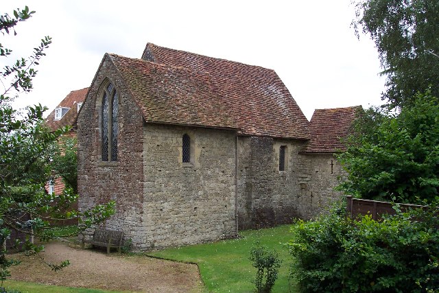
Old Soar Manor

Old Soar Manor is an English Heritage property, owned and maintained by the National Trust. Located near Plaxtol, Kent, England, it is a small 13th century...

Hadlow Rural Community School

Hadlow Rural Community School is a coeducational secondary school located in Hadlow in the English county of Kent.It is a free school that was established...

Hadlow Castle

Hadlow Castle was an 18th-century country house in Hadlow, Kent, England, built in the fashionable Strawberry Hill 'Gothic' style. The house was gradually...

Nearby Amenities

Located within 500m of 51.243193,0.32413059
Power: tower
Lat/Long: 51.2400126/0.3206075
Power: tower
Lat/Long: 51.2415602/0.3185991
Post Box
Collection Times: Mo-Fr 16:00; Sa 10:00; Su off
Colour: red
Ref: TN11 13
Royal Cypher: VR
Royal Cypher Wikidata: Q33102356
Lat/Long: 51.245897/0.3290124
The data included in this document is from www.openstreetmap.org. The data is made available under ODbL.

Have you been to Hamptons Park?

Leave your review of Hamptons Park below (or comments, questions and feedback).