The Park

Downs, Moorland in Lincolnshire East Lindsey

England

The Park

Rowgate Hill
Rowgate Hill Credit: David Brown

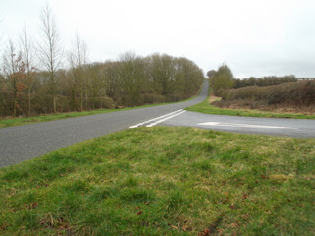
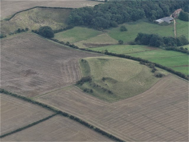
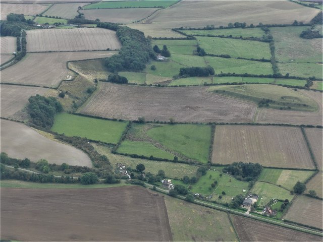
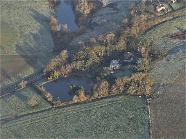
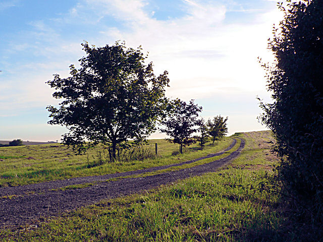
The Park in Lincolnshire is a sprawling natural area that encompasses downs and moorland, offering visitors a diverse and picturesque landscape to explore. The downs are characterized by their gentle rolling hills and open grasslands, providing stunning views of the surrounding countryside. Visitors can enjoy leisurely walks or hikes through the downs, taking in the fresh air and peaceful atmosphere.

The moorland section of The Park offers a different experience, with its rugged terrain and wild beauty. Here, visitors can discover unique plant and animal species that thrive in this harsh environment. The moorland is also home to a variety of bird species, making it a popular spot for birdwatching enthusiasts.

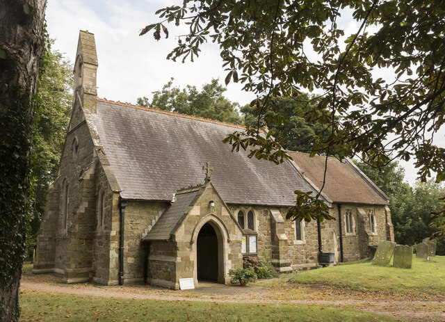
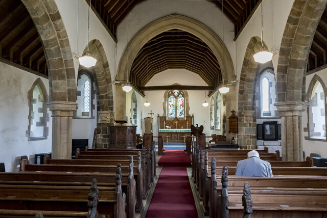
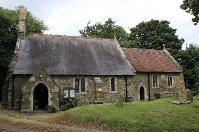
Throughout The Park, visitors can expect to encounter a rich array of flora and fauna, from vibrant wildflowers to grazing livestock. The area is also dotted with historical landmarks and archaeological sites, adding an additional layer of interest for those looking to delve into the region's past.

Overall, The Park in Lincolnshire offers a tranquil escape from the hustle and bustle of everyday life, providing a serene natural setting for relaxation, exploration, and appreciation of the great outdoors.

If you have any feedback on the listing, please let us know in the comments section below.
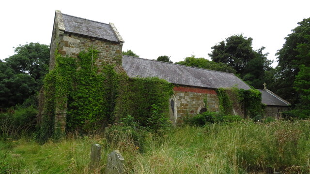
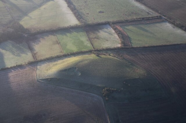
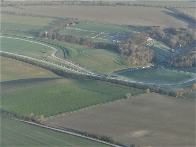
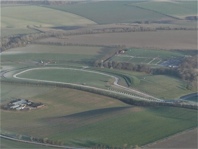
The Park Images

Images are sourced within 2km of 53.297682/-0.075156838 or Grid Reference TF2879. Thanks to Geograph Open Source API. All images are credited.

Rowgate Hill
Rowgate Hill
St Martin's church, Scamblesby There was probably a church here in Anglo-Saxon times, and  there are remnants of 12th C. fabric.
The chancel was rebuilt in 1890, and the nave in 1893 at a cost of £800. The architect was R. H. Fowler.

The church is built in green sandstone with limestone ashlar dressings and  a slate roof.
There is a nave with a west bellcote, north and south aisles, a south porch and chancel. The north aisle has a reused 12th C. Lancet window.
One of the nave pillars is early Norman, taken from the demolished church of Cawkwell (now a deserted mediaeval village). <a href="https://www.geograph.org.uk/gridref/TF2879">TF2879</a>
The font is a large thirteenth century bowl with an octagonal pedestal.
Most of the internal fabric is 19th-century, however there are older poppy heads on the pews which were taken from Cawkwell church, they depict different characters including a possible Green Man.

There are several wall monuments, and the east window with a depiction of St Martin. There is no organ.
St Martin's church, Scamblesby
There was probably a church here in Anglo-Saxon times, and there are remnants of 12th C. fabric. The chancel was rebuilt in 1890, and the nave in 1893 at a cost of £800. The architect was R. H. Fowler. The church is built in green sandstone with limestone ashlar dressings and a slate roof. There is a nave with a west bellcote, north and south aisles, a south porch and chancel. The north aisle has a reused 12th C. Lancet window. One of the nave pillars is early Norman, taken from the demolished church of Cawkwell (now a deserted mediaeval village). TF2879 The font is a large thirteenth century bowl with an octagonal pedestal. Most of the internal fabric is 19th-century, however there are older poppy heads on the pews which were taken from Cawkwell church, they depict different characters including a possible Green Man. There are several wall monuments, and the east window with a depiction of St Martin. There is no organ.
Interior, St Martin's church, Scamblesby Looking up the nave towards the chancel.
Interior, St Martin's church, Scamblesby
Looking up the nave towards the chancel.
East window, St Martin's church, Scamblesby Showing St Martin dividing his cloak for the beggar, and Jesus walking on water.
In memory of Christopher Bell Robson, Churchwarden, d. 1907 aged 61.
Artist unknown.
East window, St Martin's church, Scamblesby
Showing St Martin dividing his cloak for the beggar, and Jesus walking on water. In memory of Christopher Bell Robson, Churchwarden, d. 1907 aged 61. Artist unknown.
Font, St Martin's church, Scamblesby There was probably a church here in Anglo-Saxon times, and  there are remnants of 12th C. fabric.
The chancel was rebuilt in 1890, and the nave in 1893 at a cost of £800. The architect was R. H. Fowler.

The church is built in green sandstone with limestone ashlar dressings and  a slate roof.
There is a nave with a west bellcote, north and south aisles, a south porch and chancel. The north aisle has a reused 12th C. Lancet window.
One of the nave pillars is early Norman, taken from the demolished church of Cawkwell (now a deserted mediaeval village). <a href="https://www.geograph.org.uk/gridref/TF2879">TF2879</a>
The font is a large thirteenth century bowl with an octagonal pedestal.
Most of the internal fabric is 19th-century, however there are older poppy heads on the pews which were taken from Cawkwell church, they depict different characters including a possible Green Man.

There are several wall monuments, and the east window with a depiction of St Martin. There is no organ.
Font, St Martin's church, Scamblesby
There was probably a church here in Anglo-Saxon times, and there are remnants of 12th C. fabric. The chancel was rebuilt in 1890, and the nave in 1893 at a cost of £800. The architect was R. H. Fowler. The church is built in green sandstone with limestone ashlar dressings and a slate roof. There is a nave with a west bellcote, north and south aisles, a south porch and chancel. The north aisle has a reused 12th C. Lancet window. One of the nave pillars is early Norman, taken from the demolished church of Cawkwell (now a deserted mediaeval village). TF2879 The font is a large thirteenth century bowl with an octagonal pedestal. Most of the internal fabric is 19th-century, however there are older poppy heads on the pews which were taken from Cawkwell church, they depict different characters including a possible Green Man. There are several wall monuments, and the east window with a depiction of St Martin. There is no organ.
Pew end, St Martin's church, Scamblesby There was probably a church here in Anglo-Saxon times, and  there are remnants of 12th C. fabric.
The chancel was rebuilt in 1890, and the nave in 1893 at a cost of £800. The architect was R. H. Fowler.

The church is built in green sandstone with limestone ashlar dressings and  a slate roof.
There is a nave with a west bellcote, north and south aisles, a south porch and chancel. The north aisle has a reused 12th C. Lancet window.
One of the nave pillars is early Norman, taken from the demolished church of Cawkwell (now a deserted mediaeval village). <a href="https://www.geograph.org.uk/gridref/TF2879">TF2879</a>
The font is a large thirteenth century bowl with an octagonal pedestal.
Most of the internal fabric is 19th-century, however there are older poppy heads on the pews which were taken from Cawkwell church, they depict different characters including a possible Green Man.

There are several wall monuments, and the east window with a depiction of St Martin. There is no organ.
Pew end, St Martin's church, Scamblesby
There was probably a church here in Anglo-Saxon times, and there are remnants of 12th C. fabric. The chancel was rebuilt in 1890, and the nave in 1893 at a cost of £800. The architect was R. H. Fowler. The church is built in green sandstone with limestone ashlar dressings and a slate roof. There is a nave with a west bellcote, north and south aisles, a south porch and chancel. The north aisle has a reused 12th C. Lancet window. One of the nave pillars is early Norman, taken from the demolished church of Cawkwell (now a deserted mediaeval village). TF2879 The font is a large thirteenth century bowl with an octagonal pedestal. Most of the internal fabric is 19th-century, however there are older poppy heads on the pews which were taken from Cawkwell church, they depict different characters including a possible Green Man. There are several wall monuments, and the east window with a depiction of St Martin. There is no organ.
Memorial, St Martin's church, Scamblesby Memorial to Margaret Thorndike, nee Coppinger. She was daughter of Henry Coppinger of Suffolk, and married Fancis Thorndike of Scamblesby. She died in 1629.
"The heart on earth no other tomb desires,
And envies not those pompous names whose lives
Money and skill, not love and sorrow, gives."

Info:
Some Lincolnshire Epitaphs
Foster, James.  The Antiquary; London Vol. 5, Iss. 2, (Feb 1909): p66-68.
Memorial, St Martin's church, Scamblesby
Memorial to Margaret Thorndike, nee Coppinger. She was daughter of Henry Coppinger of Suffolk, and married Fancis Thorndike of Scamblesby. She died in 1629. "The heart on earth no other tomb desires, And envies not those pompous names whose lives Money and skill, not love and sorrow, gives." Info: Some Lincolnshire Epitaphs Foster, James. The Antiquary; London Vol. 5, Iss. 2, (Feb 1909): p66-68.
Direction Sign – Signpost on Bluestone Heath Road in Scamblesby parish Located on the southwest side of the T junction of Bluestone Heath Road and a minor road to Highfield Caldwell in Scamblesby parish. 3 arms and no finial.

Milestone Society National ID: LI_TF2781A
Direction Sign – Signpost on Bluestone Heath Road in Scamblesby parish
Located on the southwest side of the T junction of Bluestone Heath Road and a minor road to Highfield Caldwell in Scamblesby parish. 3 arms and no finial. Milestone Society National ID: LI_TF2781A
Direction Sign – Signpost on the Old Main Road in Scamblesby Located on the northwest side of the T junction of Old Main Road and South Street in Scamblesby parish. 3 arms and no finial. See also <a title="https://www.geograph.org.uk/photo/6674007" href="https://www.geograph.org.uk/photo/6674007">Link</a>.

Milestone Society National ID: LI_TF2778
Direction Sign – Signpost on the Old Main Road in Scamblesby
Located on the northwest side of the T junction of Old Main Road and South Street in Scamblesby parish. 3 arms and no finial. See also Link. Milestone Society National ID: LI_TF2778
Direction Sign – Signpost on Rowgate Road, Scamblesby parish Located on the northwest side of the crossroads of Rowgate Road and Oslear's Lane, east of the village, Scamblesby parish. 4 arms and no finial. See also <a title="https://www.geograph.org.uk/photo/466098" href="https://www.geograph.org.uk/photo/466098">Link</a>.

Milestone Society National ID: LI_TF2978
Direction Sign – Signpost on Rowgate Road, Scamblesby parish
Located on the northwest side of the crossroads of Rowgate Road and Oslear's Lane, east of the village, Scamblesby parish. 4 arms and no finial. See also Link. Milestone Society National ID: LI_TF2978
Gaumer Hill, Scamblesby: aerial 2021 (1) See <span class="nowrap"><a title="https://www.heritagegateway.org.uk/Gateway/Results_Single.aspx?uid=MLI42287&resourceID=1006" rel="nofollow ugc noopener" href="https://www.heritagegateway.org.uk/Gateway/Results_Single.aspx?uid=MLI42287&resourceID=1006">Link</a><img style="margin-left:2px;" alt="External link" title="External link - shift click to open in new window" src="https://s1.geograph.org.uk/img/external.png" width="10" height="10"/></span> and <a href="https://www.geograph.org.uk/photo/7002944">TF2877 : Gaumer Hill, Scamblesby: aerial 2021 (1)</a>. 

A pronounced series of cultivation terraces with working platforms up to 9m wide and with 6.5m vertical intervals. Cultivation terraces were ploughed up by the farmer the week beginning 5th June 1995. The terraces were at Gaumer Hill, east of High Field Farm.
Gaumer Hill, Scamblesby: aerial 2021 (1)
See LinkExternal link and TF2877 : Gaumer Hill, Scamblesby: aerial 2021 (1). A pronounced series of cultivation terraces with working platforms up to 9m wide and with 6.5m vertical intervals. Cultivation terraces were ploughed up by the farmer the week beginning 5th June 1995. The terraces were at Gaumer Hill, east of High Field Farm.
Gaumer Hill, Scamblesby: aerial 2021 (2) See <span class="nowrap"><a title="https://www.heritagegateway.org.uk/Gateway/Results_Single.aspx?uid=MLI42287&resourceID=1006" rel="nofollow ugc noopener" href="https://www.heritagegateway.org.uk/Gateway/Results_Single.aspx?uid=MLI42287&resourceID=1006">Link</a><img style="margin-left:2px;" alt="External link" title="External link - shift click to open in new window" src="https://s1.geograph.org.uk/img/external.png" width="10" height="10"/></span> and <a href="https://www.geograph.org.uk/photo/7002944">TF2877 : Gaumer Hill, Scamblesby: aerial 2021 (1)</a>. 

A pronounced series of cultivation terraces with working platforms up to 9m wide and with 6.5m vertical intervals. Cultivation terraces were ploughed up by the farmer the week beginning 5th June 1995. The terraces were at Gaumer Hill, east of High Field Farm. 

Gaumer Hill right. View is southwards along western Wolds escarpment, with Bluestone Heath Road running parallel (top left).
Gaumer Hill, Scamblesby: aerial 2021 (2)
See LinkExternal link and TF2877 : Gaumer Hill, Scamblesby: aerial 2021 (1). A pronounced series of cultivation terraces with working platforms up to 9m wide and with 6.5m vertical intervals. Cultivation terraces were ploughed up by the farmer the week beginning 5th June 1995. The terraces were at Gaumer Hill, east of High Field Farm. Gaumer Hill right. View is southwards along western Wolds escarpment, with Bluestone Heath Road running parallel (top left).
Church of St. Martin, Scamblesby 2021
Asterby - St Peter's Church
Gaumer Hill, Scamblesby, cultivation terraces: aerial 2022 See: <span class="nowrap"><a title="https://www.heritagegateway.org.uk/Gateway/Results_Single.aspx?uid=MLI42287&resourceID=1006" rel="nofollow ugc noopener" href="https://www.heritagegateway.org.uk/Gateway/Results_Single.aspx?uid=MLI42287&resourceID=1006">Link</a><img style="margin-left:2px;" alt="External link" title="External link - shift click to open in new window" src="https://s1.geograph.org.uk/img/external.png" width="10" height="10"/></span>
Gaumer Hill, Scamblesby, cultivation terraces: aerial 2022
See: LinkExternal link
Cadwell Park: aerial 2022 (0)
Cadwell Park: aerial 2022 (2)
Cawkwell House and Deserted Medieval Village, Scamblesby: aerial 2022 For village see: <span class="nowrap"><a title="https://www.heritagegateway.org.uk/Gateway/Results_Single.aspx?uid=MLI40806&resourceID=1006" rel="nofollow ugc noopener" href="https://www.heritagegateway.org.uk/Gateway/Results_Single.aspx?uid=MLI40806&resourceID=1006">Link</a><img style="margin-left:2px;" alt="External link" title="External link - shift click to open in new window" src="https://s1.geograph.org.uk/img/external.png" width="10" height="10"/></span>

For House see: <span class="nowrap"><a title="https://www.heritagegateway.org.uk/Gateway/Results_Single.aspx?uid=MLI93136&resourceID=1006" rel="nofollow ugc noopener" href="https://www.heritagegateway.org.uk/Gateway/Results_Single.aspx?uid=MLI93136&resourceID=1006">Link</a><img style="margin-left:2px;" alt="External link" title="External link - shift click to open in new window" src="https://s1.geograph.org.uk/img/external.png" width="10" height="10"/></span>
Cawkwell House and Deserted Medieval Village, Scamblesby: aerial 2022
For village see: LinkExternal link For House see: LinkExternal link
Show me another place!

The Park is located at Grid Ref: TF2879 (Lat: 53.297682, Lng: -0.075156838)

Administrative County: Lincolnshire

District: East Lindsey

Police Authority: Lincolnshire

What 3 Words

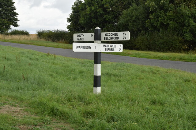
///plums.smoker.rods. Near Burwell, Lincolnshire

Nearby Locations

The Park Cawkwell

Related Wikis

Cawkwell

Cawkwell is a hamlet and former civil parish, now in the parish of Scamblesby, in the East Lindsey district of Lincolnshire, England. It is situated approximately...

Scamblesby

Scamblesby is a village and civil parish in the East Lindsey district from Lincolnshire, England. It is situated 6 miles (10 km) south-west from Louth...

Cadwell Park

Cadwell Park is a motor racing circuit in Lincolnshire, England, 5 mi (8.0 km) south of Louth, owned and operated by MotorSport Vision, a business associated...

Asterby

Asterby is a hamlet between Goulceby and Scamblesby, west of Louth, in the East Lindsey district of Lincolnshire, England. The civil parish of Asterby...

Nearby Amenities

Located within 500m of 53.297682,-0.075156838
Cawkwell
Is In: Lincolnshire, England, UK
Place: hamlet
Source: Bing
Wikidata: Q5055218
Lat/Long: 53.2999822/-0.0787311
Gatewood House Farm
Alt Name: Holly House
Place: farm
Source: Bing
Lat/Long: 53.2950999/-0.0809682
The Park
Place: locality
Source: Bing
Lat/Long: 53.2970318/-0.0784251
Landuse: forest
Lat/Long: 53.2983085/-0.0796409
Cawkwell
Historic: deserted_medieval_village
Lat/Long: 53.3009089/-0.0785512
The data included in this document is from www.openstreetmap.org. The data is made available under ODbL.

Have you been to The Park?

Leave your review of The Park below (or comments, questions and feedback).