Beamish Park

Downs, Moorland in Durham

England

Beamish Park

Beware of trains At a foot crossing on the Tanfield Railway.
Beware of trains Credit: Craig Allan

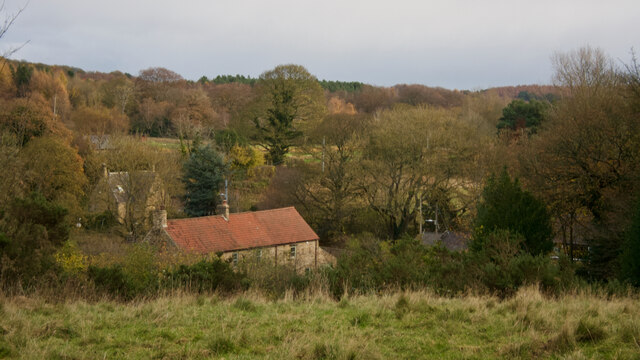
Beamish Park, located in Durham, is a picturesque parkland known for its stunning landscapes and serene ambiance. Spanning across acres of lush greenery, the park offers a perfect retreat for nature enthusiasts and those seeking a peaceful escape.

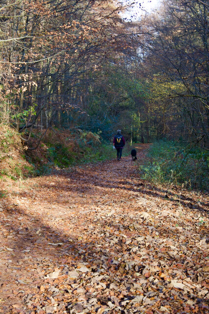
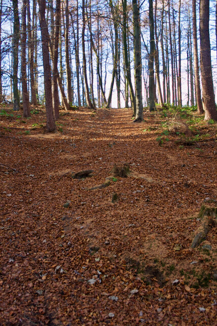
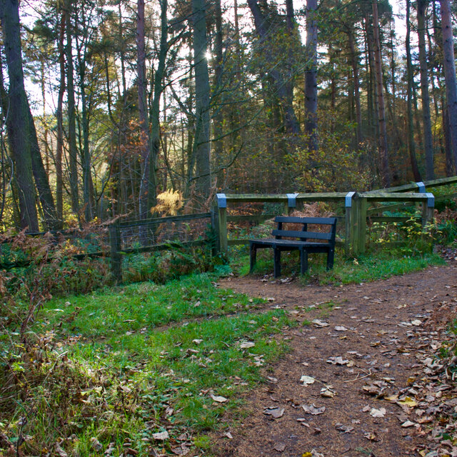
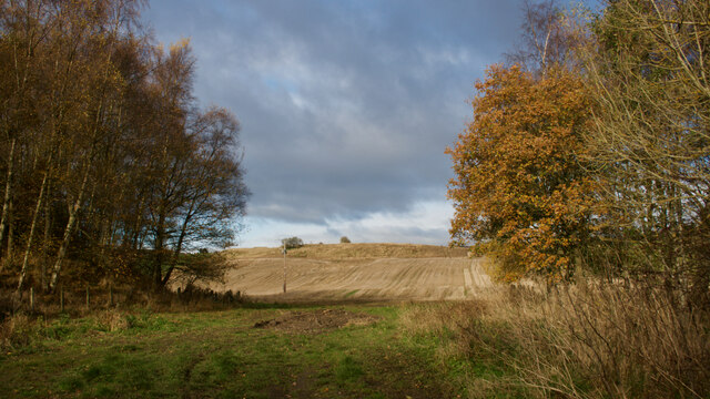
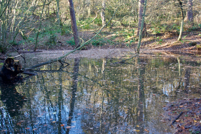
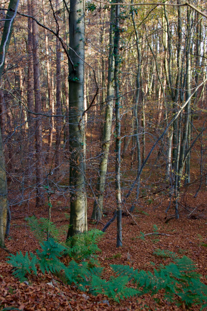
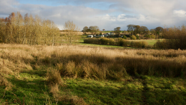
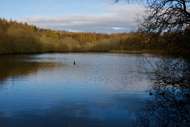
The park's diverse terrain includes expansive downs and moorland, adding to its scenic beauty. The downs, characterized by their gently rolling hills, provide panoramic views of the surrounding countryside. Visitors can enjoy leisurely walks or picnics while immersing themselves in the tranquility of the downs.

The moorland section of Beamish Park showcases a different side of the landscape, with its heather-covered hills and rugged terrain. It offers a unique habitat for various plants and wildlife, making it a haven for nature lovers and birdwatchers.

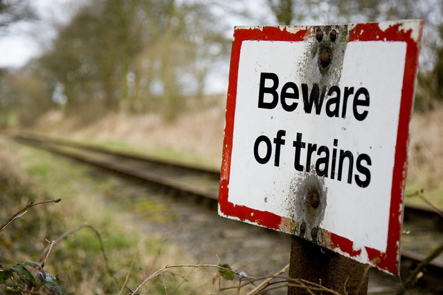
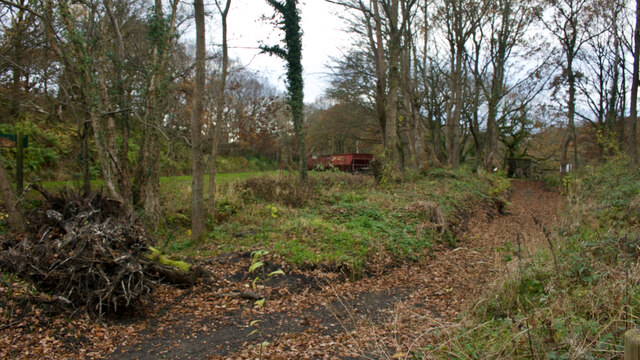
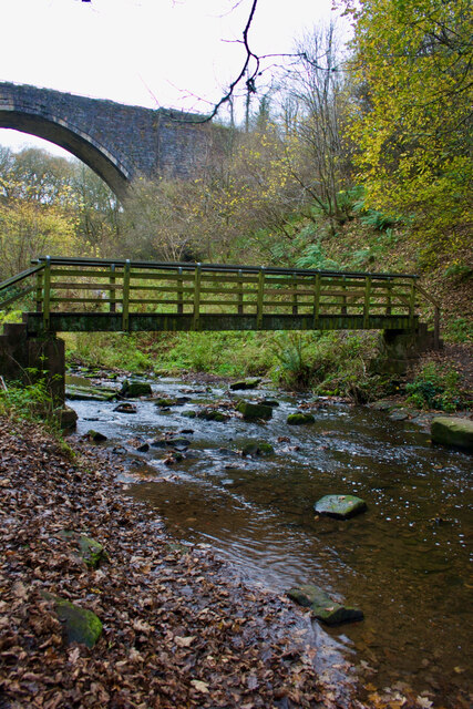
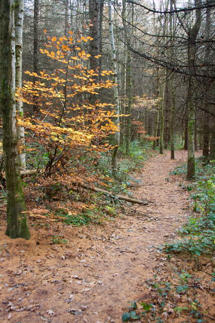
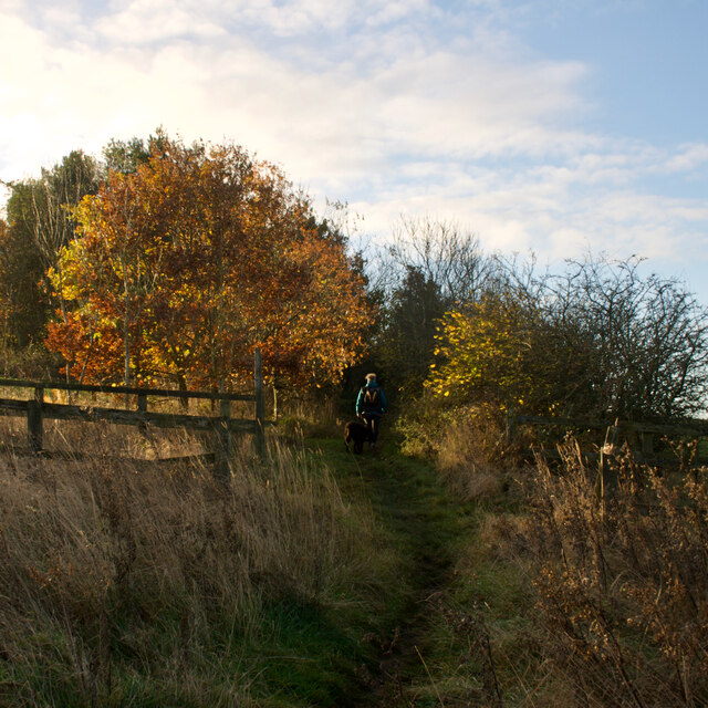
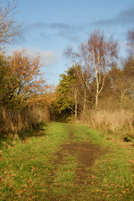
A network of well-maintained trails meanders through the park, providing opportunities for hiking and exploring the different sections. The paths are suitable for all levels of fitness, ensuring accessibility for everyone. Along these paths, visitors may encounter charming streams, ancient trees, and wildflowers, enhancing the overall visual appeal of the park.

Beamish Park also boasts a rich cultural history, with remnants of past settlements and archaeological sites scattered throughout the area. These historical features add an additional layer of intrigue and fascination for visitors interested in the region's heritage.

In summary, Beamish Park in Durham offers a idyllic setting with its downs, moorland, and well-maintained trails. It is an oasis of tranquility, where visitors can immerse themselves in the natural beauty and explore the rich history of the area.

If you have any feedback on the listing, please let us know in the comments section below.

Beamish Park Images

Images are sourced within 2km of 54.889526/-1.6656534 or Grid Reference NZ2155. Thanks to Geograph Open Source API. All images are credited.

Beware of trains At a foot crossing on the Tanfield Railway.
Beware of trains
At a foot crossing on the Tanfield Railway.
A track through the delightfully named Hellhole Wood
Beech woodland, Hellhole Wood
Beamish Burn
Beamish Burn
Bench, Carrickshill Wood
The old Causey Arch station
Footbridge over the Causey Burn With some other bridge behind.
Footbridge over the Causey Burn
With some other bridge behind.
View to Andrew's House
Small pond, Hellhole Wood
Beech woodland, Hellhole Wood
Hedley Hall Farm
Hedley Hall Farm
Mill Wood
Mill Wood
Pond, Mill Wood
Pond, Mill Wood
Footpath to Hedley Lane
Track, Hedley Fell
Track, Hedley Fell
Industrial Ruins Probably boiler and engine houses associated with nearby drift.

sitelines.newcastle.gov.uk. (2021). Beamish Burn, engine house and windlass. [online] Available at: <span class="nowrap"><a title="https://twsitelines.info/SMR/6960" rel="nofollow ugc noopener" href="https://twsitelines.info/SMR/6960">Link</a><img style="margin-left:2px;" alt="External link" title="External link - shift click to open in new window" src="https://s1.geograph.org.uk/img/external.png" width="10" height="10"/></span> [Accessed 2 Dec. 2021].

‌sitelines.newcastle.gov.uk. (2021). Beamish Burn, boilers. [online] Available at: <span class="nowrap"><a title="https://twsitelines.info/SMR/6961" rel="nofollow ugc noopener" href="https://twsitelines.info/SMR/6961">Link</a><img style="margin-left:2px;" alt="External link" title="External link - shift click to open in new window" src="https://s1.geograph.org.uk/img/external.png" width="10" height="10"/></span> [Accessed 2 Dec. 2021].
Industrial Ruins
Probably boiler and engine houses associated with nearby drift. sitelines.newcastle.gov.uk. (2021). Beamish Burn, engine house and windlass. [online] Available at: LinkExternal link [Accessed 2 Dec. 2021]. ‌sitelines.newcastle.gov.uk. (2021). Beamish Burn, boilers. [online] Available at: LinkExternal link [Accessed 2 Dec. 2021].
Industrial Ruins - dressed stone scatter Probably boiler and engine houses associated with nearby drift.

sitelines.newcastle.gov.uk. (2021). Beamish Burn, engine house and windlass. [online] Available at: <span class="nowrap"><a title="https://twsitelines.info/SMR/6960" rel="nofollow ugc noopener" href="https://twsitelines.info/SMR/6960">Link</a><img style="margin-left:2px;" alt="External link" title="External link - shift click to open in new window" src="https://s1.geograph.org.uk/img/external.png" width="10" height="10"/></span> [Accessed 2 Dec. 2021].

‌sitelines.newcastle.gov.uk. (2021). Beamish Burn, boilers. [online] Available at: <span class="nowrap"><a title="https://twsitelines.info/SMR/6961" rel="nofollow ugc noopener" href="https://twsitelines.info/SMR/6961">Link</a><img style="margin-left:2px;" alt="External link" title="External link - shift click to open in new window" src="https://s1.geograph.org.uk/img/external.png" width="10" height="10"/></span> [Accessed 2 Dec. 2021].
Industrial Ruins - dressed stone scatter
Probably boiler and engine houses associated with nearby drift. sitelines.newcastle.gov.uk. (2021). Beamish Burn, engine house and windlass. [online] Available at: LinkExternal link [Accessed 2 Dec. 2021]. ‌sitelines.newcastle.gov.uk. (2021). Beamish Burn, boilers. [online] Available at: LinkExternal link [Accessed 2 Dec. 2021].
Show me another place!

Beamish Park is located at Grid Ref: NZ2155 (Lat: 54.889526, Lng: -1.6656534)

Unitary Authority: County Durham

Police Authority: Durham

What 3 Words

///passes.series.fuses. Near Tanfield, Co. Durham

Related Wikis

Beamish Hall

Beamish Hall is a mid-18th-century country house, now converted to a hotel, which stands in 24 acres (97,000 m2) of grounds near the town of Stanley, County...

Beamish Museum

Beamish Museum is the first regional open-air museum, in England, located at Beamish, near the town of Stanley, in County Durham, England. Beamish pioneered...

Beamish Museum transport collection

Beamish Museum contains much of transport interest, and the size of its site makes good internal transportation for visitors and staff purposes a necessity...

High Forge

High Forge is a hamlet in County Durham, England. It is situated a short distance to the west of Urpeth, north of Beamish. == References ==

Causey, County Durham

Causey is a village in County Durham, in England. It is situated a short distance to the north of Stanley. == Demographic Information == Village contains...

Beamish railway station

Beamish was a railway station which served the village of Beamish in County Durham, North East England, from 1894 to 1953. The station was built by the...

Causey Bank Mires

Causey Bank Mires is a Site of Special Scientific Interest in the Derwentside district of County Durham, England. It lies alongside and to the west of...

Kip Hill

Kip Hill is a village in County Durham, in England. It is situated directly to the north of Stanley, near Shield Row. It has two pubs, the Blue Bell Inn...

Nearby Amenities

Located within 500m of 54.889526,-1.6656534
Railway: switch
Lat/Long: 54.8889155/-1.6582557
Railway: tram_level_crossing
Lat/Long: 54.8852659/-1.6643104
Disused Tourism: attraction
Old Name: Beamish Wild Birds of Prey Conservation Centre
Lat/Long: 54.8878595/-1.6728191
Disused Tourism: attraction
Old Name: Beamish Wild Ropes Activity Centre
Lat/Long: 54.8884399/-1.6724683
Railway: switch
Lat/Long: 54.889086/-1.6582799
Railway: switch
Lat/Long: 54.888358/-1.6651385
Railway: railway_crossing
Lat/Long: 54.888853/-1.6635449
Railway: switch
Lat/Long: 54.8891544/-1.6613223
Railway: switch
Lat/Long: 54.8887512/-1.6638735
Railway: switch
Lat/Long: 54.8890571/-1.6630235
Railway: switch
Lat/Long: 54.8885491/-1.6641685
Railway: switch
Lat/Long: 54.8884812/-1.6647237
Crossing Barrier: full
Railway: level_crossing
Lat/Long: 54.888302/-1.6652579
Crossing Barrier: full
Railway: level_crossing
Lat/Long: 54.8882779/-1.6652249
Railway: switch
Lat/Long: 54.8887381/-1.6638131
Beamish Town
Description: Usually used in a Clockwise direction only
Operator: Beamish Museum - Transport Department
Public Transport: stop_position
Railway: tram_stop
Tram: yes
Lat/Long: 54.8893143/-1.6603538
Historic: memorial
Lat/Long: 54.8893789/-1.6603243
Dentist
J. Jones
Healthcare: dentist
Lat/Long: 54.8892846/-1.6614042
Cafe
Tea Rooms
Level: 1
Lat/Long: 54.8890258/-1.660763
Fairground
Place: locality
Lat/Long: 54.8884005/-1.6632069
Historic: memorial
Lat/Long: 54.88863/-1.6613128
Barrier: bollard
Lat/Long: 54.8903965/-1.6713247
Entrance: yes
Level: 1
Lat/Long: 54.8889988/-1.6609194
Foulbridge
Place: locality
Lat/Long: 54.8854244/-1.6659041
Dipwood Halt
Railway: station
Station: miniature
Usage: tourism
Lat/Long: 54.8862872/-1.6645975
Regional Resource Centre
Board Type: notice
Information: board
Tourism: information
Lat/Long: 54.886031/-1.6645042
Regional Resource Centre, Collections Study Room
Entrance: yes
Lat/Long: 54.8860435/-1.664519
The Town
Information: map
Map Size: site
Tourism: information
Lat/Long: 54.8887603/-1.6596435
Entrance: yes
Lat/Long: 54.8861918/-1.6645616
Bench
Lat/Long: 54.8869522/-1.6643218
Leisure: picnic_table
Lat/Long: 54.8873554/-1.6636253
Leisure: picnic_table
Lat/Long: 54.8873754/-1.6637359
Leisure: picnic_table
Lat/Long: 54.8873944/-1.6638515
Leisure: picnic_table
Lat/Long: 54.8874134/-1.6638648
Leisure: picnic_table
Lat/Long: 54.8874305/-1.663878
Leisure: picnic_table
Lat/Long: 54.8874751/-1.6640415
Bench
Lat/Long: 54.8887405/-1.6580438
Waste Basket
Lat/Long: 54.8887835/-1.6594382
Bench
Lat/Long: 54.8887901/-1.6593936
Image: https://www.geograph.org.uk/photo/3751734
Railway: turntable
Lat/Long: 54.8863159/-1.6644925
Mini Roundabout
Lat/Long: 54.8878831/-1.6596851
Joseph Herrons Bakery
Addr City: Stanley
Addr Housename: Beamish Museum
Addr Postcode: DH9 0RG
Addr Village: Beamish
Fhrs Id: 655264
Shop: bakery
Source Addr: FHRS Open Data
Lat/Long: 54.8889717/-1.6602304
JR & D Edis Photographers
Craft: photographer
Website: https://www.beamish.org.uk/photographers/
Lat/Long: 54.8890506/-1.6603239
W Smith's Chemist
Addr City: Stanley
Addr Housename: Beamish Museum
Addr Postcode: DH9 0RG
Addr Village: Beamish
Fhrs Id: 879418
Shop: chemist
Source Addr: FHRS Open Data
Website: https://www.beamish.org.uk/chemist/
Lat/Long: 54.8891685/-1.6604011
Annfeld Plain Industrial Co-Operative Society
Shop: general
Lat/Long: 54.8891691/-1.6608111
Toilets
Male: yes
Lat/Long: 54.8894034/-1.6605807
Toilets
Female: yes
Lat/Long: 54.88944/-1.6603909
WHSmith
Addr City: Stanley
Addr Postcode: DH9 0RG
Addr Suburb: Beamish
Fhrs Id: 996257
Shop: newsagent
Lat/Long: 54.889456/-1.6605193
Entrance: yes
Lat/Long: 54.8894762/-1.6607379
Railway: switch
Lat/Long: 54.8892586/-1.6609661
Man Made: crane
Mapillary: 1114780985928628
Lat/Long: 54.8884716/-1.6643784
Solicitor's office
Office: lawyer
Lat/Long: 54.8892449/-1.6616178
Printer
Level: 1
Shop: copyshop
Lat/Long: 54.8893289/-1.6609217
Stationer & Newspaper Branch Office
Shop: stationery
Lat/Long: 54.8893143/-1.6610156
Turning Circle
Lat/Long: 54.8900414/-1.6710208
Cafe
John's Café
Addr City: Stanley
Addr Postcode: DH9 0RG
Addr Suburb: Beamish
Fhrs Id: 1469332
Website: https://www.beamish.org.uk/exhibits/johns-cafe/
Lat/Long: 54.8885986/-1.659283
Toilets
Access: yes
Changing Table: yes
Toilets Disposal: flush
Unisex: yes
Wheelchair: yes
Lat/Long: 54.8861725/-1.6645786
Power: pole
Lat/Long: 54.8863507/-1.6670492
Power: pole
Lat/Long: 54.8863422/-1.6671042
Power: pole
Lat/Long: 54.8863171/-1.6672719
Power: pole
Lat/Long: 54.886147/-1.6683984
Power: pole
Lat/Long: 54.8859372/-1.6697046
Bench
Backrest: yes
Mapillary: 1847833252072171
Lat/Long: 54.8862359/-1.6643969
Bench
Backrest: yes
Mapillary: 1847833252072171
Lat/Long: 54.8862024/-1.6643972
Ruston Bucyrus 25-RB excavator
Exhibit: excavator
Image: https://www.geograph.org.uk/photo/7269203
Outdoor: yes
Lat/Long: 54.8857142/-1.664764
Bench
Mapillary: 926307981303552
Lat/Long: 54.8851704/-1.6649437
Information: map
Tourism: information
Lat/Long: 54.8889332/-1.662871
Bench
Backrest: yes
Mapillary: 403291048102127
Lat/Long: 54.888811/-1.663967
Bench
Backrest: no
Mapillary: 588802662169181
Lat/Long: 54.8886361/-1.6646456
Mapillary: 1528345347528775
Railway: signal
Lat/Long: 54.8884997/-1.6645809
Mapillary: 1528345347528775
Railway: signal
Lat/Long: 54.8885391/-1.6647553
Exhibit: post_box
Mapillary: 220211076719341
Post Box Type: pillar
Royal Cypher: VR
Lat/Long: 54.8891565/-1.6610592
Barrier: entrance
Lat/Long: 54.8887269/-1.6606372
Waste Basket
Waste: trash
Lat/Long: 54.8890378/-1.6612671
Bench
Backrest: yes
Lat/Long: 54.8889591/-1.6612094
Bench
Backrest: yes
Lat/Long: 54.8890281/-1.6613911
Bench
Backrest: yes
Lat/Long: 54.8890381/-1.6612925
Bench
Backrest: yes
Lat/Long: 54.8890108/-1.6612188
Bench
Backrest: yes
Lat/Long: 54.8888954/-1.661249
Bench
Backrest: yes
Lat/Long: 54.8888781/-1.6613241
Content: water
Man Made: storage_tank
Lat/Long: 54.8882687/-1.6654587
Exhibit: post_box
Image: https://www.geograph.org.uk/photo/5581269
Listed Status: Grade II
Mapillary: 6369612899746463
Post Box Design: penfold
Post Box Type: pillar
Royal Cypher: VR
Lat/Long: 54.8888245/-1.6599655
1900's Town
Place: neighbourhood
Website: https://www.beamish.org.uk/explore-discover/1900s-town/
Lat/Long: 54.8893714/-1.6604376
Exhibit: water_trough
Mapillary: 6369612899746463
Lat/Long: 54.8888654/-1.659987
1950's Town
Place: neighbourhood
Lat/Long: 54.8884257/-1.6586298
1950's Farm
Place: neighbourhood
Website: https://www.beamish.org.uk/explore-discover/1950s-farm/
Lat/Long: 54.8859958/-1.6622414
Information: map
Tourism: information
Lat/Long: 54.8861019/-1.6643943
Bus Stop
Beamish Town
Bus: yes
Description: Usually used in an Anti-Clockwise direction only
Operator: Beamish Museum - Transport Department
Public Transport: stop_position
Railway: tram_stop
Shelter: no
Tram: yes
Lat/Long: 54.8890718/-1.6617266
The data included in this document is from www.openstreetmap.org. The data is made available under ODbL.

Have you been to Beamish Park?

Leave your review of Beamish Park below (or comments, questions and feedback).