Low Park

Downs, Moorland in Northumberland

England

Low Park

Footpath near the River Coquet
Footpath near the River Coquet Credit: Les Hull

Low Park is a picturesque area located in Northumberland, a county in the northeast of England. Nestled amidst the natural beauty of the region, Low Park offers a serene and tranquil setting for visitors and locals alike. The area is characterized by its expansive downs and moorlands, which provide breathtaking panoramic views of the surrounding landscape.

The downs in Low Park are vast open spaces covered in grass and heather, creating a stunning tapestry of colors throughout the year. Walking across these downs, visitors can enjoy the fresh air and immerse themselves in the peacefulness of the countryside. The moorland, on the other hand, is a more rugged terrain, covered in heath and scattered with craggy outcrops. This diverse landscape provides a home to a variety of wildlife, including birds, rabbits, and even the occasional deer.

For nature lovers and outdoor enthusiasts, Low Park offers a plethora of activities. Hiking and walking trails crisscross the downs and moorlands, allowing visitors to explore the area at their own pace. The rolling hills and expansive vistas also make Low Park a popular destination for birdwatching, with numerous species of birds making their homes in the area.

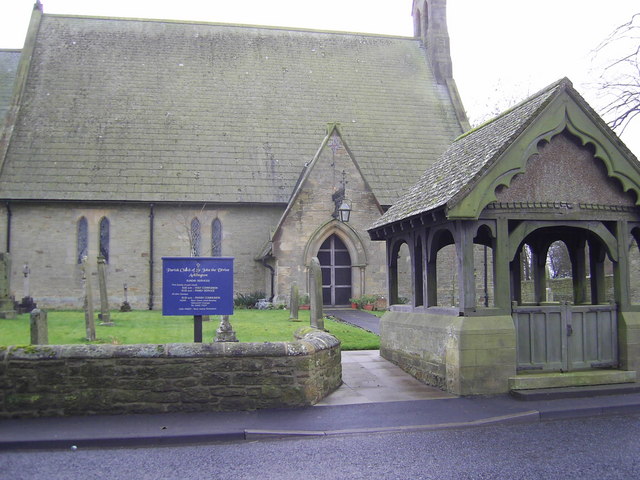
In addition to its natural beauty, Low Park is also rich in history. The area is dotted with ancient monuments, including burial sites and standing stones, providing a glimpse into the region's past. The nearby villages offer charming cafes and pubs, where visitors can enjoy a traditional meal or a warm drink after a day of exploring.

Overall, Low Park is a hidden gem in Northumberland, offering a peaceful retreat and a chance to connect with nature in a truly stunning setting.

If you have any feedback on the listing, please let us know in the comments section below.

Low Park Images

Images are sourced within 2km of 55.311023/-1.6676965 or Grid Reference NU2101. Thanks to Geograph Open Source API. All images are credited.

Footpath near the River Coquet
Acton Dean Footpath through Acton Dean to Acton Hall, a Grade II listed 18th/19th century building.
Acton Dean
Footpath through Acton Dean to Acton Hall, a Grade II listed 18th/19th century building.
River Coquet The River Coquet with the St Oswalds Way Long Distance Path on the river bank.
River Coquet
The River Coquet with the St Oswalds Way Long Distance Path on the river bank.
River Coquet downstream from Felton The cluster of buildings on the far bank is Mouldshaugh Farm <a href="https://www.geograph.org.uk/gridref/NU1901">NU1901</a>.
River Coquet downstream from Felton
The cluster of buildings on the far bank is Mouldshaugh Farm NU1901.
Footbridge over Acton Burn
Confluence of the Acton Burn and River Coquet
Autumnal Colours
Autumnal Colours
Acklington Station
Acklington Station
Parish Church of St John Acklington
Railway Inn Acklington
Road Bridge Road Bridge Over Railway at Acklington
Road Bridge
Road Bridge Over Railway at Acklington
Cattle Mart Cattle Mart at Acklington
Cattle Mart
Cattle Mart at Acklington
Lane to High Park The no through road that leads to High Park, a farm above the Coquet valley.
Lane to High Park
The no through road that leads to High Park, a farm above the Coquet valley.
Memorial to the Guyzance Tragedy On January 17, 1945, ten soldiers drowned while taking part in a military exercise at Guyzance, on the River Coquet, in Northumberland. The river was in full flood and their boat was swept over the weir and capsized. The men, all aged 18, were weighed down by full combat gear and drowned. In 1995, a memorial service was held to mark the 50th anniversary of the tragedy and a plaque was erected, which now stands in the way of a re-development.
Look at other photo for additional information.
Memorial to the Guyzance Tragedy
On January 17, 1945, ten soldiers drowned while taking part in a military exercise at Guyzance, on the River Coquet, in Northumberland. The river was in full flood and their boat was swept over the weir and capsized. The men, all aged 18, were weighed down by full combat gear and drowned. In 1995, a memorial service was held to mark the 50th anniversary of the tragedy and a plaque was erected, which now stands in the way of a re-development. Look at other photo for additional information.
The weir which was the scene of the Guyzance Tragedy The date on this memorial is different from the plaque nearby (see <a title="https://www.geograph.org.uk/photo/334298" href="https://www.geograph.org.uk/photo/334298">Link</a> ).  This memorial has 15th January and the plaque has 17th January.
The information below was supplied by David Lauckner
The dates are different because the chap who carved the plaque incorrectly assumed that the date of a memorial service (held in Felton on the Sunday nearest to the anniversary) was the date of the tragedy - actually Jan 17th.  Changing the 5 to a 7 was apparently not possible and the error was accepted by the regiments concerned. Last night I was at a talk given by Mrs Vera Vaggs about the tragedy and she mentioned the date discrepancy.  Mrs Vaggs was a prime mover in gaining recognition for the 10 soldiers lost in the tragedy.  The carving was done by a Felton man, the late Charlie Dick.  The initial plaque (at the top) only commemorated the incident.  He later added the second carving with the names.  The stone with the engraved plate was added to the site in 2004 by the Darlington and Aycliffe Branch of the DLI Association.  Just looking at the picture of the memorial stone and was reminded that the poem was also written by Charlie Dick.
Look at other photo for information relating to the tragedy.
The weir which was the scene of the Guyzance Tragedy
The date on this memorial is different from the plaque nearby (see Link ). This memorial has 15th January and the plaque has 17th January. The information below was supplied by David Lauckner The dates are different because the chap who carved the plaque incorrectly assumed that the date of a memorial service (held in Felton on the Sunday nearest to the anniversary) was the date of the tragedy - actually Jan 17th. Changing the 5 to a 7 was apparently not possible and the error was accepted by the regiments concerned. Last night I was at a talk given by Mrs Vera Vaggs about the tragedy and she mentioned the date discrepancy. Mrs Vaggs was a prime mover in gaining recognition for the 10 soldiers lost in the tragedy. The carving was done by a Felton man, the late Charlie Dick. The initial plaque (at the top) only commemorated the incident. He later added the second carving with the names. The stone with the engraved plate was added to the site in 2004 by the Darlington and Aycliffe Branch of the DLI Association. Just looking at the picture of the memorial stone and was reminded that the poem was also written by Charlie Dick. Look at other photo for information relating to the tragedy.
Brainshaugh Priory (ruins) Keys to the Past Web Site: Brainshaugh Priory was founded in around 1147 by Richard Tison for nuns who belonged to the Premonstratensian order. The priory had fallen out of use by 1500. Today, the chapel is still standing and displays building work dating from the 12th to 14th centuries as well as some modern walling. Outside the chapel are the remains of a fluted pillar and a medieval grave cover. The uneven ground to the south of the chapel would suggest that the foundations of other priory buildings are buried there.
Brainshaugh Priory (ruins)
Keys to the Past Web Site: Brainshaugh Priory was founded in around 1147 by Richard Tison for nuns who belonged to the Premonstratensian order. The priory had fallen out of use by 1500. Today, the chapel is still standing and displays building work dating from the 12th to 14th centuries as well as some modern walling. Outside the chapel are the remains of a fluted pillar and a medieval grave cover. The uneven ground to the south of the chapel would suggest that the foundations of other priory buildings are buried there.
Footpath at Morwick Banks
Morwick Moor House On our weekly walk we followed the footpath to this house and according to the map you have to cross the railway line.  The footpath was well marked but when we got to the railway line the gates had been secured by metal band yet there was no indication of this.  Having got to this point we climbed over the fence and with great cation crossed the railway line ------ being fleet of foot we all made it.
Morwick Moor House
On our weekly walk we followed the footpath to this house and according to the map you have to cross the railway line. The footpath was well marked but when we got to the railway line the gates had been secured by metal band yet there was no indication of this. Having got to this point we climbed over the fence and with great cation crossed the railway line ------ being fleet of foot we all made it.
Show me another place!

Low Park is located at Grid Ref: NU2101 (Lat: 55.311023, Lng: -1.6676965)

Unitary Authority: Northumberland

Police Authority: Northumbria

What 3 Words

///headers.menswear.tripled. Near Acklington, Northumberland

Nearby Locations

Station Wood Low Park

Related Wikis

Acklington Park

Acklington Park is a former civil parish, now in the parish of Acklington, Northumberland, England. It was the birthplace of John Rushworth (born c.1612...

Acklington railway station

Acklington is a railway station on the East Coast Main Line, which runs between London King's Cross and Edinburgh Waverley. The station, situated 28 miles...

Acklington

Acklington is a small village in Northumberland, England. It is situated to the south-west of Amble, inland from the North Sea coast. It is served by Acklington...

Guyzance

Guyzance, historically Guizance, is a small village or hamlet and former civil parish, now in the parish of Acklington, in Northumberland, England. It...

Nearby Amenities

Located within 500m of 55.311023,-1.6676965
Power: tower
Lat/Long: 55.3145085/-1.664165
Power: tower
Lat/Long: 55.3096519/-1.6638178
Power: pole
Lat/Long: 55.3119373/-1.6643949
Power: tower
Lat/Long: 55.3117614/-1.6639879
Power: pole
Lat/Long: 55.3135627/-1.6633008
Power: pole
Lat/Long: 55.3129866/-1.6655069
Power: pole
Lat/Long: 55.3127604/-1.6638191
Power: pole
Lat/Long: 55.3070367/-1.6678189
Power: pole
Lat/Long: 55.3078293/-1.667256
Power: pole
Lat/Long: 55.3086527/-1.6666764
Power: pole
Lat/Long: 55.3094667/-1.6660969
Power: pole
Lat/Long: 55.3102782/-1.665534
Power: pole
Lat/Long: 55.3110969/-1.664992
Power: pole
Lat/Long: 55.3132379/-1.6673592
Power: pole
Lat/Long: 55.3134711/-1.6691002
Power: pole
Lat/Long: 55.3139995/-1.6621139
Power: pole
Lat/Long: 55.314354/-1.6701342
The data included in this document is from www.openstreetmap.org. The data is made available under ODbL.

Have you been to Low Park?

Leave your review of Low Park below (or comments, questions and feedback).