Running Moss

Downs, Moorland in Yorkshire

England

Running Moss

Cakes of Bread on Blackhole Moor
Cakes of Bread on Blackhole Moor Credit: Neil Theasby

Running Moss is a picturesque village located in the heart of Yorkshire, known for its breathtaking natural beauty and serene surroundings. Situated amidst the stunning Yorkshire Downs and Moorland, the village offers a tranquil escape from the hustle and bustle of city life.

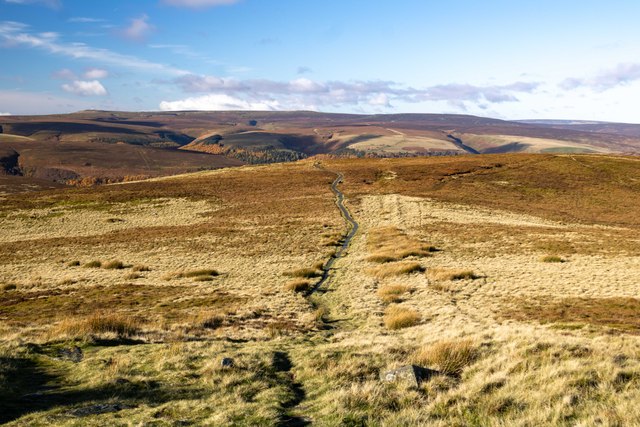
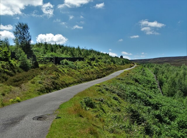
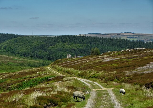
The village is adorned with lush green fields, rolling hills, and a diverse range of flora and fauna, making it a haven for nature enthusiasts and hikers. The Yorkshire Downs surrounding Running Moss offer breathtaking panoramic views of the countryside, making it a popular destination for outdoor activities such as walking, cycling, and horse riding.

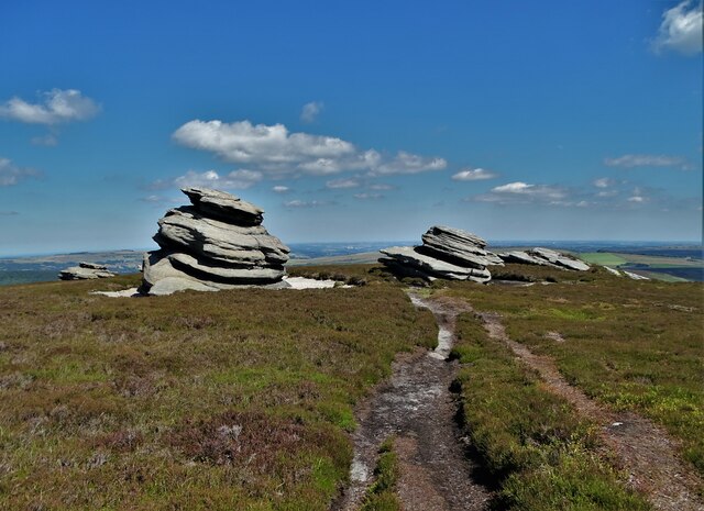
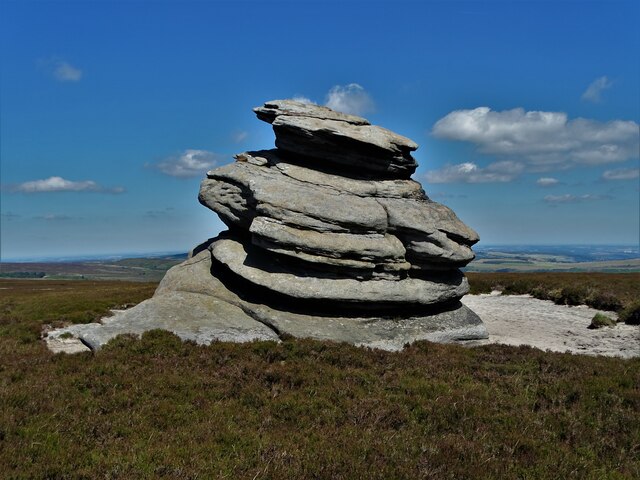
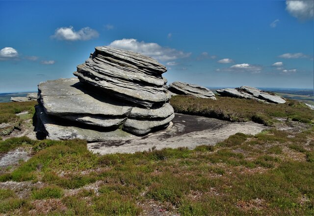
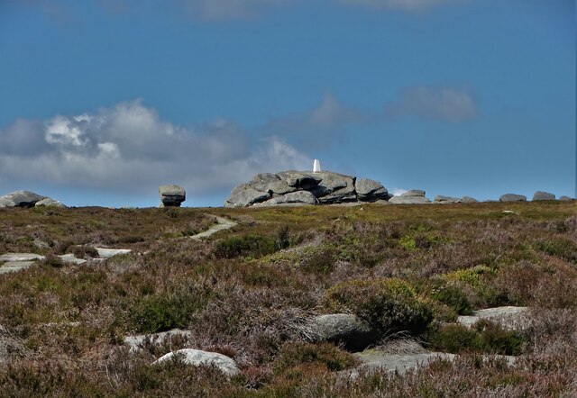
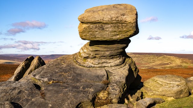
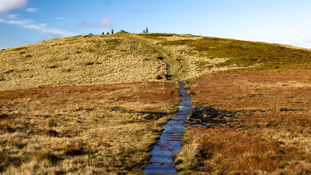
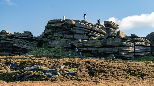
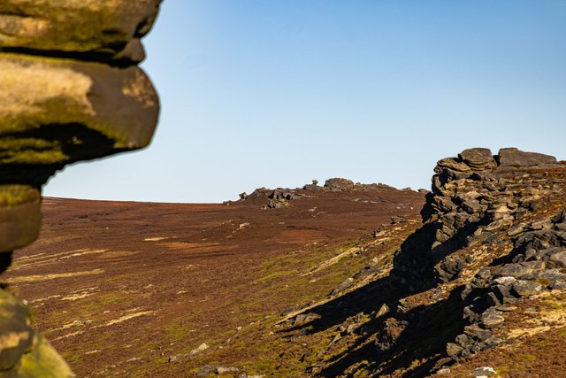
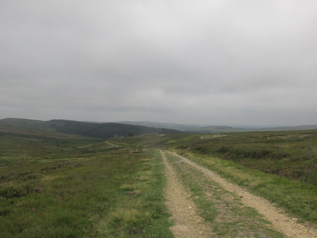
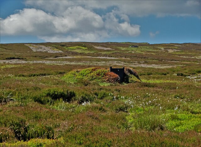
The moorland in the vicinity of Running Moss is a unique ecosystem characterized by heather-covered landscapes, scattered boulders, and peat bogs. This rugged terrain provides a habitat for a variety of wildlife, including rare bird species, foxes, and hares. The moorland is also home to numerous walking trails, allowing visitors to explore its untamed beauty and discover hidden gems along the way.

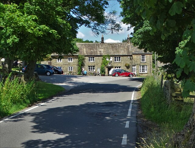
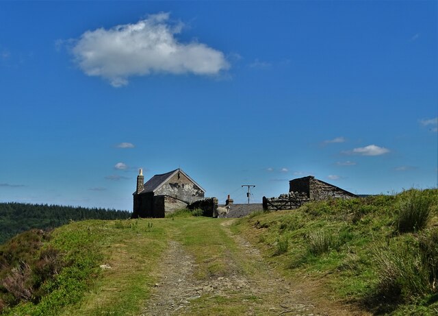
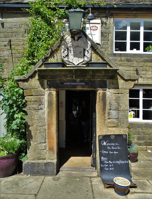
Running Moss itself is a charming village with traditional stone houses, a quaint village green, and a cozy local pub. The friendly and welcoming community adds to the village's allure, making it an ideal place to experience the warmth and hospitality of Yorkshire.

Overall, Running Moss, with its stunning Yorkshire Downs and Moorland, offers a serene retreat for those seeking a peaceful getaway, immersing visitors in the beauty of nature while providing a sense of tranquility and relaxation.

If you have any feedback on the listing, please let us know in the comments section below.
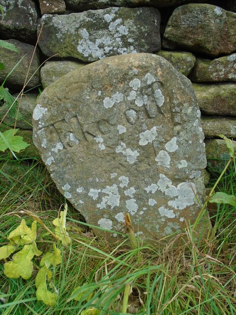
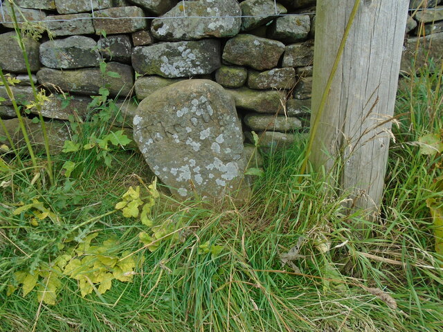
Running Moss Images

Images are sourced within 2km of 53.405341/-1.6883129 or Grid Reference SK2089. Thanks to Geograph Open Source API. All images are credited.

Cakes of Bread on Blackhole Moor
The largest outcrop - Cakes of Bread On the edge of Blackhole Moor
The largest outcrop - Cakes of Bread
On the edge of Blackhole Moor
At Cakes of Bread The closest outcrop is the second largest in this eye-catching moorland arrangement. One can only wonder how ancient people related to such stones in millennia gone by.
At Cakes of Bread
The closest outcrop is the second largest in this eye-catching moorland arrangement. One can only wonder how ancient people related to such stones in millennia gone by.
View north to Back Tor The rock formation on Derwent Edge is topped by a triangulation pillar.
View north to Back Tor
The rock formation on Derwent Edge is topped by a triangulation pillar.
Lost Lad Path leading up to Lost Lad.
Lost Lad
Path leading up to Lost Lad.
Lost Lad View from Lost Lad looking northwest over Howden Moor.
Lost Lad
View from Lost Lad looking northwest over Howden Moor.
Back Tor View from the Salt Cellar looking along Derwent Edge, past Dovestone Tor, towards <a href="https://www.geograph.org.uk/photo/7649461">SK1990 : Back Tor</a>.
Back Tor
View from the Salt Cellar looking along Derwent Edge, past Dovestone Tor, towards SK1990 : Back Tor.
The Foulstone Road Looking back downhill on the way up to Back Tor.
The Foulstone Road
Looking back downhill on the way up to Back Tor.
Approaching "Strines Inn"
Foulstone Road It leads to Foulstone Delf and Derwent Moors. The area is under the control of Fitzwilliam Wentworth Estates - mostly for the purposes of grouse shooting.
Foulstone Road
It leads to Foulstone Delf and Derwent Moors. The area is under the control of Fitzwilliam Wentworth Estates - mostly for the purposes of grouse shooting.
Summer cloud over Foulstone Delf This moorland property is part of the Fitzwilliam-Wentworth Estates and is almost certainly connected with grouse shooting and rearing of game birds.
Summer cloud over Foulstone Delf
This moorland property is part of the Fitzwilliam-Wentworth Estates and is almost certainly connected with grouse shooting and rearing of game birds.
Looking back along Foulstone Road To Foulstone Delf - the property to the right of the track
Looking back along Foulstone Road
To Foulstone Delf - the property to the right of the track
Grouse butt No.10 on Foulstone Moor From here, during the shooting season, men with shotguns blast grouse out of the sky. They call it sport.
Grouse butt No.10 on Foulstone Moor
From here, during the shooting season, men with shotguns blast grouse out of the sky. They call it sport.
Entrance to "The Strines Inn" "The building that now houses The Strines Inn was originally a manor house built in 1275. Over the years it was extended and eventually converted into an inn in 1771." - copied from the pub's website.
Entrance to "The Strines Inn"
"The building that now houses The Strines Inn was originally a manor house built in 1275. Over the years it was extended and eventually converted into an inn in 1771." - copied from the pub's website.
Horse stone The Mortimer Road Turnpike first enacted in 1771, renewed 1792, failed by 1813.   Named after Hans Winthrop Mortimer, Lord of the Manor of Bamford.   It failed because it didn't make any money and didn't become an important route.   But it was very hilly!   Extra horses were needed and had to be paid for to help carts and carriages up very steep hills, so a stone such as this 'Take off' was placed at the top.   This one is about 30m north of the 16thC Strines Inn which is 1015ft above sea level.  
The stone is Grade II listed 1203771.
Horse stone
The Mortimer Road Turnpike first enacted in 1771, renewed 1792, failed by 1813. Named after Hans Winthrop Mortimer, Lord of the Manor of Bamford. It failed because it didn't make any money and didn't become an important route. But it was very hilly! Extra horses were needed and had to be paid for to help carts and carriages up very steep hills, so a stone such as this 'Take off' was placed at the top. This one is about 30m north of the 16thC Strines Inn which is 1015ft above sea level. The stone is Grade II listed 1203771.
Horse stone Standing away from the 'Take off' stone near The Strines Inn, its position near a telegraph pole on the east side of Mortimer Road can be seen.  The story of this road can be read in 'The Mortimer Road' by Howard Smith. ISBN 978-1-5272-3446-8.
Horse stone
Standing away from the 'Take off' stone near The Strines Inn, its position near a telegraph pole on the east side of Mortimer Road can be seen. The story of this road can be read in 'The Mortimer Road' by Howard Smith. ISBN 978-1-5272-3446-8.
Show me another place!

Running Moss is located at Grid Ref: SK2089 (Lat: 53.405341, Lng: -1.6883129)

Division: West Riding

Unitary Authority: Sheffield

Police Authority: South Yorkshire

What 3 Words

///oldest.cheaply.witless. Near Bradfield, South Yorkshire

Nearby Locations

Running Moss

Related Wikis

Derwent Edge

Derwent Edge is a Millstone Grit escarpment that lies above the Upper Derwent Valley in the Peak District National Park in the English county of Derbyshire...

Lost Lad

Lost Lad is a hill, 518 metres (1,699 ft) high on the Derwent Edge in the Peak District in the county of Derbyshire in England. It is a subpeak of Back...

Strines Reservoir

Strines Reservoir is a water storage reservoir situated at 53.4099°N 1.6557°W / 53.4099; -1.6557 (Strines_Reservoir), 8 miles (13 km) west of the centre...

Sugworth Hall

Sugworth Hall is an English country house on Sugworth Road in Bradfield Dale, near Sheffield, England. It is situated approximately 8 miles (13 km) west...

Moscar Cross

Moscar Cross is the name of a standing stone (or "guide stoop") and surrounding area in the Peak District on the border between Derbyshire and Sheffield...

Derwent Woodlands War Memorial

Derwent Woodlands War Memorial is a 20th-century grade II listed war memorial near the Ladybower Reservoir, Derbyshire. == History == The war memorial...

Hallfield House

Hallfield House is a Grade II listed building situated in Bradfield Dale, 1.7 miles (2.74 km) west of the village of Low Bradfield, near Sheffield in England...

Ladybower Reservoir

Ladybower Reservoir is a large Y-shaped, artificial reservoir, the lowest of three in the Upper Derwent Valley in Derbyshire, England. The River Ashop...

Nearby Amenities

Located within 500m of 53.405341,-1.6883129
Strines Moor
Natural: peak
Lat/Long: 53.4029154/-1.6826269
The data included in this document is from www.openstreetmap.org. The data is made available under ODbL.

Have you been to Running Moss?

Leave your review of Running Moss below (or comments, questions and feedback).