Milston Down

Downs, Moorland in Wiltshire

England

Milston Down

Hare Warren, Wiltshire Looking along a tank track on the perimeter of the Bulford Ranges danger area.
Hare Warren, Wiltshire Credit: Rebecca A Wills

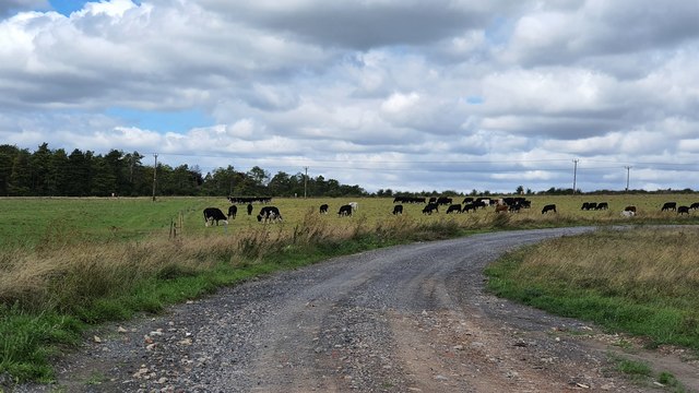
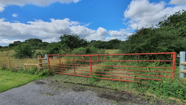
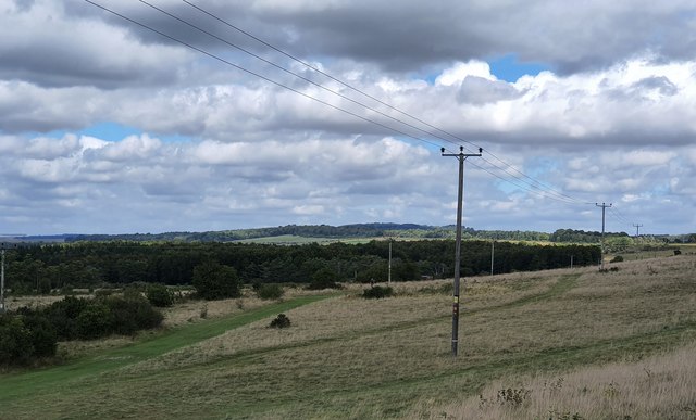
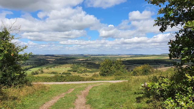
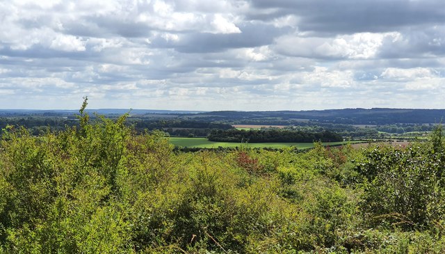
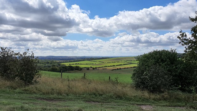
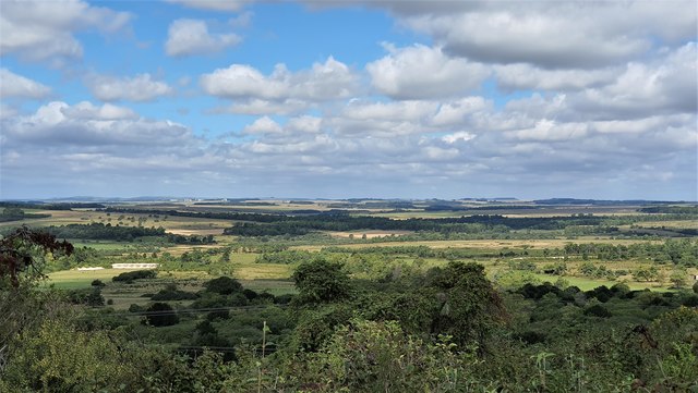
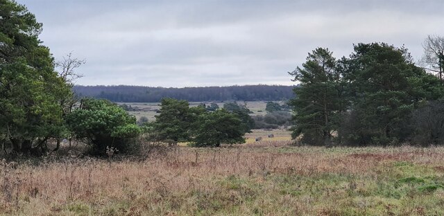
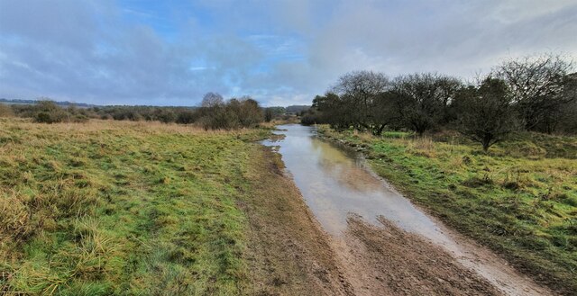
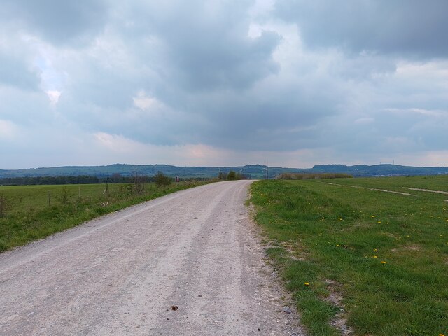
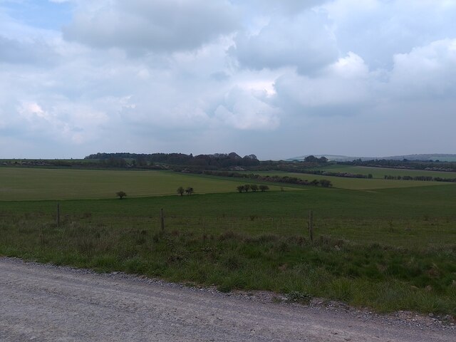
Milston Down is a region of open, rolling countryside located in Wiltshire, England. It is part of the larger area known as the Downs, which is characterized by its expansive grasslands and chalk hills. The landscape of Milston Down is dotted with patches of woodland and scattered with small farms and hamlets.

The area is known for its rich biodiversity, with a variety of plant and animal species calling it home. Visitors to Milston Down can expect to see a range of birdlife, including skylarks, kestrels, and buzzards, as well as a diverse array of wildflowers and grasses. The area is also home to several species of butterflies and other insects.

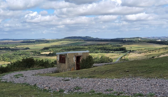
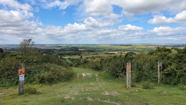
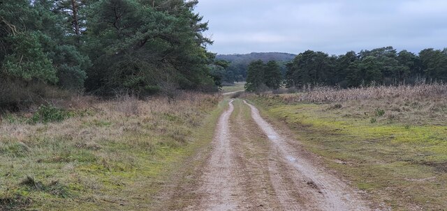
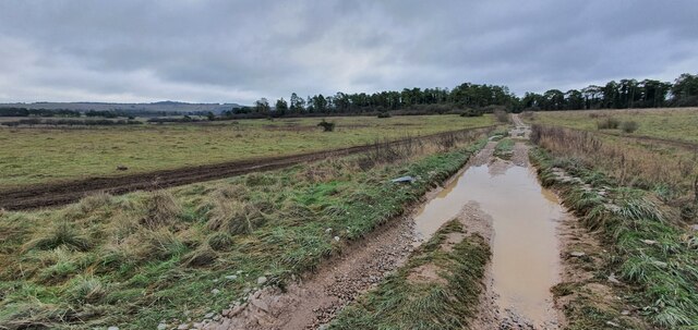
Milston Down offers stunning views of the surrounding countryside, with the chalk hills of the Downs providing a dramatic backdrop. The area is popular with hikers and nature enthusiasts, who come to explore the network of footpaths and bridleways that crisscross the landscape. Whether you're looking for a leisurely stroll or a more challenging hike, Milston Down offers something for everyone to enjoy in its peaceful and picturesque setting.

If you have any feedback on the listing, please let us know in the comments section below.

Milston Down Images

Images are sourced within 2km of 51.213353/-1.7082506 or Grid Reference SU2046. Thanks to Geograph Open Source API. All images are credited.

Hare Warren, Wiltshire Looking along a tank track on the perimeter of the Bulford Ranges danger area.
Hare Warren, Wiltshire
Looking along a tank track on the perimeter of the Bulford Ranges danger area.
Milston Down, Wiltshire Looking at shrub-land over a gate in the perimeter fence of the Bulford Rifle Ranges.
Milston Down, Wiltshire
Looking at shrub-land over a gate in the perimeter fence of the Bulford Rifle Ranges.
Beacon Hill, Wiltshire Looking towards Milston Down from the base of Beacon Hill.
Beacon Hill, Wiltshire
Looking towards Milston Down from the base of Beacon Hill.
Hills Copse Over looking the Bulford Rifle Ranges from Hills Copse.
Hills Copse
Over looking the Bulford Rifle Ranges from Hills Copse.
Beacon Hill, Wiltshire Looking across woodland and farmland towards Furze Copse from Beacon Hill.
Beacon Hill, Wiltshire
Looking across woodland and farmland towards Furze Copse from Beacon Hill.
Beacon Hill, Wiltshire Looking in the direction of the village of Cholderton from Beacon Hill.
Beacon Hill, Wiltshire
Looking in the direction of the village of Cholderton from Beacon Hill.
Bulford Down, Bulford Over looking the Bulford Rifle Ranges from Bulford Down.
Bulford Down, Bulford
Over looking the Bulford Rifle Ranges from Bulford Down.
Bulford Down, Bulford Looking down a track towards the Bulford Rifle Ranges.
Bulford Down, Bulford
Looking down a track towards the Bulford Rifle Ranges.
Bulford Down, Wiltshire Looking over the Bulford Rifle Ranges from Bulford Down.
Bulford Down, Wiltshire
Looking over the Bulford Rifle Ranges from Bulford Down.
Bourne Bottom, Wiltshire Looking from Bourne Bottom towards Brigmerston Down. This photograph was taken inside the Bulford Ranges Danger Area, which is open to the public when the red flags are not flying.
Bourne Bottom, Wiltshire
Looking from Bourne Bottom towards Brigmerston Down. This photograph was taken inside the Bulford Ranges Danger Area, which is open to the public when the red flags are not flying.
Milston Down, Wiltshire Flooding around Nine Mile River on Milston Down. This photograph was taken inside the Bulford Ranges Danger Area, which is open to the public when the red flags are not flying.
Milston Down, Wiltshire
Flooding around Nine Mile River on Milston Down. This photograph was taken inside the Bulford Ranges Danger Area, which is open to the public when the red flags are not flying.
Hare Warren, Wiltshire Looking from Hare Warren in the direction of Milston Down. This photograph was taken inside the Bulford Ranges Danger Area, which is open to the public when the red flags are not flying.
Hare Warren, Wiltshire
Looking from Hare Warren in the direction of Milston Down. This photograph was taken inside the Bulford Ranges Danger Area, which is open to the public when the red flags are not flying.
Brigmerston Down, Wiltshire Looking southwest over Brigmerston Down from the vicinity of the Devil's Ditch (a Late Bronze Age or Iron Age boundary earthwork). This photograph was taken inside the Bulford Ranges Danger Area, which is open to the public when the red flags are not flying.
Brigmerston Down, Wiltshire
Looking southwest over Brigmerston Down from the vicinity of the Devil's Ditch (a Late Bronze Age or Iron Age boundary earthwork). This photograph was taken inside the Bulford Ranges Danger Area, which is open to the public when the red flags are not flying.
Track across Brigmerston Field A track across Brigmerston Field near to Bulford.
Track across Brigmerston Field
A track across Brigmerston Field near to Bulford.
Down Barn Plantation Looking from a track across Brigmerston Field at Down Barn Plantation near to Bulford.
Down Barn Plantation
Looking from a track across Brigmerston Field at Down Barn Plantation near to Bulford.
Old Milestone by bridleway North of Bulford Camp The milestone is located 100m south of the MOD red gate, 230m along the byway from the junction with Sheepbridge Road, on the east side of road. Parish of Bulford (Salisbury District). Carved stone post, Marlborough gable design, erected by the Marlborough & Salisbury turnpike trust in the 19th century. 

Inscription reads:-
To / Saliſbury / (X) / To / Marlbro / XVII / S(....) / Hill / to Hungerford

According to NMR (Swindon), the bottom legend was originally 'Strait up ye Hill to Hungerford'

Milestone Society National ID: WI_MLSA17
Old Milestone by bridleway North of Bulford Camp
The milestone is located 100m south of the MOD red gate, 230m along the byway from the junction with Sheepbridge Road, on the east side of road. Parish of Bulford (Salisbury District). Carved stone post, Marlborough gable design, erected by the Marlborough & Salisbury turnpike trust in the 19th century. Inscription reads:- To / Saliſbury / (X) / To / Marlbro / XVII / S(....) / Hill / to Hungerford According to NMR (Swindon), the bottom legend was originally 'Strait up ye Hill to Hungerford' Milestone Society National ID: WI_MLSA17
Brigmerston Down, Wiltshire Looking broadly north/south down a track running over Brigmerston Down. This photograph was taken inside the Bulford Ranges Danger Area, which is open to the public when the red flags are not flying.
Brigmerston Down, Wiltshire
Looking broadly north/south down a track running over Brigmerston Down. This photograph was taken inside the Bulford Ranges Danger Area, which is open to the public when the red flags are not flying.
Milston Down, Wiltshire Looking south-southwest down a flooded track running between Brigmerston Field and Milston Down. This photograph was taken inside the Bulford Ranges Danger Area, which is open to the public when the red flags are not flying.
Milston Down, Wiltshire
Looking south-southwest down a flooded track running between Brigmerston Field and Milston Down. This photograph was taken inside the Bulford Ranges Danger Area, which is open to the public when the red flags are not flying.
Show me another place!

Milston Down is located at Grid Ref: SU2046 (Lat: 51.213353, Lng: -1.7082506)

Unitary Authority: Wiltshire

Police Authority: Wiltshire

What 3 Words

///pushed.leap.decoded. Near Tidworth, Wiltshire

Nearby Locations

Milston Down

Related Wikis

Bulford Kiwi

The Bulford Kiwi is a large depiction of a kiwi, carved in the chalk on Beacon Hill above the military town of Bulford on Salisbury Plain in Wiltshire...

Sling Camp

Sling Camp was a World War I camp occupied by New Zealand soldiers beside the then-military town of Bulford on the Salisbury Plain in Wiltshire, England...

Shipton Bellinger

Shipton Bellinger is a village and civil parish in Hampshire, England. Shipton Bellinger is about 5 miles (8 km) north-east of the town of Amesbury and...

A338 road

The A338 is a major primary route in southern England, that runs from the junction with the A35 at Poole in Dorset to the junction with the A420 at Besselsleigh...

Related Videos

Battle-Group moves out for training exercise on Salisbury Plain.

Well, here's something you don't gets to see very often - a fully armed Challenger 2 battle group move begins exercise by ...

Nearby Amenities

Located within 500m of 51.213353,-1.7082506
Archaeological Site: tumulus
Historic: archaeological_site
Lat/Long: 51.213822/-1.7094206
Archaeological Site: tumulus
Historic: archaeological_site
Lat/Long: 51.2133986/-1.7102253
Archaeological Site: tumulus
Historic: archaeological_site
Lat/Long: 51.2125114/-1.7109227
Archaeological Site: tumulus
Historic: archaeological_site
Lat/Long: 51.213559/-1.7078972
Archaeological Site: tumulus
Historic: archaeological_site
Lat/Long: 51.2129987/-1.7098229
Archaeological Site: tumulus
Historic: archaeological_site
Lat/Long: 51.2124375/-1.7100643
Archaeological Site: tumulus
Historic: archaeological_site
Lat/Long: 51.2123703/-1.7092543
Archaeological Site: tumulus
Historic: archaeological_site
Lat/Long: 51.213454/-1.7084886
Milston Down
Place: locality
Lat/Long: 51.214652/-1.7094957
Archaeological Site: tumulus
Historic: archaeological_site
Lat/Long: 51.2167671/-1.7117839
Ford: yes
Lat/Long: 51.2167747/-1.7124134
The data included in this document is from www.openstreetmap.org. The data is made available under ODbL.

Have you been to Milston Down?

Leave your review of Milston Down below (or comments, questions and feedback).