Green Fell

Downs, Moorland in Westmorland Eden

England

Green Fell

The Pennine Way near Knock Hush
The Pennine Way near Knock Hush Credit: Dave Kelly

Green Fell is a picturesque region located in the historic county of Westmorland in North West England. Situated amidst a captivating landscape of rolling hills, the area is renowned for its stunning natural beauty and diverse ecosystems. Green Fell is characterized by its verdant downs and vast moorland, which offer breathtaking views of the surrounding countryside.

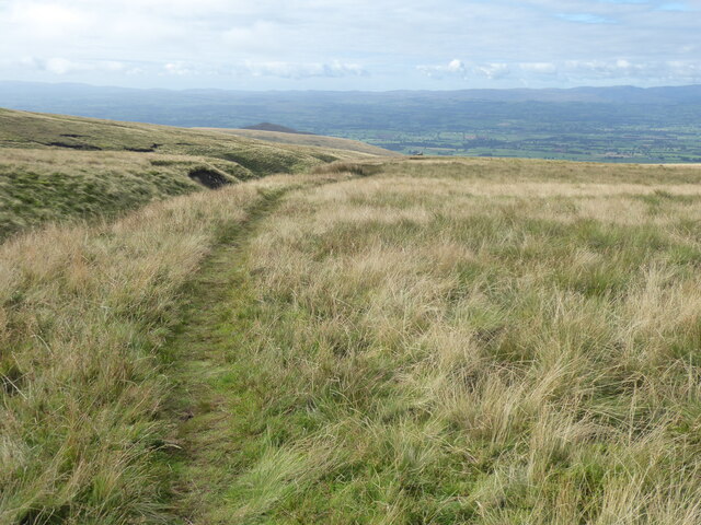
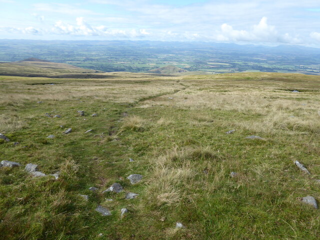
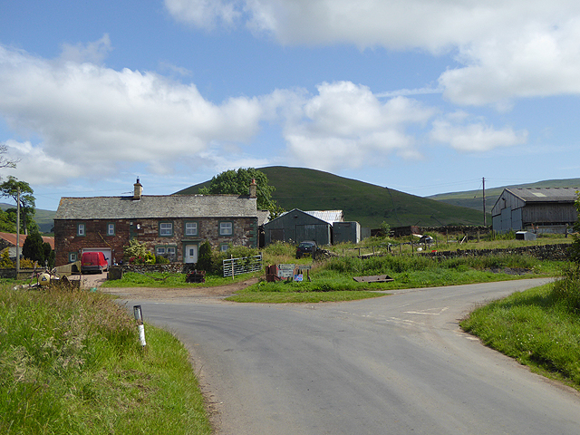
The downs of Green Fell are a prominent feature of the region, marked by their gently sloping hills covered in lush green grass. These downs provide ideal grazing grounds for livestock and are dotted with small farms and quaint cottages. The fertile soil supports a variety of plant life, including wildflowers and heather, creating a vibrant tapestry of colors throughout the seasons.

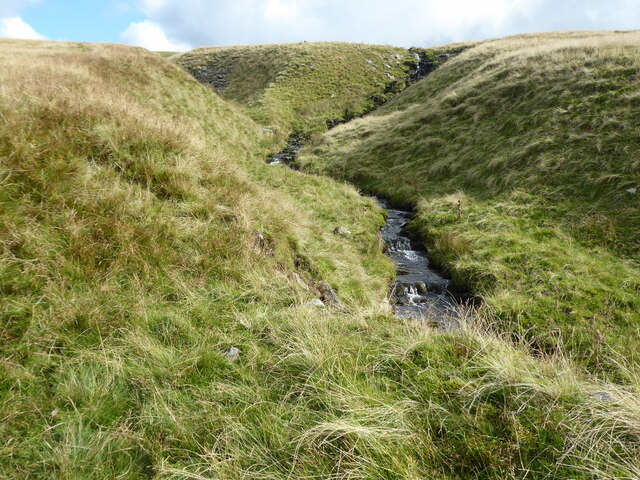
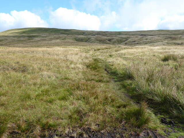
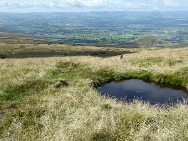
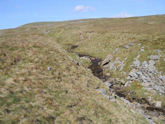
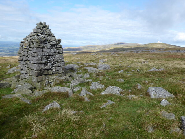
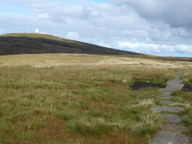
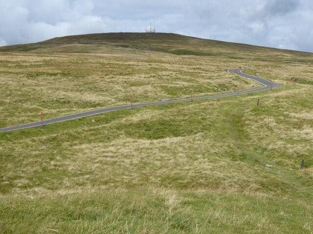
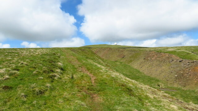
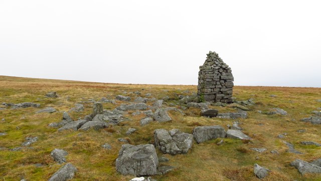
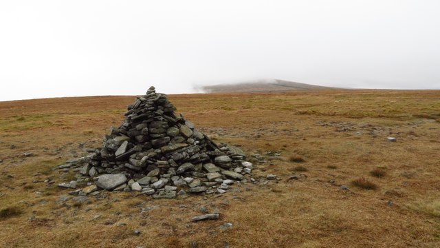
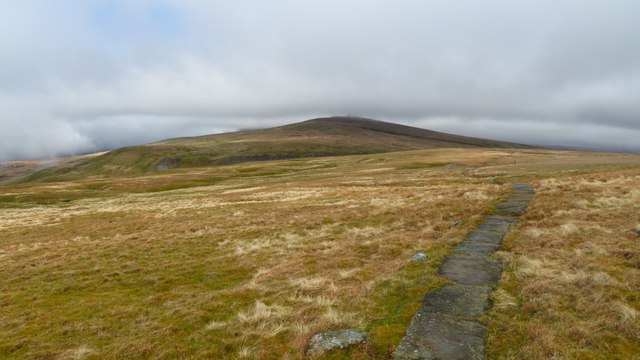
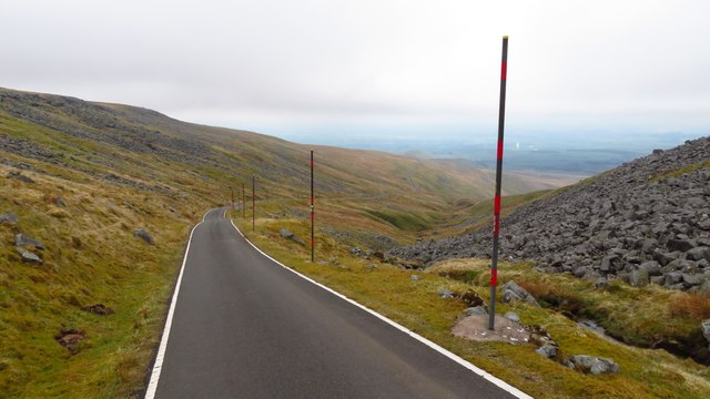
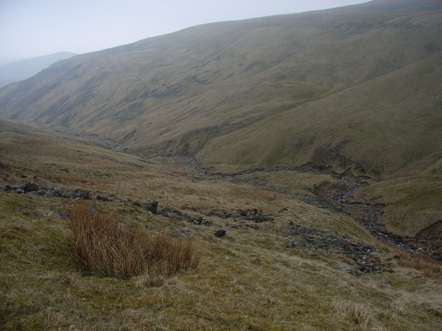
At higher altitudes, Green Fell transitions into moorland, a captivating landscape of open expanses and rocky outcrops. The moorland is a haven for wildlife, with species such as red grouse, curlews, and hares thriving in this unique habitat. The area is also home to a rich variety of plant life, including mosses, lichens, and heather.

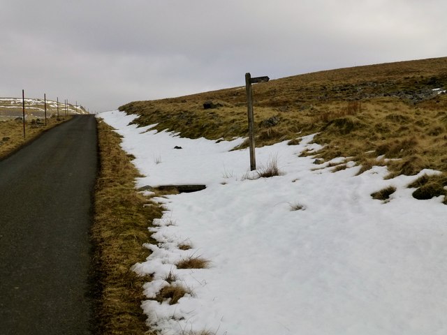
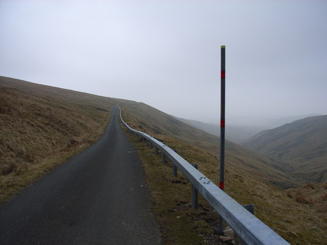
Green Fell is popular among outdoor enthusiasts, offering numerous opportunities for hiking, birdwatching, and nature photography. The well-maintained footpaths and trails make it accessible to visitors of all abilities, allowing them to explore the region's natural wonders at their own pace.

Overall, Green Fell in Westmorland is a captivating destination that showcases the beauty and diversity of the English countryside. Whether you are seeking tranquility, wildlife encounters, or simply a connection with nature, Green Fell offers a truly immersive experience in a stunning natural setting.

If you have any feedback on the listing, please let us know in the comments section below.

Green Fell Images

Images are sourced within 2km of 54.665248/-2.4384523 or Grid Reference NY7130. Thanks to Geograph Open Source API. All images are credited.

The Pennine Way near Knock Hush
The Pennine Way near Green Fell Spring
Knock Hush
Knock Hush
Footpath To Dufton Climbing the fell road to Great Dun Fell and a footpath branches off towards Dufton.
Footpath To Dufton
Climbing the fell road to Great Dun Fell and a footpath branches off towards Dufton.
The Pennine Way near Knock Old Man
The Pennine Way at Knock Old Man
The Pennine Way near Knock Fell
The Pennine Way near Green Castle
Bridleway leading up to Great Dun Fell & running beside Dunfell Hash
Knock Old Man (Currick) Knock Fell
Cairn on summit of Knock Fell - view towards Great Dun Fell
On Pennine Way heading north from Knock Fell towards Great Dun Fell
Private service road leading down from Great Dun Fell
Access road, Great Dun Fell The access road to the Civil Aviation Authority's air traffic control radar station on Great Dun Fell - the highest surfaced road in England.
Access road, Great Dun Fell
The access road to the Civil Aviation Authority's air traffic control radar station on Great Dun Fell - the highest surfaced road in England.
The valley of Knock Ore Gill With a glimpse of Burney Hill.
The valley of Knock Ore Gill
With a glimpse of Burney Hill.
The Dun Fell road The road providing access to Dun Fell radar station and Silverband Mine.
The Dun Fell road
The road providing access to Dun Fell radar station and Silverband Mine.
Show me another place!

Green Fell is located at Grid Ref: NY7130 (Lat: 54.665248, Lng: -2.4384523)

Administrative County: Cumbria

District: Eden

Police Authority: Cumbria

What 3 Words

///printouts.overt.ticket. Near Appleby-in-Westmorland, Cumbria

Nearby Locations

Green Fell

Related Wikis

Dufton Pike

Dufton Pike is a hill in the northern Pennines, in Cumbria, England. It is classed as a Marilyn (a hill with topographic prominence of at least 150m)....

Knock, Cumbria

Knock is a small village in the Eden district of Cumbria, England, and 1.9 km northwest of the larger village of Dufton and 3.1 km south of the village...

High Cup Gill

High Cup Gill (or High Cup Nick or just High Cup), almost a geometrically perfect U-shaped chasm, is a valley deeply incised into the Pennine scarp to...

St Cuthbert's Church, Dufton

St Cuthbert's Church is situated 3⁄4 mile (1.2 km) north of the village of Dufton, Cumbria, England. It should not be confused with the nearby St Cuthbert...

Cross Fell

Cross Fell is the highest mountain in the Pennines of Northern England and the highest point in England outside the Lake District. It is located in the...

Dufton

Dufton is a village and civil parish in Cumbria, England. Historically part of Westmorland, it lies in the Eden Valley and below Great Dun Fell. It is...

Milburn, Cumbria

Milburn is a small village and civil parish in the Eden district of Cumbria, England. It is located on the northern side of the Eden Valley, about 9 miles...

Warcop Training Area

The Warcop Training Area (WTA) is a UK Ministry of Defence military training area near the village of Warcop in Cumbria. Part of the Defence Training...

Nearby Amenities

Located within 500m of 54.665248,-2.4384523
Knock Fell
Ele: 793.7
Man Made: survey_point
Natural: peak
Source: NPE
Wikidata: Q24640155
Lat/Long: 54.666551/-2.4336092
Green Fell
Place: locality
Lat/Long: 54.6649711/-2.4403797
Man Made: cairn
Source: Bing
Lat/Long: 54.6650181/-2.4353834
Natural: sinkhole
Lat/Long: 54.6649895/-2.4364954
Natural: sinkhole
Lat/Long: 54.6644627/-2.4361977
Natural: sinkhole
Lat/Long: 54.6650074/-2.4372284
Natural: sinkhole
Lat/Long: 54.6650922/-2.437455
Natural: sinkhole
Lat/Long: 54.6654159/-2.4383264
Natural: sinkhole
Lat/Long: 54.6654383/-2.438199
Natural: sinkhole
Lat/Long: 54.6657939/-2.4373738
Natural: sinkhole
Lat/Long: 54.6658996/-2.4374126
Natural: sinkhole
Lat/Long: 54.6661366/-2.4364711
Natural: sinkhole
Lat/Long: 54.6649515/-2.4377781
Natural: sinkhole
Lat/Long: 54.6633745/-2.4378322
Natural: sinkhole
Lat/Long: 54.66353/-2.4377921
Natural: sinkhole
Lat/Long: 54.6634704/-2.4379179
Natural: sinkhole
Lat/Long: 54.6635564/-2.437958
Natural: sinkhole
Lat/Long: 54.6636804/-2.4379437
Natural: sinkhole
Lat/Long: 54.6636722/-2.4380494
Natural: sinkhole
Lat/Long: 54.6637135/-2.4381266
Natural: sinkhole
Lat/Long: 54.6637664/-2.4381238
Natural: sinkhole
Lat/Long: 54.6638425/-2.438038
Natural: sinkhole
Lat/Long: 54.6639929/-2.4380895
Natural: sinkhole
Lat/Long: 54.6641401/-2.4381095
Natural: sinkhole
Lat/Long: 54.6643749/-2.4382639
Natural: sinkhole
Lat/Long: 54.6643666/-2.4384468
Natural: sinkhole
Lat/Long: 54.6644096/-2.4386069
Natural: sinkhole
Lat/Long: 54.6643765/-2.4387155
Natural: sinkhole
Lat/Long: 54.6639764/-2.4384868
Natural: sinkhole
Lat/Long: 54.6640244/-2.4388871
Natural: sinkhole
Lat/Long: 54.6643468/-2.4388613
Natural: sinkhole
Lat/Long: 54.6643964/-2.4390014
Natural: sinkhole
Lat/Long: 54.6645435/-2.4386984
Natural: sinkhole
Lat/Long: 54.6645849/-2.4385812
Natural: sinkhole
Lat/Long: 54.664689/-2.4385755
Natural: sinkhole
Lat/Long: 54.6646808/-2.4387155
Natural: sinkhole
Lat/Long: 54.6646692/-2.4389614
Natural: sinkhole
Lat/Long: 54.6646973/-2.4390157
Natural: sinkhole
Lat/Long: 54.6647502/-2.43905
Natural: sinkhole
Lat/Long: 54.6649056/-2.4389643
Natural: sinkhole
Lat/Long: 54.6649585/-2.4391158
Natural: sinkhole
Lat/Long: 54.6650329/-2.4391958
Natural: sinkhole
Lat/Long: 54.6650181/-2.438564
Natural: sinkhole
Lat/Long: 54.6650958/-2.4381352
Natural: sinkhole
Lat/Long: 54.665147/-2.4381838
Natural: sinkhole
Lat/Long: 54.6652347/-2.4382095
Natural: sinkhole
Lat/Long: 54.6652446/-2.4384611
Natural: sinkhole
Lat/Long: 54.6652231/-2.4385669
Natural: sinkhole
Lat/Long: 54.6652743/-2.438827
Natural: sinkhole
Lat/Long: 54.6651867/-2.4390357
Natural: sinkhole
Lat/Long: 54.665152/-2.4391815
Natural: sinkhole
Lat/Long: 54.6651718/-2.4393445
Natural: sinkhole
Lat/Long: 54.6652281/-2.4394045
Natural: sinkhole
Lat/Long: 54.6652958/-2.4394731
Natural: sinkhole
Lat/Long: 54.6650544/-2.4394245
Natural: sinkhole
Lat/Long: 54.6650214/-2.4395989
Natural: sinkhole
Lat/Long: 54.6647949/-2.4394245
Natural: sinkhole
Lat/Long: 54.6649007/-2.4392387
Natural: sinkhole
Lat/Long: 54.6646064/-2.4392816
Natural: sinkhole
Lat/Long: 54.6645832/-2.4391387
Natural: sinkhole
Lat/Long: 54.6646808/-2.4391415
Natural: sinkhole
Lat/Long: 54.6644807/-2.4392158
Natural: sinkhole
Lat/Long: 54.6643947/-2.4394617
Natural: sinkhole
Lat/Long: 54.6643484/-2.4394588
Natural: sinkhole
Lat/Long: 54.6640806/-2.4396447
Natural: sinkhole
Lat/Long: 54.6646378/-2.4396733
Natural: sinkhole
Lat/Long: 54.6647783/-2.4398476
Natural: sinkhole
Lat/Long: 54.6649453/-2.4398333
Natural: sinkhole
Lat/Long: 54.664947/-2.4399849
Natural: sinkhole
Lat/Long: 54.6649652/-2.4401164
Natural: sinkhole
Lat/Long: 54.6650594/-2.4400964
Natural: sinkhole
Lat/Long: 54.6651454/-2.4402079
Natural: sinkhole
Lat/Long: 54.6651966/-2.4402707
Natural: sinkhole
Lat/Long: 54.6651801/-2.439902
Natural: sinkhole
Lat/Long: 54.6653537/-2.4400077
Natural: sinkhole
Lat/Long: 54.6653686/-2.4396818
Natural: sinkhole
Lat/Long: 54.665448/-2.4396818
Natural: sinkhole
Lat/Long: 54.665405/-2.4393188
Natural: sinkhole
Lat/Long: 54.6654711/-2.4392473
Natural: sinkhole
Lat/Long: 54.6655968/-2.4394017
Natural: sinkhole
Lat/Long: 54.6657241/-2.4393473
Natural: sinkhole
Lat/Long: 54.66582/-2.4394188
Natural: sinkhole
Lat/Long: 54.665815/-2.4395703
Natural: sinkhole
Lat/Long: 54.6658497/-2.4397333
Natural: sinkhole
Lat/Long: 54.665901/-2.4399534
Natural: sinkhole
Lat/Long: 54.6657704/-2.4400735
Natural: sinkhole
Lat/Long: 54.6656645/-2.4398962
Natural: sinkhole
Lat/Long: 54.6656943/-2.4400135
Natural: sinkhole
Lat/Long: 54.6656844/-2.4403022
Natural: sinkhole
Lat/Long: 54.6656662/-2.4405395
Natural: sinkhole
Lat/Long: 54.6659423/-2.4403079
Natural: sinkhole
Lat/Long: 54.666025/-2.4396504
Natural: sinkhole
Lat/Long: 54.6662895/-2.4397219
Natural: sinkhole
Lat/Long: 54.6662977/-2.440338
Natural: sinkhole
Lat/Long: 54.6662336/-2.440471
Natural: sinkhole
Lat/Long: 54.6665155/-2.4398562
Natural: sinkhole
Lat/Long: 54.6669063/-2.4393024
Natural: sinkhole
Lat/Long: 54.6666212/-2.4402383
Natural: sinkhole
Lat/Long: 54.6664002/-2.4396236
Natural: sinkhole
Lat/Long: 54.6664354/-2.4400999
Natural: sinkhole
Lat/Long: 54.6666821/-2.440338
Natural: sinkhole
Lat/Long: 54.6672189/-2.4384854
Natural: sinkhole
Lat/Long: 54.6673246/-2.4386571
Natural: sinkhole
Lat/Long: 54.6675264/-2.4379814
Natural: sinkhole
Lat/Long: 54.6675778/-2.4380059
Natural: sinkhole
Lat/Long: 54.6676349/-2.4380898
Natural: sinkhole
Lat/Long: 54.6676563/-2.4381318
Natural: sinkhole
Lat/Long: 54.6676948/-2.438159
Natural: sinkhole
Lat/Long: 54.6677377/-2.4381886
Natural: sinkhole
Lat/Long: 54.6676577/-2.4385465
Natural: sinkhole
Lat/Long: 54.6677876/-2.4382503
Natural: sinkhole
Lat/Long: 54.6674265/-2.4385711
Natural: sinkhole
Lat/Long: 54.667495/-2.4386896
Natural: sinkhole
Lat/Long: 54.6679313/-2.4383311
Natural: sinkhole
Lat/Long: 54.6679868/-2.4383609
Natural: sinkhole
Lat/Long: 54.6680768/-2.4380165
Natural: sinkhole
Lat/Long: 54.6677264/-2.4370032
Natural: sinkhole
Lat/Long: 54.6681994/-2.4360032
Natural: sinkhole
Lat/Long: 54.6679734/-2.4372814
Natural: sinkhole
Lat/Long: 54.6680347/-2.4372284
Natural: sinkhole
Lat/Long: 54.6681151/-2.4374801
Natural: sinkhole
Lat/Long: 54.6681917/-2.4374072
Natural: sinkhole
Lat/Long: 54.6682568/-2.4375033
Natural: sinkhole
Lat/Long: 54.6680768/-2.4376721
Natural: sinkhole
Lat/Long: 54.6684254/-2.437586
Natural: sinkhole
Lat/Long: 54.6684962/-2.4376721
Natural: sinkhole
Lat/Long: 54.668569/-2.4376887
Natural: sinkhole
Lat/Long: 54.6686935/-2.4377682
Natural: sinkhole
Lat/Long: 54.6687567/-2.4374999
Natural: sinkhole
Lat/Long: 54.6688294/-2.437437
Natural: sinkhole
Lat/Long: 54.6688582/-2.437543
Natural: sinkhole
Lat/Long: 54.6687241/-2.4370529
Natural: sinkhole
Lat/Long: 54.6689118/-2.4361522
Natural: sinkhole
Lat/Long: 54.6690075/-2.4376523
Natural: sinkhole
Lat/Long: 54.6689041/-2.4375794
Natural: sinkhole
Lat/Long: 54.6689539/-2.4379238
Natural: sinkhole
Lat/Long: 54.669065/-2.4380364
Natural: sinkhole
Lat/Long: 54.6691779/-2.437735
Natural: sinkhole
Lat/Long: 54.6692756/-2.4373079
Natural: sinkhole
Lat/Long: 54.6694901/-2.4376291
Natural: sinkhole
Lat/Long: 54.6694997/-2.4377847
Natural: sinkhole
Lat/Long: 54.6693369/-2.4378278
Natural: sinkhole
Lat/Long: 54.6690362/-2.438202
Natural: sinkhole
Lat/Long: 54.6692258/-2.4384437
Natural: sinkhole
Lat/Long: 54.668996/-2.4385198
Natural: sinkhole
Lat/Long: 54.6688543/-2.4382483
Natural: sinkhole
Lat/Long: 54.668795/-2.4382483
Natural: sinkhole
Lat/Long: 54.6685881/-2.4380894
Natural: sinkhole
Lat/Long: 54.6686456/-2.4384503
Natural: sinkhole
Lat/Long: 54.66841/-2.4383973
Natural: sinkhole
Lat/Long: 54.6683392/-2.4382914
Natural: sinkhole
Lat/Long: 54.6681668/-2.4384569
Natural: sinkhole
Lat/Long: 54.6696249/-2.4377394
Natural: sinkhole
Lat/Long: 54.669547/-2.4380665
Natural: sinkhole
Lat/Long: 54.6694728/-2.438259
Natural: sinkhole
Lat/Long: 54.6622566/-2.4353176
Natural: sinkhole
Lat/Long: 54.6623876/-2.4349445
Natural: sinkhole
Lat/Long: 54.6624802/-2.4349311
Natural: sinkhole
Lat/Long: 54.6624904/-2.4347668
Natural: sinkhole
Lat/Long: 54.6624005/-2.4346424
Natural: sinkhole
Lat/Long: 54.6623768/-2.4353993
Natural: sinkhole
Lat/Long: 54.6624177/-2.4354855
Natural: sinkhole
Lat/Long: 54.662464/-2.4355563
Natural: sinkhole
Lat/Long: 54.6623981/-2.4357409
Natural: sinkhole
Lat/Long: 54.6624426/-2.4357224
Natural: sinkhole
Lat/Long: 54.6624604/-2.4358455
Natural: sinkhole
Lat/Long: 54.6624818/-2.4359132
Natural: sinkhole
Lat/Long: 54.6625779/-2.4359993
Natural: sinkhole
Lat/Long: 54.6626277/-2.4360855
Natural: sinkhole
Lat/Long: 54.6626313/-2.4362978
Natural: sinkhole
Lat/Long: 54.6626313/-2.4362208
Natural: sinkhole
Lat/Long: 54.6627665/-2.4362578
Natural: sinkhole
Lat/Long: 54.6630388/-2.4363778
Natural: sinkhole
Lat/Long: 54.6628199/-2.4362824
Natural: sinkhole
Lat/Long: 54.6627968/-2.4365008
Natural: sinkhole
Lat/Long: 54.6628324/-2.4366239
Natural: sinkhole
Lat/Long: 54.6630334/-2.4370639
Natural: sinkhole
Lat/Long: 54.662989/-2.438114
Natural: sinkhole
Lat/Long: 54.6631534/-2.4379096
Natural: sinkhole
Lat/Long: 54.66358/-2.4386205
Natural: sinkhole
Lat/Long: 54.6691799/-2.4388045
Natural: sinkhole
Lat/Long: 54.6693819/-2.4388152
Natural: sinkhole
Lat/Long: 54.6690611/-2.4398548
Natural: sinkhole
Lat/Long: 54.6685096/-2.4393481
Natural: sinkhole
Lat/Long: 54.6681718/-2.4390918
Natural: sinkhole
Lat/Long: 54.6683959/-2.4390322
Natural: sinkhole
Lat/Long: 54.668027/-2.4388355
Natural: sinkhole
Lat/Long: 54.6680787/-2.4385196
Natural: sinkhole
Lat/Long: 54.6692189/-2.4391066
The data included in this document is from www.openstreetmap.org. The data is made available under ODbL.

Have you been to Green Fell?

Leave your review of Green Fell below (or comments, questions and feedback).