Sniddle Moss

Downs, Moorland in Yorkshire Craven

England

Sniddle Moss

Greystonegill Lane approaching High Barn Looking southward. The rounded outline of Burn Moor can be seen in the far distance.
Greystonegill Lane approaching High Barn Credit: Peter Wood

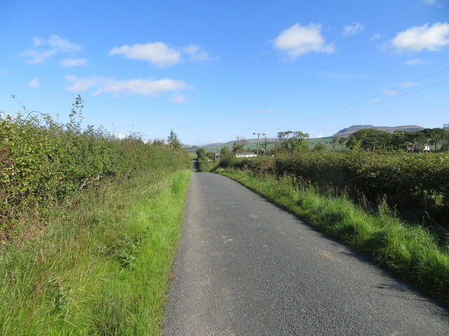
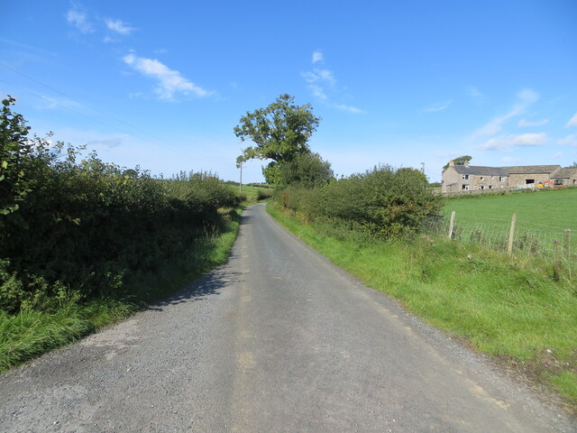
Sniddle Moss is a picturesque area located in the region of Yorkshire, England. Nestled between the Yorkshire Downs and the Moorland, it offers a unique blend of natural beauty and charm. The moss itself refers to a large, open expanse of wetland, characterized by its marshy terrain and rich biodiversity.

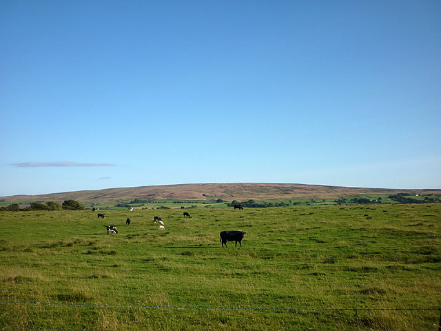
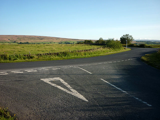
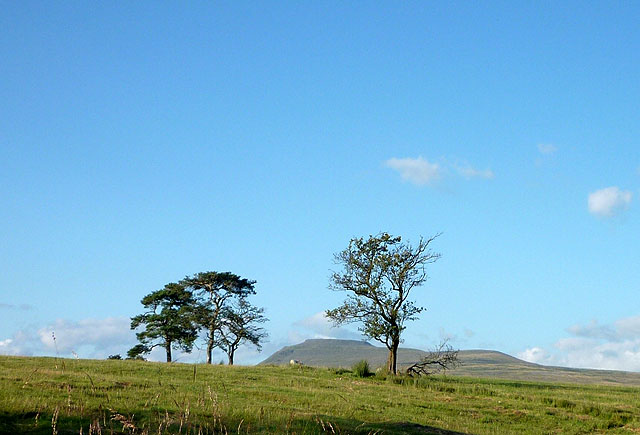
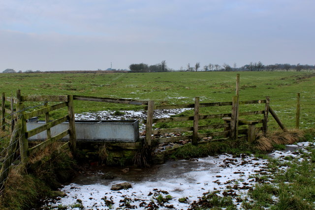
The landscape of Sniddle Moss is a breathtaking sight to behold. Rolling hills and lush green meadows dominate the scenery, creating a serene and tranquil atmosphere. The area is known for its diverse range of flora and fauna, with a multitude of plant species thriving in the wetland environment. Visitors can expect to encounter rare orchids, vibrant wildflowers, and various species of moss that contribute to the unique ecosystem.

The abundance of wildlife in Sniddle Moss is equally impressive. The wetland attracts a wide array of bird species, making it a paradise for birdwatchers. Visitors may catch a glimpse of the elusive curlew, lapwing, or even the majestic red kite soaring overhead. Other inhabitants include rabbits, hares, and deer, which can often be spotted grazing peacefully in the meadows.

Outdoor enthusiasts will find plenty of activities to enjoy in Sniddle Moss. The area boasts numerous walking trails, providing an opportunity to explore the stunning surroundings while taking in the fresh country air. The Yorkshire Downs and Moorland offer a picturesque backdrop for hiking, cycling, and even horseback riding.

In summary, Sniddle Moss is a captivating destination that showcases the beauty of Yorkshire's natural landscape. Its wetland environment, diverse flora and fauna, and outdoor recreational opportunities make it a must-visit for nature lovers and adventurers alike.

If you have any feedback on the listing, please let us know in the comments section below.
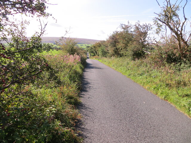
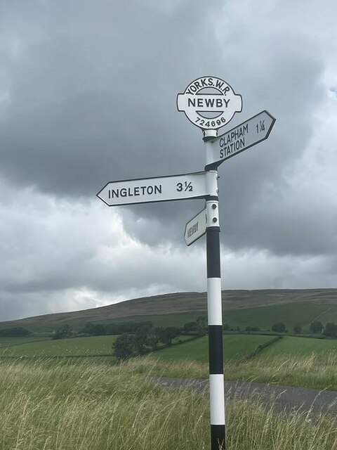
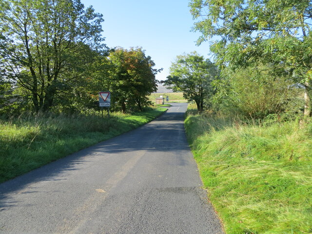
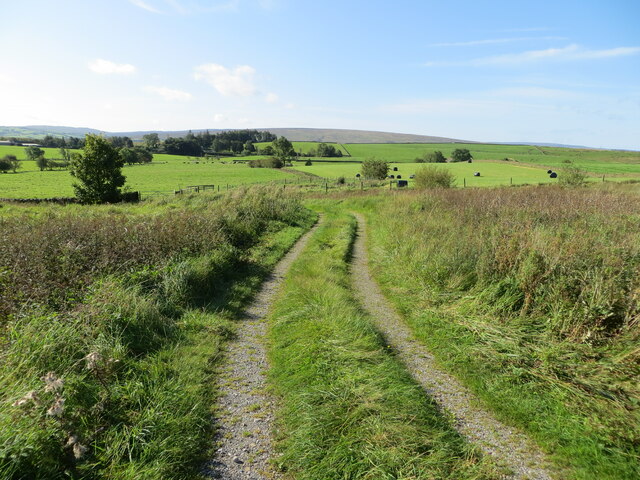
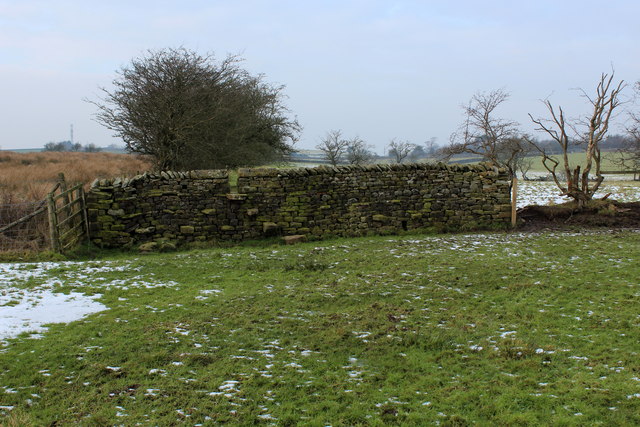
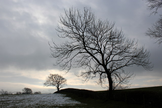
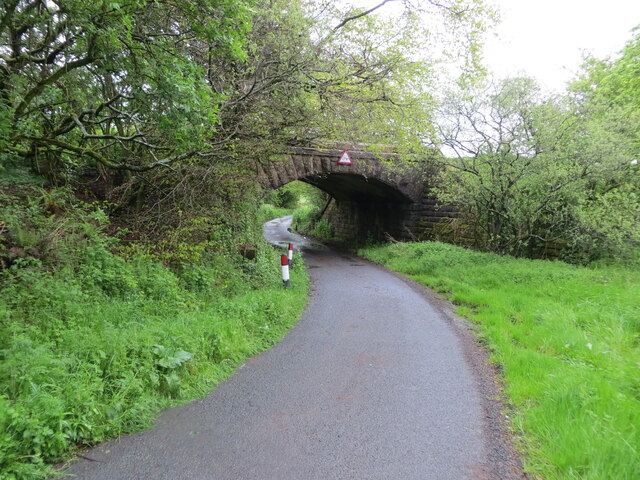
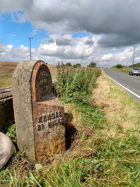
Sniddle Moss Images

Images are sourced within 2km of 54.122388/-2.4459181 or Grid Reference SD7069. Thanks to Geograph Open Source API. All images are credited.

Greystonegill Lane approaching High Barn Looking southward. The rounded outline of Burn Moor can be seen in the far distance.
Greystonegill Lane approaching High Barn
Looking southward. The rounded outline of Burn Moor can be seen in the far distance.
Direction Sign – Signpost near Newby village Located on the northeast side of a junction south of the A65 and Newby village. Clapham cum Newby parish. 3 arms and annulus and bar finial. Its previous condition can be seen here <a title="https://www.geograph.org.uk/photo/1333399" href="https://www.geograph.org.uk/photo/1333399">Link</a>.

Milestone Society National ID: YW_SD7269
Direction Sign – Signpost near Newby village
Located on the northeast side of a junction south of the A65 and Newby village. Clapham cum Newby parish. 3 arms and annulus and bar finial. Its previous condition can be seen here Link. Milestone Society National ID: YW_SD7269
Henbusk Lane, Newby Looking south-westward towards the A65 at Goat Gap Cafe.
Henbusk Lane, Newby
Looking south-westward towards the A65 at Goat Gap Cafe.
Farm track giving access to hay field and pastureland at Bolderber Looking south-westward.
Farm track giving access to hay field and pastureland at Bolderber
Looking south-westward.
Hedge enclosed lane near Chesters Looking north-eastward towards Kiln Lodge. In the far distance (right) Ingleborough can be seen.
Hedge enclosed lane near Chesters
Looking north-eastward towards Kiln Lodge. In the far distance (right) Ingleborough can be seen.
Hedge and fence enclosed lane at Chesters Looking westward.
Hedge and fence enclosed lane at Chesters
Looking westward.
Cattle grazing by Greystonegill Lane Looking towards the Bowland moors from the B6480 just east of High Bentham.
Cattle grazing by Greystonegill Lane
Looking towards the Bowland moors from the B6480 just east of High Bentham.
The junction of Greystonegill and Nutgill Lanes with the B6480 This stunning landmark is just east of High Bentham.
The junction of Greystonegill and Nutgill Lanes with the B6480
This stunning landmark is just east of High Bentham.
Trees by Nutgill Lane Ingleborough visible beyond.
Trees by Nutgill Lane
Ingleborough visible beyond.
Old biscuit van - 'By Appointment' A McVitie & Price van.
Old biscuit van - 'By Appointment'
A McVitie & Price van.
Logo on old biscuit van The logo on the side of <a href="https://www.geograph.org.uk/photo/3989629">SD6968 : Old biscuit van - 'By Appointment'</a>
Logo on old biscuit van
On the path between Meregill and Linghaw Cross (1) A soggy slog in January across muddy pastures - the trough contents are sealed under a layer of ice.
On the path between Meregill and Linghaw Cross (1)
A soggy slog in January across muddy pastures - the trough contents are sealed under a layer of ice.
On the path between Meregill and Linghaw Cross (2) Soggy and squelchy does not begin to describe this right of way over pasture
On the path between Meregill and Linghaw Cross (2)
Soggy and squelchy does not begin to describe this right of way over pasture
Pastures at Twilight near Meregill Admired while walking the right of way between Linghaw Cross and Meregill
Pastures at Twilight near Meregill
Admired while walking the right of way between Linghaw Cross and Meregill
Minor road passing beneath a former railway bridge near Whinney Mire Looking eastward.
Minor road passing beneath a former railway bridge near Whinney Mire
Looking eastward.
Old Boundary Marker between Ingleton and High Bentham Parish Boundary Marker on the east side of Nutgill Lane southeast of the turn to Nutgill Farm. On the boundary of Ingleton and Bentham parishes. Inscribed INGLETON (vertical line) BENTHAM. See also <a title="https://www.geograph.org.uk/photo/183407" href="https://www.geograph.org.uk/photo/183407">Link</a>.

Milestone Society National ID: YW_INGBEN01pb
Old Boundary Marker between Ingleton and High Bentham
Parish Boundary Marker on the east side of Nutgill Lane southeast of the turn to Nutgill Farm. On the boundary of Ingleton and Bentham parishes. Inscribed INGLETON (vertical line) BENTHAM. See also Link. Milestone Society National ID: YW_INGBEN01pb
Old milestone This West Riding CC milestone is west of Clapham almost opposite Goat Gap.  It was once well painted but exposure to the weather and closeness to the tarmac of the A65 have taken its toll.
Old milestone
This West Riding CC milestone is west of Clapham almost opposite Goat Gap. It was once well painted but exposure to the weather and closeness to the tarmac of the A65 have taken its toll.
Old milestone A close-up of the now very rusty West Riding CC milestone first set up in 1893/94.  Close inspection reveals WILLIAM TOWLER/GLOBE FOUNDRY/LEEDS on the bevel.  The mileage to Keighley, 33, is hidden by rust and grass.  This style of milestone was set up by the newly formed County Council some years after the Keighley, Skipton and Kirby in Kendal turnpike trust ended in the early 1870s.
Old milestone
A close-up of the now very rusty West Riding CC milestone first set up in 1893/94. Close inspection reveals WILLIAM TOWLER/GLOBE FOUNDRY/LEEDS on the bevel. The mileage to Keighley, 33, is hidden by rust and grass. This style of milestone was set up by the newly formed County Council some years after the Keighley, Skipton and Kirby in Kendal turnpike trust ended in the early 1870s.
Show me another place!

Sniddle Moss is located at Grid Ref: SD7069 (Lat: 54.122388, Lng: -2.4459181)

Division: West Riding

Administrative County: North Yorkshire

District: Craven

Police Authority: North Yorkshire

What 3 Words

///sediment.reputable.thrilled. Near Ingleton, North Yorkshire

Related Wikis

Keasden Beck

Keasden Beck is a stream in Yorkshire (formerly the West Riding) rising near Keasden Head, joining the River Wenning south west of Clapham. == References... ==
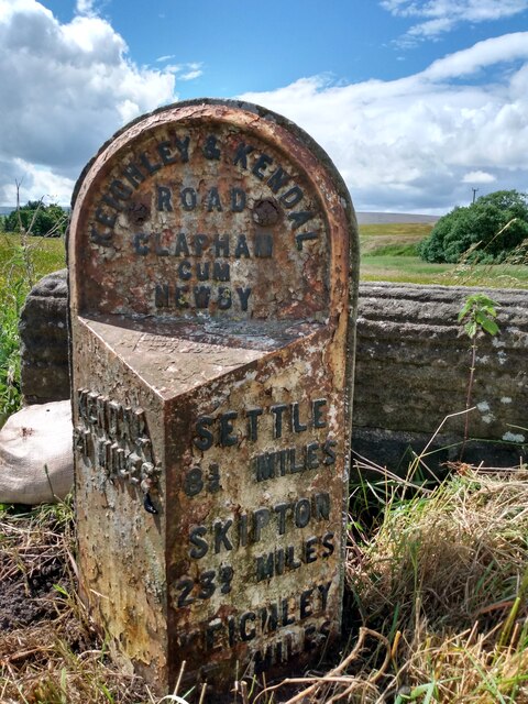
Clapham cum Newby

Clapham cum Newby is a civil parish in the Craven district of North Yorkshire, England. It was formerly in the Settle Rural District. It contains the villages...

Clapham railway station

Clapham is a railway station on the Bentham Line, which runs between Leeds and Morecambe via Skipton. The station, situated 48 miles (77 km) north-west...

Ingleton Coalfield

The Ingleton Coalfield is in North Yorkshire, close to its border with Lancashire in north-west England. Isolated from other coal-producing areas, it is...

Keasden

Keasden is a hamlet in the civil parish of Clapham-cum-Newby, in the Craven district of the county of North Yorkshire, in the north-western England. It...

Ingleton, North Yorkshire

Ingleton is a village and civil parish in the Craven district of North Yorkshire, England. The village is 19 miles (30 km) from Kendal and 17 miles (28...

Ingleton railway station (Midland Railway)

Ingleton (Midland) railway station was one of two stations serving the village of Ingleton, North Yorkshire, England. It was originally open for just ten...

Clapham, North Yorkshire

Clapham is a village in the civil parish of Clapham cum Newby in the Craven district of North Yorkshire, England. It was previously in the West Riding...

Nearby Amenities

Located within 500m of 54.122388,-2.4459181
Newby Moor
Created By: Potlatch 0.10f
Is In: Craven, North Yorkshire, Yorkshire, England, UK
Place: locality
Source: npe
Lat/Long: 54.1235494/-2.4507598
Power: pole
Lat/Long: 54.1265488/-2.4483392
Power: pole
Lat/Long: 54.126027/-2.4473789
Power: pole
Lat/Long: 54.1249047/-2.4451876
Power: pole
Lat/Long: 54.1243388/-2.4440852
Power: pole
Lat/Long: 54.1237793/-2.4429426
Power: pole
Lat/Long: 54.1232354/-2.4419528
Power: pole
Lat/Long: 54.1226019/-2.4407083
Power: pole
Lat/Long: 54.1224542/-2.4394825
Power: pole
Lat/Long: 54.1198952/-2.4397998
Power: pole
Lat/Long: 54.1200574/-2.44116
Power: pole
Lat/Long: 54.1202243/-2.4424938
Power: pole
Lat/Long: 54.1203741/-2.4437881
Power: pole
Lat/Long: 54.1205333/-2.445151
Power: pole
Lat/Long: 54.1206986/-2.4464584
Power: pole
Lat/Long: 54.1208561/-2.4478186
Power: pole
Lat/Long: 54.1210184/-2.4491735
Power: pole
Lat/Long: 54.1211852/-2.4505232
Power: pole
Lat/Long: 54.1213382/-2.4518412
Power: pole
Lat/Long: 54.121505/-2.4531724
Sniddle Moss
Natural: wetland
Lat/Long: 54.1220662/-2.4466254
The data included in this document is from www.openstreetmap.org. The data is made available under ODbL.

Have you been to Sniddle Moss?

Leave your review of Sniddle Moss below (or comments, questions and feedback).