White Side Pasture

Downs, Moorland in Yorkshire Craven

England

White Side Pasture

Looking down Long Gill Stretching down towards the valley of Ease Gill
Looking down Long Gill Credit: Chris Heaton

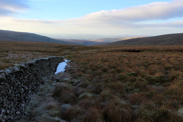
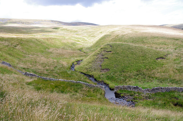
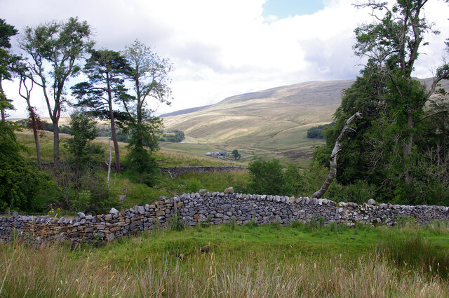
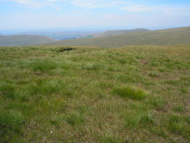
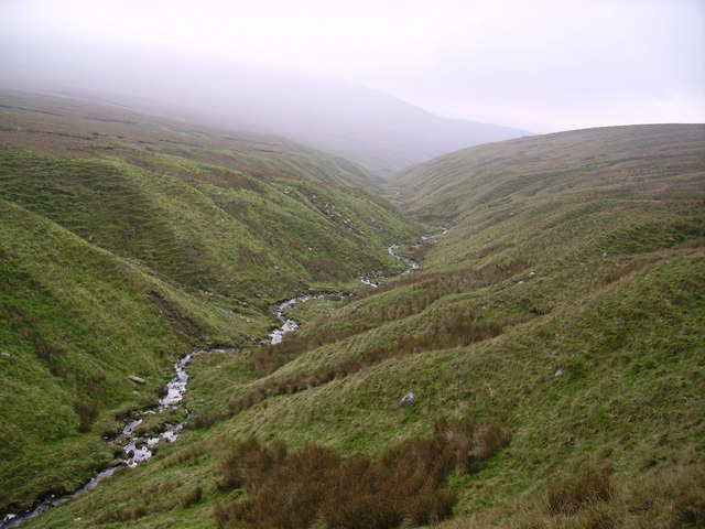
White Side Pasture is a picturesque area located in the heart of Yorkshire, England. Nestled amidst the stunning Yorkshire Downs and Moorland, this vast pastureland is a haven for nature enthusiasts and outdoor adventurers alike. Stretching over several acres, White Side Pasture offers breathtaking panoramic views of the surrounding countryside.

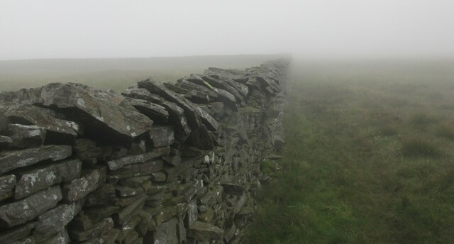
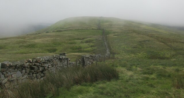
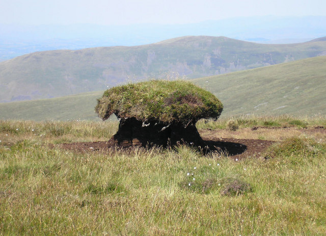
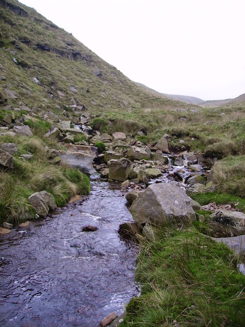
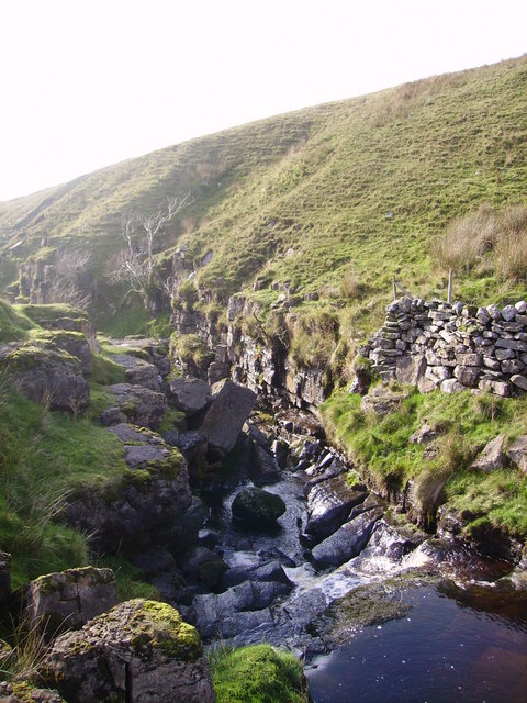
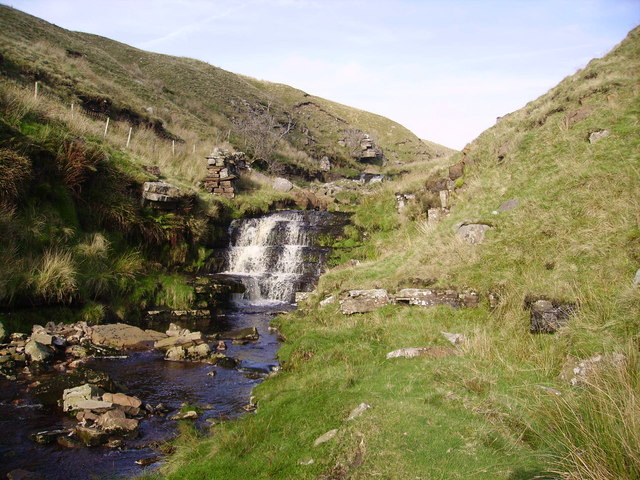
The terrain of White Side Pasture is characterized by rolling hills, lush green meadows, and scattered woodlands. The area is home to a diverse range of flora and fauna, including heather, gorse, and various species of wildflowers. The vibrant colors of the landscape change with the seasons, creating a mesmerizing tapestry of beauty.

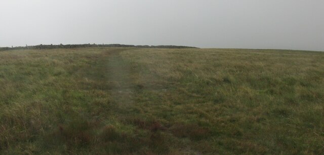
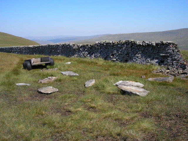
The pastureland is dotted with numerous walking trails, making it the perfect destination for hikers and ramblers. These trails lead visitors through meandering pathways, allowing them to explore the idyllic countryside at their own pace. The area is also popular among birdwatchers, as it attracts a wide variety of bird species, including kestrels, lapwings, and curlews.

White Side Pasture is not only rich in natural beauty but also holds historical significance. The area is scattered with ancient burial mounds and stone circles, providing a glimpse into the region's prehistoric past. Visitors can immerse themselves in the history of the area while enjoying the tranquility and serenity it offers.

Overall, White Side Pasture is a captivating destination that showcases the true essence of Yorkshire's countryside. Whether you are seeking a peaceful retreat or an adventure-filled exploration, this area has something to offer everyone.

If you have any feedback on the listing, please let us know in the comments section below.

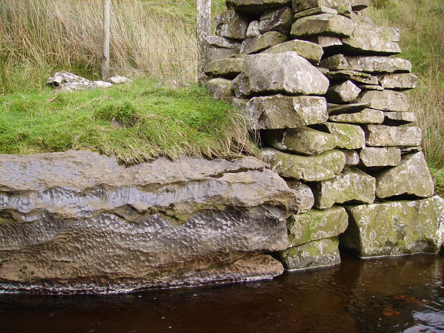
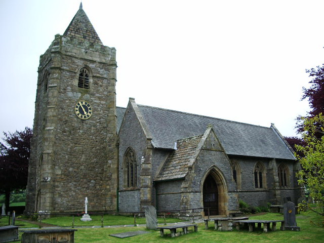
White Side Pasture Images

Images are sourced within 2km of 54.221724/-2.4539207 or Grid Reference SD7080. Thanks to Geograph Open Source API. All images are credited.

Looking down Long Gill Stretching down towards the valley of Ease Gill
Looking down Long Gill
Stretching down towards the valley of Ease Gill
Boundary wall on  Blakeamaya Foggy morning.
Boundary wall on Blakeamaya
Foggy morning.
Path on Green Hill The highest spot in Lancashire.
Path on Green Hill
The highest spot in Lancashire.
The boundary wall Looking back towards Green Hill.
The boundary wall
Looking back towards Green Hill.
Yordas Grains, Kingsdale Yordas Gill winds down the fellside before dropping down into Yordas Cave (out of picture, ~100m to right).
Yordas Grains, Kingsdale
Yordas Gill winds down the fellside before dropping down into Yordas Cave (out of picture, ~100m to right).
Yordas Wood, Kingsdale Looking towards Kingsdale Head. Whernside is in the background.
Yordas Wood, Kingsdale
Looking towards Kingsdale Head. Whernside is in the background.
Boundary wall on Gragareth. Yorkshire to the left, Lancashire to the right.
Boundary wall on Gragareth.
Yorkshire to the left, Lancashire to the right.
Mini oxbow lake in formation Just a walk up the stream from yordas cave
Mini oxbow lake in formation
Just a walk up the stream from yordas cave
On the Gragareth ridge Looking west towards Lunesdale in the heat haze.
On the Gragareth ridge
Looking west towards Lunesdale in the heat haze.
Work in progress The truck has been used to carry stone and equipment up the fell to repair the collapsed part of the wall at the right. No work was actually in progress on this extremely hot day.
Work in progress
The truck has been used to carry stone and equipment up the fell to repair the collapsed part of the wall at the right. No work was actually in progress on this extremely hot day.
Giant toadstool? No, it's a peat hag. The surrounding peat has eroded down a few feet and grass has grown on top. This remaining islet of peat will slowly erode until it disappears.

Middleton Fell can be seen in the distance.
Giant toadstool?
No, it's a peat hag. The surrounding peat has eroded down a few feet and grass has grown on top. This remaining islet of peat will slowly erode until it disappears. Middleton Fell can be seen in the distance.
Long Gill Foot Where Long Gill meets Ease Gill.
Long Gill Foot
Where Long Gill meets Ease Gill.
Ease Gill Looking down the Gill in its upper reaches under Crag Hill
Ease Gill
Looking down the Gill in its upper reaches under Crag Hill
Ease Gill The Gill is an interesting place to explore.The Ash trees on the rock outcrop may soon find themselves transplanted as everything slips downward along the steep edges of the Gill.
Ease Gill
The Gill is an interesting place to explore.The Ash trees on the rock outcrop may soon find themselves transplanted as everything slips downward along the steep edges of the Gill.
Ease Gill Following the Gill is interesting though a little rough in places.
Ease Gill
Following the Gill is interesting though a little rough in places.
Waterfall ,Ease Gill There are a series of fine waterfalls in the upper reaches of the gill but none are noted on the O. S. Map.
Waterfall ,Ease Gill
There are a series of fine waterfalls in the upper reaches of the gill but none are noted on the O. S. Map.
Rock, Ease Gill Strangely marked rock which appeared strikingly different from the most of the other rocks in the gill.
Rock, Ease Gill
Strangely marked rock which appeared strikingly different from the most of the other rocks in the gill.
Rock, Ease Gill Unusuall pock marked rock next to the bit of wall on the gill.
Rock, Ease Gill
Unusuall pock marked rock next to the bit of wall on the gill.
Show me another place!

White Side Pasture is located at Grid Ref: SD7080 (Lat: 54.221724, Lng: -2.4539207)

Division: West Riding

Administrative County: North Yorkshire

District: Craven

Police Authority: North Yorkshire

What 3 Words

///inferior.pull.eyeliner. Near Ingleton, North Yorkshire

Related Wikis

Thornton in Lonsdale

Thornton in Lonsdale is a village and civil parish in the Craven District and ceremonial county of North Yorkshire in England. It is very close to the...

Green Hill (Lancashire)

Green Hill is a mountain or fell in north west England. Its summit is 628 metres (2,060 ft) above sea level. It is located above Cowan Bridge, Lancashire...

Yordas Cave

Yordas Cave is a solutional cave in Kingsdale, North Yorkshire, England. It has been renowned since the eighteenth century as a natural curiosity, and...

Gragareth

Gragareth is a mountain straddling the border between Lancashire and North Yorkshire in England. At 627 metres (2,057 ft), its summit is the second highest...

Related Videos

County Tops - Lancashire

Gragareth and Green Hill via Yordas Cave. Yordas Cave, just off the narrow road through Kingsdale, was a tourist attraction in the ...

Three Men of Gragareth #gragareth #threemenofgragareth #lancashire

The Three Men of Gragareth are a group of tall cairns on the western side of Gragareth Fell. Gragareth is the highest point in ...

Evening run up Gregareth

Evening run up Gregareth May 2020.

Have you been to White Side Pasture?

Leave your review of White Side Pasture below (or comments, questions and feedback).