Burn Moor Fell

Downs, Moorland in Yorkshire Craven

England

Burn Moor Fell

Burn Moor Fell Trig As described on T:UK or just Burn Moor.
Parked after cattle grid at 427 metres at SD6823860865 then Great Harlow, Hailshowers Fell, Bowlands Knotts, return to Hailshowers Fell, Great Harlow, Thistle Hill, Burn Moor and then to road below Moor Cock Farm and then up road back to my car.
Name: Burn Moor
Hill number: 108581
Height: 402m / 1319ft
Area: 36: Lancashire, Cheshire & the Southern Pennines
Class: 4
Grid ref: SD695645 (est)
Drop: 34m
Col: 368m
Burn Moor Fell Trig Credit: Rude Health

Burn Moor Fell is a picturesque expanse of moorland located in the county of Yorkshire, England. Situated within the North York Moors National Park, this vast area covers approximately 1,000 hectares and offers stunning views of the surrounding countryside.

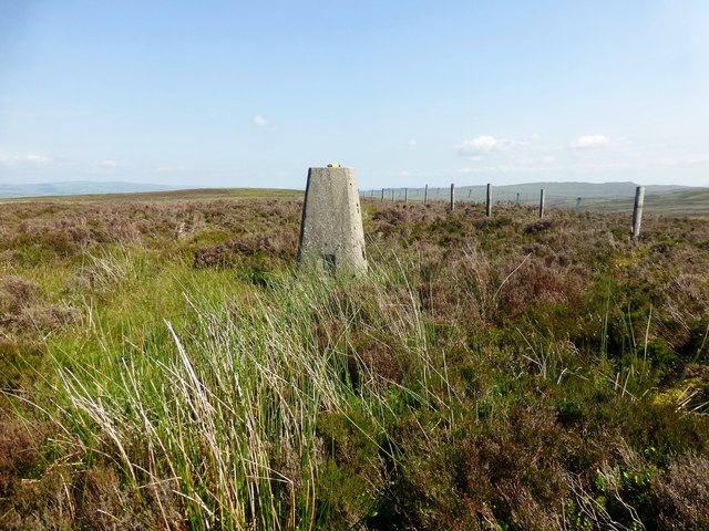
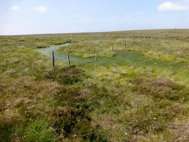
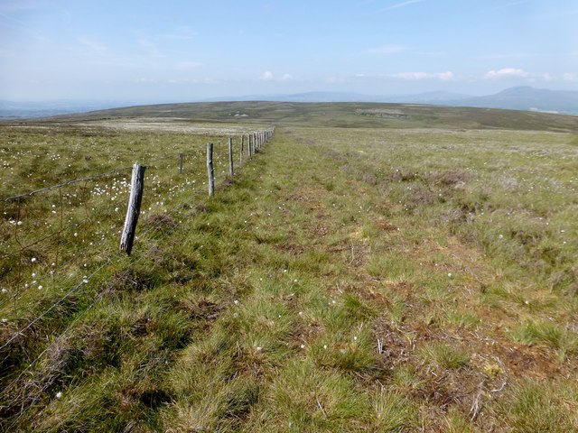
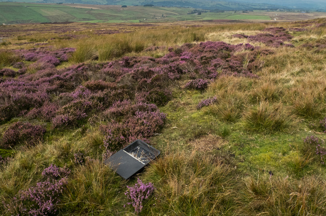
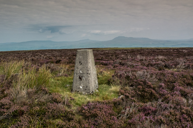
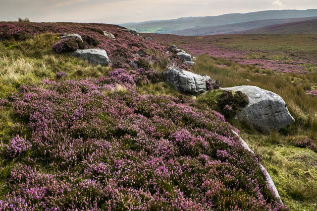
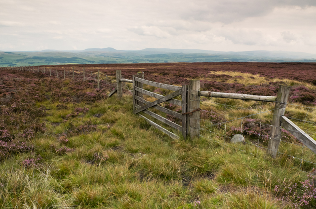
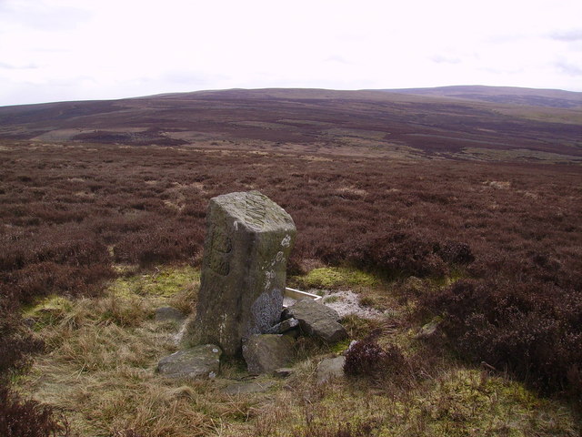
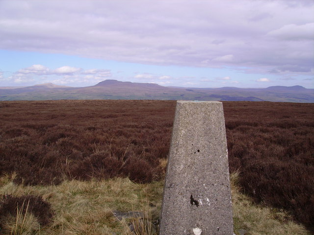
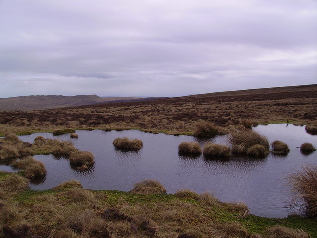
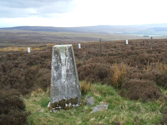
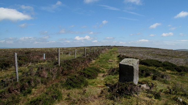
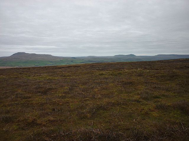
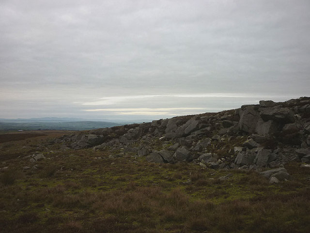
The moorland terrain of Burn Moor Fell is characterized by its rolling hills, heather-covered slopes, and expansive open spaces. It is home to a diverse range of flora and fauna, including rare bird species, such as the golden plover and merlin, which attract birdwatchers from far and wide.

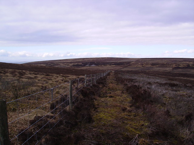
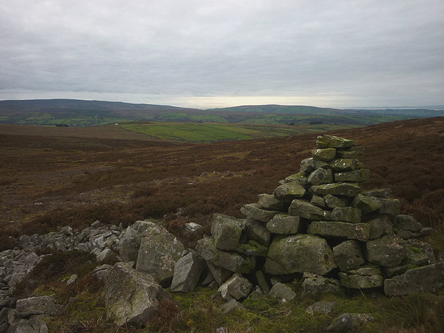
The landscape of Burn Moor Fell is largely untouched and provides a serene environment for visitors to explore. Numerous footpaths and trails crisscross the moor, allowing hikers and nature enthusiasts to immerse themselves in the beauty of the surroundings. The famous Cleveland Way, a long-distance footpath, also passes through this area, offering spectacular views of the countryside.

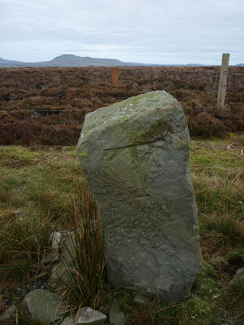
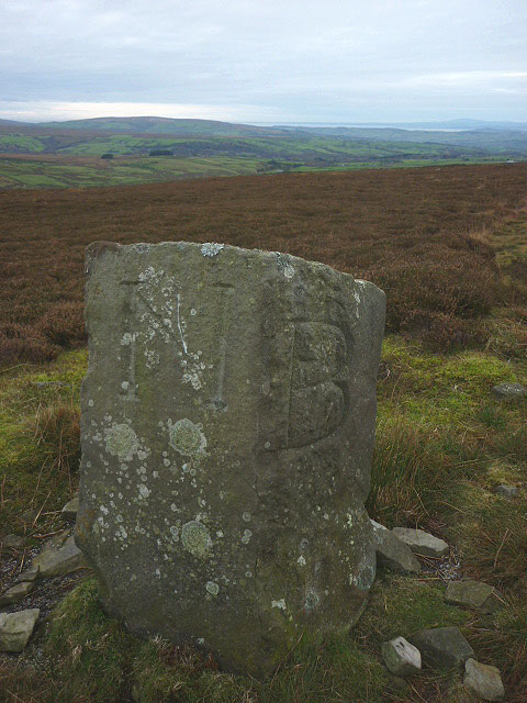
In addition to its natural beauty, Burn Moor Fell has historical significance. The remains of ancient stone circles and burial mounds can be found scattered across the moor, offering glimpses into the area's past. These archaeological sites provide a fascinating insight into the lives of the people who once inhabited this remote landscape.

Overall, Burn Moor Fell is a destination that offers visitors a chance to connect with nature, enjoy breathtaking views, and delve into the rich history of the Yorkshire countryside. Whether it's a leisurely walk, a birdwatching expedition, or an exploration of ancient ruins, this moorland is a haven for those seeking tranquility and natural beauty.

If you have any feedback on the listing, please let us know in the comments section below.

Burn Moor Fell Images

Images are sourced within 2km of 54.072722/-2.4534238 or Grid Reference SD7064. Thanks to Geograph Open Source API. All images are credited.

Burn Moor Fell Trig As described on T:UK or just Burn Moor.
Parked after cattle grid at 427 metres at SD6823860865 then Great Harlow, Hailshowers Fell, Bowlands Knotts, return to Hailshowers Fell, Great Harlow, Thistle Hill, Burn Moor and then to road below Moor Cock Farm and then up road back to my car.
Name: Burn Moor
Hill number: 108581
Height: 402m / 1319ft
Area: 36: Lancashire, Cheshire & the Southern Pennines
Class: 4
Grid ref: SD695645 (est)
Drop: 34m
Col: 368m
Burn Moor Fell Trig
As described on T:UK or just Burn Moor. Parked after cattle grid at 427 metres at SD6823860865 then Great Harlow, Hailshowers Fell, Bowlands Knotts, return to Hailshowers Fell, Great Harlow, Thistle Hill, Burn Moor and then to road below Moor Cock Farm and then up road back to my car. Name: Burn Moor Hill number: 108581 Height: 402m / 1319ft Area: 36: Lancashire, Cheshire & the Southern Pennines Class: 4 Grid ref: SD695645 (est) Drop: 34m Col: 368m
Boggy Spot Near Fox Holes I had been following the fence until this boggy spot near Fox Holes which required a detour.
Boggy Spot Near Fox Holes
I had been following the fence until this boggy spot near Fox Holes which required a detour.
Walking Over Burn Moor I follow the fence most of the way between Hailshowers Fell to Burn Moor Fell trig apart from the odd boggy bit.
Walking Over Burn Moor
I follow the fence most of the way between Hailshowers Fell to Burn Moor Fell trig apart from the odd boggy bit.
Fellside below Burn Moor Typical heather moor below the summit of Burn Moor
Fellside below Burn Moor
Typical heather moor below the summit of Burn Moor
Trig Pillar Burn Moor
East Cat Stones Burn Moor
Fence and Gate Burn Moor
Standard on Burn Moor On the top. Easy to identify as it has 'standard'carved in the top
Standard on Burn Moor
On the top. Easy to identify as it has 'standard'carved in the top
Trig Pillar Burn Moor Looking at Ingleborough (again!)
Trig Pillar Burn Moor
Looking at Ingleborough (again!)
Fence over Burn Moor Looking back at the top with West Cat Stones in view.
Fence over Burn Moor
Looking back at the top with West Cat Stones in view.
Tarn Thistly Hill Looking towards Bowland Knotts by the fence  north of the top.
Tarn Thistly Hill
Looking towards Bowland Knotts by the fence north of the top.
Trig  pillar, Burn Moor
Trig pillar, Burn Moor
View to the Summit Area of Burn Moor The summit of Burn Moor lies along the fence line and is marked by a trig point. Close to the camera position is a splendid boundary stone known as 'Standard on Burn Moor', it has letters carved on three faces and the word 'Standard' on its top.
View to the Summit Area of Burn Moor
The summit of Burn Moor lies along the fence line and is marked by a trig point. Close to the camera position is a splendid boundary stone known as 'Standard on Burn Moor', it has letters carved on three faces and the word 'Standard' on its top.
The northern slopes of Burn Moor Burned recently to promote new heather growth for the grouse.
The northern slopes of Burn Moor
Burned recently to promote new heather growth for the grouse.
Cairn at West Cat Stones Plenty of stones but no cats.
Cairn at West Cat Stones
Plenty of stones but no cats.
Davidson's Crag A series of small gritstone buttresses and boulders.
Davidson's Crag
A series of small gritstone buttresses and boulders.
The south face of the Standard on Burn Moor The stone sits on a county (and parish) boundary. On this, the Lancashire side, I presume the carved 'T' stands for Tatham.
The south face of the Standard on Burn Moor
The stone sits on a county (and parish) boundary. On this, the Lancashire side, I presume the carved 'T' stands for Tatham.
Two faces of the Standard on Burn Moor The stone sits on a county (and parish) boundary. On these, facing towards Yorkshire, I presume the carved 'B' stands for Bentham and the 'N' for Clapham-with-Newby?
Two faces of the Standard on Burn Moor
The stone sits on a county (and parish) boundary. On these, facing towards Yorkshire, I presume the carved 'B' stands for Bentham and the 'N' for Clapham-with-Newby?
Show me another place!

Burn Moor Fell is located at Grid Ref: SD7064 (Lat: 54.072722, Lng: -2.4534238)

Division: West Riding

Administrative County: North Yorkshire

District: Craven

Police Authority: North Yorkshire

What 3 Words

///file.butlers.detect. Near High Bentham, North Yorkshire

Nearby Locations

Burn Moor Fell

Related Wikis

Keasden

Keasden is a hamlet in the civil parish of Clapham-cum-Newby, in the Craven district of the county of North Yorkshire, in the north-western England. It...

Keasden Beck

Keasden Beck is a stream in Yorkshire (formerly the West Riding) rising near Keasden Head, joining the River Wenning south west of Clapham. == References... ==

Great Stone of Fourstones

The Great Stone of Fourstones, or the Big Stone as it is known locally, is a glacial deposit on the moorlands of Tatham Fells, England, straddling the...

Clapham railway station

Clapham is a railway station on the Bentham Line, which runs between Leeds and Morecambe via Skipton. The station, situated 48 miles (77 km) north-west...

Church of the Good Shepherd, Tatham

The Church of the Good Shepherd is on Tatham Fell in Lancashire, England. It is an active Anglican parish church in the deanery of Tunstall, the archdeaconry...

St Margaret's Church, High Bentham

St Margaret's Church is in Station Road, High Bentham, North Yorkshire, England. It is an Anglican parish church in the deanery of Ewecross, the archdeaconry...

Eldroth

Eldroth is a village in North Yorkshire, England. It is in the civil parish of Lawkland, part of the former Craven District, some 3.25 miles (5.23 km)...

Bentham railway station

Bentham is a railway station on the Bentham Line, which runs between Leeds and Morecambe via Skipton. The station, situated 19 miles (31 km) east of Lancaster...

Nearby Amenities

Located within 500m of 54.072722,-2.4534238
Burn Moor
Is In: Craven, North Yorkshire
Place: locality
Source: OS OpenData Streetview
Lat/Long: 54.0742232/-2.4576419
Burn Moor Fell
Is In: Craven, North Yorkshire
Place: locality
Source: OS OpenData Streetview
Lat/Long: 54.0738455/-2.4491662
The data included in this document is from www.openstreetmap.org. The data is made available under ODbL.

Have you been to Burn Moor Fell?

Leave your review of Burn Moor Fell below (or comments, questions and feedback).