Roachburn Wood

Downs, Moorland in Cumberland Carlisle

England

Roachburn Wood

Riggfoot Farm and environs near Tindale A view of this pastoral scene captured from a footpath/cycleway utilising the route of a former railway.

This photograph was taken during the Coronavirus (COVID-19) pandemic of 2020/21/22.
Riggfoot Farm and environs near Tindale Credit: James T M Towill

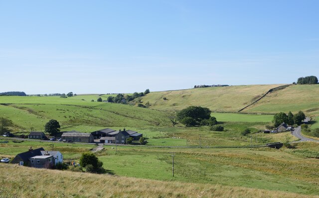
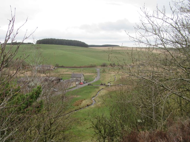
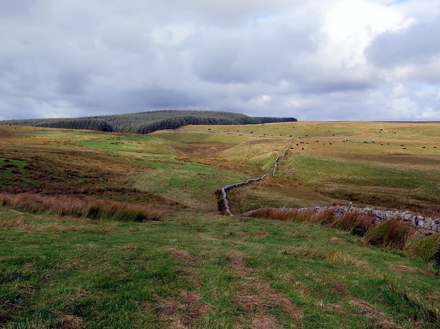
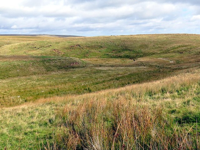
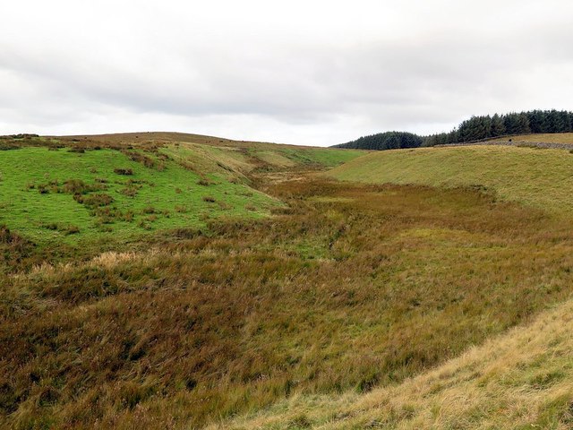
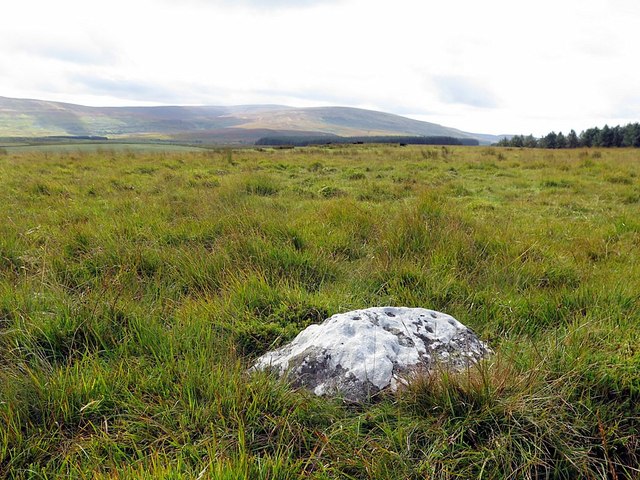
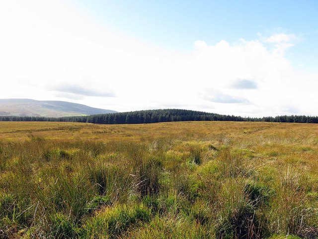
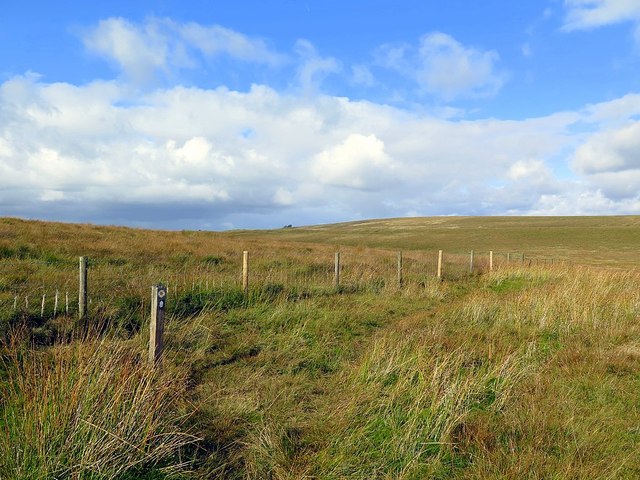
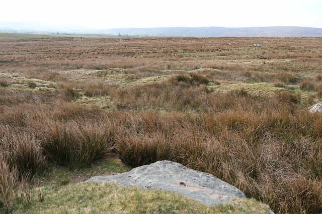
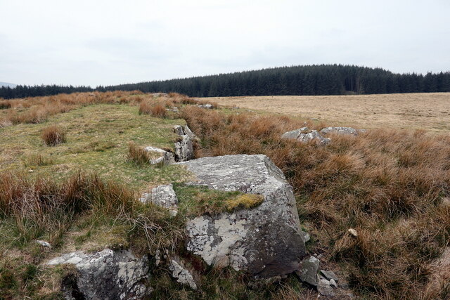
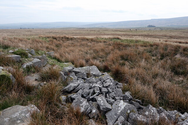
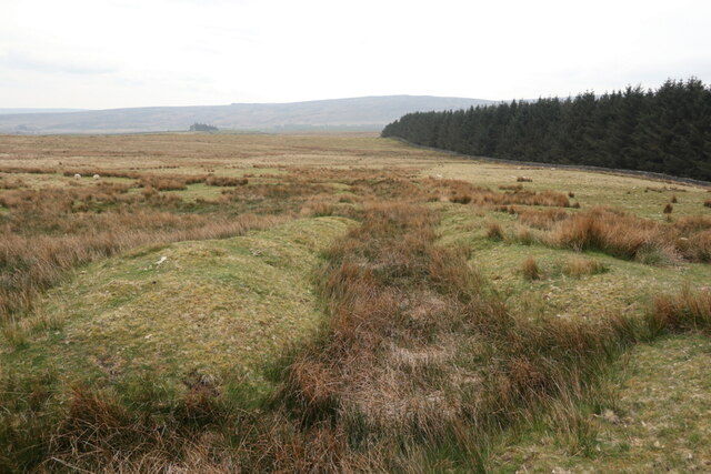
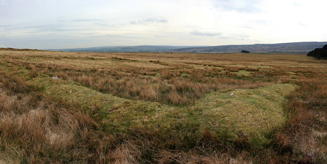
Roachburn Wood is a picturesque woodland located in the region of Cumberland, England. It is situated amidst the stunning landscape of the Downs and Moorland, offering visitors a unique and peaceful experience in nature. Covering an area of approximately 50 acres, Roachburn Wood is home to a diverse range of flora and fauna, making it a haven for wildlife enthusiasts and nature lovers.

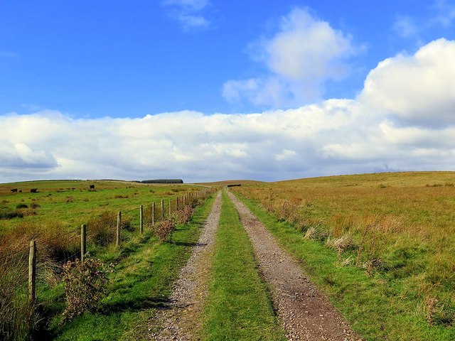
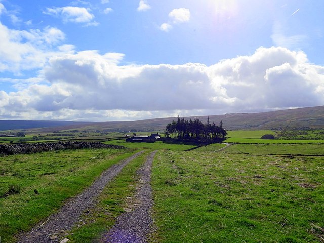
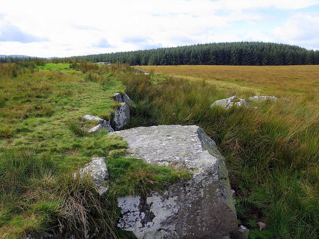
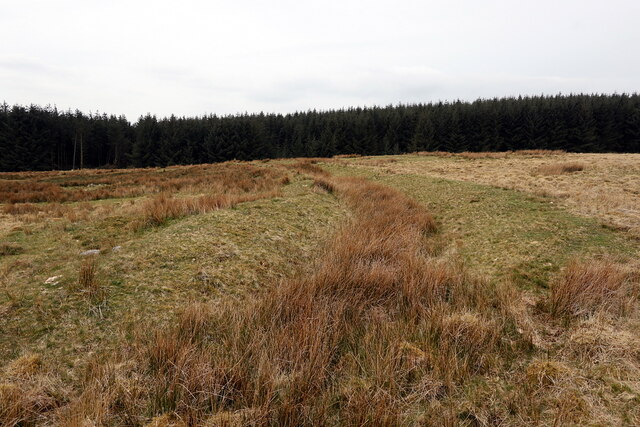
The woodland itself consists primarily of native broadleaf trees, including oak, beech, and birch, creating a dense and verdant canopy that provides shelter and habitat for a variety of wildlife species. Visitors can wander along well-maintained footpaths that wind through the wood, allowing them to immerse themselves in the tranquil surroundings.

Roachburn Wood is particularly renowned for its vibrant display of bluebells during the spring season, which transforms the forest floor into a breathtaking carpet of blue. This natural spectacle attracts many visitors who come to witness the beauty and serenity of the woodland.

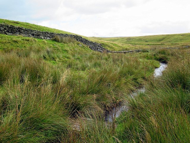
The wood also features a small stream that meanders through its heart, enhancing the scenic charm of the area. The sound of gently flowing water adds to the overall ambiance and provides a soothing backdrop for visitors as they explore the woodland.

For those seeking a peaceful retreat or an opportunity to reconnect with nature, Roachburn Wood in Cumberland is a must-visit destination. Its idyllic setting, diverse wildlife, and seasonal displays make it a haven for anyone looking to escape the hustle and bustle of everyday life.

If you have any feedback on the listing, please let us know in the comments section below.

Roachburn Wood Images

Images are sourced within 2km of 54.943366/-2.5830622 or Grid Reference NY6261. Thanks to Geograph Open Source API. All images are credited.

Riggfoot Farm and environs near Tindale A view of this pastoral scene captured from a footpath/cycleway utilising the route of a former railway.

This photograph was taken during the Coronavirus (COVID-19) pandemic of 2020/21/22.
Riggfoot Farm and environs near Tindale
A view of this pastoral scene captured from a footpath/cycleway utilising the route of a former railway. This photograph was taken during the Coronavirus (COVID-19) pandemic of 2020/21/22.
Riggfoot Farm
Riggfoot Farm
Track to Haining House
Haining House
Haining House
Hartleyburn Common from Stanniston Hill The wall on the right is the county boundary between Cumbria (left) and Northumberland (right).
Hartleyburn Common from Stanniston Hill
The wall on the right is the county boundary between Cumbria (left) and Northumberland (right).
Valley of Kellah Burn near Black Rigg
Kellah Burn
Kellah Burn
Kellah Burn east of Cocklit Hill
Cup-marked rock, Hartleyburn Common The heavily lichen-encrusted stone measures 0.83 x 0.61 metres and has an intricate design carved on its south to north sloping face. As good photographs have already been taken for the Northumberland & Durham Rock Art Project no further disturbance was caused although motifs below the ground surface at the north end are less eroded and well preserved.

The motifs consist of approximately 15 single cups scattered about the surface, 10 cups with single rings, some of which are joined, and a further four cups possibly with rings or partial rings. A number of short grooves may also connect motifs, but the busy design makes this difficult to determine.

At the south end, the stone is heavily lichen encrusted and only one cup in this area appears to have a ring. At the north end, the majority of cups have rings or partial rings and tooling marks are present in most motifs, suggesting this end at least, has been covered for millennia.

Within 30 metres north, three cairns of varying size can be found, the sloping carved surface looks towards this area. Evidence of possible cord rigg 40 metres west and also piles of clearance stone mean the area was cultivated in the later prehistoric.

Hartleyburn Common 5 (ERA-749) <span class="nowrap"><a title="http://archaeologydataservice.ac.uk/era/section/panel/overview.jsf?eraId=749" rel="nofollow ugc noopener" href="http://archaeologydataservice.ac.uk/era/section/panel/overview.jsf?eraId=749">Link</a><img style="margin-left:2px;" alt="External link" title="External link - shift click to open in new window" src="https://s1.geograph.org.uk/img/external.png" width="10" height="10"/></span>
Cup-marked rock, Hartleyburn Common
The heavily lichen-encrusted stone measures 0.83 x 0.61 metres and has an intricate design carved on its south to north sloping face. As good photographs have already been taken for the Northumberland & Durham Rock Art Project no further disturbance was caused although motifs below the ground surface at the north end are less eroded and well preserved. The motifs consist of approximately 15 single cups scattered about the surface, 10 cups with single rings, some of which are joined, and a further four cups possibly with rings or partial rings. A number of short grooves may also connect motifs, but the busy design makes this difficult to determine. At the south end, the stone is heavily lichen encrusted and only one cup in this area appears to have a ring. At the north end, the majority of cups have rings or partial rings and tooling marks are present in most motifs, suggesting this end at least, has been covered for millennia. Within 30 metres north, three cairns of varying size can be found, the sloping carved surface looks towards this area. Evidence of possible cord rigg 40 metres west and also piles of clearance stone mean the area was cultivated in the later prehistoric. Hartleyburn Common 5 (ERA-749) LinkExternal link
Cup-marked rock, Hartleyburn Common The rock is on the edge of a shallow quarry <a href="https://www.geograph.org.uk/photo/603292">NY6361 : Disused quarry, Hartleyburn Common</a>

The upper surface of the slab near the outer quarried edge shows cup marks and linear striations although it cannot be certain whether these are natural or artificial. It was recorded by Stan Beckensall as 'Hartleyburn Common 1a' <span class="nowrap"><a title="http://rockart.ncl.ac.uk/panel_detail.asp?pi=742" rel="nofollow ugc noopener" href="http://rockart.ncl.ac.uk/panel_detail.asp?pi=742">Link</a><img style="margin-left:2px;" alt="External link" title="External link - shift click to open in new window" src="https://s1.geograph.org.uk/img/external.png" width="10" height="10"/></span>

Photos on the ERA website (ERA-742) <span class="nowrap"><a title="http://archaeologydataservice.ac.uk/era/section/panel/overview.jsf?eraId=742" rel="nofollow ugc noopener" href="http://archaeologydataservice.ac.uk/era/section/panel/overview.jsf?eraId=742">Link</a><img style="margin-left:2px;" alt="External link" title="External link - shift click to open in new window" src="https://s1.geograph.org.uk/img/external.png" width="10" height="10"/></span> were taken in good natural light and would be hard to better.
Cup-marked rock, Hartleyburn Common
The rock is on the edge of a shallow quarry NY6361 : Disused quarry, Hartleyburn Common The upper surface of the slab near the outer quarried edge shows cup marks and linear striations although it cannot be certain whether these are natural or artificial. It was recorded by Stan Beckensall as 'Hartleyburn Common 1a' LinkExternal link Photos on the ERA website (ERA-742) LinkExternal link were taken in good natural light and would be hard to better.
Hartleyburn Common (North Side) View towards the forest plantation of Denton Fell just over the wall which marks the county boundary between Northumberland and Cumbria. Low Hill is the high point within the plantation.
Hartleyburn Common (North Side)
View towards the forest plantation of Denton Fell just over the wall which marks the county boundary between Northumberland and Cumbria. Low Hill is the high point within the plantation.
Pennine Way near Cross Rigg
Old quarry above Ash Cleugh
Old quarry near The Curricks Strangely thought it looked familiar <a href="https://www.geograph.org.uk/photo/4675152">NY6361 : Cup-marked rock, Hartleyburn Common</a>
Old quarry near The Curricks
Strangely thought it looked familiar NY6361 : Cup-marked rock, Hartleyburn Common
Disused quarry near The Curricks
The Curricks Camp, Hartleyburn The Curricks is an earthwork enclosure, almost rectangular in shape measuring about 73m north-south by 60m east-west. It has two banks and a ditch around it and an entrance through the east side. Inside the enclosure are two platforms and some low banks or walls. This was probably a small farm built in the Iron Age or Roman period, but has been re-used in medieval times. A medieval shieling has been built into the bank near the entrance and two long banks seem to form a much larger outer enclosure to the west. It is a Scheduled Monument protected by law.
Keys to the Past: <span class="nowrap"><a title="http://www.keystothepast.info/article/10339/site-Details?PRN=N6102" rel="nofollow ugc noopener" href="http://www.keystothepast.info/article/10339/site-Details?PRN=N6102">Link</a><img style="margin-left:2px;" alt="External link" title="External link - shift click to open in new window" src="https://s1.geograph.org.uk/img/external.png" width="10" height="10"/></span> <span class="nowrap"><a title="https://web.archive.org/web/20210426163905/http://www.keystothepast.info/article/10339/site-Details?PRN=N6102" rel="nofollow ugc noopener" href="https://web.archive.org/web/20210426163905/http://www.keystothepast.info/article/10339/site-Details?PRN=N6102">Archive Link</a><img style="margin-left:2px;" alt="External link" title="External link - shift click to open in new window" src="https://s1.geograph.org.uk/img/external.png" width="10" height="10"/></span>
Historic England: <span class="nowrap"><a title="https://historicengland.org.uk/listing/the-list/list-entry/1006494" rel="nofollow ugc noopener" href="https://historicengland.org.uk/listing/the-list/list-entry/1006494">Link</a><img style="margin-left:2px;" alt="External link" title="External link - shift click to open in new window" src="https://s1.geograph.org.uk/img/external.png" width="10" height="10"/></span>
Historic England Research Records: <span class="nowrap"><a title="https://www.heritagegateway.org.uk/Gateway/Results_Single.aspx?uid=14111&resourceID=19191" rel="nofollow ugc noopener" href="https://www.heritagegateway.org.uk/Gateway/Results_Single.aspx?uid=14111&resourceID=19191">Link</a><img style="margin-left:2px;" alt="External link" title="External link - shift click to open in new window" src="https://s1.geograph.org.uk/img/external.png" width="10" height="10"/></span> <span class="nowrap"><a title="https://web.archive.org/web/20210501125351/https://www.heritagegateway.org.uk/Gateway/Results_Single.aspx?uid=14111&resourceID=19191" rel="nofollow ugc noopener" href="https://web.archive.org/web/20210501125351/https://www.heritagegateway.org.uk/Gateway/Results_Single.aspx?uid=14111&resourceID=19191">Archive Link</a><img style="margin-left:2px;" alt="External link" title="External link - shift click to open in new window" src="https://s1.geograph.org.uk/img/external.png" width="10" height="10"/></span>
The Curricks Camp, Hartleyburn
The Curricks is an earthwork enclosure, almost rectangular in shape measuring about 73m north-south by 60m east-west. It has two banks and a ditch around it and an entrance through the east side. Inside the enclosure are two platforms and some low banks or walls. This was probably a small farm built in the Iron Age or Roman period, but has been re-used in medieval times. A medieval shieling has been built into the bank near the entrance and two long banks seem to form a much larger outer enclosure to the west. It is a Scheduled Monument protected by law. Keys to the Past: LinkExternal link Archive LinkExternal link Historic England: LinkExternal link Historic England Research Records: LinkExternal link Archive LinkExternal link
The Curricks Camp, Hartleyburn Common The Curricks is an earthwork enclosure, almost rectangular in shape measuring about 73m north-south by 60m east-west. It has two banks and a ditch around it and an entrance through the east side. Inside the enclosure are two platforms and some low banks or walls. This was probably a small farm built in the Iron Age or Roman period, but has been re-used in medieval times. A medieval shieling has been built into the bank near the entrance and two long banks seem to form a much larger outer enclosure to the west. It is a Scheduled Monument protected by law.
Keys to the Past: <span class="nowrap"><a title="http://www.keystothepast.info/article/10339/site-Details?PRN=N6102" rel="nofollow ugc noopener" href="http://www.keystothepast.info/article/10339/site-Details?PRN=N6102">Link</a><img style="margin-left:2px;" alt="External link" title="External link - shift click to open in new window" src="https://s1.geograph.org.uk/img/external.png" width="10" height="10"/></span> <span class="nowrap"><a title="https://web.archive.org/web/20210426163905/http://www.keystothepast.info/article/10339/site-Details?PRN=N6102" rel="nofollow ugc noopener" href="https://web.archive.org/web/20210426163905/http://www.keystothepast.info/article/10339/site-Details?PRN=N6102">Archive Link</a><img style="margin-left:2px;" alt="External link" title="External link - shift click to open in new window" src="https://s1.geograph.org.uk/img/external.png" width="10" height="10"/></span>
Historic England: <span class="nowrap"><a title="https://historicengland.org.uk/listing/the-list/list-entry/1006494" rel="nofollow ugc noopener" href="https://historicengland.org.uk/listing/the-list/list-entry/1006494">Link</a><img style="margin-left:2px;" alt="External link" title="External link - shift click to open in new window" src="https://s1.geograph.org.uk/img/external.png" width="10" height="10"/></span>
Historic England Research Records: <span class="nowrap"><a title="https://www.heritagegateway.org.uk/Gateway/Results_Single.aspx?uid=14111&resourceID=19191" rel="nofollow ugc noopener" href="https://www.heritagegateway.org.uk/Gateway/Results_Single.aspx?uid=14111&resourceID=19191">Link</a><img style="margin-left:2px;" alt="External link" title="External link - shift click to open in new window" src="https://s1.geograph.org.uk/img/external.png" width="10" height="10"/></span> <span class="nowrap"><a title="https://web.archive.org/web/20210501125351/https://www.heritagegateway.org.uk/Gateway/Results_Single.aspx?uid=14111&resourceID=19191" rel="nofollow ugc noopener" href="https://web.archive.org/web/20210501125351/https://www.heritagegateway.org.uk/Gateway/Results_Single.aspx?uid=14111&resourceID=19191">Archive Link</a><img style="margin-left:2px;" alt="External link" title="External link - shift click to open in new window" src="https://s1.geograph.org.uk/img/external.png" width="10" height="10"/></span>
The Curricks Camp, Hartleyburn Common
The Curricks is an earthwork enclosure, almost rectangular in shape measuring about 73m north-south by 60m east-west. It has two banks and a ditch around it and an entrance through the east side. Inside the enclosure are two platforms and some low banks or walls. This was probably a small farm built in the Iron Age or Roman period, but has been re-used in medieval times. A medieval shieling has been built into the bank near the entrance and two long banks seem to form a much larger outer enclosure to the west. It is a Scheduled Monument protected by law. Keys to the Past: LinkExternal link Archive LinkExternal link Historic England: LinkExternal link Historic England Research Records: LinkExternal link Archive LinkExternal link
Show me another place!

Roachburn Wood is located at Grid Ref: NY6261 (Lat: 54.943366, Lng: -2.5830622)

Administrative County: Cumbria

District: Carlisle

Police Authority: Cumbria

What 3 Words

///then.intruded.flux. Near Greenhead, Northumberland

Related Wikis

Tindale, Cumbria

Tindale or Tindale Fell is a hamlet in the parish of Farlam in the City of Carlisle district of the English county of Cumbria. It is to the south of the...

Midgeholme Coalfield

The Midgeholme Coalfield is a coalfield in Midgeholme, on the border of Cumbria with Northumberland in northern England. It is the largest of a series...

Nether Denton

Nether Denton is a scattered settlement and civil parish in rural Cumbria, England, situated about 12 miles (19 km) north-east of Carlisle, by the A69...

Geltsdale RSPB reserve

Geltsdale RSPB reserve is a nature reserve in Geltsdale, Cumbria, England. The Royal Society for the Protection of Birds manages the site for upland birds...

Midgeholme

Midgeholme is a hamlet and civil parish in City of Carlisle district, Cumbria, England. At the 2001 census the parish had a population of 67.The parish...

Halton Lea Gate

Halton Lea Gate is a small village in Northumberland, England, on the A689 road close to the boundary of the counties of Northumberland and Cumbria. The...

Upper Denton

Upper Denton is a small village and civil parish in the north of Cumbria, England, about 1 km north of the A69 road linking Haltwhistle and Brampton. The...

Hallbankgate

Hallbankgate is a village in Cumbria, England, 13 miles (21 km) east of Carlisle. A former coal and lead mining village, it straddles the A689 Brampton...

Have you been to Roachburn Wood?

Leave your review of Roachburn Wood below (or comments, questions and feedback).