Bleadale Moss

Downs, Moorland in Yorkshire Ribble Valley

England

Bleadale Moss

Fair Snape Fell trig
Fair Snape Fell trig Credit: Thomas Petersson

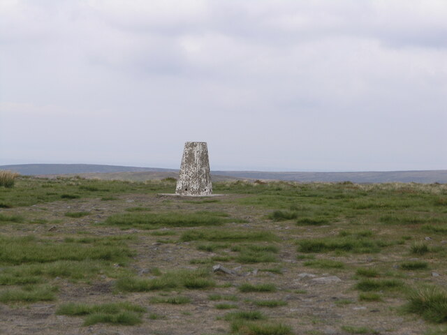
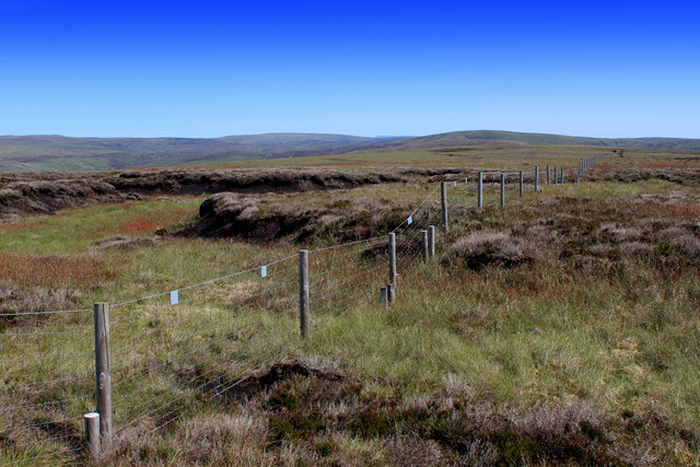
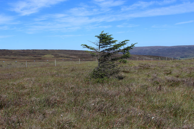
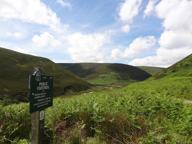
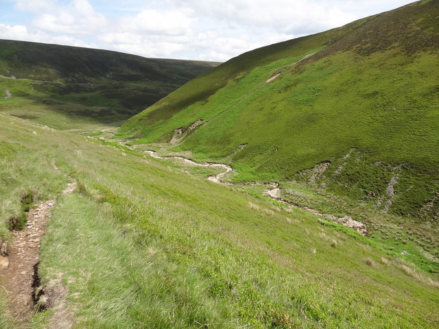
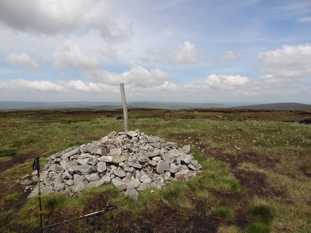
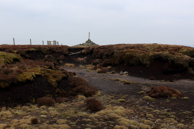
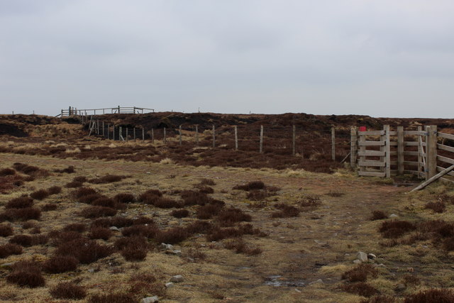
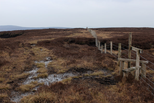
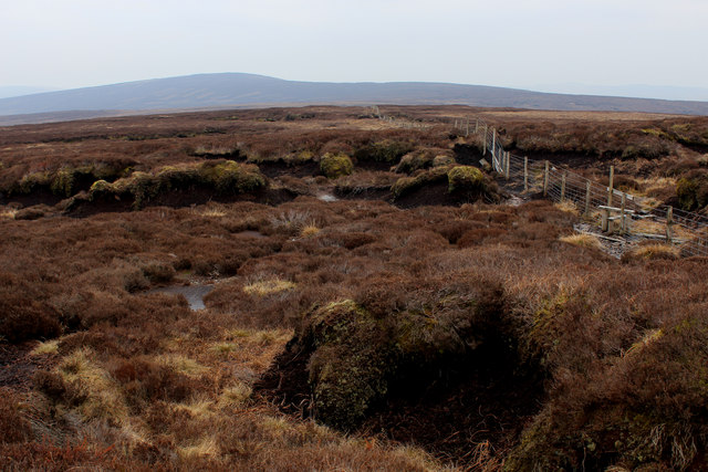
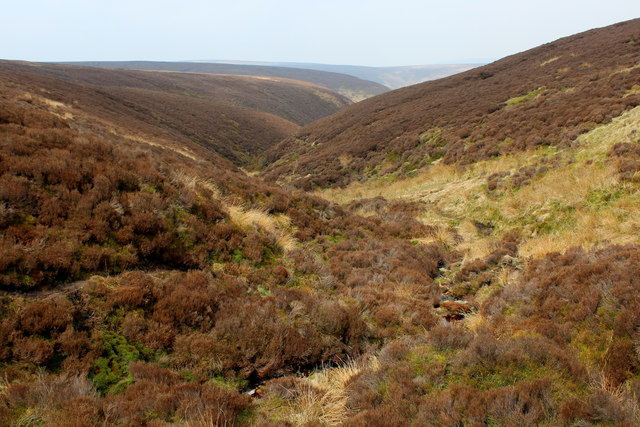
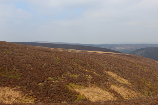
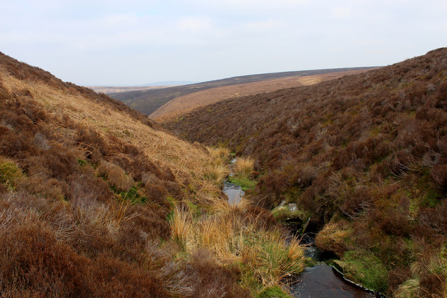
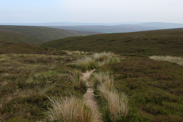
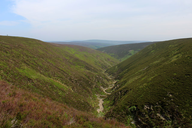
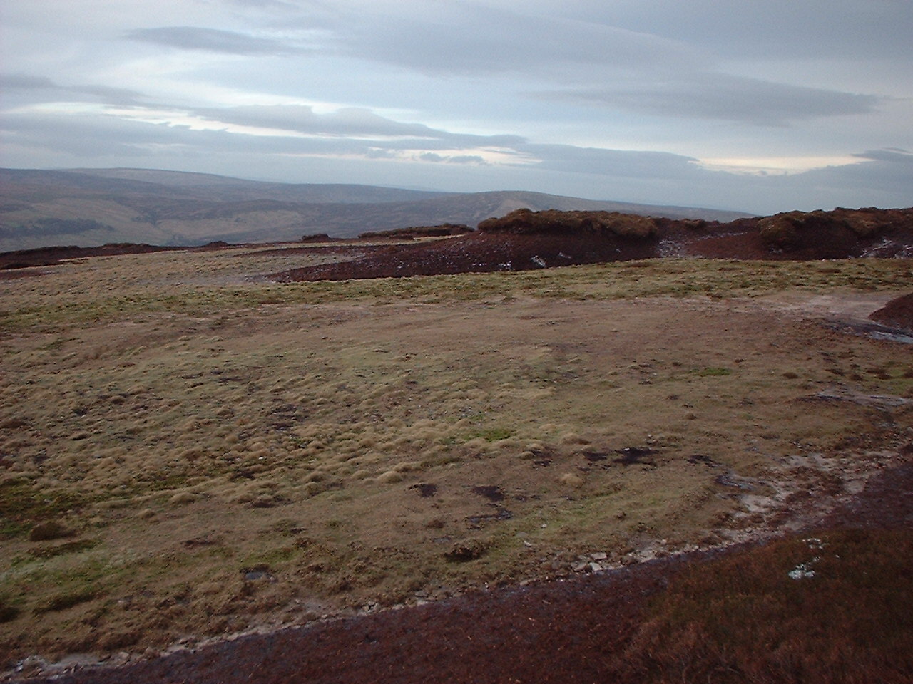
Bleadale Moss is a vast area of moorland located in the Yorkshire Downs region of Yorkshire, England. Stretching over several miles, it is a prominent feature of the landscape and attracts visitors from all around the country. The moorland is characterized by its rolling hills, heather-covered expanses, and numerous peat bogs.

The area is known for its diverse wildlife, with a wide range of species calling Bleadale Moss their home. Bird watchers are particularly drawn to the moorland, as it is home to various species, including curlews, lapwings, and golden plovers. The moorland also supports a variety of plant life, such as bilberry bushes, cotton grass, and bog mosses.

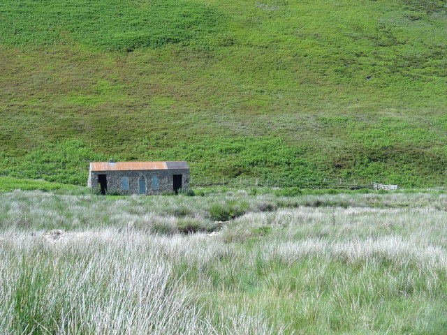
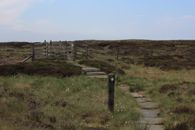
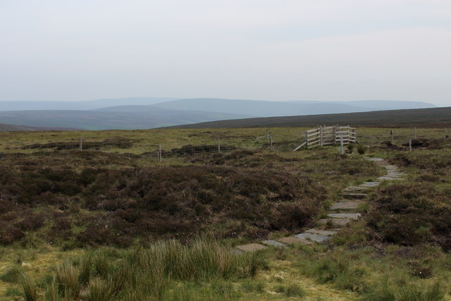
Bleadale Moss is a popular destination for outdoor enthusiasts and hikers due to its extensive network of footpaths and trails. These paths allow visitors to explore the moorland's beauty and take in the breathtaking views of the surrounding countryside. The area is also renowned for its tranquility and solitude, providing a peaceful escape from the hustle and bustle of city life.

Despite its natural beauty, Bleadale Moss faces some challenges. The peat bogs, which are a significant feature of the moorland, are prone to erosion and degradation. Conservation efforts are underway to protect and restore the fragile ecosystem of the area, ensuring its long-term sustainability.

In conclusion, Bleadale Moss is a captivating expanse of moorland in the Yorkshire Downs. Its unique landscape, diverse wildlife, and extensive footpaths make it an ideal destination for nature lovers and outdoor enthusiasts. However, ongoing efforts are necessary to preserve and protect this valuable natural resource for future generations.

If you have any feedback on the listing, please let us know in the comments section below.

Bleadale Moss Images

Images are sourced within 2km of 53.936383/-2.6051943 or Grid Reference SD6049. Thanks to Geograph Open Source API. All images are credited.

Fair Snape Fell trig
On Lingy Pits Lonely moorland in the form of peat groughs and haggs crossed by a boundary fence
On Lingy Pits
Lonely moorland in the form of peat groughs and haggs crossed by a boundary fence
Solitary Conifer on Lingy Pits The only tree in sight.
Closer examination reveals it is probably a Norwegian Spruce.
Solitary Conifer on Lingy Pits
The only tree in sight. Closer examination reveals it is probably a Norwegian Spruce.
Langden Castle OS map days "Langden Castle (ruin)" but it's not a castle and it's not a ruin.  Probably originally a shooting lodge.  not sure what it's used for now but it's well secured.
Langden Castle
OS map days "Langden Castle (ruin)" but it's not a castle and it's not a ruin. Probably originally a shooting lodge. not sure what it's used for now but it's well secured.
The path towards Fiendsdale Head Peaks and Northern Footpaths Society signpost no. 418
The path towards Fiendsdale Head
Peaks and Northern Footpaths Society signpost no. 418
Fiendsdale meanders Fiendsdale Water meanders before it joins Langden Beck.
Fiendsdale meanders
Fiendsdale Water meanders before it joins Langden Beck.
Cairn on the top With views across Bowland towards the Pennines
Cairn on the top
With views across Bowland towards the Pennines
Highest Point on Fair Snape Fell This lonely cairn marks the highest point on the Fair Snape Fell plateau, a good kilometre away from the trig point.
Highest Point on Fair Snape Fell
This lonely cairn marks the highest point on the Fair Snape Fell plateau, a good kilometre away from the trig point.
Boundary Fencing on the Fair Snape Fell Plateau
Fenceline on Saddle Fell The path on the watershed beside the fence is a trial of fortitude, especially in wet conditions
Fenceline on Saddle Fell
The path on the watershed beside the fence is a trial of fortitude, especially in wet conditions
Bleadale Water Tributary Headwaters Following the watershed on Saddle Fell has its problems.  This is one of them, a mass of soft wet peat in the form of groughs and haggs, which form pools of sluggish puddles, that gradually trickle northwards to form the headwaters of Bleadale Water.
Bleadale Water Tributary Headwaters
Following the watershed on Saddle Fell has its problems. This is one of them, a mass of soft wet peat in the form of groughs and haggs, which form pools of sluggish puddles, that gradually trickle northwards to form the headwaters of Bleadale Water.
Below Bleadale Grains Several narrow watercourses meet down here to form a tributary headwater for Bleadale Water.
Below Bleadale Grains
Several narrow watercourses meet down here to form a tributary headwater for Bleadale Water.
A Southern Bowland View
A View from beside a Tributary of Bleadale Water This took a fair bit of effort, fighting through knee high heather to negotiate myself into the extreme south eastern corner of this square.
A View from beside a Tributary of Bleadale Water
This took a fair bit of effort, fighting through knee high heather to negotiate myself into the extreme south eastern corner of this square.
Approaching Fiendsdale Head from the North The highest point on the path from Bleasdale to the Trough of Bowland
Approaching Fiendsdale Head from the North
The highest point on the path from Bleasdale to the Trough of Bowland
Approaching Fiendsdale Head from the South Highest point on the footpath between Bleasdale and the Trough of Bowland
Approaching Fiendsdale Head from the South
Highest point on the footpath between Bleasdale and the Trough of Bowland
Heading North towards Fiendsdale
Looking down Fiendsdale Water Running down a deep cleft on the moorland landscape, Fiendsdale Water acts as one of the main tributaries for Langdon Brook.
The footpath runs high up on the western bank.
Looking down Fiendsdale Water
Running down a deep cleft on the moorland landscape, Fiendsdale Water acts as one of the main tributaries for Langdon Brook. The footpath runs high up on the western bank.
Show me another place!

Bleadale Moss is located at Grid Ref: SD6049 (Lat: 53.936383, Lng: -2.6051943)

Division: West Riding

Administrative County: Lancashire

District: Ribble Valley

Police Authority: Lancashire

What 3 Words

///mothering.metro.practical. Near Longridge, Lancashire

Related Wikis

Forest of Bowland

The Forest of Bowland, also known as the Bowland Fells and formerly the Chase of Bowland, is an area of gritstone fells, deep valleys and peat moorland...

Hawthornthwaite Fell

Hawthornthwaite Fell is one of the larger hills in the Forest of Bowland in the north west of England. Hawthornthwaite Fell marks the extreme western limit...

National nature reserves in Lancashire

National nature reserves in Lancashire in England are established by Natural England. There are two national nature reserves in Lancashire, both of which...

Sykes Smelt Mill

Sykes Smelt Mill was a mediaeval mill located between Sykes and Hareden in Bowland Forest High, Lancashire, England. It stood on the banks of Langden Brook...

Parlick

Parlick (also known as Parlick Pike) is an approximately cone-shaped steep-sided hill at the extreme south of the main range of Bowland fells in Lancashire...

Trough of Bowland

The Trough of Bowland is a valley and high pass in the Forest of Bowland Area of Outstanding Natural Beauty, Lancashire, England. The pass, reaching 968...

Grey Stone of Trough

The Grey Stone of Trough is an historic boundary marker in Bowland Forest High, in the Trough of Bowland, Lancashire, England. A Grade II listed structure...

Bleasdale

Bleasdale is a village and civil parish in the Wyre district of Lancashire, England, in the Forest of Bowland Area of Outstanding Natural Beauty. The two...

Have you been to Bleadale Moss?

Leave your review of Bleadale Moss below (or comments, questions and feedback).