Modbury Withy Bed

Downs, Moorland in Dorset

England

Modbury Withy Bed

View from near Old Coastguard House The B3157 from Bridport passes over the coastal hills on its way to Abbotsbury and Weymouth. The village of Swyre lies in the valley just ahead, beyond which the road climbs Limekiln Hill. On the right can be seen the beach which is the northern extension of Chesil Beach and in the distance is Portland.
View from near Old Coastguard House Credit: Ron Strutt

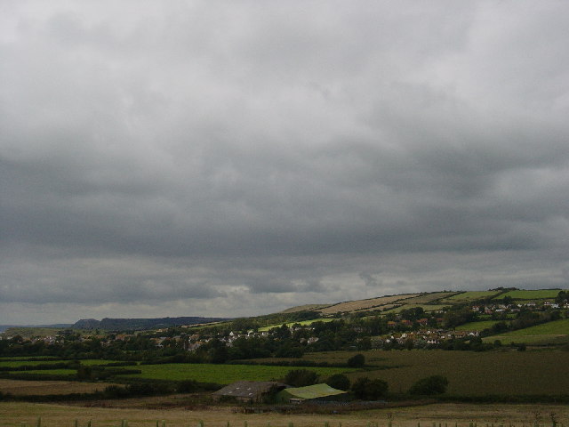
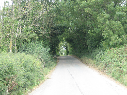
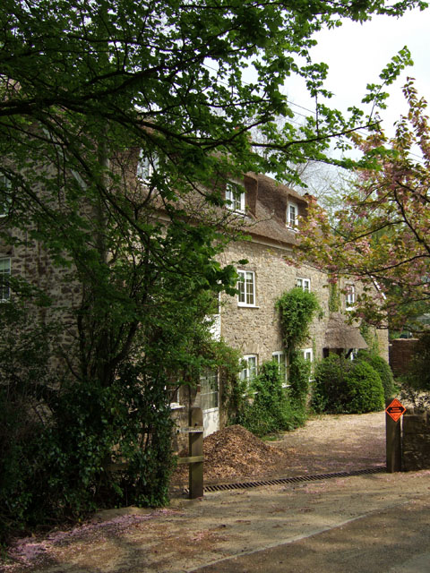
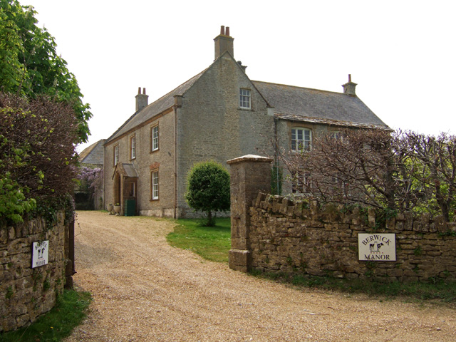
Modbury Withy Bed is a small village located in the county of Dorset, England. Situated on the South West Peninsula, the village is nestled amidst the picturesque scenery of the Downs and Moorland. The village itself is characterized by its charming cottages, which exude a traditional English countryside vibe.

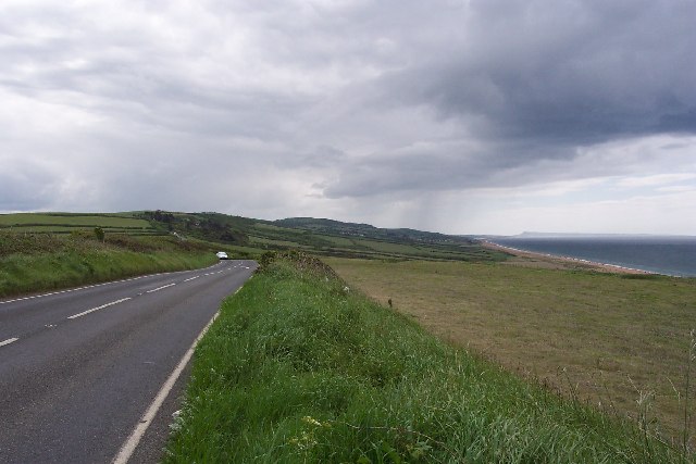
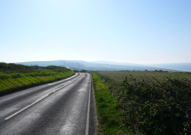
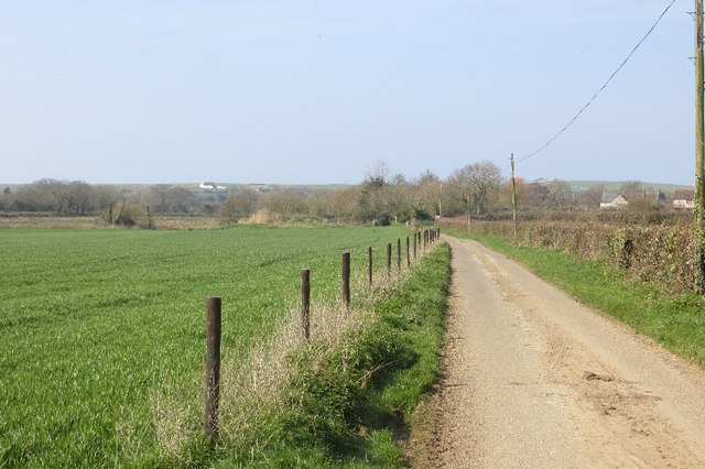
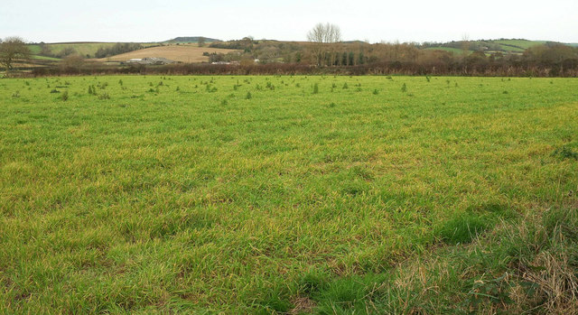
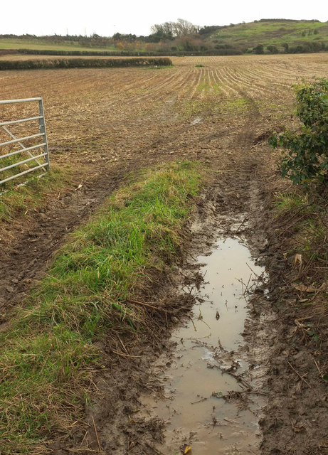
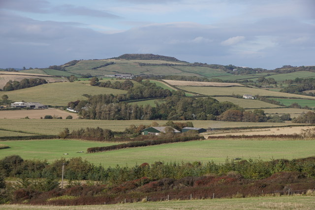
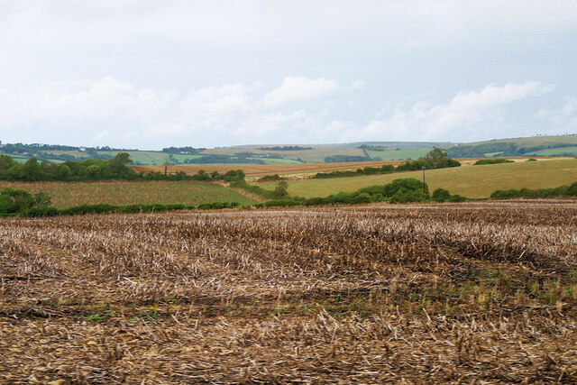
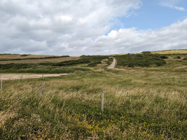
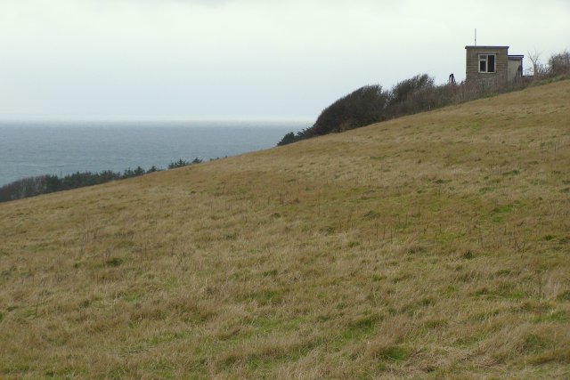
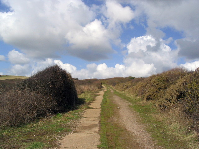
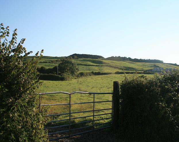
The Downs and Moorland surrounding Modbury Withy Bed offer breathtaking views and provide ample opportunities for outdoor enthusiasts. The rolling hills of the Downs provide a perfect setting for long walks, hiking, and horseback riding. The vast moorland, on the other hand, offers a serene escape and is home to a rich variety of flora and fauna.

Despite its small size, Modbury Withy Bed boasts a close-knit community that takes great pride in its local heritage. The villagers often come together to organize events and festivities, showcasing the village's vibrant culture. The village also has a quaint village pub and a few local shops, providing essentials for its residents and visitors.

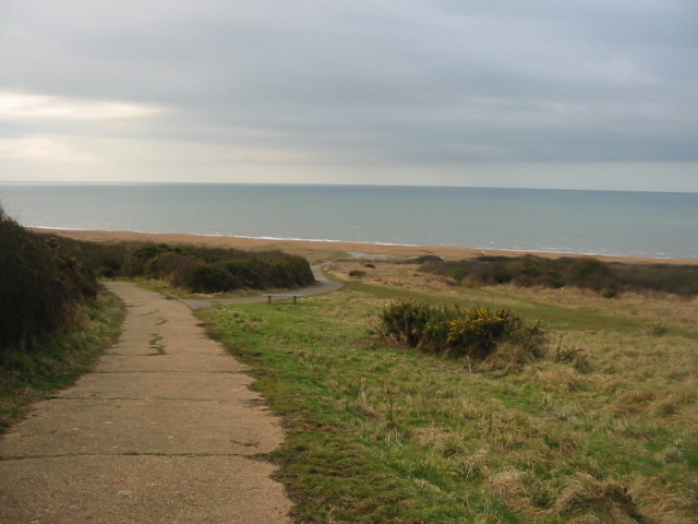
For those seeking historical and cultural experiences, Modbury Withy Bed is conveniently located near several notable attractions. The nearby town of Dorchester is renowned for its Roman ruins and museums, offering a glimpse into the region's rich history. The Jurassic Coast, a UNESCO World Heritage site, is also within easy reach, boasting stunning cliffs and beautiful beaches.

In summary, Modbury Withy Bed is a charming village nestled in the heart of Dorset's Downs and Moorland. With its scenic landscapes, close-knit community, and proximity to historical and cultural attractions, it offers a delightful retreat for nature lovers and history enthusiasts alike.

If you have any feedback on the listing, please let us know in the comments section below.

Modbury Withy Bed Images

Images are sourced within 2km of 50.70647/-2.6895078 or Grid Reference SY5189. Thanks to Geograph Open Source API. All images are credited.

View from near Old Coastguard House The B3157 from Bridport passes over the coastal hills on its way to Abbotsbury and Weymouth. The village of Swyre lies in the valley just ahead, beyond which the road climbs Limekiln Hill. On the right can be seen the beach which is the northern extension of Chesil Beach and in the distance is Portland.
View from near Old Coastguard House
The B3157 from Bridport passes over the coastal hills on its way to Abbotsbury and Weymouth. The village of Swyre lies in the valley just ahead, beyond which the road climbs Limekiln Hill. On the right can be seen the beach which is the northern extension of Chesil Beach and in the distance is Portland.
Burton Bradstock looking W with Golden Cap in distance
View towards Othona Looking East along the B3157 from a few metres west of the entrance drive to The Old Coastguard House on a sunny but very hazy morning. Othona can be made out as the dark trees in the middle distance with Green Hill to its left and Chesil Beach to the right. Othona is a 7-acre Christian community of about 8 people with up to 35 other people there on holiday on the beautiful Jurassic Coast. Sounds like heaven!
View towards Othona
Looking East along the B3157 from a few metres west of the entrance drive to The Old Coastguard House on a sunny but very hazy morning. Othona can be made out as the dark trees in the middle distance with Green Hill to its left and Chesil Beach to the right. Othona is a 7-acre Christian community of about 8 people with up to 35 other people there on holiday on the beautiful Jurassic Coast. Sounds like heaven!
Footpath across arable land Leading east from Annings Lane towards Graston Farm.
Footpath across arable land
Leading east from Annings Lane towards Graston Farm.
Annings Lane Looking towards Burton Bradstock.
Annings Lane
Looking towards Burton Bradstock.
Bride flood plain east of Burton Bradstock Looking right from where <a href="https://www.geograph.org.uk/photo/5630037">SY4989 : Bride flood plain east of Burton Bradstock</a> was taken. The farm left of centre is Peacehaven Farm.
Bride flood plain east of Burton Bradstock
Looking right from where SY4989 : Bride flood plain east of Burton Bradstock was taken. The farm left of centre is Peacehaven Farm.
Arable field by Bredy Road On the other side of the road from <a href="https://www.geograph.org.uk/photo/5630037">SY4989 : Bride flood plain east of Burton Bradstock</a>. A field boundary comes to an abrupt halt halfway across the field.
Arable field by Bredy Road
On the other side of the road from SY4989 : Bride flood plain east of Burton Bradstock. A field boundary comes to an abrupt halt halfway across the field.
Farmland east of Burton Bradstock From Bind Barrow.
Farmland east of Burton Bradstock
From Bind Barrow.
Field near Cogden Farm
Sheep Grazing near Beacon Nap
Track on Burton Common
Bredy Lane Bredy Lane as it crests Bredy North Hill, going towards Shipton Gorge.
Bredy Lane
Bredy Lane as it crests Bredy North Hill, going towards Shipton Gorge.
Burton Common This part of Burton Common gently slopes seawards, towards Cogden Beach. The building on the right looks as if it is a disused coastguard lookout. Otherwise it might be associated with the disused quarry beyond.
Burton Common
This part of Burton Common gently slopes seawards, towards Cogden Beach. The building on the right looks as if it is a disused coastguard lookout. Otherwise it might be associated with the disused quarry beyond.
The path from Cogden Beach This is the path down from the car park to the beach, looking back up the hill. It always seems much longer going up than it does going down!
The path from Cogden Beach
This is the path down from the car park to the beach, looking back up the hill. It always seems much longer going up than it does going down!
The Mill House near Clayhanger Former mill house on the minor road between Bridport and Litton Cheney, from the public footpath to the south.
The Mill House near Clayhanger
Former mill house on the minor road between Bridport and Litton Cheney, from the public footpath to the south.
The Mill House near Clayhanger (2)
Berwick Manor Farmhouse On the Bridport road. Grade II listed detached former Manor House, now a farmhouse. Fragments of a late C16 core exist in the north range. Early C19 rebuilding, with c.1900 alterations to north range. Note the stone tiles above the eaves of the roof fronting the camera. I can only guess these were used sparingly on the grounds of cost, and that they were in use prior to the widespread use of guttering. Perhaps it was because stone tiling could project further over the eaves, thus throwing off excess water well away from the walls. If anyone could offer an alternative explanation for the use of stone tiling at the eaves, the author would like to hear from them.
Berwick Manor Farmhouse
On the Bridport road. Grade II listed detached former Manor House, now a farmhouse. Fragments of a late C16 core exist in the north range. Early C19 rebuilding, with c.1900 alterations to north range. Note the stone tiles above the eaves of the roof fronting the camera. I can only guess these were used sparingly on the grounds of cost, and that they were in use prior to the widespread use of guttering. Perhaps it was because stone tiling could project further over the eaves, thus throwing off excess water well away from the walls. If anyone could offer an alternative explanation for the use of stone tiling at the eaves, the author would like to hear from them.
Show me another place!

Modbury Withy Bed is located at Grid Ref: SY5189 (Lat: 50.70647, Lng: -2.6895078)

Unitary Authority: Dorset

Police Authority: Dorset

What 3 Words

///beamed.upset.listening. Near Bridport, Dorset

Related Wikis

Chilcombe

Chilcombe is a hamlet and civil parish in Dorset, England, situated in the Dorset unitary authority administrative area about 4 miles (6.4 km) east of...

Swyre

Swyre ( ) is a small village and civil parish in southwest Dorset, England, situated in a valley beside Chesil Beach 6 miles (9.7 km) southeast of Bridport...

Holy Trinity Church, Swyre

Holy Trinity Church is a Church of England church in Swyre, Dorset, England. The oldest part of the church has been dated to the early 15th century, with...

Shipton Hill Settlement

The Shipton Hill Settlement is an archaeological site, a defended settlement of the Iron Age, near Shipton Gorge in Dorset, England. It is a scheduled...

Shipton Gorge

Shipton Gorge is a village and civil parish in southwest Dorset, England, 3 miles (4.8 km) east of Bridport. Dorset County Council's 2013 mid-year estimate...

Puncknowle

Puncknowle ( PUN-əl) is a village and civil parish in the county of Dorset in southwest England, situated on the southern slopes of the Bride Valley approximately...

Burton Bradstock

Burton Bradstock is a village and civil parish in Dorset, England, approximately 2+1⁄2 miles (4 km) southeast of Bridport and 1⁄2 mile (0.8 km) inland...

Askerswell

Askerswell () is a small village and civil parish in the county of Dorset in southwest England. It is sited on the small River Asker. It lies 11 miles...

Nearby Amenities

Located within 500m of 50.70647,-2.6895078
Modbury farm shop
Shop: convenience
Lat/Long: 50.7053487/-2.6837232
Ford: yes
Lat/Long: 50.7089033/-2.6850749
The data included in this document is from www.openstreetmap.org. The data is made available under ODbL.

Have you been to Modbury Withy Bed?

Leave your review of Modbury Withy Bed below (or comments, questions and feedback).