Crannel Moor

Downs, Moorland in Somerset Mendip

England

Crannel Moor

Junction, Godney See also <a href="https://www.geograph.org.uk/photo/2065537">ST4942 : Lane junction at Godney</a>, with a different view of the junction.
Junction, Godney Credit: Derek Harper

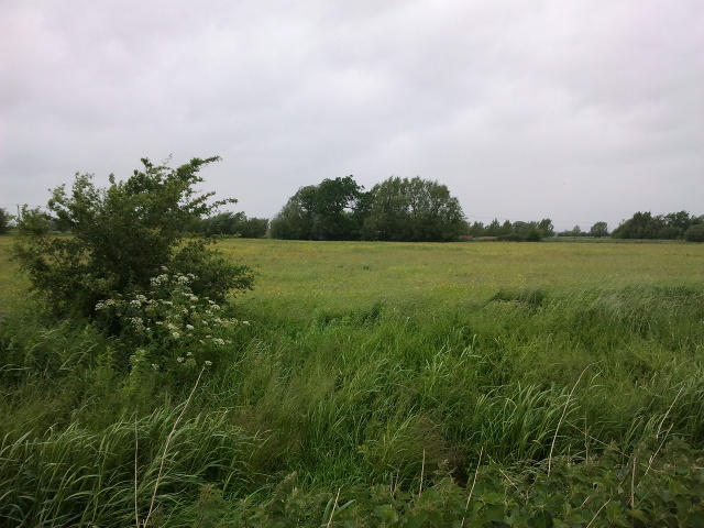
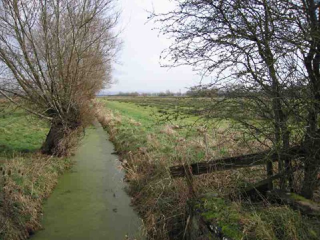
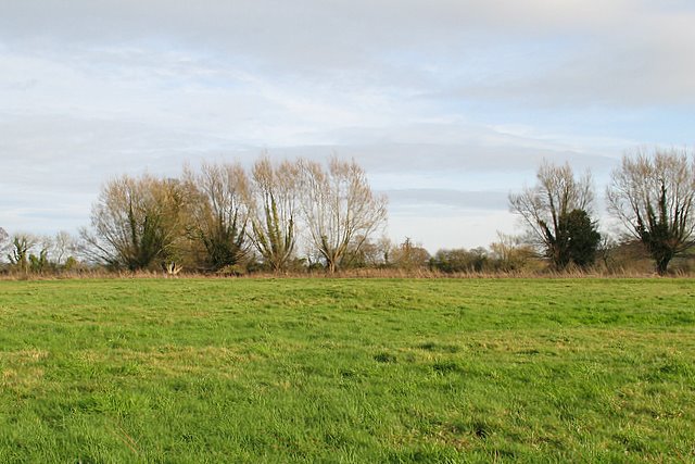
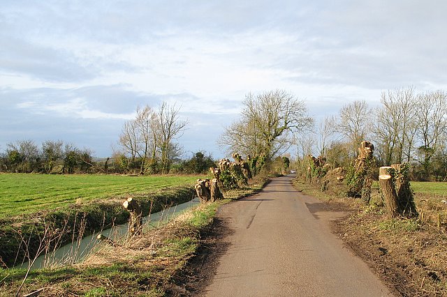
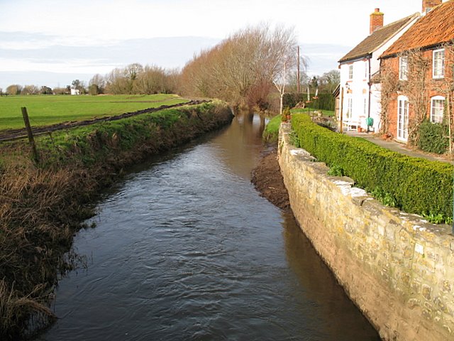
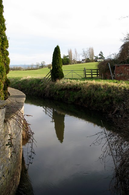
Crannel Moor is a picturesque area located in Somerset, England. Nestled amidst the stunning Somerset Downs, this moorland boasts breathtaking natural beauty. Covering a vast expanse of land, Crannel Moor is a haven for nature enthusiasts and outdoor adventurers.

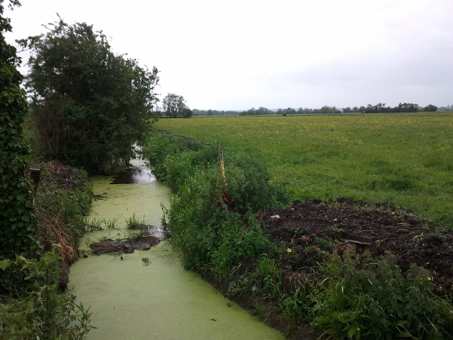
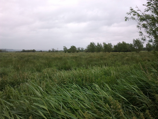
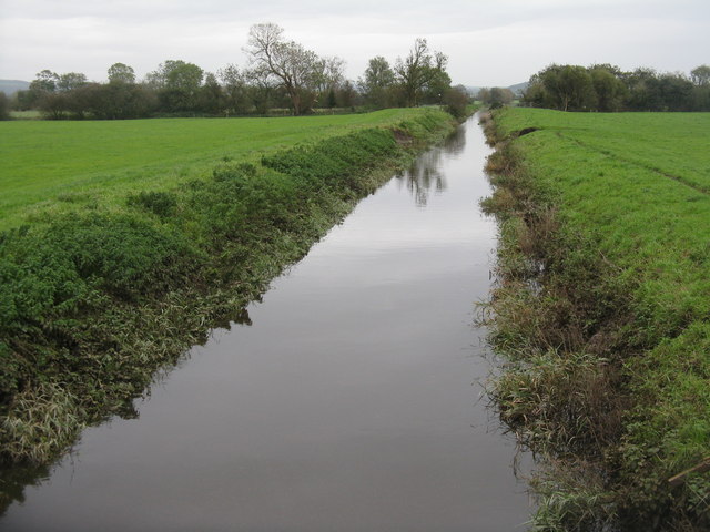
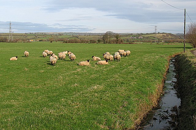
The moorland is characterized by its rolling hills, expansive grasslands, and fascinating rock formations. It is home to a diverse array of flora and fauna, making it a hotspot for wildlife observation and nature photography. Visitors can spot various species of birds, including skylarks and kestrels, as well as small mammals such as rabbits and foxes.

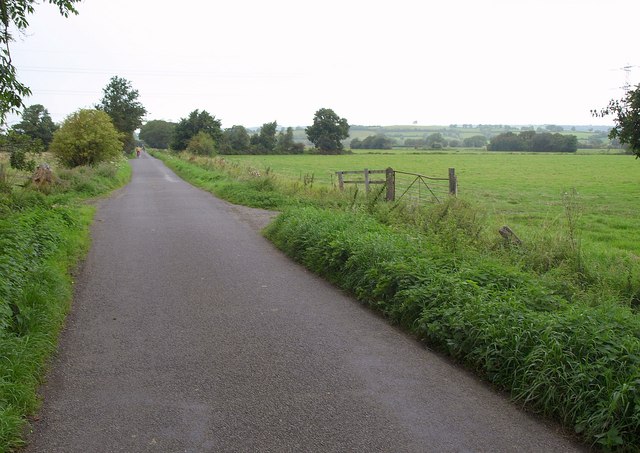
Crannel Moor offers a range of activities for visitors to enjoy. Walking and hiking trails crisscross the moorland, providing an opportunity to explore the area's natural wonders. The trails cater to all levels of fitness, from gentle strolls to more challenging treks. Additionally, the moorland is popular among cyclists, with many scenic cycling routes available.

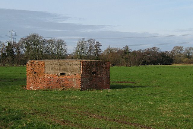
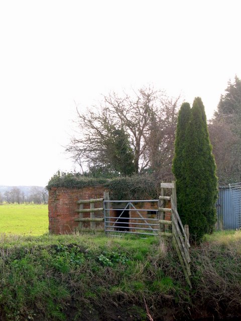
For those interested in history and archaeology, Crannel Moor offers a glimpse into the past. The area is scattered with ancient burial mounds and prehistoric remains, providing valuable insights into the region's rich heritage.

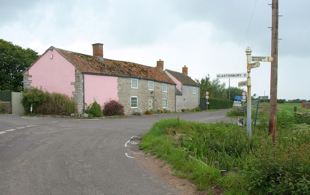
Crannel Moor is easily accessible, with ample parking facilities and nearby amenities. Whether it's a peaceful walk in nature, a birdwatching expedition, or an exploration of ancient history, Crannel Moor offers a captivating experience for visitors of all ages and interests.

If you have any feedback on the listing, please let us know in the comments section below.

Crannel Moor Images

Images are sourced within 2km of 51.175413/-2.70691 or Grid Reference ST5042. Thanks to Geograph Open Source API. All images are credited.

Junction, Godney See also <a href="https://www.geograph.org.uk/photo/2065537">ST4942 : Lane junction at Godney</a>, with a different view of the junction.
Junction, Godney
See also ST4942 : Lane junction at Godney, with a different view of the junction.
Godney Drove Running across the levels between Godney and Bleadney, becoming Yeap's Drove further north. It's starting to rain heavily.
Godney Drove
Running across the levels between Godney and Bleadney, becoming Yeap's Drove further north. It's starting to rain heavily.
Drain on the edge of a field next to Godney Road, looking south west
Looking east from Godney Road
Looking north west from Great Withy Drove
Flow Measuring Station on River Sheppey The River Sheppey is a significant watercourse on this part of the Somerset Levels, taking water from the foot of the Mendips at Wells, meandering around Godney and into the rhynes that feed the River Brue. 
The Environment Agency monitor the river flow and can thus predict flooding: data available at <span class="nowrap"><a title="http://www.environment-agency.gov.uk/homeandleisure/floods/riverlevels/riverstation.aspx?StationId=3054&RegionId=5&AreaId=9&CatchmentId=19" rel="nofollow ugc noopener" href="http://www.environment-agency.gov.uk/homeandleisure/floods/riverlevels/riverstation.aspx?StationId=3054&RegionId=5&AreaId=9&CatchmentId=19">Link</a><img style="margin-left:2px;" alt="External link" title="External link - shift click to open in new window" src="https://s1.geograph.org.uk/img/external.png" width="10" height="10"/></span>
Flow Measuring Station on River Sheppey
The River Sheppey is a significant watercourse on this part of the Somerset Levels, taking water from the foot of the Mendips at Wells, meandering around Godney and into the rhynes that feed the River Brue. The Environment Agency monitor the river flow and can thus predict flooding: data available at LinkExternal link
Division Rhyne at Godney Looking east from the bridge carrying Godney Road over the rhyne.
Division Rhyne at Godney
Looking east from the bridge carrying Godney Road over the rhyne.
Batch Farm Looking over the fields from the Godney Road bridge over the Division Rhyne.
Batch Farm
Looking over the fields from the Godney Road bridge over the Division Rhyne.
Pill Box in Godney I've come across several of these on the levels. Heaven knows what they were defending!
Pill Box in Godney
I've come across several of these on the levels. Heaven knows what they were defending!
East Backwater Rhyne Apparently, there used to be a village and a lake southeast of here in the next square <a title="https://www.geograph.org.uk/photo/675683" href="https://www.geograph.org.uk/photo/675683">Link</a> . If you go into Glastonbury High Street and find some local books, you can find reference to it.
East Backwater Rhyne
Apparently, there used to be a village and a lake southeast of here in the next square Link . If you go into Glastonbury High Street and find some local books, you can find reference to it.
Derelict House on the Levels It amazes me that there are houses on the levels. They must flood from time to time and what with global warming!!! The area is marked as Piggery on the 25,000 map but there are no pigs there now.
Derelict House on the Levels
It amazes me that there are houses on the levels. They must flood from time to time and what with global warming!!! The area is marked as Piggery on the 25,000 map but there are no pigs there now.
Glastonbury Lake Village site It looks like an ordinary field but is in fact the site of the Glastonbury Lake Village - a Scheduled Ancient Monument.

A small mound can be seen in the centre of the field in the photograph - and it was this and other mounds in the field which lead to the discovery of the site in 1892 by Arthur Bulleid.  The site was excavated by Bulleid and others between 1892-1898 and then 1904-1907.  The wealth of artefacts discovered are on display at the Tribunal Museum in Glastonbury.  

In 1984 a restricted examination/excavation of the Lake Village site was carried out by the Somerset Levels Project led by J. M. and B. J. Coles.  I know this because I was there digging!
Glastonbury Lake Village site
It looks like an ordinary field but is in fact the site of the Glastonbury Lake Village - a Scheduled Ancient Monument. A small mound can be seen in the centre of the field in the photograph - and it was this and other mounds in the field which lead to the discovery of the site in 1892 by Arthur Bulleid. The site was excavated by Bulleid and others between 1892-1898 and then 1904-1907. The wealth of artefacts discovered are on display at the Tribunal Museum in Glastonbury. In 1984 a restricted examination/excavation of the Lake Village site was carried out by the Somerset Levels Project led by J. M. and B. J. Coles. I know this because I was there digging!
Godney Road This straight road runs from the outskirts of Glastonbury, through moorland of less than 5m in height, to the small village of Godney.  Many of the trees parallel to the road have recently been cut back or pollarded.
Godney Road
This straight road runs from the outskirts of Glastonbury, through moorland of less than 5m in height, to the small village of Godney. Many of the trees parallel to the road have recently been cut back or pollarded.
Type 29 Pill Box on 'Stop Line Green' This pill box is in Upper Godney just to the north of the river Sheppey.

Stop Line Green was a 100 mile continuous semi-circular defensive line (also known as Bristol Outer Defences). It ran from Highbridge on the Bristol Channel in the south to Upper Framilode on the river Severn in the north. It was a last line of defence against an attack from the east and was built on the assumption that the Germans had already advanced this far west. It was designed to defend Bristol and so keep the port open for evacuation, resupply or reinforcements. There were many other 'stop lines' in Southern Britain, with different colour codes, all designed to be a hindrance to tanks in the event of an invasion. (Taken from 'Warwalks - Stop Line Green' by Major Green - 1999.)
Type 29 Pill Box on 'Stop Line Green'
This pill box is in Upper Godney just to the north of the river Sheppey. Stop Line Green was a 100 mile continuous semi-circular defensive line (also known as Bristol Outer Defences). It ran from Highbridge on the Bristol Channel in the south to Upper Framilode on the river Severn in the north. It was a last line of defence against an attack from the east and was built on the assumption that the Germans had already advanced this far west. It was designed to defend Bristol and so keep the port open for evacuation, resupply or reinforcements. There were many other 'stop lines' in Southern Britain, with different colour codes, all designed to be a hindrance to tanks in the event of an invasion. (Taken from 'Warwalks - Stop Line Green' by Major Green - 1999.)
Sheep Grazing Sheep grazing on low lying pasture near the village of Upper Godney on the Somerset Levels.  The Mendip Hills can be seen in the far distance.
Sheep Grazing
Sheep grazing on low lying pasture near the village of Upper Godney on the Somerset Levels. The Mendip Hills can be seen in the far distance.
Pill Box in Upper Godney This Pill Box is just to the south of the river Sheppey and is nowhere near as obvious as the other pill box in this square as it is behind a farm making it somewhat inaccessible.  It is a Type 29 Pill Box on 'Stop Line Green'.

Stop Line Green was a 100 mile continuous semi-circular defensive line (also known as Bristol Outer Defences). It ran from Highbridge on the Bristol Channel in the south to Upper Framilode on the river Severn in the north. It was a last line of defence against an attack from the east and was built on the assumption that the Germans had already advanced this far west. It was designed to defend Bristol and so keep the port open for evacuation, resupply or reinforcements. There were many other 'stop lines' in Southern Britain, with different colour codes, all designed to be a hindrance to tanks in the event of an invasion. (Taken from 'Warwalks - Stop Line Green' by Major Green - 1999.)
Pill Box in Upper Godney
This Pill Box is just to the south of the river Sheppey and is nowhere near as obvious as the other pill box in this square as it is behind a farm making it somewhat inaccessible. It is a Type 29 Pill Box on 'Stop Line Green'. Stop Line Green was a 100 mile continuous semi-circular defensive line (also known as Bristol Outer Defences). It ran from Highbridge on the Bristol Channel in the south to Upper Framilode on the river Severn in the north. It was a last line of defence against an attack from the east and was built on the assumption that the Germans had already advanced this far west. It was designed to defend Bristol and so keep the port open for evacuation, resupply or reinforcements. There were many other 'stop lines' in Southern Britain, with different colour codes, all designed to be a hindrance to tanks in the event of an invasion. (Taken from 'Warwalks - Stop Line Green' by Major Green - 1999.)
River Sheppey in Upper Godney - facing west The River Sheppey is a tributary of the river Brue.  It originates in the Mendips; the source being a group of springs to the west of the settlement of Doulting where water draining through the limestone of the Mendips appears. From Doulting the Sheppey flows southwest through the wetlands to the north of the Polden Hills. At Charlton parts of the rivers course have been culverted and the river flows beneath ground through Shepton Mallet. 

The river reappears at Darshill and its course continues southwest through Croscombe, Dinder, Woodford, Coxley. From Coxley the course of the river heads north through Hay Moor and North Moor, wetlands, supplied and drained by the river. The river continues west through Ash Moor, here the river course turns sharply to the south through Frogmore and west through Godney. At Lower Godney the river is channelled through the ‘James Wear River’ and the ‘Decoy Rhine’to Westhay Level where it joins ‘Whites River’ and then the River Brue. No part of the Sheppey is tidal.
River Sheppey in Upper Godney - facing west
The River Sheppey is a tributary of the river Brue. It originates in the Mendips; the source being a group of springs to the west of the settlement of Doulting where water draining through the limestone of the Mendips appears. From Doulting the Sheppey flows southwest through the wetlands to the north of the Polden Hills. At Charlton parts of the rivers course have been culverted and the river flows beneath ground through Shepton Mallet. The river reappears at Darshill and its course continues southwest through Croscombe, Dinder, Woodford, Coxley. From Coxley the course of the river heads north through Hay Moor and North Moor, wetlands, supplied and drained by the river. The river continues west through Ash Moor, here the river course turns sharply to the south through Frogmore and west through Godney. At Lower Godney the river is channelled through the ‘James Wear River’ and the ‘Decoy Rhine’to Westhay Level where it joins ‘Whites River’ and then the River Brue. No part of the Sheppey is tidal.
River Sheppey in Upper Godney - facing east The River Sheppey is a tributary of the river Brue.  It originates in the Mendips; the source being a group of springs to the west of the settlement of Doulting where water draining through the limestone of the Mendips appears. From Doulting the Sheppey flows southwest through the wetlands to the north of the Polden Hills. At Charlton parts of the rivers course have been culverted and the river flows beneath ground through Shepton Mallet. 

The river reappears at Darshill and its course continues southwest through Croscombe, Dinder, Woodford, Coxley. From Coxley the course of the river heads north through Hay Moor and North Moor, wetlands, supplied and drained by the river. The river continues west through Ash Moor, here the river course turns sharply to the south through Frogmore and west through Godney. At Lower Godney the river is channelled through the ‘James Wear River’ and the ‘Decoy Rhine’to Westhay Level where it joins ‘Whites River’ and then the River Brue. No part of the Sheppey is tidal.
River Sheppey in Upper Godney - facing east
The River Sheppey is a tributary of the river Brue. It originates in the Mendips; the source being a group of springs to the west of the settlement of Doulting where water draining through the limestone of the Mendips appears. From Doulting the Sheppey flows southwest through the wetlands to the north of the Polden Hills. At Charlton parts of the rivers course have been culverted and the river flows beneath ground through Shepton Mallet. The river reappears at Darshill and its course continues southwest through Croscombe, Dinder, Woodford, Coxley. From Coxley the course of the river heads north through Hay Moor and North Moor, wetlands, supplied and drained by the river. The river continues west through Ash Moor, here the river course turns sharply to the south through Frogmore and west through Godney. At Lower Godney the river is channelled through the ‘James Wear River’ and the ‘Decoy Rhine’to Westhay Level where it joins ‘Whites River’ and then the River Brue. No part of the Sheppey is tidal.
Show me another place!

Crannel Moor is located at Grid Ref: ST5042 (Lat: 51.175413, Lng: -2.70691)

Administrative County: Somerset

District: Mendip

Police Authority: Avon and Somerset

What 3 Words

///soggy.surgical.dockers. Near Glastonbury, Somerset

Nearby Locations

Crannel Moor

Related Wikis

St Cuthbert Out

St Cuthbert Out, sometimes Wells St Cuthbert Out, is a civil parish in the Mendip district of Somerset, England. It entirely surrounds (but does not include...

Polsham railway station

Polsham was a railway station on the Somerset and Dorset Railway in the village of Polsham, Somerset in England. Opening in December 1861 on the Somerset...

Fenny Castle

Fenny Castle is the remains of a motte and bailey castle in the parish of Wookey, Somerset, England. It is a Scheduled Ancient Monument, but not accessible...

Glastonbury Lake Village

Glastonbury Lake Village was an Iron Age village, situated on a crannog or man made island in the Somerset Levels, near Godney, some 3 miles (5 km) north...

Holy Trinity Church, Godney

Holy Trinity Church is a former Church of England church in Godney, Somerset, England. Designed by George Phillips Manners, it was built in 1839–41 and...

Christ Church, Coxley

Christ Church is a Church of England church in Coxley, Somerset, England. It was built in 1839–40 to the designs of Richard Carver and is a Grade II listed...
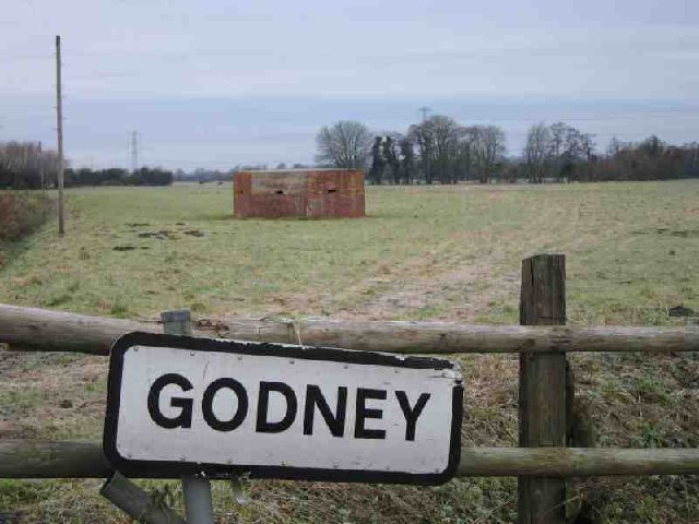
Godney

Godney is a village and civil parish near Glastonbury on the River Sheppey on the Somerset Levels in the Mendip district of Somerset, England. == History... ==

St Dunstan's School, Glastonbury

St Dunstan's School is a secondary school in Glastonbury, Somerset, England. The school is for students between the ages of 11 and 16 years. It is named...

Nearby Amenities

Located within 500m of 51.175413,-2.70691
Material: wood
Power: pole
Lat/Long: 51.1726892/-2.7014089
Material: wood
Power: pole
Lat/Long: 51.1735236/-2.7025591
Material: wood
Power: pole
Lat/Long: 51.1741471/-2.7034368
Material: wood
Power: pole
Lat/Long: 51.174937/-2.7045375
Material: wood
Power: pole
Lat/Long: 51.1756204/-2.7054896
Material: wood
Power: pole
Lat/Long: 51.1763393/-2.7064699
Material: wood
Power: pole
Lat/Long: 51.1768696/-2.7072025
Material: wood
Power: pole
Lat/Long: 51.1777438/-2.70842
Material: wood
Power: pole
Lat/Long: 51.1783784/-2.7093083
Material: wood
Power: pole
Source: bing
Lat/Long: 51.1789528/-2.7093087
Material: wood
Power: pole
Lat/Long: 51.1743426/-2.7000669
Material: wood
Power: pole
Lat/Long: 51.1750061/-2.7013269
Material: wood
Power: pole
Lat/Long: 51.1756562/-2.702555
Material: wood
Power: pole
Lat/Long: 51.1763041/-2.7037406
Material: wood
Power: pole
Lat/Long: 51.1771295/-2.7040308
Material: wood
Power: pole
Lat/Long: 51.1779238/-2.7042857
Material: wood
Power: pole
Lat/Long: 51.1789733/-2.704629
Power: pole
Source: bing
Lat/Long: 51.1789024/-2.7107947
The data included in this document is from www.openstreetmap.org. The data is made available under ODbL.

Have you been to Crannel Moor?

Leave your review of Crannel Moor below (or comments, questions and feedback).