Great Moss

Downs, Moorland in Cumberland Copeland

England

Great Moss

River Esk Small fall and pool on the Esk
River Esk Credit: Michael Graham

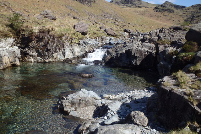
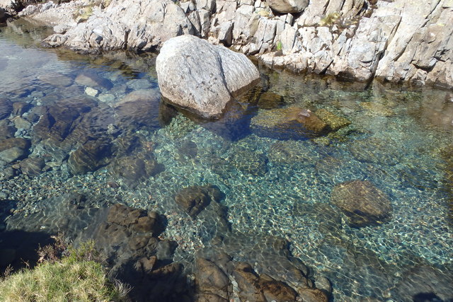
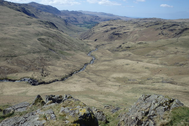
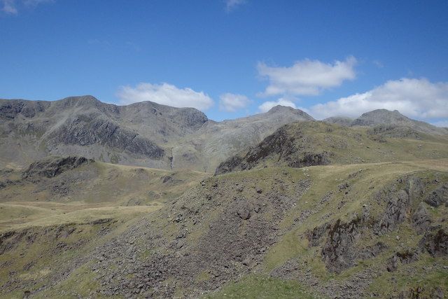
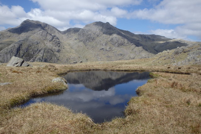
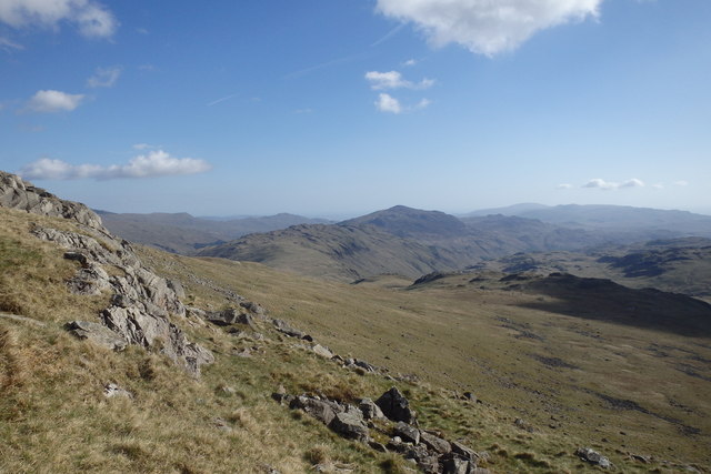
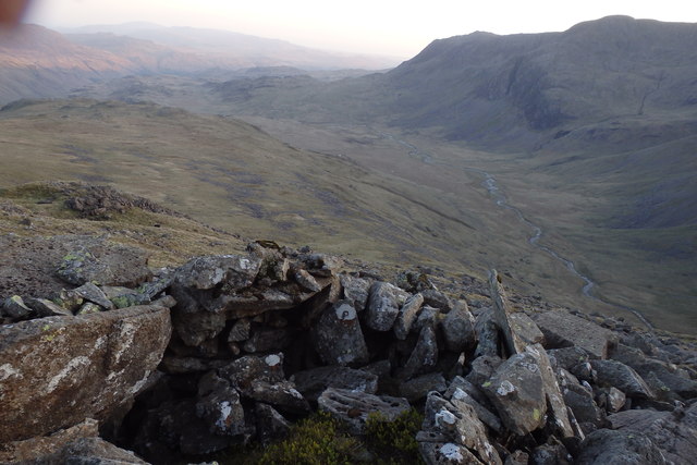
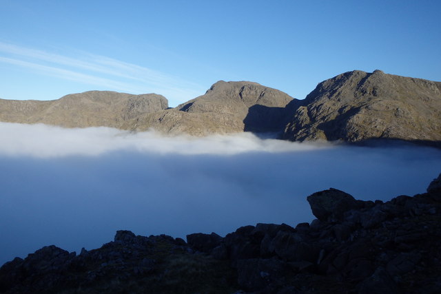
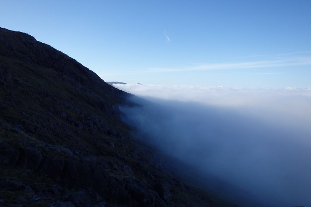
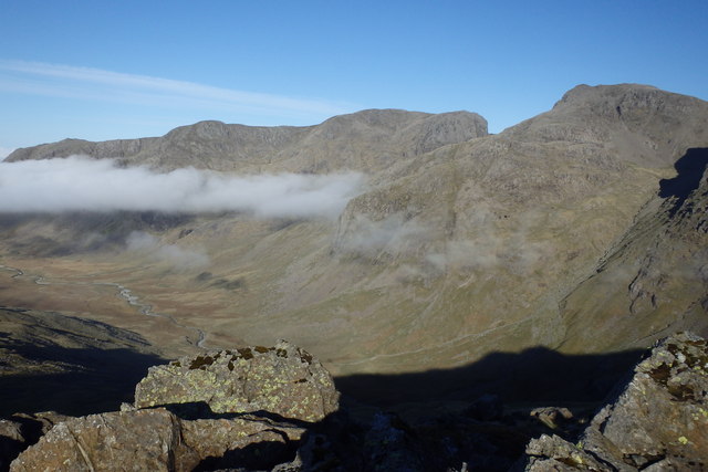
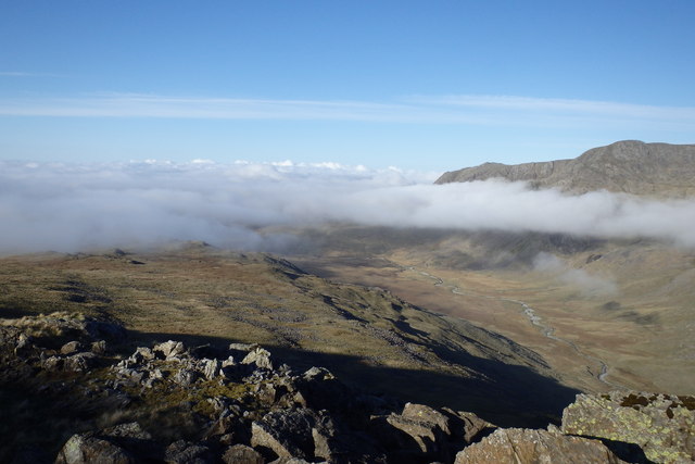
Great Moss is a vast expanse of moorland located in the county of Cumberland, England. Stretching across an area of approximately 2,500 acres, it is renowned for its stunning natural beauty and rich biodiversity. The moss is situated within the Lake District National Park, which further enhances its significance as a beloved tourist destination.

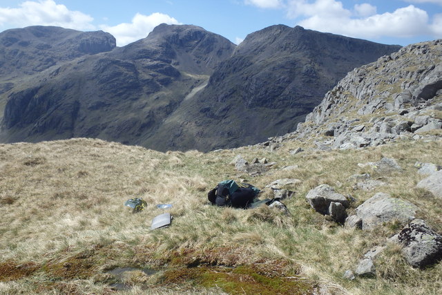
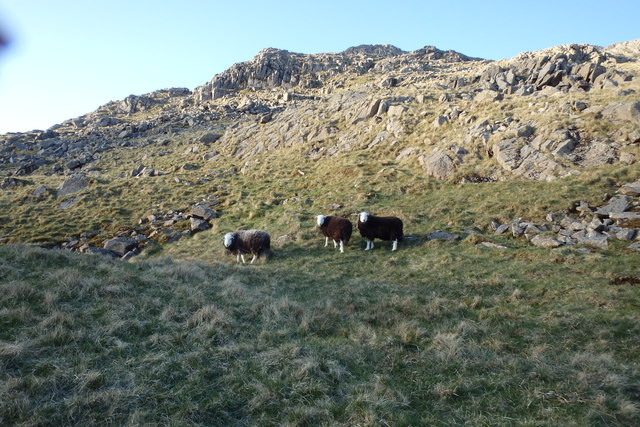
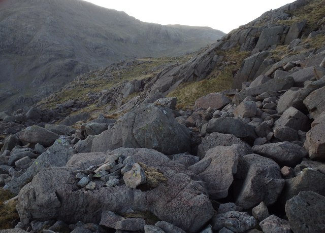
This unique landscape is characterized by its rolling hills, heather-covered moors, and scattered stands of native trees. It is home to a diverse range of plant and animal species, making it a haven for nature enthusiasts and wildlife lovers. Rare and protected species such as curlews, red grouse, and golden plovers can be spotted here, adding to the area's ecological importance.

The moss also has historical significance, as it has been traditionally used for sheep farming, peat cutting, and hunting. These activities have shaped the land and left their mark on the local culture and traditions.

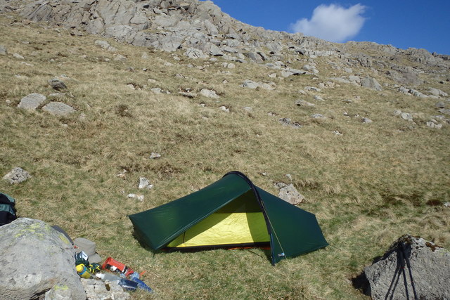
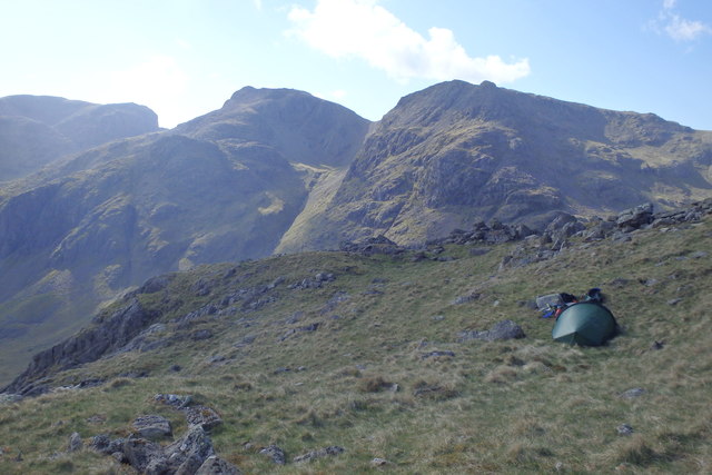
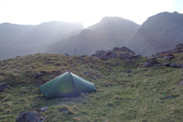
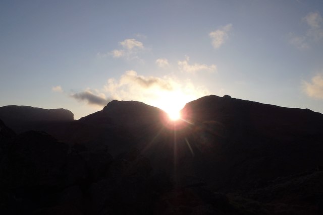
For visitors, Great Moss offers numerous opportunities for outdoor activities such as hiking, birdwatching, and photography. The vast open space and panoramic views make it an ideal location for those seeking solitude and tranquility. The moorland is crisscrossed by a network of footpaths and trails, allowing visitors to explore its diverse habitats and discover its hidden gems.

In summary, Great Moss in Cumberland is a captivating moorland that showcases the beauty of nature and offers a range of recreational activities. Its ecological and historical significance, combined with its breathtaking landscapes, make it an essential destination for nature enthusiasts and outdoor adventurers alike.

If you have any feedback on the listing, please let us know in the comments section below.

Great Moss Images

Images are sourced within 2km of 54.436147/-3.2009162 or Grid Reference NY2205. Thanks to Geograph Open Source API. All images are credited.

River Esk Small fall and pool on the Esk
River Esk
Small fall and pool on the Esk
River Esk Lovely colours in the clear water of The Cumbrian Esk
River Esk
Lovely colours in the clear water of The Cumbrian Esk
On Pianett Knott Above Lingcove Beck
On Pianett Knott
Above Lingcove Beck
On Pianett Knott Looking towards the Scafells
On Pianett Knott
Looking towards the Scafells
Small Tarn, Pike de Bield Moss Scafells in shot
Small Tarn, Pike de Bield Moss
Scafells in shot
Spring, Yeastyrigg Crags Water bottles were filled as I chanced upon this spring high up under Yeastygill Crags
Spring, Yeastyrigg Crags
Water bottles were filled as I chanced upon this spring high up under Yeastygill Crags
Tent, Yeastyrigg Crags On a perfect May day for camping on the fells. Laser Competition 1.
Tent, Yeastyrigg Crags
On a perfect May day for camping on the fells. Laser Competition 1.
Tent, Yeastyrigg Crags Flat ground at a premium on Yeastyrigg Crags
Tent, Yeastyrigg Crags
Flat ground at a premium on Yeastyrigg Crags
Above Pike de Bield Moss Harter Fell in the distance
Above Pike de Bield Moss
Harter Fell in the distance
Tent, Yeastyrigg Crags My first pitch was great but I had positioned the tent under a crumbling crag with several large loose rocks directly above me. I moved to this slightly safer spot.
Tent, Yeastyrigg Crags
My first pitch was great but I had positioned the tent under a crumbling crag with several large loose rocks directly above me. I moved to this slightly safer spot.
Herdwicks, Yeastygill Crags These three young sheep were rather put out when I camped on their heaf.
Herdwicks, Yeastygill Crags
These three young sheep were rather put out when I camped on their heaf.
Sunset from Yeastygill Crags Sun dropping in the dip of Little Narrow Cove
Sunset from Yeastygill Crags
Sun dropping in the dip of Little Narrow Cove
Lanty Slee's Still? Whilst camping under Yeastygill Crags I came across two small old cairns pointing towards a couple of crumbling walled enclosures in the rocks. This one had a piece of rusting iron pipe in it. The remote pathless position leads me to conclude that these could be the remains of stills used by the famous moonshiner and smuggler.
Lanty Slee's Still?
Whilst camping under Yeastygill Crags I came across two small old cairns pointing towards a couple of crumbling walled enclosures in the rocks. This one had a piece of rusting iron pipe in it. The remote pathless position leads me to conclude that these could be the remains of stills used by the famous moonshiner and smuggler.
Old Cairn, Yeastyrigg Crags This old pile of rocks on a boulder seems to give direction towards a small walled enclosure which may have been the location of an old Whisky still.
Old Cairn, Yeastyrigg Crags
This old pile of rocks on a boulder seems to give direction towards a small walled enclosure which may have been the location of an old Whisky still.
Inversion Upper Eskdale A great sight to wake you up from your tent in the morning
Inversion Upper Eskdale
A great sight to wake you up from your tent in the morning
Inversion Yeastyrigg Crags Mist stopped at about 2300'
Inversion Yeastyrigg Crags
Mist stopped at about 2300'
Above Upper Eskdale Morning on a wild camp
Above Upper Eskdale
Morning on a wild camp
Above Pike de Bield Cloud retreating down Eskdale
Above Pike de Bield
Cloud retreating down Eskdale
Show me another place!

Great Moss is located at Grid Ref: NY2205 (Lat: 54.436147, Lng: -3.2009162)

Administrative County: Cumbria

District: Copeland

Police Authority: Cumbria

What 3 Words

///blows.cork.curve. Near Ambleside, Cumbria

Nearby Locations

Great Moss High Gait Crags

Related Wikis

Slight Side

Slight Side is a fell in the English Lake District it stands 25 kilometres (16 miles) east southeast of the town of Whitehaven and reaches a height of...

Scafell

Scafell ( or ; also spelled Sca Fell, previously Scawfell) is a mountain in the Lake District region of Cumbria, England. It has a height of 964 metres...

Mickledore

Mickledore (the name means great door or pass) is a narrow ridge, 840 metres (2755 ft) high, connecting the mountains of Scafell and Scafell Pike in the...

Ill Crag

Ill Crag is a fell in the English Lake District. At 935 metres (3,068 ft), it is the fourth-highest peak in England, after Scafell Pike, Sca Fell, and...

Nearby Amenities

Located within 500m of 54.436147,-3.2009162
Ford: yes
Lat/Long: 54.4403302/-3.202591
Scar Lathing
Place: locality
Lat/Long: 54.4332294/-3.1977894
Sampston's Stones
Place: locality
Lat/Long: 54.4374065/-3.2071498
Ford: yes
Lat/Long: 54.438925/-3.196575
Ford: yes
Lat/Long: 54.4398235/-3.1970996
Ford: yes
Lat/Long: 54.4400305/-3.20195
Ford: yes
Lat/Long: 54.4376436/-3.204044
Ford: yes
Lat/Long: 54.4319876/-3.2033852
Ford: yes
Lat/Long: 54.4324786/-3.2040863
The data included in this document is from www.openstreetmap.org. The data is made available under ODbL.

Have you been to Great Moss?

Leave your review of Great Moss below (or comments, questions and feedback).