Plumtree Bank Moss

Downs, Moorland in Lancashire South Lakeland

England

Plumtree Bank Moss

Remains of wooden ballast bin Only a few rotten pieces of wood remain from this ballast bin beside the former Furness Railway Coniston Branch near Moss Side.  Built from old wooden railway sleepers it is difficult to place an age on this ballast bin, but it is possible it pre-dates the formation of the London Midland and Scottish Railway in 1923 who later introduced concrete bins (see photograph <a href="https://www.geograph.org.uk/photo/6797992">NY2924 : LMS Standard Concrete Ballast Bin</a>).
Positioned approximately every mile, more frequently on curved track, ballast bins were used to store small stone chippings which were used by the railway Lengthsmen to pack and adjust the railway sleepers. Using only a jack and a shovel, an experienced Lengthsman could judge exactly the right quantity of chippings to use to obtain a perfect ‘top’ to the rail and they often took great pride in the quality of their work.
The Coniston Branch closed to passengers in October 1958 and to all traffic with effect from the 30 April 1962 although the last train had run during the preceding week.  The track bed in front of the ballast bin is deep in mud and trampled by cows.
Remains of wooden ballast bin Credit: Adrian Taylor

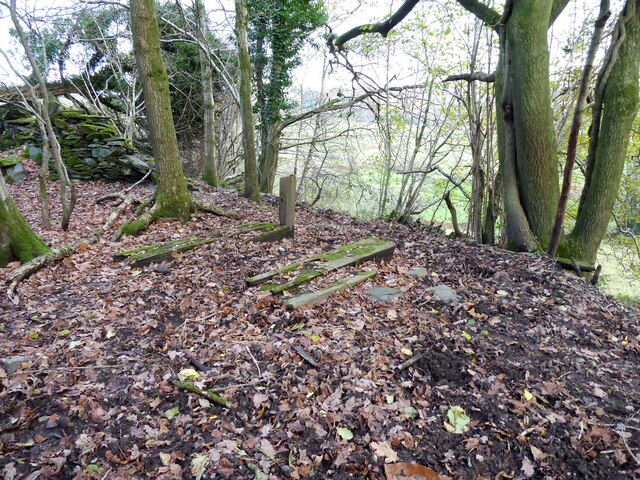
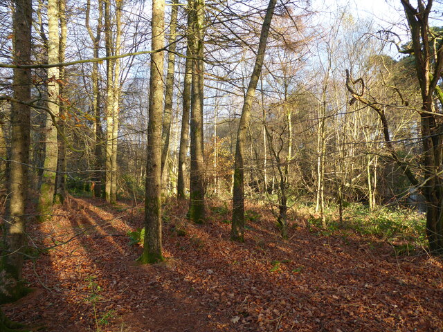
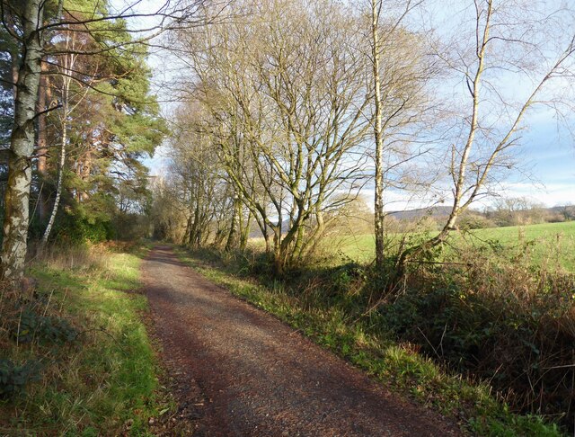
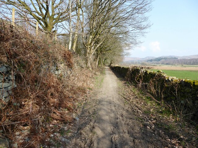
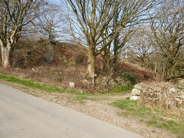
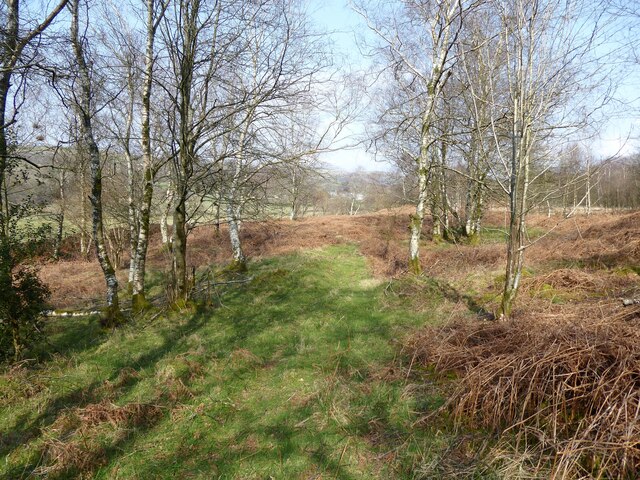
Plumtree Bank Moss is a vast area located in the county of Lancashire, England. Situated amidst the rolling landscape, it spans over a large expanse of downs and moorland. The moss is predominantly covered by a mosaic of various types of vegetation, including heather, grasses, and low-lying shrubs.

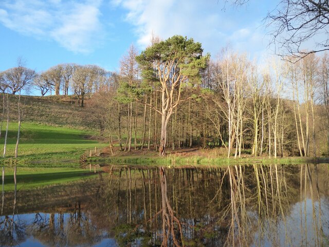
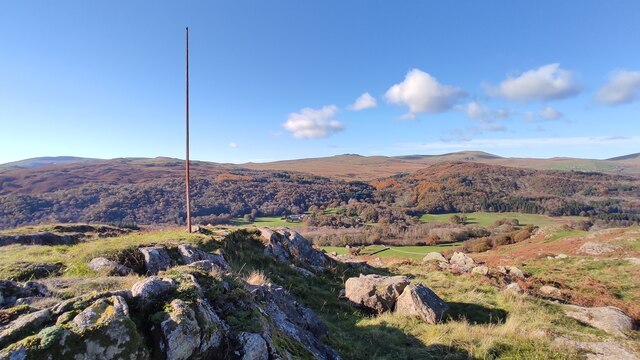
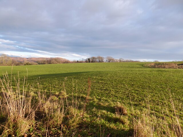
The downs of Plumtree Bank Moss are characterized by gentle slopes and undulating terrain. They offer breathtaking panoramic views of the surrounding countryside, making it a popular destination for outdoor enthusiasts and nature lovers. The downs are home to a diverse range of plant species, such as bilberry, harebell, and cotton grass, providing a rich habitat for various insects, birds, and small mammals.

The moorland of Plumtree Bank Moss is a unique ecosystem, known for its boggy and waterlogged terrain. It is dominated by sphagnum moss, which forms a thick layer across the ground, giving it a characteristic spongy texture. This type of moss is vital for water retention, and it plays a crucial role in maintaining the area's hydrology.

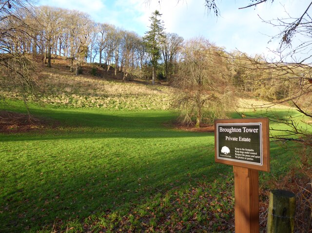
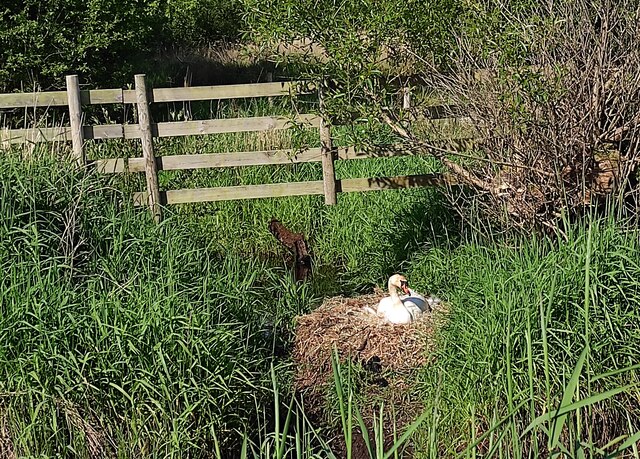
Plumtree Bank Moss is also home to several rare and endangered species, including the black grouse and the common lizard. The area is a designated Site of Special Scientific Interest (SSSI), highlighting its importance for conservation.

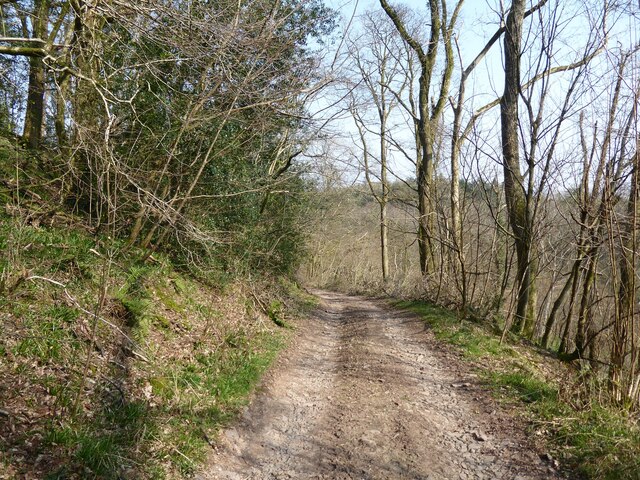
Visitors to Plumtree Bank Moss can enjoy a range of recreational activities, such as hiking, birdwatching, and nature photography. The tranquil and unspoiled environment provides a serene escape from the hustle and bustle of urban life, making it a haven for those seeking solace in nature.

If you have any feedback on the listing, please let us know in the comments section below.

Plumtree Bank Moss Images

Images are sourced within 2km of 54.295708/-3.197808 or Grid Reference SD2289. Thanks to Geograph Open Source API. All images are credited.

Remains of wooden ballast bin Only a few rotten pieces of wood remain from this ballast bin beside the former Furness Railway Coniston Branch near Moss Side.  Built from old wooden railway sleepers it is difficult to place an age on this ballast bin, but it is possible it pre-dates the formation of the London Midland and Scottish Railway in 1923 who later introduced concrete bins (see photograph <a href="https://www.geograph.org.uk/photo/6797992">NY2924 : LMS Standard Concrete Ballast Bin</a>).
Positioned approximately every mile, more frequently on curved track, ballast bins were used to store small stone chippings which were used by the railway Lengthsmen to pack and adjust the railway sleepers. Using only a jack and a shovel, an experienced Lengthsman could judge exactly the right quantity of chippings to use to obtain a perfect ‘top’ to the rail and they often took great pride in the quality of their work.
The Coniston Branch closed to passengers in October 1958 and to all traffic with effect from the 30 April 1962 although the last train had run during the preceding week.  The track bed in front of the ballast bin is deep in mud and trampled by cows.
Remains of wooden ballast bin
Only a few rotten pieces of wood remain from this ballast bin beside the former Furness Railway Coniston Branch near Moss Side. Built from old wooden railway sleepers it is difficult to place an age on this ballast bin, but it is possible it pre-dates the formation of the London Midland and Scottish Railway in 1923 who later introduced concrete bins (see photograph NY2924 : LMS Standard Concrete Ballast Bin). Positioned approximately every mile, more frequently on curved track, ballast bins were used to store small stone chippings which were used by the railway Lengthsmen to pack and adjust the railway sleepers. Using only a jack and a shovel, an experienced Lengthsman could judge exactly the right quantity of chippings to use to obtain a perfect ‘top’ to the rail and they often took great pride in the quality of their work. The Coniston Branch closed to passengers in October 1958 and to all traffic with effect from the 30 April 1962 although the last train had run during the preceding week. The track bed in front of the ballast bin is deep in mud and trampled by cows.
Woodland in East Park This woodland is in the grounds of the Broughton Tower Estate.
An ornamental lake can be glimpsed through the trees in the right background.
Woodland in East Park
This woodland is in the grounds of the Broughton Tower Estate. An ornamental lake can be glimpsed through the trees in the right background.
Ornamental lake, East Park This is the southernmost of two ornamental lakes in the East Park of the Broughton Tower Estate.  Although on private land the public has access from the public bridleway on the track bed of the former railway from Foxfield to Coniston which is adjacent.  There is also a public footpath crossing the narrow isthmus between the two lakes.
Ornamental lake, East Park
This is the southernmost of two ornamental lakes in the East Park of the Broughton Tower Estate. Although on private land the public has access from the public bridleway on the track bed of the former railway from Foxfield to Coniston which is adjacent. There is also a public footpath crossing the narrow isthmus between the two lakes.
Remains of Weather Cock on Rawfold Bank, with Duddon Hall in view A "Weather Cock" is marked at this position on OS maps: 6 inch, published 1850 and 25 inch, published 1913. This iron pole is currently situated at the location. Duddon Hall can be seen in the centre of the picture.
Remains of Weather Cock on Rawfold Bank, with Duddon Hall in view
A "Weather Cock" is marked at this position on OS maps: 6 inch, published 1850 and 25 inch, published 1913. This iron pole is currently situated at the location. Duddon Hall can be seen in the centre of the picture.
The Coniston Branch near Wall End Now only used by walkers and cyclists, this is the route of the former Furness Railway branch line from Foxfield to Coniston.
The last passenger service ran on 4 October 1958 with a final enthusiats’ special train on the 27 August 1961. The last freight train ran during the week ending 29 April 1962 and the track was lifted early in 1963.
The Coniston Branch near Wall End
Now only used by walkers and cyclists, this is the route of the former Furness Railway branch line from Foxfield to Coniston. The last passenger service ran on 4 October 1958 with a final enthusiats’ special train on the 27 August 1961. The last freight train ran during the week ending 29 April 1962 and the track was lifted early in 1963.
Broughton Tower Estate
Field near Wall End The broken ground to the right of the photograph is described on old Ordnance Survey maps as a marl pit.
The fell in the background, left of centre, is Great Burney, 298m (979ft).
Field near Wall End
The broken ground to the right of the photograph is described on old Ordnance Survey maps as a marl pit. The fell in the background, left of centre, is Great Burney, 298m (979ft).
Ordnance Survey Rivet This OS rivet can be found on the stile SE side of the road. It marks a point 15.027m above mean sea level.
Ordnance Survey Rivet
This OS rivet can be found on the stile SE side of the road. It marks a point 15.027m above mean sea level.
Ordnance Survey Rivet This OS rivet can be found on the wall east side of the road. It marks a point 9.422m above mean sea level.
Ordnance Survey Rivet
This OS rivet can be found on the wall east side of the road. It marks a point 9.422m above mean sea level.
Kirkby Pool
Kirkby Pool
Lane near Brookside The lane is a public footpath leading to Buttstead Wood.
Lane near Brookside
The lane is a public footpath leading to Buttstead Wood.
Stile beside Buttstead Wood The public footpath from The Hill to Woodland crosses this stile adjacent to Buttstead Wood.
There is an Ordnance Survey rivet benchmark with cut mark on the bottom stone step of the stile (detail photograph <a href="https://www.geograph.org.uk/photo/7259390">SD2389 : Benchmark, Buttstead Wood</a>).
Stile beside Buttstead Wood
The public footpath from The Hill to Woodland crosses this stile adjacent to Buttstead Wood. There is an Ordnance Survey rivet benchmark with cut mark on the bottom stone step of the stile (detail photograph SD2389 : Benchmark, Buttstead Wood).
Benchmark, Buttstead Wood Detail of the Ordnance Survey rivet benchmark with cut mark on the horizontal bottom step of a public footpath stile adjacent to Buttstead Wood.  The benchmark marks a height of 8.6076m above mean sea level (Ordnance Datum Newlyn) last verified in 1954 (location photograph <a href="https://www.geograph.org.uk/photo/7259381">SD2389 : Stile beside Buttstead Wood</a>).
Benchmark, Buttstead Wood
Detail of the Ordnance Survey rivet benchmark with cut mark on the horizontal bottom step of a public footpath stile adjacent to Buttstead Wood. The benchmark marks a height of 8.6076m above mean sea level (Ordnance Datum Newlyn) last verified in 1954 (location photograph SD2389 : Stile beside Buttstead Wood).
Lane entrance near Brookside Leading from the road near Brookside the lane leads to Buttstead Wood and carries a public footpath to Low Rosthwaite.
There is an Ordnance Survey rivet benchmark on the top of the low stone post partially hidden in the brambles to the left of the footpath signpost (photograph <a href="https://www.geograph.org.uk/photo/7260566">SD2389 : Rivet benchmark near Brookside</a>).
Lane entrance near Brookside
Leading from the road near Brookside the lane leads to Buttstead Wood and carries a public footpath to Low Rosthwaite. There is an Ordnance Survey rivet benchmark on the top of the low stone post partially hidden in the brambles to the left of the footpath signpost (photograph SD2389 : Rivet benchmark near Brookside).
Rivet benchmark near Brookside Detail of an Ordnance Survey rivet benchmark on the top of a low stone post near Brookside.  The benchmark marks a height of 11.0246m above mean sea level (Ordnance Datum Newlyn) last verified in 1972 (location photograph <a href="https://www.geograph.org.uk/photo/7260558">SD2389 : Lane entrance near Brookside</a>).
Rivet benchmark near Brookside
Detail of an Ordnance Survey rivet benchmark on the top of a low stone post near Brookside. The benchmark marks a height of 11.0246m above mean sea level (Ordnance Datum Newlyn) last verified in 1972 (location photograph SD2389 : Lane entrance near Brookside).
Woodland path near Latter Rigg
Farm track near Wall End This farm track is also a public bridleway.
Farm track near Wall End
This farm track is also a public bridleway.
Swan on Nest by Galloper Pool On Thornthwaite Latter Rigg Moss.
Swan on Nest by Galloper Pool
On Thornthwaite Latter Rigg Moss.
Show me another place!

Plumtree Bank Moss is located at Grid Ref: SD2289 (Lat: 54.295708, Lng: -3.197808)

Administrative County: Cumbria

District: South Lakeland

Police Authority: Cumbria

What 3 Words

///secure.supposing.cuddled. Near Millom, Cumbria

Related Wikis

Broughton Mills

Broughton Mills is a village in Cumbria, England, located 3.5 kilometres from the larger town of Broughton-in-furness. The village consists of about 40...

Broughton West

Broughton West is a civil parish in the Westmorland and Furness district of Cumbria, England. In the 2001 census the parish had a population of 954, decreasing...

Blacksmiths Arms, Broughton Mills

The Blacksmiths Arms is a Grade II listed public house at Broughton Mills, Cumbria, England.It is on the Campaign for Real Ale's National Inventory of...

Rosthwaite, Broughton West

Rosthwaite is a settlement in the Broughton West civil parish of Westmorland and Furness, Cumbria England. It is part of the Lake District, 3 miles (4...

Woodland railway station

Woodland railway station served the hamlet of Woodland, in Lancashire, England (now in Cumbria). It was on the branch line to Coniston. == History == Authorised...

Broughton-in-Furness

Broughton in Furness is a market town in the civil parish of Broughton West in the Westmorland and Furness district of Cumbria, England. It had a population...

Great Stickle

Great Stickle is a fell located in the southern Lake District of England with an altitude of 305 m (1,001 ft). Alfred Wainwright included it in the Stickle...

Broughton-in-Furness railway station

Broughton-in-Furness railway station served the market town of Broughton-in-Furness, in Lancashire, England (now in Cumbria). It was on the branch line...

Related Videos

Caw from The Hawk

Exploring some Outlying Wainwights from The Hawk.

The best ride I have had in the Lake District and a Perfect Pint Awaits!

I Ride through the best Lake District countryside that I have seen so far and I meet a Barmen called Zack in a country Inn with the ...

The glorious western Lake District from above on a perfect evening.

Shot on Insta360 Sphere strapped to a DJI Air2 s The zoom towards the end is towards Scafell Pike, Englands highest hill.

Finding the Swinside Stone Circle

A lovely little walk from Duddon Bridge to the Swinside Stone Circle. It's about 11km (7 miles) long.

Nearby Amenities

Located within 500m of 54.295708,-3.197808
Place: farm
Lat/Long: 54.294874/-3.198769
Post Box
Collection Times: Mo-Fr 17:00; Sa 10:30
Drive Through: no
Post Box Type: wall
Ref: LA20 138
Lat/Long: 54.2923541/-3.2021726
Power: pole
Lat/Long: 54.2933318/-3.2023351
Power: pole
Lat/Long: 54.2935414/-3.2012994
Power: pole
Lat/Long: 54.2939457/-3.1992779
Power: pole
Lat/Long: 54.2942973/-3.197498
Power: pole
Lat/Long: 54.2944627/-3.1966749
Power: pole
Lat/Long: 54.2944627/-3.1953718
Power: pole
Lat/Long: 54.2944589/-3.1943537
Power: pole
Lat/Long: 54.2944646/-3.1930104
Power: pole
Lat/Long: 54.2944646/-3.1917685
Power: pole
Lat/Long: 54.2947579/-3.1966362
Power: pole
Lat/Long: 54.2958333/-3.1966281
Power: pole
Lat/Long: 54.296685/-3.1966008
Power: pole
Lat/Long: 54.2975949/-3.1966008
Power: pole
Lat/Long: 54.2987201/-3.1968488
Power: pole
Lat/Long: 54.2996365/-3.1970518
The data included in this document is from www.openstreetmap.org. The data is made available under ODbL.

Have you been to Plumtree Bank Moss?

Leave your review of Plumtree Bank Moss below (or comments, questions and feedback).