North Cliff

Cliff, Slope in Yorkshire

England

North Cliff

The beach at Double Gates
The beach at Double Gates Credit: Ian S

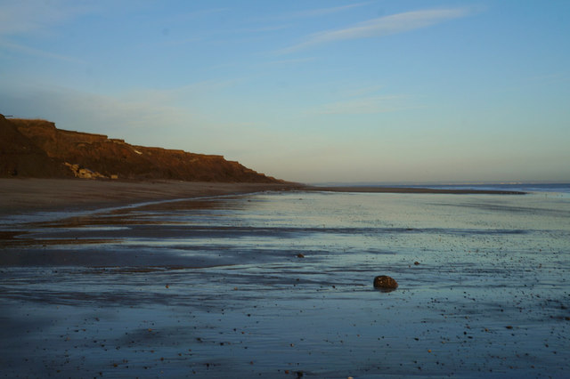
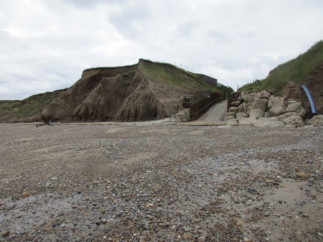
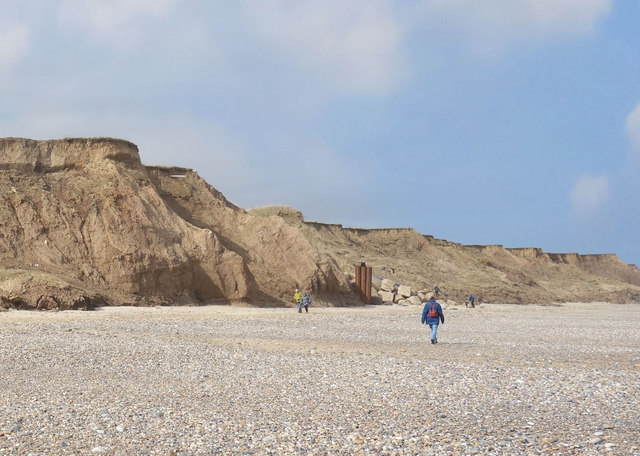
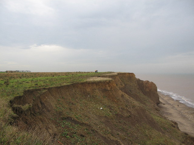
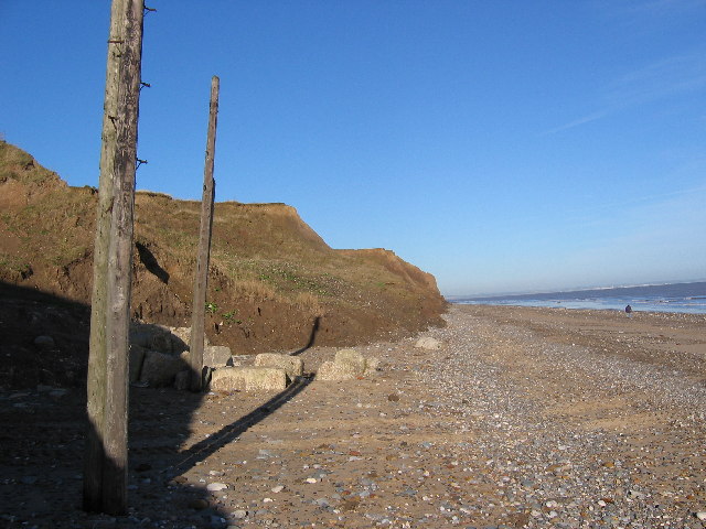
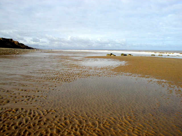
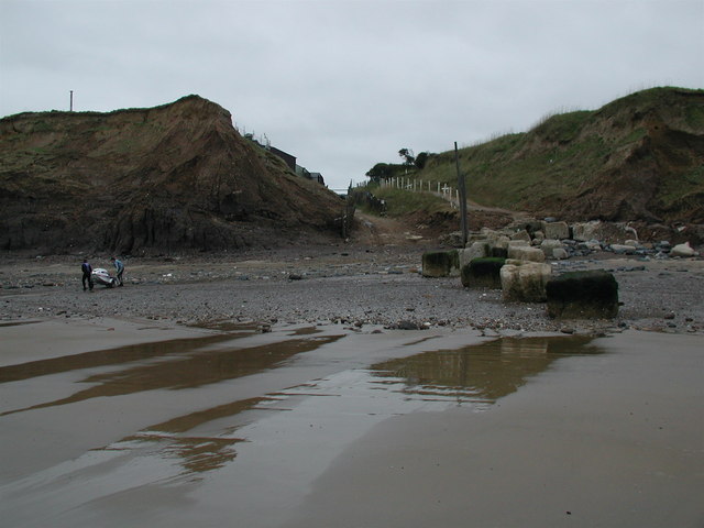
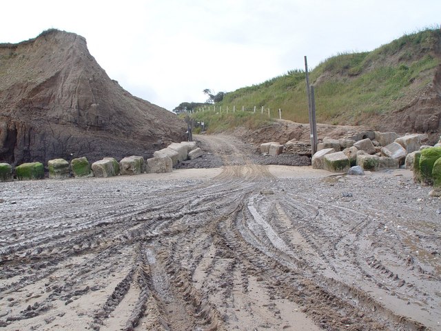
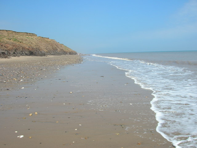
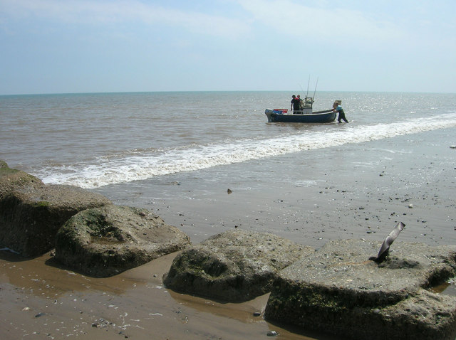
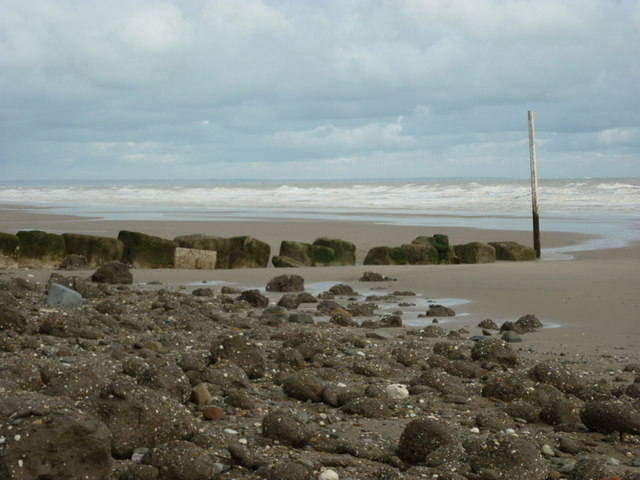
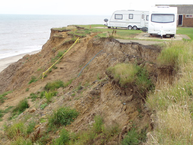
North Cliff is a prominent geological feature located in the picturesque region of Yorkshire, England. Situated in the coastal town of Scarborough, it is known for its stunning views and rugged beauty. Rising majestically above the North Sea, North Cliff is a steep and imposing slope that stretches along the coastline for approximately 1.6 kilometers.

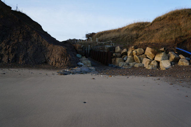
The cliff is composed primarily of layers of sandstone and shale, which have been shaped over millennia by the forces of erosion and weathering. This geological formation showcases the region's rich history and provides a valuable insight into the area's ancient past. Fossilized remains of marine life, such as ammonites and belemnites, can often be found embedded within the rock formations, serving as a testament to the area's prehistoric origins.

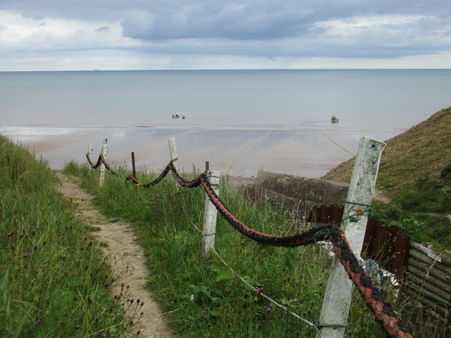
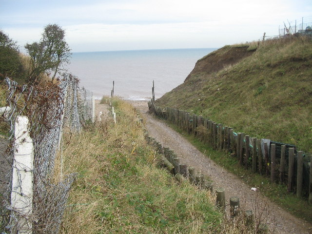
North Cliff offers visitors a variety of recreational opportunities, with numerous walking trails and viewpoints along its length. From the summit, visitors can enjoy breathtaking panoramic vistas of the sea, Scarborough's coastline, and the surrounding countryside. The cliff's dramatic landscape also attracts avid climbers and thrill-seekers who challenge themselves to conquer its steep slopes.

In addition to its natural beauty, North Cliff is home to several cultural landmarks. At its summit stands the imposing Scarborough Castle, a medieval fortress that dates back to the 12th century. The castle offers visitors a glimpse into the region's turbulent past and provides a fascinating insight into its strategic significance throughout history.

Overall, North Cliff is a captivating destination that combines stunning natural scenery with historical significance. Its imposing presence and breathtaking views make it a must-visit location for nature lovers, history enthusiasts, and those seeking an exhilarating outdoor experience.

If you have any feedback on the listing, please let us know in the comments section below.

North Cliff Images

Images are sourced within 2km of 53.92578/-0.16849027 or Grid Reference TA2049. Thanks to Geograph Open Source API. All images are credited.

The beach at Double Gates
Ready to launch This boat has been towed down from the Northcliff Boating Club site on the cliff top and is about to be pushed into the sea.
Ready to launch
This boat has been towed down from the Northcliff Boating Club site on the cliff top and is about to be pushed into the sea.
Beach access, Double Gates For the use of the Northcliff Boating Club. Anyone else has to scramble down the cliff as best they can.
Beach access, Double Gates
For the use of the Northcliff Boating Club. Anyone else has to scramble down the cliff as best they can.
The beach at Double Gates
Beach and Cliffs at Double Gates There is now very little land apart from beach left in TA2050. This is the extreme south west of the square.
Beach and Cliffs at Double Gates
There is now very little land apart from beach left in TA2050. This is the extreme south west of the square.
Double Gates Looking down the sailing club slipway to the area of beach known as Double Gates, although not much beach is visible at high tide! I assume the name comes from the open gates at the bottom of the slip, and the closed gates at the top of the slip, just behind the photographer position.
Double Gates
Looking down the sailing club slipway to the area of beach known as Double Gates, although not much beach is visible at high tide! I assume the name comes from the open gates at the bottom of the slip, and the closed gates at the top of the slip, just behind the photographer position.
Double Gates beach Looking north from the clifftop adjacent to the sailing club slipway at Double Gates, the soft nature of the cliffs can be seen. The section at centre right has been undermined and seems about to collapse onto the beach.
Double Gates beach
Looking north from the clifftop adjacent to the sailing club slipway at Double Gates, the soft nature of the cliffs can be seen. The section at centre right has been undermined and seems about to collapse onto the beach.
Beach  at Double Gates What you see here is just about all of the solid ground in this grid square. This view looking north from the SW corner of the square at TA2001350091. To the left are the twin posts of the North Cliff Boating Club slipway.
Beach at Double Gates
What you see here is just about all of the solid ground in this grid square. This view looking north from the SW corner of the square at TA2001350091. To the left are the twin posts of the North Cliff Boating Club slipway.
Atwick Beach Taken looking northwards towards the Bridlington Bay and Flamborough Head.
Atwick Beach
Taken looking northwards towards the Bridlington Bay and Flamborough Head.
Double Gates Beach The beach at Double Gates on the parish boundary between Atwick and Hornsea, looking southwest towards the boatyard slipway.
Double Gates Beach
The beach at Double Gates on the parish boundary between Atwick and Hornsea, looking southwest towards the boatyard slipway.
Double Gates Slipway and Beach Several craft had been towed by tractor to the water, hence the tyre marks.  The large stone blocks are an attempt to delay the erosion of the clay cliffs.
Double Gates Slipway and Beach
Several craft had been towed by tractor to the water, hence the tyre marks. The large stone blocks are an attempt to delay the erosion of the clay cliffs.
Double Gates Beach
Double Gates Beach
Coastal Defences, Double Gates
The beach at Double Gates
Cliff Road closed Presumably due to coastal erosion.
Cliff Road closed
Presumably due to coastal erosion.
End of the road
End of the road
Who's next to go? Caravan site and road facing erosion
Who's next to go?
Caravan site and road facing erosion
The slipway at Double Gates, Atwick
Show me another place!

North Cliff is located at Grid Ref: TA2049 (Lat: 53.92578, Lng: -0.16849027)

Division: East Riding

Unitary Authority: East Riding of Yorkshire

Police Authority: Humberside

What 3 Words

///scribble.fidgeted.zinc. Near Hornsea, East Yorkshire

Nearby Locations

North Cliff

Related Wikis

Hornsea Cottage Hospital

Hornsea Cottage Hospital is a health facility in Eastgate, Hornsea, East Riding of Yorkshire, England. == History == The facility, which was built as a...

Hornsea School and Language College

Hornsea School and Language College is situated in the small seaside town of Hornsea in the East Riding of Yorkshire, England. It is a secondary comprehensive...

Hornsea Town Hall

Hornsea Town Hall is a municipal building in Newbegin in Hornsea, a town in the East Riding of Yorkshire in England. The building began life as a Wesleyan...

Hornsea Museum

Hornsea Museum is a local museum in Hornsea, East Riding of Yorkshire, northern England. == History == The museum was established in 1978. It is housed...

Nearby Amenities

Located within 500m of 53.92578,-0.16849027
Source: PGS
Lat/Long: 53.9287801/-0.1703324
Bus Stop
Hornsea Caravan Park
Bus: yes
Naptan AtcoCode: 2200YEZ01256
Naptan Bearing: S
Naptan CommonName: Hornsea Caravan Park
Naptan Landmark: Caravan Park
Naptan Street: Cliff Road
Naptan Verified: no
Public Transport: platform
Source: naptan_import
Lat/Long: 53.9237835/-0.1693691
Turning Circle
Source: Bing
Lat/Long: 53.9219599/-0.1673239
Turning Circle
Source: Bing
Lat/Long: 53.9220816/-0.1668248
Line Management: branch
Location Transition: yes
Material: wood
Power: pole
Ref: L1930-12
Lat/Long: 53.9246907/-0.1707657
Line Management: termination
Material: wood
Power: tower
Ref: L1930-13
Transformer: distribution
Lat/Long: 53.9247265/-0.1705538
Line Management: termination
Location Transition: yes
Material: wood
Power: pole
Ref: L4915-1
Lat/Long: 53.924916/-0.1703506
Material: wood
Power: pole
Ref: L4915-2
Lat/Long: 53.9254978/-0.170712
Line Management: termination
Material: wood
Power: tower
Ref: L4915-4
Transformer: distribution
Lat/Long: 53.9267368/-0.17151
Material: wood
Power: pole
Ref: L4915-3
Lat/Long: 53.9261351/-0.1711244
Material: wood
Power: pole
Ref: L1930-11
Lat/Long: 53.9244621/-0.171921
Material: wood
Power: tower
Ref: L1930-10
Transformer: distribution
Lat/Long: 53.9242264/-0.1731542
Material: wood
Power: pole
Ref: L1930-9
Lat/Long: 53.924012/-0.1743303
The data included in this document is from www.openstreetmap.org. The data is made available under ODbL.

Have you been to North Cliff?

Leave your review of North Cliff below (or comments, questions and feedback).