Rubha Bàn Beag

Landscape Feature in Perthshire

Scotland

Rubha Bàn Beag

Stob an Aonaich Mhòir ridge Loch Ericht below.
Stob an Aonaich Mhòir ridge Credit: Alan Reid

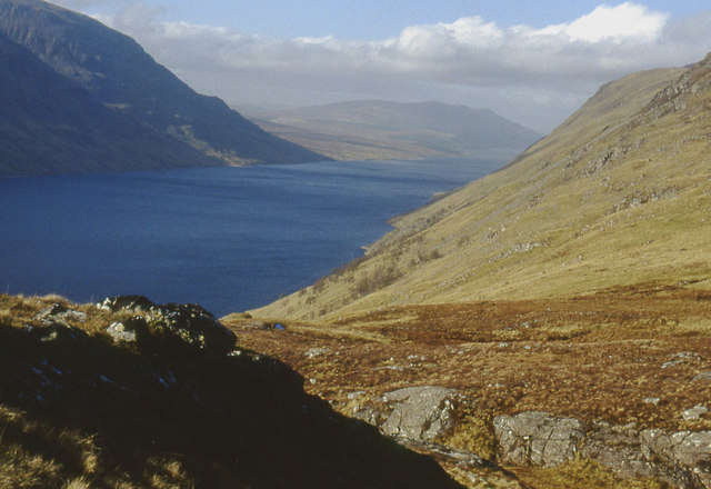
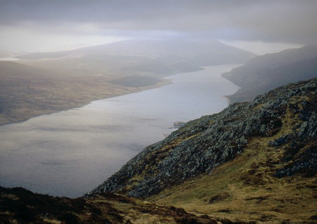
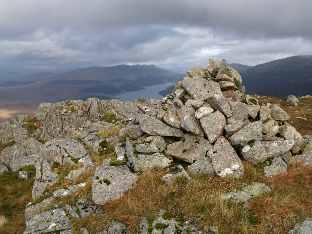
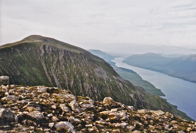
Rubha Bàn Beag is a stunning landscape feature located in Perthshire, Scotland. Situated on the western shore of Loch Tay, it is a prominent headland that juts out into the water. The name Rubha Bàn Beag translates to "small white point" in Gaelic, which perfectly describes its appearance.

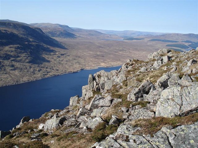
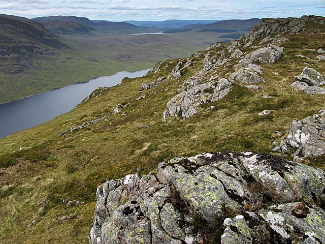
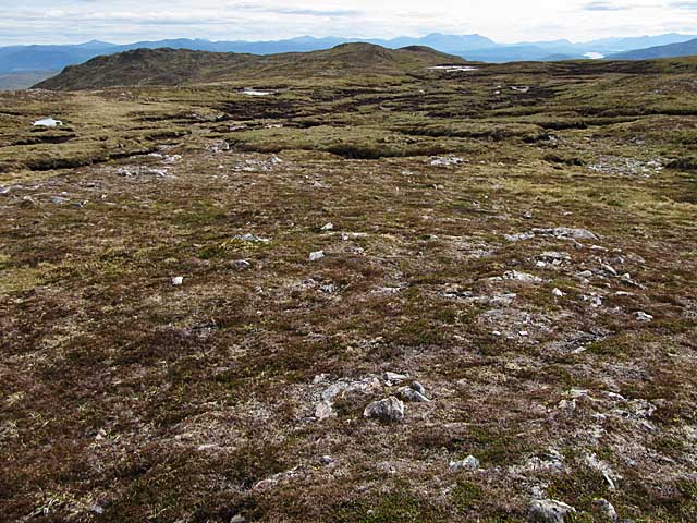
The headland is characterized by its rocky terrain, with its white quartzite cliffs standing tall against the turquoise waters of the loch. These cliffs provide a dramatic backdrop to the surrounding landscape, creating a picturesque scene that is truly awe-inspiring.

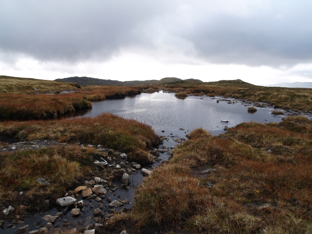
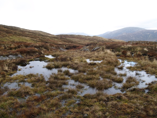
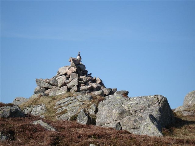
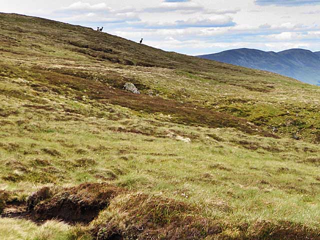
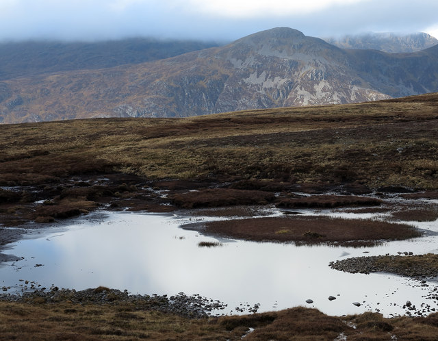
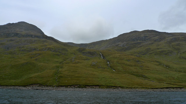
The area around Rubha Bàn Beag is rich in biodiversity and natural beauty. The headland itself is covered in a variety of plant species, including heather, gorse, and wildflowers, which add vibrant splashes of color to the rugged landscape. It is also home to a diverse range of wildlife, such as red deer, mountain hares, and various bird species.

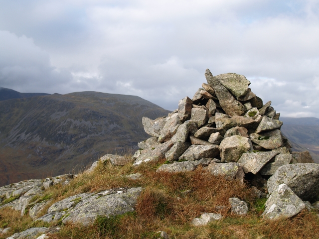
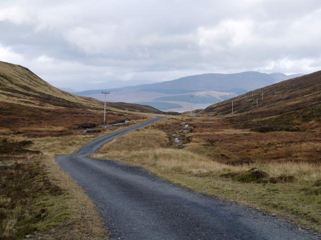
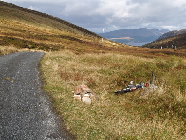
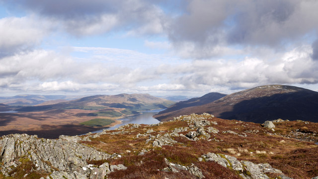
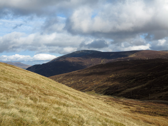
The location of Rubha Bàn Beag offers breathtaking panoramic views of Loch Tay and the surrounding mountains. On a clear day, visitors can see the towering peaks of Ben Lawers and Schiehallion in the distance, adding to the overall grandeur of the scene.

Due to its natural beauty and tranquility, Rubha Bàn Beag has become a popular spot for outdoor enthusiasts and nature lovers. It offers opportunities for hiking, photography, bird-watching, and simply enjoying the peacefulness of the surroundings.

In conclusion, Rubha Bàn Beag is a stunning landscape feature in Perthshire, offering a unique blend of rugged cliffs, diverse flora and fauna, and breathtaking views of Loch Tay. It is a place where visitors can connect with nature and experience the true beauty of the Scottish countryside.

If you have any feedback on the listing, please let us know in the comments section below.

Rubha Bàn Beag Images

Images are sourced within 2km of 56.795462/-4.4088238 or Grid Reference NN5269. Thanks to Geograph Open Source API. All images are credited.

Stob an Aonaich Mhòir ridge Loch Ericht below.
Stob an Aonaich Mhòir ridge
Loch Ericht below.
Loch Ericht from Stob an Aonaich Mhòir
Bogpool, Stob an Aonaich Mhoir On the wide ridge towards Carn Dearg.
Bogpool, Stob an Aonaich Mhoir
On the wide ridge towards Carn Dearg.
Summit Cairn, Stob an Aonaich Mhoir. Looking across Loch Ericht to Beinn Bheoil
Summit Cairn, Stob an Aonaich Mhoir.
Looking across Loch Ericht to Beinn Bheoil
Summit, Stob an Aonaich Mhoir Another view of the summit cairn, looking towards the head of Loch Ericht.
Summit, Stob an Aonaich Mhoir
Another view of the summit cairn, looking towards the head of Loch Ericht.
Private road, Allt an Sgailean. On the descent to Coire Lodge.
Private road, Allt an Sgailean.
On the descent to Coire Lodge.
Bogpools, Stob an Aonaich Mhoir A typical mix of coarse grasses, heather and bog.
Bogpools, Stob an Aonaich Mhoir
A typical mix of coarse grasses, heather and bog.
Highest point on the Coire Lodge road. The cairn marks the highest point at 634m.  Looking down into Loch Ericht.
Highest point on the Coire Lodge road.
The cairn marks the highest point at 634m. Looking down into Loch Ericht.
Ptarmigan on Stob an Aonaich Mhoir OK, we already have two pictures of this cairn- but mine has a ptarmigan perched on it!
Ptarmigan on Stob an Aonaich Mhoir
OK, we already have two pictures of this cairn- but mine has a ptarmigan perched on it!
Loch Ericht from Stob an Aonaich Mhoir This summit is a stunning viewpoint, perched high above Loch Ericht. The small lake beyond is Loch Pattack.
Loch Ericht from Stob an Aonaich Mhoir
This summit is a stunning viewpoint, perched high above Loch Ericht. The small lake beyond is Loch Pattack.
Deer on the horizon On the east side of Stob an Aonaich Mhoir
Deer on the horizon
On the east side of Stob an Aonaich Mhoir
View north from Stob an Aonaich Mhoir The steep slopes lead down to Loch Ericht, Loch Pattack is in the distance
View north from Stob an Aonaich Mhoir
The steep slopes lead down to Loch Ericht, Loch Pattack is in the distance
Boggy ground SW of Stob an Aonaich Mhoir summit
Rocks at summit area of Stob an Aonaich Mhòir The remote Corbett, Stob an Aonaich Mhòir lies to the east of Loch Ericht. The distant view has the north end of the loch, (a reservoir dammed at both ends), with The Fara to the left. The nearer dome to the right and flecked with snow patches is Beinn Udlamain.
Rocks at summit area of Stob an Aonaich Mhòir
The remote Corbett, Stob an Aonaich Mhòir lies to the east of Loch Ericht. The distant view has the north end of the loch, (a reservoir dammed at both ends), with The Fara to the left. The nearer dome to the right and flecked with snow patches is Beinn Udlamain.
Grassy eastern slope of Stob an Aonaich Mhòir The Munro, Beinn Udlamain is seen beyond the grass slope of Stob an Aonaich Mhòir, a remote Corbett above Loch Ericht.
Grassy eastern slope of Stob an Aonaich Mhòir
The Munro, Beinn Udlamain is seen beyond the grass slope of Stob an Aonaich Mhòir, a remote Corbett above Loch Ericht.
Peaty pool south-west of Stob an Aonaich Mhòir The pool lies on the broad ridge connecting the Corbett, Stob an Aonaich Mhòir, with its subsidiary top, Carn Dearg. Sròn Coire na h-Iolaire is the obvious distant peak; it lies beyond the gulf holding Loch Ericht and is part of the Munro, Beinn Bheoil. Ben Alder, misted, is the farthest distant ground.
Peaty pool south-west of Stob an Aonaich Mhòir
The pool lies on the broad ridge connecting the Corbett, Stob an Aonaich Mhòir, with its subsidiary top, Carn Dearg. Sròn Coire na h-Iolaire is the obvious distant peak; it lies beyond the gulf holding Loch Ericht and is part of the Munro, Beinn Bheoil. Ben Alder, misted, is the farthest distant ground.
Beinn Bheoil and Loch Ericht Taken from the same location as geograph <a href="https://www.geograph.org.uk/photo/46912">NN5170 : Beinn Bheòil and Loch Ericht</a> but four years earlier - not much changed! The walk over Beinn Bheoil followed on from Ben Alder and made for a spectacular day out. It was (almost) downhill all the way back to Dalwhinnie on the bike!
Beinn Bheoil and Loch Ericht
Taken from the same location as geograph NN5170 : Beinn Bheòil and Loch Ericht but four years earlier - not much changed! The walk over Beinn Bheoil followed on from Ben Alder and made for a spectacular day out. It was (almost) downhill all the way back to Dalwhinnie on the bike!
Three burns Three burns issuing from Sron Coire na h-Iolaire
Three burns
Three burns issuing from Sron Coire na h-Iolaire
Show me another place!

Rubha Bàn Beag is located at Grid Ref: NN5269 (Lat: 56.795462, Lng: -4.4088238)

Unitary Authority: Perth and Kinross

Police Authority: Tayside

What 3 Words

///leathers.destroyer.neat. Near Pubil, Perth & Kinross

Nearby Locations

Rubha Bàn Beag

Related Wikis

Stob an Aonaich Mhòir

Stob an Aonaich Mhoir (855 m) is a remote mountain in the Grampian Mountains of Scotland. It lies in Perthshire, on the eastern shore of Loch Ericht. Due...

Beinn Bheoil

Beinn Bheoil (1,019 m) is a mountain in the Grampian Mountains of Scotland, located on the western shore of Loch Ericht in Highland. Taking the form of...

Ben Alder

Ben Alder (Scottish Gaelic: Beinn Eallair) is the highest mountain in the remote area of the Scottish Highlands between Loch Ericht and Glen Spean. It...

Lochan a' Garbh Coire

Lochan a' Garbh Coire is a small freshwater loch located below the summit of Ben Alder in the Highlands of Scotland. At over 1,120 m (3,670 ft) above sea...

Beinn Udlamain

Beinn Udlamain is a Scottish mountain which stands just to the west of the summit of the Pass of Drumochter and east of Loch Ericht, some 30 km west-northwest...

Loch Ericht

Loch Ericht (Scottish Gaelic: Loch Eireachd) is a freshwater loch on the border between the former Perthshire, now Perth and Kinross and the former Inverness...

Geal-Chàrn

Geal-Chàrn (Scottish Gaelic: White Peak) is a mountain in the Highlands of Scotland, 14 kilometres North East of Corrour railway station == See also... ==

Sgairneach Mhòr

Sgairneach Mhòr is a Scottish mountain which lies in a group of seven Munros near the summit of the Pass of Drumochter and are known as the Drumochter...

Nearby Amenities

Located within 500m of 56.795462,-4.4088238
The data included in this document is from www.openstreetmap.org. The data is made available under ODbL.

Have you been to Rubha Bàn Beag?

Leave your review of Rubha Bàn Beag below (or comments, questions and feedback).