Kirk Loch

Lake, Pool, Pond, Freshwater Marsh in Dumfriesshire

Scotland

Kirk Loch

Lochmaben Castle Access Track
Lochmaben Castle Access Track Credit: David Dixon

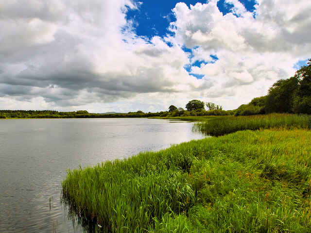
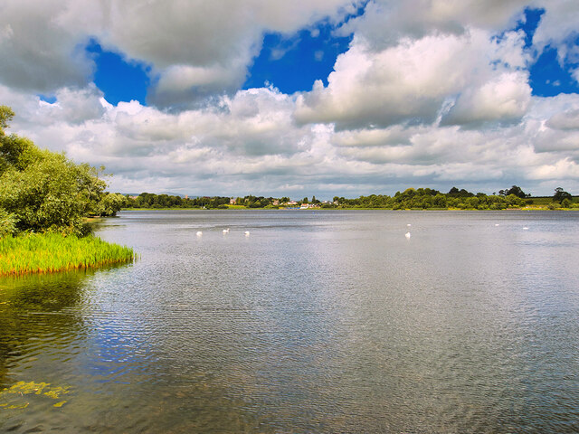
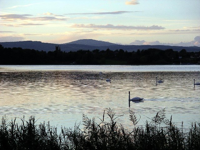
Kirk Loch is a freshwater body located in Dumfriesshire, Scotland. It is a small, picturesque lake nestled in the beautiful countryside, surrounded by rolling hills and lush greenery. The loch covers an area of approximately 15 acres, making it an ideal spot for various recreational activities.

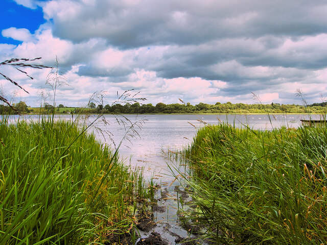
The water in Kirk Loch is crystal clear and fed by small streams and springs that flow through the surrounding landscape. The lake is home to a diverse range of aquatic flora and fauna, making it a haven for nature enthusiasts and wildlife photographers. Visitors can spot various bird species, such as mallards, swans, and herons, gracefully gliding across the water's surface.

The tranquil atmosphere and scenic beauty of Kirk Loch attract many visitors who enjoy activities like fishing and boating. Anglers flock to the lake to catch brown trout, which thrive in its cool waters. Boating enthusiasts can bring their own kayaks or canoes to explore the lake's calm waters or simply relax and take in the stunning views from the shore.

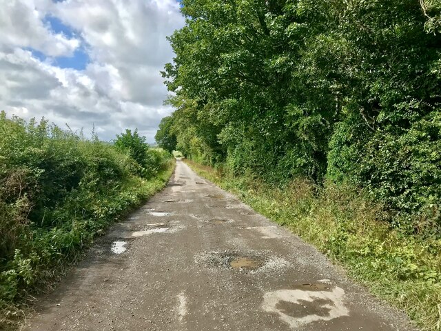
Surrounding the lake, there are several walking trails that allow visitors to enjoy the area's natural beauty up close. These trails meander through woodlands, offering glimpses of the loch and its inhabitants along the way. Additionally, there are picnic areas and benches dotted around the lake, providing a perfect setting for a peaceful lunch or a moment of relaxation.

Kirk Loch is a true gem in Dumfriesshire, offering visitors a chance to immerse themselves in nature's tranquility and take part in various outdoor activities. With its diverse ecosystem and scenic surroundings, it is a must-visit destination for nature lovers and those seeking a peaceful retreat.

If you have any feedback on the listing, please let us know in the comments section below.
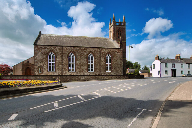
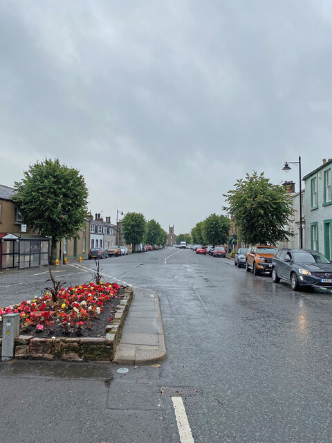
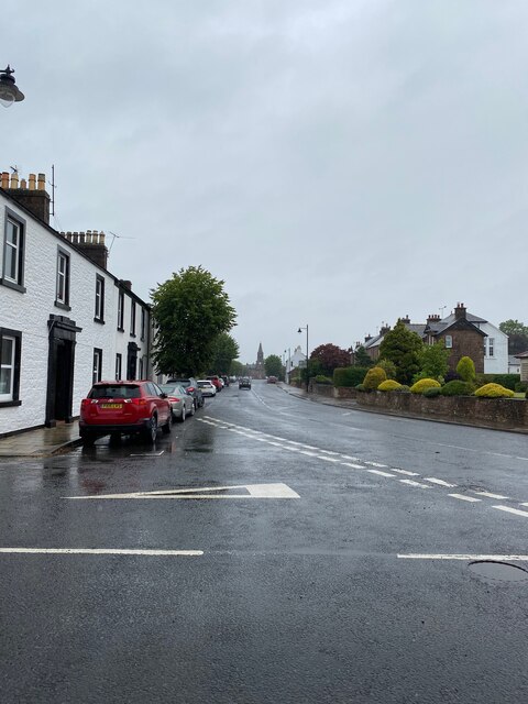
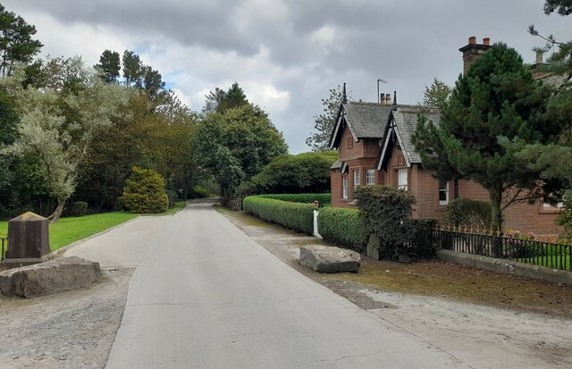
Kirk Loch Images

Images are sourced within 2km of 55.12544/-3.4460166 or Grid Reference NY0782. Thanks to Geograph Open Source API. All images are credited.

Lochmaben Castle Access Track
Castle Loch Castle Loch is the largest of the three lochs which encircle Lochmaben.
Castle Loch
Castle Loch is the largest of the three lochs which encircle Lochmaben.
Castle Loch, Lochmaben Castle Loch is the largest of the three lochs which encircle the small town of Lochmaben.
Castle Loch, Lochmaben
Castle Loch is the largest of the three lochs which encircle the small town of Lochmaben.
Lochmaben, Castle Loch Castle Loch is the largest of the three lochs which encircle the small town of Lochmaben.
Lochmaben, Castle Loch
Castle Loch is the largest of the three lochs which encircle the small town of Lochmaben.
Lochmaben Castle The ruins of Lochmaben Castle are situated on a promontory projecting into the southern end of Castle Loch. The castle was built by Edward I towards the end of the thirteenth century. It was an important outpost in hostile territory for the English, and withstood several sieges and attacks, before falling to the Scots in 1385.

The castle remained a major site in wars with the English before it was finally abandoned in the 1700s, after which its stones were taken for use in local buildings. Today it’s situated among attractive woodland next to a loch. 

The remains of the castle are of national importance as the best-preserved, and earliest example of the peels built in Scotland by Edward I and is designated as a scheduled monument by Historic Environment Scotland (SM90205 <span class="nowrap"><a title="http://portal.historicenvironment.scot/designation/SM90205" rel="nofollow ugc noopener" href="http://portal.historicenvironment.scot/designation/SM90205">Link</a><img style="margin-left:2px;" alt="External link" title="External link - shift click to open in new window" src="https://s1.geograph.org.uk/img/external.png" width="10" height="10"/></span> )
Lochmaben Castle
The ruins of Lochmaben Castle are situated on a promontory projecting into the southern end of Castle Loch. The castle was built by Edward I towards the end of the thirteenth century. It was an important outpost in hostile territory for the English, and withstood several sieges and attacks, before falling to the Scots in 1385. The castle remained a major site in wars with the English before it was finally abandoned in the 1700s, after which its stones were taken for use in local buildings. Today it’s situated among attractive woodland next to a loch. The remains of the castle are of national importance as the best-preserved, and earliest example of the peels built in Scotland by Edward I and is designated as a scheduled monument by Historic Environment Scotland (SM90205 LinkExternal link )
Ruins of Lochmaben Castle The ruins of Lochmaben Castle are situated on a promontory projecting into the southern end of Castle Loch. The castle was built by Edward I towards the end of the thirteenth century. It was an important outpost in hostile territory for the English, and withstood several sieges and attacks, before falling to the Scots in 1385.

The castle remained a major site in wars with the English before it was finally abandoned in the 1700s, after which its stones were taken for use in local buildings. Today it’s situated among attractive woodland next to a loch. 

The remains of the castle are of national importance as the best-preserved, and earliest example of the peels built in Scotland by Edward I and is designated as a scheduled monument by Historic Environment Scotland (SM90205 <span class="nowrap"><a title="http://portal.historicenvironment.scot/designation/SM90205" rel="nofollow ugc noopener" href="http://portal.historicenvironment.scot/designation/SM90205">Link</a><img style="margin-left:2px;" alt="External link" title="External link - shift click to open in new window" src="https://s1.geograph.org.uk/img/external.png" width="10" height="10"/></span> ).
Ruins of Lochmaben Castle
The ruins of Lochmaben Castle are situated on a promontory projecting into the southern end of Castle Loch. The castle was built by Edward I towards the end of the thirteenth century. It was an important outpost in hostile territory for the English, and withstood several sieges and attacks, before falling to the Scots in 1385. The castle remained a major site in wars with the English before it was finally abandoned in the 1700s, after which its stones were taken for use in local buildings. Today it’s situated among attractive woodland next to a loch. The remains of the castle are of national importance as the best-preserved, and earliest example of the peels built in Scotland by Edward I and is designated as a scheduled monument by Historic Environment Scotland (SM90205 LinkExternal link ).
Lochmaben War Memorial Lochmaben’s War Memorial is a statue of a soldier of the King’s Own Scottish Borderers regiment with head bowed and inverted rifle and wearing Tam o'Shanter and puttees. The inscriptions read, “To the glory of God and in ever grateful remembrance of the men of this parish who gave their lives in the Great War 1914-1919”, “Their name liveth for evermore” and “Lo. These are they from suff’rings great.

The memorial stands on a three-stepped square base and plinth set in a memorial garden with raised flower beds at the south end of Main Street at the junction of Lockerbie Road.
Lochmaben War Memorial
Lochmaben’s War Memorial is a statue of a soldier of the King’s Own Scottish Borderers regiment with head bowed and inverted rifle and wearing Tam o'Shanter and puttees. The inscriptions read, “To the glory of God and in ever grateful remembrance of the men of this parish who gave their lives in the Great War 1914-1919”, “Their name liveth for evermore” and “Lo. These are they from suff’rings great. The memorial stands on a three-stepped square base and plinth set in a memorial garden with raised flower beds at the south end of Main Street at the junction of Lockerbie Road.
War Memorial and Garden, Lochmaben Lochmaben’s War Memorial is a statue of a soldier of the King’s Own Scottish Borderers regiment with head bowed and inverted rifle and wearing Tam o'Shanter and puttees. The inscriptions read, “To the glory of God and in ever grateful remembrance of the men of this parish who gave their lives in the Great War 1914-1919”, “Their name liveth for evermore” and “Lo. These are they from suff’rings great.

The memorial stands on a three-stepped square base and plinth set in a memorial garden with raised flower beds at the south end of Main Street at the junction of Lockerbie Road.
War Memorial and Garden, Lochmaben
Lochmaben’s War Memorial is a statue of a soldier of the King’s Own Scottish Borderers regiment with head bowed and inverted rifle and wearing Tam o'Shanter and puttees. The inscriptions read, “To the glory of God and in ever grateful remembrance of the men of this parish who gave their lives in the Great War 1914-1919”, “Their name liveth for evermore” and “Lo. These are they from suff’rings great. The memorial stands on a three-stepped square base and plinth set in a memorial garden with raised flower beds at the south end of Main Street at the junction of Lockerbie Road.
Lochmaben Church Rectangular-plan 4-bay Gothic church at the south end of High Street, built 1819-20

Category A listed building (LB37539 <span class="nowrap"><a title="http://portal.historicenvironment.scot/designation/LB37539" rel="nofollow ugc noopener" href="http://portal.historicenvironment.scot/designation/LB37539">Link</a><img style="margin-left:2px;" alt="External link" title="External link - shift click to open in new window" src="https://s1.geograph.org.uk/img/external.png" width="10" height="10"/></span> Historic Environment Scotland).
Lochmaben Church
Rectangular-plan 4-bay Gothic church at the south end of High Street, built 1819-20 Category A listed building (LB37539 LinkExternal link Historic Environment Scotland).
Lochmaben
Lochmaben
Lochmaben, Town Hall
OS Cut Mark - Lochmaben, Town Hall <span class="nowrap"><a title="https://www.bench-marks.org.uk/bm70198" rel="nofollow ugc noopener" href="https://www.bench-marks.org.uk/bm70198">Link</a><img style="margin-left:2px;" alt="External link" title="External link - shift click to open in new window" src="https://s1.geograph.org.uk/img/external.png" width="10" height="10"/></span>
OS Cut Mark - Lochmaben, Town Hall
Lochmaben looking towards the Town Hall
OS Cut Mark - Lochmaben, Parish Church <span class="nowrap"><a title="https://www.bench-marks.org.uk/bm69993" rel="nofollow ugc noopener" href="https://www.bench-marks.org.uk/bm69993">Link</a><img style="margin-left:2px;" alt="External link" title="External link - shift click to open in new window" src="https://s1.geograph.org.uk/img/external.png" width="10" height="10"/></span>
OS Cut Mark - Lochmaben, Parish Church
Gatehouse at Halleaths Gatehouse at Halleaths.
Gatehouse at Halleaths
Gatehouse at Halleaths.
Old Milestone by the B7020, Main Road, Lochmaben War Memorial By the B7020, in parish of Lochmaben (Annandale District), Lochmaben, just before junction with A709 by War Memorial.

Inscription once read:- : (Annan / 13) :

Surveyed

Milestone Society National ID: DG_ANLM13
Old Milestone by the B7020, Main Road, Lochmaben War Memorial
By the B7020, in parish of Lochmaben (Annandale District), Lochmaben, just before junction with A709 by War Memorial. Inscription once read:- : (Annan / 13) : Surveyed Milestone Society National ID: DG_ANLM13
Lochmaben Castle Lochmaben Castle ruins date from the mid 14th century, although there was an earlier timber structure on the site. Built by the ancestors of Robert the Bruce, the castle stands close to Castle Loch & the village of Lochmaben.
Lochmaben Castle
Lochmaben Castle ruins date from the mid 14th century, although there was an earlier timber structure on the site. Built by the ancestors of Robert the Bruce, the castle stands close to Castle Loch & the village of Lochmaben.
Castle Loch, Lochmaben, Dumfries & Galloway The largest of 3 lochs surrounding the village of Lochmaben, Castle Loch takes its name from nearby Lochmaben Castle which has links to Robert the Bruce. The loch is an important site for migrating water birds.
Castle Loch, Lochmaben, Dumfries & Galloway
The largest of 3 lochs surrounding the village of Lochmaben, Castle Loch takes its name from nearby Lochmaben Castle which has links to Robert the Bruce. The loch is an important site for migrating water birds.
Show me another place!

Kirk Loch is located at Grid Ref: NY0782 (Lat: 55.12544, Lng: -3.4460166)

Unitary Authority: Dumfries and Galloway

Police Authority: Dumfries and Galloway

What 3 Words

///downcast.briskly.fork. Near Lochmaben, Dumfries & Galloway

Nearby Locations

Kirk Loch

Related Wikis

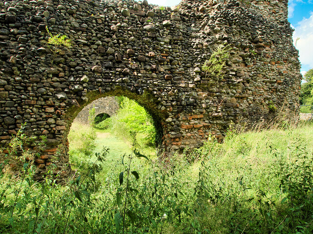
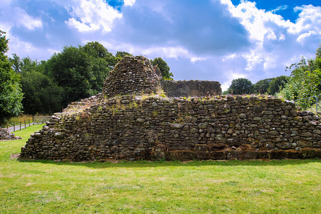
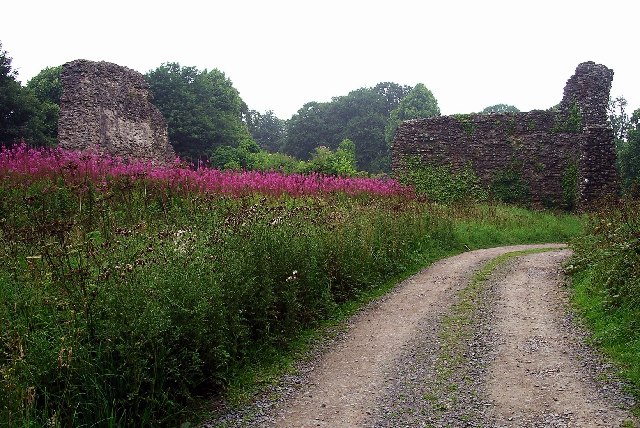
Old Lochmaben Castle

Lochmaben Castle was a 12th-century castle on the spit of land between Loch Kirk and Loch Castle, in Lochmaben, Scotland.The motte and bailey castle was...
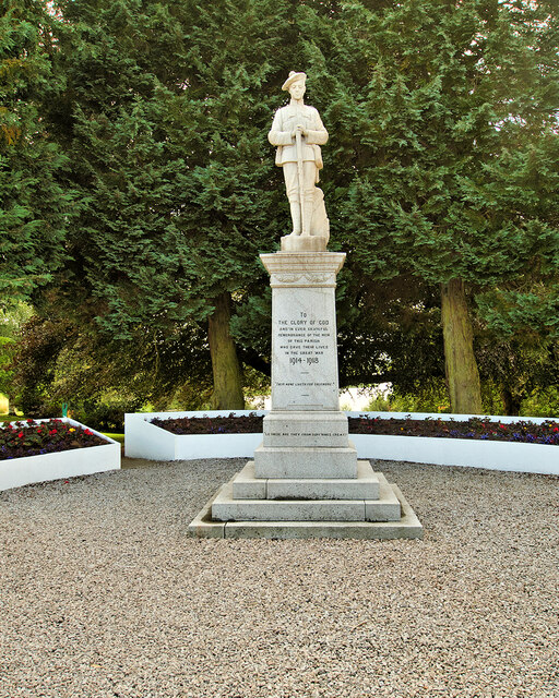
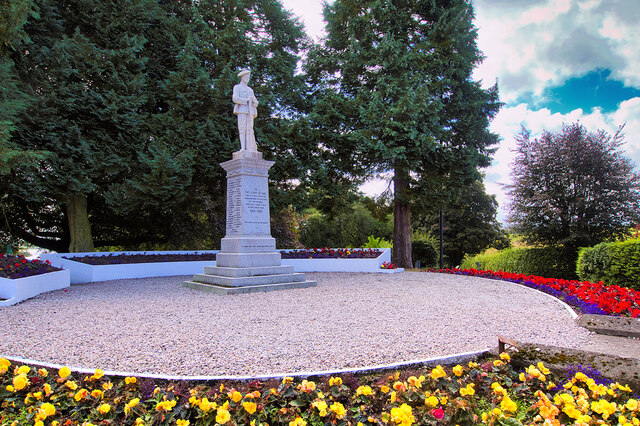
Lochmaben

Lochmaben (Gaelic: Loch Mhabain) is a small town and civil parish in Scotland, and site of a castle. It lies 4 miles (6 km) west of Lockerbie, in Dumfries...
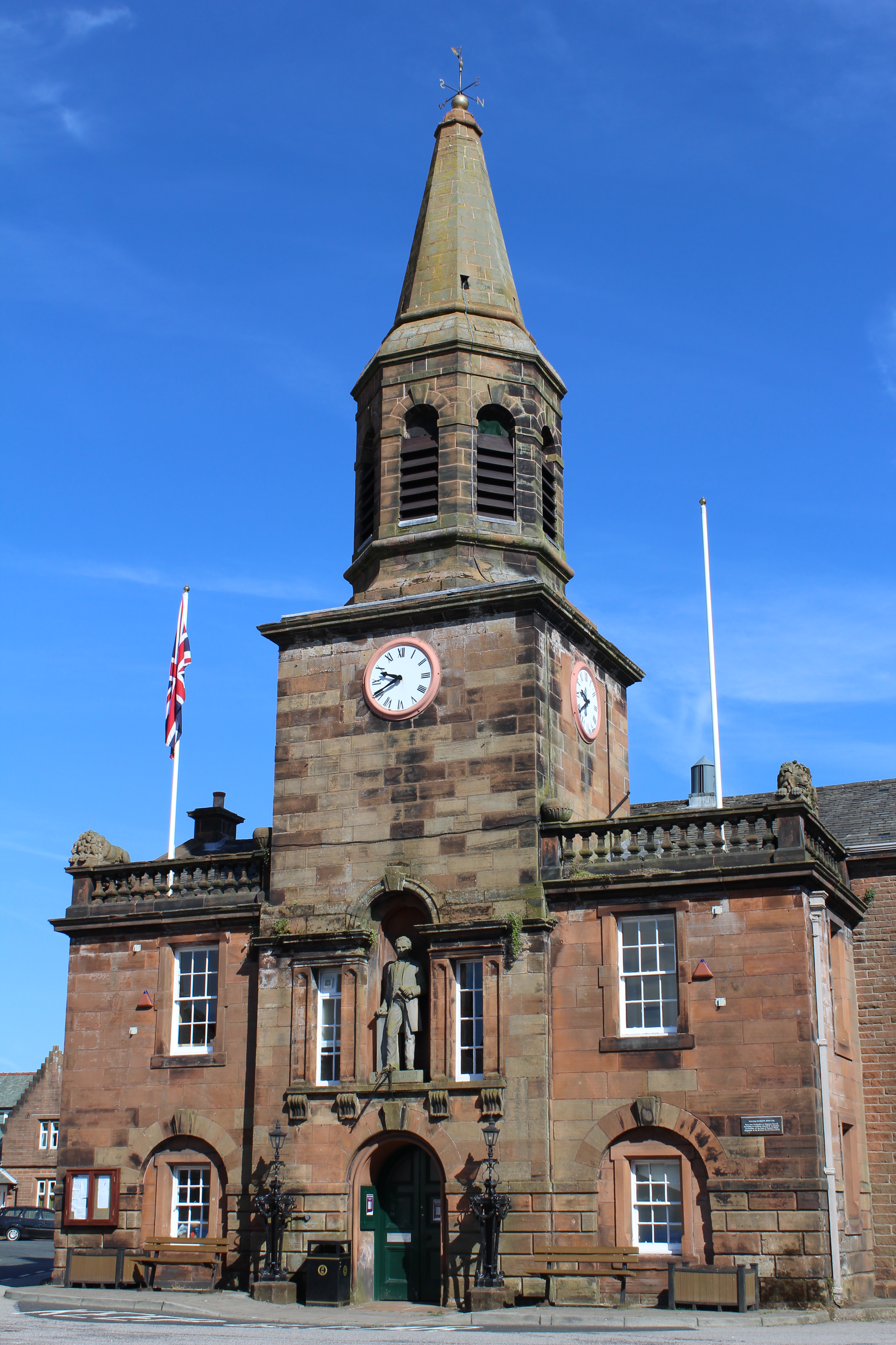
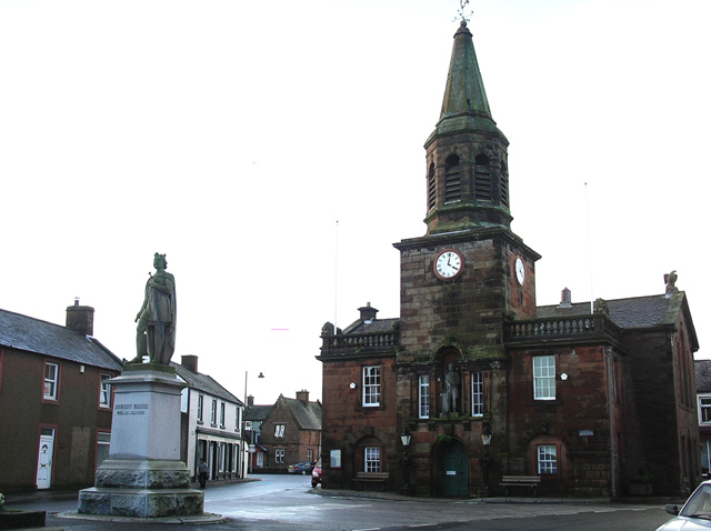
Lochmaben Town Hall

Lochmaben Town Hall is a municipal building in the High Street in Lochmaben, Dumfries and Galloway, Scotland. The structure, which accommodates a library...

Battle of Lochmaben Fair

The Battle of Lochmaben Fair was an engagement in Lochmaben, Scotland, on 22 July 1484 between Scottish loyalists to James III of Scotland and the rebels...

Nearby Amenities

Located within 500m of 55.12544,-3.4460166
Lochmaben
Is In: Dumfries & Galloway, Scotland, UK
Name En: Lochmaben
Name Gd: Loch Mhabain
Name Sco: Lochmaiben
Place: town
Population: 1942
Wikidata: Q3257725
Wikipedia: en:Lochmaben
Lat/Long: 55.1288756/-3.441277
Bus Stop
High Street
Naptan AtcoCode: 680000183333
Naptan Bearing: NW
Naptan CommonName: High Street
Naptan Indicator: Post Office
Naptan Landmark: Post Office
Naptan NaptanCode: 34234535
Naptan Notes: none
Naptan Street: High Street
Naptan Verified: no
Source: naptan_import
Lat/Long: 55.128482/-3.4410684
Bus Stop
High Street
Naptan AtcoCode: 680000183444
Naptan Bearing: SE
Naptan CommonName: High Street
Naptan Indicator: opp Post Office
Naptan Landmark: Post Office
Naptan NaptanCode: 34234534
Naptan Notes: none
Naptan Street: High Street
Naptan Verified: no
Source: naptan_import
Lat/Long: 55.1284413/-3.4407062
Bus Stop
Bruce Street
Naptan AtcoCode: 680000183501
Naptan Bearing: SW
Naptan CommonName: Bruce Street
Naptan Indicator: no 48
Naptan Landmark: Creamery
Naptan NaptanCode: 34234536
Naptan Notes: none
Naptan Street: Bruce Street
Naptan Verified: no
Source: naptan_import
Lat/Long: 55.1281838/-3.4465159
Bus Stop
Bruce Street
Naptan AtcoCode: 680000183502
Naptan Bearing: NE
Naptan CommonName: Bruce Street
Naptan Indicator: opp no 48
Naptan Landmark: Creamery
Naptan NaptanCode: 34234537
Naptan Notes: none
Naptan Street: Bruce Street
Naptan Verified: no
Source: naptan_import
Lat/Long: 55.1282156/-3.4468621
Bus Stop
Hospital
Naptan AtcoCode: 680000557333
Naptan Bearing: W
Naptan CommonName: Hospital
Naptan Indicator: opp road end
Naptan Landmark: Bruce Street
Naptan NaptanCode: 34234539
Naptan Notes: none
Naptan Street: A709
Naptan Verified: no
Source: naptan_import
Lat/Long: 55.1271249/-3.4524218
Bus Stop
Hospital
Naptan AtcoCode: 680000557444
Naptan Bearing: E
Naptan CommonName: Hospital
Naptan Indicator: road end
Naptan Landmark: Bruce Street
Naptan NaptanCode: 34234538
Naptan Notes: none
Naptan Street: A709
Naptan Verified: no
Source: naptan_import
Lat/Long: 55.1271897/-3.4522673
Barrier: bollard
Lat/Long: 55.1275093/-3.4397047
Kings Arms Hotel
Tourism: hotel
Lat/Long: 55.1286743/-3.4414354
Bank
RBS
Brand: RBS
Brand Wikidata: Q160126
Brand Wikipedia: en:Royal Bank of Scotland
Official Name: Royal Bank of Scotland
Lat/Long: 55.1284596/-3.441178
Townhall
Addr City: Lochmaben
Addr Housename: Lochmaben Town Hall
Addr Housenumber: 3
Addr Postcode: DG11 1NQ
Addr Street: High Street
Lat/Long: 55.1289706/-3.4414617
Atm
Operator: RBS
Lat/Long: 55.1284228/-3.441135
Cafe
Village Fare
Lat/Long: 55.1283246/-3.441017
Pharmacy
The Co-op Operative Pharmacy
Dispensing: yes
Healthcare: pharmacy
Lat/Long: 55.1278707/-3.4405879
Restaurant
King Crown
Cuisine: regional
Lat/Long: 55.1287196/-3.4434108
Kirk Loch
Tourism: camp_site
Lat/Long: 55.1277947/-3.4428213
commemoration site of James Mounsey, discover of rhubarb
Lat/Long: 55.1286364/-3.4421869
Post Office
Lochmaben Post Office
Addr City: Lockerbie
Addr Country: GB
Addr Housenumber: 4
Addr Postcode: DG11 1NQ
Addr Street: High Street
Addr Village: Lochmaben
Brand: Post Office
Brand Wikidata: Q1783168
Check Date: 2022-05-27
Check Date Opening Hours: 2022‑05‑27
Contact Website: https://www.postoffice.co.uk/branch-finder/4364716/lochmaben
Opening Hours: Mo 14:00-16:00; We,Fr 10:00-16:00
Ref Pol Id: 136388
Lat/Long: 55.1286843/-3.4407764
Lochmaben Mercat Cross
Historic: memorial
Memorial: mercat_cross
Lat/Long: 55.1289326/-3.4435762
Power: pole
Lat/Long: 55.122486/-3.4404986
Power: pole
Lat/Long: 55.1231769/-3.4401307
Power: pole
Lat/Long: 55.1238964/-3.439813
Power: pole
Lat/Long: 55.124604/-3.4394702
Post Box
Post Box Type: pillar
Lat/Long: 55.1285867/-3.4411194
The data included in this document is from www.openstreetmap.org. The data is made available under ODbL.

Have you been to Kirk Loch?

Leave your review of Kirk Loch below (or comments, questions and feedback).