Ffynnon Llugwy

Lake, Pool, Pond, Freshwater Marsh in Caernarfonshire

Wales

Ffynnon Llugwy

Ffynnon Llugwy Reservoir Looking south from Bwlch Eryl Farchog. Gallt yr Ogof (right) and Moel Siabod (left) are in the distance.
Ffynnon Llugwy Reservoir Credit: Ian Taylor

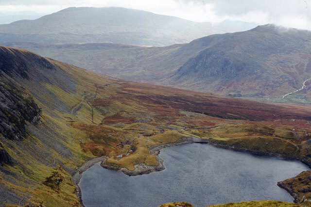
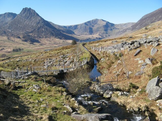
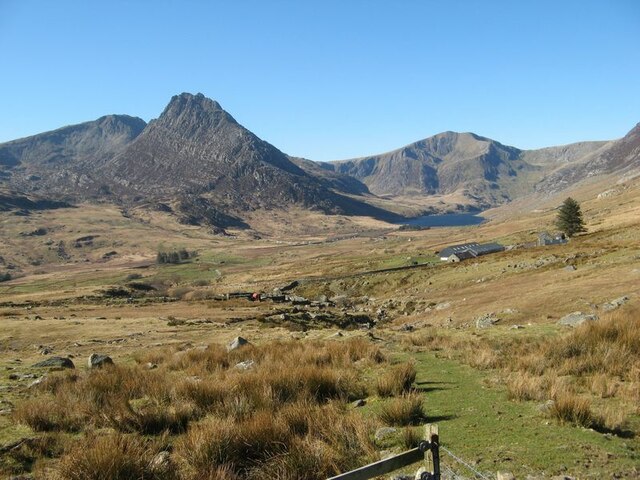
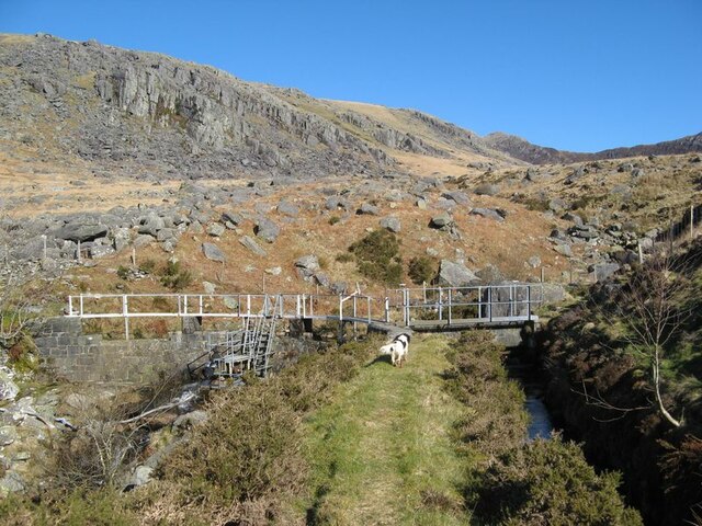
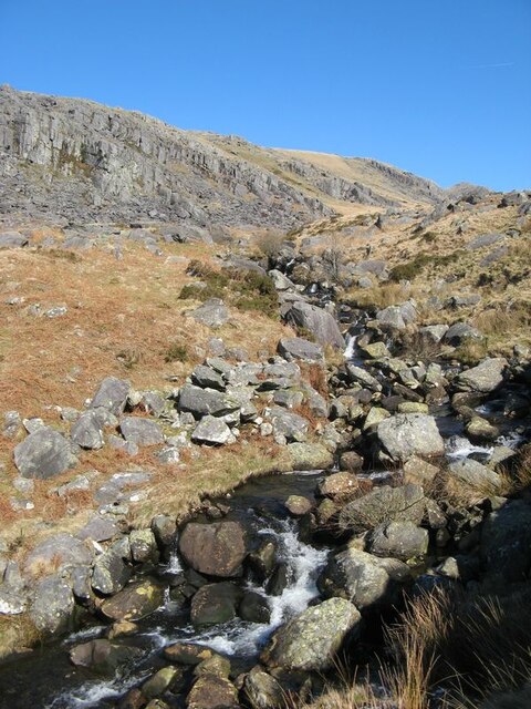
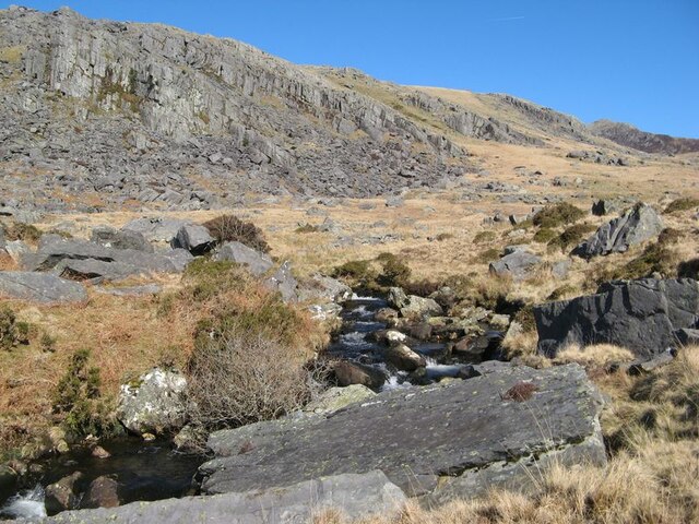
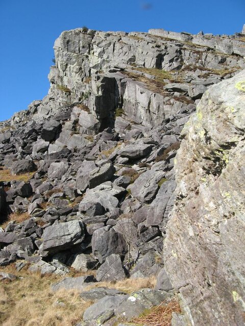
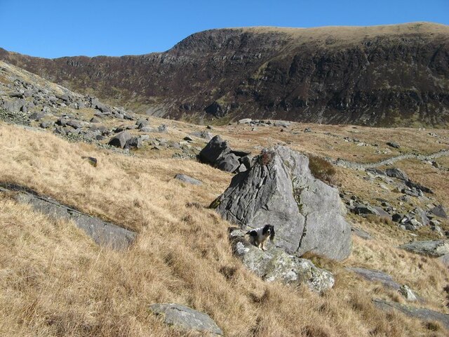
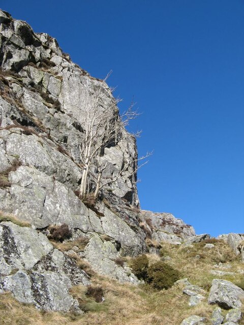
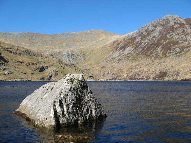
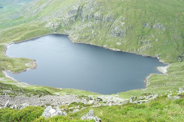
Ffynnon Llugwy is a small freshwater lake located in Caernarfonshire, Wales. Situated in the picturesque Snowdonia National Park, the lake is surrounded by stunning mountainous landscapes, making it a popular destination for nature enthusiasts and hikers alike.

With a surface area of approximately 10 hectares, Ffynnon Llugwy is relatively small compared to other lakes in the region. Its name translates to "Pool of the River Llugwy," derived from the nearby river that flows into it. The lake is fed by rainwater and the river, ensuring a constant supply of freshwater.

The water in Ffynnon Llugwy is crystal clear, providing a perfect habitat for various species of fish, including brown trout and salmon. Anglers often visit the lake to try their luck at catching these prized fish. The lake is also home to a variety of aquatic vegetation, including water lilies and reeds, which provide shelter and food for numerous bird species.

Surrounding the lake is a freshwater marsh, characterized by its lush vegetation and wetland habitat. This marshland is an essential ecosystem, supporting a wide range of plant and animal life. It provides nesting sites for waterfowl such as ducks and geese, as well as a breeding ground for amphibians and insects.

Ffynnon Llugwy is not only a haven for wildlife but also a place of natural beauty. Visitors can enjoy scenic walks along the lake's shoreline, taking in the panoramic views of the surrounding mountains. The tranquility and serenity of Ffynnon Llugwy make it a perfect spot for relaxation and contemplation amidst nature's wonders.

If you have any feedback on the listing, please let us know in the comments section below.

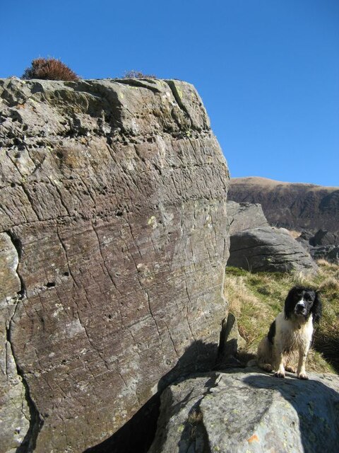
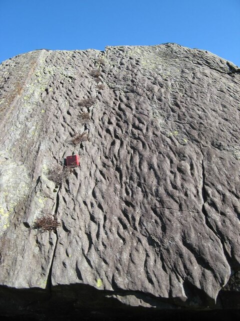
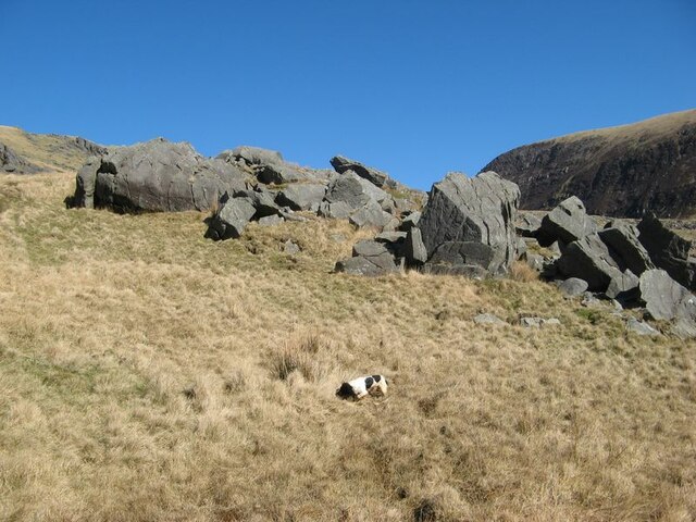
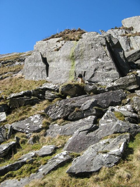
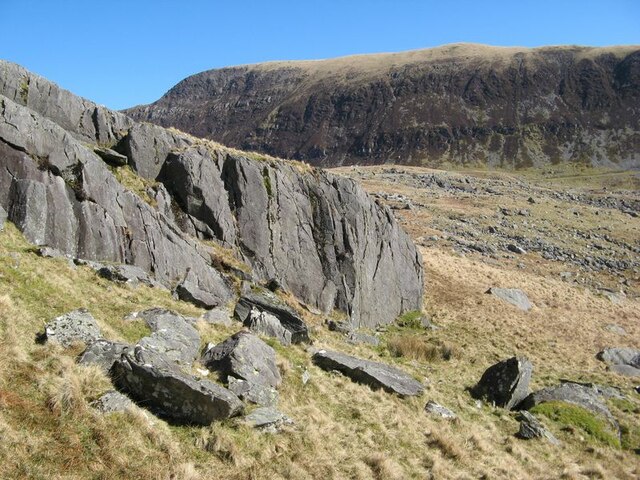
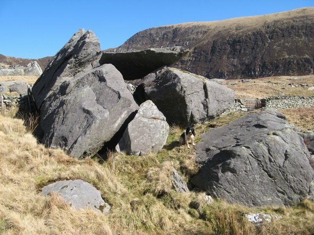
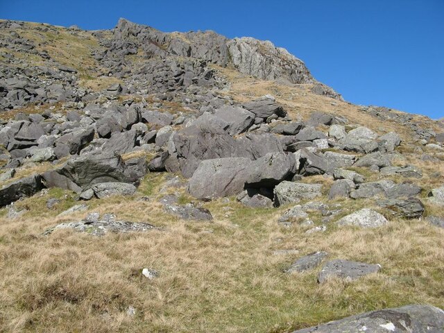
Ffynnon Llugwy Images

Images are sourced within 2km of 53.145584/-3.9563533 or Grid Reference SH6962. Thanks to Geograph Open Source API. All images are credited.

Ffynnon Llugwy Reservoir Looking south from Bwlch Eryl Farchog. Gallt yr Ogof (right) and Moel Siabod (left) are in the distance.
Ffynnon Llugwy Reservoir
Looking south from Bwlch Eryl Farchog. Gallt yr Ogof (right) and Moel Siabod (left) are in the distance.
Afon Llugwy weir A view of the Afon Llugwy weir and leat. The first dam on the lake known as Ffynnon Llugwy was built as part of the hydro-electric catchment for the Dolgarrog Aluminium Works, but was in later years relinquished for a drinking water supply. However, excess water continued to be collected when it was available and delivered through the col to Llyn Cowlyd.
Afon Llugwy weir
A view of the Afon Llugwy weir and leat. The first dam on the lake known as Ffynnon Llugwy was built as part of the hydro-electric catchment for the Dolgarrog Aluminium Works, but was in later years relinquished for a drinking water supply. However, excess water continued to be collected when it was available and delivered through the col to Llyn Cowlyd.
Llugwy leat Water collected at the gauging weir on the Afon Llugwy (see <a href="https://www.geograph.org.uk/photo/7123413">SH6861 : Afon Llugwy weir</a>) is delivered by this leat to Llyn Cowlyd where it joins the catchment of the Dolgarrog hydro-electric power scheme.
My assistant decided shortly after this image was captured to jump into the leat for a drink and a paddle. He was able to jump and climb out more easily than I had feared.
Llugwy leat
Water collected at the gauging weir on the Afon Llugwy (see SH6861 : Afon Llugwy weir) is delivered by this leat to Llyn Cowlyd where it joins the catchment of the Dolgarrog hydro-electric power scheme. My assistant decided shortly after this image was captured to jump into the leat for a drink and a paddle. He was able to jump and climb out more easily than I had feared.
Glan Llugwy A farm amid challenging moorland on the side of the Ogwen Valley, with spectacular views of the mountains.
Glan Llugwy
A farm amid challenging moorland on the side of the Ogwen Valley, with spectacular views of the mountains.
Afon Llugwy weir Approaching the Llugwy gauging weir, where excess water is diverted to Llyn Cowlyd along the leat. The Afon Llugwy runs through an impressive field of glacially-derived boulders which appear to spread out from rockfalls on Carreg Minianog.
Afon Llugwy weir
Approaching the Llugwy gauging weir, where excess water is diverted to Llyn Cowlyd along the leat. The Afon Llugwy runs through an impressive field of glacially-derived boulders which appear to spread out from rockfalls on Carreg Minianog.
Afon Llugwy with boulders At this point the Afon Llugwy descends rapidly through a defile it has created by washing fine sediments away from glacial deposits. The resulting jumble of massive, remnant boulders is most impressive.
Afon Llugwy with boulders
At this point the Afon Llugwy descends rapidly through a defile it has created by washing fine sediments away from glacial deposits. The resulting jumble of massive, remnant boulders is most impressive.
Afon Llugwy and Carreg Minianog The Afon Llugwy is less steep as it skirts the apron of debris which has fallen from Carreg Minianog. The angular nature of glacially-transported debris which is dumped about here suggests that it has not been transported far.
I am a particular enthusiast for the 'late-winter' colour palette of bleached grass and brown, dry bracken and it was an absolute joy to be out in the sun despite a degree of sogginess around the feet on this spectacularly wet moorland.
Afon Llugwy and Carreg Minianog
The Afon Llugwy is less steep as it skirts the apron of debris which has fallen from Carreg Minianog. The angular nature of glacially-transported debris which is dumped about here suggests that it has not been transported far. I am a particular enthusiast for the 'late-winter' colour palette of bleached grass and brown, dry bracken and it was an absolute joy to be out in the sun despite a degree of sogginess around the feet on this spectacularly wet moorland.
Rockfall, Carreg Minianog Extensive rockfalls here can be attributed to the presence of bedding surfaces inclined towards the low ground excavated by glacial action. The rockfalls are probably periglacial features that developed following the loss of significant buttressing by thick ice after de-glaciation, at which time frost acting on the bare rock would detach blocks to slide under the influence of gravity. A great deal of the huge volume of glacial boulders on the valley side appear to originate in this area.
The rock is a coarse sandstone with a significant content of rhyolite debris which has been eroded from rocks of the Llewelyn Volcanic Group of Ordovician, Caradoc age. Fallen blocks show good sections parallel and normal to the bedding surfaces.
Rockfall, Carreg Minianog
Extensive rockfalls here can be attributed to the presence of bedding surfaces inclined towards the low ground excavated by glacial action. The rockfalls are probably periglacial features that developed following the loss of significant buttressing by thick ice after de-glaciation, at which time frost acting on the bare rock would detach blocks to slide under the influence of gravity. A great deal of the huge volume of glacial boulders on the valley side appear to originate in this area. The rock is a coarse sandstone with a significant content of rhyolite debris which has been eroded from rocks of the Llewelyn Volcanic Group of Ordovician, Caradoc age. Fallen blocks show good sections parallel and normal to the bedding surfaces.
Bedding in sandstone Bedding and cross-stratification features are well-displayed in this fallen block of sandstone belonging to the Llewelyn Volcanic Group (Ordovician, Caradoc age).
Bedding in sandstone
Bedding and cross-stratification features are well-displayed in this fallen block of sandstone belonging to the Llewelyn Volcanic Group (Ordovician, Caradoc age).
Ripple-marking in sandstone A fabulous surface showing a slightly-oblique section through extensive ripple-marks in sandstone belonging to the Llewelyn Volcanic Group (Ordovician, Caradoc). Notebook included for scale (length 15cm).
Ripple-marking in sandstone
A fabulous surface showing a slightly-oblique section through extensive ripple-marks in sandstone belonging to the Llewelyn Volcanic Group (Ordovician, Caradoc). Notebook included for scale (length 15cm).
Glacial boulder group A collection of erratic boulders dropped in a group on the slope below Cwm Llugwy. Some, but not all, of them show significant rounding from transport within an ice stream.
Glacial boulder group
A collection of erratic boulders dropped in a group on the slope below Cwm Llugwy. Some, but not all, of them show significant rounding from transport within an ice stream.
Boulder-strewn hillside Giant boulders are tossed about at the foot of steep slopes leading onto Creigiau  Hirion. Ahead and to the right lie extensive deposits of moraine associated with the development of Cwm Llugwy.
Boulder-strewn hillside
Giant boulders are tossed about at the foot of steep slopes leading onto Creigiau Hirion. Ahead and to the right lie extensive deposits of moraine associated with the development of Cwm Llugwy.
Fallen blocks Large blocks of sandstone have fallen from the steep hillside. They preserve features such as bedding, cross-stratification and ripple-marking. In these sandstones are recorded the erosion of volcanic highlands to the north, and the deposition of the debris by braided rivers crossing wide plain to the contemporary ocean. All belong to the Llewelyn Volcanic Group (ordovician, Caradoc age).
Fallen blocks
Large blocks of sandstone have fallen from the steep hillside. They preserve features such as bedding, cross-stratification and ripple-marking. In these sandstones are recorded the erosion of volcanic highlands to the north, and the deposition of the debris by braided rivers crossing wide plain to the contemporary ocean. All belong to the Llewelyn Volcanic Group (ordovician, Caradoc age).
Competent crags Rock outcrop here is showing fewer signs of periglacial erosion and more evidence for flowing, solid ice which has carried away blocks quarried from the flanks of the valley. The cliffs of Y Braich form the backdrop to ground which is covered with moraine deposits.
Competent crags
Rock outcrop here is showing fewer signs of periglacial erosion and more evidence for flowing, solid ice which has carried away blocks quarried from the flanks of the valley. The cliffs of Y Braich form the backdrop to ground which is covered with moraine deposits.
Boulder group with lid A most satisfying group of glacial boulders atop outcrop which has been smoothed by ice flowing down the slope. A small watercourse chuckles its way underneath the boulders and around the rock outcrop, protected by a heavy iron bar.
Boulder group with lid
A most satisfying group of glacial boulders atop outcrop which has been smoothed by ice flowing down the slope. A small watercourse chuckles its way underneath the boulders and around the rock outcrop, protected by a heavy iron bar.
Change of rock-type Rockfalls from the southern margin of Craig y Llyn are mostly of a dark grey sandstone (Llewelyn Volcanic Group) but there are also pale blocks of rhyolite. Looking up the slope shows a contact between grey sandstone and pale grey rhyolite, actually welded ash-flows of the Capel Curig Volcanic Formation. The silica-rich volcanic rock weathers to a very pale grey colour and is distinctive in outcrops. Both rock types are of Ordovician, Caradoc age.
Change of rock-type
Rockfalls from the southern margin of Craig y Llyn are mostly of a dark grey sandstone (Llewelyn Volcanic Group) but there are also pale blocks of rhyolite. Looking up the slope shows a contact between grey sandstone and pale grey rhyolite, actually welded ash-flows of the Capel Curig Volcanic Formation. The silica-rich volcanic rock weathers to a very pale grey colour and is distinctive in outcrops. Both rock types are of Ordovician, Caradoc age.
Craig y Llyn A cliff face developed in hard, volcanic rocks belonging to the Capel Curig Volcanic Formation (Ordovician, Caradoc). A rowan tree is growing on a rather inhospitable cliff face, but probably only survived because sheep could not reach it. The Capel Curig Volcanic Formation represents the accumulation of rhyolitic tuffs which were erupted from volcanoes spread between Tryfan and the northern coast beyond Conwy. It is chilling to consider the violence of eruptions which would hurl red-hot clouds of ash as far as 25km before they coalesced and hardened, often under water.
Craig y Llyn
A cliff face developed in hard, volcanic rocks belonging to the Capel Curig Volcanic Formation (Ordovician, Caradoc). A rowan tree is growing on a rather inhospitable cliff face, but probably only survived because sheep could not reach it. The Capel Curig Volcanic Formation represents the accumulation of rhyolitic tuffs which were erupted from volcanoes spread between Tryfan and the northern coast beyond Conwy. It is chilling to consider the violence of eruptions which would hurl red-hot clouds of ash as far as 25km before they coalesced and hardened, often under water.
Island boulder A single, glacial boulder forming an island in the water of Ffynnon Lugwy. From this angle it can be seen that Cwm Llugwy forms a second, shallow cirque above the primary cirque which holds the lake.
Island boulder
A single, glacial boulder forming an island in the water of Ffynnon Lugwy. From this angle it can be seen that Cwm Llugwy forms a second, shallow cirque above the primary cirque which holds the lake.
Show me another place!

Ffynnon Llugwy is located at Grid Ref: SH6962 (Lat: 53.145584, Lng: -3.9563533)

Unitary Authority: Conwy

Police Authority: North Wales

What 3 Words

///captions.mornings.markets. Near Bethesda, Gwynedd

Nearby Locations

Ffynnon Llugwy

Related Wikis

Ffynnon Llugwy

Ffynnon Llugwy (English: Llugwy spring) is a lake in the Carneddau range of mountains in Snowdonia, North Wales. It lies at a height of about 1,786 feet...

Pen yr Helgi Du

Pen yr Helgi Du (Head or Hill of the Black Hound) is a mountain peak in the eastern part of the Carneddau in Snowdonia, North Wales. It lies on the south...

Carnedd Llewelyn

Carnedd Llewelyn, also spelled Carnedd Llywelyn, is a mountain massif in the Carneddau range in Snowdonia, north-west Wales. It is the highest point of...

Llyn Llyffant

Llyn Llyffant is the highest lake in Wales, located at grid reference SH 687 645. Its name translates into English as "frog lake". It lies at an elevation...

Pen Llithrig y Wrach

Pen Llithrig y Wrach is a mountain peak in Snowdonia, North Wales. It is one of the four Marilyns that make up the Carneddau range. To the east is Creigiau...

Welsh 1000 m Peaks Race

The Welsh 1000m Peaks Race takes place on the first Saturday in June each year. The 32 km route is also known as the Snowdonia Summits Marathon as competitors...

Llyn Cowlyd

Llyn Cowlyd is the deepest lake in northern Wales. It lies in the Snowdonia National Park at the upper end of Cwm Cowlyd on the south-eastern edge of...

Foel Meirch

Foel Meirch is a top of Carnedd Dafydd in the Carneddau range in Snowdonia, North Wales. It offers commanding views of Carnedd Llewelyn and Yr Elen, and...

Have you been to Ffynnon Llugwy?

Leave your review of Ffynnon Llugwy below (or comments, questions and feedback).