Loch Stack

Lake, Pool, Pond, Freshwater Marsh in Sutherland

Scotland

Loch Stack

Boulders along path north-east of Lone The path passes between two boulders, surely the result of a larger one splitting.
The route is used as access for ascents of the mountain, Arkle, part of which is seen above the trees.
Boulders along path north-east of Lone Credit: Trevor Littlewood

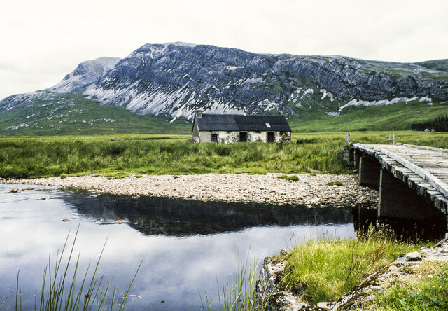
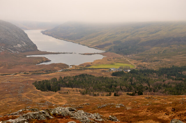
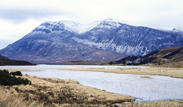
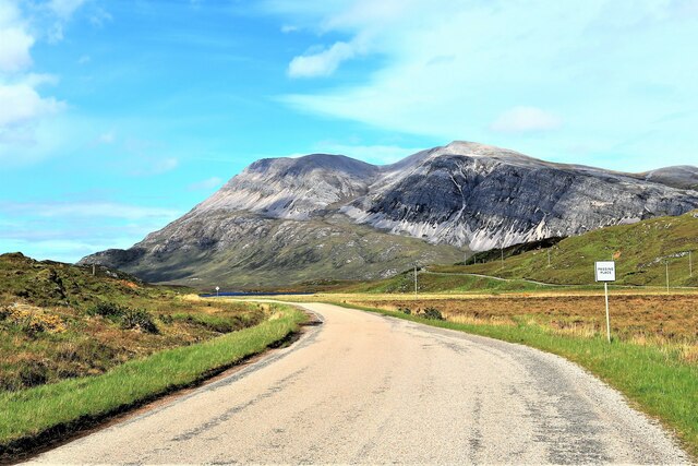
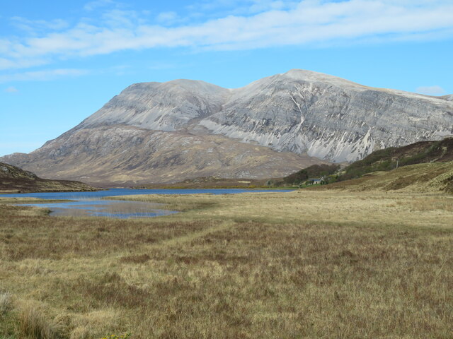
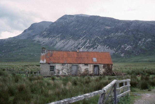
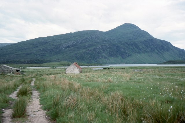
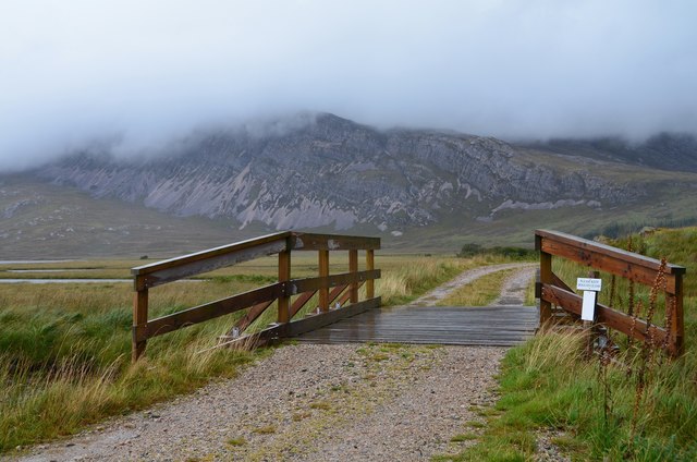
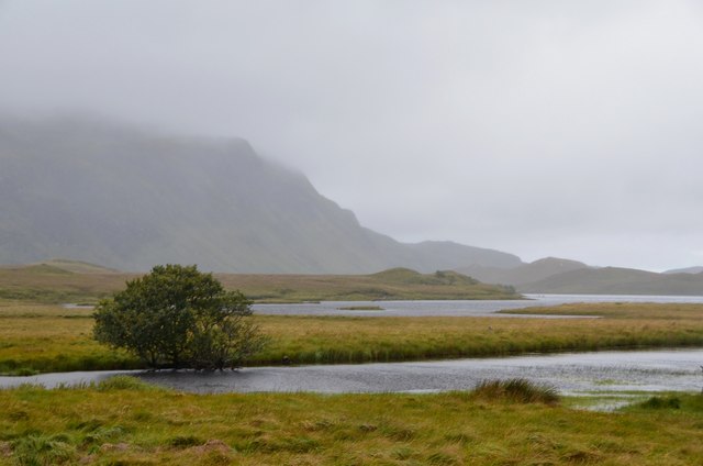
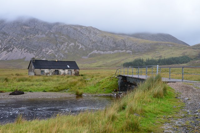
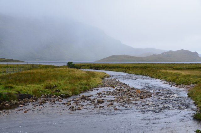
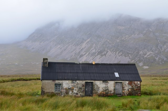
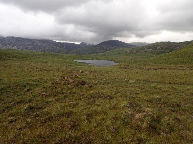
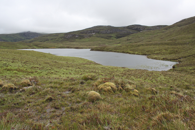
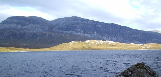
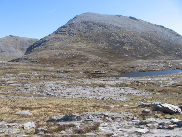
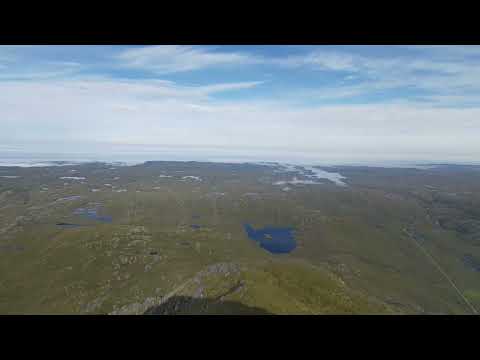
Loch Stack is a picturesque freshwater loch located in the county of Sutherland, Scotland. Situated amidst the stunning landscape of the Scottish Highlands, the loch covers an area of approximately 5 square kilometers and is nestled between the towering peaks of Ben Stack and Arkle.

The loch is renowned for its pristine and tranquil environment, offering visitors a unique opportunity to immerse themselves in the beauty of nature. It is a popular destination for outdoor enthusiasts, including anglers, birdwatchers, and hikers.

Fishing is a popular activity at Loch Stack, with the loch being home to a variety of fish species, including brown trout and Arctic charr. Anglers can enjoy the peaceful surroundings while casting their lines and trying their luck at catching these elusive fish.

The loch is also a haven for birdlife, attracting a diverse range of species. It is particularly well-known for its population of red-throated divers, which nest on the loch's islands during the breeding season. Other bird species that can be spotted include golden eagles, ospreys, and various waterfowl.

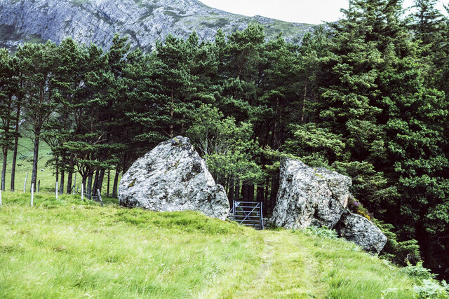
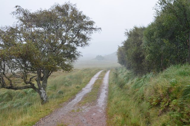
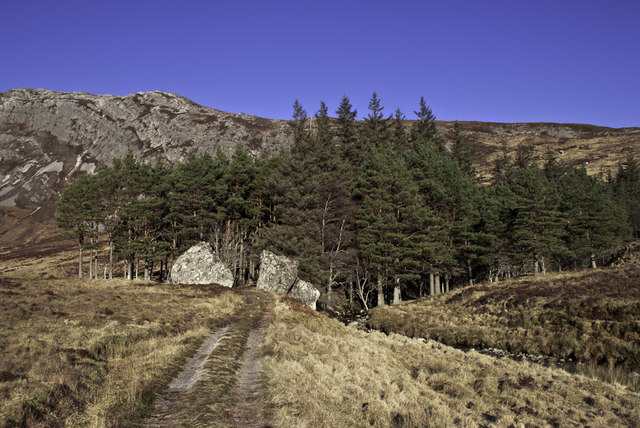
Surrounded by heather-clad hills and offering breathtaking panoramic views, Loch Stack is a paradise for hikers. There are numerous trails in the area, catering to different abilities and interests. These trails provide opportunities to explore the surrounding wilderness, offering glimpses of waterfalls, ancient woodlands, and stunning vistas.

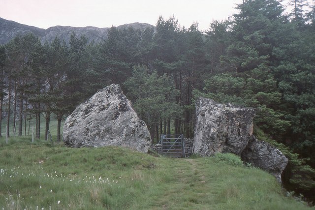
Overall, Loch Stack is a hidden gem in the Scottish Highlands, offering a tranquil retreat for those seeking solace in nature's embrace. Its unspoiled beauty and diverse wildlife make it a must-visit destination for nature lovers and outdoor enthusiasts alike.

If you have any feedback on the listing, please let us know in the comments section below.

Loch Stack Images

Images are sourced within 2km of 58.334882/-4.9123463 or Grid Reference NC2942. Thanks to Geograph Open Source API. All images are credited.

Boulders along path north-east of Lone The path passes between two boulders, surely the result of a larger one splitting.
The route is used as access for ascents of the mountain, Arkle, part of which is seen above the trees.
Boulders along path north-east of Lone
The path passes between two boulders, surely the result of a larger one splitting. The route is used as access for ascents of the mountain, Arkle, part of which is seen above the trees.
Lone in 1996 The bothy at Lone seen across the Abhainn an Loin with Arkle in the distance.
Jim Barton's image made in 2017 shows that there's been little obvious change over the intervening 21 years. <a title="https://www.geograph.org.uk/photo/5531727" href="https://www.geograph.org.uk/photo/5531727">Link</a>
Lone in 1996
The bothy at Lone seen across the Abhainn an Loin with Arkle in the distance. Jim Barton's image made in 2017 shows that there's been little obvious change over the intervening 21 years. Link
View over Achfary and Loch More, Sutherland Viewed from the eastern slope of Ben Stack.  Part of the Duke of Westminster's Estate in the Scottish Highlands.
View over Achfary and Loch More, Sutherland
Viewed from the eastern slope of Ben Stack. Part of the Duke of Westminster's Estate in the Scottish Highlands.
Southern end of Loch Stack The narrow, southern end of the loch seen from the A838 north of Achfary.
Arkle is the striking mountain.
Southern end of Loch Stack
The narrow, southern end of the loch seen from the A838 north of Achfary. Arkle is the striking mountain.
Arkle from An Earachd Arkle from the A838 at An Earachd.
Arkle from An Earachd
Arkle from the A838 at An Earachd.
Head of Loch Stack Near this point the superb mountain that is Arkle comes into view for travellers heading NW on A838.
Head of Loch Stack
Near this point the superb mountain that is Arkle comes into view for travellers heading NW on A838.
Lone Bothy in 1989 The bothy had one fairly well kept room with boarded walls and concrete floor and some cooking utensils. The sleeping area was a bit more Spartan with a cobbled floor, but had serviceable bunks. I spent two comfy nights here when exploring the area, fortunately in a midge-free spell. The screes and crags of Arkle are beyond.
Lone Bothy in 1989
The bothy had one fairly well kept room with boarded walls and concrete floor and some cooking utensils. The sleeping area was a bit more Spartan with a cobbled floor, but had serviceable bunks. I spent two comfy nights here when exploring the area, fortunately in a midge-free spell. The screes and crags of Arkle are beyond.
Lone Bothy and Ben Stack Ben Stack (720m) seen across Loch Stack.
Lone Bothy and Ben Stack
Ben Stack (720m) seen across Loch Stack.
Path through the split boulder, Lone A landmark on the path to Arkle and Strath Dionard. Note the cotton grass, left.
Path through the split boulder, Lone
A landmark on the path to Arkle and Strath Dionard. Note the cotton grass, left.
Track to Lone on a wet day The track from the S end of Loch Stack.
Track to Lone on a wet day
The track from the S end of Loch Stack.
Bridge over the Allt a' Chuilinn On the track to Lone with the south ridge of Arkle in the background.
Bridge over the Allt a' Chuilinn
On the track to Lone with the south ridge of Arkle in the background.
Loch Stack and Ben Stack Low-lying ground at the southern end of the loch.
Loch Stack and Ben Stack
Low-lying ground at the southern end of the loch.
Lone and the bridge over the Abhainn an Loin The old house at Lone, which was available as a bothy on my visit here in 1989. I am not sure if it still is; it was locked today, it being the stalking season. Compare with <a href="https://www.geograph.org.uk/photo/5280641">NC3042 : Lone Bothy in 1989</a>.
Lone and the bridge over the Abhainn an Loin
The old house at Lone, which was available as a bothy on my visit here in 1989. I am not sure if it still is; it was locked today, it being the stalking season. Compare with NC3042 : Lone Bothy in 1989.
Abhainn an Loin The river that drains into Loch Stack from Srath Luib na Seilich, the glen south of Meall Horn.
Abhainn an Loin
The river that drains into Loch Stack from Srath Luib na Seilich, the glen south of Meall Horn.
Lone in 2017 The old house with Arkle in the background. See also <a href="https://www.geograph.org.uk/photo/5280641">NC3042 : Lone Bothy in 1989</a>.
Lone in 2017
The old house with Arkle in the background. See also NC3042 : Lone Bothy in 1989.
Loch nam Breac Buidhe The loch was surrounded by moorland that was very dry at this time.
Loch nam Breac Buidhe
The loch was surrounded by moorland that was very dry at this time.
Loch nam Breac Buidhe Surrounded by boggy moorland north of Ben Screavie.
Loch nam Breac Buidhe
Surrounded by boggy moorland north of Ben Screavie.
Gateway to the woods
Show me another place!

Loch Stack is located at Grid Ref: NC2942 (Lat: 58.334882, Lng: -4.9123463)

Unitary Authority: Highland

Police Authority: Highlands and Islands

What 3 Words

///revolting.stance.path. Near Oldshoremore, Highland

Nearby Locations

Loch Stack

Related Wikis

A838 road

The A838 is a major road in Sutherland, in the Highland area of Scotland. It runs generally northwest from the A836 in the Lairg area to Laxford Bridge...

Achfary

Achfary (Scottish Gaelic: Achadh Taigh Phairidh) is a hamlet in the Scottish council area of Highland. To the east of the village lies Loch nan Ealachan...

Ben Stack

Ben Stack (Scottish Gaelic: Beinn Stac) is a mountain in Sutherland, in the northwest of Scotland. It is 721 m (2,365 ft) high. It lies southeast of Laxford...

North West Sutherland National Scenic Area

North West Sutherland is a national scenic area (NSA) covering the mountains and coastal scenery of the northwestern part of the county of Sutherland...

Arkle (Sutherland)

Arkle (Scottish Gaelic: Airceil) is a mountain in Sutherland, in the far north-west corner of the Scottish Highlands. Like its sister Foinaven, the mountain...

Meallan Liath Coire Mhic Dhùghaill

Meallan Liath Coire Mhic Dhughaill (801 m) is a mountain in the Northwest Highlands, Scotland. It lies in the far north of Scotland between Lairg and Durness...

Laxford

Laxford is a remote area in the far Northwest Highlands of Scotland around the River Laxford which runs northwest from Loch Stack to Laxford Bay. This...
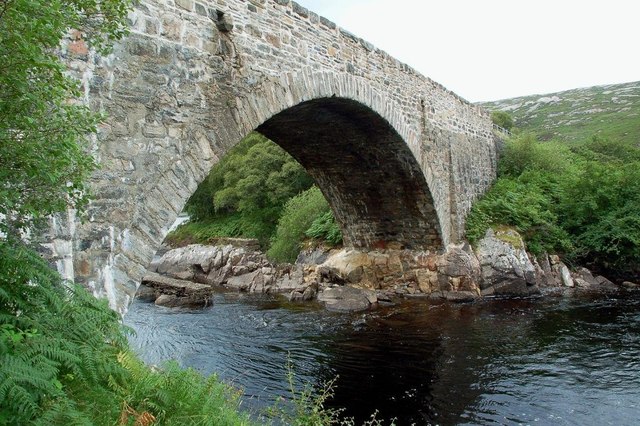
Laxford Bridge

The Laxford Bridge is a stone arch bridge in Sutherland, Scotland which carries the A838 across the River Laxford north to Rhiconich and Durness. The bridge...

Related Videos

Ben Stack summit, far northwest Scotland

721m, Graham. From the end of the ridge just beyond the summit. Ben More Assynt 0:04 Canisp 0:08 Quinag 0:09 Foinaven 0:31 ...

Day 3 of 30 videos in 30 days - The North Coast 500

From the Kyle of Durness to Loch Stack. A longer video as it's an awesome drive where we got to see wild Deer.

Nearby Amenities

Located within 500m of 58.334882,-4.9123463
The data included in this document is from www.openstreetmap.org. The data is made available under ODbL.

Have you been to Loch Stack?

Leave your review of Loch Stack below (or comments, questions and feedback).