Rubha nam Brisgein
Coastal Feature, Headland, Point in Inverness-shire
Scotland
Rubha nam Brisgein
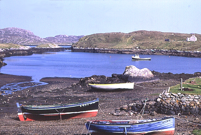
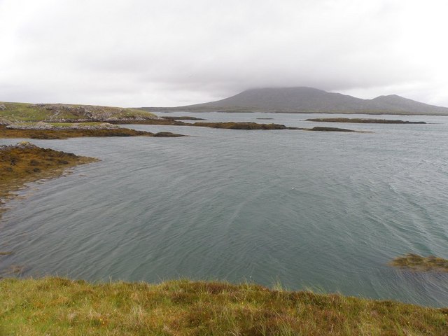
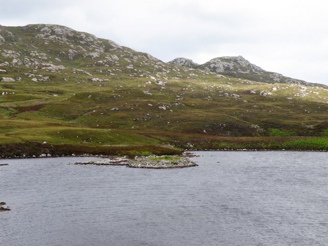
Rubha nam Brisgein, located in Inverness-shire, Scotland, is a captivating coastal feature that boasts a stunning headland and point. Situated on the western coast of Scotland, Rubha nam Brisgein offers breathtaking views of the surrounding landscape and the vast expanse of the Atlantic Ocean.
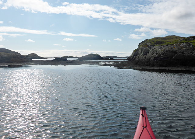
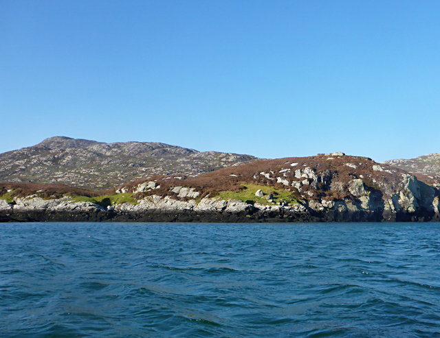
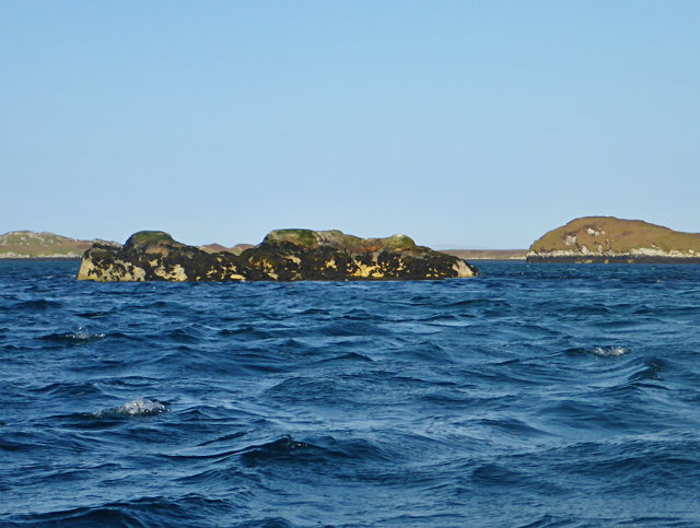
The headland is characterized by its rugged and rocky terrain, which adds to its dramatic and picturesque appeal. Jutting out into the ocean, it forms a prominent natural boundary between the land and the sea. The rocky cliffs that line the headland are often battered by the crashing waves, creating a mesmerizing spectacle for visitors.
Rubha nam Brisgein also serves as a point of interest for wildlife enthusiasts. The headland is home to a diverse array of coastal flora and fauna, including seabirds, seals, and occasional sightings of dolphins and whales. Many bird species can be observed nesting on the cliffs, making it an ideal spot for birdwatching.
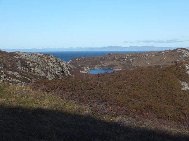
The point itself offers panoramic views of the surrounding coastline, with its elevated position providing a unique perspective of the surrounding landscape. Visitors can enjoy the tranquility of the area while taking in the beauty of the rugged cliffs, the sparkling sea, and the distant mountains.
Access to Rubha nam Brisgein is relatively easy, with a well-maintained footpath leading to the headland. Visitors are advised to wear appropriate footwear and exercise caution when navigating the rocky terrain. Whether it's a leisurely stroll, nature photography, or simply soaking in the natural beauty, Rubha nam Brisgein is a must-visit destination for nature enthusiasts and lovers of coastal landscapes.
If you have any feedback on the listing, please let us know in the comments section below.
Rubha nam Brisgein Images
Images are sourced within 2km of 57.500849/-7.1938779 or Grid Reference NF8957. Thanks to Geograph Open Source API. All images are credited.


Rubha nam Brisgein is located at Grid Ref: NF8957 (Lat: 57.500849, Lng: -7.1938779)
Unitary Authority: Na h-Eileanan an Iar
Police Authority: Highlands and Islands
What 3 Words
///tulip.amps.demanding. Near Balivanich, Na h-Eileanan Siar
Nearby Locations
Related Wikis

Ronay
Ronay (Scottish Gaelic: Rònaigh) is an island in the Outer Hebrides of Scotland, which lies a short distance off the east coast of Grimsay. == Geography... ==

Flodaigh Mòr
Flodaigh Mòr (or Floddaymore) is an uninhabited island in the Outer Hebrides of Scotland. == Geography and geology == Flodaigh Mòr lies east of North Uist...
Grimsay
Grimsay (Scottish Gaelic: Griomasaigh) is a tidal island in the Outer Hebrides of Scotland. == Geography == Grimsay is the largest of the low-lying stepping...

Fraoch-Eilean
Fraoch-eilean is a small island with an uncertain population north of Benbecula in the Outer Hebrides of Scotland. It is about 55 hectares (140 acres...
Nearby Amenities
Located within 500m of 57.500849,-7.1938779Have you been to Rubha nam Brisgein?
Leave your review of Rubha nam Brisgein below (or comments, questions and feedback).