Furze Clump

Wood, Forest in Cambridgeshire South Cambridgeshire

England

Furze Clump

Harvest time on The Gogs The combine had stopped and the tractor and full trailer shown in <a href="https://www.geograph.org.uk/photo/6904418">TL5053 : Combining on The Gogs</a> were disappearing over the crest of the hill in a cloud of dust.

Comparable views of these fields south-west of The Roman Road:
<a href="https://www.geograph.org.uk/photo/4209983">TL5053 : Field gate on The Roman Road</a>
<a href="https://www.geograph.org.uk/photo/4708677">TL5053 : Farm track and autumn fields</a>
<a href="https://www.geograph.org.uk/photo/5574989">TL5053 : The Gogs from the Roman Road</a>
<a href="https://www.geograph.org.uk/photo/6791839">TL5053 : A field gate on The Roman Road</a>
Harvest time on The Gogs Credit: John Sutton

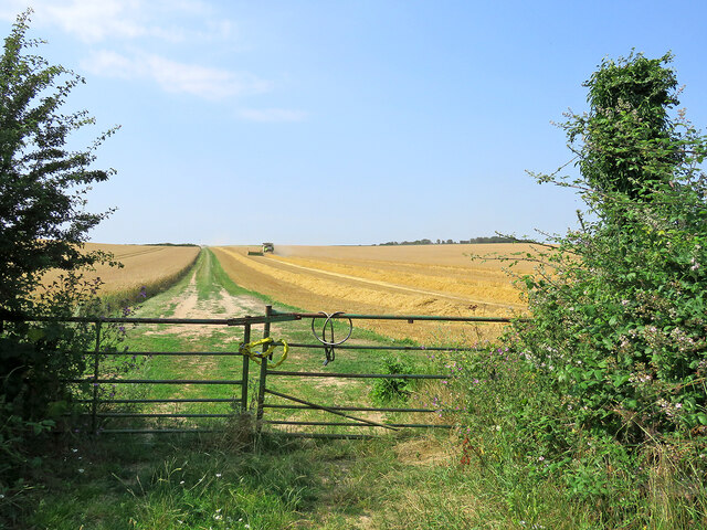
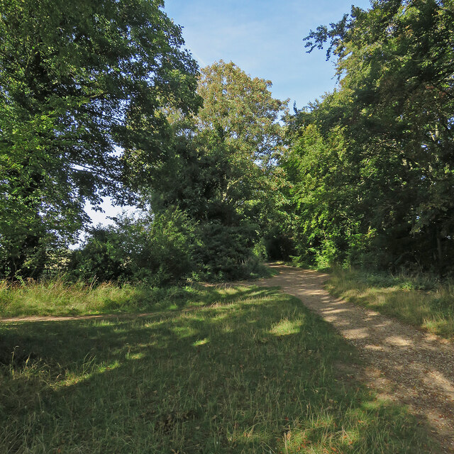
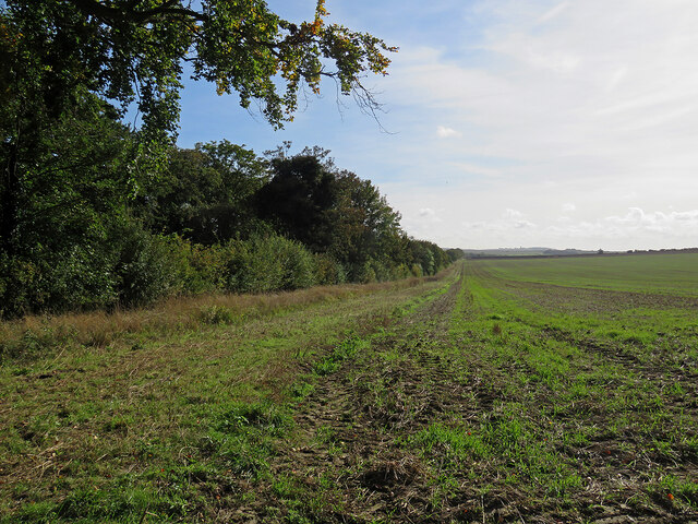
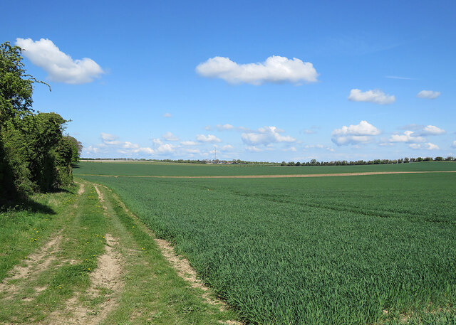
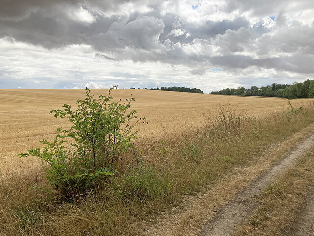
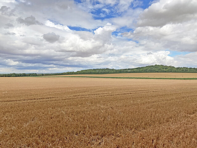
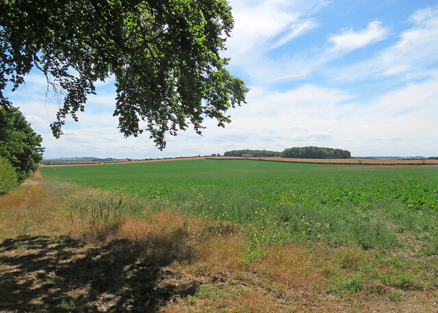
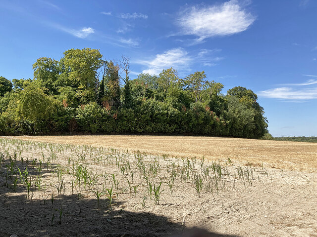
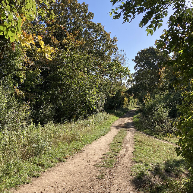
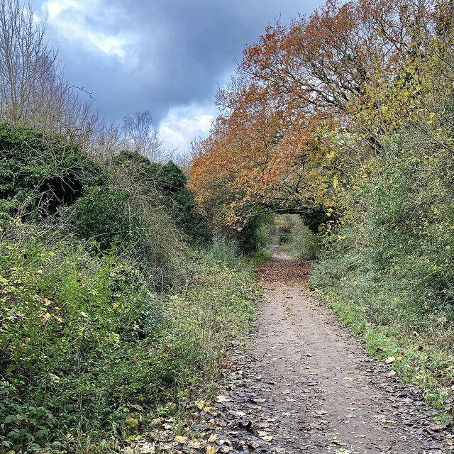
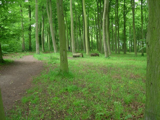
Furze Clump is a picturesque woodland located in Cambridgeshire, England. Covering an area of approximately 100 acres, it is a popular destination for nature enthusiasts and outdoor activities. The clump is situated just outside the village of Fulbourn, offering a tranquil escape from the bustling city life.

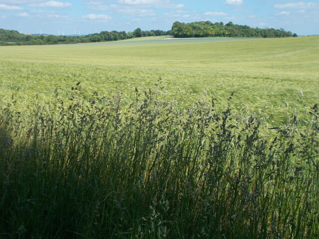
The woodland is predominantly composed of oak and birch trees, creating a dense canopy that provides shade and shelter for a variety of wildlife. The forest floor is adorned with carpets of bluebells during the spring season, adding a splash of vibrant color to the landscape.

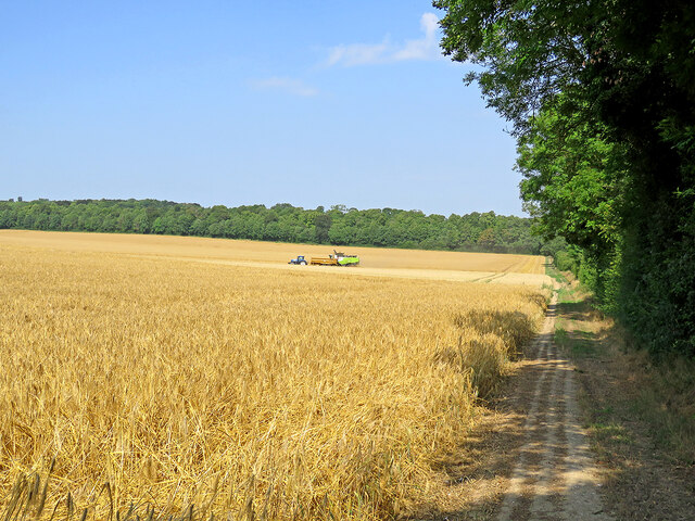
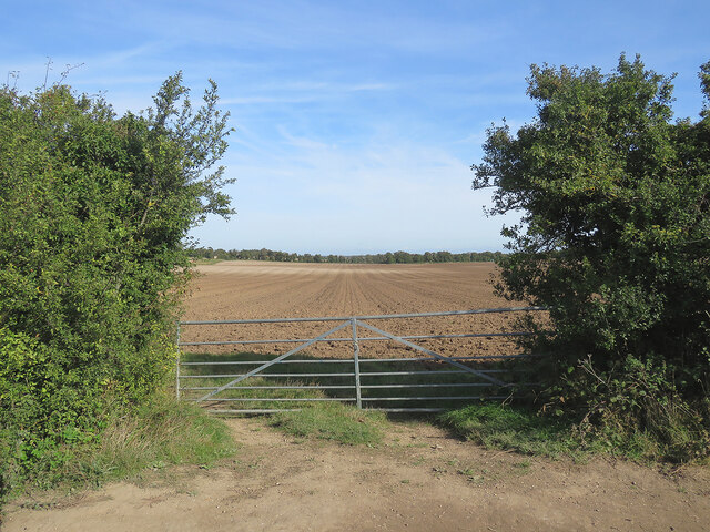
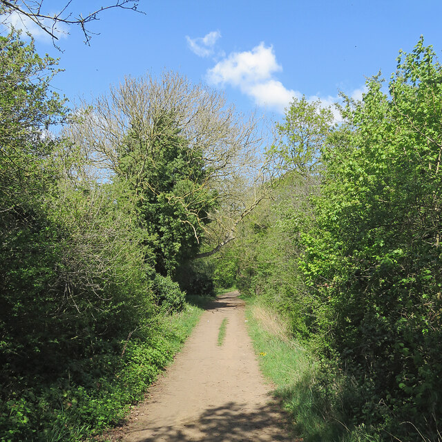
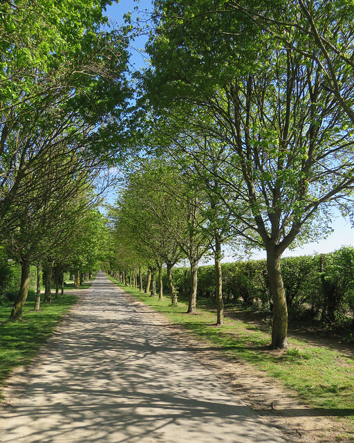
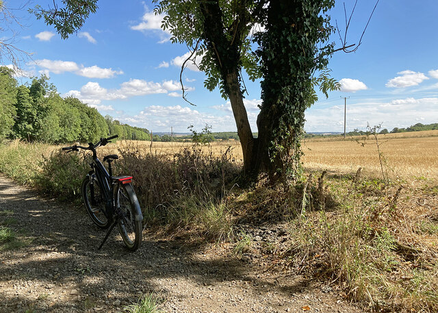
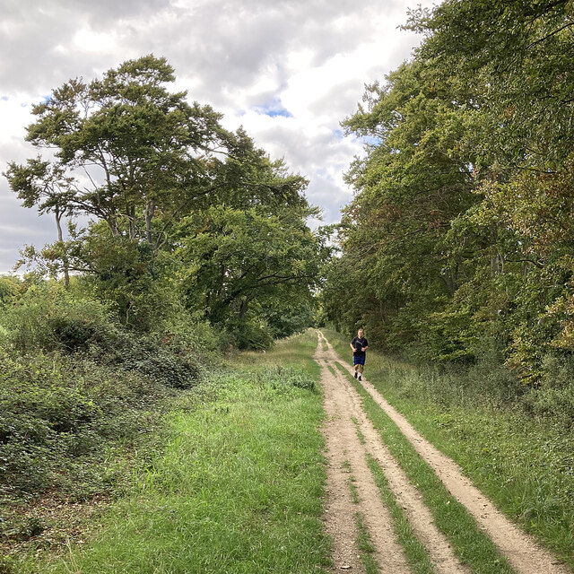
Furze Clump is intersected by a network of footpaths and trails, allowing visitors to explore the woodland at their own pace. These pathways are well-maintained and offer stunning views of the surrounding countryside. The clump also features a small lake, which provides a serene spot for picnics or birdwatching.

The woodland is home to a diverse range of wildlife, including deer, foxes, and a multitude of bird species. Birdwatchers are often treated to sightings of woodpeckers, jays, and various songbirds. The peaceful atmosphere and natural beauty of Furze Clump make it a popular destination for photographers and nature enthusiasts alike.

Furze Clump is well-equipped for visitors, with ample parking facilities and information boards outlining the history and significance of the woodland. It is managed and maintained by the local authorities to ensure its preservation and accessibility for future generations to enjoy.

If you have any feedback on the listing, please let us know in the comments section below.

Furze Clump Images

Images are sourced within 2km of 52.156881/0.18760395 or Grid Reference TL4953. Thanks to Geograph Open Source API. All images are credited.

Harvest time on The Gogs The combine had stopped and the tractor and full trailer shown in <a href="https://www.geograph.org.uk/photo/6904418">TL5053 : Combining on The Gogs</a> were disappearing over the crest of the hill in a cloud of dust.

Comparable views of these fields south-west of The Roman Road:
<a href="https://www.geograph.org.uk/photo/4209983">TL5053 : Field gate on The Roman Road</a>
<a href="https://www.geograph.org.uk/photo/4708677">TL5053 : Farm track and autumn fields</a>
<a href="https://www.geograph.org.uk/photo/5574989">TL5053 : The Gogs from the Roman Road</a>
<a href="https://www.geograph.org.uk/photo/6791839">TL5053 : A field gate on The Roman Road</a>
Harvest time on The Gogs
The combine had stopped and the tractor and full trailer shown in TL5053 : Combining on The Gogs were disappearing over the crest of the hill in a cloud of dust. Comparable views of these fields south-west of The Roman Road: TL5053 : Field gate on The Roman Road TL5053 : Farm track and autumn fields TL5053 : The Gogs from the Roman Road TL5053 : A field gate on The Roman Road
Combining on The Gogs I stepped through a gap in the Roman Road hedgerow for this view of a huge barley field being harvested. The woodland on the far side of the field is at the edge of Wandlebury Country Park and the Gog Magog golf course.
Combining on The Gogs
I stepped through a gap in the Roman Road hedgerow for this view of a huge barley field being harvested. The woodland on the far side of the field is at the edge of Wandlebury Country Park and the Gog Magog golf course.
Fields on the edge of Wandlebury Country Park Beautiful open countryside just a couple of miles to the south east of Cambridge.
Fields on the edge of Wandlebury Country Park
Beautiful open countryside just a couple of miles to the south east of Cambridge.
Autumn cultivation on The Gogs Looking north-east through a gateway on The Roman Road. <a href="https://www.geograph.org.uk/photo/4209983">TL5053 : Field gate on The Roman Road</a> and <a href="https://www.geograph.org.uk/photo/6904416">TL5053 : Harvest time on The Gogs</a> are two of several pictures of the view uphill in the opposite direction.
Autumn cultivation on The Gogs
Looking north-east through a gateway on The Roman Road. TL5053 : Field gate on The Roman Road and TL5053 : Harvest time on The Gogs are two of several pictures of the view uphill in the opposite direction.
Early autumn on The Roman Road At the junction with Mile Road (left) on a bright October morning.
Early autumn on The Roman Road
At the junction with Mile Road (left) on a bright October morning.
Trees lining The Roman Road The Roman Road runs south-east from the Gog Magog Hills on the edge of Cambridge into the hills of East Cambridgeshire, petering out near Horseheath. This picture was taken from a field edge on a bright October morning.
Trees lining The Roman Road
The Roman Road runs south-east from the Gog Magog Hills on the edge of Cambridge into the hills of East Cambridgeshire, petering out near Horseheath. This picture was taken from a field edge on a bright October morning.
A spring morning on The Roman Road Bright and warm, with a lot of vivid greens.
A spring morning on The Roman Road
Bright and warm, with a lot of vivid greens.
Wheatfields on The Gogs Taken from just inside a gateway on The Roman Road on a fine morning in late April. Hill Farm is on the skyline in the centre, getting on for a mile away.
Wheatfields on The Gogs
Taken from just inside a gateway on The Roman Road on a fine morning in late April. Hill Farm is on the skyline in the centre, getting on for a mile away.
On Babraham Road in spring Looking towards Fulbourn on a fine morning in late April. This road serves farms and businesses near Fulbourn, but does not reach Babraham - beyond Lodge Farm (some way behind the camera) it becomes a footpath and joins The Roman Road.
On Babraham Road in spring
Looking towards Fulbourn on a fine morning in late April. This road serves farms and businesses near Fulbourn, but does not reach Babraham - beyond Lodge Farm (some way behind the camera) it becomes a footpath and joins The Roman Road.
Stubble on the Gogs Looking uphill towards Fox's Burrow Plantation from the track which runs from The Roman Road to the A1307.
Stubble on the Gogs
Looking uphill towards Fox's Burrow Plantation from the track which runs from The Roman Road to the A1307.
Stubble and big sky Harvest time in South Cambridgeshire, seen from a gap in the trees lining The Roman Road. The plantations at Lodge Farm are on the skyline.
Stubble and big sky
Harvest time in South Cambridgeshire, seen from a gap in the trees lining The Roman Road. The plantations at Lodge Farm are on the skyline.
Towards Signal Hill and Meggs Hill The skyline plantations are on Signal Hill (left) and Meggs Hill, two of the gentle Gog Magog Hills south-east of Cambridge. The picture was taken from a field corner at the junction of The Roman Road (which the trees on the extreme left line) and Mile Road.
Towards Signal Hill and Meggs Hill
The skyline plantations are on Signal Hill (left) and Meggs Hill, two of the gentle Gog Magog Hills south-east of Cambridge. The picture was taken from a field corner at the junction of The Roman Road (which the trees on the extreme left line) and Mile Road.
Copley Hill in a dry summer Mid August in the drought summer of 2022 - and some of the leaves in the plantation on Copley Hill are turning while the rest have lost their high summer richness.
Copley Hill in a dry summer
Mid August in the drought summer of 2022 - and some of the leaves in the plantation on Copley Hill are turning while the rest have lost their high summer richness.
Stubble on The Gogs An August view from the bridle track from the A1307 to The Roman Road (ahead), skirting Wandlebury Country Park.
Stubble on The Gogs
An August view from the bridle track from the A1307 to The Roman Road (ahead), skirting Wandlebury Country Park.
Café sign on the edge of Wandlebury Country Park
A runner on The Roman Road Near Copley Hill on a mid-September afternoon - one of high cloud and some lengthy sunny spells.
A runner on The Roman Road
Near Copley Hill on a mid-September afternoon - one of high cloud and some lengthy sunny spells.
On The Roman Road in early autumn Looking south east on a cloudless Sunday morning in early October. Some leaves have turned in the last week.
On The Roman Road in early autumn
Looking south east on a cloudless Sunday morning in early October. Some leaves have turned in the last week.
The Roman Road: dark sky and bright leaves On the Gog Magog Hills, looking towards the Cambridge end of The Roman Road on the first Saturday morning of December.
The Roman Road: dark sky and bright leaves
On the Gog Magog Hills, looking towards the Cambridge end of The Roman Road on the first Saturday morning of December.
Show me another place!

Furze Clump is located at Grid Ref: TL4953 (Lat: 52.156881, Lng: 0.18760395)

Administrative County: Cambridgeshire

District: South Cambridgeshire

Police Authority: Cambridgeshire

What 3 Words

///hang.camera.disgraced. Near Fulbourn, Cambridgeshire

Related Wikis

Wandlebury Hill Fort

Wandlebury Hill Fort, also known as the Wandlebury Ring, is an Iron Age hillfort located on Wandlebury Hill in the Gog Magog Hills, Cambridgeshire, England...

Wandlebury Hill

Wandlebury Hill (grid reference TL493534) is a peak in the Gog Magog Hills, a ridge of low chalk hills extending for several miles to the southeast of...

Little Trees Hill

Little Trees Hill is one of the highest points of the Gog Magog Hills, a ridge of low chalk hills extending for several miles to the south-east of Cambridge...

Gog Magog Golf Club

Gog Magog Golf Club is a golf club, located in Shelford Bottom, Cambridgeshire, England. It is located about 4 miles south of Cambridge. == History... ==

Gog Magog Hills

The Gog Magog Hills are a range of low chalk hills, extending for several miles to the southeast of Cambridge in England. The highest points are situated...

Gog Magog Golf Course

Gog Magog Golf Course is an 88.4-hectare (218-acre) biological Site of Special Scientific Interest on Gog Magog Golf Club south-east of Cambridge in Cambridgeshire...

Beechwoods

Beechwoods is a 9.8 hectare Local Nature Reserve south-east of Cambridge, England. It is owned by County Farms and managed by the Wildlife Trust for Bedfordshire...

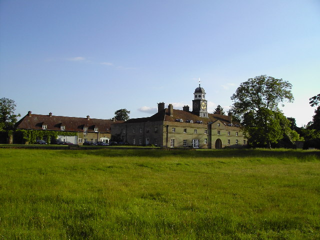
Middlefield, Stapleford

Middlefield is a mansion in Stapleford, Cambridgeshire, England, designed in 1908–9 by Edwin Lutyens. It is a grade II* listed building.Middlefield was...

Related Videos

London, Cambridge & Paris in 8 minutes - enjoy!

August 2019, trip to see Colin at Cambridge and visit Paris. (8 minutes)

Elie Having Fun Day At Queen Ediths Holiday Club 👧

Elie Having Fun Day At Queen Ediths Holiday Club #FunDay #Elie #funtastics #playingtimewithelie.

Wander at Wandlebury

17 July 2020 A day tour at Wandlebury Park, Cambridge, United Kingdom.

Cambridge Cherry Hinton Motorhome Trip

Motorhome trip to Cambridge Cherry Hinton Caravan and Motorhome club site Walk around Cherry Hinton Chalk Pits Nature ...

Nearby Amenities

Located within 500m of 52.156881,0.18760395
Parking
Wandlebury
Access: yes
Fee: yes
Opening Hours: sunrise-sunset
Parking: surface
Lat/Long: 52.1573846/0.1806489
Wandlebury Ring (Iron Age Hill Fort)
Historic: archaeological_site
Lat/Long: 52.1587892/0.1816366
Source: Bing
Lat/Long: 52.1590243/0.1830005
Barrier: bollard
Bollard: fixed
Lat/Long: 52.158273/0.1918541
Wormwood Hill
Natural: hill
Note: Wormwood Hill tumulus is registered as a scheduled monument
Place: locality
Source: npe
Lat/Long: 52.1541118/0.1870665
Created By: Potlatch 0.10f
Man Made: survey_point
Ref: S4365
Tpuk Ref: TP3395
Lat/Long: 52.1604181/0.1846859
Clark's Corner
Place: locality
Source: http://www.woodlandtrust.org.uk
Lat/Long: 52.1575043/0.1892777
Toilets
Lat/Long: 52.158219/0.1823128
Fixme: check which route this line takes
Guyed: yes
Height: 8
Material: wood
Power: pole
Lat/Long: 52.1542665/0.1884629
Power: pole
Lat/Long: 52.1535563/0.1896551
Material: wood
Power: pole
Lat/Long: 52.1566768/0.1924594
Material: wood
Power: pole
Lat/Long: 52.1559099/0.1917191
Material: wood
Power: pole
Lat/Long: 52.1572954/0.1930548
Power: pole
Lat/Long: 52.1527829/0.1890838
Height: 6
Line Attachment: pin
Material: wood
Power: pole
Lat/Long: 52.1548729/0.1873485
Material: wood
Power: pole
Lat/Long: 52.1579191/0.1936891
Height: 6
Line Attachment: pin
Material: wood
Power: pole
Lat/Long: 52.1555081/0.1862059
Material: wood
Power: pole
Lat/Long: 52.1543396/0.1902371
Material: wood
Power: pole
Lat/Long: 52.1551399/0.1909989
Guyed: yes
Height: 6
Line Attachment: pin
Location Transition: yes
Material: wood
Power: pole
Lat/Long: 52.1561646/0.1849319
Horse Grave Godolphin Arabian (c. 1724 – 1753)
Tourism: information
Lat/Long: 52.1582499/0.1822493
Wandlebury Hill
Ele: 74
Natural: hill
Wikidata: Q7967272
Wikipedia: en:Wandlebury Hill
Lat/Long: 52.1578117/0.183484
Parking
Lat/Long: 52.1560773/0.1824765
Ely View
Tourism: viewpoint
Lat/Long: 52.1603375/0.1892435
Bicycle Parking
Bicycle Parking: stands
Capacity: 30
Covered: no
Lat/Long: 52.1576104/0.1812434
Bench
Lat/Long: 52.1585013/0.1820877
Bench
Lat/Long: 52.1585423/0.1833504
Bench
Lat/Long: 52.1584116/0.1827993
Barrier: entrance
Lat/Long: 52.158875/0.1812473
Barrier: entrance
Lat/Long: 52.1597931/0.1830336
Board Type: nature
Check Date: 2021-02-27
Information: board
Marker: plate
Operator: CPPF
Orienteering: marker
Ref: 52
Sport: orienteering
Tourism: information
Lat/Long: 52.157603/0.1813519
Bench
Backrest: yes
Material: wood
Seats: 3
Lat/Long: 52.159715/0.1892304
Bench
Backrest: yes
Material: wood
Seats: 4
Lat/Long: 52.1594814/0.1897753
Bench
Backrest: yes
Material: wood
Lat/Long: 52.1570531/0.1867245
Waste Basket
Waste: dog_excrement
Lat/Long: 52.1571696/0.1866582
Bench
Backrest: yes
Material: wood
Lat/Long: 52.1559253/0.1907934
Bench
Lat/Long: 52.1588699/0.1831687
Bench
Lat/Long: 52.1592896/0.1834838
Colour: yellow
Marker: post
Utility: gas
Lat/Long: 52.1560896/0.1932166
Colour: yellow
Marker: post
Utility: gas
Lat/Long: 52.1561/0.1931748
Bench
Lat/Long: 52.1561162/0.1895973
Barrier: swing_gate
Lat/Long: 52.1553058/0.1905884
Bench
Lat/Long: 52.155681/0.1812181
Vending Machine
Payment Credit Cards: yes
Payment Debit Cards: yes
Vending: parking_tickets
Lat/Long: 52.1576669/0.1811836
Clock
Display: sundial
Lat/Long: 52.1583111/0.1828614
Cafe
Pop-up Cafe
Outdoor Seating: yes
Website: https://www.cambridgeppf.org/wandlebury-visit
Lat/Long: 52.1582535/0.1834541
Leisure: picnic_table
Lat/Long: 52.1582165/0.1835306
Leisure: picnic_table
Lat/Long: 52.1581688/0.1834367
Waste Basket
Waste: dog_excrement
Lat/Long: 52.1576093/0.1814465
Recycling
Recycling Type: container
Lat/Long: 52.1582017/0.1833187
Bench
Backrest: yes
Lat/Long: 52.1579203/0.185384
Leisure: picnic_table
Lat/Long: 52.1576768/0.185207
Leisure: picnic_table
Lat/Long: 52.157741/0.1852365
Bbq
Lat/Long: 52.1577377/0.185156
Bbq
Lat/Long: 52.1568985/0.1842454
Wandlebury Orchard
Information: board
Operator: CPPF
Tourism: information
Lat/Long: 52.1589175/0.1811796
Entrance: yes
Lat/Long: 52.1560829/0.1855098
Leisure: picnic_table
Lat/Long: 52.1559441/0.1855978
Bench
Lat/Long: 52.1558357/0.1905509
Bench
Lat/Long: 52.1551589/0.1900945
Bench
Lat/Long: 52.1549963/0.18548
Bench
Lat/Long: 52.1567739/0.1863351
Leisure: picnic_table
Material: wood
Lat/Long: 52.1586151/0.1834169
Barrier: entrance
Lat/Long: 52.1583763/0.1832716
Barrier: entrance
Lat/Long: 52.1594505/0.1815969
Leisure: picnic_table
Material: wood
Lat/Long: 52.158682/0.1823191
Leisure: picnic_table
Material: wood
Lat/Long: 52.1586573/0.1824023
Material: wood
Power: pole
Lat/Long: 52.1535557/0.189655
Bench
Backrest: yes
Material: wood
Seats: 3
Lat/Long: 52.1604059/0.18907
Bench
Backrest: yes
Material: wood
Seats: 4
Lat/Long: 52.1575197/0.1850142
Leisure: picnic_table
Material: wood
Lat/Long: 52.1586214/0.1829642
Leisure: picnic_table
Material: wood
Lat/Long: 52.1585426/0.1827827
Bench
Backrest: yes
Material: wood
Seats: 3
Lat/Long: 52.1583831/0.1917801
Bench
Backrest: yes
Material: wood
Seats: 3
Lat/Long: 52.1584062/0.1830228
Bench
Backrest: yes
Material: wood
Seats: 3
Lat/Long: 52.1603823/0.183064
Bench
Backrest: yes
Material: wood
Seats: 3
Lat/Long: 52.1584059/0.1831305
Bench
Backrest: yes
Material: wood
Seats: 4
Lat/Long: 52.1591781/0.186095
Information: guidepost
Tourism: information
Lat/Long: 52.157482/0.1846483
Information: guidepost
Tourism: information
Lat/Long: 52.1573613/0.1837783
Bench
Backrest: yes
Material: wood
Seats: 3
Lat/Long: 52.1549027/0.1852999
Leisure: picnic_table
Material: wood
Lat/Long: 52.1586451/0.182771
Power: pole
Lat/Long: 52.1534318/0.1886042
The data included in this document is from www.openstreetmap.org. The data is made available under ODbL.

Have you been to Furze Clump?

Leave your review of Furze Clump below (or comments, questions and feedback).