Gattons Plantation

Wood, Forest in Kent

England

Gattons Plantation

Birchwood Road towards Dartford
Birchwood Road towards Dartford Credit: JThomas

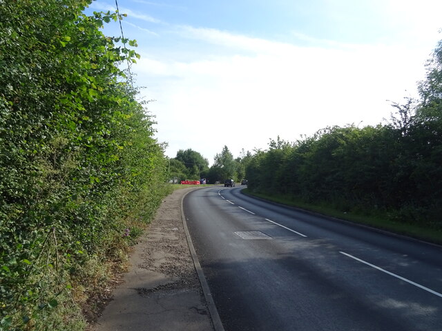
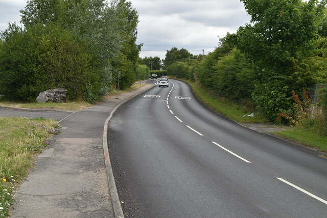
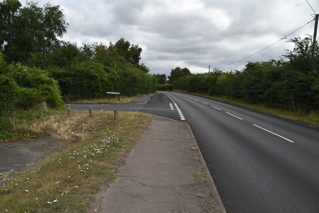
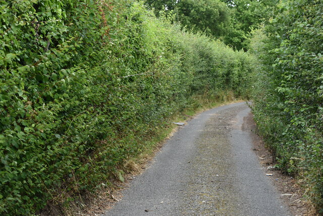
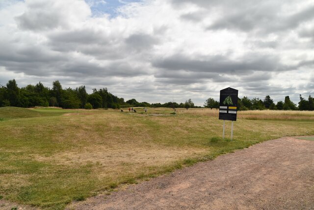
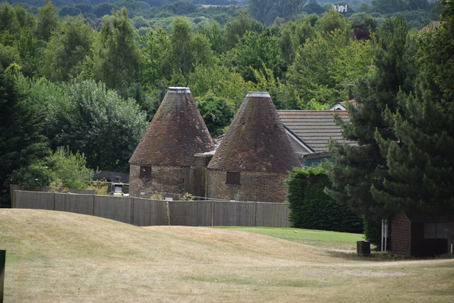
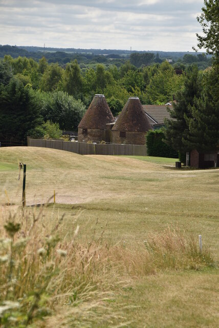
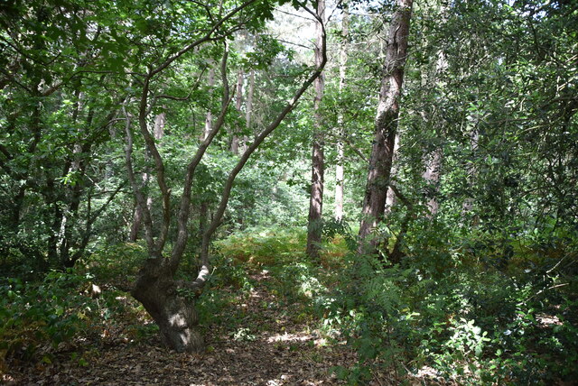
Gattons Plantation, located in Kent, England, is a historic woodland area known for its picturesque landscape and rich biodiversity. Covering a vast expanse of approximately 200 acres, the plantation is situated within the larger Gatton Park estate, which spans over 600 acres of land and includes a stately home and formal gardens.

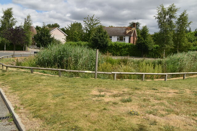
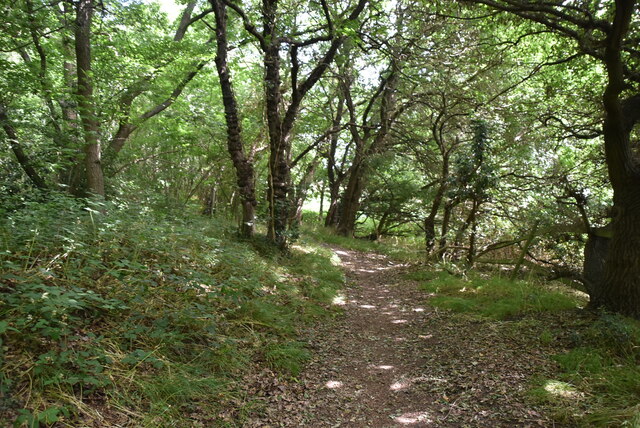
The woodland at Gattons Plantation is primarily composed of native broadleaf trees, including oak, beech, and birch, creating a diverse and vibrant ecosystem. The dense canopy provides a habitat for a variety of wildlife, such as deer, foxes, and numerous bird species, making it a popular destination for nature enthusiasts and birdwatchers.

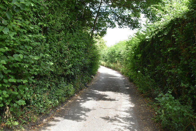
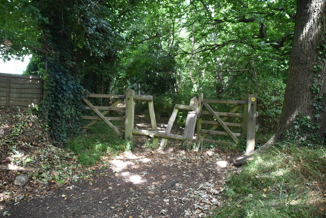
The plantation offers several walking trails and paths, allowing visitors to explore the natural beauty of the area. These paths are well-maintained and provide easy access to the woodland, making it suitable for individuals of all ages and abilities. Along the way, visitors may also come across various flora and fauna, including wildflowers, fungi, and small mammals.

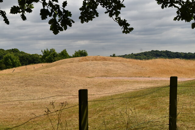
Gattons Plantation has a rich historical background, dating back to the 18th century when it was originally designed as a pleasure ground for the Gatton Park estate. The woodland has been carefully managed throughout the years, balancing conservation efforts with public access. Today, it serves as an important recreational and educational resource, offering a tranquil escape from the urban environment and an opportunity to learn about the local ecology and history.

If you have any feedback on the listing, please let us know in the comments section below.

Gattons Plantation Images

Images are sourced within 2km of 51.424963/0.14655413 or Grid Reference TQ4971. Thanks to Geograph Open Source API. All images are credited.

Birchwood Road towards Dartford
Birchwood Rd
Birchwood Rd
Birchwood Rd
Birchwood Rd
Stonehill Green
Stonehill Green
Stonehill Green
Stonehill Green
Stonehill Farm
Stonehill Farm
Barn, Stonehill Farm
The Forge
The Forge
Birchwood Park Golf Course Website: <span class="nowrap"><a title="www.birchwoodparkgc.co.uk/" rel="nofollow ugc noopener" href="http://www.birchwoodparkgc.co.uk/">Link</a><img style="margin-left:2px;" alt="External link" title="External link - shift click to open in new window" src="https://s1.geograph.org.uk/img/external.png" width="10" height="10"/></span>
Birchwood Park Golf Course
Website: LinkExternal link
Pond, Stonehill Green
Stonehill Green
Stonehill Green
Stonehill Green
Stonehill Green
Oast, Birchwood Park Golf Centre Buildings made to look like oast houses.
Oast, Birchwood Park Golf Centre
Buildings made to look like oast houses.
Oast, Birchwood Park Golf Centre Buildings made to look like oast houses.
Oast, Birchwood Park Golf Centre
Buildings made to look like oast houses.
Entering Joyden Wood A Woodland Trust site in Dartford borough, opened to the public in 1988.  Close to the A2 and A20 trunk roads,this remains a natural ancient woodland and contains visible remains of the ancient "Faesten Dic" (strong dyke), an Anglo-Saxon (or possibly older) defensive ditch.  It is approximately 130 hectares in area and contains many tracks and paths; the main tracks are open to horses and cyclists.
Entering Joyden Wood
A Woodland Trust site in Dartford borough, opened to the public in 1988. Close to the A2 and A20 trunk roads,this remains a natural ancient woodland and contains visible remains of the ancient "Faesten Dic" (strong dyke), an Anglo-Saxon (or possibly older) defensive ditch. It is approximately 130 hectares in area and contains many tracks and paths; the main tracks are open to horses and cyclists.
Joyden Wood A Woodland Trust site in Dartford borough, opened to the public in 1988.  Close to the A2 and A20 trunk roads,this remains a natural ancient woodland and contains visible remains of the ancient "Faesten Dic" (strong dyke), an Anglo-Saxon (or possibly older) defensive ditch.  It is approximately 130 hectares in area and contains many tracks and paths; the main tracks are open to horses and cyclists.
Joyden Wood
A Woodland Trust site in Dartford borough, opened to the public in 1988. Close to the A2 and A20 trunk roads,this remains a natural ancient woodland and contains visible remains of the ancient "Faesten Dic" (strong dyke), an Anglo-Saxon (or possibly older) defensive ditch. It is approximately 130 hectares in area and contains many tracks and paths; the main tracks are open to horses and cyclists.
Joyden Wood
Joyden Wood
Birchwood Park Golf Course Website: <span class="nowrap"><a title="www.birchwoodparkgc.co.uk/" rel="nofollow ugc noopener" href="http://www.birchwoodparkgc.co.uk/">Link</a><img style="margin-left:2px;" alt="External link" title="External link - shift click to open in new window" src="https://s1.geograph.org.uk/img/external.png" width="10" height="10"/></span>
Birchwood Park Golf Course
Website: LinkExternal link
Show me another place!

Gattons Plantation is located at Grid Ref: TQ4971 (Lat: 51.424963, Lng: 0.14655413)

Unitary Authority: Bexley

Police Authority: Metropolitan

What 3 Words

///chin.waddle.legend. Near Bexley, London

Related Wikis

Joyden's Wood

Joyden's Wood is an area of ancient woodland that straddles the border between the London Borough of Bexley in South East London and the Borough of Dartford...

North Cray

North Cray is an area in South East London, England, within the London Borough of Bexley. It is located east of Sidcup and south of Bexleyheath and is...

Loring Hall

Loring Hall is a private mental health care facility in North Cray, London Borough of Bexley. Formerly known as Wollet Hall or Woollet Hall, it is a Grade...

Foots Cray Meadows

Foots Cray Meadows is an area of parkland and woodland 97 hectares (240 acres) in size, within the London Borough of Bexley, England. It borders the suburbs...

Ruxley

Ruxley is a rural settlement of South East London, England that straddles the boundary of the London Boroughs of Bromley and Bexley. It is located 13 miles...
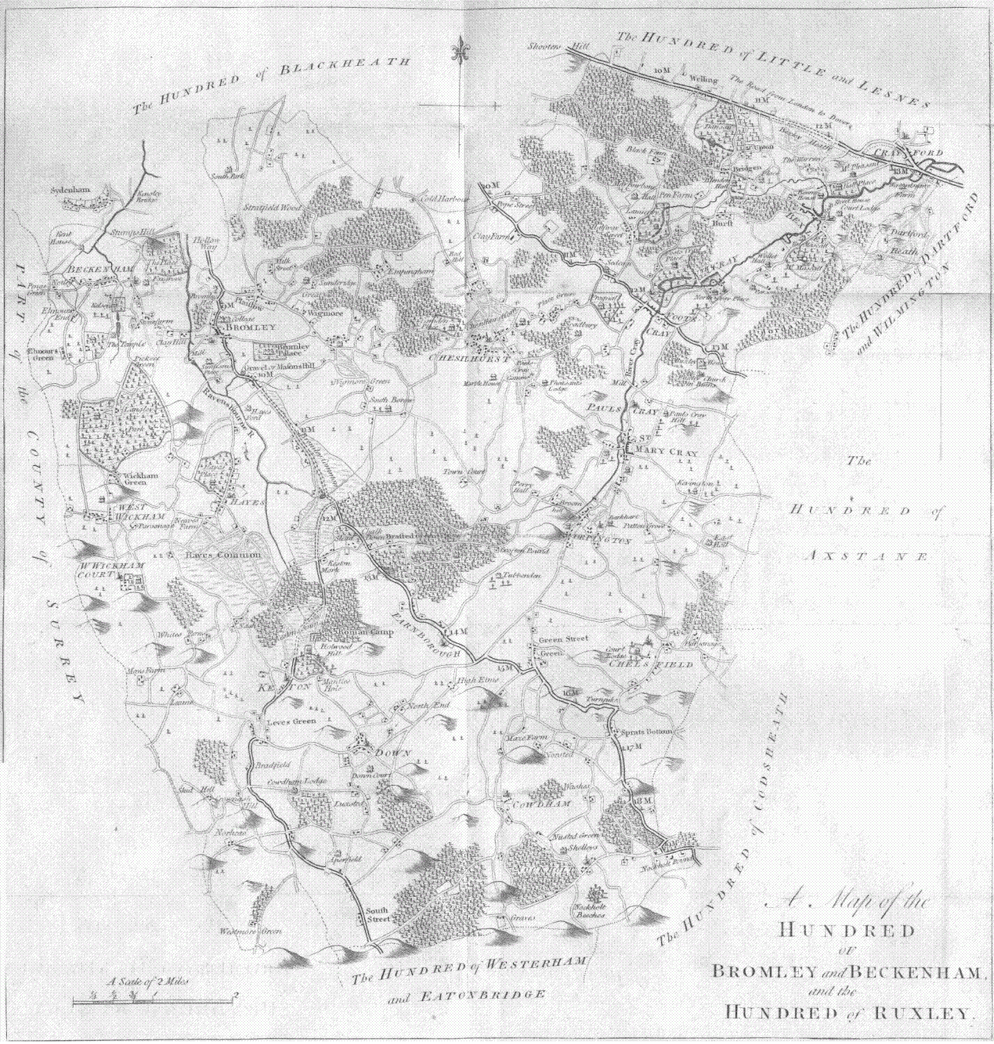
Hundred of Ruxley

Ruxley (previously Rokesley, and in the Domesday Book Helmestrei) was an ancient hundred, a land division in the north west of the county of Kent, England...

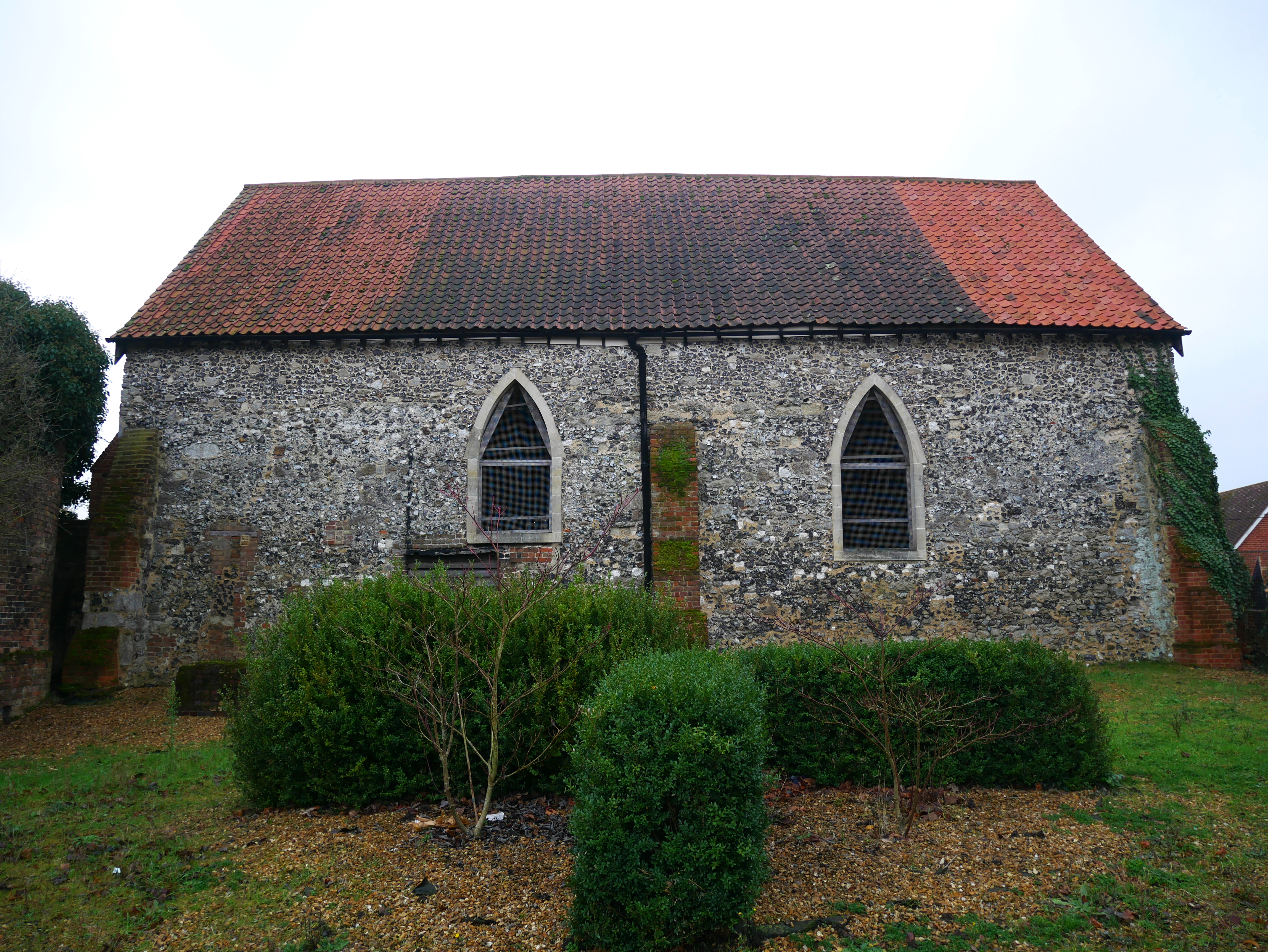
St Botolph's Church, Ruxley

St Botolph's Church is a church building in Ruxley, in the London Borough of Bromley, southeast London, England. It was constructed in the thirteenth century...

Bexley railway station

Bexley railway station is in the London Borough of Bexley in south-east London, in Travelcard Zone 6. It is 13 miles 69 chains (22.3 km) down the line...

Nearby Amenities

Located within 500m of 51.424963,0.14655413
Fixme: Fpath_incomplete
Lat/Long: 51.4270272/0.1520831
Fixme: Fpath_incomplete
Lat/Long: 51.4269317/0.1517646
Barrier: bollard
Bicycle: no
Foot: yes
Lat/Long: 51.4266327/0.1531699
Barrier: stile
Foot: yes
Lat/Long: 51.4239613/0.1534715
Fixme: Fpath_incomplete
Lat/Long: 51.4239368/0.1535
Barrier: stile
Lat/Long: 51.4212464/0.1497489
Noexit: yes
Lat/Long: 51.4227595/0.146588
Barrier: kissing_gate
Lat/Long: 51.4247556/0.1445334
The data included in this document is from www.openstreetmap.org. The data is made available under ODbL.

Have you been to Gattons Plantation?

Leave your review of Gattons Plantation below (or comments, questions and feedback).