Mill Wood

Wood, Forest in Sussex Wealden

England

Mill Wood

New roundabout east of Maresfield
New roundabout east of Maresfield Credit: nick macneill

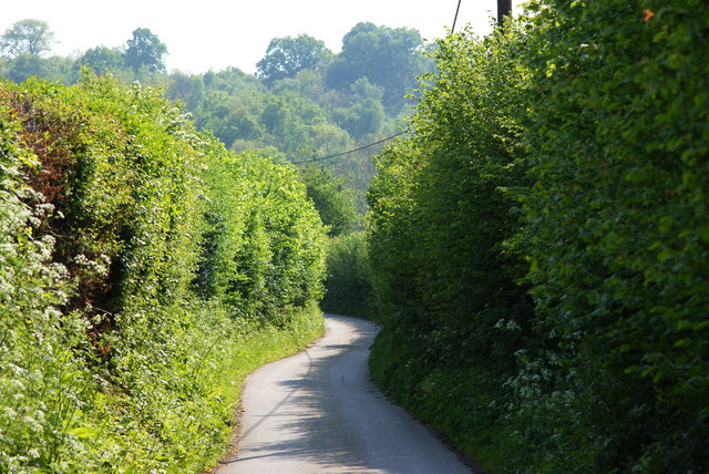
Mill Wood is a lush and idyllic forest located in the county of Sussex, England. Covering an area of approximately 50 hectares, this woodland is a haven for nature lovers, hikers, and wildlife enthusiasts alike. The wood is named after a historic mill that was once present in the area.

As visitors enter Mill Wood, they are greeted by a dense canopy of mature trees, predominantly consisting of oak, beech, and ash. The woodland floor is a tapestry of vibrant wildflowers, ferns, and mosses, creating a picturesque and serene atmosphere. The diversity of plant life provides a habitat for numerous bird species, including woodpeckers, nightingales, and thrushes.

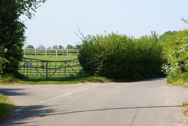
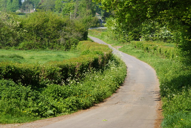
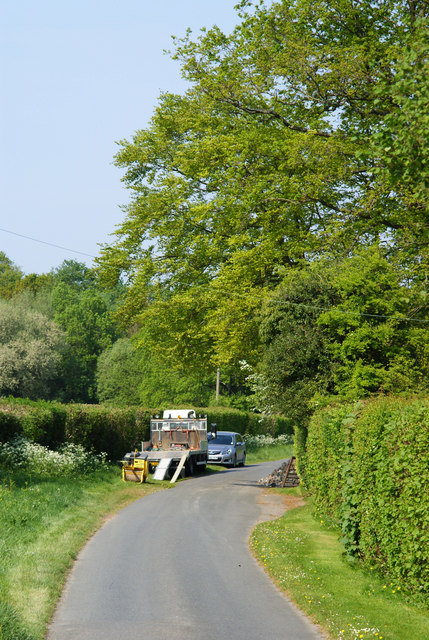
Traversing through the wood, visitors will discover a network of well-maintained footpaths that wind through the forest, offering glimpses of enchanting glades and hidden ponds along the way. The tranquil ambiance and stunning natural beauty make Mill Wood an ideal location for leisurely walks, picnics, and photography.

Wildlife thrives in this woodland, with sightings of deer, foxes, badgers, and squirrels being common. The wood is also home to a rich variety of insect life, including butterflies, beetles, and dragonflies. These creatures contribute to the delicate balance of the ecosystem and add to the overall charm of Mill Wood.

Managed by a local conservation group, the wood is well-preserved, ensuring the protection of its unique flora and fauna. The group also organizes educational programs and guided tours to raise awareness about the importance of woodland conservation.

In conclusion, Mill Wood in Sussex is a captivating forest that offers visitors a chance to immerse themselves in nature's splendor. With its diverse plant and animal life, picturesque trails, and peaceful ambiance, it is a true gem for anyone seeking solace in the beauty of the natural world.

If you have any feedback on the listing, please let us know in the comments section below.
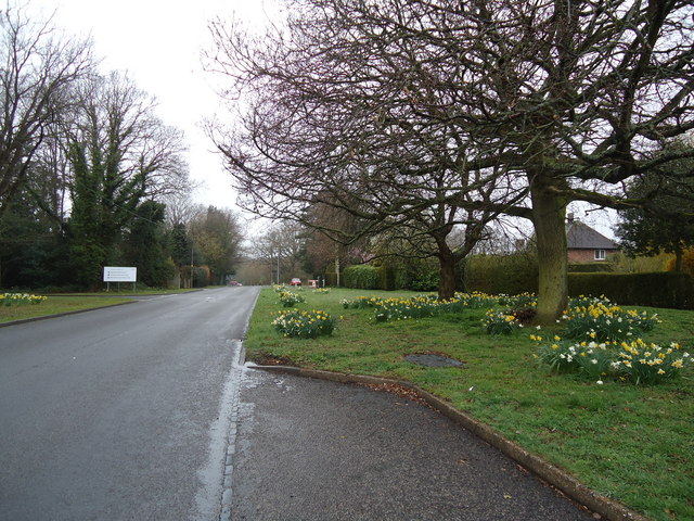
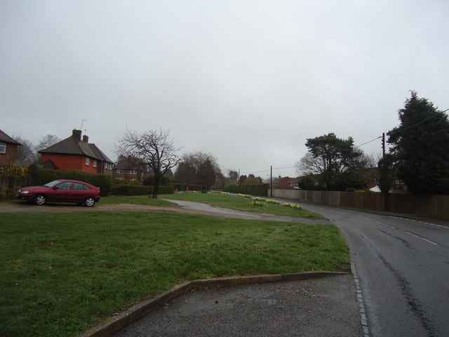
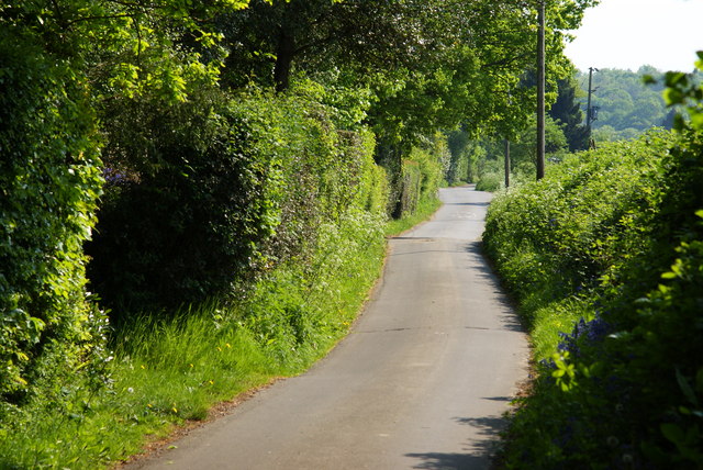
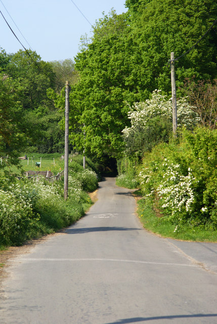
Mill Wood Images

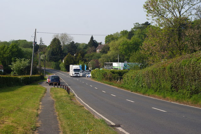
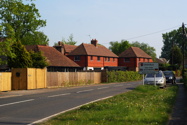
Images are sourced within 2km of 50.994342/0.095382717 or Grid Reference TQ4723. Thanks to Geograph Open Source API. All images are credited.

New roundabout east of Maresfield
Batts Bridge Road, Maresfield
Nursery Lane, Fairwarp, Sussex A quiet country lane. Out of picture, to the left, a row of houses is hidden by the high hedge.
Nursery Lane, Fairwarp, Sussex
A quiet country lane. Out of picture, to the left, a row of houses is hidden by the high hedge.
Nursery Lane, Fairwarp, Sussex Looking in the direction of Fairwarp village. A row of houses is out of picture, to the right.
Nursery Lane, Fairwarp, Sussex
Looking in the direction of Fairwarp village. A row of houses is out of picture, to the right.
Nursery Lane, Fairwarp, Sussex Looking in the direction of Maresfield. Note the high hedges, either side of this narrow lane.
Nursery Lane, Fairwarp, Sussex
Looking in the direction of Maresfield. Note the high hedges, either side of this narrow lane.
Junction of Nursery Lane and Burrells Lane, Sussex The location is just north of the Maresfield Park estate.
Junction of Nursery Lane and Burrells Lane, Sussex
The location is just north of the Maresfield Park estate.
Nursery Lane, Maresfield, Sussex Photograph taken from beside Nightingale Wood, looking north.
Nursery Lane, Maresfield, Sussex
Photograph taken from beside Nightingale Wood, looking north.
Nursery Lane, Maresfield, Sussex The large tree, to the right of picture, marks the position of Oak Tree Cottage.
Nursery Lane, Maresfield, Sussex
The large tree, to the right of picture, marks the position of Oak Tree Cottage.
Entrance to Maresfield Park, Sussex Formerly a large private estate, the road beyond the gatehouse is still marked as 'private'. Judging from the gatehouse, it must have been an impressive estate in its heyday.
Entrance to Maresfield Park, Sussex
Formerly a large private estate, the road beyond the gatehouse is still marked as 'private'. Judging from the gatehouse, it must have been an impressive estate in its heyday.
Morris 1000 Traveller, Uckfield, Sussex A fine survivor, some 45 years old.
Morris 1000 Traveller, Uckfield, Sussex
A fine survivor, some 45 years old.
Morris 1000 Traveller, Uckfield, Sussex At some stage in its 45 year life, some of the timbers have been replaced on the car. Timber rot was always a problem with this model, especially if left out in all weathers.
Morris 1000 Traveller, Uckfield, Sussex
At some stage in its 45 year life, some of the timbers have been replaced on the car. Timber rot was always a problem with this model, especially if left out in all weathers.
High Street, Maresfield, Sussex Photographed from close to Maresfield church.
High Street, Maresfield, Sussex
Photographed from close to Maresfield church.
Graves in Maresfield Cemetery, Sussex Photographed from the footpath in High Street.
Graves in Maresfield Cemetery, Sussex
Photographed from the footpath in High Street.
Graves in Maresfield Cemetery, Sussex Photographed from the footpath on High Street.
Graves in Maresfield Cemetery, Sussex
Photographed from the footpath on High Street.
The Mill House, Maresfield, Sussex The former mill house lies just within this grid square. The pond, serving this house, lies to the west; an aerial view suggests that the pond may have been truncated by the construction of the A22 Maresfield bypass, some years ago.
The Mill House, Maresfield, Sussex
The former mill house lies just within this grid square. The pond, serving this house, lies to the west; an aerial view suggests that the pond may have been truncated by the construction of the A22 Maresfield bypass, some years ago.
London Road, Budlett's Common, Sussex Chichester Caravans can be seen, in the centre of picture.
London Road, Budlett's Common, Sussex
Chichester Caravans can be seen, in the centre of picture.
London Road, Ringles Cross, Sussex Looking in the direction of Uckfield. The town sign can be seen, to the right of picture.
London Road, Ringles Cross, Sussex
Looking in the direction of Uckfield. The town sign can be seen, to the right of picture.
Show me another place!

Mill Wood is located at Grid Ref: TQ4723 (Lat: 50.994342, Lng: 0.095382717)

Administrative County: East Sussex

District: Wealden

Police Authority: Sussex

What 3 Words

///leotard.lays.uncouth. Near Uckfield, East Sussex

Related Wikis

A.F.C. Uckfield Town

A.F.C. Uckfield Town is a community football club based in Uckfield, East Sussex, England. They are currently members of the Southern Combination Premier...

A.F.C. Uckfield

Association Football Club Uckfield was a football club based in Uckfield, East Sussex, England. == History == The club was formed in 1988 as Wealden Football...

Cooper's Green

Cooper's Green is a village in the civil parish of Buxted in the Wealden district of East Sussex, England. Its nearest town is Uckfield, which lies approximately...

Maresfield

Maresfield is a village and civil parish in the Wealden District of East Sussex, England. The village itself lies 1.5 miles (2.4 km) north from Uckfield...

Buxted Park

Buxted Park is an 84.7 hectare (206.16 acre) biological Site of Special Scientific Interest, located near the village of Buxted, East Sussex, England....

Five Ash Down

Five Ash Down is a small village within the civil parish of Buxted, in the Wealden district of East Sussex, England. Its nearest town is Uckfield, which...

St Margaret the Queen, Buxted

The Church of St Margaret the Queen is a grade I listed building in Buxted Park, East Sussex, England. It is dedicated to Saint Margaret of Scotland, an...

Uckfield Baptist Church

Uckfield Baptist Church is a Baptist congregation based in the town of Uckfield in East Sussex, England. Although services now take place in a school...

Nearby Amenities

Located within 500m of 50.994342,0.095382717
Turning Circle
Lat/Long: 50.9934663/0.1014437
Post Box
Operator: Royal Mail
Operator Wikidata: Q638098
Post Box Type: lamp
Ref: TN22 60D
Royal Cypher: EIIR
Royal Cypher Wikidata: Q33102113
Lat/Long: 50.9961146/0.0948144
Mill House Farm
Place: farm
Source Name: OS_OpenData_Streetview
Lat/Long: 50.9924057/0.0929522
Addr Housename: Milestones
Building: house
Lat/Long: 50.9915849/0.0975955
Addr Housename: Blackhouse Farm
Place: farm
Lat/Long: 50.9915349/0.0954048
Addr Housename: Copperdene
Building: house
Lat/Long: 50.9913925/0.097426
Bus Stop
Budletts Common London Road
Bus: yes
Public Transport: platform
Lat/Long: 50.991741/0.0958827
Public Footpath
Information: guidepost
Tourism: information
Lat/Long: 50.9961063/0.1017711
Footpath
Information: guidepost
Tourism: information
Lat/Long: 50.9930978/0.0927262
Footpath
Information: guidepost
Tourism: information
Lat/Long: 50.9930157/0.092302
Public Footpath
Information: guidepost
Tourism: information
Lat/Long: 50.9944493/0.0975957
Bridleway
Information: guidepost
Operator: East Sussex County Council
Tourism: information
Lat/Long: 50.9938851/0.0983914
Footpath
Information: guidepost
Note: Notice “Wealdon District Council offical diversion”
Operator: East Sussex County Council
Tourism: information
Lat/Long: 50.9954068/0.0958372
Footpath
Information: guidepost
Note: Post on its side
Tourism: information
Lat/Long: 50.9935337/0.0952803
Footpath
Information: guidepost
Note: Notice “Wealdon District Council offical diversion”
Operator: East Sussex County Council
Tourism: information
Lat/Long: 50.9934265/0.0954901
Footpath
Information: guidepost
Tourism: information
Lat/Long: 50.9924715/0.0958353
Barrier: stile
Lat/Long: 50.993439/0.0955251
Addr Housename: Kilworth House
Building: house
Lat/Long: 50.9922022/0.0960194
Bridleway
Information: guidepost
Operator: East Sussex County Council
Tourism: information
Lat/Long: 50.9920213/0.0954158
Addr City: Five Ash Down
Addr Housename: Gwynant
Addr Postcode: TN22 3AH
Addr Street: Five Ash Down
Building: house
Lat/Long: 50.9938053/0.1023544
Addr City: Five Ash Down
Addr Housename: Spindleberry
Addr Postcode: TN22 3AH
Addr Street: Five Ash Down
Building: house
Lat/Long: 50.9938771/0.1023316
Addr City: Five Ash Down
Addr Housename: Cinders
Addr Postcode: TN22 3AH
Addr Street: Five Ash Down
Building: house
Lat/Long: 50.9938045/0.1022243
Addr City: Five Ash Down
Addr Housename: St Anton
Addr Postcode: TN22 3AH
Addr Street: Five Ash Down
Building: house
Lat/Long: 50.9939581/0.1022458
Footpath
Information: guidepost
Operator: East Sussex County Council
Tourism: information
Lat/Long: 50.9926844/0.0909511
Footpath
Information: guidepost
Operator: East Sussex County Council
Tourism: information
Lat/Long: 50.9933768/0.0892445
Barrier: kissing_gate
Lat/Long: 50.9926546/0.0910115
Give Way
Direction: backward
Lat/Long: 50.9918959/0.0956319
Addr Housenumber: 2
Building: yes
Lat/Long: 50.993846/0.0925445
Addr Housenumber: 1
Building: yes
Lat/Long: 50.9938936/0.092499
The data included in this document is from www.openstreetmap.org. The data is made available under ODbL.

Have you been to Mill Wood?

Leave your review of Mill Wood below (or comments, questions and feedback).