Dingle

Settlement in Lancashire

England

Dingle

Old Boundary Marker on Ashfield Road, Aigburth Vale Parish Boundary Marker against the brick wall of Boots on the north side of the crossroads of the A561 Aigburth Road and the A5058 Ashfield Road, Liverpool 17. Inscribed T / T P │ T G (Township of Toxteth Park and Township of Garston) and possibly dates from 1866 when Garston was made a parish.

Milestone Society National ID: LA_LCTPGA01pb
Old Boundary Marker on Ashfield Road, Aigburth Vale Credit: M Faherty

Dingle is a small village located in the picturesque county of Lancashire, in the northwest of England. Situated in the Ribble Valley, Dingle boasts a charming and idyllic setting, surrounded by rolling hills and beautiful countryside. With a population of around 500 residents, it is known for its tight-knit community and friendly atmosphere.

The village itself is characterized by its traditional stone-built houses and quaint cottages, giving it a timeless and rustic feel. Dingle is dotted with well-maintained gardens and green spaces, providing a peaceful and serene environment for its residents.

Despite its small size, Dingle offers a range of amenities for its locals and visitors. The village has a primary school, a local shop, and a cozy pub, where locals often gather to socialize and relax. Additionally, there are several walking trails and nature reserves nearby, allowing residents to enjoy the stunning countryside that surrounds them.

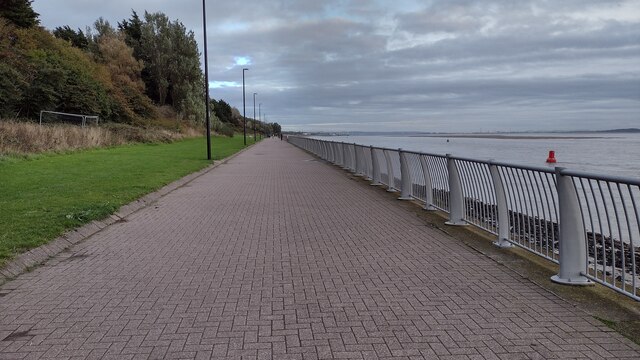
Dingle's location in Lancashire also offers easy access to a range of attractions and amenities in the wider area. The bustling market town of Clitheroe is just a short drive away, offering a variety of shops, restaurants, and leisure facilities. The nearby Forest of Bowland, an Area of Outstanding Natural Beauty, provides endless opportunities for outdoor activities such as hiking, cycling, and birdwatching.

In summary, Dingle is a picturesque and welcoming village in Lancashire, offering residents a tranquil and close-knit community, stunning natural surroundings, and easy access to nearby amenities and attractions.

If you have any feedback on the listing, please let us know in the comments section below.
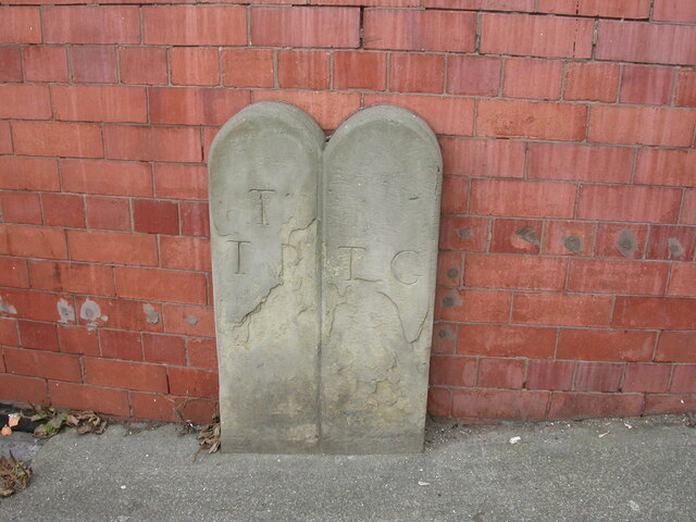
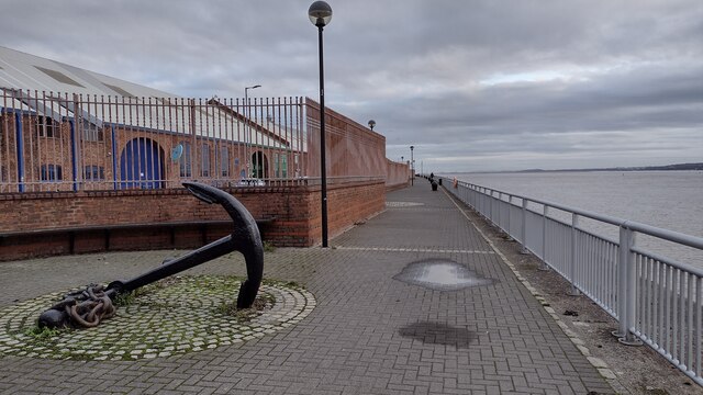
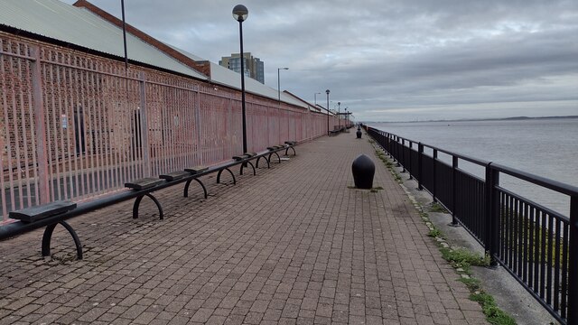
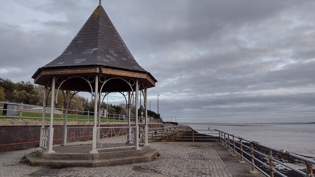
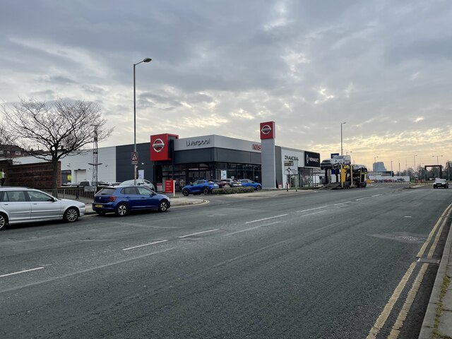
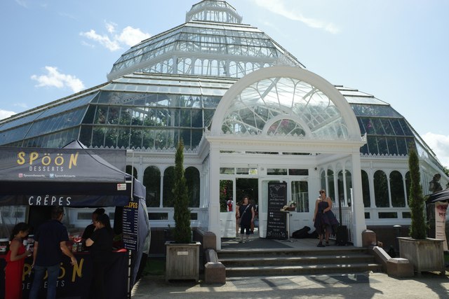
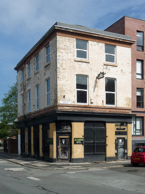
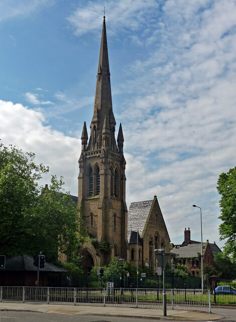
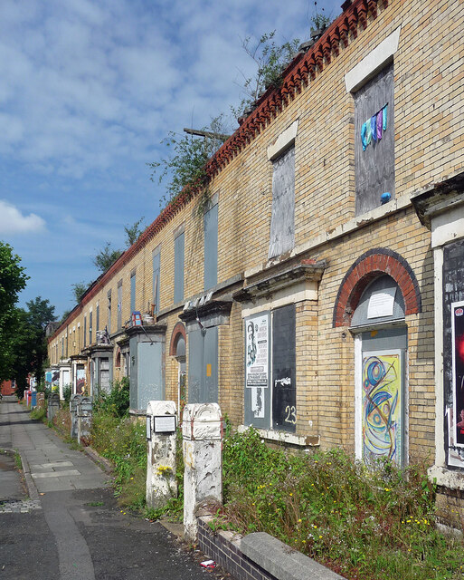
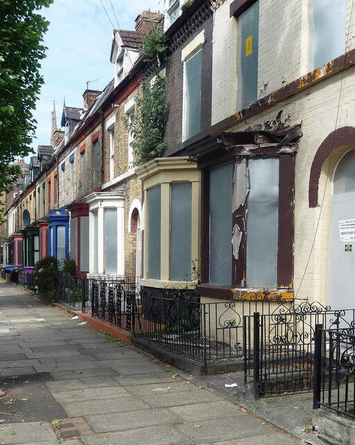
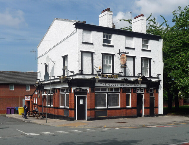
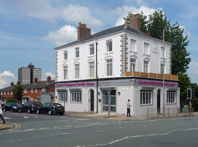
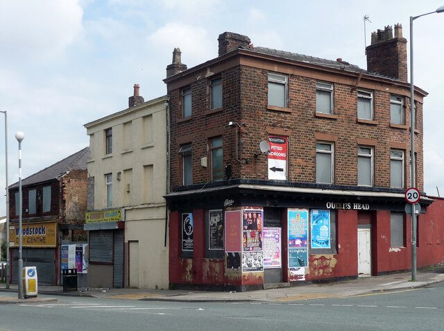
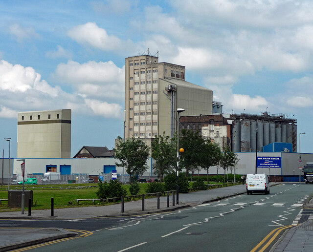
Dingle Images

Images are sourced within 2km of 53.376456/-2.956752 or Grid Reference SJ3687. Thanks to Geograph Open Source API. All images are credited.

Old Boundary Marker on Ashfield Road, Aigburth Vale Parish Boundary Marker against the brick wall of Boots on the north side of the crossroads of the A561 Aigburth Road and the A5058 Ashfield Road, Liverpool 17. Inscribed T / T P │ T G (Township of Toxteth Park and Township of Garston) and possibly dates from 1866 when Garston was made a parish.

Milestone Society National ID: LA_LCTPGA01pb
Old Boundary Marker on Ashfield Road, Aigburth Vale
Parish Boundary Marker against the brick wall of Boots on the north side of the crossroads of the A561 Aigburth Road and the A5058 Ashfield Road, Liverpool 17. Inscribed T / T P │ T G (Township of Toxteth Park and Township of Garston) and possibly dates from 1866 when Garston was made a parish. Milestone Society National ID: LA_LCTPGA01pb
Old Anchor by the River Mersey Trans Pennine Trail passing an old anchor by the River Mersey alongside Brunswick Business Park
Old Anchor by the River Mersey
Trans Pennine Trail passing an old anchor by the River Mersey alongside Brunswick Business Park
Trans Pennine Trail by the River Mersey Trans Pennine Trail by the River Mersey alongside Brunswick Business Park
Trans Pennine Trail by the River Mersey
Trans Pennine Trail by the River Mersey alongside Brunswick Business Park
Trans Pennine Trail by the River Mersey Trans Pennine Trail by the River Mersey at Riverside Drive
Trans Pennine Trail by the River Mersey
Trans Pennine Trail by the River Mersey at Riverside Drive
Otterspool Promenade Otterspool Promenade beside the River Mersey
Otterspool Promenade
Otterspool Promenade beside the River Mersey
The Palm House In Sefton Park
The Palm House
In Sefton Park
Fountain in Lake In Sefton Park near the 'Eros' drinking fountain
Fountain in Lake
In Sefton Park near the 'Eros' drinking fountain
Brunswick railway terminus (site), Liverpool Opened in 1864 by the Garston and Liverpool Railway, soon part of the Cheshire Lines Committee, this station was the northern terminus for passengers until 1874 when a new link was opened to Liverpool Central station. The station continued as a goods station until the 1970s.
View north towards the site. All trace has apparently been removed.
For more information, see <span class="nowrap"><a title="http://www.disused-stations.org.uk/b/brunswick/index.shtml" rel="nofollow ugc noopener" href="http://www.disused-stations.org.uk/b/brunswick/index.shtml">Link</a><img style="margin-left:2px;" alt="External link" title="External link - shift click to open in new window" src="https://s1.geograph.org.uk/img/external.png" width="10" height="10"/></span>.
Brunswick railway terminus (site), Liverpool
Opened in 1864 by the Garston and Liverpool Railway, soon part of the Cheshire Lines Committee, this station was the northern terminus for passengers until 1874 when a new link was opened to Liverpool Central station. The station continued as a goods station until the 1970s. View north towards the site. All trace has apparently been removed. For more information, see LinkExternal link.
Brunswick railway terminus (site), Liverpool Opened in 1864 by the Garston and Liverpool Railway, soon part of the Cheshire Lines Committee, this station was the northern terminus for passengers until 1874 when a new link was opened to Liverpool Central station. The station continued as a goods station until the 1970s, with a large new building erected on the site in 1894.
View south east from the road, from a similar position to <a href="https://www.geograph.org.uk/photo/6497747">SJ3488 : Brunswick Goods Station, 1964 – 1</a> taken nearly 60 years earlier. Almost no trace remains.
For more information, see <span class="nowrap"><a title="http://www.disused-stations.org.uk/b/brunswick/index.shtml" rel="nofollow ugc noopener" href="http://www.disused-stations.org.uk/b/brunswick/index.shtml">Link</a><img style="margin-left:2px;" alt="External link" title="External link - shift click to open in new window" src="https://s1.geograph.org.uk/img/external.png" width="10" height="10"/></span>.
Brunswick railway terminus (site), Liverpool
Opened in 1864 by the Garston and Liverpool Railway, soon part of the Cheshire Lines Committee, this station was the northern terminus for passengers until 1874 when a new link was opened to Liverpool Central station. The station continued as a goods station until the 1970s, with a large new building erected on the site in 1894. View south east from the road, from a similar position to SJ3488 : Brunswick Goods Station, 1964 – 1 taken nearly 60 years earlier. Almost no trace remains. For more information, see LinkExternal link.
The Palm House The Palm House, Sefton Park, Liverpool
The Palm House
The Palm House, Sefton Park, Liverpool
Former pub, Upper Hill Street, Liverpool The Alexandra Hotel had closed by 2008. In 2022 it was still disused, but looking a lot greener, no doubt enhancing local biodiversity, if nothing else.
Former pub, Upper Hill Street, Liverpool
The Alexandra Hotel had closed by 2008. In 2022 it was still disused, but looking a lot greener, no doubt enhancing local biodiversity, if nothing else.
Former church, Princes Road, Liverpool Welsh Presbyterian Church, by W. & G. Audsley, 1868. Grade II listed.
It has been derelict since the 1990s, and was still rotting away in 2022.
Former church, Princes Road, Liverpool
Welsh Presbyterian Church, by W. & G. Audsley, 1868. Grade II listed. It has been derelict since the 1990s, and was still rotting away in 2022.
Ducie Street, Liverpool One of numerous streets of Victorian terraced houses condemned to, or at least slated for, demolition under the misguided 'Pathfinder' initiative which ran from 2002 to 2011. Liverpool seems to have been more afflicted than anywhere else. In 2022, these houses were still standing, but were still empty and deteriorating.
Ducie Street, Liverpool
One of numerous streets of Victorian terraced houses condemned to, or at least slated for, demolition under the misguided 'Pathfinder' initiative which ran from 2002 to 2011. Liverpool seems to have been more afflicted than anywhere else. In 2022, these houses were still standing, but were still empty and deteriorating.
Hatherley Street, Liverpool One of numerous streets of Victorian terraced houses condemned to, or at least slated for, demolition under the misguided 'Pathfinder' initiative which ran from 2002 to 2011. Liverpool seems to have been more afflicted than anywhere else. By 2022, these houses had been renovated and, in a radical step, were being inhabited by human beings.
Hatherley Street, Liverpool
One of numerous streets of Victorian terraced houses condemned to, or at least slated for, demolition under the misguided 'Pathfinder' initiative which ran from 2002 to 2011. Liverpool seems to have been more afflicted than anywhere else. By 2022, these houses had been renovated and, in a radical step, were being inhabited by human beings.
The Globe, Park Road, Liverpool The pub was still open in 2022 although it has had a paint job since this photo.
The Globe, Park Road, Liverpool
The pub was still open in 2022 although it has had a paint job since this photo.
Former pub, Park Road, Liverpool (1) The Toxteth - the name survives on the Park Road front.
Some nice ground floor detail has been lost in an unsympathetic conversion to offices, occupied by Central Liverpool Credit Union.
Former pub, Park Road, Liverpool (1)
The Toxteth - the name survives on the Park Road front. Some nice ground floor detail has been lost in an unsympathetic conversion to offices, occupied by Central Liverpool Credit Union.
Former pub, Park Road, Liverpool (2) On the corner of North Hill Street was a modest pub, the Queen's Head, which seems to have closed in 2008.
Little changed in 2022 - only the flyposters have been active.
Former pub, Park Road, Liverpool (2)
On the corner of North Hill Street was a modest pub, the Queen's Head, which seems to have closed in 2008. Little changed in 2022 - only the flyposters have been active.
Grain Industrial Estate, Mill Street, Liverpool Including a large flour mill which was operated by ADM.
The site seems to have closed since this photo and everything is slated for demolition.
Grain Industrial Estate, Mill Street, Liverpool
Including a large flour mill which was operated by ADM. The site seems to have closed since this photo and everything is slated for demolition.
Show me another place!

Dingle is located at Grid Ref: SJ3687 (Lat: 53.376456, Lng: -2.956752)

Unitary Authority: Liverpool

Police Authority: Merseyside

What 3 Words

///hiking.inner.waters. Near New Ferry, Merseyside

Nearby Locations

Dingle

Related Wikis

King's Leadership Academy Liverpool

King's Leadership Academy Liverpool (formerly Shorefields School and then University Academy Liverpool) is a coeducational secondary school and sixth form...

St Michaels railway station

St Michaels railway station is a railway station in St Michael's Hamlet, Liverpool, England, on the Northern Line of the Merseyrail suburban system. It...

Norwegian Fishermans' Church, Liverpool

Norwegian Fishermans' Church in Liverpool, England, is one of 29 churches organised by Sjømannskirken (Norwegian Church Abroad), a voluntary organisation...

Dingle, Liverpool

Dingle (known locally as the Dingle) is an inner city area of Liverpool, Merseyside, England. It is located to the south of the city, bordered by the adjoining...

Otterspool Tower

Otterspool Tower is a name commonly given to a supertall skyscraper that was proposed in Liverpool, United Kingdom. Developers, Wiggins Group, first touted...

Riverside (Liverpool ward)

Riverside ward was an electoral division of Liverpool City Council covering the southern city centre, the Dingle, and parts of Toxteth. == Background... ==

International Garden Festival

The International Garden Festival was a garden festival recognised by the International Association of Horticultural producers (AIPH) and the Bureau International...

Turner Home, Liverpool

The Turner Home (formerly the Turner Memorial Home, then the Turner Nursing Home) is in Dingle Lane, Toxteth, Liverpool, Merseyside, England. Founded...

Nearby Amenities

Located within 500m of 53.376456,-2.956752
Post Box
Ref: L17 267
Lat/Long: 53.3762812/-2.9602185
Post Box
Ref: L17 428
Lat/Long: 53.3792644/-2.9541305
Place Of Worship
Dingle Mount Church
Religion: christian
Lat/Long: 53.3791315/-2.9609334
Post Box
St Michael's Church Road
Collection Times: Mo-Fr 16:00; Sa 11:45
Description: EIIR post box L17 253 on St Michael's Church Road
Operator: Royal Mail
Post Box Design: type_b
Post Box Type: pillar
Ref: L17 253
Royal Cypher: EIIR
Royal Cypher Wikidata: Q33102113
Wikimedia Commons: Category:Post box L17 253, St Michael's Church Road
Lat/Long: 53.376666/-2.9503817
St Michaels
Naptan AtcoCode: 9100STMCHLS
Network: National Rail
Network Website: https://www.nationalrail.co.uk/stations/stm/
Network Wikidata: Q26334
Operator: Merseyrail
Public Transport: station
Railway: station
Ref Crs: STM
Wheelchair: yes
Wikidata: Q1817693
Wikipedia: en:St Michaels railway station
Lat/Long: 53.3759381/-2.9535298
Crossing
Crossing: traffic_signals
Crossing Island: no
Tactile Paving: yes
Lat/Long: 53.3733505/-2.9532799
Pub
Aigburth Cricket and Bowling Club
Lat/Long: 53.3752981/-2.9541082
Barrier: bollard
Bicycle: yes
Foot: yes
Horse: yes
Motor Vehicle: no
Lat/Long: 53.3776866/-2.9565514
Barrier: cycle_barrier
Bicycle: dismount
Cyclestreets Id: 106313
Foot: yes
Horse: no
Motor Vehicle: no
Lat/Long: 53.3774867/-2.9617402
Nursing Home
Turner Care Home
Wikidata: Q7855935
Wikipedia: en:Turner Home, Liverpool
Lat/Long: 53.3807402/-2.9575192
Bus Stop
DINGLE MOUNT/BOSNIA STREET
Bus: yes
Naptan AtcoCode: 2800S41013A
Naptan Bearing: NW
Naptan CommonName: DINGLE MOUNT/BOSNIA STREET
Naptan Indicator: DINGLE MOUNT/DINGLE LANE
Naptan Landmark: OPP DINGLE BROWN CORNER HIGSON COURT
Naptan NaptanCode: merdataw
Naptan Notes: No Notes
Naptan PlusbusZoneRef: LVRPLCH
Naptan ShortCommonName: Dingle Mt/Bosnia St
Naptan Street: DINGLE MOUNT
Naptan Verified: no
Public Transport: platform
Source: naptan_import
Lat/Long: 53.3795313/-2.9613861
Bus Stop
Dingle Mount/st Finbars Church
Bus: yes
Naptan AtcoCode: 2800S41013B
Naptan Bearing: NW
Naptan CommonName: Dingle Mount/st Finbars Church
Naptan Indicator: Dingle Mount/st Finbars Church
Naptan Landmark: Dingle Brow
Naptan NaptanCode: merdatda
Naptan Notes: No Notes
Naptan PlusbusZoneRef: LVRPLCH
Naptan ShortCommonName: Dingle Mount
Naptan Street: Dingle Mount
Naptan Verified: no
Public Transport: platform
Source: naptan_import
Lat/Long: 53.3795517/-2.9610859
Bus Stop
Dingle Mount/st Finbars Church
Bus: yes
Naptan AtcoCode: 2800S41013D
Naptan Bearing: NW
Naptan CommonName: Dingle Mount/st Finbars Church
Naptan Indicator: Dingle Mount/st Finbars Church
Naptan Landmark: Dingle Lane
Naptan NaptanCode: mertgaga
Naptan PlusbusZoneRef: LVRPLCH
Naptan ShortCommonName: Dingle Mount
Naptan Street: Dingle Mount
Naptan Verified: no
Public Transport: platform
Source: naptan_import
Lat/Long: 53.3793453/-2.9610361
Bus Stop
DINGLE LANE/KINNAIRD STREET
Bench: yes
Bus: yes
Naptan AtcoCode: 2800S41014A
Naptan Bearing: SW
Naptan CommonName: DINGLE LANE/KINNAIRD STREET
Naptan Indicator: DINGLE LANE/DINGLE MOUNT
Naptan Landmark: OPP 28 NR CORNER KINNAIRD STREET
Naptan NaptanCode: merdatdg
Naptan Notes: No Notes
Naptan PlusbusZoneRef: LVRPLCH
Naptan ShortCommonName: Dingle Lane
Naptan Street: DINGLE LANE
Naptan Verified: no
Public Transport: platform
Shelter: yes
Source: naptan_import
Lat/Long: 53.3801754/-2.9584239
Bus Stop
Dingle Lane/chillingham Street
Bus: yes
Naptan AtcoCode: 2800S41014B
Naptan Bearing: NE
Naptan CommonName: Dingle Lane/chillingham Street
Naptan Indicator: Dingle Lane/dingle Mount
Naptan Landmark: O/s Shop 50 Corner Chillingham Street
Naptan NaptanCode: merdatdj
Naptan Notes: No Notes
Naptan PlusbusZoneRef: LVRPLCH
Naptan ShortCommonName: Dingle Lane
Naptan Street: Dingle Lane
Naptan Verified: no
Public Transport: platform
Source: naptan_import
Lat/Long: 53.3796359/-2.9595543
Bus Stop
RIVERSIDE DRIVE/PLEASURE ISLAND
Bench: yes
Bus: yes
Naptan AtcoCode: 2800S41167A
Naptan Bearing: NW
Naptan CommonName: RIVERSIDE DRIVE/PLEASURE ISLAND
Naptan Indicator: RIVERSIDE DRIVE/PLEASURE ISLAND
Naptan Landmark: O/S PLEASURE ISLAND
Naptan NaptanCode: merdgpmt
Naptan Notes: No Notes
Naptan PlusbusZoneRef: LVRPLCH
Naptan ShortCommonName: Pleasure Island
Naptan Street: RIVERSIDE DRIVE
Naptan Verified: no
Public Transport: platform
Shelter: yes
Source: naptan_import
Lat/Long: 53.3736372/-2.9543088
Bus Stop
RIVERSIDE DRIVE/PLEASURE ISLAND
Bus: yes
Naptan AtcoCode: 2800S41167B
Naptan Bearing: SE
Naptan CommonName: RIVERSIDE DRIVE/PLEASURE ISLAND
Naptan Indicator: RIVERSIDE DRIVE/PLEASURE ISLAND
Naptan Landmark: OPP PLEASURE ISLAND
Naptan NaptanCode: merdgpmw
Naptan Notes: No Notes
Naptan PlusbusZoneRef: LVRPLCH
Naptan ShortCommonName: Pleasure Island
Naptan Street: RIVERSIDE DRIVE
Naptan Verified: no
Public Transport: platform
Shelter: yes
Source: naptan_import
Lat/Long: 53.3736143/-2.953785
Bus Stop
RIVERSIDE DRIVE/PROMENADE GARDEN
Bus: yes
Naptan AtcoCode: 2800S41168A
Naptan Bearing: NE
Naptan CommonName: RIVERSIDE DRIVE/PROMENADE GARDEN
Naptan Indicator: RIVERSIDE DRIVE/PROMENADE GARDENS
Naptan Landmark: OPP FESTIVAL HALL (PART OF PLEASURE ISLAND)
Naptan NaptanCode: merdgpta
Naptan Notes: No Notes
Naptan PlusbusZoneRef: LVRPLCH
Naptan ShortCommonName: Promenade Gardens
Naptan Street: RIVERSIDE DRIVE
Naptan Verified: no
Public Transport: platform
Source: naptan_import
Lat/Long: 53.3745517/-2.9607331
Bus Stop
RIVERSIDE DRIVE/PROMENADE GARDENS
Bench: yes
Bus: yes
Naptan AtcoCode: 2800S41168B
Naptan Bearing: W
Naptan CommonName: RIVERSIDE DRIVE/PROMENADE GARDENS
Naptan Indicator: RIVERSIDE DRIVE/PROMENADE GARDENS
Naptan Landmark: O/S FESTIVAL HALL (PART OF PLEASURE ISLAND)
Naptan NaptanCode: merdgptd
Naptan Notes: No Notes
Naptan PlusbusZoneRef: LVRPLCH
Naptan ShortCommonName: Promenade Gdns
Naptan Street: RIVERSIDE DRIVE
Naptan Verified: no
Public Transport: platform
Shelter: yes
Source: naptan_import
Lat/Long: 53.374774/-2.9586599
Entrance: yes
Wheelchair: limited
Lat/Long: 53.3756039/-2.9528419
Toilets
Source: gps_trace
Lat/Long: 53.3720474/-2.9569165
Crossing
Crossing: traffic_signals
Crossing Island: yes
Crossing Ref: pelican
Tactile Paving: yes
Lat/Long: 53.3808374/-2.957528
Traffic Signals
Traffic Signals: signal
Lat/Long: 53.3808002/-2.9576846
Generator Method: photovoltaic
Generator Output Electricity: yes
Generator Source: solar
Generator Type: solar_photovoltaic_panel
Location: roof
Power: generator
Source: imagery
Lat/Long: 53.3740915/-2.9515679
Generator Method: photovoltaic
Generator Output Electricity: yes
Generator Source: solar
Generator Type: solar_photovoltaic_panel
Location: roof
Power: generator
Source: imagery
Lat/Long: 53.3741075/-2.9517288
Generator Method: photovoltaic
Generator Output Electricity: yes
Generator Source: solar
Generator Type: solar_photovoltaic_panel
Location: roof
Power: generator
Source: imagery
Lat/Long: 53.3736546/-2.9523913
Generator Method: photovoltaic
Generator Output Electricity: yes
Generator Source: solar
Generator Type: solar_photovoltaic_panel
Location: roof
Power: generator
Source: imagery
Lat/Long: 53.3760916/-2.9611594
Generator Method: photovoltaic
Generator Output Electricity: yes
Generator Source: solar
Generator Type: solar_photovoltaic_panel
Location: roof
Power: generator
Source: imagery
Lat/Long: 53.3769317/-2.9618273
Generator Method: photovoltaic
Generator Output Electricity: yes
Generator Source: solar
Generator Type: solar_photovoltaic_panel
Location: roof
Power: generator
Source: imagery
Lat/Long: 53.3769429/-2.9617468
Bicycle Parking
Bicycle Parking: stands
Capacity: 16
Covered: no
Fee: no
Lat/Long: 53.3784559/-2.957806
Cycleway: asl
Lat/Long: 53.3808366/-2.9576697
Barrier: kerb
Kerb: lowered
Tactile Paving: yes
Lat/Long: 53.3808046/-2.9574697
Barrier: kerb
Kerb: lowered
Tactile Paving: yes
Lat/Long: 53.3808826/-2.9577528
Crossing
Crossing: traffic_signals
Crossing Island: yes
Crossing Ref: pelican
Tactile Paving: yes
Lat/Long: 53.3808715/-2.9576554
St Michaels
Public Transport: stop_position
Railway: stop
Train: yes
Lat/Long: 53.3756959/-2.9529281
St Michaels
Public Transport: stop_position
Railway: stop
Train: yes
Lat/Long: 53.3763245/-2.9544725
Crossing
Lat/Long: 53.373281/-2.9521602
Crossing
Crossing: unmarked
Lat/Long: 53.3749361/-2.9591577
Crossing
Crossing: unmarked
Lat/Long: 53.3750868/-2.9595004
Crossing
Crossing: unmarked
Lat/Long: 53.3750815/-2.95964
Crossing
Crossing: unmarked
Lat/Long: 53.3746862/-2.9597903
Crossing
Crossing: unmarked
Lat/Long: 53.374768/-2.9598818
Crossing
Crossing: unmarked
Lat/Long: 53.3748405/-2.9591367
Second Home
Shop: second_hand
Lat/Long: 53.3802406/-2.9527769
Addr Housenumber: 6
Addr Street: Hassop Way
Lat/Long: 53.3791727/-2.9564991
Addr Housenumber: 10
Addr Street: Hassop Way
Lat/Long: 53.3792349/-2.9566587
Addr Housenumber: 2
Addr Street: Hassop Way
Lat/Long: 53.3791387/-2.9563345
Addr Housenumber: 8
Addr Street: Hassop Way
Lat/Long: 53.3792242/-2.9565877
Addr Housenumber: 14
Addr Street: Hassop Way
Lat/Long: 53.3792632/-2.9568275
Addr Housenumber: 4
Addr Street: Hassop Way
Lat/Long: 53.3791569/-2.956415
Addr Housenumber: 16
Addr Street: Hassop Way
Lat/Long: 53.3792749/-2.9569151
Addr Housenumber: 12
Addr Street: Hassop Way
Lat/Long: 53.3792471/-2.9567417
Barrier: cycle_barrier
Bicycle: no
Cycle Barrier: squeeze
Cycle Barrier Installation: fixed
Lat/Long: 53.3788591/-2.9562118
Addr Housenumber: 1
Addr Street: Lambton Road
Lat/Long: 53.3805803/-2.9539276
Addr Housenumber: 96
Addr Street: Aigburth Road
Lat/Long: 53.3801064/-2.9524209
Addr Housenumber: 1A
Addr Street: Errol Street
Lat/Long: 53.3799682/-2.9522984
Prima
Self Service: yes
Shop: laundry
Lat/Long: 53.3799784/-2.9520906
Shiraz Nails
Beauty: nails
Opening Hours: Mo-Sa 09:00-19:00
Shop: beauty
Lat/Long: 53.3801612/-2.9525527
Shop: vacant
Lat/Long: 53.3800249/-2.9522112
Shop: dry_cleaning
Lat/Long: 53.3800058/-2.9521515
4 Seasons
Beauty: nails
Shop: beauty
Lat/Long: 53.3799576/-2.9520298
Beauty by Arla
Shop: beauty
Lat/Long: 53.3801423/-2.9525105
Rudy
Shop: hairdresser
Lat/Long: 53.3801351/-2.9524945
Shop: vacant
Lat/Long: 53.3801131/-2.9524115
SK News and Wine
Shop: convenience
Lat/Long: 53.3802085/-2.9526675
The data included in this document is from www.openstreetmap.org. The data is made available under ODbL.

Have you been to Dingle?

Leave your review of Dingle below (or comments, questions and feedback).