Leech Wood

Wood, Forest in Cheshire

England

Leech Wood

Shutlingsloe From Croker Hill
Shutlingsloe Credit: Anthony O'Neil

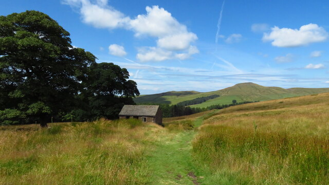
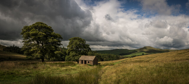
Leech Wood is a charming woodland located in the county of Cheshire, England. Covering an area of approximately 50 acres, it is often referred to as Leech Forest due to its dense and abundant vegetation. The woodland is situated near the village of Nantwich, making it easily accessible for locals and visitors alike.

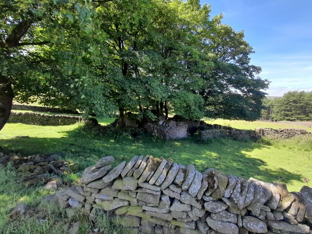
The wood is predominantly composed of various species of trees, including oak, beech, and birch, which create a diverse and picturesque landscape. The forest floor is enriched with a thick carpet of moss and ferns, adding to its enchanting ambiance. Throughout the year, the woodland boasts an array of vibrant colors, from the fresh green leaves in spring to the golden hues in autumn.

Leech Wood is a haven for wildlife enthusiasts, as it provides a sanctuary for numerous species of fauna. Birdwatchers will delight in the opportunity to spot various bird species, including woodpeckers, jays, and nuthatches. Small mammals such as squirrels, rabbits, and foxes also call this woodland home.

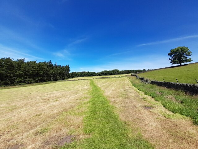
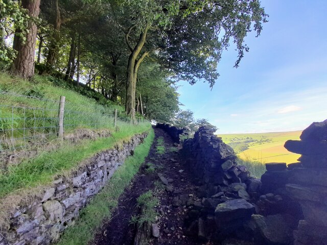
The wood offers a network of well-maintained footpaths, providing visitors with the perfect opportunity to immerse themselves in nature. Walking through Leech Wood, one can enjoy the tranquil atmosphere and listen to the gentle sound of leaves rustling in the wind.

Overall, Leech Wood in Cheshire is a captivating natural haven, offering an escape from the hustle and bustle of daily life. With its diverse flora and fauna, it provides a peaceful retreat for individuals seeking solace in nature's beauty.

If you have any feedback on the listing, please let us know in the comments section below.
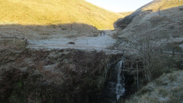
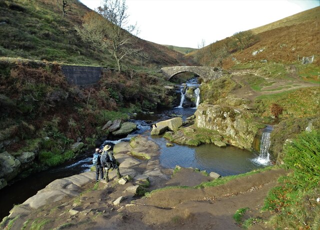
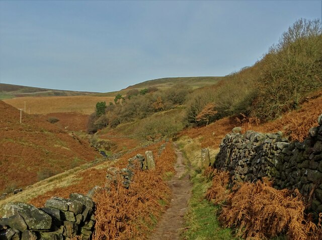
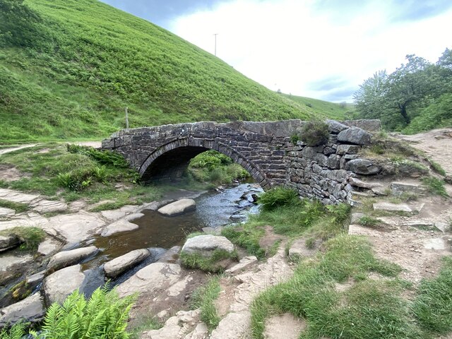
Leech Wood Images

Images are sourced within 2km of 53.213928/-2.0149045 or Grid Reference SJ9968. Thanks to Geograph Open Source API. All images are credited.

Shutlingsloe From Croker Hill
Shutlingsloe
From Croker Hill
Shutlingsloe, Peak District Viewed from the A54, on the edge of the Peak District in Cheshire.
Shutlingsloe, Peak District
Viewed from the A54, on the edge of the Peak District in Cheshire.
Shutlingsloe & Croker Hill from Whetstone Ridge A clear sunny morning with a cold air inversion over the Cheshire Plain. The hills beyond are just into Wales.
Shutlingsloe & Croker Hill from Whetstone Ridge
A clear sunny morning with a cold air inversion over the Cheshire Plain. The hills beyond are just into Wales.
St. Saviours Church, Wildboarclough The church was built between 1901 and 1909 for the 16th Earl of Derby to celebrate the safe return of his sons from the Boer War. The building was carried out by workers from the Crag estate. The foundation stone was laid by the Countess of Derby on 14 September 1901, and the church was consecrated in 1909.


<span class="nowrap"><a title="https://en.wikipedia.org/wiki/St_Saviour%27s_Church,_Wildboarclough" rel="nofollow ugc noopener" href="https://en.wikipedia.org/wiki/St_Saviour%27s_Church,_Wildboarclough">Link</a><img style="margin-left:2px;" alt="External link" title="External link - shift click to open in new window" src="https://s1.geograph.org.uk/img/external.png" width="10" height="10"/></span>
St. Saviours Church, Wildboarclough
The church was built between 1901 and 1909 for the 16th Earl of Derby to celebrate the safe return of his sons from the Boer War. The building was carried out by workers from the Crag estate. The foundation stone was laid by the Countess of Derby on 14 September 1901, and the church was consecrated in 1909. LinkExternal link
Ruins at Tagscloughhole
Footpath across a mown field
Walled footpath by Berrybank Wood
View towards Shutlingsloe from Tegg's Nose visitor centre The distance between the two is 4.5km as the crow flies.
View towards Shutlingsloe from Tegg's Nose visitor centre
The distance between the two is 4.5km as the crow flies.
Shutlingsloe from near Crag Hall, Wildboarclough
Moorland path west of A54 near Wildboarclough & view towards Shutlingsloe
Shuttlingsloe Summit Panno Class: Ethel, Hump, Dodd (500-599m), Dewey  ( <span class="nowrap"><a title="https://www.hill-bagging.co.uk/mountaindetails.php?qu=S&rf=3644" rel="nofollow ugc noopener" href="https://www.hill-bagging.co.uk/mountaindetails.php?qu=S&rf=3644">Link</a><img style="margin-left:2px;" alt="External link" title="External link - shift click to open in new window" src="https://s1.geograph.org.uk/img/external.png" width="10" height="10"/></span> )

Trigpoint ( <span class="nowrap"><a title="http://www.trigpointinguk.com/trigs/trig-details.php?t=5970" rel="nofollow ugc noopener" href="http://www.trigpointinguk.com/trigs/trig-details.php?t=5970">Link</a><img style="margin-left:2px;" alt="External link" title="External link - shift click to open in new window" src="https://s1.geograph.org.uk/img/external.png" width="10" height="10"/></span> )
Shuttlingsloe Summit Panno
Class: Ethel, Hump, Dodd (500-599m), Dewey ( LinkExternal link ) Trigpoint ( LinkExternal link )
Birchenough Hill 459m / 1506ft Pano Summit TuMP summit 

<span class="nowrap"><a title="https://www.hill-bagging.co.uk/mountaindetails.php?qu=S&rf=16500" rel="nofollow ugc noopener" href="https://www.hill-bagging.co.uk/mountaindetails.php?qu=S&rf=16500">Link</a><img style="margin-left:2px;" alt="External link" title="External link - shift click to open in new window" src="https://s1.geograph.org.uk/img/external.png" width="10" height="10"/></span>
Birchenough Hill 459m / 1506ft Pano Summit
TuMP summit LinkExternal link
Half Summer, Half Not, Wildboarclough Barn
Cumberland Brook waterfall Quite spectacular.
Cumberland Brook waterfall
Quite spectacular.
Three Shires Head Bridge - crossing The River Dane This is where the ancient ceremonial counties of Cheshire, Staffordshire and Derbyshire meet. Three Shires Head is also known as Three Shires Heads - both versions are acceptable. The pool to the right is I think known as Panniers Pool - often braved by hardy swimmers.
Three Shires Head Bridge - crossing The River Dane
This is where the ancient ceremonial counties of Cheshire, Staffordshire and Derbyshire meet. Three Shires Head is also known as Three Shires Heads - both versions are acceptable. The pool to the right is I think known as Panniers Pool - often braved by hardy swimmers.
On the moorland track to Three Shires Head Along the valley of The River Dane
On the moorland track to Three Shires Head
Along the valley of The River Dane
Panniers Pool Bridge At Three Shires Head, where Cheshire, Derbyshire an Staffordshire meet.
Panniers Pool Bridge
At Three Shires Head, where Cheshire, Derbyshire an Staffordshire meet.
Footpath ladder A steep climb over a wall takes this footpath to the A54.
Footpath ladder
A steep climb over a wall takes this footpath to the A54.
Show me another place!

Leech Wood is located at Grid Ref: SJ9968 (Lat: 53.213928, Lng: -2.0149045)

Unitary Authority: Cheshire East

Police Authority: Cheshire

What 3 Words

///nips.decisions.upstarts. Near Buxton, Derbyshire

Nearby Locations

Leech Wood

Related Wikis

Crag Hall

Crag Hall is a country house east of the village of Wildboarclough, Cheshire, England and owned by the Earl of Derby. == Description == It was built in...

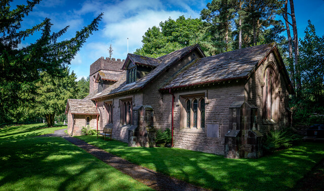
St Saviour's Church, Wildboarclough

St Saviour's Church is in the village of Wildboarclough, Cheshire, England. It is an active Anglican parish church in the deanery of Macclesfield, the...

Wildboarclough

Wildboarclough ( WIL-bÉ™-kluf) is a village in the civil parish of Macclesfield Forest and Wildboarclough, in the Cheshire East district, in the ceremonial...
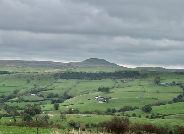
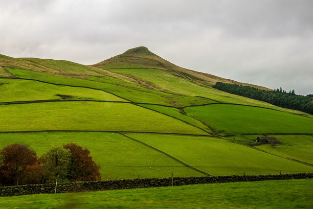
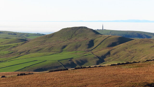
Shutlingsloe

Shutlingsloe is a hill near the village of Wildboarclough, in the east of the county of Cheshire. It stands to the south of Macclesfield Forest, on the...

Three Shire Heads

Three Shire Heads (also known as Three Shires Head) is the point on Axe Edge Moor where Cheshire, Derbyshire and Staffordshire meet, at UK grid reference...

Allgreave

Allgreave is a village in Cheshire, England. It lies on the A54 (Buxton to Congleton) road, near to the border with Staffordshire. Allgreave Methodist...

Macclesfield Forest and Wildboarclough

Macclesfield Forest and Wildboarclough is a civil parish in the unitary authority of Cheshire East and the ceremonial county of Cheshire, England. It...

Lud's Church

Lud's Church (sometimes written as Ludchurch) is a deep chasm penetrating the Millstone Grit bedrock created by a massive landslip on the hillside above...

Nearby Amenities

Located within 500m of 53.213928,-2.0149045
Ele: 319.0000000
Lat/Long: 53.2147453/-2.0189279
Ele: 321.0000000
Lat/Long: 53.2143065/-2.0192928
Ele: 321.0000000
Lat/Long: 53.2142252/-2.0193992
Ele: 311.0000000
Lat/Long: 53.2135009/-2.0209055
Ele: 321.0000000
Lat/Long: 53.2143123/-2.0192387
Barrier: stile
Lat/Long: 53.2113414/-2.0143039
Information: guidepost
Operator: Peak & Northern Footpaths Society
Ref: 132
Tourism: information
Lat/Long: 53.2149522/-2.0158601
The data included in this document is from www.openstreetmap.org. The data is made available under ODbL.

Have you been to Leech Wood?

Leave your review of Leech Wood below (or comments, questions and feedback).