Granny Wood

Wood, Forest in Yorkshire

England

Granny Wood

Bridgegate
Bridgegate Credit: Alex McGregor

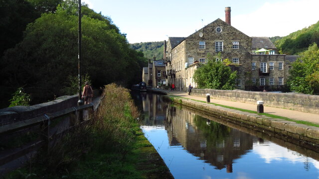
Granny Wood, located in Yorkshire, England, is a charming forest area known for its natural beauty and serene atmosphere. Spread across a vast expanse, this woodland is a popular destination for nature lovers and outdoor enthusiasts alike.

The forest is predominantly made up of ancient oak trees, which provide a dense canopy, creating a cool and shaded environment even on hot summer days. The well-maintained footpaths and trails that wind through the forest make it an ideal location for walking, jogging, or cycling, offering visitors the opportunity to explore its hidden nooks and crannies.

Granny Wood is also home to a rich variety of flora and fauna. Wildflowers such as bluebells, primroses, and foxgloves adorn the forest floor, creating a vibrant tapestry of colors. Birdwatchers can spot a diverse range of avian species, including woodpeckers, owls, and jays, while small mammals like squirrels, rabbits, and hedgehogs often scurry through the undergrowth.

For those seeking tranquility, Granny Wood provides a peaceful retreat away from the hustle and bustle of city life. The forest's idyllic setting invites visitors to relax and unwind, offering a welcome respite from daily stresses. Picnic areas are scattered throughout the woodland, allowing families and friends to enjoy a leisurely lunch amidst the natural surroundings.

In conclusion, Granny Wood is a picturesque forest in Yorkshire that offers a tranquil escape for nature lovers. Its ancient oaks, diverse wildlife, and well-maintained trails make it a perfect destination for outdoor activities or simply enjoying the beauty of nature.

If you have any feedback on the listing, please let us know in the comments section below.

Granny Wood Images

Images are sourced within 2km of 53.743714/-2.0230851 or Grid Reference SD9827. Thanks to Geograph Open Source API. All images are credited.

Bridgegate
Bridgegate
The White Swan
The White Swan
Shoulder Of Mutton
Shoulder Of Mutton
Canal lock
Canal lock
Canal view
Canal view
The Flying Saucer at Hebden Bridge Cafe and studio in old canal warehouse
The Flying Saucer at Hebden Bridge
Cafe and studio in old canal warehouse
Northgate View along Northgate towards the main village
Northgate
View along Northgate towards the main village
From above the church tower Picture taken from my DJi Mini drone of the top of the church tower, the new graveyard just beyond, and in the far distance Whiteley Arches rail bridge in the green Calder Valley.
From above the church tower
Picture taken from my DJi Mini drone of the top of the church tower, the new graveyard just beyond, and in the far distance Whiteley Arches rail bridge in the green Calder Valley.
Whitehall Farm archway Archway marking the entrance to Whitehall Farm, inscribed on the lintel are the initials JB standing for John Bentley, once owner of the farm and the date of 1578..
Whitehall Farm archway
Archway marking the entrance to Whitehall Farm, inscribed on the lintel are the initials JB standing for John Bentley, once owner of the farm and the date of 1578..
View along the church roof A view along the roof of the church of St Thomas the Apostle, looking towards the village of Old town in the distance.
View along the church roof
A view along the roof of the church of St Thomas the Apostle, looking towards the village of Old town in the distance.
Heptonstall from Smeekin Hill Taken from the Smeekin Hill/Wadsworth war memorial looking across Hebden Dale towards Heptonstall and in the far distance the peace monument of Stoodley Pike Monument.
Heptonstall from Smeekin Hill
Taken from the Smeekin Hill/Wadsworth war memorial looking across Hebden Dale towards Heptonstall and in the far distance the peace monument of Stoodley Pike Monument.
Looking up the church tower Looking up the tower of the church of St Thomas the Apostle.
Looking up the church tower
Looking up the tower of the church of St Thomas the Apostle.
Halifax Road at Calderside View from rail line on Whiteley Arches
Halifax Road at Calderside
View from rail line on Whiteley Arches
Oakville Road at Calderside View from Rochdale to Leeds railway
Oakville Road at Calderside
View from Rochdale to Leeds railway
The aqueduct carrying the Rochdale Canal over the Calder at Hebden Bridge The Rochdale Canal runs for 33 miles between Manchester and Sowerby Bridge in West Yorkshire, UK. In Sowerby Bridge it connects with the Calder and Hebble Navigation. In Manchester it connects with the Ashton and Bridgewater Canals. 

The canal was opened between Sowerby Bridge and Todmorden and from Manchester to Rochdale in 1799 and between Todmorden and Rochdale in 1805. Most of the canal was closed in 1952. Restoration work began in late 1980s and by  1996 the canal was opened to navigation once again between Sowerby Bridge and the summit level. The canal was re-opened to navigation along its entire length in July 2002 and forms part of the South Pennine Ring. 

<span class="nowrap"><a title="http://www.penninewaterways.co.uk/rochdale/index.htm" rel="nofollow ugc noopener" href="http://www.penninewaterways.co.uk/rochdale/index.htm">Link</a><img style="margin-left:2px;" alt="External link" title="External link - shift click to open in new window" src="https://s1.geograph.org.uk/img/external.png" width="10" height="10"/></span>
The aqueduct carrying the Rochdale Canal over the Calder at Hebden Bridge
The Rochdale Canal runs for 33 miles between Manchester and Sowerby Bridge in West Yorkshire, UK. In Sowerby Bridge it connects with the Calder and Hebble Navigation. In Manchester it connects with the Ashton and Bridgewater Canals. The canal was opened between Sowerby Bridge and Todmorden and from Manchester to Rochdale in 1799 and between Todmorden and Rochdale in 1805. Most of the canal was closed in 1952. Restoration work began in late 1980s and by 1996 the canal was opened to navigation once again between Sowerby Bridge and the summit level. The canal was re-opened to navigation along its entire length in July 2002 and forms part of the South Pennine Ring. LinkExternal link
Seat at eastern end of Horsehold Wood & view over Calderside A seat with a view.
Seat at eastern end of Horsehold Wood & view over Calderside
A seat with a view.
View towards Hebden Bridge from eastern end of Horsehold Wood
Rochdale Canal at Hebden Bridge
Show me another place!

Granny Wood is located at Grid Ref: SD9827 (Lat: 53.743714, Lng: -2.0230851)

Division: West Riding

Unitary Authority: Calderdale

Police Authority: West Yorkshire

What 3 Words

///popular.comedians.beaker. Near Hebden Bridge, West Yorkshire

Related Wikis

Hepton Rural District

Hepton was a rural district in the West Riding of Yorkshire, England, from 1894 to 1974. The district included four civil parishes: Heptonstall, Blackshaw...

Battle of Heptonstall

The Battle of Heptonstall occurred in November 1643 during the First English Civil War at Hebden Bridge and Heptonstall, Yorkshire. During the battle,...

Hebden Bridge Town Hall

Hebden Bridge Town Hall, formerly Hebden Bridge Council Offices, is a municipal building in St George's Street, Hebden Bridge, West Yorkshire, England...

Hebden Bridge Picture House

Hebden Bridge Picture House in Hebden Bridge, West Yorkshire, is one of the last remaining council-owned cinemas in Britain. Together with the adjacent...

Birchcliffe Baptist Church

Birchcliffe Baptist Church is a redundant Baptist chapel in the town of Hebden Bridge, West Yorkshire, England. It was founded by Daniel Taylor in 1764...

Hebden Royd

Hebden Royd is a civil parish in the Metropolitan Borough of Calderdale in West Yorkshire, England. According to the 2001 census it had a population of...

Hebden Bridge

Hebden Bridge is a market town in the Calderdale district of West Yorkshire, England. It is in the Upper Calder Valley, 8 miles (13 km) west of Halifax...

Hebden Bridge railway station

Hebden Bridge railway station serves the town of Hebden Bridge in West Yorkshire, England. The station is on the Calder Valley Line, operated by Northern...

Nearby Amenities

Located within 500m of 53.743714,-2.0230851
Ele: 171.1
Lat/Long: 53.7442998/-2.0163558
Ele: 184.4
Lat/Long: 53.7463438/-2.0176495
Crossing
Lat/Long: 53.7425389/-2.0170855
Mytholm
Created By: POI Editor
Place: village
Source: npe
Lat/Long: 53.7437724/-2.0285669
Parking
Lat/Long: 53.7435053/-2.0176872
Noexit: yes
Lat/Long: 53.7410729/-2.0233561
Noexit: yes
Lat/Long: 53.7410204/-2.023075
Noexit: yes
Lat/Long: 53.7409876/-2.0226238
Noexit: yes
Lat/Long: 53.7409167/-2.0221016
Noexit: yes
Lat/Long: 53.7409658/-2.0223724
Noexit: yes
Lat/Long: 53.7410051/-2.0228605
Seamark Type: gate
Waterway: lock_gate
Lat/Long: 53.7408071/-2.0221955
Seamark Type: gate
Waterway: lock_gate
Lat/Long: 53.740916/-2.0238229
Seamark Type: gate
Waterway: lock_gate
Lat/Long: 53.7407808/-2.0218115
Seamark Type: gate
Waterway: lock_gate
Lat/Long: 53.7409091/-2.0234421
Turning Circle
Stubbing Drive
Lat/Long: 53.741283/-2.0247052
Bench
Ele: 108.03
Lat/Long: 53.7409206/-2.028383
Bus Stop
HB15 Market Street
Bench: no
Bin: no
Bus: yes
Local Ref: 45019585
Naptan AtcoCode: 450019585
Naptan Bearing: E
Naptan CommonName: HB15 Market Street
Naptan Crossing: Salem Street
Naptan Indicator: Stop 45019585
Naptan Landmark: Co-op
Naptan PlusbusZoneRef: LEEDS
Naptan ShortCommonName: Salem Street
Naptan Street: Market Street
Naptan Verified: no
Public Transport: platform
Shelter: no
Source: naptan_import
Lat/Long: 53.7413618/-2.0168144
Bus Stop
HB14 Market Street
Bus: yes
Local Ref: 45019586
Naptan AtcoCode: 450019586
Naptan Bearing: W
Naptan CommonName: HB14 Market Street
Naptan Crossing: Salem Street
Naptan Indicator: Stop 45019586
Naptan Landmark: Co-op
Naptan PlusbusZoneRef: LEEDS
Naptan ShortCommonName: Salem Street
Naptan Street: Market Street
Naptan Verified: no
Public Transport: platform
Shelter: yes
Source: naptan_import
Lat/Long: 53.7411998/-2.0181031
Bus Stop
Market Street
Bus: yes
Local Ref: 45019589
Naptan AtcoCode: 450019589
Naptan Bearing: E
Naptan CommonName: Market Street
Naptan Crossing: Heptonstall Road
Naptan Indicator: Stop 45019589
Naptan PlusbusZoneRef: LEEDS
Naptan ShortCommonName: Market Street
Naptan Street: Market Street
Naptan Verified: no
Public Transport: platform
Shelter: no
Source: naptan_import
Lat/Long: 53.7418106/-2.0205444
Bus Stop
Heptonstall Road Queens Terrace
Bus: yes
Local Ref: 45019590
Naptan AtcoCode: 450019590
Naptan Bearing: NE
Naptan CommonName: Heptonstall Road Queens Terrace
Naptan Crossing: Queens Terrace
Naptan Indicator: Stop 45019590
Naptan Notes: L/C No Num
Naptan PlusbusZoneRef: LEEDS
Naptan ShortCommonName: Queens Terrace
Naptan Street: Heptonstall Road
Naptan Verified: no
Public Transport: platform
Shelter: no
Source: naptan_import
Lat/Long: 53.7423143/-2.0181339
Bus Stop
Heptonstall Road Lee Wood Road
Local Ref: 45019591
Naptan AtcoCode: 450019591
Naptan Bearing: S
Naptan CommonName: Heptonstall Road Lee Wood Road
Naptan Crossing: Lee Wood Road
Naptan Indicator: Stop 45019591
Naptan PlusbusZoneRef: LEEDS
Naptan ShortCommonName: Lee Wood Road
Naptan Street: Heptonstall Road
Naptan Verified: no
Shelter: no
Source: naptan_import
Lat/Long: 53.7440763/-2.0162242
Bus Stop
Southfield
Local Ref: 45019593
Naptan AtcoCode: 450019593
Naptan Bearing: NW
Naptan CommonName: Southfield
Naptan Crossing: Longfield
Naptan Indicator: Stop 45019593
Naptan PlusbusZoneRef: LEEDS
Naptan ShortCommonName: Southfield
Naptan Street: Southfield
Naptan Verified: no
Shelter: no
Source: naptan_import
Lat/Long: 53.7464844/-2.0212443
Bus Stop
Heptonstall Longfield
Bench: yes
Bin: yes
Bus: yes
Departures Board: timetable
Local Ref: 45019594
Naptan AtcoCode: 450019594
Naptan Bearing: SE
Naptan CommonName: Heptonstall Longfield
Naptan Crossing: Valley View Road
Naptan Indicator: Stop 45019594
Naptan PlusbusZoneRef: LEEDS
Naptan ShortCommonName: Longfield
Naptan Street: Longfield
Naptan Verified: no
Public Transport: platform
Shelter: yes
Source: naptan_import
Lat/Long: 53.7469071/-2.0198039
Bus Stop
Bankfoot Mytholm Close
Bus: yes
Local Ref: 45019814
Naptan AtcoCode: 450019814
Naptan Bearing: NW
Naptan CommonName: Bankfoot Mytholm Close
Naptan Crossing: Mytholm Close
Naptan Indicator: Stop 45019814
Naptan Landmark: Bankfoot House
Naptan PlusbusZoneRef: LEEDS
Naptan ShortCommonName: Mytholm Close
Naptan Street: Bankfoot
Naptan Verified: no
Public Transport: platform
Shelter: yes
Source: naptan_import
Lat/Long: 53.7420971/-2.0228028
Bus Stop
King Street
Bus: yes
Local Ref: 45019815
Naptan AtcoCode: 450019815
Naptan Bearing: SW
Naptan CommonName: King Street
Naptan Crossing: Church Lane
Naptan Indicator: Stop 45019815
Naptan Landmark: Church
Naptan PlusbusZoneRef: LEEDS
Naptan ShortCommonName: Church Lane
Naptan Street: King Street
Naptan Verified: no
Public Transport: platform
Shelter: no
Source: naptan_import
Lat/Long: 53.7421784/-2.0243958
Bus Stop
King Street Church Lane
Bus: yes
Departures Board: realtime
Local Ref: 45019816
Naptan AtcoCode: 450019816
Naptan Bearing: NE
Naptan CommonName: King Street Church Lane
Naptan Crossing: Church Lane
Naptan Indicator: Stop 45019816
Naptan Landmark: Mytholm Hall
Naptan PlusbusZoneRef: LEEDS
Naptan ShortCommonName: Church Lane
Naptan Street: King Street
Naptan Verified: no
Public Transport: platform
Shelter: yes
Source: naptan_import
Lat/Long: 53.7422147/-2.0249012
Bus Stop
Eaves
Bus: yes
Departures Board: timetable
Local Ref: 45023530
Naptan AtcoCode: 450023530
Naptan Bearing: N
Naptan CommonName: Eaves
Naptan Crossing: Ragley View
Naptan Indicator: Stop 45023530
Naptan Notes: L/C No Num
Naptan PlusbusZoneRef: LEEDS
Naptan ShortCommonName: Ragley View
Naptan Street: Eaves Avenue
Naptan Verified: yes
Public Transport: platform
Shelter: no
Source: naptan_import
Lat/Long: 53.7470042/-2.0282654
Bus Stop
Heptonstall Road Lee Royd
Bus: yes
Local Ref: 45025752
Naptan AtcoCode: 450025752
Naptan Bearing: SW
Naptan CommonName: Heptonstall Road Lee Royd
Naptan Crossing: Lee Royd
Naptan Indicator: Stop 45025752
Naptan PlusbusZoneRef: LEEDS
Naptan ShortCommonName: Lee Royd
Naptan Street: Heptonstall Road
Naptan Verified: no
Public Transport: platform
Shelter: no
Source: naptan_import
Lat/Long: 53.7421885/-2.0183006
Bus Stop
Heptonstall Road Lee Wood Road
Local Ref: 45025753
Naptan AtcoCode: 450025753
Naptan Bearing: N
Naptan CommonName: Heptonstall Road Lee Wood Road
Naptan Crossing: Lee Wood Road
Naptan Indicator: Stop 45025753
Naptan PlusbusZoneRef: LEEDS
Naptan ShortCommonName: Lee Wood Road
Naptan Street: Heptonstall Road
Naptan Verified: no
Shelter: no
Source: naptan_import
Lat/Long: 53.7439594/-2.0163303
Waterway: weir
Lat/Long: 53.7414295/-2.0245306
Waterway: weir
Lat/Long: 53.7415353/-2.0243221
Barrier: block
Lat/Long: 53.7434613/-2.0175297
Man Made: tower
Lat/Long: 53.7451452/-2.0207189
Bench
Ele: 182
Lat/Long: 53.7462608/-2.017463
Turning Circle
Lat/Long: 53.7470268/-2.0282113
The Attic B&B
Addr City: Hebden Bridge
Addr Housenumber: 23
Addr Postcode: HX7 6AS
Addr Street: Melbourne Street
Tourism: guest_house
Website: https://www.theatticbnb.co.uk/
Lat/Long: 53.7416158/-2.0178511
Post Box
Brand: Royal Mail
Brand Wikidata: Q638098
Brand Wikipedia: en:Royal Mail
Collection Times: Mo-Fr 09:00; Sa 07:00
Operator: Royal Mail
Operator Wikidata: Q638098
Post Box Type: wall
Ref: HX7 276D
Royal Cypher: EIIR
Royal Cypher Wikidata: Q33102113
Lat/Long: 53.7478956/-2.0211786
Parking
Capacity Disabled: yes
Parking: surface
Lat/Long: 53.7426848/-2.0258977
Sylvia Plath Hughes
Buried Wikidata: Q133054
Cemetery: grave
Historic: memorial
Inscription: IN MEMORY SYLVIA PLATH HUGHES 1932 – 1963 EVEN AMIDST FIERCE FLAMES THE GOLDEN LOTUS CAN BE PLANTED
Material: stone
Memorial: yes
Wikidata: Q133054
Wikipedia: en:Sylvia Plath
Lat/Long: 53.7478654/-2.0232777
Access: no
Barrier: stile
Bicycle: no
Foot: yes
Horse: no
Material: stone
Motor Vehicle: no
Stile: squeezer
Lat/Long: 53.7463357/-2.0175917
Power: pole
Lat/Long: 53.7403474/-2.0270553
Generator Method: photovoltaic
Generator Output Electricity: yes
Generator Source: solar
Generator Type: solar_photovoltaic_panel
Power: generator
Lat/Long: 53.7425528/-2.0261584
Generator Method: photovoltaic
Generator Output Electricity: yes
Generator Source: solar
Generator Type: solar_photovoltaic_panel
Power: generator
Lat/Long: 53.7470076/-2.023464
Bus Stop
Bench: no
Bin: no
Bus: yes
Departures Board: timetable
Public Transport: platform
Shelter: no
Lat/Long: 53.7411435/-2.0175388
Crossing
Crossing: zebra
Crossing Island: no
Lat/Long: 53.741292/-2.0171951
Post Box
Brand: Royal Mail
Brand Wikidata: Q638098
Brand Wikipedia: en:Royal Mail
Collection Times: Mo-Fr 17:00; Sa 11:15
Operator: Royal Mail
Operator Wikidata: Q638098
Post Box Type: pillar
Ref: HX7 244
Royal Cypher: GR
Royal Cypher Wikidata: Q33102273
Lat/Long: 53.7413262/-2.0173419
Public Bookcase
Public Bookcase Type: wooden_cabinet
Lat/Long: 53.7469076/-2.0228464
Post Box
Brand: Royal Mail
Brand Wikidata: Q638098
Brand Wikipedia: en:Royal Mail
Collection Times: Mo-Fr 09:00; Sa 07:00
Operator: Royal Mail
Operator Wikidata: Q638098
Post Box Type: lamp
Ref: HX7 238D
Royal Cypher: EIIR
Royal Cypher Wikidata: Q33102113
Lat/Long: 53.7432728/-2.0256481
Post Box
Brand: Royal Mail
Brand Wikidata: Q638098
Brand Wikipedia: en:Royal Mail
Collection Times: Mo-Fr 09:00; Sa 07:00
Operator: Royal Mail
Operator Wikidata: Q638098
Post Box Type: wall
Ref: HX7 161D
Royal Cypher: EIIR
Royal Cypher Wikidata: Q33102113
Lat/Long: 53.7420291/-2.0226333
Bench
Backrest: yes
Inscription: Forever in our Hearts Thomas Livesey 1983-2020 Enjoy the moment, share the view in this place that Tom loved
Material: metal
Lat/Long: 53.7438412/-2.021097
Bench
Backrest: yes
Material: metal
Lat/Long: 53.7451645/-2.0225705
Charging Station
Lat/Long: 53.7457788/-2.0205641
The data included in this document is from www.openstreetmap.org. The data is made available under ODbL.

Have you been to Granny Wood?

Leave your review of Granny Wood below (or comments, questions and feedback).