South Wood

Wood, Forest in Northumberland

England

South Wood

Car park near Hepplewoodside Bridge
Car park near Hepplewoodside Bridge Credit: Gordon Brown

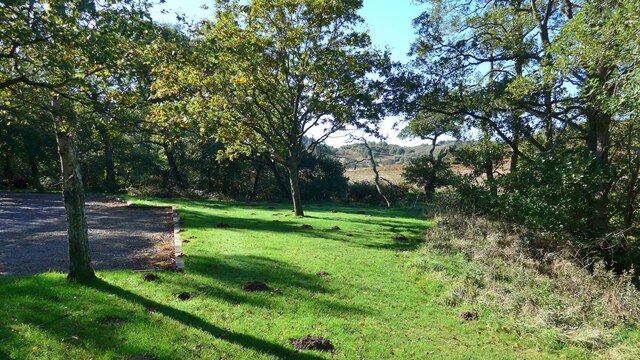
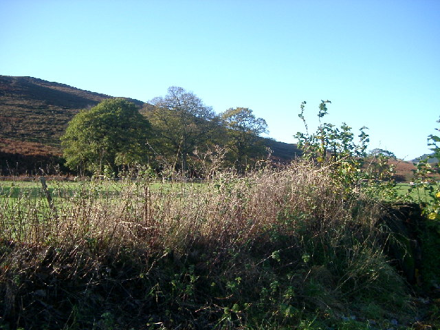
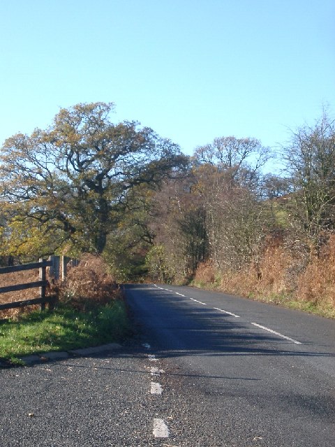
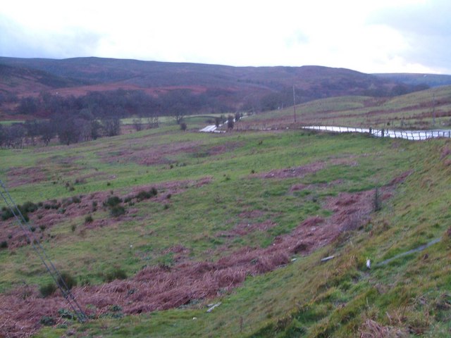
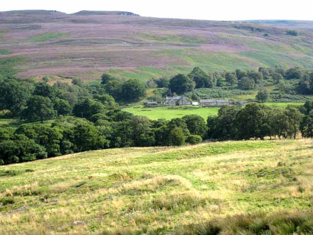
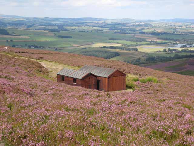
South Wood is a small village located in Northumberland, England. Situated within the county's picturesque landscape, it falls within the boundaries of the Wood district, known for its lush forests and natural beauty. The village is nestled amidst rolling hills and is surrounded by dense woodlands, making it an idyllic retreat for nature lovers and outdoor enthusiasts.

South Wood is home to a close-knit community, with a population of approximately 500 residents. The village boasts a range of amenities, including a local pub, a primary school, and a village hall that serves as a hub for various community events and gatherings. The village is also well-connected, with good transport links to nearby towns and cities.

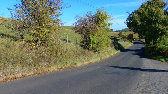
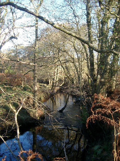
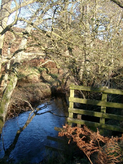
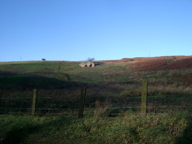
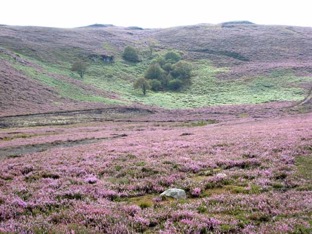
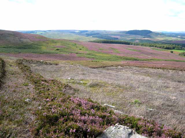
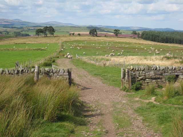
The natural surroundings of South Wood offer ample opportunities for outdoor activities. The nearby forest provides a haven for wildlife, and there are numerous walking trails and hiking routes for visitors to explore. The village is also situated close to the Northumberland National Park, which is renowned for its stunning landscapes and diverse wildlife.

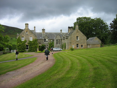
Despite its small size, South Wood has a rich history and heritage. The village is dotted with historic buildings, including a Norman church and a few traditional stone cottages that add to its charm. Local folklore suggests that the area has been inhabited for centuries, with evidence of ancient settlements and archaeological finds in the vicinity.

Overall, South Wood is a peaceful and picturesque village in the heart of Northumberland, offering a tranquil escape from the bustling city life. Its natural beauty, friendly community, and rich history make it an appealing destination for both residents and visitors alike.

If you have any feedback on the listing, please let us know in the comments section below.

South Wood Images

Images are sourced within 2km of 55.28097/-2.040697 or Grid Reference NY9798. Thanks to Geograph Open Source API. All images are credited.

Car park near Hepplewoodside Bridge
The B6341 running south of the Otterburn Ranges The red flags were up as we passed, signifying "Firing today".
The B6341 running south of the Otterburn Ranges
The red flags were up as we passed, signifying "Firing today".
Woodhouses Bastle This bastle, located south-west of Holystone Grange, was built in the early 17th century. It is built of coarse stonework and measures 11.5m long by 7.5m wide. Inside is a vaulted basement, the entrance to which is carved with the date 1602. The basement was used to keep animals, but upstairs is the first floor living area. Here, there are a few small windows and two stone wall cupboards, a stone sink, and traces of an original fireplace. The bastle was increased in height in the 18th century when an attic was added and was restored and reroofed in 1904. This is a Scheduled Monument and Grade II* Listed Building protected by law.
<span class="nowrap"><a title="https://keystothepast.info/search-records/results-of-search/results-of-search-2/site-details/?PRN=N1192" rel="nofollow ugc noopener" href="https://keystothepast.info/search-records/results-of-search/results-of-search-2/site-details/?PRN=N1192">Link</a><img style="margin-left:2px;" alt="External link" title="External link - shift click to open in new window" src="https://s1.geograph.org.uk/img/external.png" width="10" height="10"/></span>
Woodhouses Bastle
This bastle, located south-west of Holystone Grange, was built in the early 17th century. It is built of coarse stonework and measures 11.5m long by 7.5m wide. Inside is a vaulted basement, the entrance to which is carved with the date 1602. The basement was used to keep animals, but upstairs is the first floor living area. Here, there are a few small windows and two stone wall cupboards, a stone sink, and traces of an original fireplace. The bastle was increased in height in the 18th century when an attic was added and was restored and reroofed in 1904. This is a Scheduled Monument and Grade II* Listed Building protected by law. LinkExternal link
Storm Arwen Damage at Dry Burn Wood
Near Hepple, under Swindon Hill On the other side of the River Coquet from Hepple.
Near Hepple, under Swindon Hill
On the other side of the River Coquet from Hepple.
Stream near picnic area under Harehaugh Hill Taken down the stream at the picnic area. Stream runs into the River Coquet.
Stream near picnic area under Harehaugh Hill
Taken down the stream at the picnic area. Stream runs into the River Coquet.
Grasslees Burn near picnic area under Harehaugh Hill Taken downstream of the picnic area, towards the River Coquet.
Grasslees Burn near picnic area under Harehaugh Hill
Taken downstream of the picnic area, towards the River Coquet.
Rough pastures southeast of the lime kiln northeast of Grasslees Information about the lime kiln can be found on the Keys to the Past website <span class="nowrap"><a title="http://www.keystothepast.info/durhamcc/K2P.nsf/K2PDetail?readform&PRN=N9713" rel="nofollow ugc noopener" href="http://www.keystothepast.info/durhamcc/K2P.nsf/K2PDetail?readform&PRN=N9713">Link</a><img style="margin-left:2px;" alt="External link" title="External link - shift click to open in new window" src="https://s1.geograph.org.uk/img/external.png" width="10" height="10"/></span> .
Rough pastures southeast of the lime kiln northeast of Grasslees
Information about the lime kiln can be found on the Keys to the Past website LinkExternal link .
Road and trees, B6341 taken from the Parking marked on the OS map
Road and trees, B6341
taken from the Parking marked on the OS map
Hepple Whitefield A small country house built in the mid 19th century for Sir J W B Riddell. The house was altered in the 1890s, by J Hodgson Fowler, probably at the same time he rebuilt nearby Hepple Church in 1892.
Hepple Whitefield
A small country house built in the mid 19th century for Sir J W B Riddell. The house was altered in the 1890s, by J Hodgson Fowler, probably at the same time he rebuilt nearby Hepple Church in 1892.
Grasslees Burn valley Looking up the valley from the edge of Ovenstone Plantation in a howling gale on New Year's Eve. The B6341 drops to cross some side streams on its way from Rothbury to Otterburn. In the background are the hills of Harwood Forest.
Grasslees Burn valley
Looking up the valley from the edge of Ovenstone Plantation in a howling gale on New Year's Eve. The B6341 drops to cross some side streams on its way from Rothbury to Otterburn. In the background are the hills of Harwood Forest.
Midgy Ha Farm in the valley of the Grasslees Burn The hill on the skyline is Whitefield Hill <a href="https://www.geograph.org.uk/gridref/NY9897">NY9897</a>.
Midgy Ha Farm in the valley of the Grasslees Burn
The hill on the skyline is Whitefield Hill NY9897.
Sandy Crags Heather moorland.
Sandy Crags
Heather moorland.
Moorland above Hepplewoodside Looking across the valley of the Grasslees Burn.
Moorland above Hepplewoodside
Looking across the valley of the Grasslees Burn.
Beehives at Swindon in the valley of the Grasslees Burn
Shooting cabins, Whitefield Hill One of the Northumberland grouse moors, with extensive views over lower Coquetdale.
Shooting cabins, Whitefield Hill
One of the Northumberland grouse moors, with extensive views over lower Coquetdale.
Fields above Hepple Whitefield On the bridleway down from the top of Harwood Forest to lower Coquetdale (in distance).
Fields above Hepple Whitefield
On the bridleway down from the top of Harwood Forest to lower Coquetdale (in distance).
Show me another place!

South Wood is located at Grid Ref: NY9798 (Lat: 55.28097, Lng: -2.040697)

Unitary Authority: Northumberland

Police Authority: Northumbria

What 3 Words

///streaking.falls.building. Near Rothbury, Northumberland

Nearby Locations

South Wood

Related Wikis

High Cove

High Cove is a major slip feature to the west of Grasslees Burn in the Simonside Hills, Northumberland, England. It contains several small rifts and caves...

Reivers Way

The Reivers Way is a long-distance footpath in Northumberland, passing through the Northumberland National Park and the Cheviot Hills. Totalling 242 kilometres...

Hepple

Hepple is a small village and parish in rural Northumberland, 4 miles (6.4 km) west of Rothbury, which provides most of its local services. It is on the...

Tosson Hill

Tosson Hill is the highest hill in the Simonside Hills to the south of Rothbury in Northumberland, England. The summit lies about 2 kilometres (1.2 mi...

Nearby Amenities

Located within 500m of 55.28097,-2.040697
Hepple - R. Ponticum woods
Tourism: viewpoint
Lat/Long: 55.2836317/-2.0434623
The data included in this document is from www.openstreetmap.org. The data is made available under ODbL.

Have you been to South Wood?

Leave your review of South Wood below (or comments, questions and feedback).