Longsdon Wood

Wood, Forest in Staffordshire Staffordshire Moorlands

England

Longsdon Wood

Funfair in Leek A funfair on Westwood Recreation Ground in Leek.
Funfair in Leek Credit: David Weston

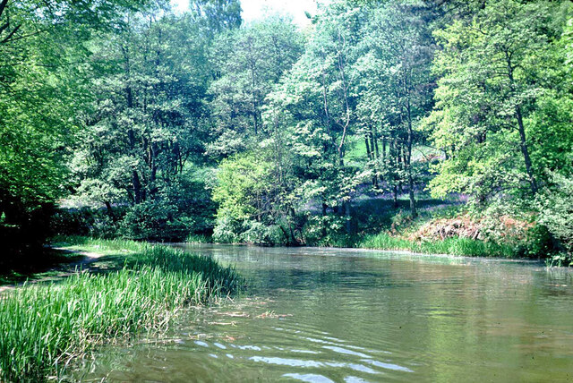
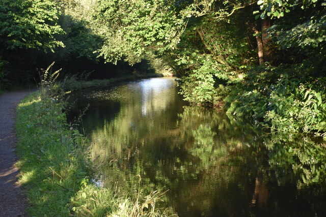
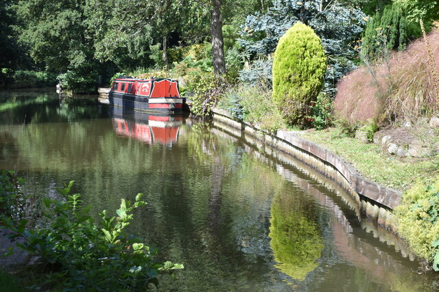
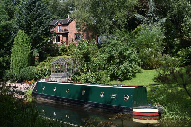
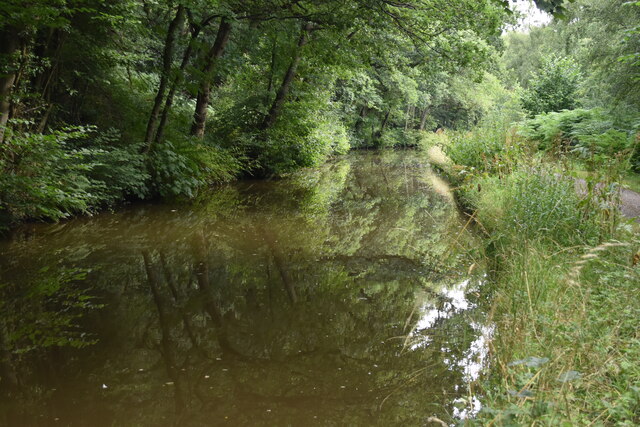
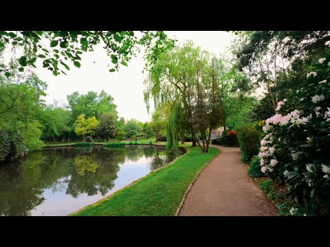
Longsdon Wood is a picturesque forest located in Staffordshire, England. Covering an area of approximately 50 acres, it is a popular destination for nature lovers and outdoor enthusiasts. The forest is nestled within the Staffordshire Moorlands, offering breathtaking views of the surrounding countryside.

The woodland is predominantly composed of native deciduous trees such as oak, birch, and beech, which provide a rich habitat for a wide variety of flora and fauna. Bluebells carpet the forest floor in the spring, creating a stunning display of vibrant colors. The diverse ecosystem supports a range of wildlife, including deer, foxes, badgers, and numerous bird species, making it a haven for wildlife enthusiasts and birdwatchers.

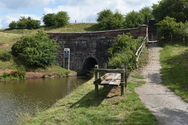
Longsdon Wood offers several well-maintained walking trails, allowing visitors to explore its natural beauty. These paths wind through the forest, offering opportunities to immerse oneself in the tranquility of nature. The forest also boasts a small picnic area, providing a perfect spot for visitors to relax and enjoy a picnic surrounded by the sights and sounds of the woodland.

The wood is managed by the local forestry commission, ensuring the preservation and conservation of the natural environment. The management practices prioritize sustainable forestry, maintaining a healthy balance between conservation and public access. Longsdon Wood is easily accessible by car, with ample parking available for visitors.

Overall, Longsdon Wood in Staffordshire is a captivating destination for those seeking a peaceful retreat in nature. Its scenic beauty, diverse wildlife, and well-maintained trails make it an ideal location for nature walks, picnics, and wildlife spotting.

If you have any feedback on the listing, please let us know in the comments section below.

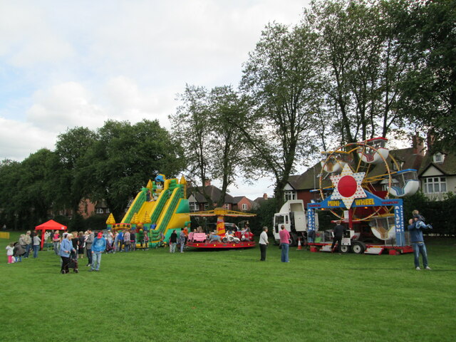
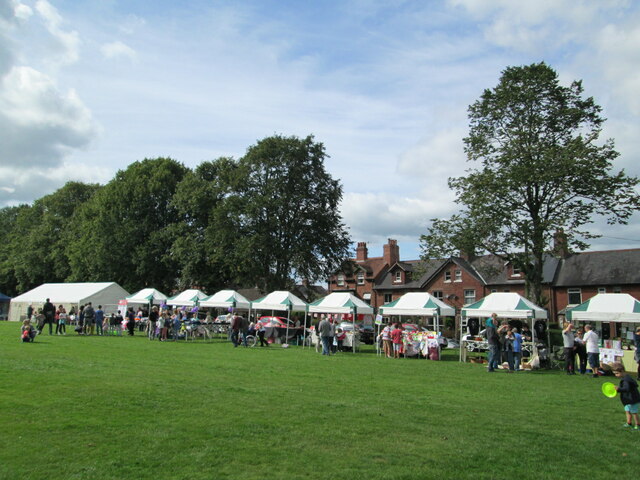
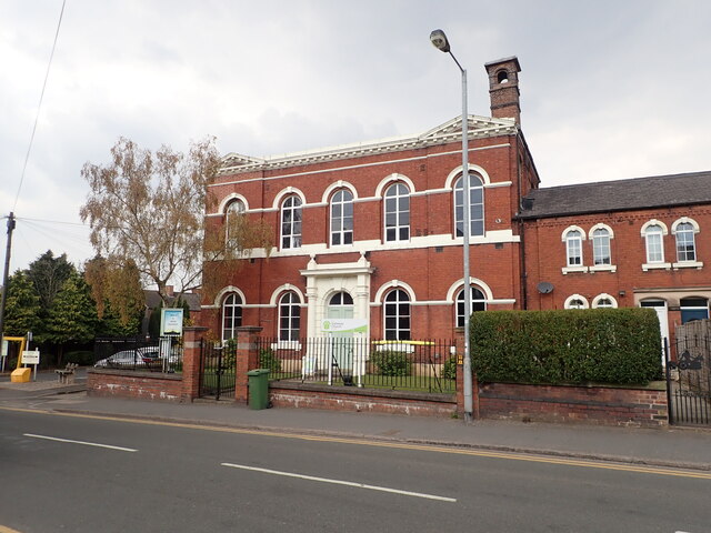
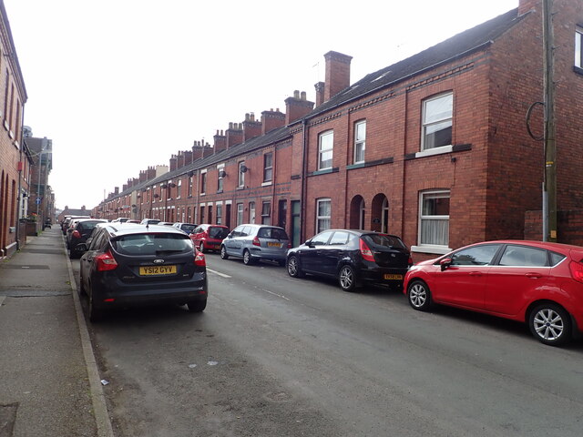
Longsdon Wood Images

Images are sourced within 2km of 53.093781/-2.0489388 or Grid Reference SJ9655. Thanks to Geograph Open Source API. All images are credited.

Funfair in Leek A funfair on Westwood Recreation Ground in Leek.
Funfair in Leek
A funfair on Westwood Recreation Ground in Leek.
Funfair in Leek Stalls at the fair on Westwood Recreation Ground in Leek.
Funfair in Leek
Stalls at the fair on Westwood Recreation Ground in Leek.
Gateway Church, West Street
Looking down Picton Street
Former Silk Mill on Waterloo Street Grade II listed building, now converted into flats.
Former Silk Mill on Waterloo Street
Grade II listed building, now converted into flats.
Hargreaves School building, Alsop Street Former school, built in 1873. The school was built for Leek Congregational Church and named after a former minister. It is listed grade II and now in use commercially.
Hargreaves School building, Alsop Street
Former school, built in 1873. The school was built for Leek Congregational Church and named after a former minister. It is listed grade II and now in use commercially.
Ash Almshouses, Leek Grade II listed almshouses on Broad Street. On the gable end is an inscription - "The gift of Elizabeth Ash, the eldest daughter of William Jolliffe". 
"An almshouse, for eight poor widows, was endowed in the year 1696, by Elizabeth Ash, widow, of this town.  Each widow is allowed two shillings per week, fuel, and a new gown once in two years." (from "A Topographical History of Staffordshire" by William Pitt)
Ash Almshouses, Leek
Grade II listed almshouses on Broad Street. On the gable end is an inscription - "The gift of Elizabeth Ash, the eldest daughter of William Jolliffe". "An almshouse, for eight poor widows, was endowed in the year 1696, by Elizabeth Ash, widow, of this town. Each widow is allowed two shillings per week, fuel, and a new gown once in two years." (from "A Topographical History of Staffordshire" by William Pitt)
Leek Tunnel, Caldon Canal, Leek Branch, 1978 The west end of the narrow but high tunnel, 120 m long. We went through to the then limit of navigation, where a dredger and barge and what they were removing were blocking further progress - see <a href="https://www.geograph.org.uk/photo/1616909">SJ9754 : Last bridge on the Leek Branch, 1978</a> - and had to reverse back, including through the tunnel, because there was nowhere to wind. There is a big pool at this end of the tunnel, fortunately.
Leek Tunnel, Caldon Canal, Leek Branch, 1978
The west end of the narrow but high tunnel, 120 m long. We went through to the then limit of navigation, where a dredger and barge and what they were removing were blocking further progress - see SJ9754 : Last bridge on the Leek Branch, 1978 - and had to reverse back, including through the tunnel, because there was nowhere to wind. There is a big pool at this end of the tunnel, fortunately.
North of last bridge, Caldon Canal, Leek Branch, 1978 Looking from the bridge. There was a dredger and spoil barges just south of the bridge, presumably working north, but unattended at the time (Sunday). The winding hole on the left, when cleared out, was the last place full length boats could wind.
North of last bridge, Caldon Canal, Leek Branch, 1978
Looking from the bridge. There was a dredger and spoil barges just south of the bridge, presumably working north, but unattended at the time (Sunday). The winding hole on the left, when cleared out, was the last place full length boats could wind.
Caldon Canal, Leek Branch, 1978 Dredging barges nearly block progress, but the dredger and another barge really did behind the camera, so we gave up trying to reach the end of the branch and a possible turning place. We had to reverse back, including through Leek Tunnel, before we could wind.
Caldon Canal, Leek Branch, 1978
Dredging barges nearly block progress, but the dredger and another barge really did behind the camera, so we gave up trying to reach the end of the branch and a possible turning place. We had to reverse back, including through Leek Tunnel, before we could wind.
Caldon Canal, Leek Branch, 1978 Looking back heading away from Horse Bridge towards Leek.
Caldon Canal, Leek Branch, 1978
Looking back heading away from Horse Bridge towards Leek.
Leek, Stanley Street There is a benchmark cut into the building on the north side of Stanley Street. It is cut into a cornerstone.
Leek, Stanley Street
There is a benchmark cut into the building on the north side of Stanley Street. It is cut into a cornerstone.
Leek, Stanley Street A wider angle showing the north side of Stanley Street; there is a benchmark cut into a cornerstone of this brick building.
Leek, Stanley Street
A wider angle showing the north side of Stanley Street; there is a benchmark cut into a cornerstone of this brick building.
Evening light on Caldon Canal near Denford
Caldon Canal at Denford
House and narrowboat at Horse Bridge
Caldon Canal near Hollinhay Wood
Southern portal of Leek Tunnel
Show me another place!

Longsdon Wood is located at Grid Ref: SJ9655 (Lat: 53.093781, Lng: -2.0489388)

Administrative County: Staffordshire

District: Staffordshire Moorlands

Police Authority: Staffordshire

What 3 Words

///aims.noodle.bleaching. Near Leek, Staffordshire

Nearby Locations

Longsdon Wood

Related Wikis

Longsdon

Longsdon is a village and civil parish in the Staffordshire Moorlands district of Staffordshire, England, about 1.5 miles (2.4 km) southwest of Leek, on...

Westwood Hall

Westwood Hall is a former stately home in Leek, Staffordshire, England. It is a Grade II listed building. It has been a school since 1921, and is now Westwood...

Westwood College, Leek

Westwood College, formerly known as Westwood High School is a mixed upper school located in Leek, Staffordshire, England. Westwood is set in the grounds...

Leek (Churnet Valley) railway station

Leek (Churnet Valley) railway station is the proposed and future terminus of the Churnet Valley Railway and is currently awaiting construction. It will...

Leek railway station

Leek railway station served the town of Leek, Staffordshire. It was opened by the North Staffordshire Railway in 1849. Passenger services to Uttoxeter...

Barnfields

Barnfields (also Barnfield) is an area in Leek, Staffordshire, England.

St Edwards Hospital tramway

The St Edward's Hospital tramway was a tramway built for Staffordshire County Council for the construction of the St Edward's County Mental Asylum at Cheddleton...

St Edward's Hospital

St Edward's Hospital was a mental health facility at Cheddleton in Staffordshire, England. The hospital closed in 2002 and was converted into apartments...

Related Videos

Leek | Staffordshire | Walk | 4K

A walk around the beautiful town of Leek, known as Queen of the Staffordshire Moorlands. We start at the bottom of St. Edwards ...

Leek Nature Reserve Walk, English Countryside 4K

https://www.buymeacoffee.com/Daveswalks All support is hugely appreciated and it helps me keep the channel going! No talking ...

Nearby Amenities

Located within 500m of 53.093781,-2.0489388
Bus Stop
Ladderedge
Bus: yes
Naptan AtcoCode: 3800C850601
Naptan Bearing: W
Naptan CommonName: Ladderedge
Naptan Indicator: o/s 105
Naptan Landmark: Ladderedge
Naptan Street: Ladderedge A53
Naptan Verified: no
Public Transport: platform
Source: naptan_import
Lat/Long: 53.0897027/-2.0460496
Bus Stop
Ladderedge
Bus: yes
Naptan AtcoCode: 3800C850602
Naptan Bearing: E
Naptan CommonName: Ladderedge
Naptan Indicator: o/s 78
Naptan Landmark: Ladderedge
Naptan Street: Ladderedge A53
Naptan Verified: no
Public Transport: platform
Source: naptan_import
Lat/Long: 53.0899367/-2.0454376
Barrier: stile
Steps: 1
Stile: stepover
Lat/Long: 53.0968365/-2.0536392
Waterway: sluice
Lat/Long: 53.0942624/-2.0487007
Barrier: stile
Steps: 1
Stile: stepover
Lat/Long: 53.0949973/-2.0504164
Bench
Lat/Long: 53.0924367/-2.0439272
Bench
Lat/Long: 53.0927829/-2.048044
Tourism: viewpoint
Lat/Long: 53.0928243/-2.0479131
Barrier: kissing_gate
Lat/Long: 53.0910579/-2.0466558
Power: pole
Source: Bing
Lat/Long: 53.0899464/-2.0472215
Power: pole
Lat/Long: 53.0909617/-2.0458786
Waste Basket
Waste: trash;dog_excrement
Lat/Long: 53.0899129/-2.0474583
Power: pole
Lat/Long: 53.0923547/-2.0440117
Power: pole
Lat/Long: 53.0916575/-2.0449452
Power: pole
Lat/Long: 53.0902904/-2.0467556
Barrier: kissing_gate
Lat/Long: 53.091044/-2.0465602
Power: pole
Lat/Long: 53.0939888/-2.0418347
Power: pole
Lat/Long: 53.0928434/-2.0434404
Barrier: kissing_gate
Lat/Long: 53.0912783/-2.0526533
Leisure: picnic_table
Lat/Long: 53.0927045/-2.0479085
Information: board
Tourism: information
Lat/Long: 53.0898681/-2.0474935
Speed Camera
Maxspeed: 40 mph
Lat/Long: 53.0893913/-2.0479465
The data included in this document is from www.openstreetmap.org. The data is made available under ODbL.

Have you been to Longsdon Wood?

Leave your review of Longsdon Wood below (or comments, questions and feedback).