West Wood

Wood, Forest in Staffordshire Staffordshire Moorlands

England

West Wood

Funfair in Leek A funfair on Westwood Recreation Ground in Leek.
Funfair in Leek Credit: David Weston

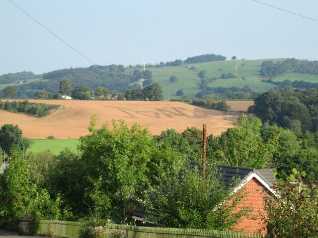
West Wood is a picturesque forest located in Staffordshire, England. Covering an area of approximately 100 acres, it is a popular destination for nature enthusiasts and outdoor activities. The wood is situated near the village of Wood, providing a serene and peaceful environment for visitors.

The woodland is predominantly composed of broad-leaved trees, such as oak, birch, and beech, creating a diverse and vibrant ecosystem. These trees offer a delightful canopy, providing shade during the summer months and a burst of colorful foliage in autumn. The forest floor is adorned with an array of wildflowers and ferns, adding to its natural beauty.

West Wood is home to a variety of wildlife, including deer, foxes, badgers, and a wide range of bird species. Birdwatchers can spot woodpeckers, owls, and many other feathered inhabitants, making it a haven for birdwatching enthusiasts.

The wood is crisscrossed by well-maintained footpaths, allowing visitors to explore its scenic trails and enjoy leisurely walks. There are also designated areas for picnics and family gatherings, providing ample space for relaxation and enjoying the tranquil surroundings.

Furthermore, West Wood offers a range of recreational activities. Cyclists can enjoy cycling trails that wind through the forest, while nature lovers can partake in birdwatching or photography. The wood also hosts educational programs and guided tours, providing an opportunity for visitors to learn about the local flora and fauna.

Overall, West Wood in Staffordshire is a stunning natural oasis, offering a peaceful retreat for those seeking solace in nature or engaging in outdoor activities.

If you have any feedback on the listing, please let us know in the comments section below.
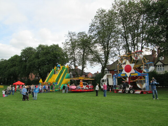
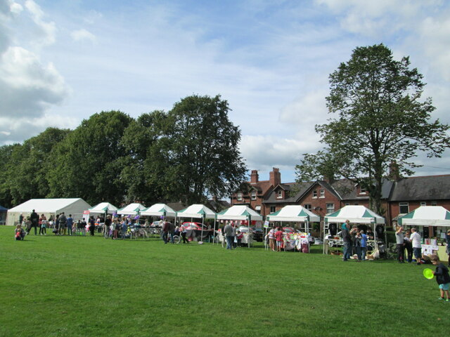
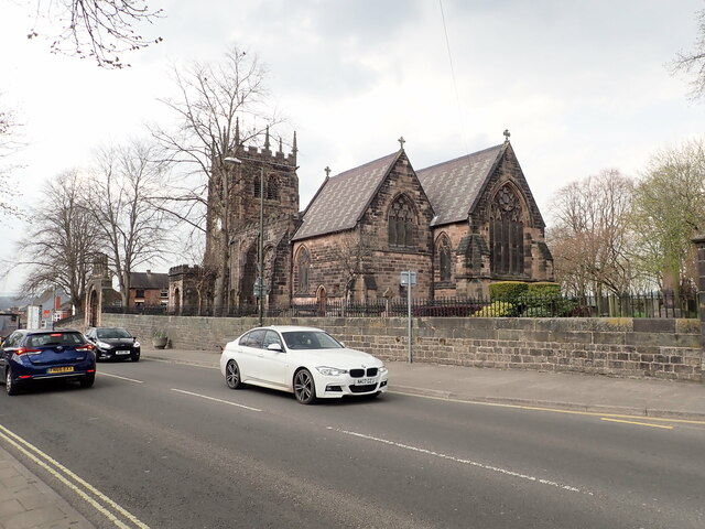
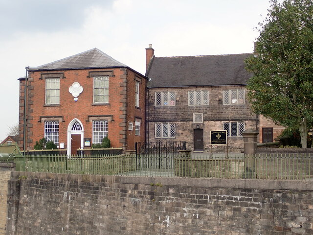
West Wood Images

Images are sourced within 2km of 53.102471/-2.0547886 or Grid Reference SJ9656. Thanks to Geograph Open Source API. All images are credited.

Funfair in Leek A funfair on Westwood Recreation Ground in Leek.
Funfair in Leek
A funfair on Westwood Recreation Ground in Leek.
Funfair in Leek Stalls at the fair on Westwood Recreation Ground in Leek.
Funfair in Leek
Stalls at the fair on Westwood Recreation Ground in Leek.
Parish Church of St Edward the Confessor The Parish Church is Leek's only medieval church, dedicated to Edward, King of England between 1042-1066. <span class="nowrap"><a title="https://www.search.staffspasttrack.org.uk/Details.aspx?&ResourceID=5362" rel="nofollow ugc noopener" href="https://www.search.staffspasttrack.org.uk/Details.aspx?&ResourceID=5362">Link</a><img style="margin-left:2px;" alt="External link" title="External link - shift click to open in new window" src="https://s1.geograph.org.uk/img/external.png" width="10" height="10"/></span>
Parish Church of St Edward the Confessor
The Parish Church is Leek's only medieval church, dedicated to Edward, King of England between 1042-1066. LinkExternal link
The Old Grammar School, Leek Former school, dated 1723. Over the door an inscription reads "This building erected by the Earl of Macclesfield, Lord High Chancellor of Great Britain, Anno Domini, 1723". Now used by the 2nd Leek Scout Group.
The Old Grammar School, Leek
Former school, dated 1723. Over the door an inscription reads "This building erected by the Earl of Macclesfield, Lord High Chancellor of Great Britain, Anno Domini, 1723". Now used by the 2nd Leek Scout Group.
Gateway Church, West Street
Looking down Picton Street
Former Silk Mill on Waterloo Street Grade II listed building, now converted into flats.
Former Silk Mill on Waterloo Street
Grade II listed building, now converted into flats.
Hargreaves School building, Alsop Street Former school, built in 1873. The school was built for Leek Congregational Church and named after a former minister. It is listed grade II and now in use commercially.
Hargreaves School building, Alsop Street
Former school, built in 1873. The school was built for Leek Congregational Church and named after a former minister. It is listed grade II and now in use commercially.
Ash Almshouses, Leek Grade II listed almshouses on Broad Street. On the gable end is an inscription - "The gift of Elizabeth Ash, the eldest daughter of William Jolliffe". 
"An almshouse, for eight poor widows, was endowed in the year 1696, by Elizabeth Ash, widow, of this town.  Each widow is allowed two shillings per week, fuel, and a new gown once in two years." (from "A Topographical History of Staffordshire" by William Pitt)
Ash Almshouses, Leek
Grade II listed almshouses on Broad Street. On the gable end is an inscription - "The gift of Elizabeth Ash, the eldest daughter of William Jolliffe". "An almshouse, for eight poor widows, was endowed in the year 1696, by Elizabeth Ash, widow, of this town. Each widow is allowed two shillings per week, fuel, and a new gown once in two years." (from "A Topographical History of Staffordshire" by William Pitt)
Rudyard Lake Steam Railway  Locomotive shed and platform. The miniature (10.25 inch gauge) railway runs about half-way up the east  side of Rudyard Reservoir.
Rudyard Lake Steam Railway
Locomotive shed and platform. The miniature (10.25 inch gauge) railway runs about half-way up the east side of Rudyard Reservoir.
Rudyard Station The miniature (10.25 inch gauge) railway runs about half-way up the east  side of Rudyard Reservoir.
Rudyard Station
The miniature (10.25 inch gauge) railway runs about half-way up the east side of Rudyard Reservoir.
North of last bridge, Caldon Canal, Leek Branch, 1978 Looking from the bridge. There was a dredger and spoil barges just south of the bridge, presumably working north, but unattended at the time (Sunday). The winding hole on the left, when cleared out, was the last place full length boats could wind.
North of last bridge, Caldon Canal, Leek Branch, 1978
Looking from the bridge. There was a dredger and spoil barges just south of the bridge, presumably working north, but unattended at the time (Sunday). The winding hole on the left, when cleared out, was the last place full length boats could wind.
Caldon Canal, Leek Branch, 1978 Dredging barges nearly block progress, but the dredger and another barge really did behind the camera, so we gave up trying to reach the end of the branch and a possible turning place. We had to reverse back, including through Leek Tunnel, before we could wind.
Caldon Canal, Leek Branch, 1978
Dredging barges nearly block progress, but the dredger and another barge really did behind the camera, so we gave up trying to reach the end of the branch and a possible turning place. We had to reverse back, including through Leek Tunnel, before we could wind.
Leek, junction of Church Lane and Church Street The benchmark is cut into the wall at the intersection of the 2 roads.
Leek, junction of Church Lane and Church Street
The benchmark is cut into the wall at the intersection of the 2 roads.
Leek, junction of Church Lane and Church Street The benchmark is cut into the wall at the intersection of the 2 roads. It is to the right of the brown Alton Towers sign.
Leek, junction of Church Lane and Church Street
The benchmark is cut into the wall at the intersection of the 2 roads. It is to the right of the brown Alton Towers sign.
Leek, Stanley Street There is a benchmark cut into the building on the north side of Stanley Street. It is cut into a cornerstone.
Leek, Stanley Street
There is a benchmark cut into the building on the north side of Stanley Street. It is cut into a cornerstone.
Leek, Stanley Street A wider angle showing the north side of Stanley Street; there is a benchmark cut into a cornerstone of this brick building.
Leek, Stanley Street
A wider angle showing the north side of Stanley Street; there is a benchmark cut into a cornerstone of this brick building.
Message in field near Leek A message has been created in a field on rising land near Abbey Green. Viewed from Belle Vue Road, Leek.
Message in field near Leek
A message has been created in a field on rising land near Abbey Green. Viewed from Belle Vue Road, Leek.
Show me another place!

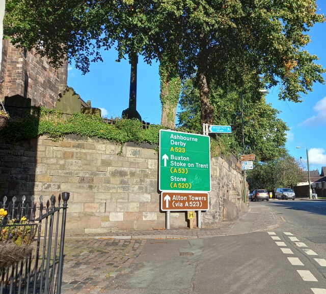
West Wood is located at Grid Ref: SJ9656 (Lat: 53.102471, Lng: -2.0547886)

Administrative County: Staffordshire

District: Staffordshire Moorlands

Police Authority: Staffordshire

What 3 Words

///distanced.stitching.divided. Near Leek, Staffordshire

Nearby Locations

West Wood Cowhay Wood

Related Wikis

Westwood College, Leek

Westwood College, formerly known as Westwood High School is a mixed upper school located in Leek, Staffordshire, England. Westwood is set in the grounds...

Westwood Hall

Westwood Hall is a former stately home in Leek, Staffordshire, England. It is a Grade II listed building. It has been a school since 1921, and is now Westwood...

Leek Town F.C.

Leek Town Football Club is an English football club based in Leek, Staffordshire, playing in the Northern Premier League Division One West, the eighth...

Leek railway station

Leek railway station served the town of Leek, Staffordshire. It was opened by the North Staffordshire Railway in 1849. Passenger services to Uttoxeter...

Highfield, Leek

Highfield is a cricket ground in Leek, Staffordshire. The ground is located just outside of the town along the Macclesfield Road, which itself forms part...

Brindley Water Mill

The Brindley Water Mill is a water mill in the town of Leek, Staffordshire, England, built in 1752 by James Brindley. It was restored to working order...

Longsdon

Longsdon is a village and civil parish in the Staffordshire Moorlands district of Staffordshire, England, about 1.5 miles (2.4 km) southwest of Leek, on...

Barnfields

Barnfields is a village in Staffordshire, England. The population at the 2011 census can be found under the Weeping Cross Ward of Stafford

Nearby Amenities

Located within 500m of 53.102471,-2.0547886
Bench
Lat/Long: 53.1008174/-2.0574714
Traffic Calming: cushion
Lat/Long: 53.1040567/-2.048146
Bus Stop
Westwood College
Bus: yes
Public Transport: platform
Lat/Long: 53.1027384/-2.0501812
The data included in this document is from www.openstreetmap.org. The data is made available under ODbL.

Have you been to West Wood?

Leave your review of West Wood below (or comments, questions and feedback).