Lodge Wood

Wood, Forest in Northumberland

England

Lodge Wood

Down  into  the  valley  toward  Akeld  Bridge  on  A697 Sand and gravel pits behind trees on the left
Down into the valley toward Akeld Bridge on A697 Credit: Martin Dawes

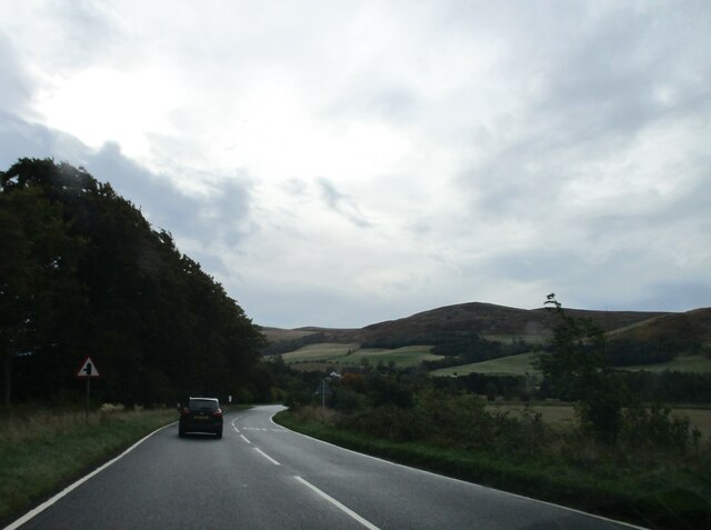
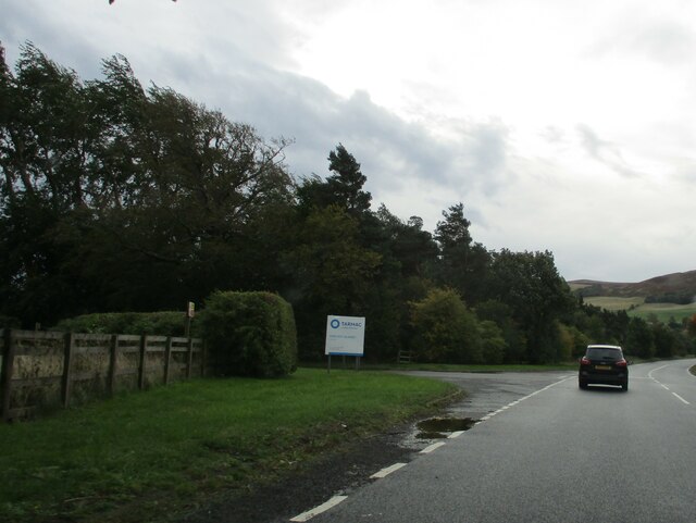
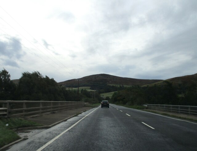
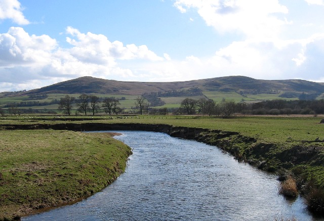
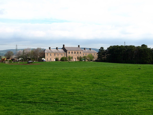
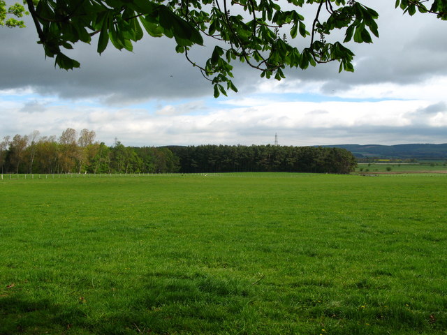
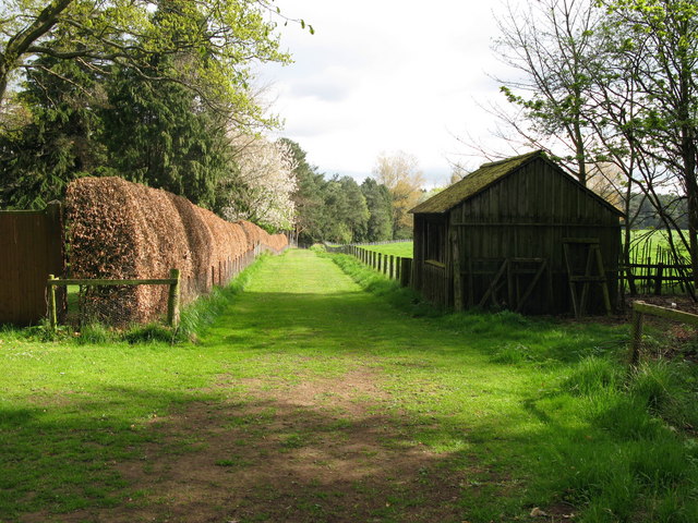
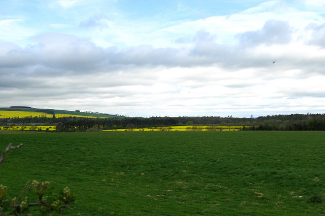
Lodge Wood is a picturesque forest located in the county of Northumberland, in the northeast of England. Situated near the town of Alnwick, this woodland encompasses an area of approximately 100 acres, making it a perfect destination for nature enthusiasts and outdoor lovers.

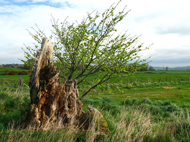
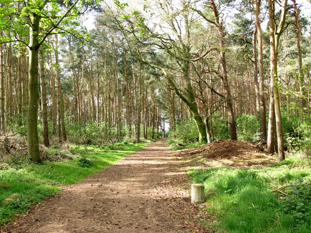
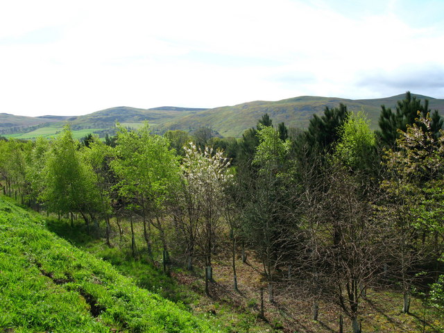
The wood is predominantly composed of a mixture of deciduous and coniferous trees, such as oak, birch, and pine, which create a diverse and vibrant ecosystem. The tall, majestic trees provide a dense canopy, casting dappled sunlight onto the forest floor, creating a serene and tranquil atmosphere.

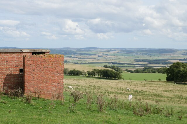
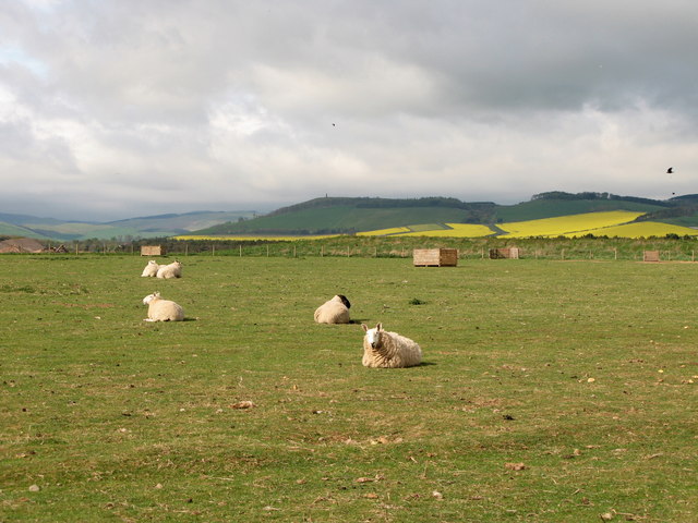
Within Lodge Wood, visitors can enjoy a variety of activities. There are well-marked walking trails that wind through the woods, allowing visitors to explore the ancient trees and discover the abundant wildlife that calls this forest home. Birdwatchers will be delighted to find an array of species, including woodpeckers, owls, and various songbirds.

Lodge Wood is also home to a rich flora, with an assortment of wildflowers and ferns adding bursts of color to the forest floor. During spring, the woodland comes alive with bluebells, creating a stunning carpet of vibrant blue hues.

For those seeking a peaceful retreat, Lodge Wood offers several picnic areas, where visitors can relax and enjoy the natural surroundings. The forest is well-maintained, with clear pathways, benches, and information boards to enhance the visitor experience.

Overall, Lodge Wood is a hidden gem in Northumberland, offering a truly immersive and enchanting woodland experience for all who venture its paths.

If you have any feedback on the listing, please let us know in the comments section below.

Lodge Wood Images

Images are sourced within 2km of 55.573743/-2.0649804 or Grid Reference NT9631. Thanks to Geograph Open Source API. All images are credited.

Down  into  the  valley  toward  Akeld  Bridge  on  A697 Sand and gravel pits behind trees on the left
Down into the valley toward Akeld Bridge on A697
Sand and gravel pits behind trees on the left
Minor  road  junction  to  Cheviot  Quarry  access road Cheviot Quarry, part of Tarmac, is a sand and gravel quarry
Minor road junction to Cheviot Quarry access road
Cheviot Quarry, part of Tarmac, is a sand and gravel quarry
Akeld  Bridge  over  the  River  Glen.  A697  southbound The River Glen runs into the River Till a couple of miles downstream from here
Akeld Bridge over the River Glen. A697 southbound
The River Glen runs into the River Till a couple of miles downstream from here
A view to the Till floodplain from Coldside Hill A view towards the former RAF Milfield (now partially occupied by Borders Gliding Club) from beside one of the buildings at the former Coldside Hill Radio Station.
A view to the Till floodplain from Coldside Hill
A view towards the former RAF Milfield (now partially occupied by Borders Gliding Club) from beside one of the buildings at the former Coldside Hill Radio Station.
On the Till/Glen floodplain near Bridge End An early December mid-afternoon on the floodplain of the River Till and River Glen approaching the end of a prolonged cold snap.
On the Till/Glen floodplain near Bridge End
An early December mid-afternoon on the floodplain of the River Till and River Glen approaching the end of a prolonged cold snap.
River Glen Looking south over the Millfield Plains towards the Cheviot foothills.
River Glen
Looking south over the Millfield Plains towards the Cheviot foothills.
Tree stump, Akeld Steads Rough grazing near Akeld Steads
Tree stump, Akeld Steads
Rough grazing near Akeld Steads
River Glen, Akeld Steads
Ewart Park Brick built building with chimney, located on the outskirts of Ewart Park. Located nearby are brick kilns, built in the late 18th or early 19th century. The clay at Ewart was regarded as the best in Northumberland and the bricks from these kilns were used to build Ewart Bridge and the cottages and houses on the estate.
Ewart Park
Brick built building with chimney, located on the outskirts of Ewart Park. Located nearby are brick kilns, built in the late 18th or early 19th century. The clay at Ewart was regarded as the best in Northumberland and the bricks from these kilns were used to build Ewart Bridge and the cottages and houses on the estate.
Ewart Newtown The building was originally built in the 1870s as a hotel for a planned railway. However, the railway was never built and the building has since been used as an outdoor centre and as farm buildings.
Ewart Newtown
The building was originally built in the 1870s as a hotel for a planned railway. However, the railway was never built and the building has since been used as an outdoor centre and as farm buildings.
Ewart Newtown Ewart Newtown was originally built in the 1870s as a hotel for a planned railway. However, the railway was never built and the building has since been used as an outdoor centre and as farm buildings.
Ewart Newtown
Ewart Newtown was originally built in the 1870s as a hotel for a planned railway. However, the railway was never built and the building has since been used as an outdoor centre and as farm buildings.
Pond Plantation, Thirlings Cropmarks of six rectangular buildings were discovered by aerial photography at Thirlings. Excavations between 1973 and 1981 found they were built of timber and were similar to others found in the area that dated to the sixth or seventh centuries. Finds including an Anglo-Saxon knife and pottery suggest that this was a small Anglo-Saxon settlement although Neolithic pottery was also found.
Pond Plantation, Thirlings
Cropmarks of six rectangular buildings were discovered by aerial photography at Thirlings. Excavations between 1973 and 1981 found they were built of timber and were similar to others found in the area that dated to the sixth or seventh centuries. Finds including an Anglo-Saxon knife and pottery suggest that this was a small Anglo-Saxon settlement although Neolithic pottery was also found.
House Plantation, Thirlings
Grass path to Thirlings Cropmarks of six rectangular buildings were discovered by aerial photography at Thirlings. Excavations between 1973 and 1981 found they were built of timber and were similar to others found in the area that dated to the sixth or seventh centuries. Finds including an Anglo-Saxon knife and pottery suggest that this was a small Anglo-Saxon settlement although Neolithic pottery was also found.
Grass path to Thirlings
Cropmarks of six rectangular buildings were discovered by aerial photography at Thirlings. Excavations between 1973 and 1981 found they were built of timber and were similar to others found in the area that dated to the sixth or seventh centuries. Finds including an Anglo-Saxon knife and pottery suggest that this was a small Anglo-Saxon settlement although Neolithic pottery was also found.
Taking a rest Grazing land near Woodbridge
Taking a rest
Grazing land near Woodbridge
Akeld Newly planted crop with view to Akeld Hill behind.
Akeld
Newly planted crop with view to Akeld Hill behind.
Embankment to east of A697, near Akeld Newly planted trees on roadside embankment on the edge of the A697 to Wooler. The embankment appeared to be newly formed. See also <a href="https://www.geograph.org.uk/photo/411301">NT9531 : Cleared area, near to Akeld</a>.
Embankment to east of A697, near Akeld
Newly planted trees on roadside embankment on the edge of the A697 to Wooler. The embankment appeared to be newly formed. See also NT9531 : Cleared area, near to Akeld.
River Glen Valley at Yeavering A number of rape fields in this Northumbrian river valley.
River Glen Valley at Yeavering
A number of rape fields in this Northumbrian river valley.
Show me another place!

Lodge Wood is located at Grid Ref: NT9631 (Lat: 55.573743, Lng: -2.0649804)

Unitary Authority: Northumberland

Police Authority: Northumbria

What 3 Words

///poetry.overtime.scarf. Near Doddington, Northumberland

Related Wikis

Akeld railway station

Akeld was a stone built railway station serving the hamlet of Akeld in Northumberland, England. It was on the Alnwick to Cornhill Branch which ran from...

Akeld

Akeld is a village and civil parish in Northumberland, England. It is situated around 2.7 miles (4.3 km) to the west of Wooler and 9.3 miles (15.0 km)...

Battle of Homildon Hill

The Battle of Holmedon Hill or Battle of Homildon Hill was a conflict between English and Scottish armies on 14 September 1402 in Northumberland, England...

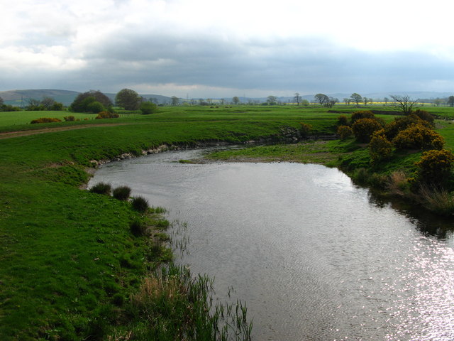
River Glen, Northumberland

The River Glen is a seven mile long tributary of the River Till flowing through Northumberland, England. The College Burn and Bowmont Water, both flowing...

Coupland, Northumberland

Coupland is a village and former civil parish, now in the parish of Ewart, in Northumberland, England. It is on the north bank of the River Glen about...

RAF Milfield

Royal Air Force Milfield or more simply RAF Milfield is a former Royal Air Force station which operated during the Second World War, located near Milfield...

Coupland Castle

Coupland Castle is situated in the village of Coupland, 4 miles (6 km) to the north-west of Wooler, Northumberland, England. It is a Grade I listed building...

Yeavering

Yeavering () is a hamlet in the north-east corner of the civil parish of Kirknewton in the English county of Northumberland. It is located on the River...

Have you been to Lodge Wood?

Leave your review of Lodge Wood below (or comments, questions and feedback).